climate impact Maps
12 geographic visualizations tagged with "climate impact"
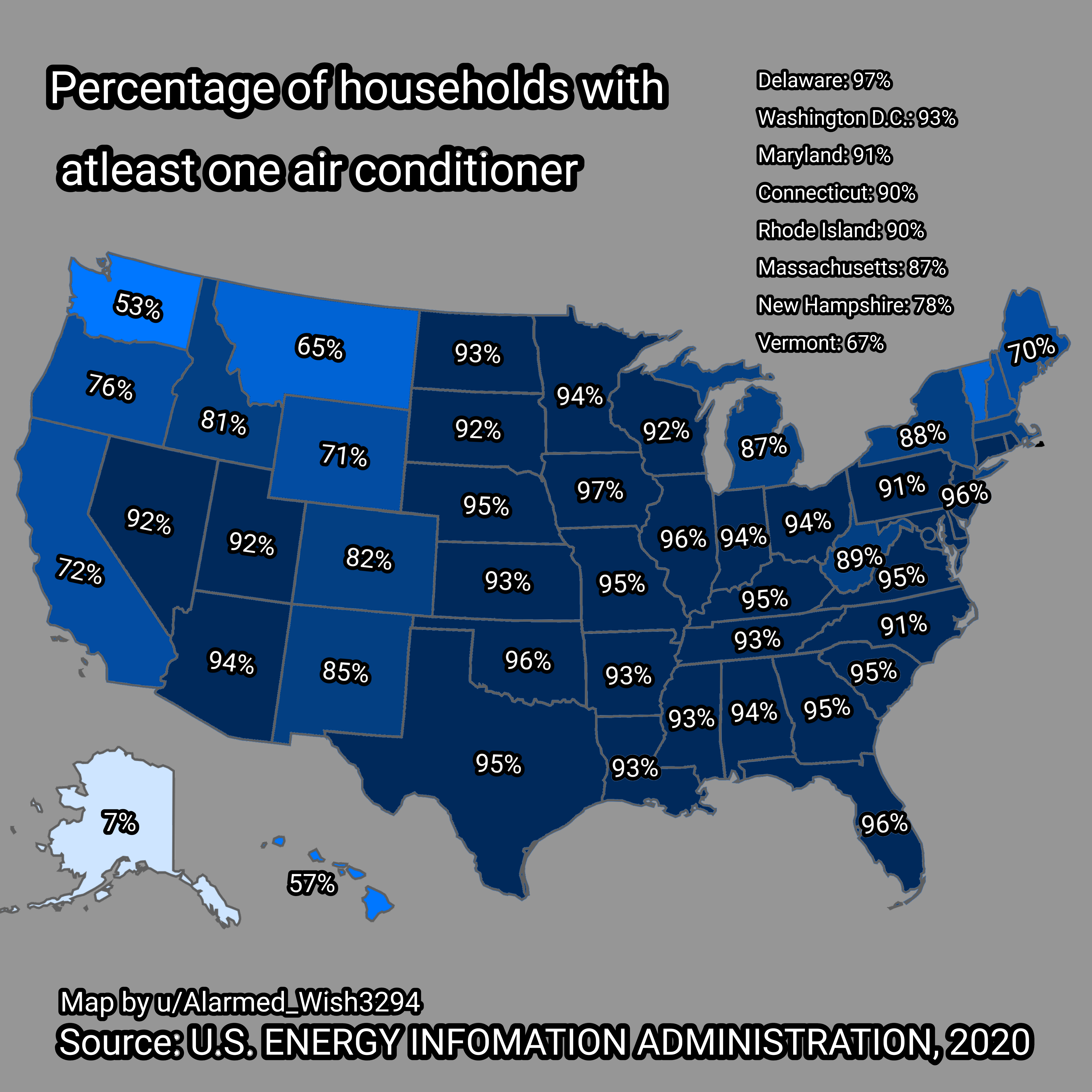
Map of Households in USA with Air Conditioners
The visualization titled "Percent of Households in USA with at least One Air Conditioner" provides a clear overview of t...
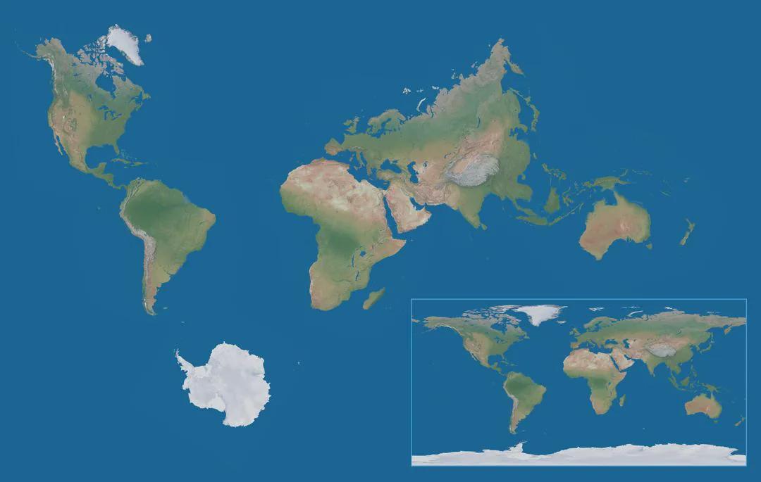
True World Map with Correct Proportions of Continents
The 'True World Map with Correct Proportions of Continents' presents a fascinating and accurate depiction of our planet'...
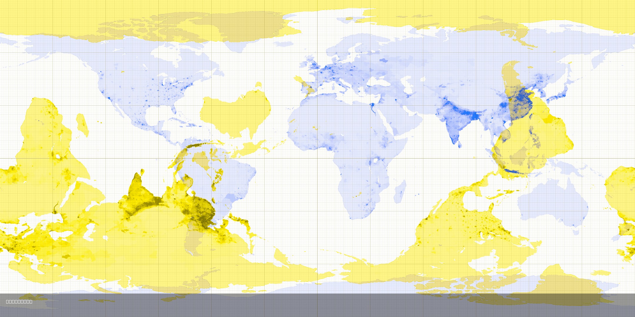
Antipode Map Showing Opposite Countries
This map visualizes the concept of antipodes, which are points that are diametrically opposite to each other on the Eart...
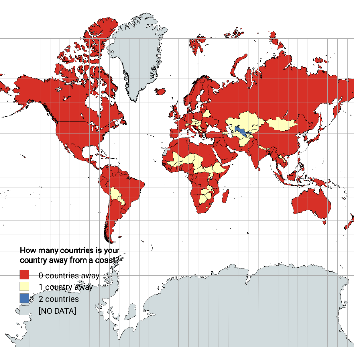
Distance from Coastline by Country Map
The "Distance from Coastline by Country Map" visually represents how far each country is from the nearest coastline. Thi...
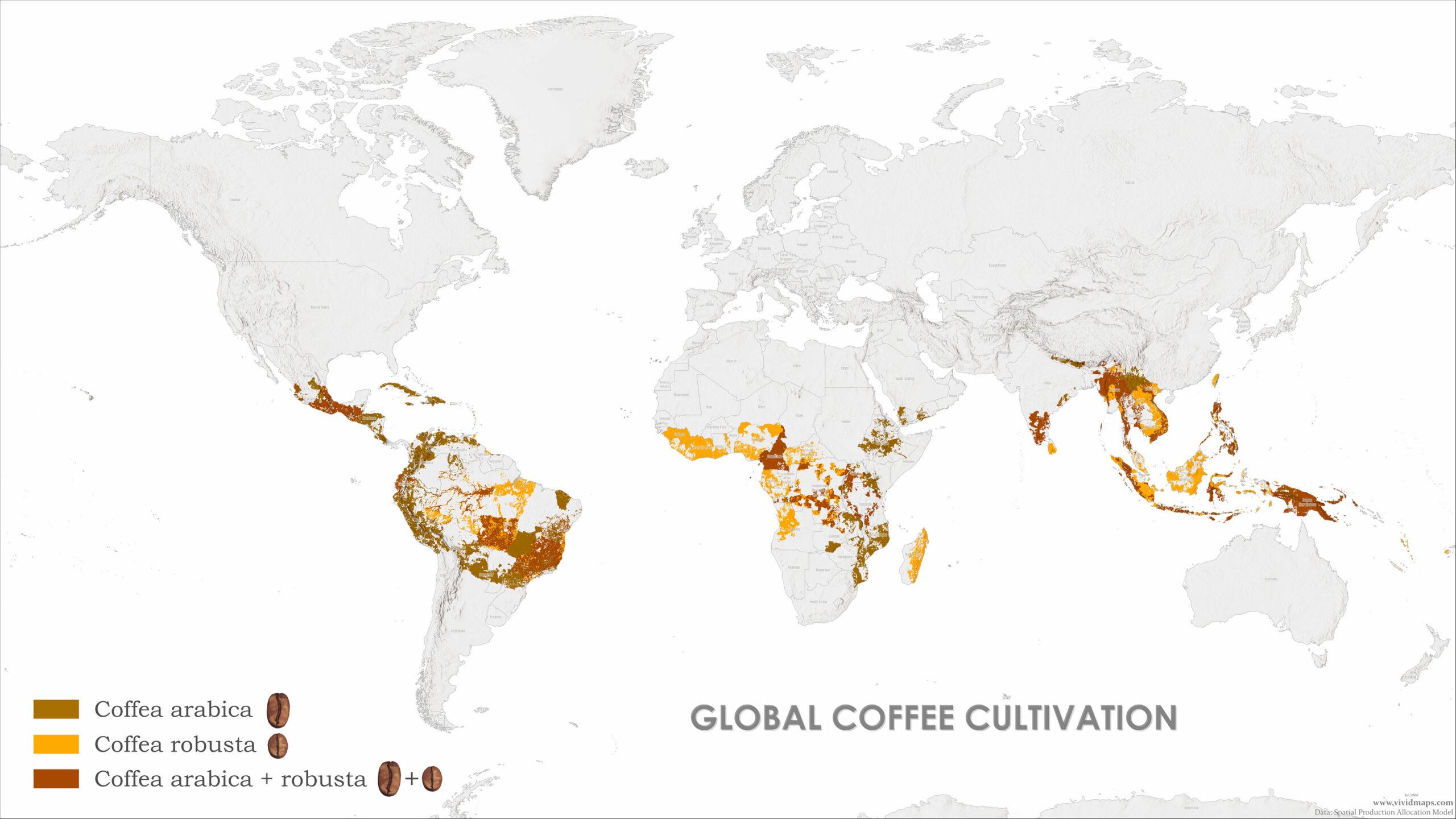
Coffee Species Distribution Map
The visualization titled \...
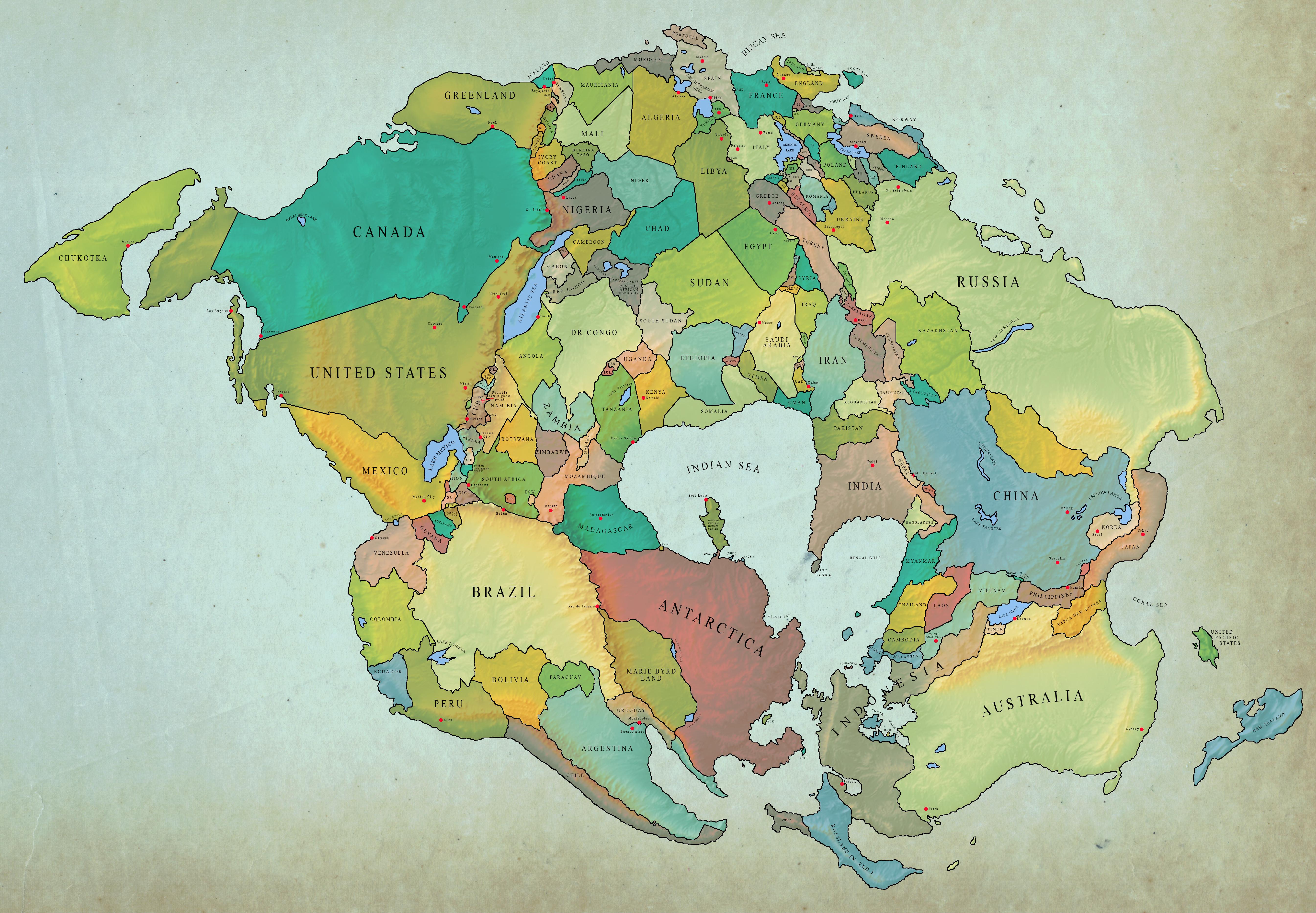
World Map 250 Million Years Later with Current Borders
Interestingly, the configuration of continents we know today is a relatively recent development in the geological timeli...
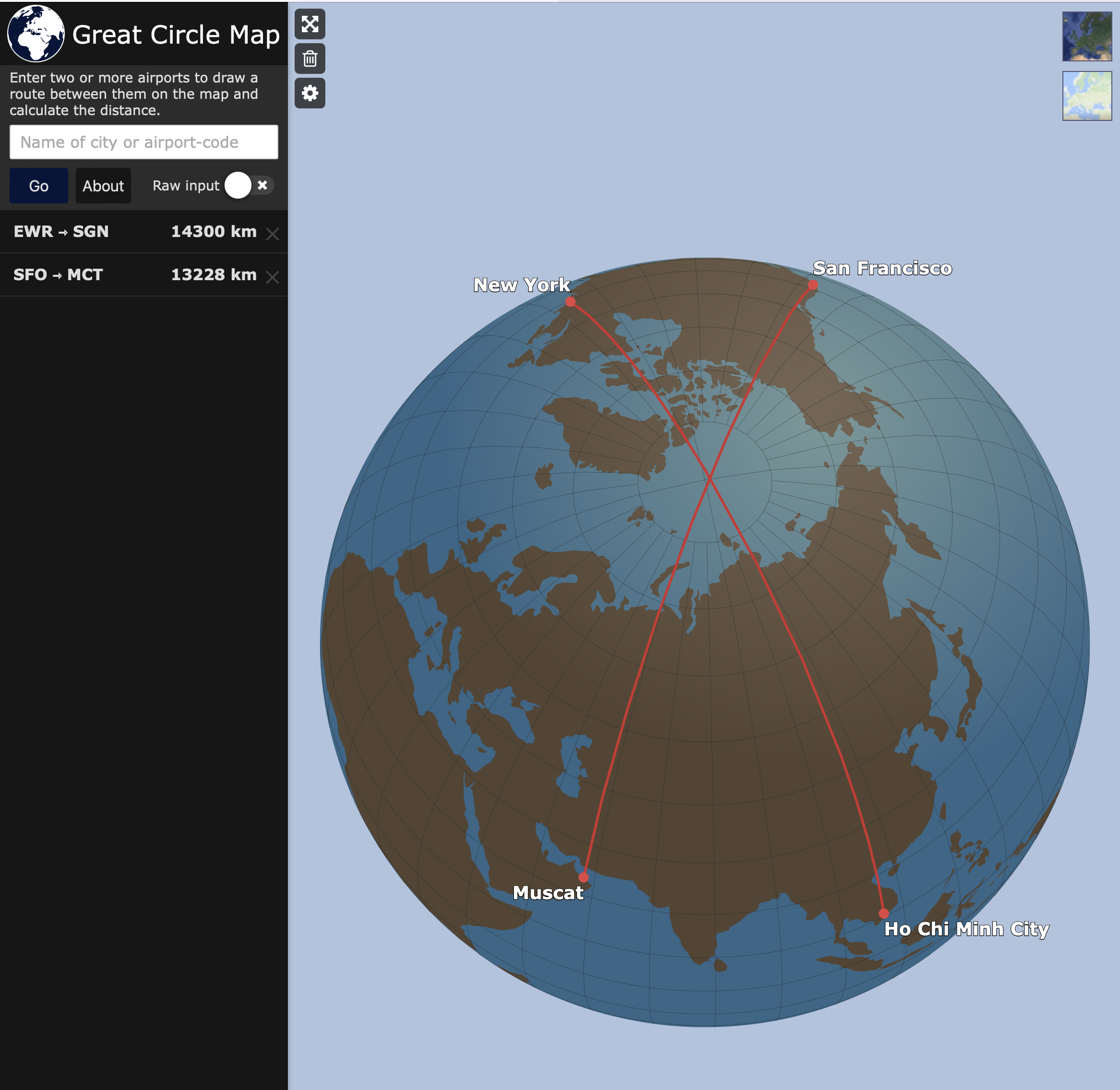
Map of City Pairs Flying Over North Pole
This map visualizes the city pairs that, for the shortest flying route, require aircraft to traverse the North Pole. It ...
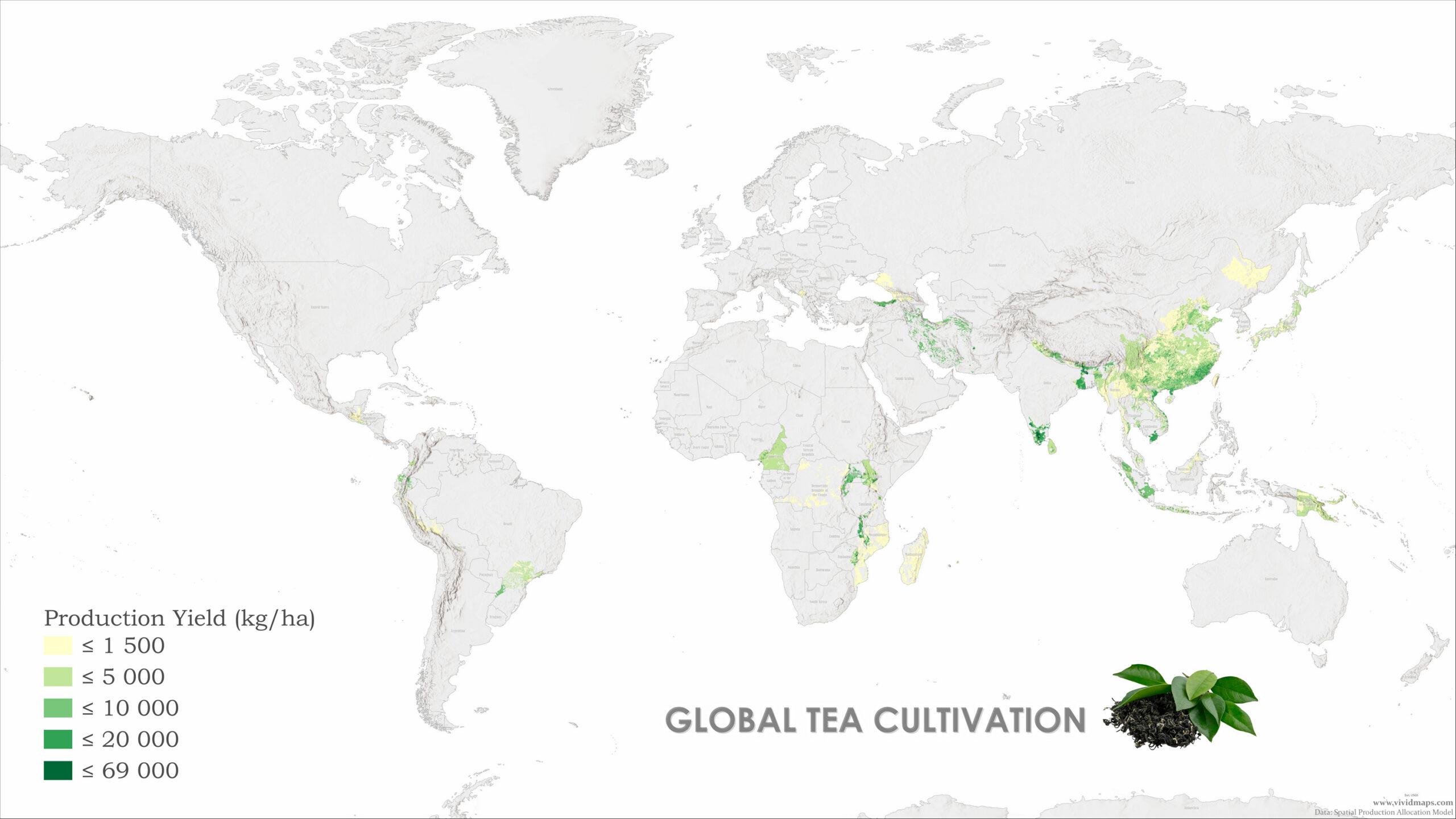
Global Tea Production Map
This map presents a detailed overview of global tea production, highlighting the countries that are the largest producer...
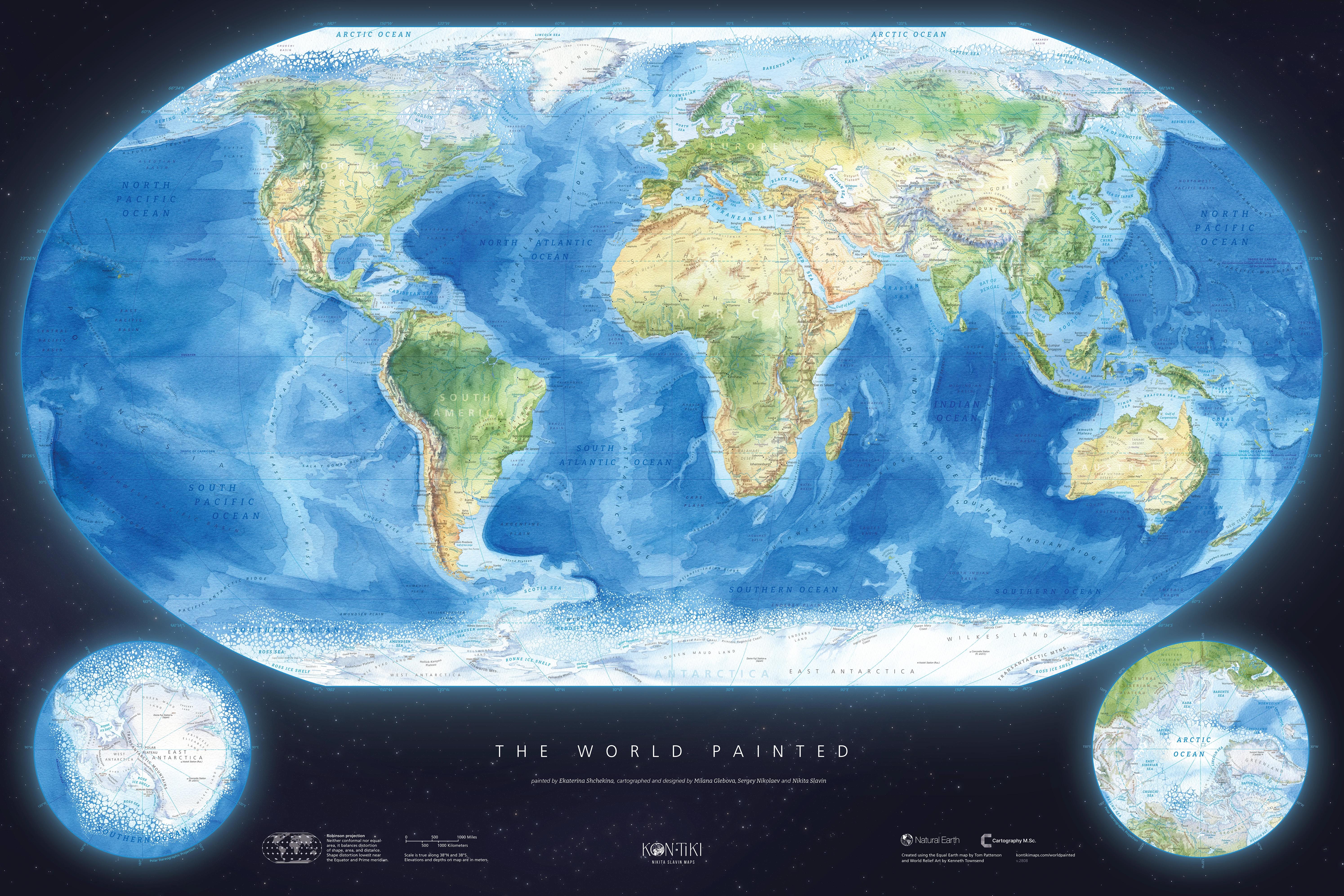
World Painted Map Overview and Analysis
The World Painted Map is a visually striking representation of the globe, where each country is adorned with vibrant col...
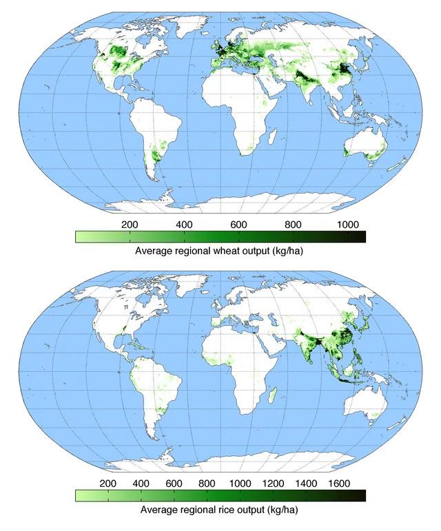
Wheat vs Rice Map: Global Cultivation Areas Map
The "Wheat vs Rice Map: Global Cultivation Areas" illustrates the primary regions around the world where these two stapl...

Power Outages by State Map
This map illustrates the frequency and duration of power outages experienced by customers across various U.S. states. By...
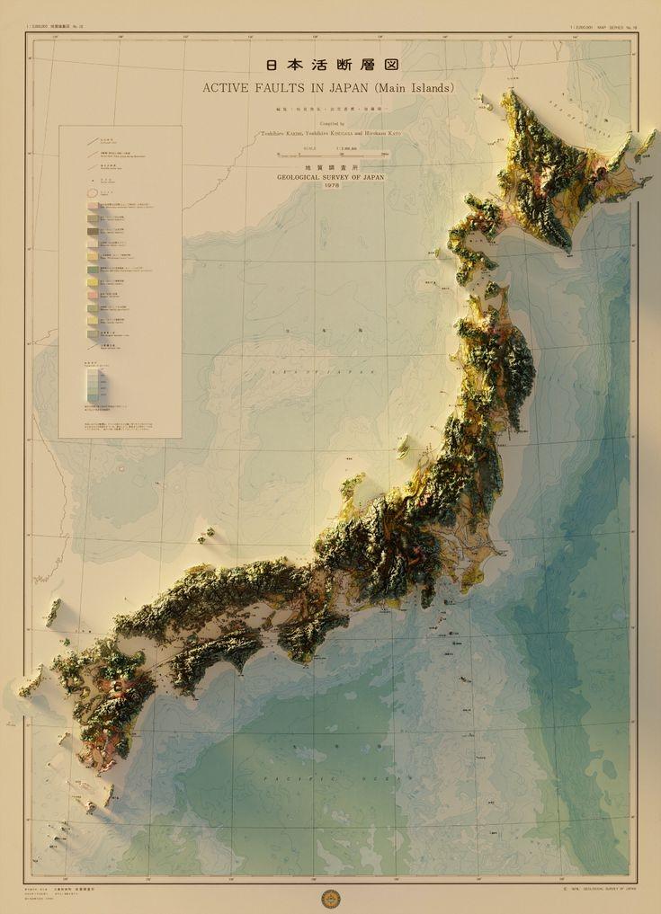
Renovated Geographic Map of Japan
Japan, an archipelago located in East Asia, consists of four main islands—Honshu, Hokkaido, Kyushu, and Shikoku—as well ...