mountains Maps
17 geographic visualizations tagged with "mountains"
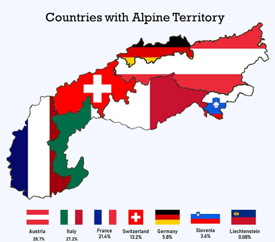
Countries with Alpine Territory Map
This map provides a visual representation of the countries that possess alpine territories, highlighting regions charact...

Elevation Map of North America
The elevation map of North America provides a detailed visual representation of the continent's topography, showcasing t...
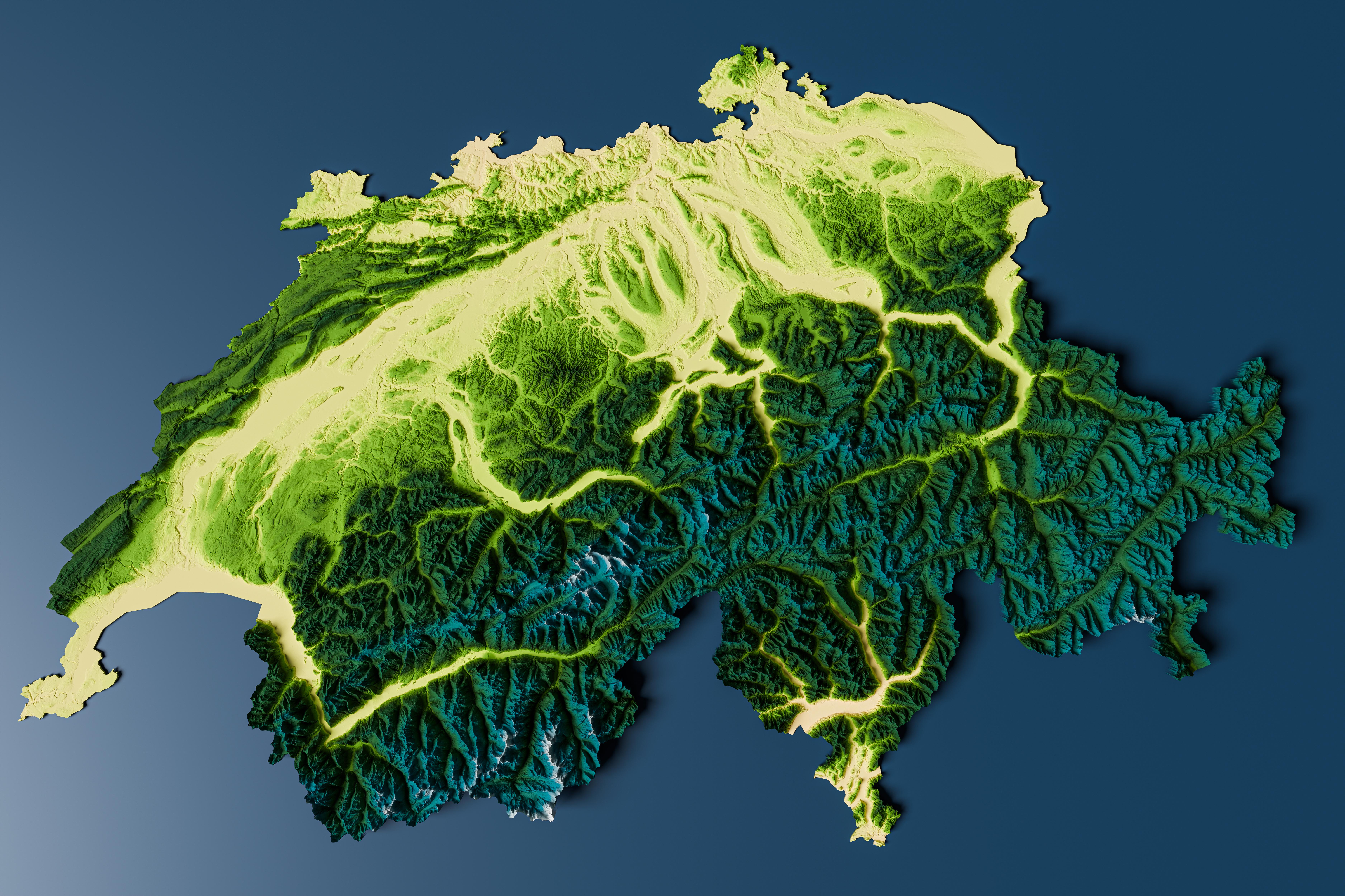
Topographic Relief Map of Switzerland
Interestingly, the topographical variation influences climate, biodiversity, and human settlement patterns. The highest ...
Western United States Geographic Features Map
The "Let's go west 😀" visualization provides a detailed overview of the geographic features of the Western United State...
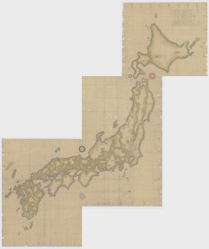
Japanese Topographical Map by Inō Tadataka
The map created by Inō Tadataka in 1821 represents a detailed topographical outline of Japan, showcasing the country's m...
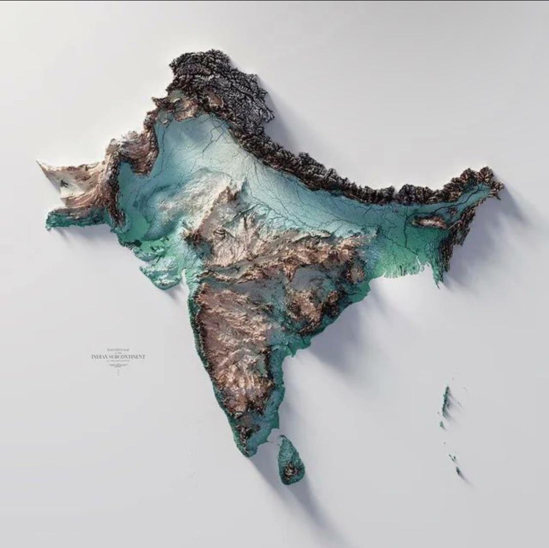
Geographical Map of the Indian Subcontinent
The Indo-Gangetic Plain, one of the most densely populated regions in the world, is another striking feature of the subc...
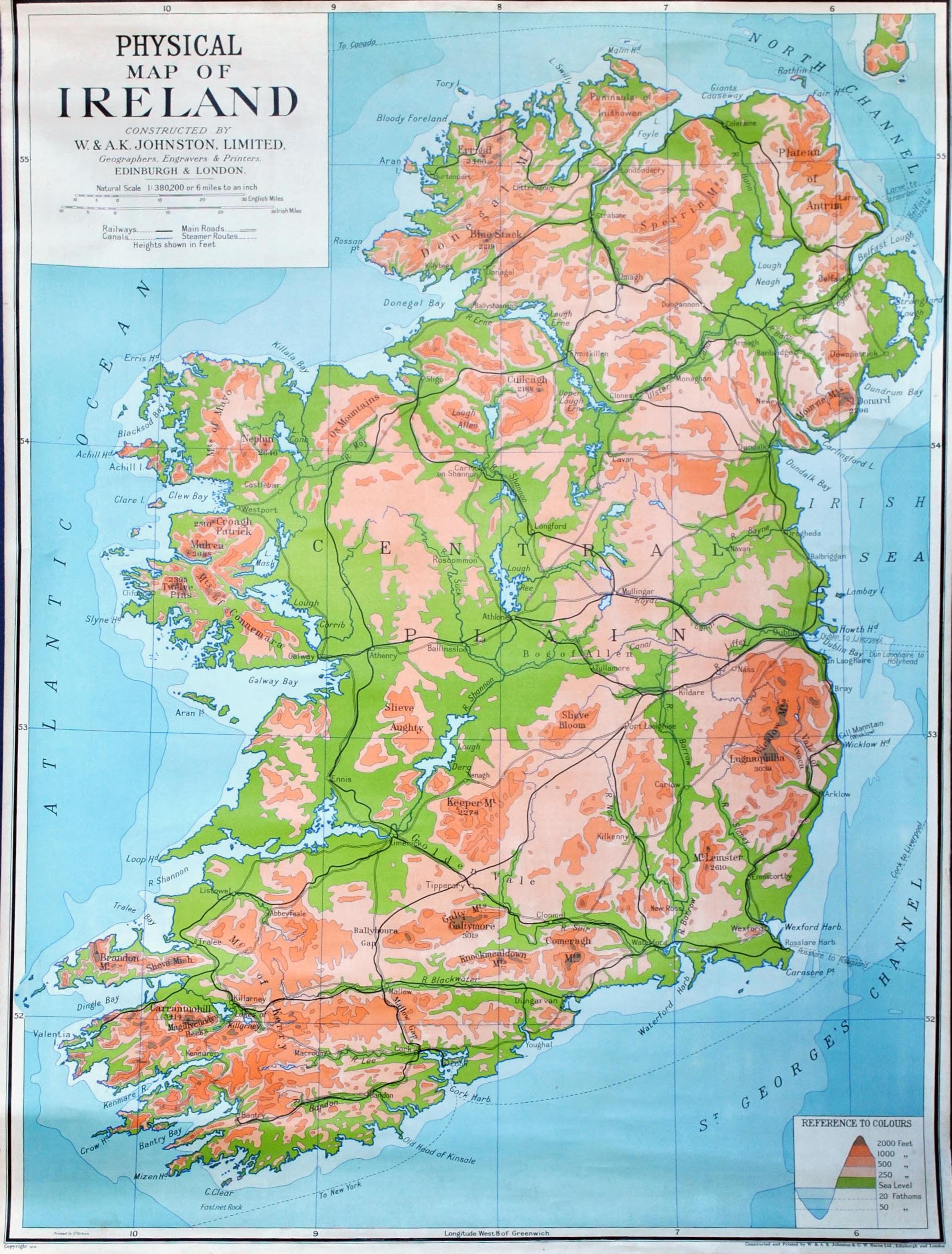
Physical Map of Ireland
The country’s rivers, such as the River Shannon—the longest river in Ireland—play a crucial role in both the ecology and...
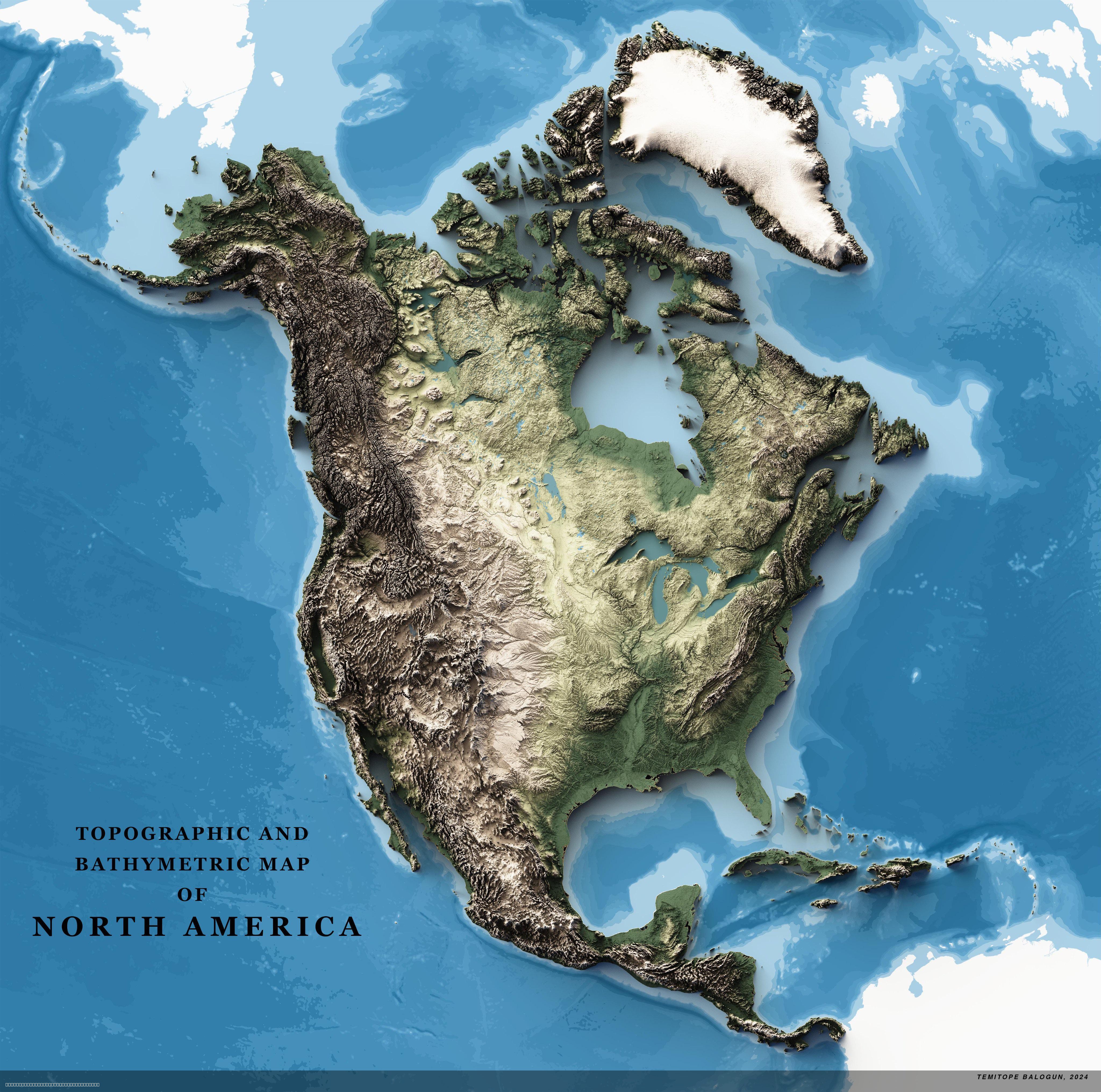
Topographic Map of North America
The 4K Topographic Map of North America provides a stunningly detailed view of the continent's diverse terrain, showcasi...
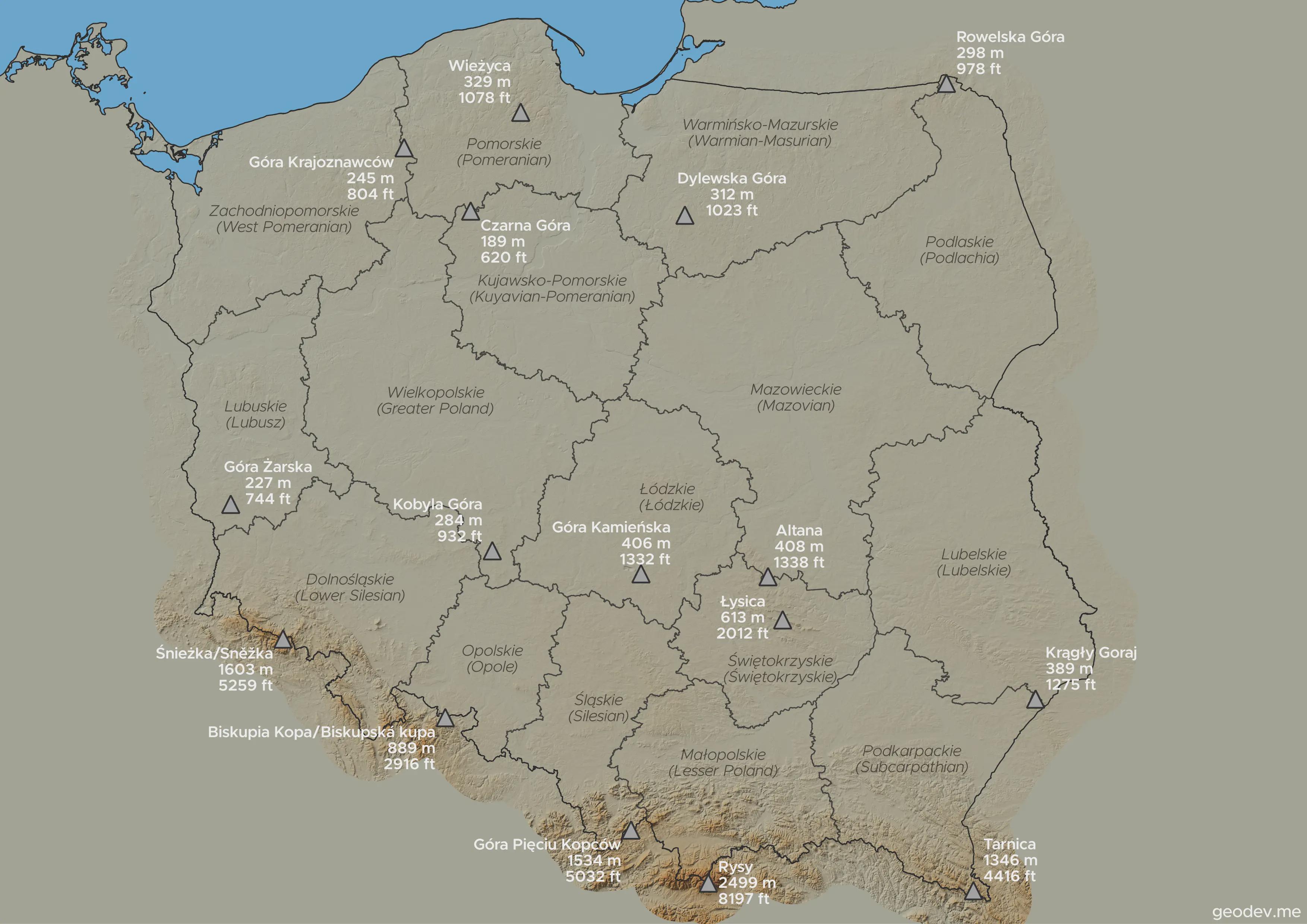
Highest Points in Each Voivodeship Map
This visualization highlights the highest points in every voivodeship in Poland, showcasing the diverse topography acros...
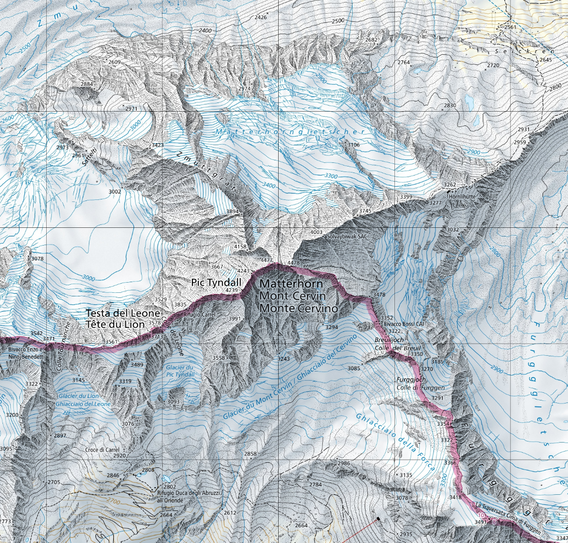
Matterhorn Location Map of Switzerland
The map titled \...
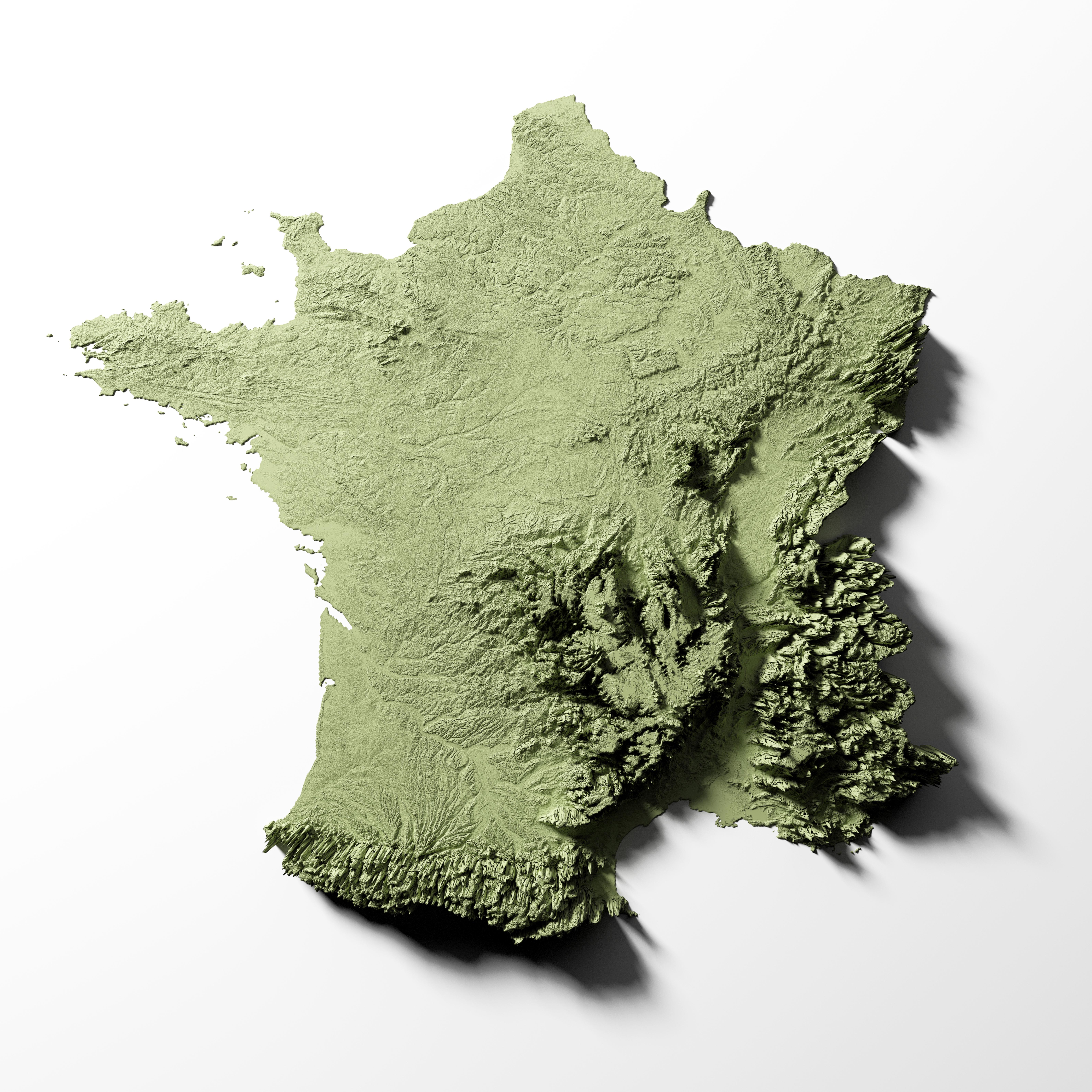
Relief Map of France
The detailed relief map of France provides a comprehensive overview of the country’s topography, showcasing its varied e...
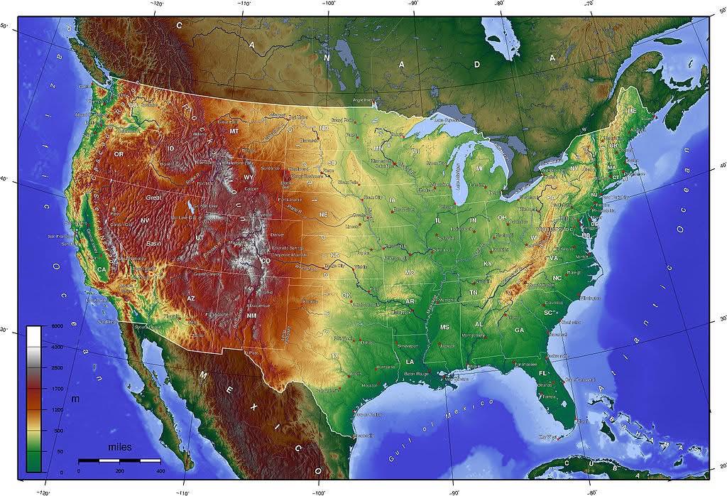
Topographic Map of the US
Transitioning from visualization to the actual topic, let’s delve deeper into the fascinating world of topography and it...
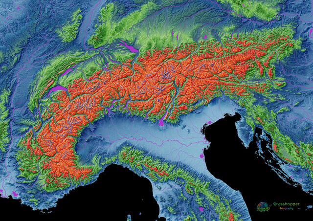
Elevation Map of the Alps
The elevation map of the Alps provides a stunning visual representation of the mountain range's topography, showcasing t...
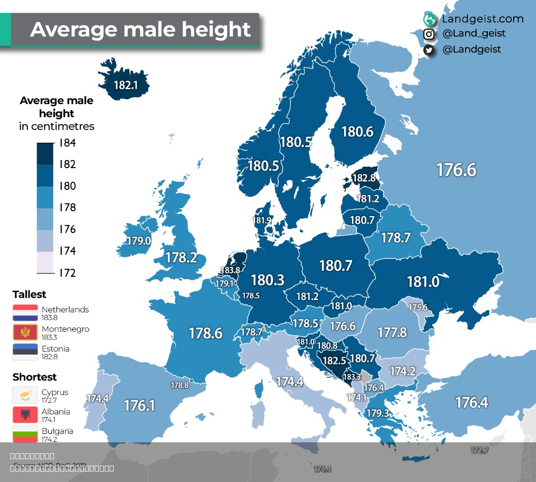
Real Height Map of Europe
The "Real Height Map of Europe" provides a striking visual representation of the varying elevations across the continent...
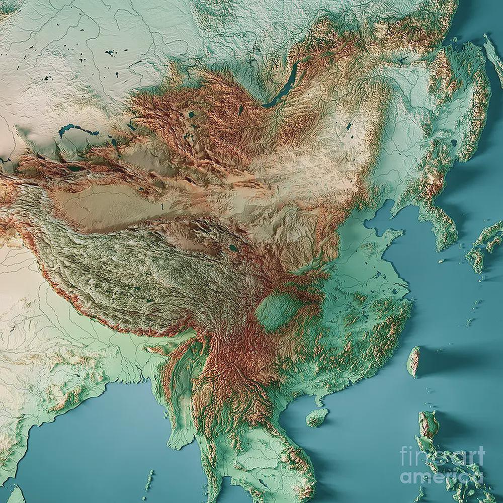
Topographic Map of East Asia
The East Asia topographic map presents a detailed view of the region's geographical features, highlighting its diverse e...
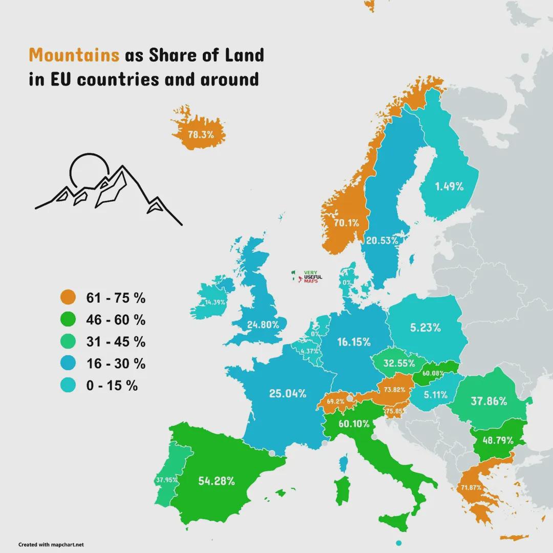
Mountains as Share of Land in EU Countries Map
The 'Mountains as Share of Land in EU Countries and Around' map visually represents the proportion of mountainous terrai...
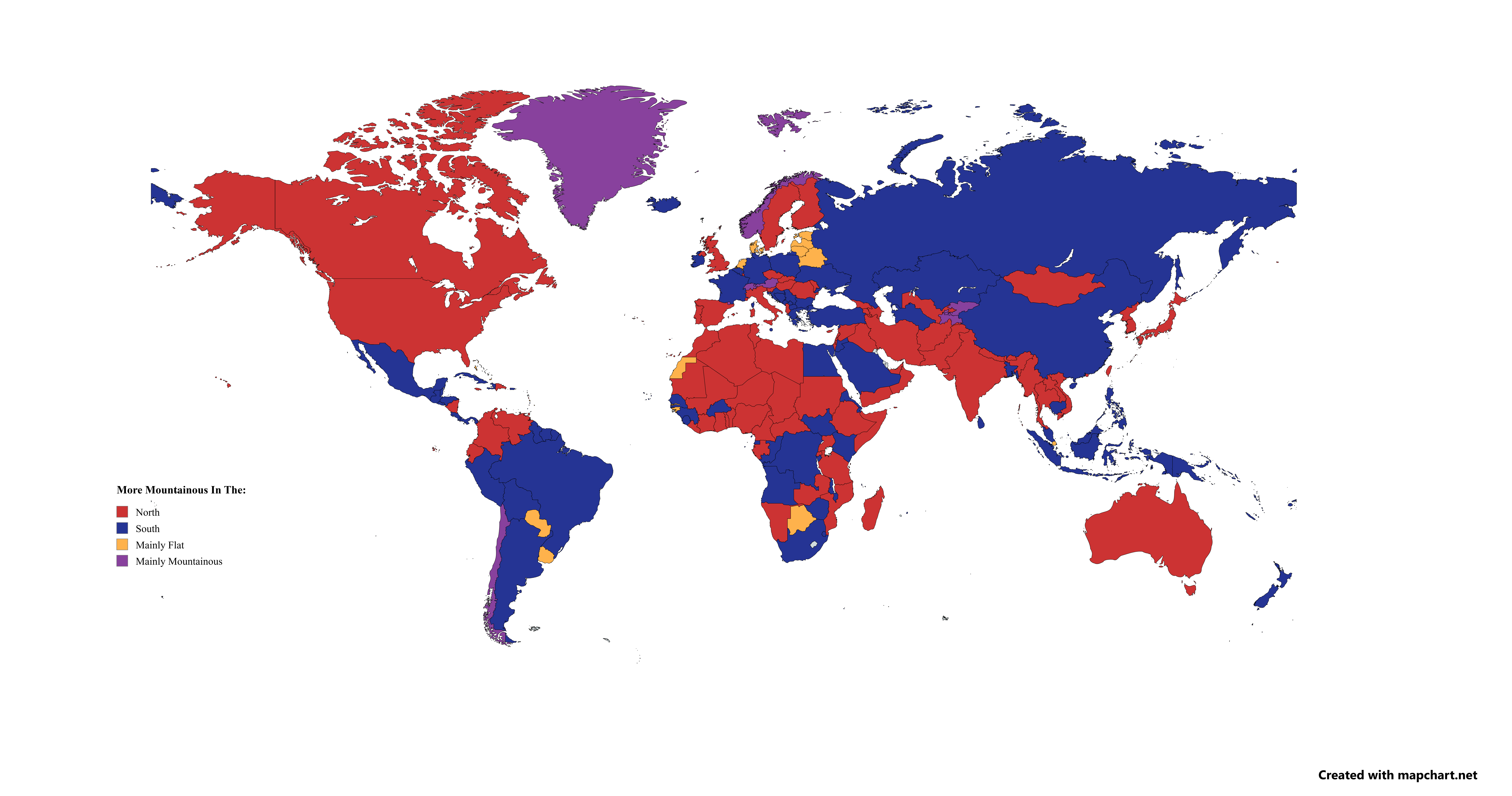
Mountainous Regions North vs South Map
This map provides a clear visual representation of the mountainous regions in various countries, comparing the elevation...