Relief Map of France

Alex Cartwright
Senior Cartographer & GIS Specialist
Alex Cartwright is a renowned cartographer and geographic information systems specialist with over 15 years of experience in spatial analysis and data...
Geographic Analysis
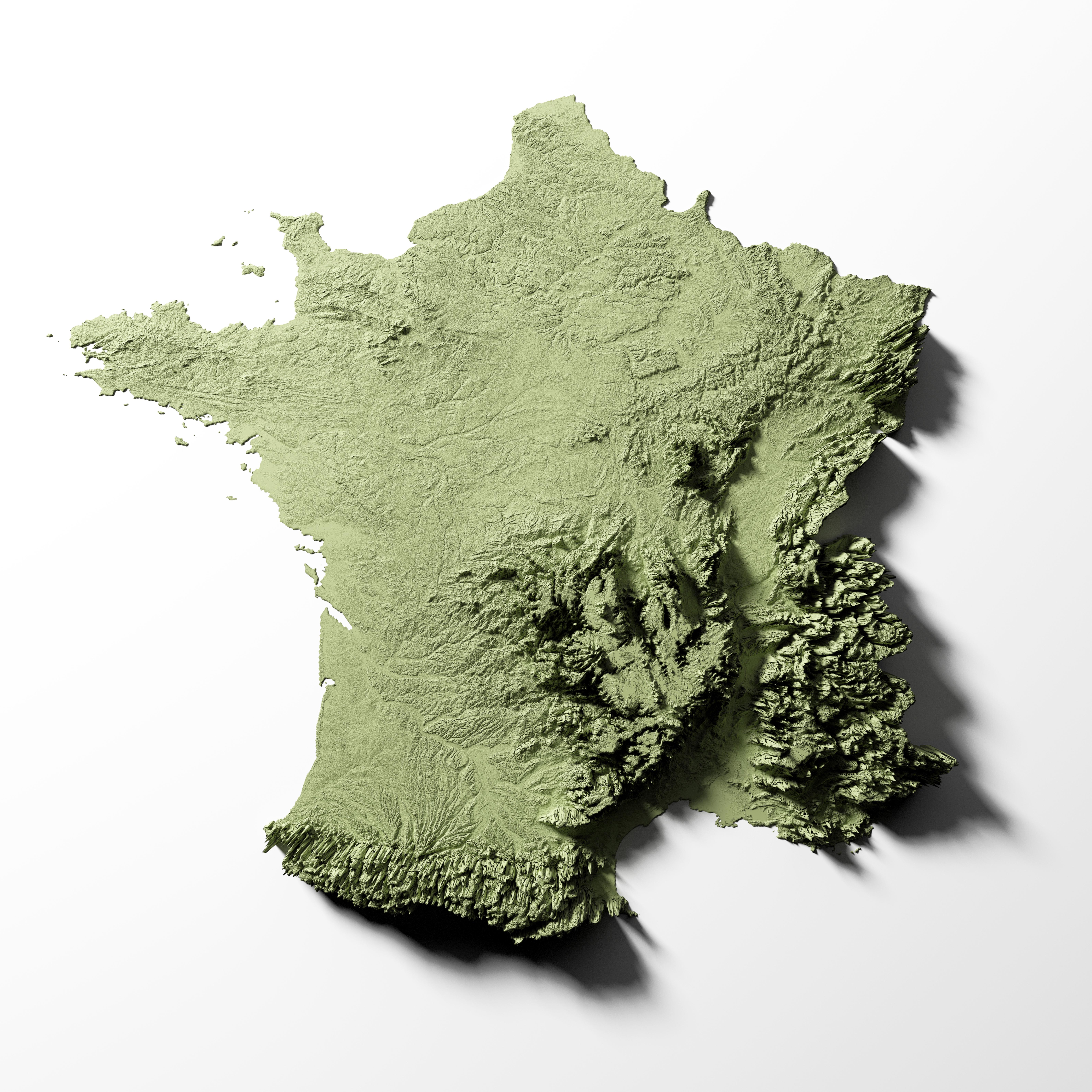
What This Map Shows
The detailed relief map of France provides a comprehensive overview of the country’s topography, showcasing its varied elevations and landforms. This visualization highlights mountains, valleys, plateaus, and plains, allowing viewers to understand the geographical diversity that defines France. The map uses color gradients and shading to represent elevation changes, making it easier to identify significant geographical features such as the Alps, Pyrenees, and the Loire Valley. With this map, you can appreciate how these physical characteristics influence not only the landscape but also the climate, biodiversity, and human activities in different regions.
Deep Dive into France’s Topography
France's topography is remarkable and varied, ranging from the rugged peaks of the Alps to the flat plains of the north. The country is characterized by several major mountain ranges that contribute to its unique landscapes. The Alps, located in the southeast, are home to Mont Blanc, the highest peak in Western Europe at 4,808 meters (15,774 feet). This majestic mountain range attracts thousands of tourists each year for skiing, hiking, and mountaineering.
On the other hand, the Pyrenees form a natural border between France and Spain, showcasing a diverse ecosystem with rich flora and fauna. The highest peak, Aneto, reaches 3,404 meters (11,168 feet), and the mountain range offers stunning views and numerous outdoor activities.
Interestingly, the Massif Central, a highland region in south-central France, is notable for its volcanic landscape. This area contains extinct volcanoes that have shaped the terrain, creating unique geological features and fertile soil that supports agriculture. The Aveyron Valley, for instance, is known for its picturesque scenery and rich wildlife.
In stark contrast, the northern regions of France are characterized by lower elevations and vast agricultural plains. The Paris Basin is a prime example, where the land is predominantly flat and fertile, making it one of the most productive agricultural areas in Europe. It’s fascinating to see how the geography of a region influences its economic activities, such as farming and urban development.
Regional Analysis
When examining the relief map of France, it’s essential to consider how different regions reflect diverse topographical features. The eastern region, with the Alps, is known for its dramatic elevation changes. This area experiences a continental climate, leading to colder winters and warmer summers, which significantly affects the types of crops grown and the lifestyle of its residents.
In contrast, the coastal regions, such as Brittany and Normandy, are characterized by rolling hills and cliffs facing the Atlantic Ocean. These areas have a moderate maritime climate, influencing agriculture and tourism. For instance, Brittany’s coastline is famous for its stunning cliffs and beautiful beaches, which draw visitors seeking both relaxation and adventure.
The Loire Valley, often referred to as the “Garden of France,” is another notable area where the relief map reveals the influence of geography. The gentle slopes and fertile lands along the Loire River yield an abundance of vineyards and orchards, contributing to the region’s reputation for fine wines and produce. The varying elevations also create microclimates that enhance agricultural diversity.
Significance and Impact
Understanding the relief of France is not just an exercise in geography; it has real-world implications. The country’s topography influences weather patterns, biodiversity, and human settlement. For example, the steep slopes of the Alps and Pyrenees result in a high level of precipitation, supporting lush forests and rich wildlife habitats. This ecological diversity is crucial for conservation efforts and biodiversity preservation.
Moreover, the geographical features of France have shaped its history and culture. The mountains served as natural barriers, influencing historical events and migrations. The valleys and plains have facilitated trade and agriculture, impacting economic development.
Looking to the future, the ongoing changes in climate patterns may further impact France's landscapes. Rising temperatures and changing precipitation patterns could alter agricultural practices and biodiversity. Understanding these geographical elements is essential for planning and sustainable development as we face environmental challenges in the coming years.
In summary, the relief map of France is not just a representation of its physical features but a window into the interconnectedness of geography, climate, and human life. Have you ever wondered how such diverse landscapes shape the culture and lifestyle of the people living there? The answer lies in the intricate tapestry of France’s topography, where every mountain, valley, and plain tells a story of natural beauty and human resilience.
Visualization Details
- Published
- August 22, 2025
- Views
- 88
Comments
Loading comments...