france Maps
13 geographic visualizations tagged with "france"
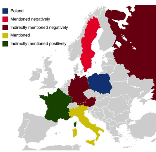
Countries Mentioned in the Polish National Anthem Map
The map titled "All The Countries Mentioned In The Polish National Anthem" provides a unique geographical insight into t...
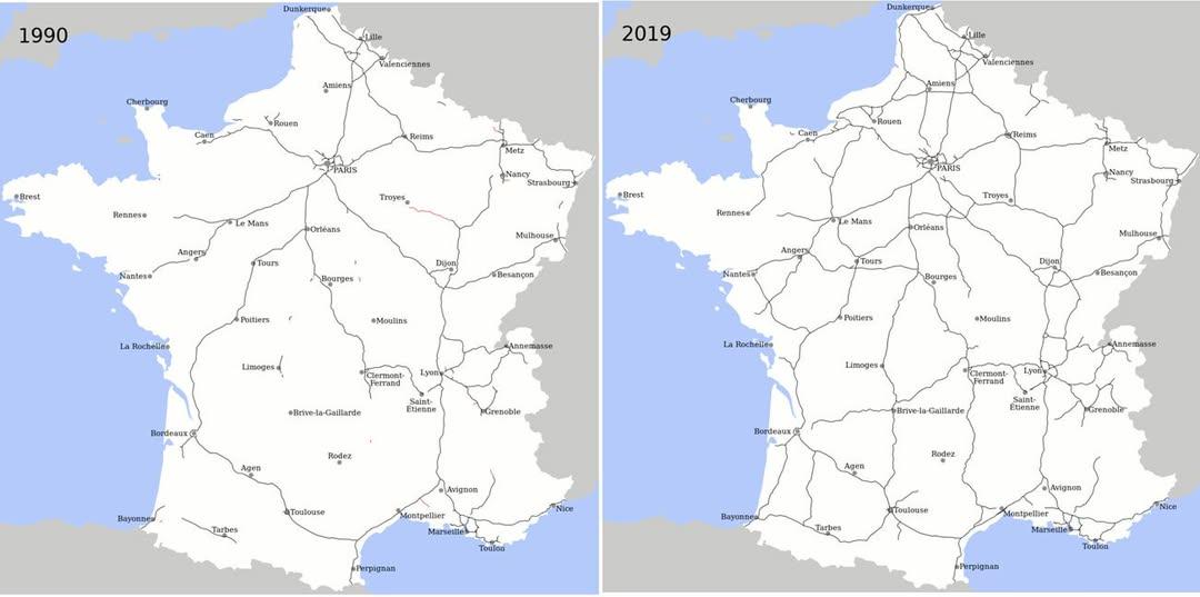
Motorway Construction Comparison Map: France vs. UK
This map effectively illustrates a striking statistic: over the last 25 years, France has constructed more miles of moto...
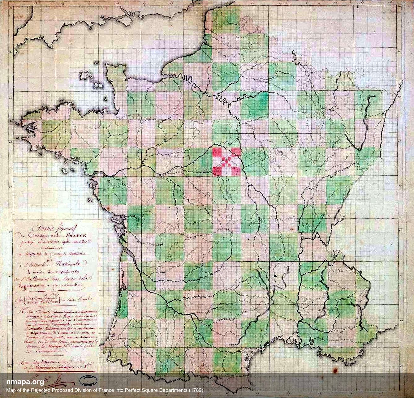
Map of the Rejected Proposed Division of France into Square Departments (1789)
This intriguing map illustrates the proposed division of France into square departments during the revolutionary period ...
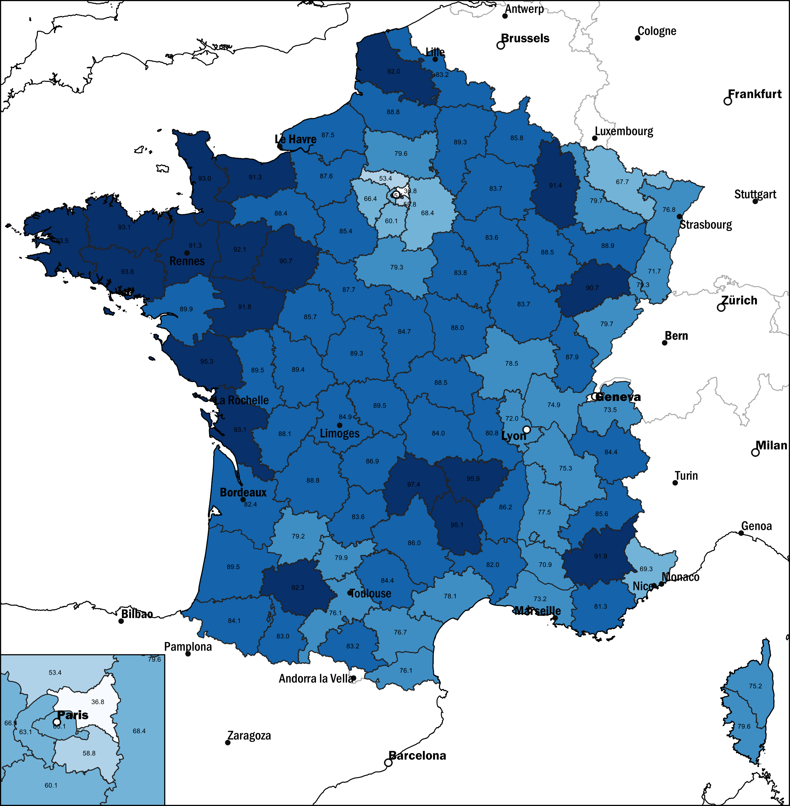
Map of French Population Without Migration Background, 2021
This map displays the percentage of the French population without a migration background as of 2021. It highlights the d...
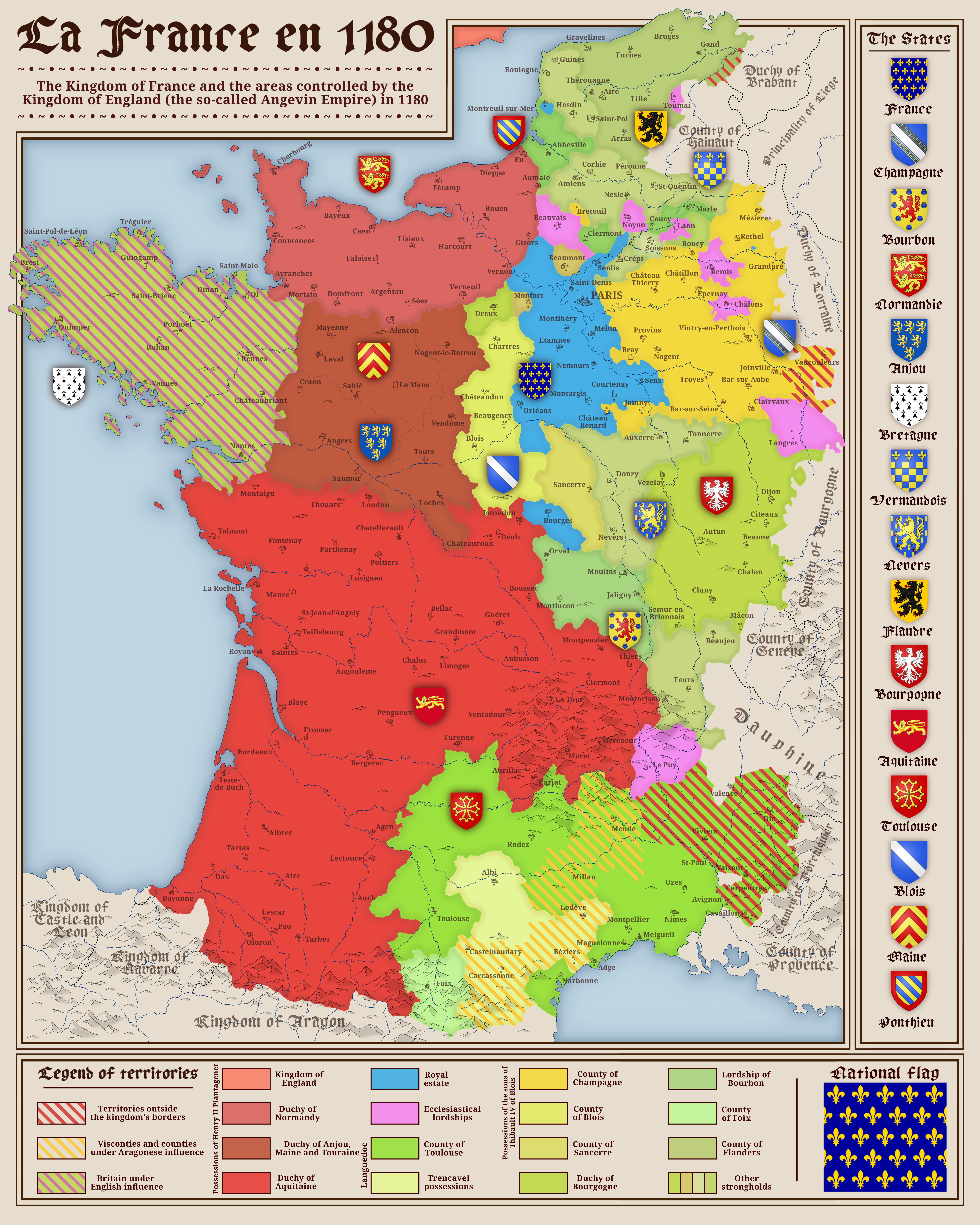
Political Map of France in 1180
The map titled "France in 1180" provides a detailed view of the political landscape of France during the late 12th centu...
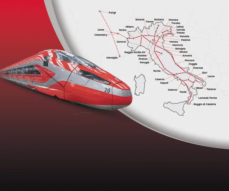
Frecciarossa High Speed Train Routes Map
The "Routes of the Frecciarossa High-Speed Trains in Italy and France" map provides a detailed visualization of the exte...
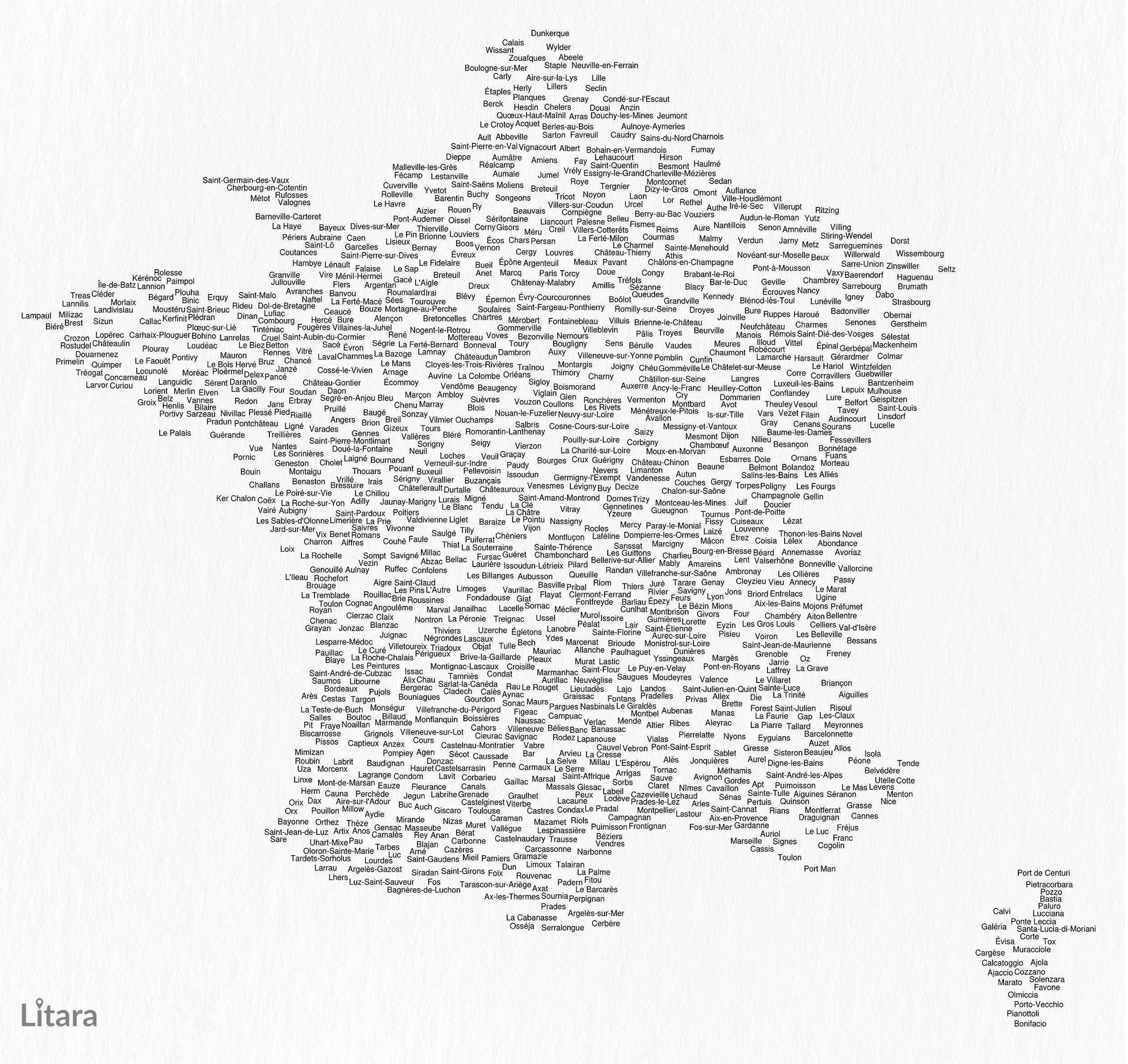
Typographic Map of France's Communes
This unique typographic map of France showcases the names of 1,156 communes, creating a captivating visual representatio...
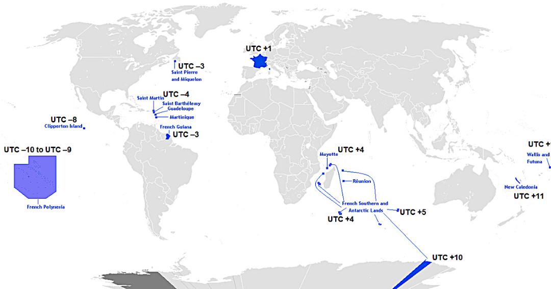
Map of France’s Twelve Time Zones
This map displays the unique and complex time zone structure of France, illustrating how the country spans twelve differ...
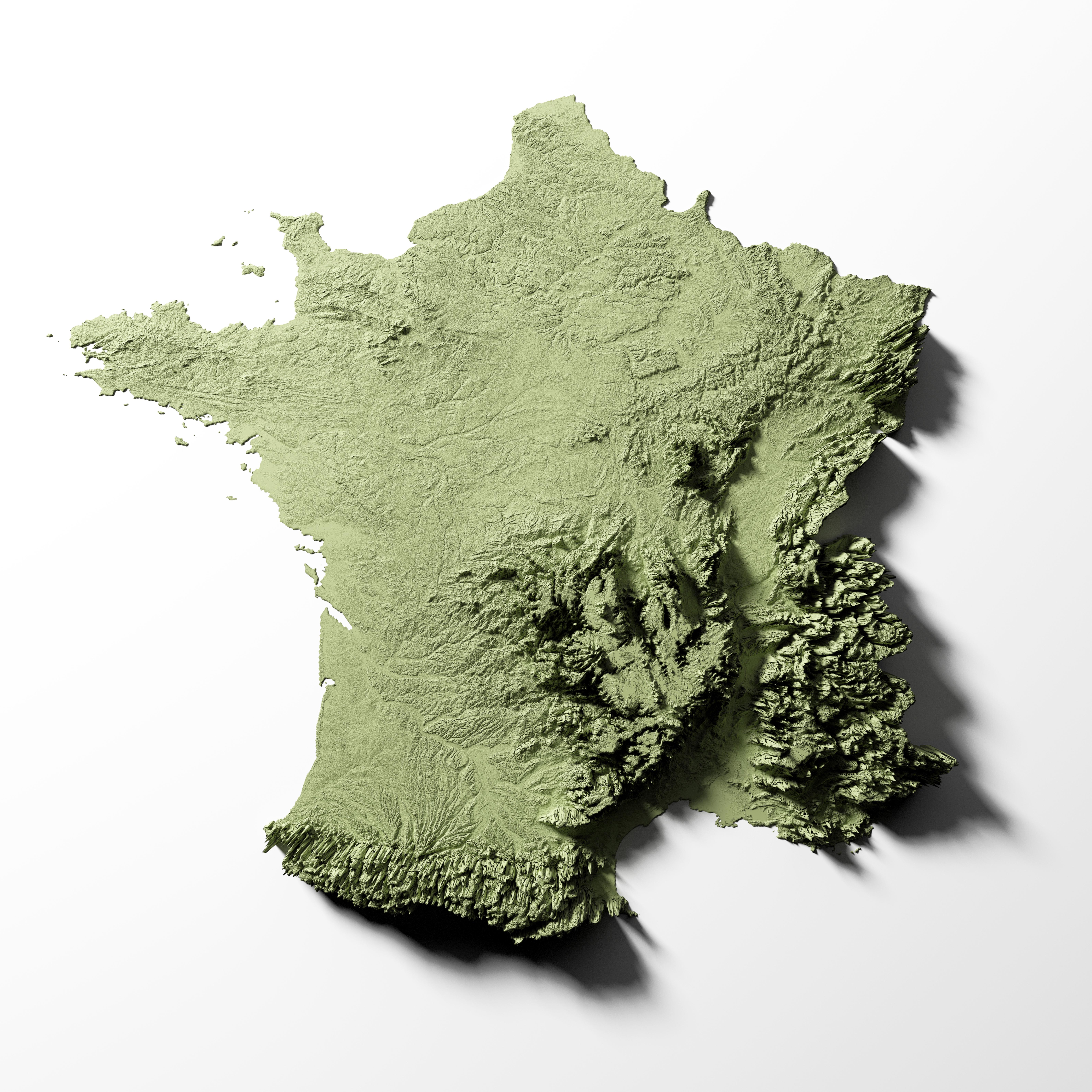
Relief Map of France
The detailed relief map of France provides a comprehensive overview of the country’s topography, showcasing its varied e...
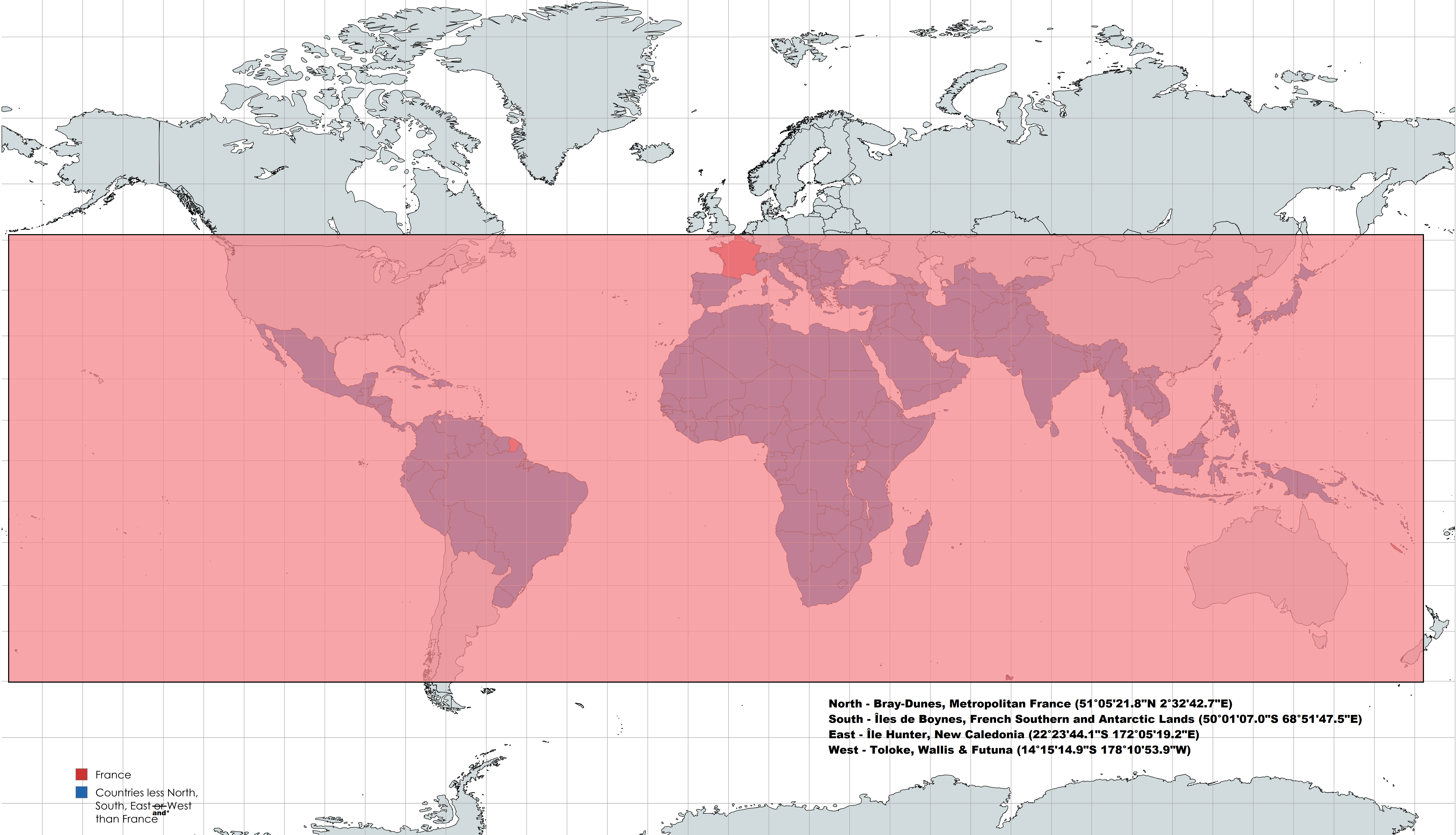
France's Geographical Extremes Map
This intriguing map highlights an interesting geographical fact: France is positioned further North, South, East, and We...
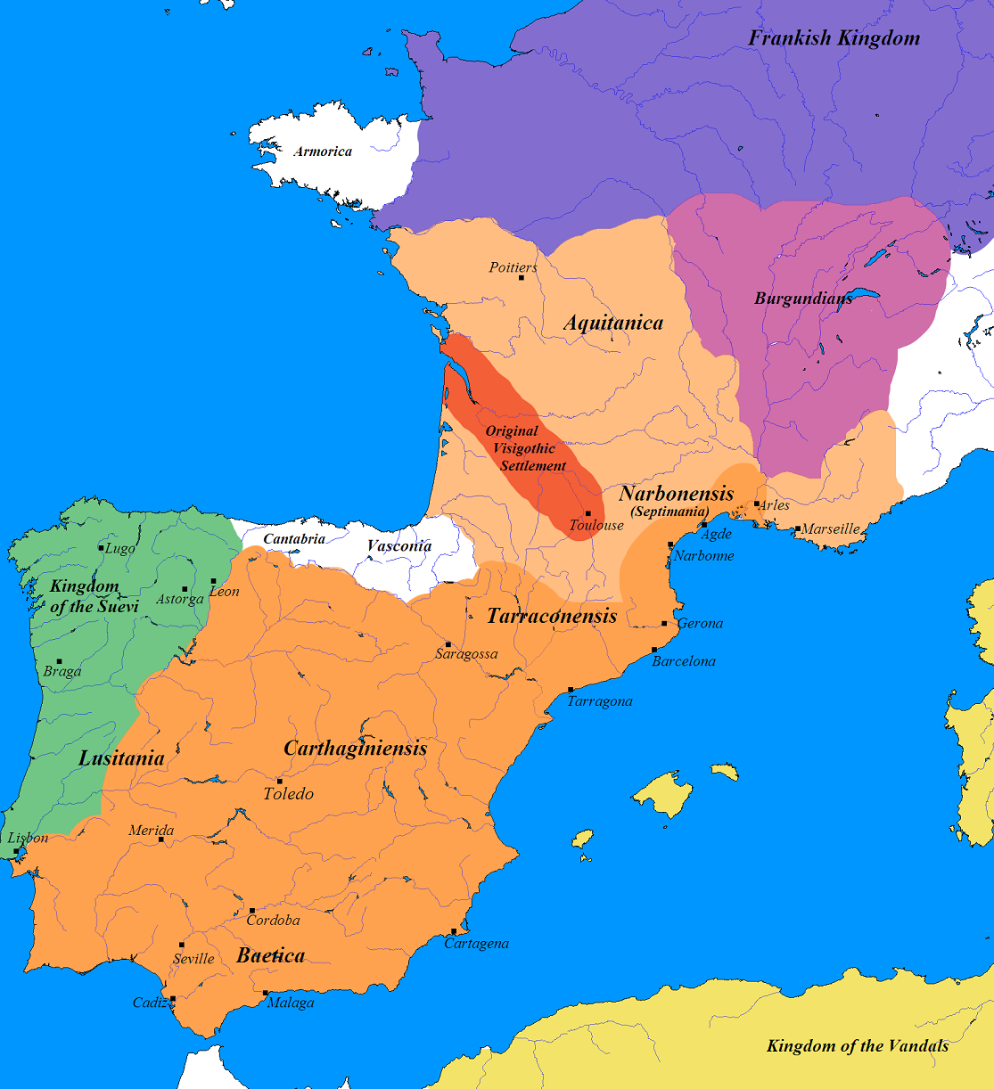
Germanic Tribes Map of France and Iberia (500 AD)
The map titled "Germanic France and Iberia (500 AD)" provides a fascinating glimpse into the landscape of post-Roman Eur...
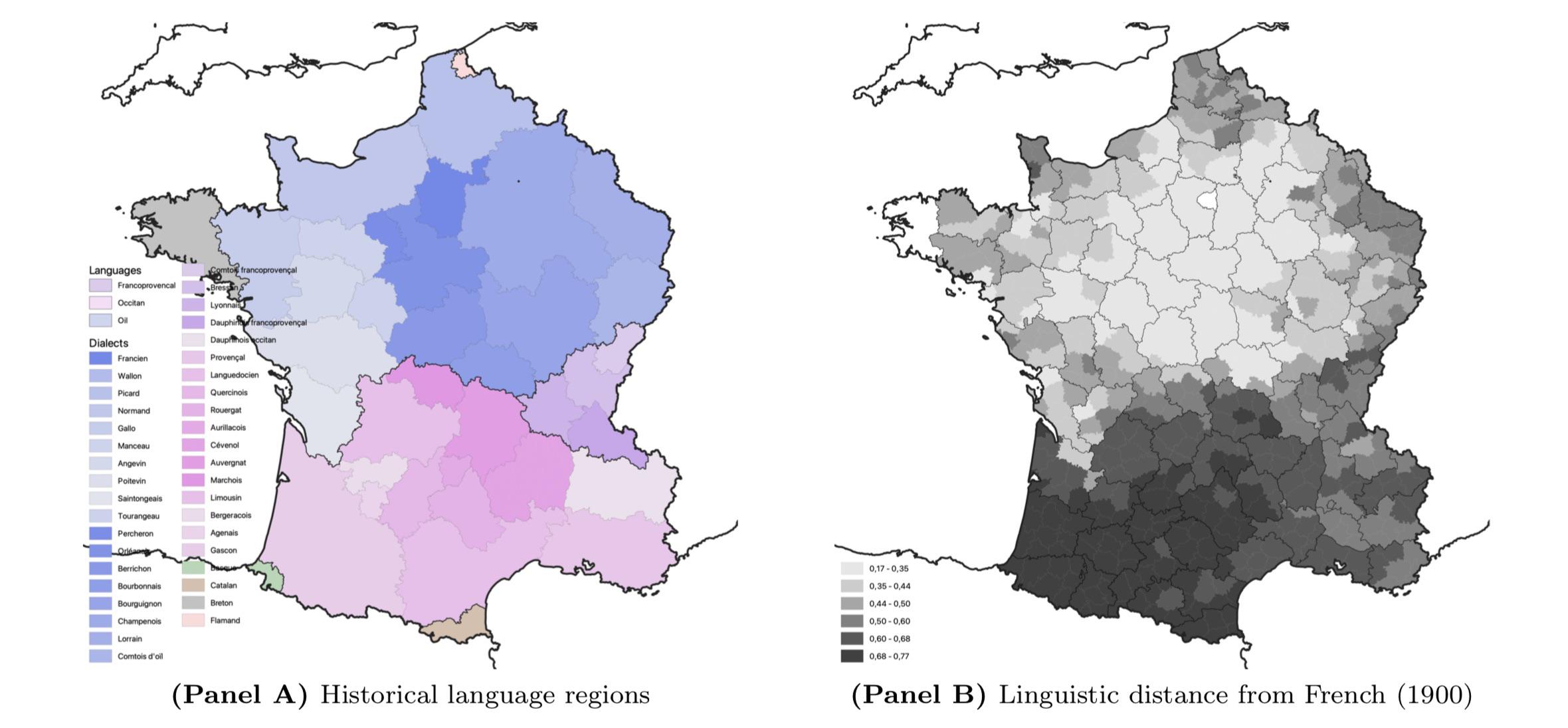
Linguistic Differences in France Map
The map titled "Linguistic Differences in France circa 1900" provides a vivid representation of the various languages an...
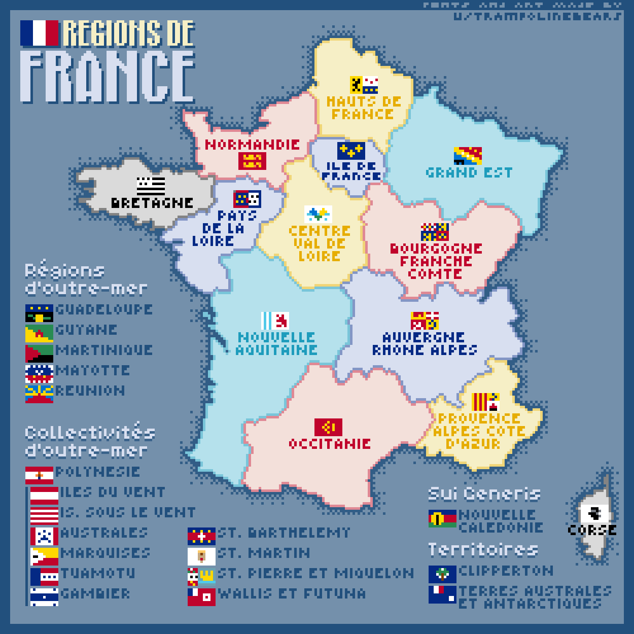
Regions of France Map
This pixel art map captures the diverse regions of France, each represented with a unique flag rendered in a charming 11...