Regions of France Map

Alex Cartwright
Senior Cartographer & GIS Specialist
Alex Cartwright is a renowned cartographer and geographic information systems specialist with over 15 years of experience in spatial analysis and data...
Geographic Analysis
What This Map Shows
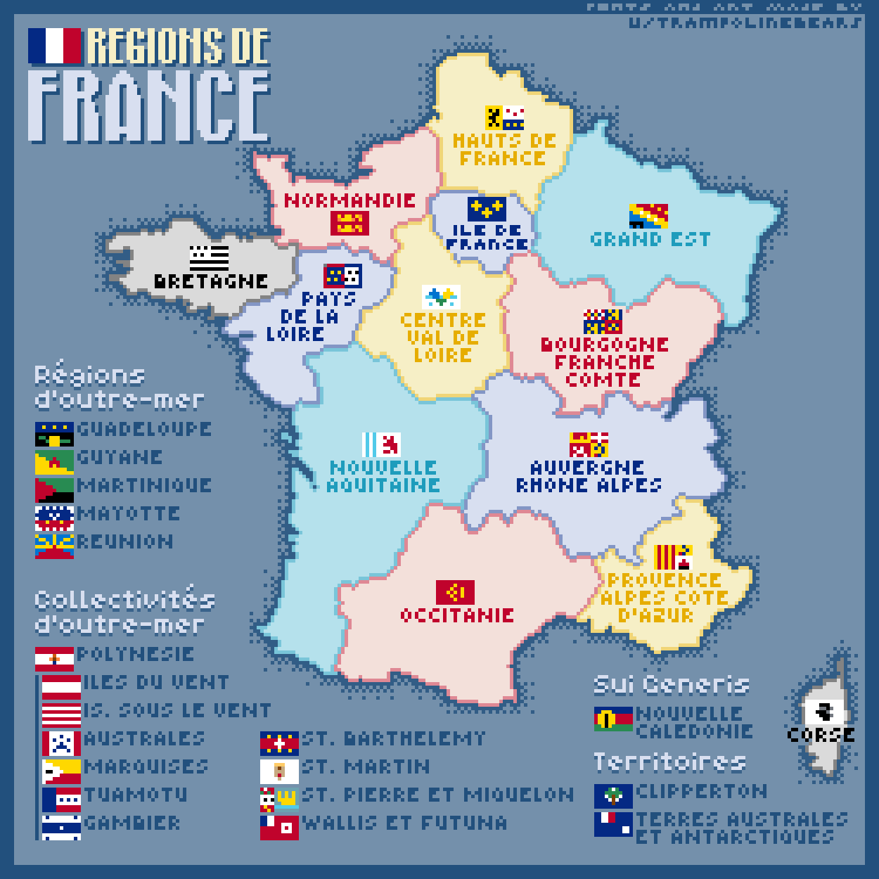
This pixel art map captures the diverse regions of France, each represented with a unique flag rendered in a charming 11x7 pixel format. The simplicity of pixel art allows for a nostalgic yet informative glance at the geographical and cultural richness that France has to offer. Each region not only showcases its distinct flag but also serves as a reminder of the historical, cultural, and administrative significance of these areas. As you look at the map, you can appreciate the visual representation of France's regional divisions, which play a crucial role in understanding the country's identity.
Deep Dive into French Regions
France is divided into 18 regions, including 13 metropolitan regions and 5 overseas regions. Each region has its own unique character, shaped by history, geography, and culture. The administrative regions serve as a basis for local governance, economic planning, and cultural identity.
One fascinating aspect of these regions is their historical backgrounds. For instance, regions such as Normandy and Brittany have rich histories tied to seafaring and trade, which date back centuries. Normandy is particularly known for its historical significance during World War II, thanks to the D-Day landings. Interestingly, Brittany has a distinct Celtic heritage that sets it apart from the rest of France, evident in its language and traditions.
Moreover, the geographical diversity across these regions is striking. The eastern regions like Alsace and Lorraine are known for their rolling vineyards and a climate that produces some of the finest wines in the world. In contrast, the southern regions, such as Provence-Alpes-Côte d'Azur, boast a Mediterranean climate, making it a popular tourist destination known for its stunning coastline and vibrant lavender fields.
Economically, the regions also differ widely. Île-de-France, which includes Paris, is the wealthiest region and serves as the economic powerhouse of the nation, while regions like Auvergne-Rhône-Alpes have a strong industrial base and are crucial for manufacturing and innovation. The disparities in economic activity reflect the varied resources and industries present in each region, from agriculture in the Loire Valley to technology in the Paris region.
Regional Analysis
When examining specific regions, we can see notable differences in demographics, culture, and economy. For example, the Île-de-France region is home to nearly 20% of France's population, making it a melting pot of cultures and ethnicities. In contrast, regions like Nouvelle-Aquitaine, which is more rural, have lower population densities and a stronger focus on agriculture and tourism.
Interestingly, the northern regions like Hauts-de-France have been historically industrial, but in recent years, they have been undergoing significant economic transformation. Urban revitalization projects and investments in technology have started to reshape the economic landscape, creating new opportunities for residents. On the other hand, the Mediterranean regions of Occitanie and Provence-Alpes-Côte d'Azur have seen growth in tourism and services, with millions flocking to their beaches each year.
Each region's identity is also manifested in its festivals, cuisine, and local customs. For instance, the Alsace region is known for its Christmas markets and unique blend of French and German cuisine, while the Basque region is celebrated for its vibrant festivals and distinct gastronomic traditions, including pintxos and Basque cake.
Significance and Impact
Understanding the regions of France is essential not just for geographical knowledge but also for recognizing the cultural and economic dynamics at play. These regions play a pivotal role in shaping national policies, influencing local economies, and fostering cultural heritage. As France continues to evolve, the interplay between urban and rural areas, as well as the challenges posed by globalization, will determine the future of these regions.
In recent years, there has been a growing trend towards regional autonomy and empowerment. Many regions are advocating for more control over their economic and cultural affairs, reflecting a desire for localized governance that aligns more closely with the needs of their populations. This shift could have profound implications for the future of regional identities in France, making it a topic worth watching.
In conclusion, the pixel art map of the regions of France not only serves as a visual delight but also opens the door to a deeper understanding of the intricate tapestry that makes up this remarkable country. Each pixel represents a story, a heritage, and a unique place within the broader narrative of France.
Visualization Details
- Published
- September 1, 2025
- Views
- 100
Comments
Loading comments...