administrative divisions Maps
16 geographic visualizations tagged with "administrative divisions"
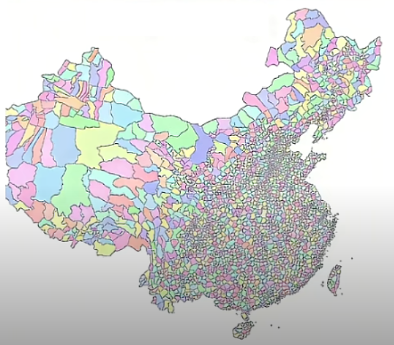
All Counties in China Map
The "All Counties in China Map" provides a comprehensive view of the administrative divisions within the country. It hig...
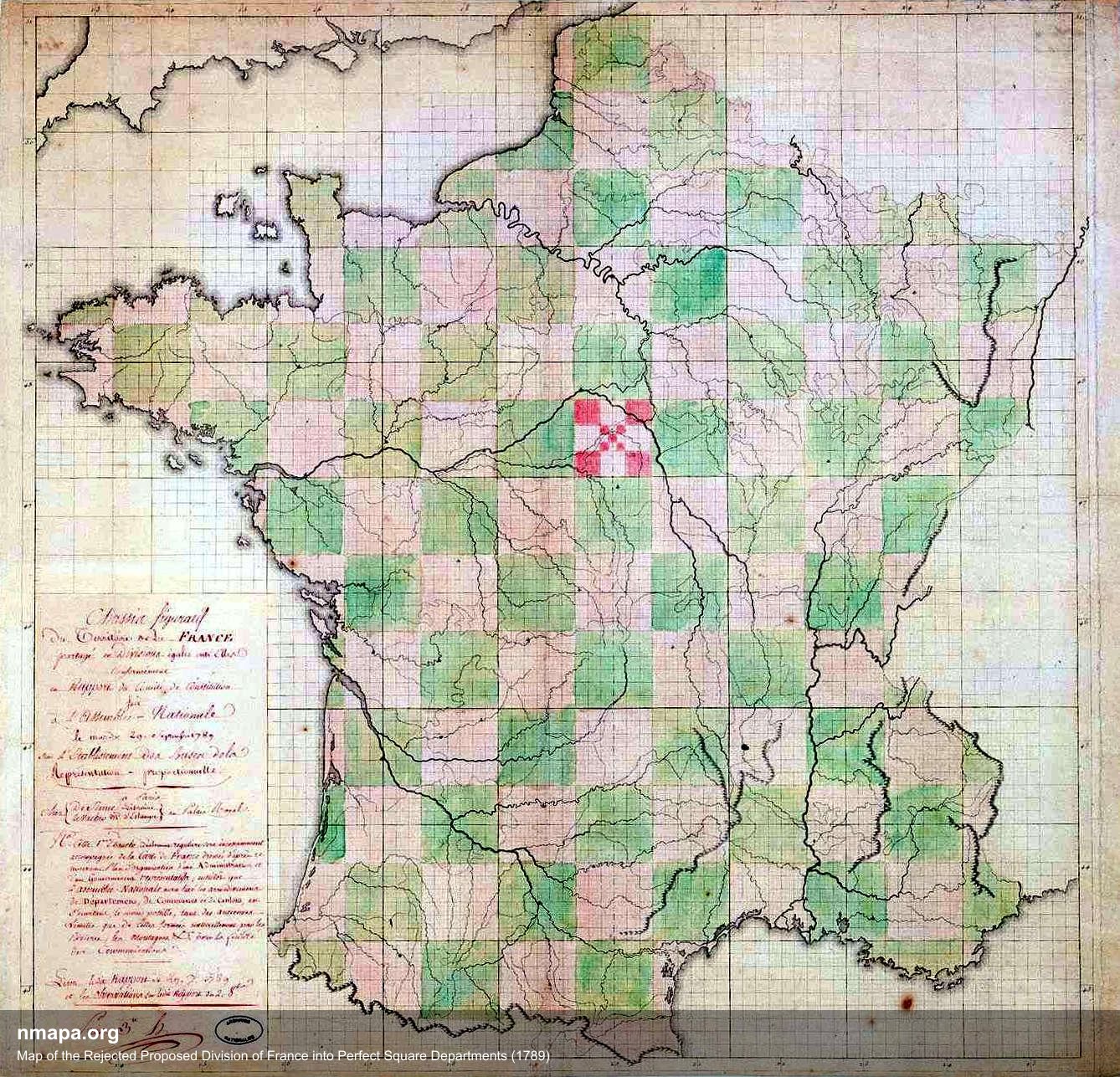
Map of the Rejected Proposed Division of France into Square Departments (1789)
This intriguing map illustrates the proposed division of France into square departments during the revolutionary period ...
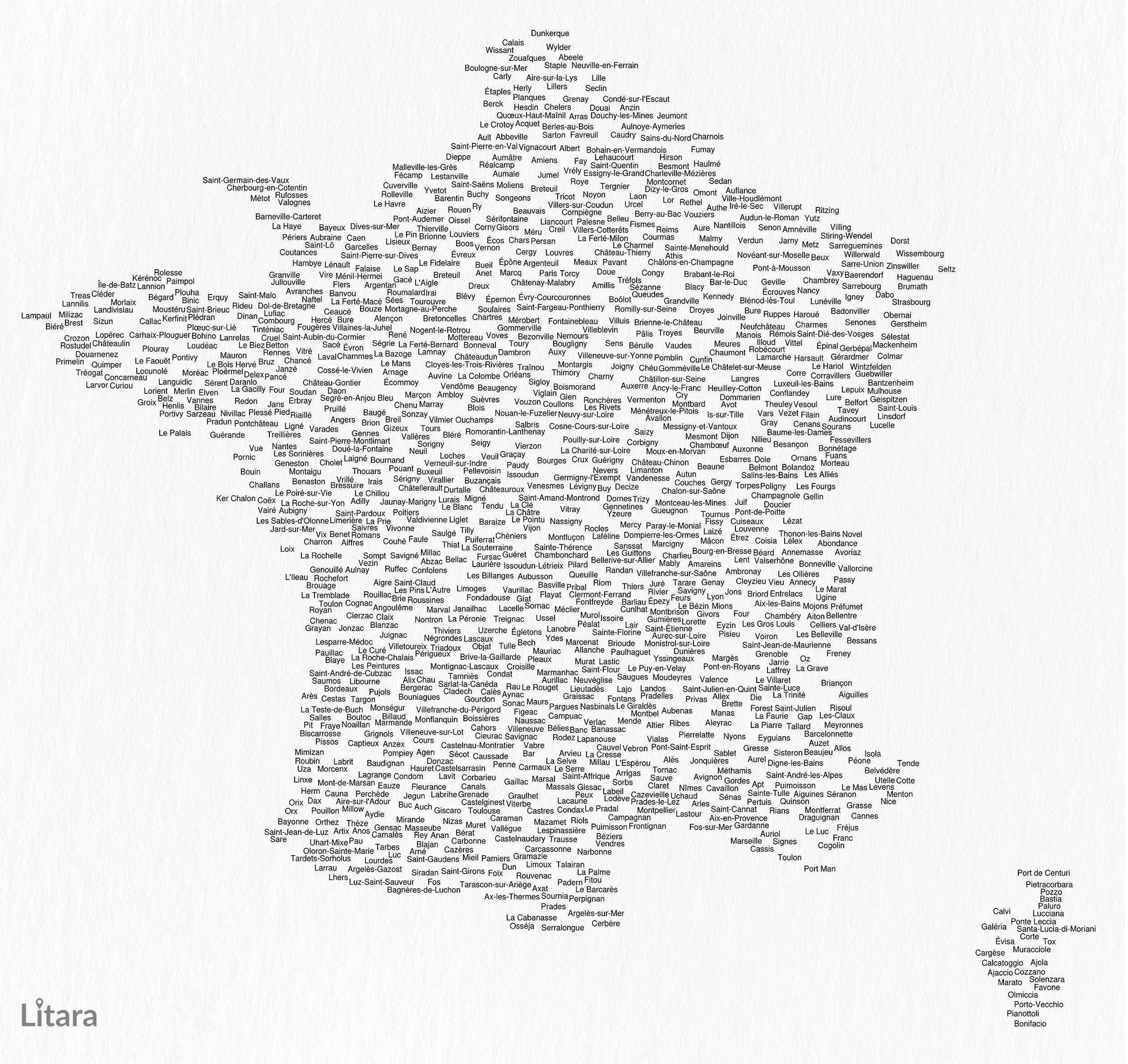
Typographic Map of France's Communes
This unique typographic map of France showcases the names of 1,156 communes, creating a captivating visual representatio...
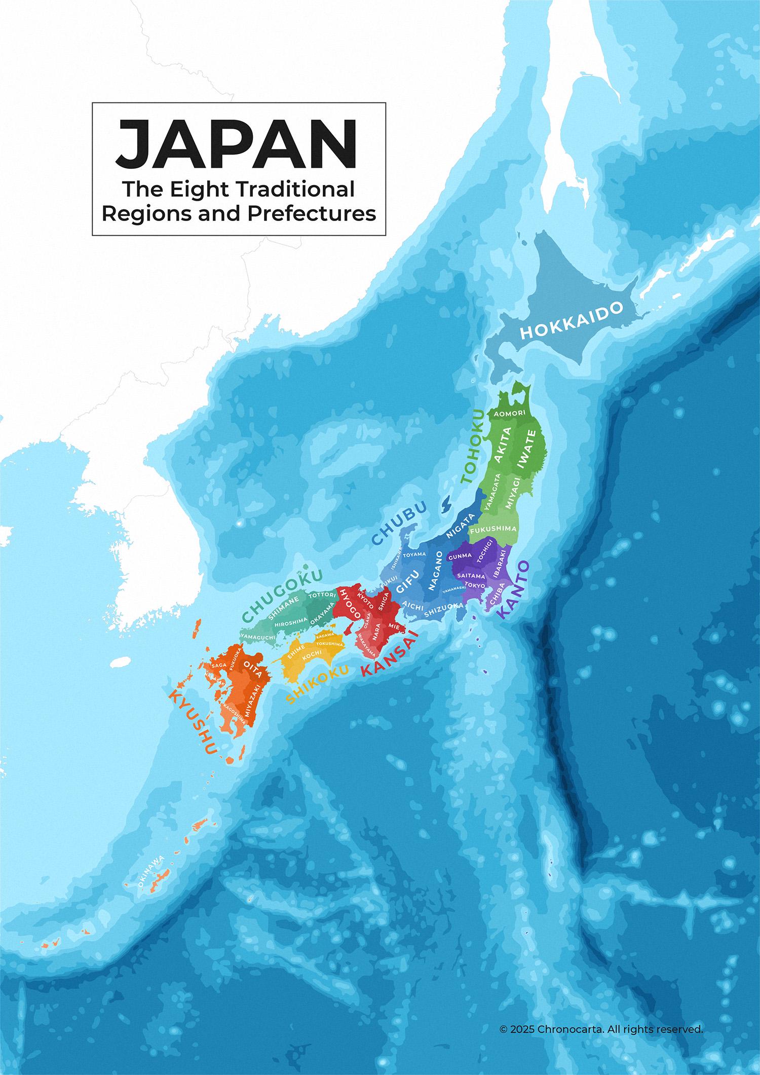
Japan’s Traditional Regions and Prefectures Map
This detailed administrative map of Japan illustrates the country's eight traditional regions and their corresponding pr...
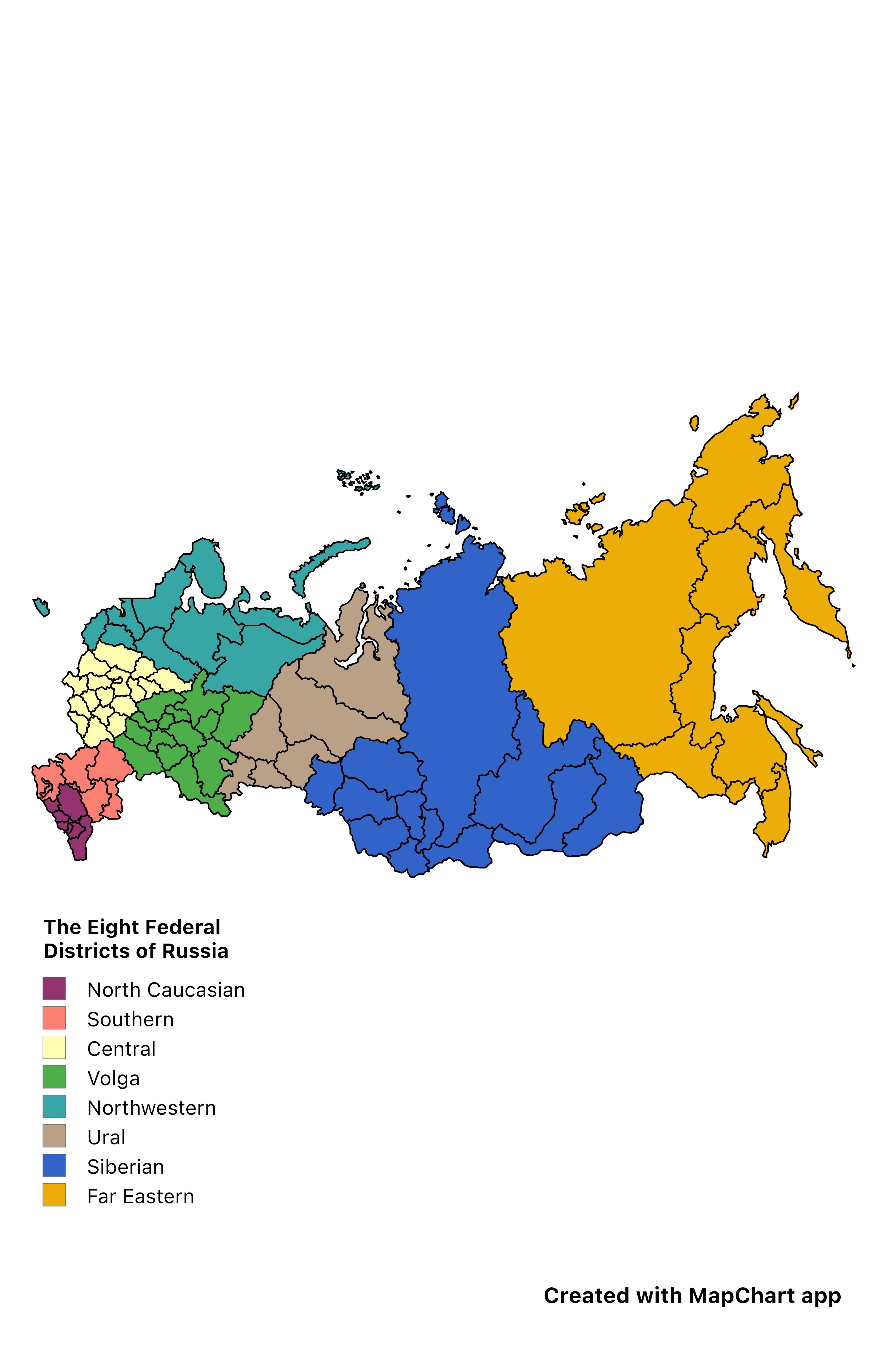
Eight Federal Districts of Russia Map
The "Eight Federal Districts of Russia" map provides a clear visual representation of the administrative divisions withi...
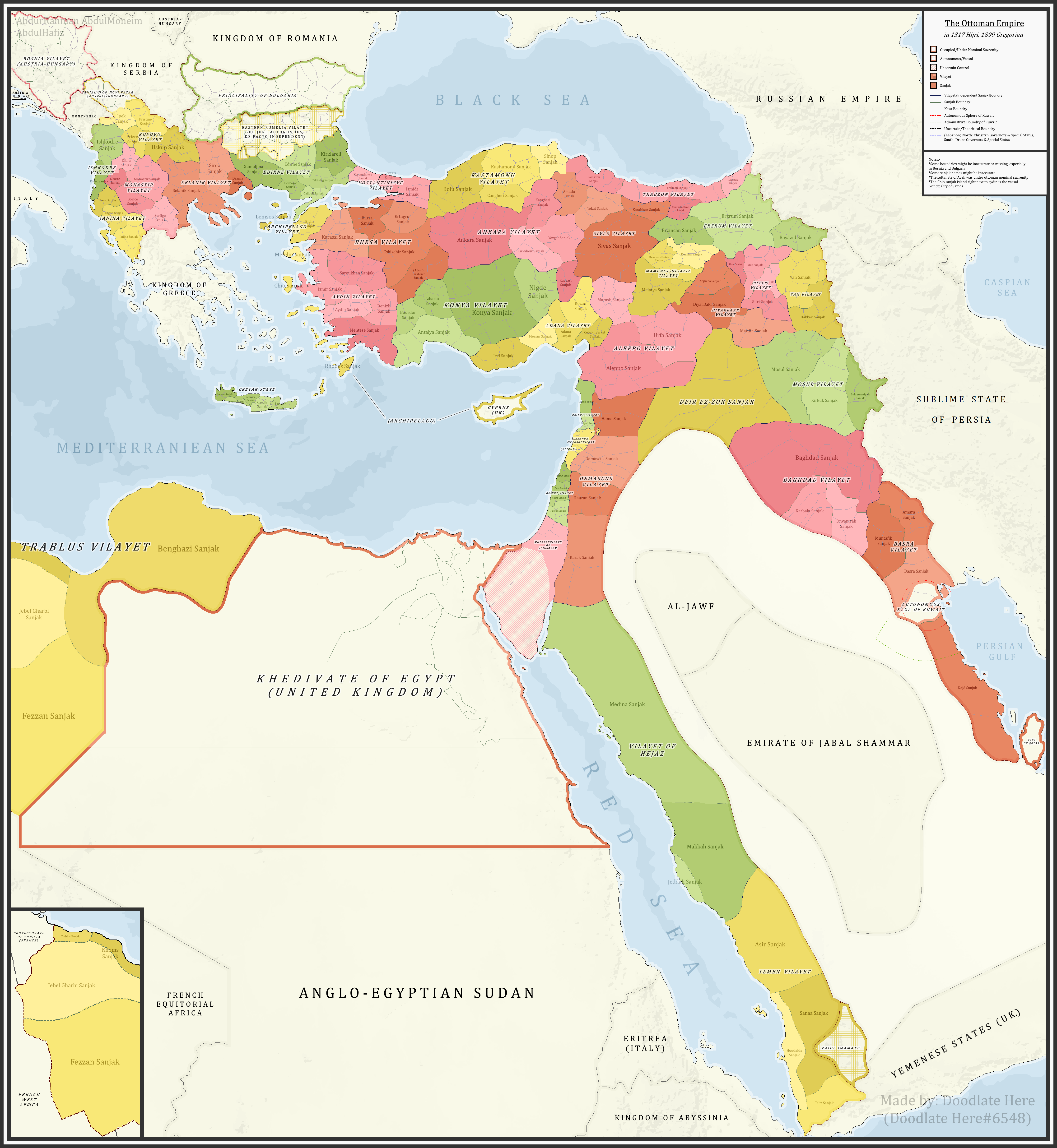
Ottoman Sanjaks in 1899 Map
...
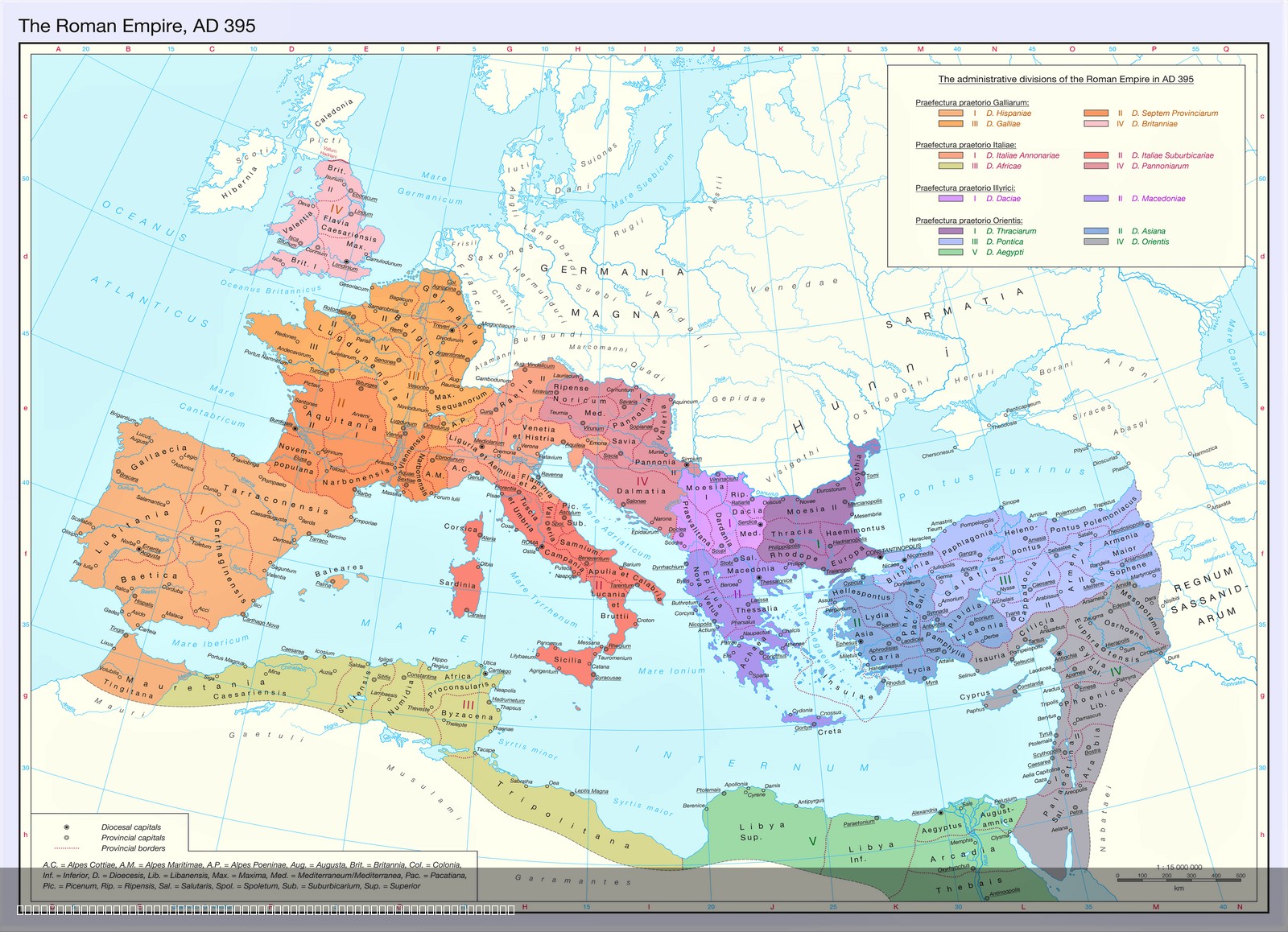
Territorial Organization of the Late Roman Empire Map
The map titled "The Territorial Organization of the Late Roman Empire (395 AD)" provides a detailed visualization of the...
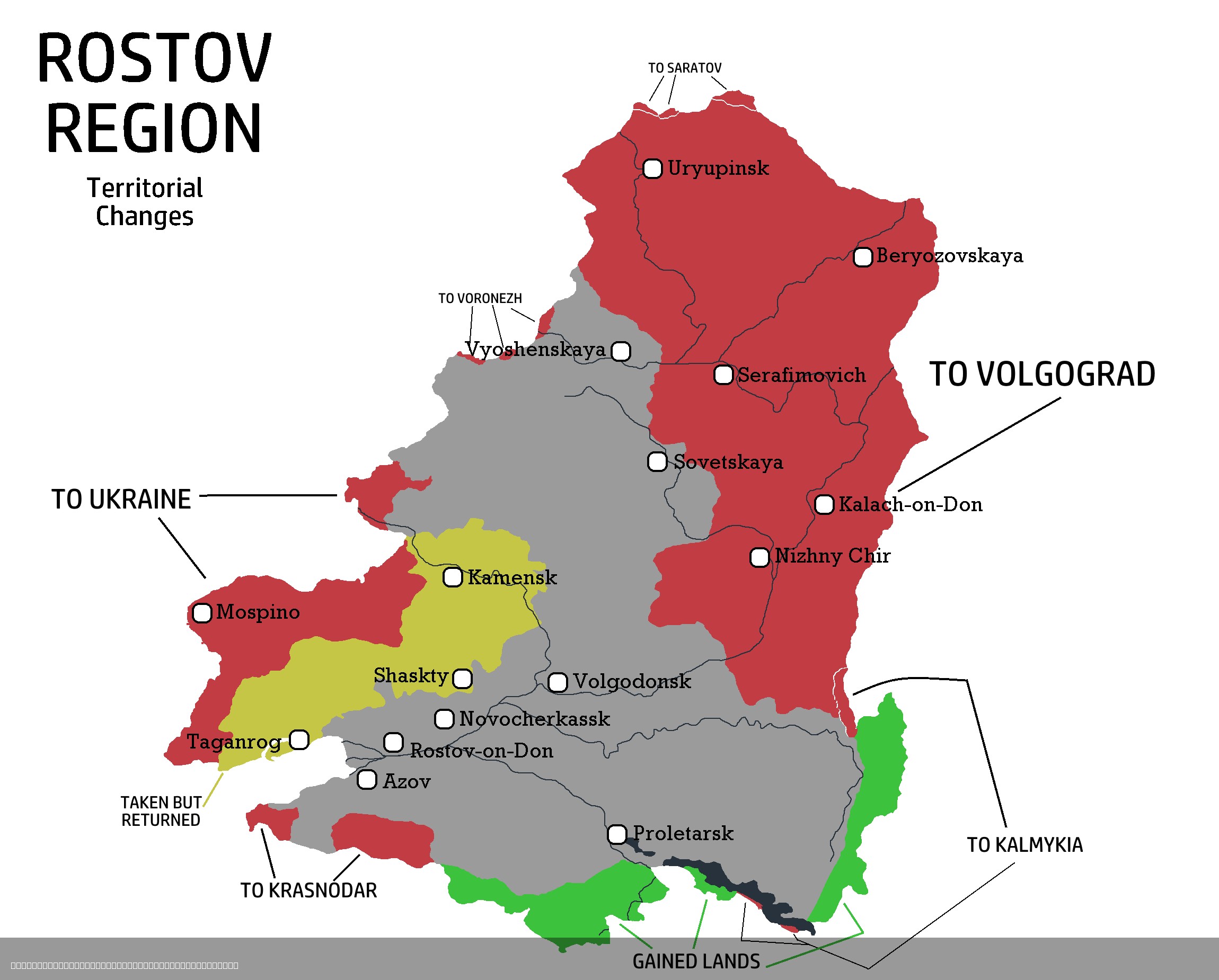
Rostov Region Territorial Changes Map 1917-2025
The "Rostov Region Territorial Changes Map 1917-2025" provides a comprehensive visual representation of the territorial ...
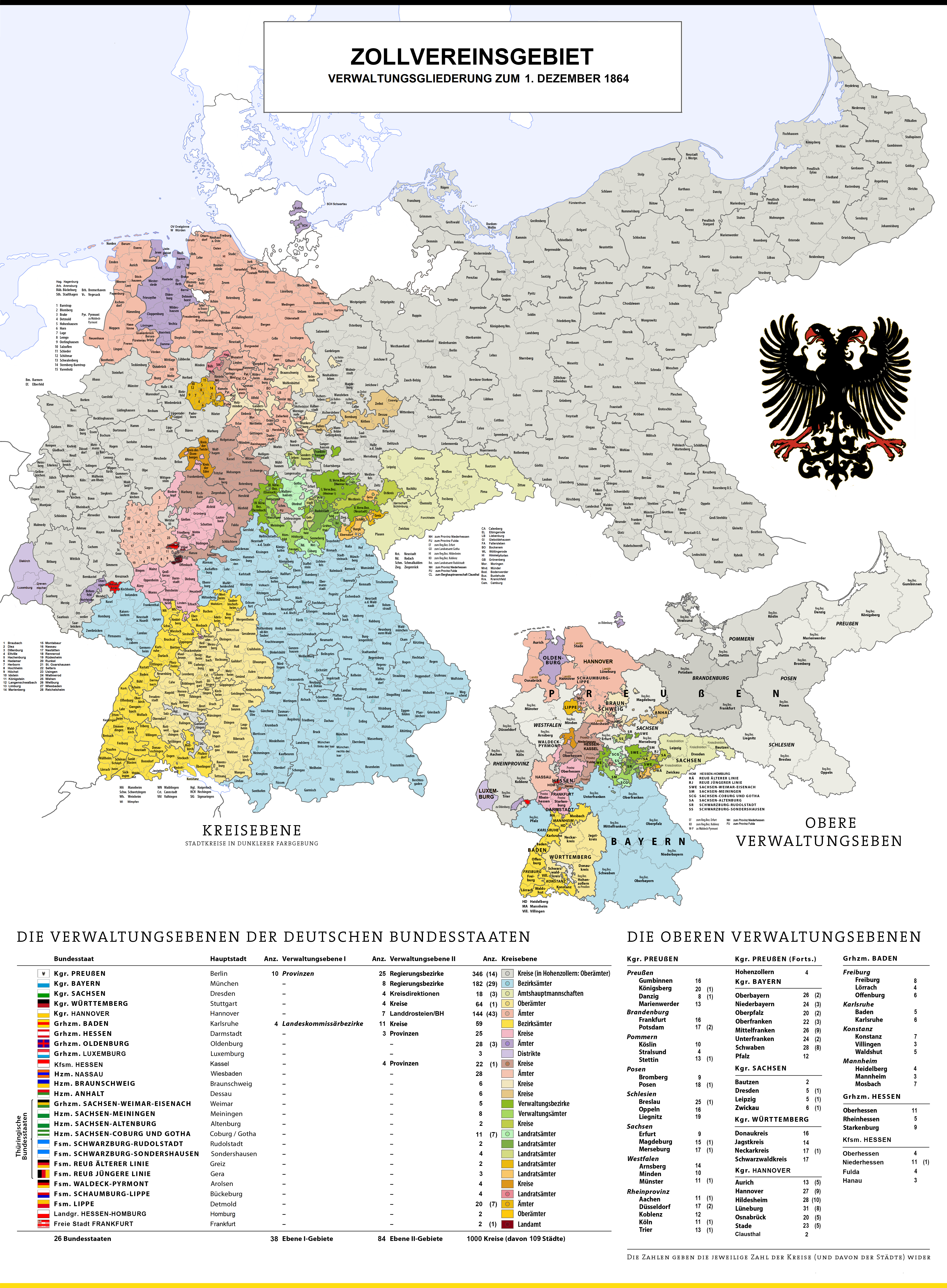
Map of Administrative Divisions of German Customs Union 1864
This visualization presents the administrative divisions of the German Customs Union as they were on December 1, 1864. T...
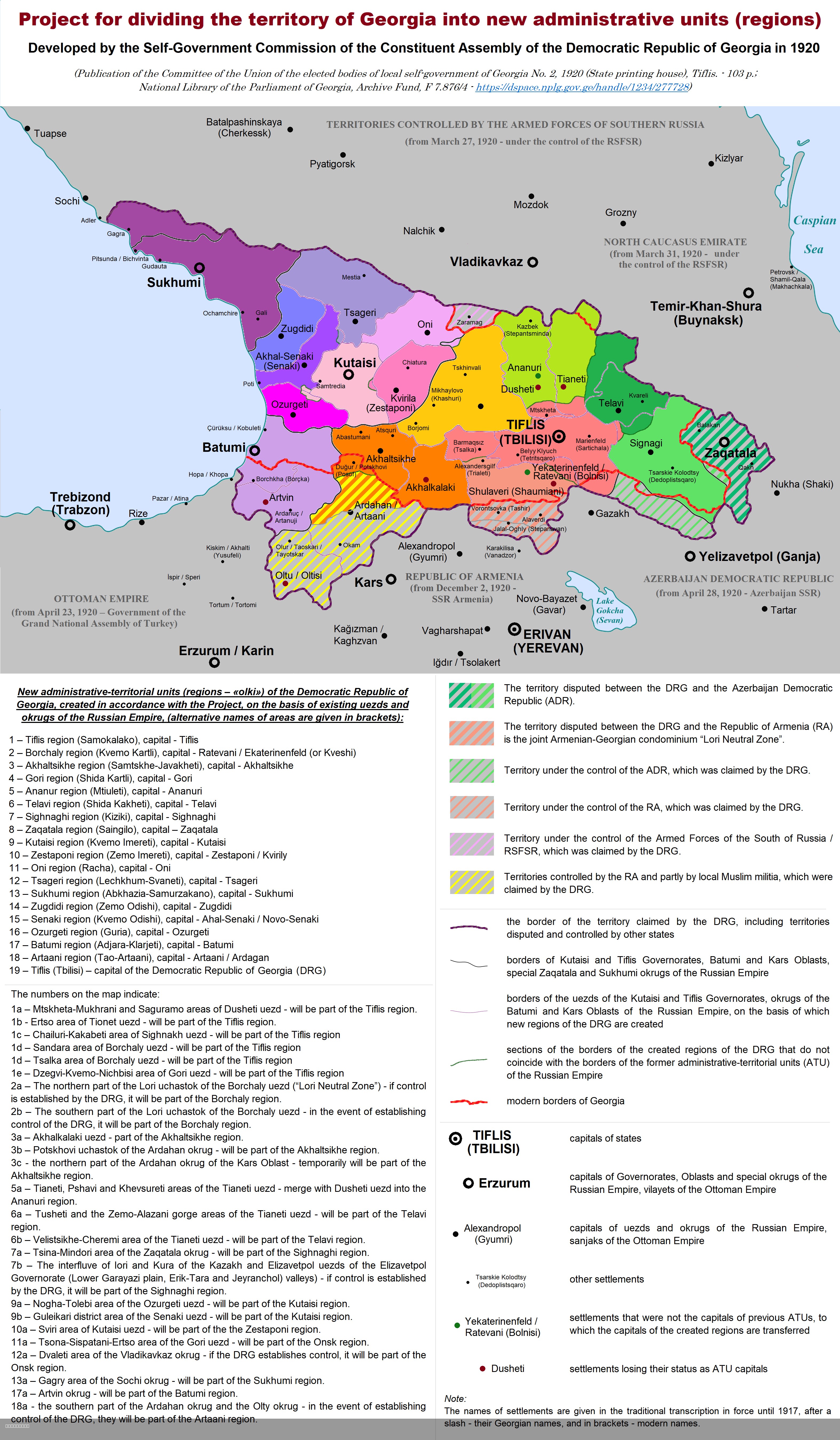
Administrative Divisions of Democratic Republic of Georgia Map
This map illustrates the division of the territory of the Democratic Republic of Georgia (DRG) into new administrative u...
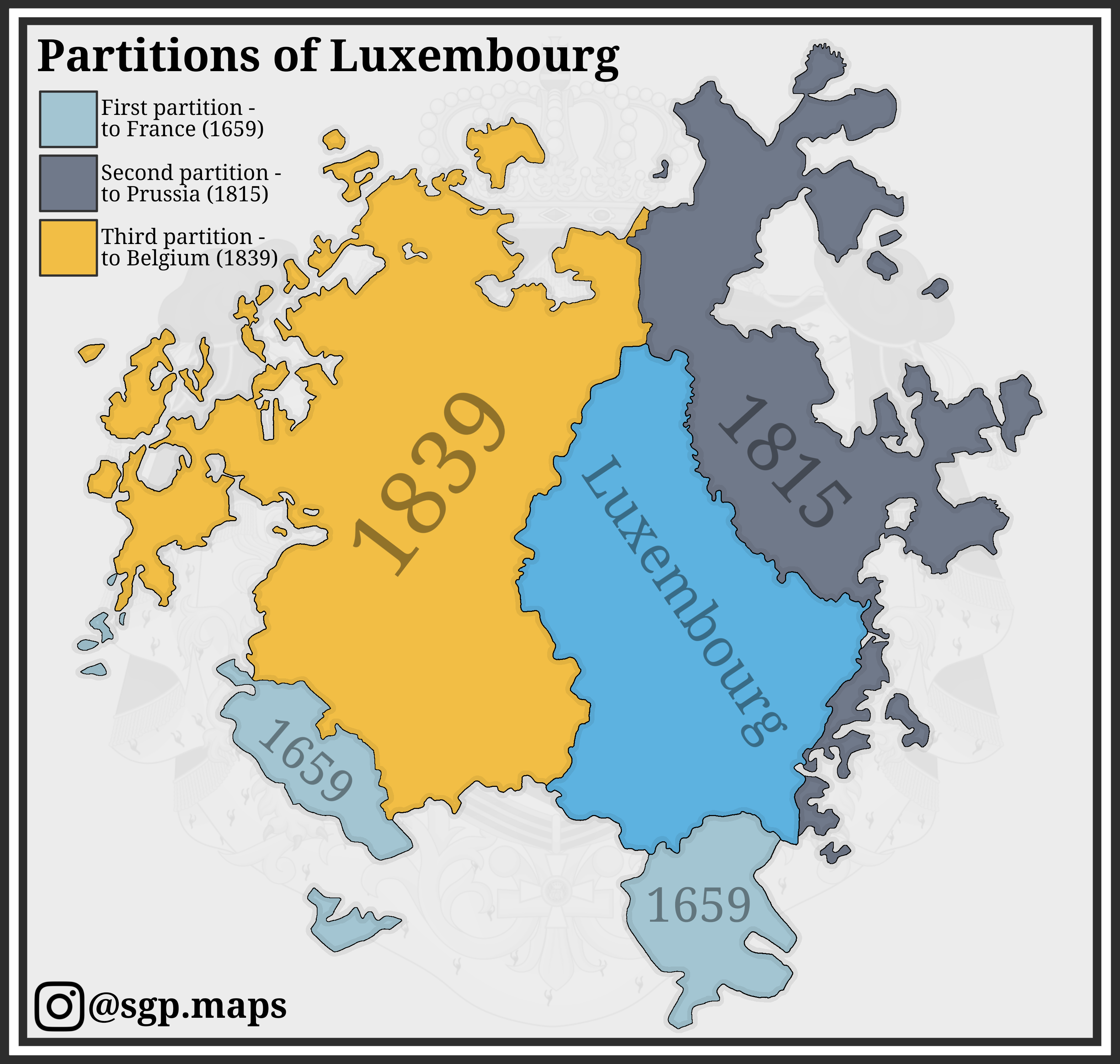
Partitions of Luxembourg Map
The "Partitions of Luxembourg" map illustrates the historical and political divisions within the Grand Duchy of Luxembou...
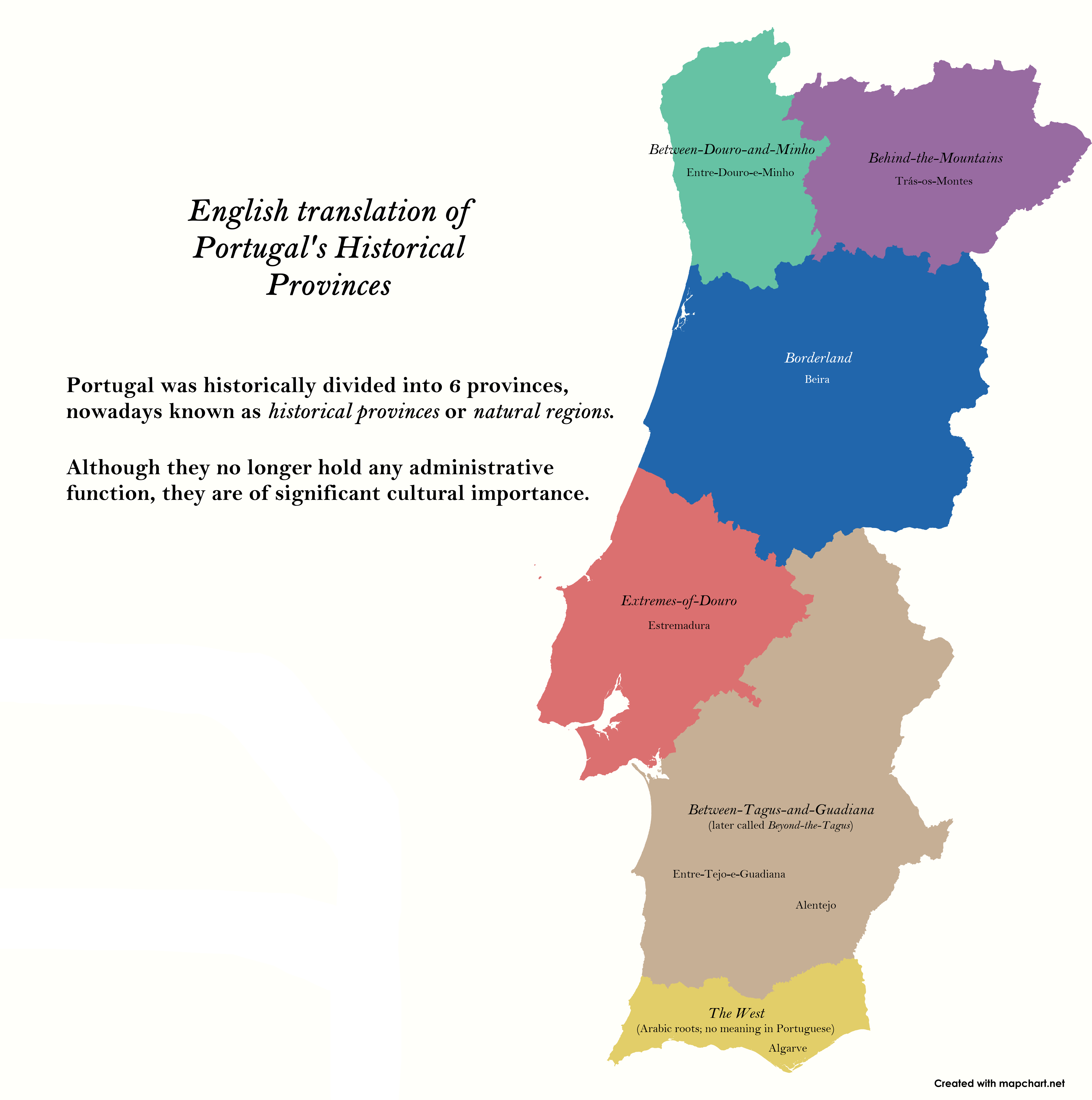
Map of Portugal's Historical Provinces
This map provides a detailed visualization of Portugal's historical provinces, highlighting the distinct regions that ha...
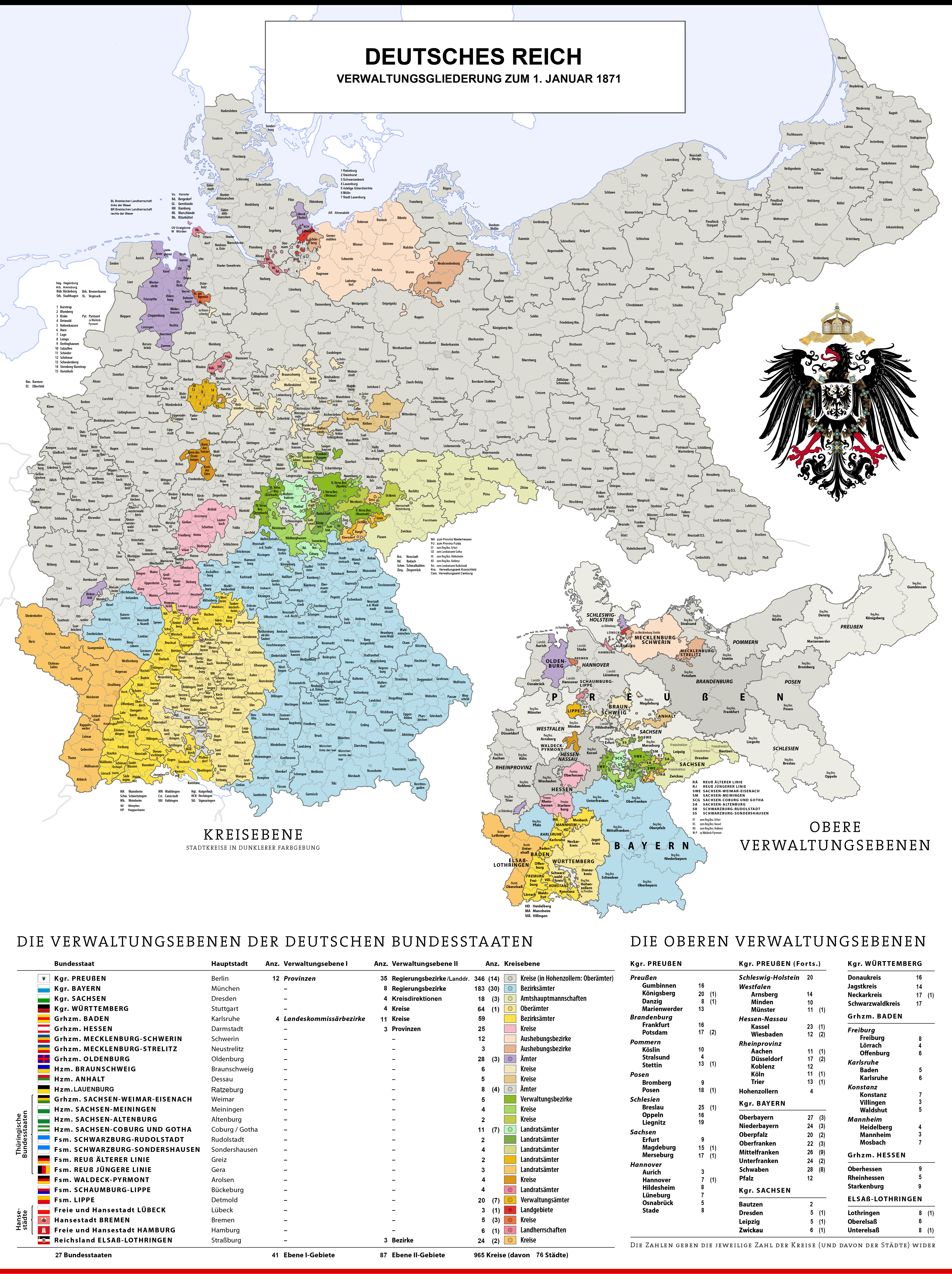
Administrative Divisions of Germany Map 1870
This historical map illustrates the administrative divisions of Germany as they existed on January 1, 1870. At this time...
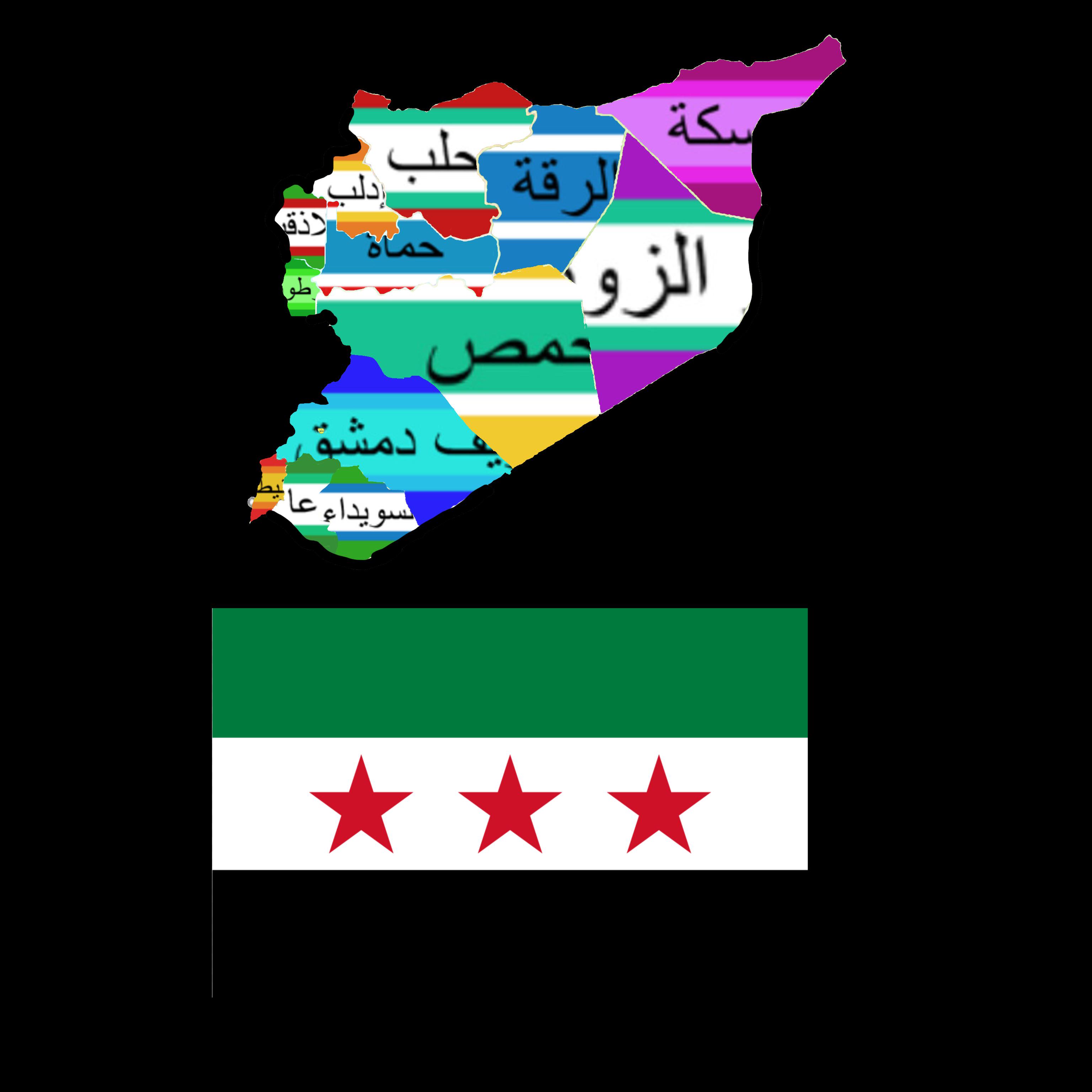
Syria Governorates Flag Map
The "Syria Governorates Flag Map" visually represents the various governorates of Syria along with their corresponding f...
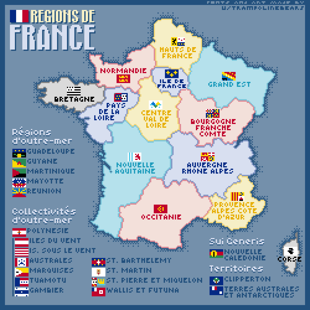
Regions of France Map
This pixel art map captures the diverse regions of France, each represented with a unique flag rendered in a charming 11...
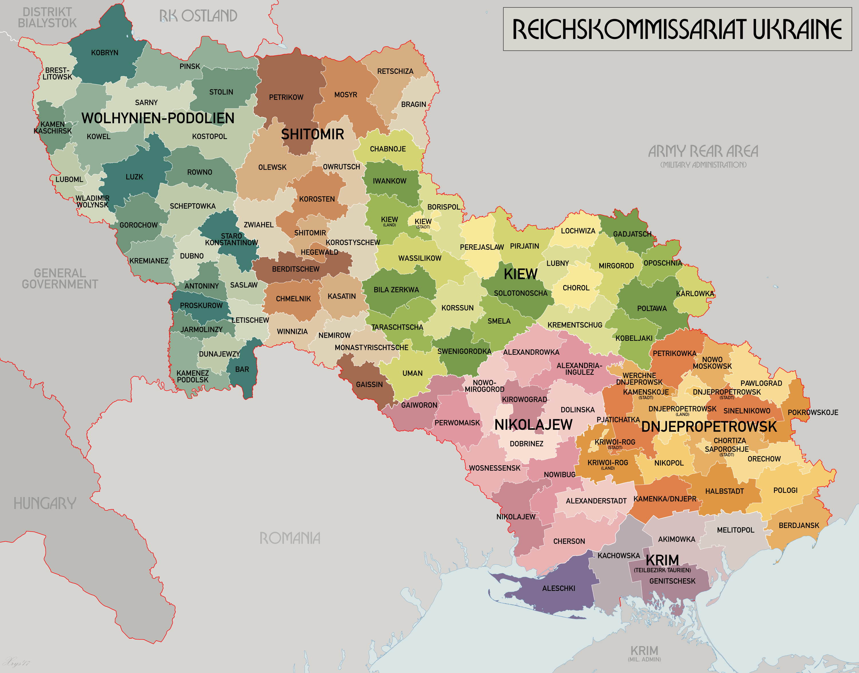
Reichskommissariat Ukraine Map
The "Reichskommissariat Ukraine Map" provides a historical representation of the administrative division established by ...