Syria Governorates Flag Map

Marcus Rodriguez
Historical Geography Expert
Marcus Rodriguez specializes in historical cartography and geographic data analysis. With a background in both history and geography, he brings unique...
Geographic Analysis
What This Map Shows
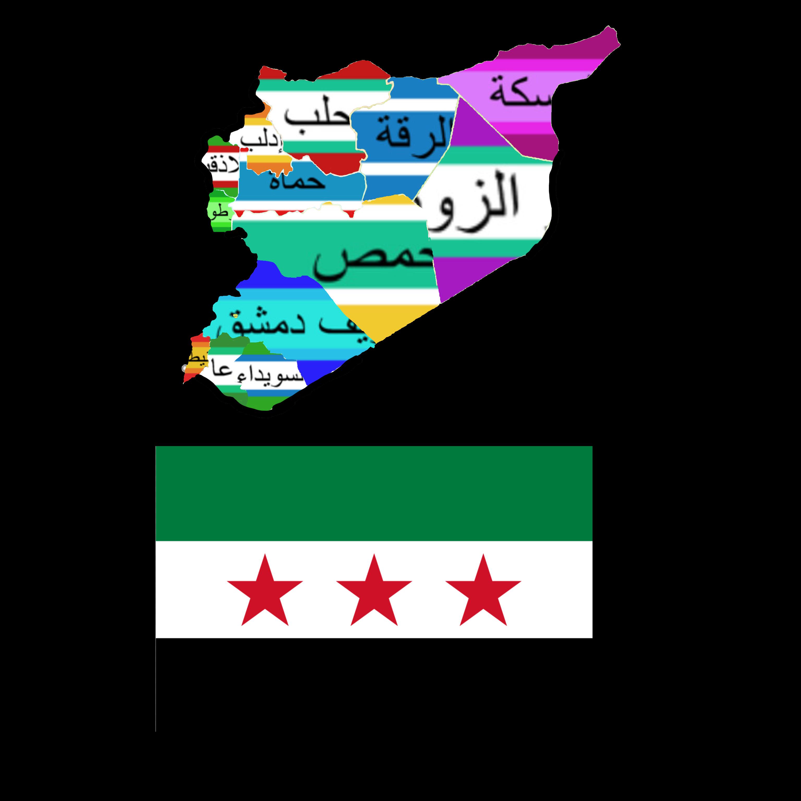
The "Syria Governorates Flag Map" visually represents the various governorates of Syria along with their corresponding flags. Each section of the map is filled with the unique flag of that particular governorate, providing a colorful and informative depiction of the country’s administrative divisions. This map not only helps in identifying the geographical layout of Syria but also highlights the cultural and regional identities of its diverse governorates.
Deep Dive into Syria's Governorates
Syria is divided into 14 governorates, known as "muhafazat" in Arabic, each with its own administrative structure and local governance. These governorates differ vastly in terms of demographics, cultural heritage, and economic activities. Interestingly, this division plays a significant role in the political and social dynamics of the country.
The largest governorate by area is Al-Hasakah, located in the northeastern part of Syria, which covers approximately 47,000 square kilometers. It is rich in agricultural resources, particularly wheat and barley, and has a diverse population that includes Kurds, Arabs, and Assyrians. In contrast, the smallest governorate is Damascus, the capital city, which is only about 105 square kilometers. Despite its size, Damascus is a historical and cultural hub, boasting a rich heritage that dates back thousands of years.
Another notable governorate is Aleppo, which has a significant economic role due to its historical status as a trade center. Aleppo’s economy was heavily reliant on its bustling markets and industries before the civil war. Have you noticed how the conflict has drastically altered the landscape and demographics of such an important region? The population, once thriving, has faced massive displacement, with many residents fleeing to other areas or countries.
Homs, also known as the "City of the Sun," is another governorate that has experienced tumultuous changes. With its strategic location connecting various regions, Homs has been a focal point during conflicts and has seen destruction of its historical architecture.
The southern governorate of Daraa is often associated with the beginning of the Syrian civil war in 2011. This area, with its agricultural base, faced significant upheaval, leading to profound shifts in its population and economic stability.
Regional Analysis
When we analyze the regional variations among Syria's governorates, it becomes evident that each area has its own unique characteristics. For example, the coastal governorate of Tartus enjoys a Mediterranean climate, which supports tourism and fishing industries. On the other hand, regions like Raqqa, which is situated in the northeast, have a more arid climate and are heavily reliant on agriculture and livestock for their economy.
Interestingly, socio-political factors also play a role in shaping these regions. The governorates in the north, such as Idlib and Aleppo, have been significantly impacted by the ongoing conflict, leading to a surge in internally displaced persons (IDPs) seeking refuge in safer areas. The demographic shifts caused by these movements have resulted in a mosaic of cultures and communities within the governorates, fundamentally altering their social fabric.
In terms of education and health services, governorates like Damascus and Aleppo have historically had better infrastructure compared to more rural areas, which often lack access to basic services. This disparity can lead to differences in quality of life and opportunities for residents, further entrenching socio-economic divides across the country.
Significance and Impact
Understanding the geographical and administrative divisions of Syria is crucial, especially in light of the socio-political context of the region. The differences among the governorates impact not only local governance but also national policy decisions. For instance, how resources are allocated varies from one governorate to another, often influenced by political affiliations and control.
Moreover, the ongoing conflict has led to significant humanitarian crises, with many governorates experiencing shortages of food, healthcare, and basic services. The map serves as a reminder of the complexities and challenges that different regions face, and it highlights the importance of addressing these disparities in any future peace-building efforts.
As we look towards the future, it’s essential to consider how these regions can rebuild and recover from the devastation. Will the cultural identities represented by the flags on this map help foster unity, or will they continue to highlight divisions? The answer to this question will significantly shape Syria’s path moving forward.
Visualization Details
- Published
- September 21, 2025
- Views
- 66
Comments
Loading comments...