syria Maps
9 geographic visualizations tagged with "syria"
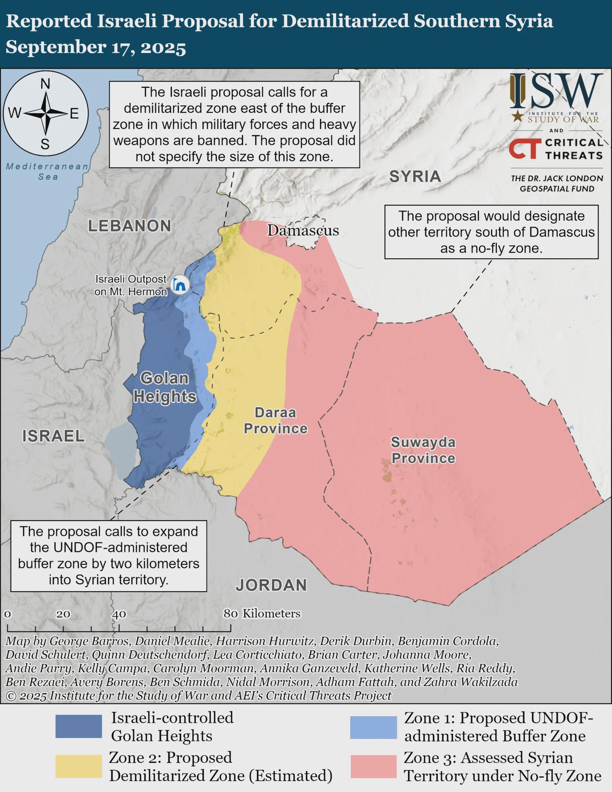
Demilitarized Southern Syria Proposal Map
The visualization titled "Reported Israeli Proposal for Demilitarized Southern Syria, September 17, 2025" provides a geo...
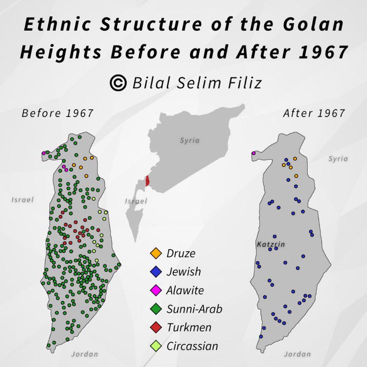
Golan Heights Historical Map Overview
The visualization titled "Golan Heights, then and now" presents a compelling comparison of the Golan Heights region, hig...
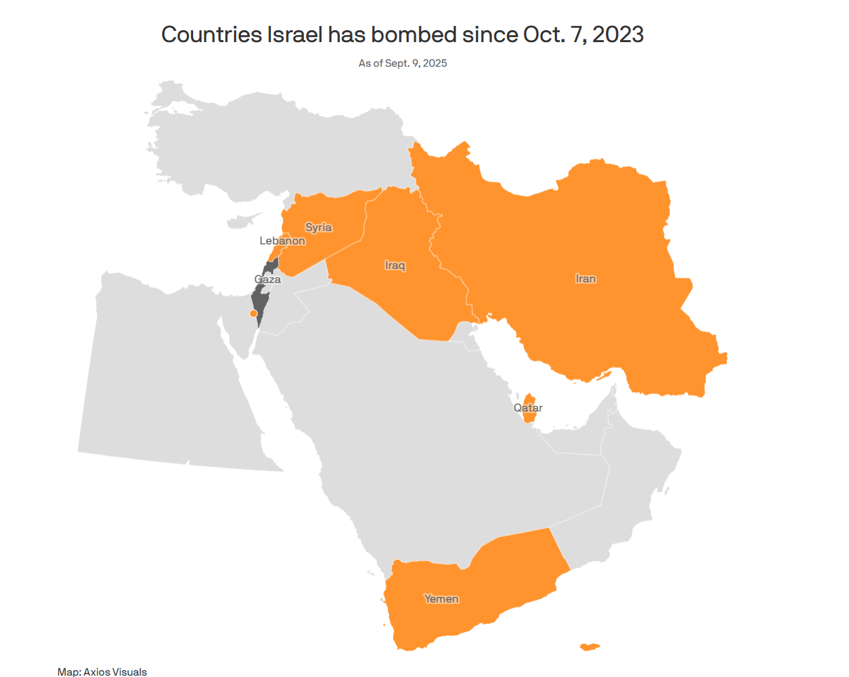
Map of Countries Bombed by Israel Since 7/10
...
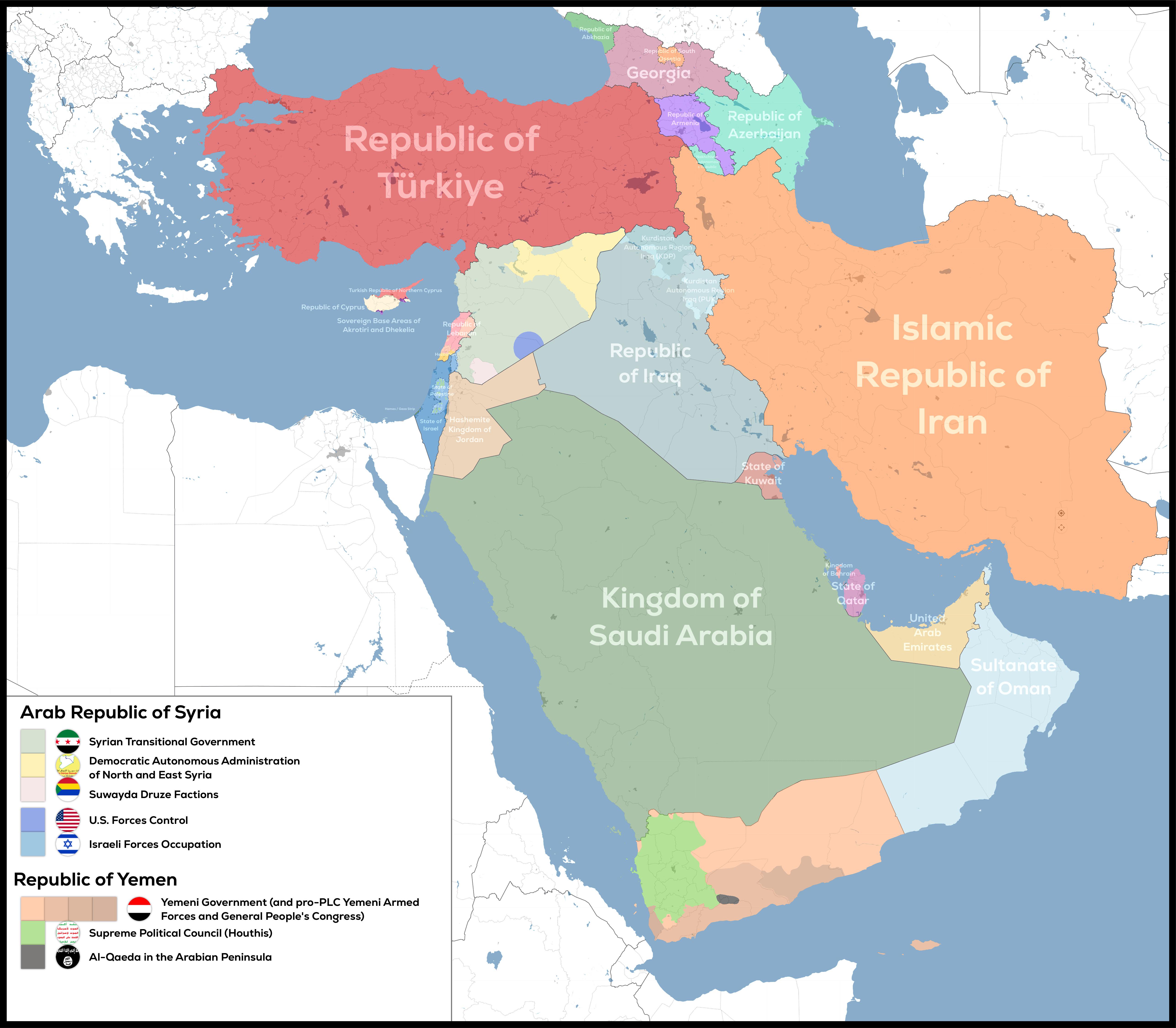
De Facto Geopolitical Map of West Asia
The "De-Facto Geopolitical Map of West Asia" provides a striking illustration of the current territorial control in this...
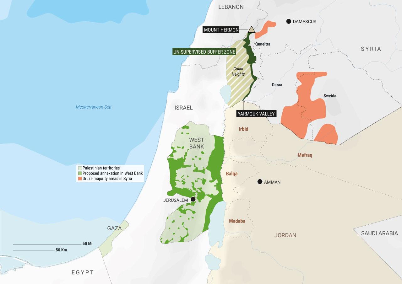
Map of Proposed Annexation Locations in West Bank
The visualization titled "Palestinian territories, proposed annexation locations in the West Bank, and Druze majority ar...
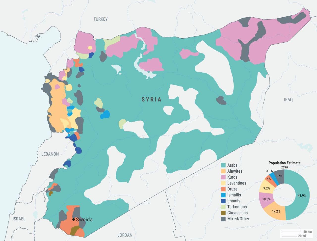
Syrian Ethnic and Sectarian Groups Map
The "Syrian Ethnic and Sectarian Groups Map" provides a visual representation of the complex tapestry of ethnic and reli...
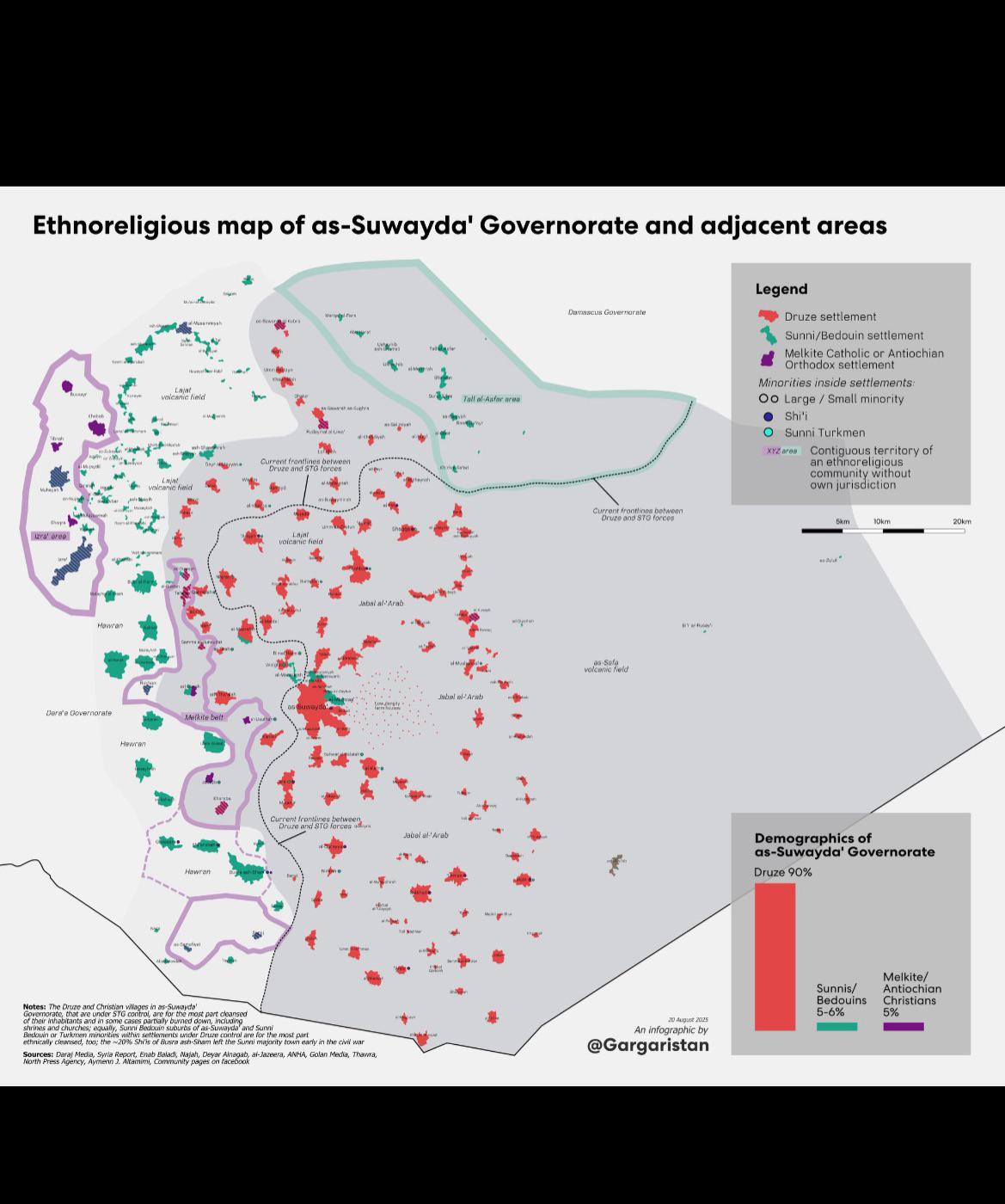
Ethno-Religious Map of Suwayda Governorate
In addition to the Druze, the region also hosts a variety of Christian denominations, including Greek Orthodox and Greek...
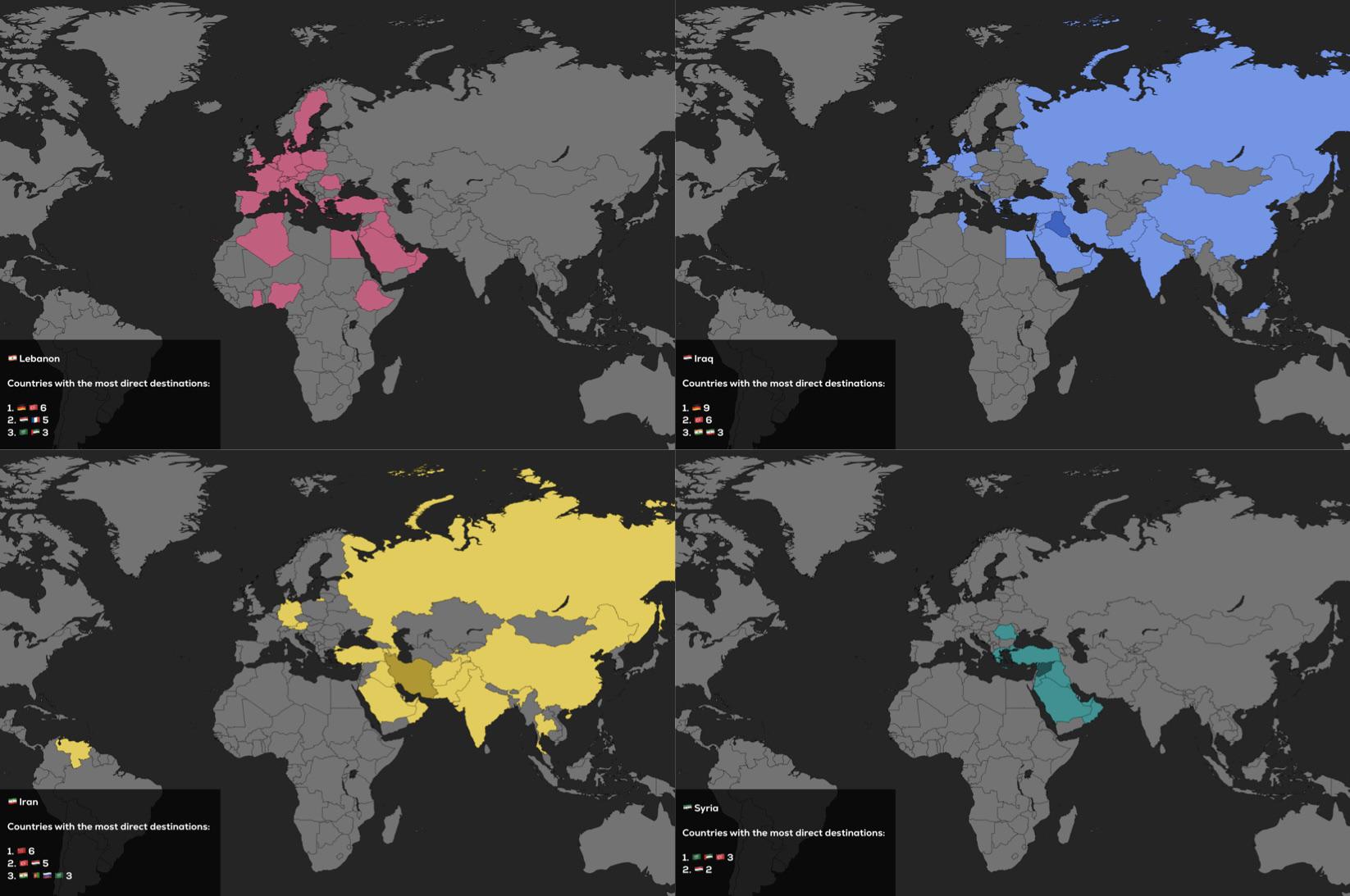
Direct Flights Map of Lebanon, Iraq, Iran and Syria
The visualization titled "Direct Flights of Lebanon, Iraq, Iran and Syria as of 2025" presents a comprehensive overview ...
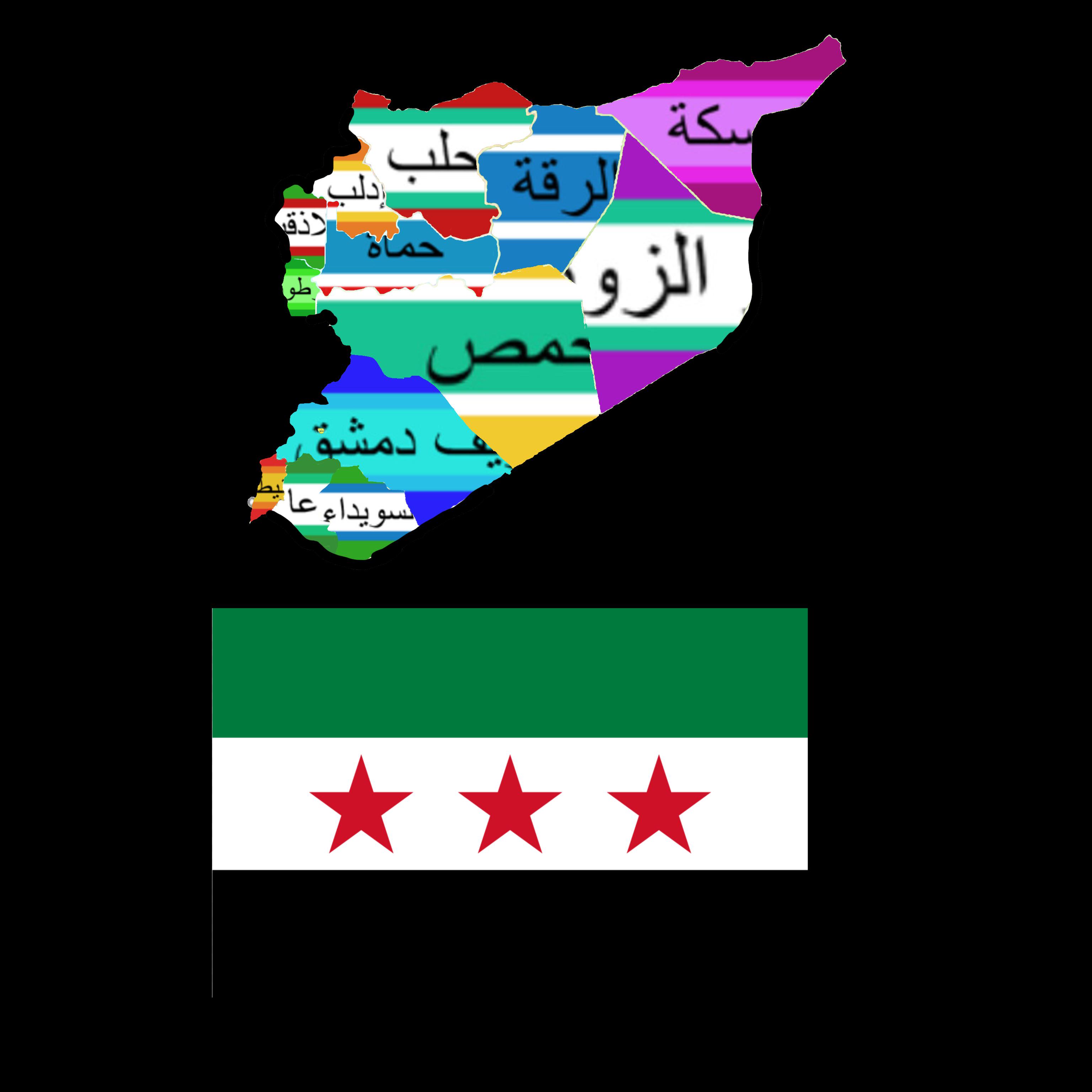
Syria Governorates Flag Map
The "Syria Governorates Flag Map" visually represents the various governorates of Syria along with their corresponding f...