demographics Maps
352 geographic visualizations tagged with "demographics"
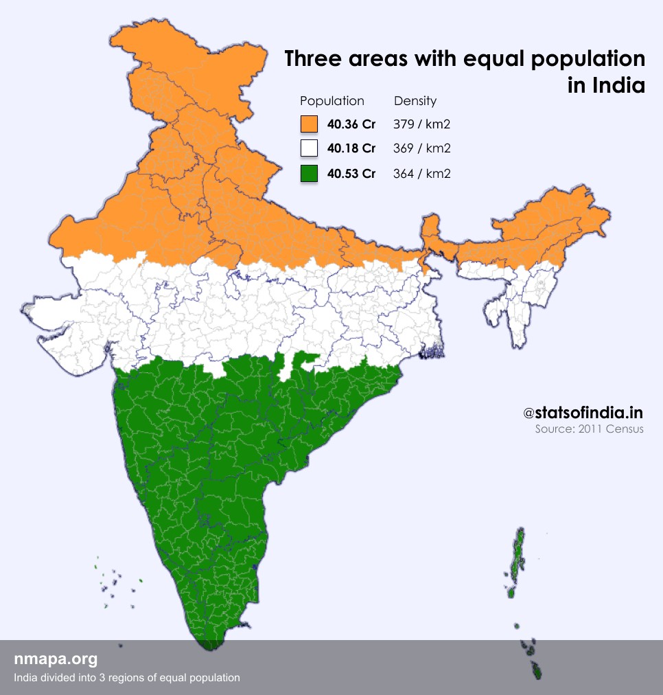
Population Map: India divided into 3 regions of equal population
This map displays "India divided into 3 regions of equal population" and provides a clear visual representation of the g...
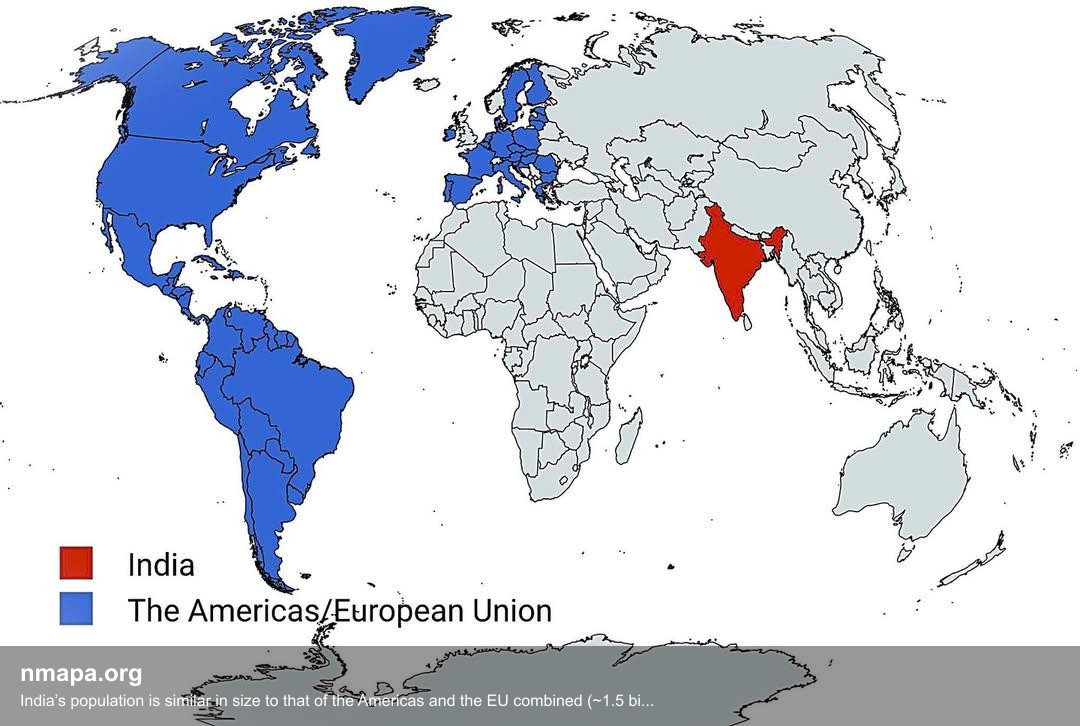
Population Map: India’s population is similar in size to that of the Americas and the EU combined (~1.5 billion)
This map displays "India’s population is similar in size to that of the Americas and the EU combined (~1.5 billion)" and...

Cultural Characteristics Map of New England
The map titled "New Englanders be New Englanding" presents a fascinating look at the unique cultural characteristics and...

Iceland Population Distribution Map
This map illustrates a striking aspect of Iceland's population distribution: the red area represents only 1% of the coun...
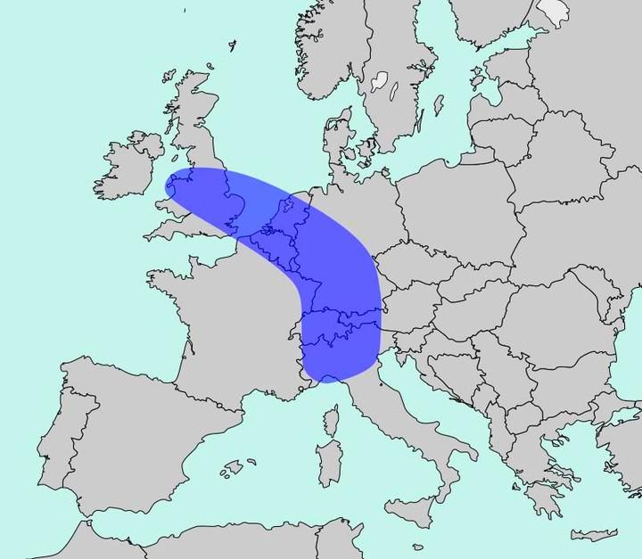
Population Density Map of Europe
The map titled "The Blue Banana" visualizes Europe’s most densely populated corridor, home to approximately 111 million ...
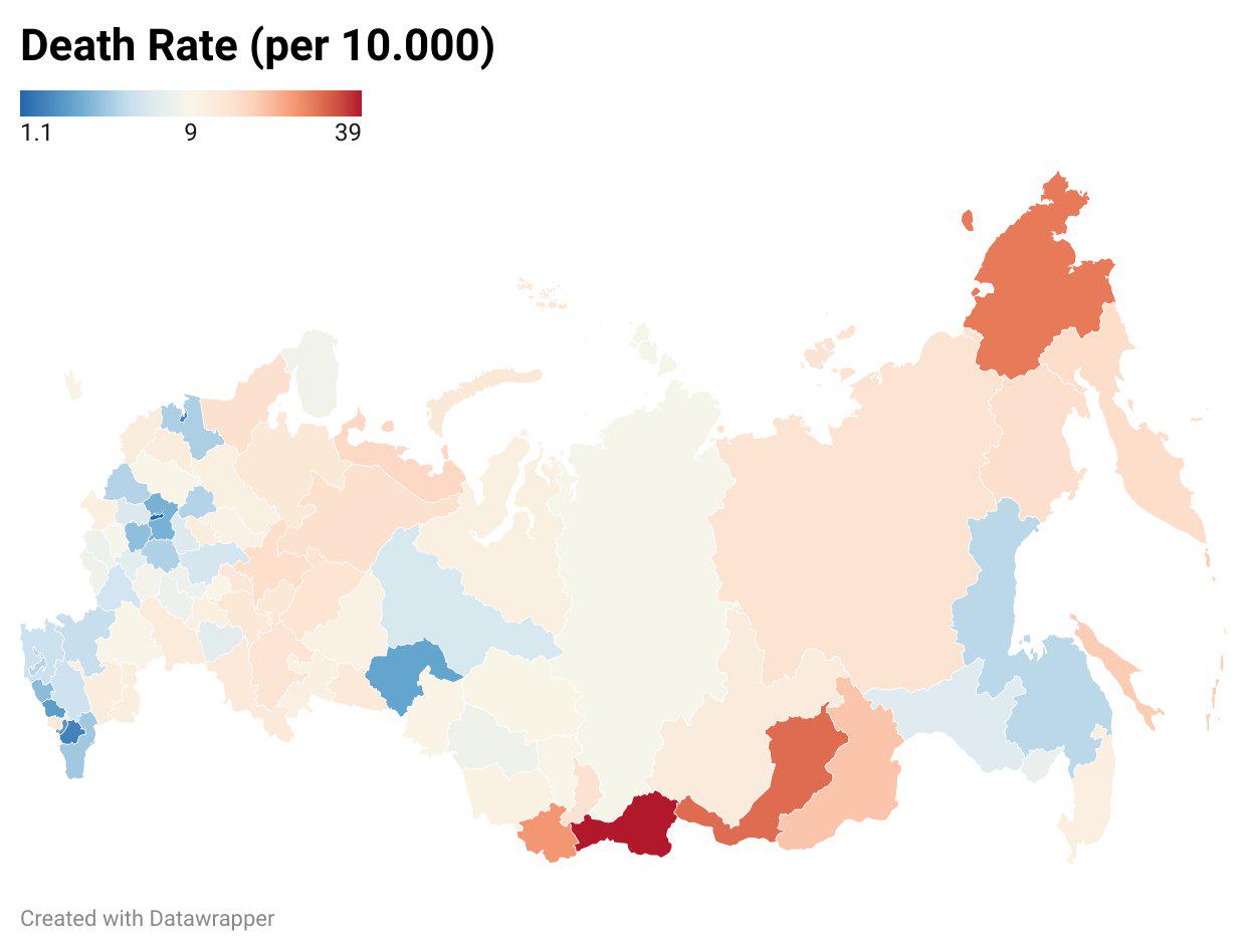
Death Toll in Russia Ukraine War by State Map
The "Death Toll in Russia's Ukraine War by State Map" provides a stark visualization of the human cost of the ongoing co...
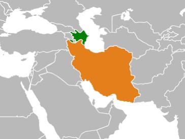
Map of Countries with Large Diasporas
This map highlights a fascinating demographic phenomenon: it illustrates countries where a significant portion of their ...
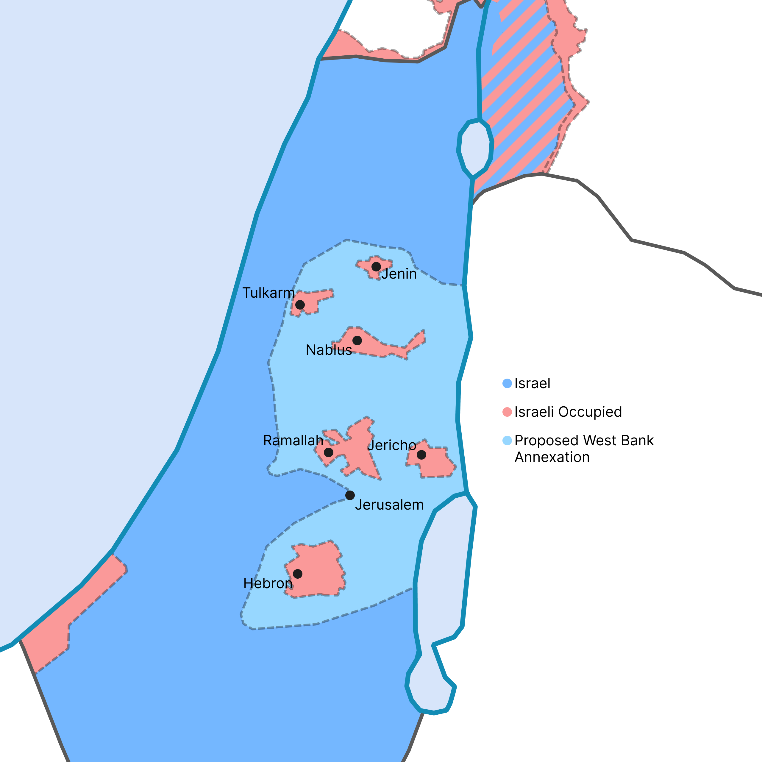
West Bank Annexation Proposal Map
This map visualizes the potential outcome of the Israeli government's recent proposal to annex a significant portion of ...
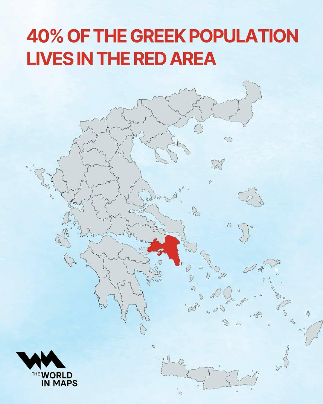
Population Distribution Map of Greece
This map illustrates a striking demographic trend in Greece: approximately 40% of the nation's population resides within...
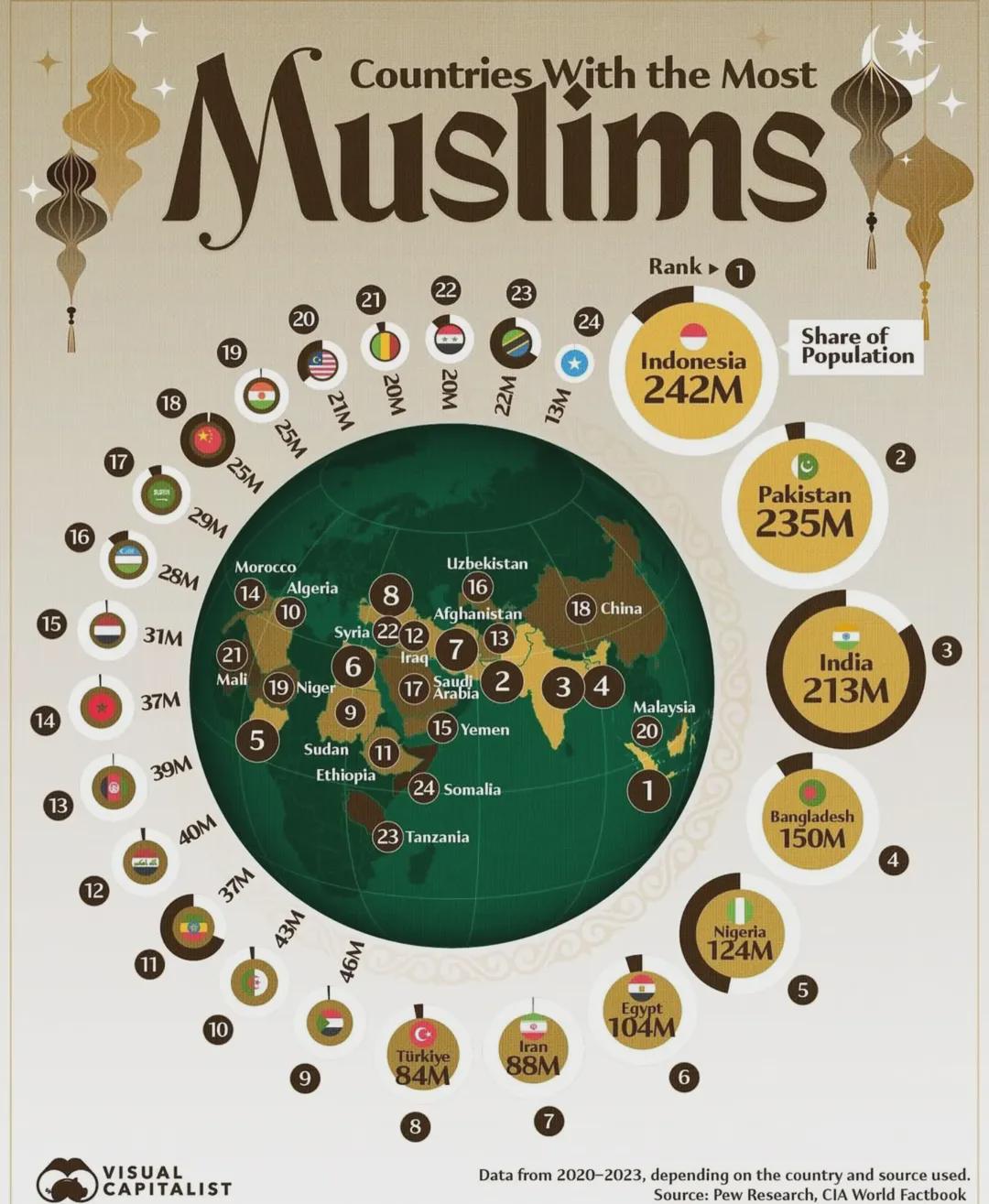
Countries With The Most Muslims Map
This map illustrates the distribution of Muslim populations across the globe, highlighting the countries with the larges...
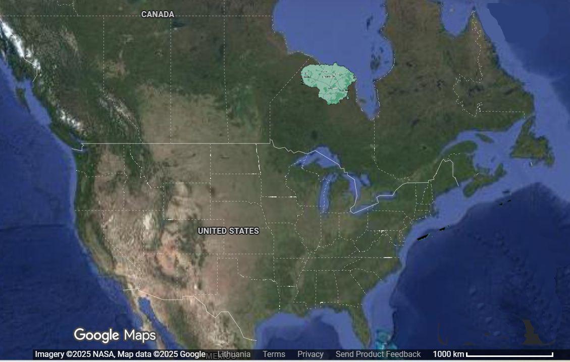
Lithuania Relocation 6000km West Map
This visualization intriguingly displays the geographical consequences of relocating Lithuania approximately 6,000 kilom...
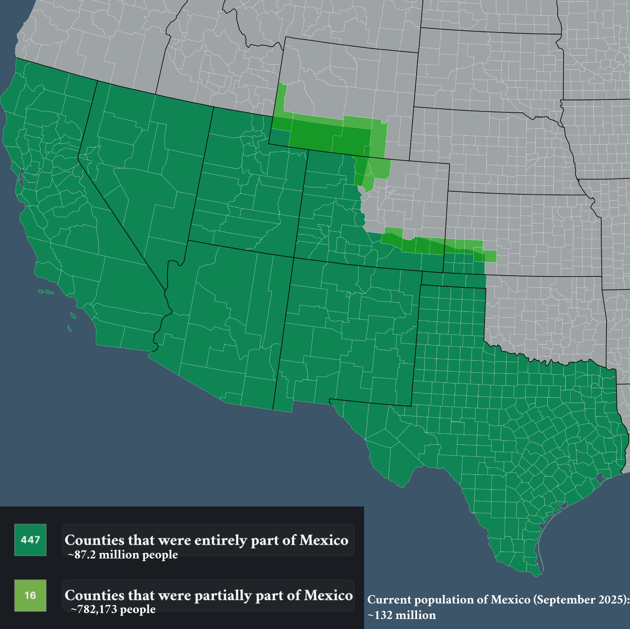
Map of Counties that Used to be Part of Mexico
The visualization titled "Counties that used to be part of Mexico" provides an insightful look into the historical terri...
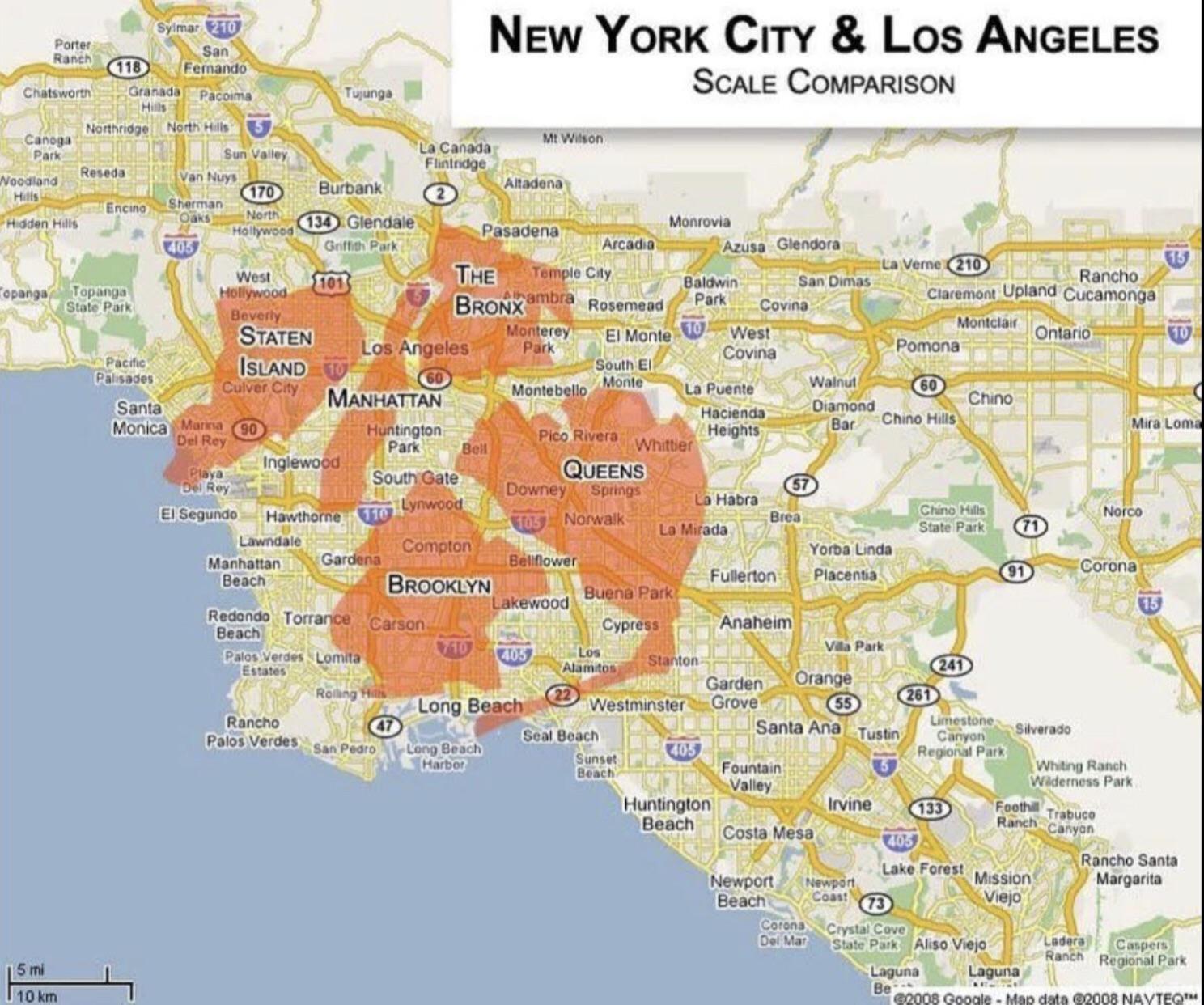
Population and Area Comparison Map of New York and Los Angeles
This map provides a clear visual comparison of the population and area of two of the most iconic cities in the United St...
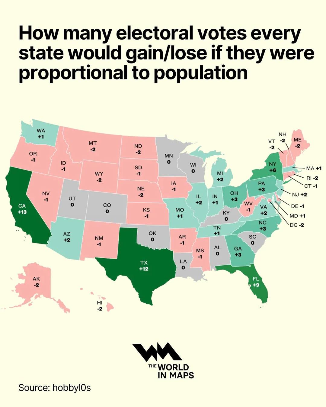
Electoral Votes by State Population Map
This map visualizes how the allocation of electoral votes would change if they were distributed proportionally to the po...
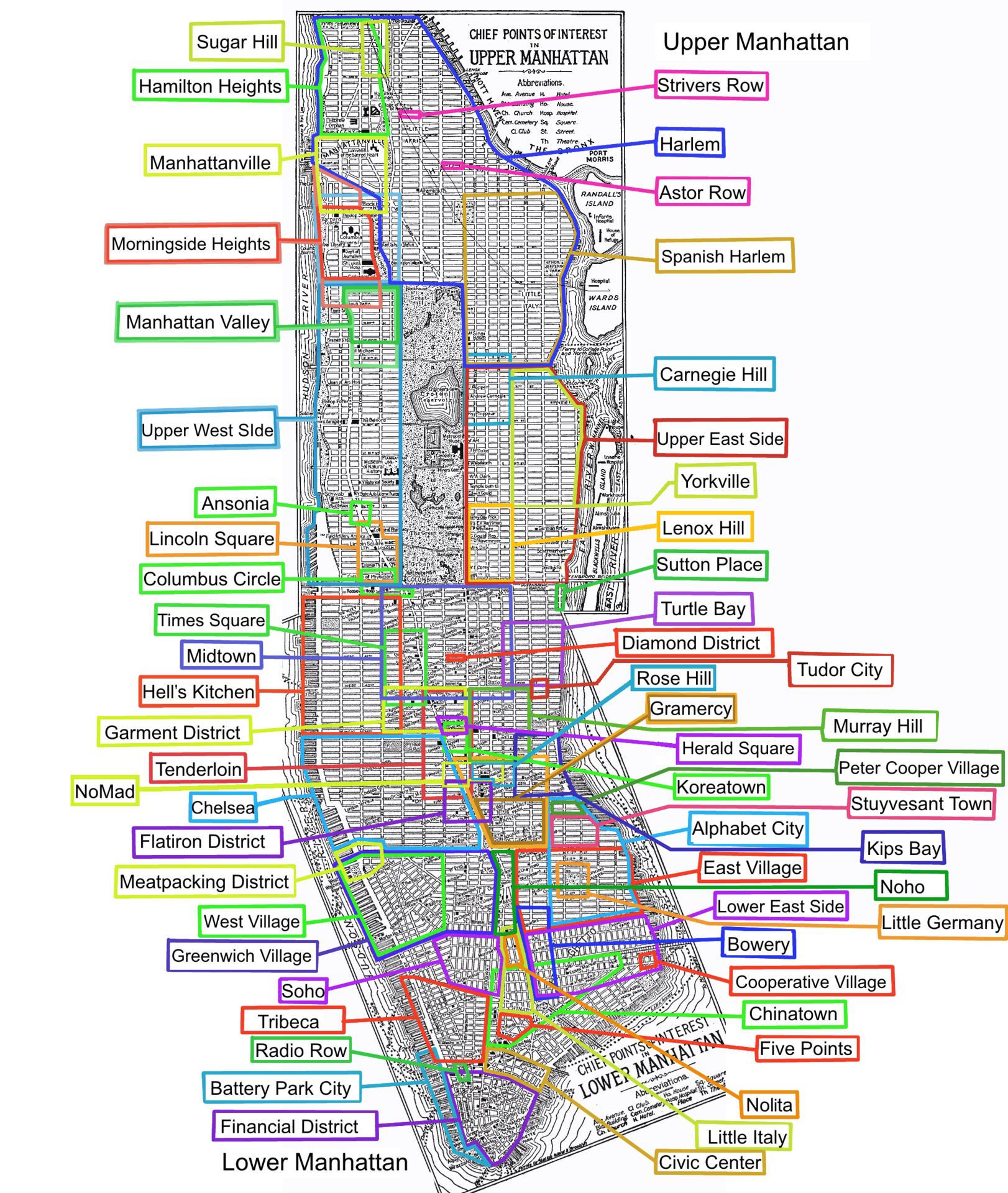
Neighborhoods of Manhattan Map
The "Neighborhoods of Manhattan Map" presents a detailed overview of the various neighborhoods that make up Manhattan, o...
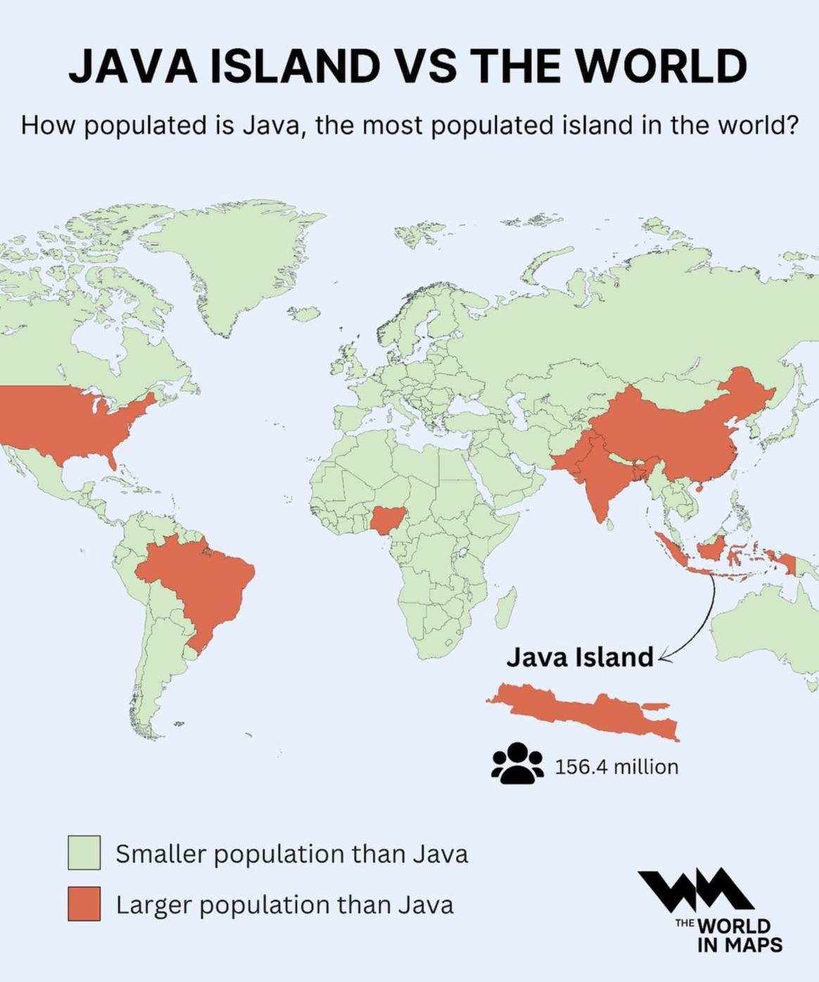
Population Density Map of Java Island
The visualization at hand provides a striking representation of Java Island, illustrating its status as the most populat...
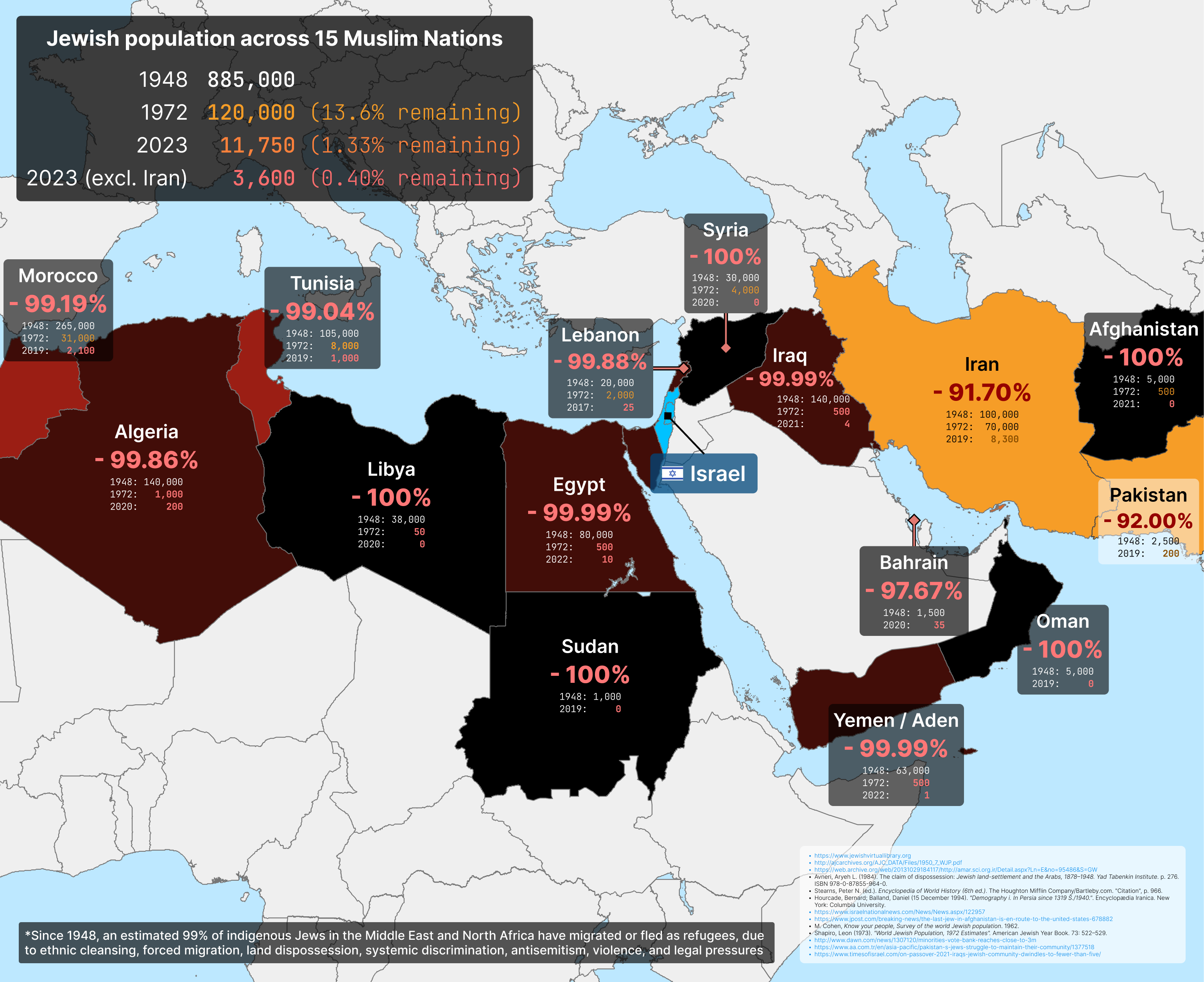
Jews in the Middle East Map
The Jewish community in Iran has faced significant challenges, particularly following the 1979 Islamic Revolution, which...
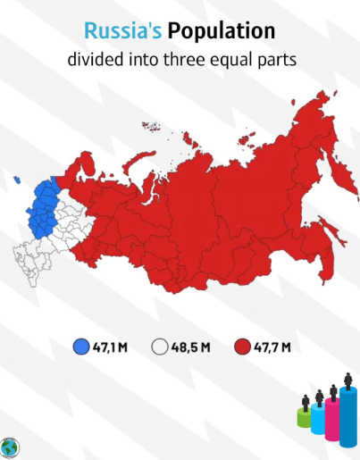
Equally Populated Areas of Russia Map
Russia’s overall population is approximately 144 million, but this number is not evenly spread. Much of the population i...
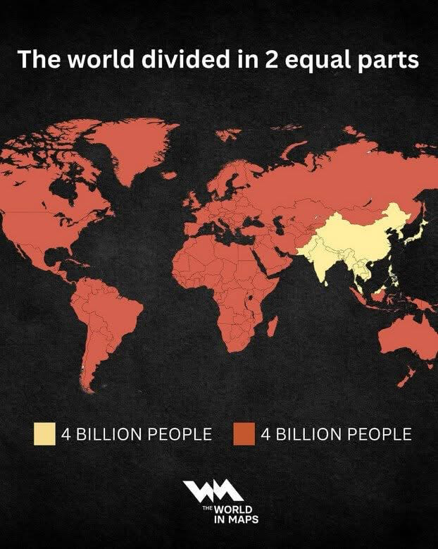
World Population Distribution Map
The 'World Population Distribution Map' effectively visualizes how the global population is divided into two equal parts...
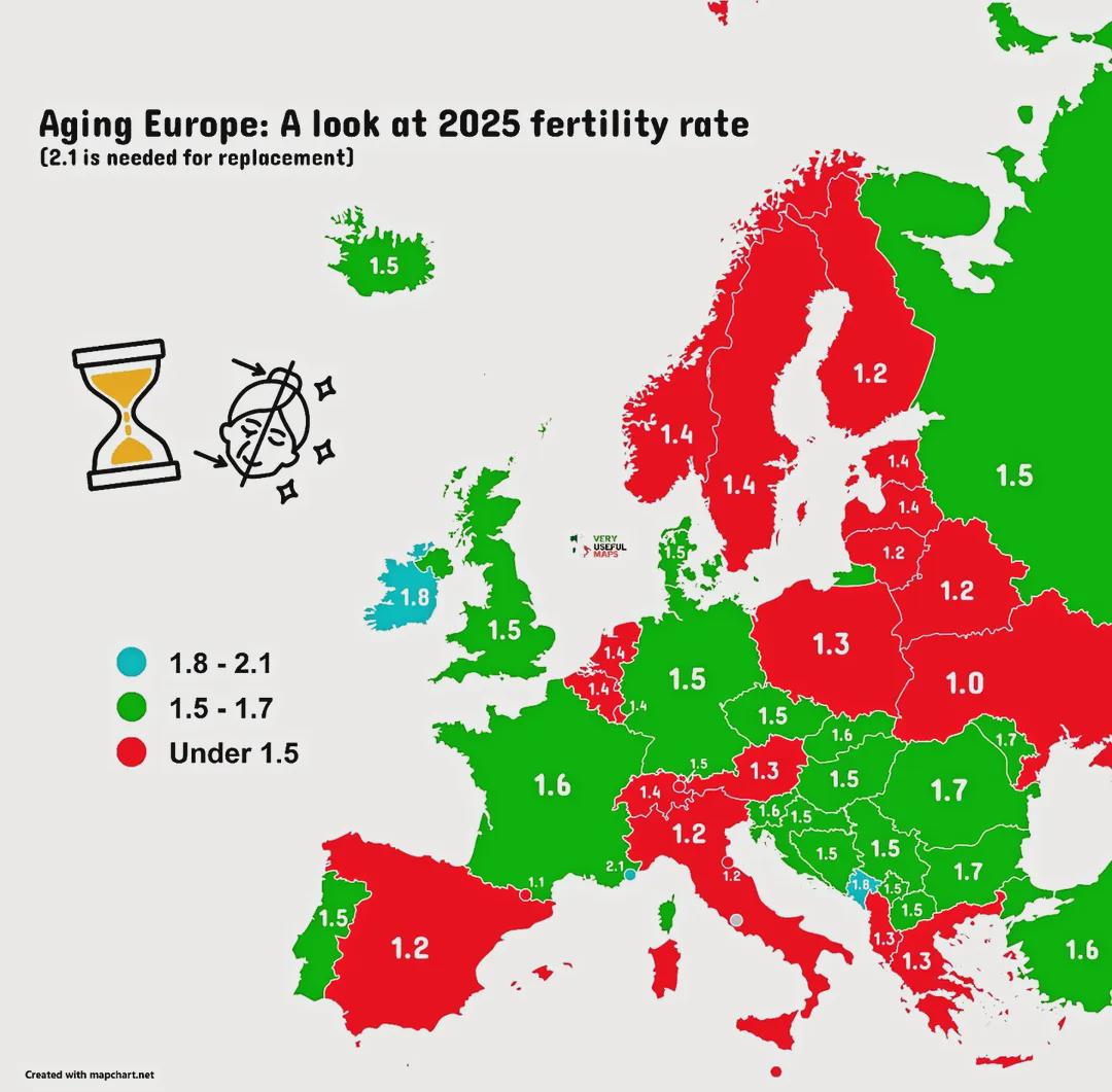
Ageing Population Map of Europe
The "Ageing Europe!" map provides a comprehensive visualization of the demographic shifts occurring across the continent...
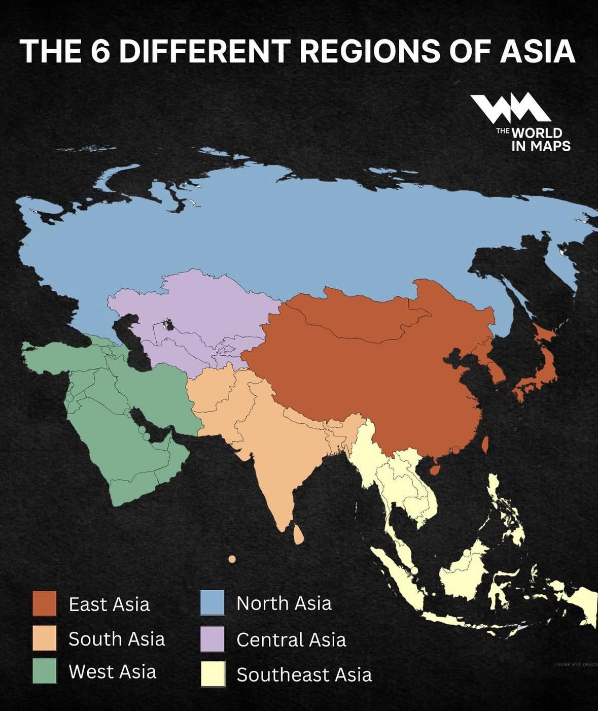
Regions of Asia Map
The "Regions of Asia Map" provides a comprehensive overview of the six distinct geographical regions that comprise the A...
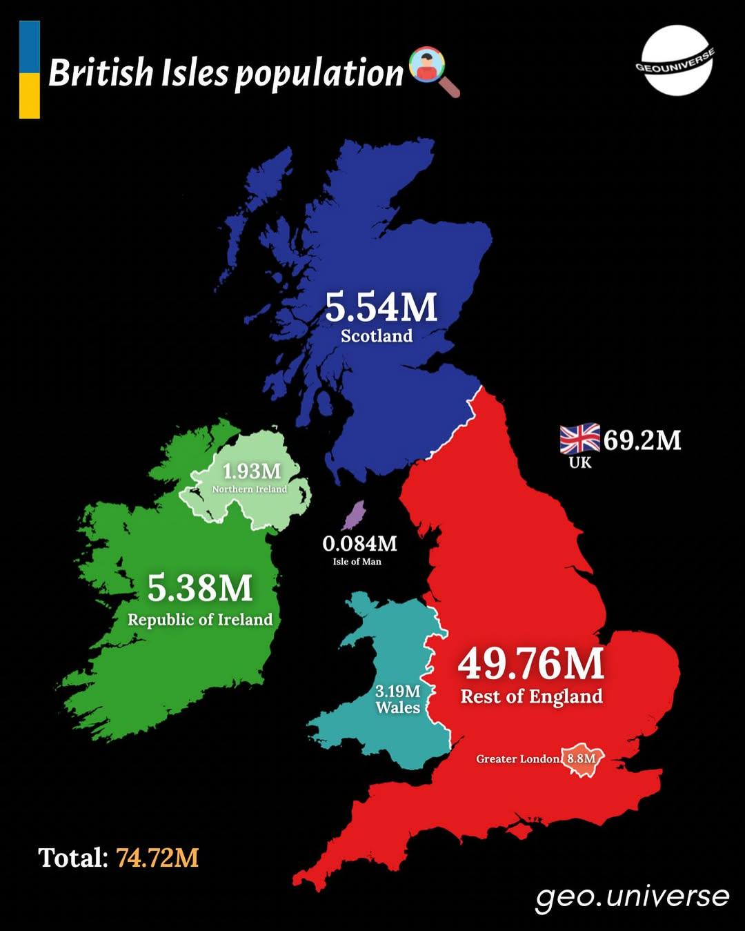
Population Distribution Map of the British Isles
The "British Isles by Population" map presents a detailed visualization of the population distribution across the Britis...
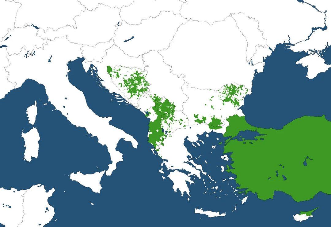
Muslim Majority Regions in the Balkans Map
The \...
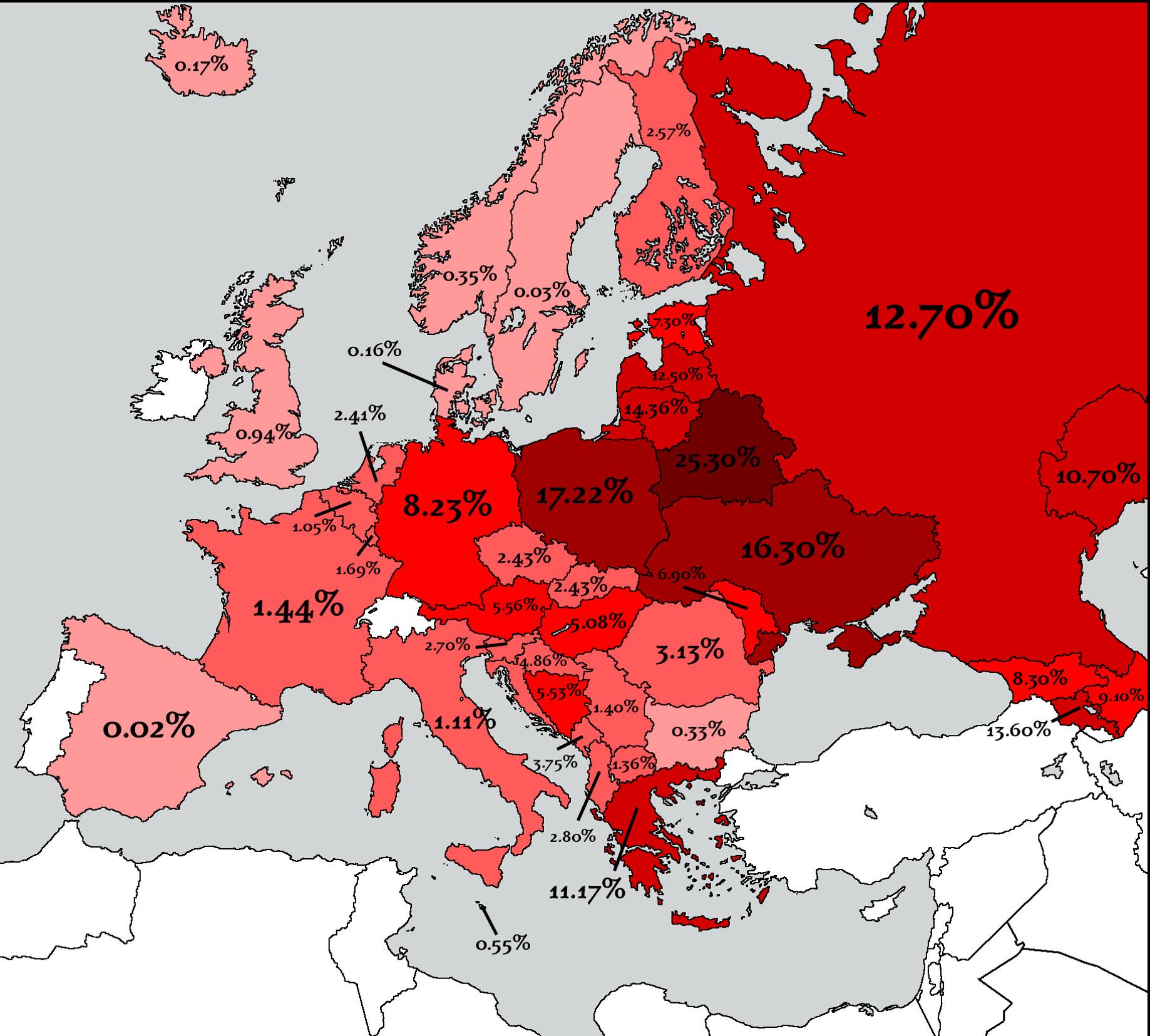
Countries That Lost the Most People in WW2 Map
The map titled "Countries That Lost the Most People in WW2" provides a stark visual representation of the human cost of ...
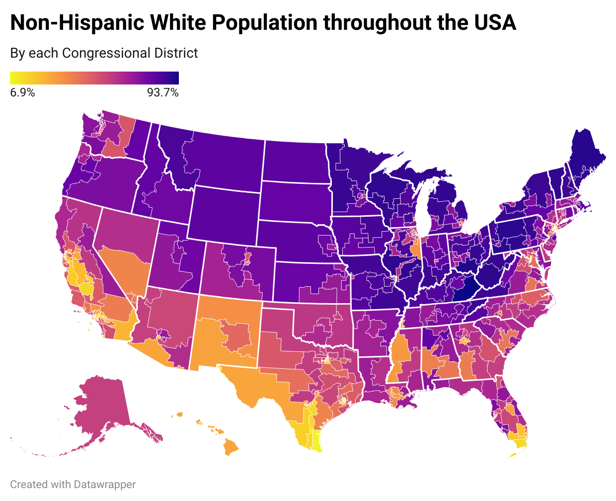
White Population by US Congressional District Map
The "White Population by US Congressional District Map" visualizes the percentage of the white population residing in ea...
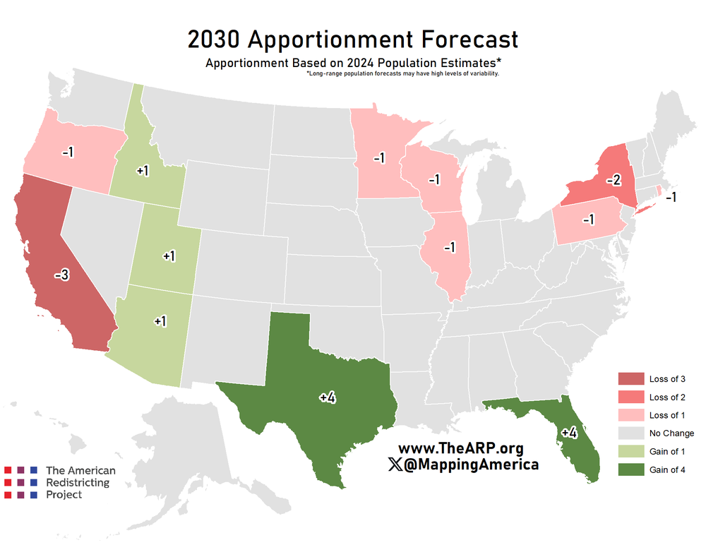
Electoral College Votes Forecast Map 2030
The "Forecast Apportionment of Electoral College Votes of 2030" map illustrates the projected distribution of electoral ...
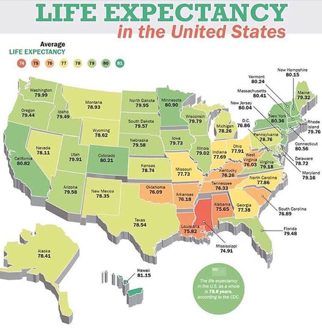
Life Expectancy by State in the USA Map
The \...
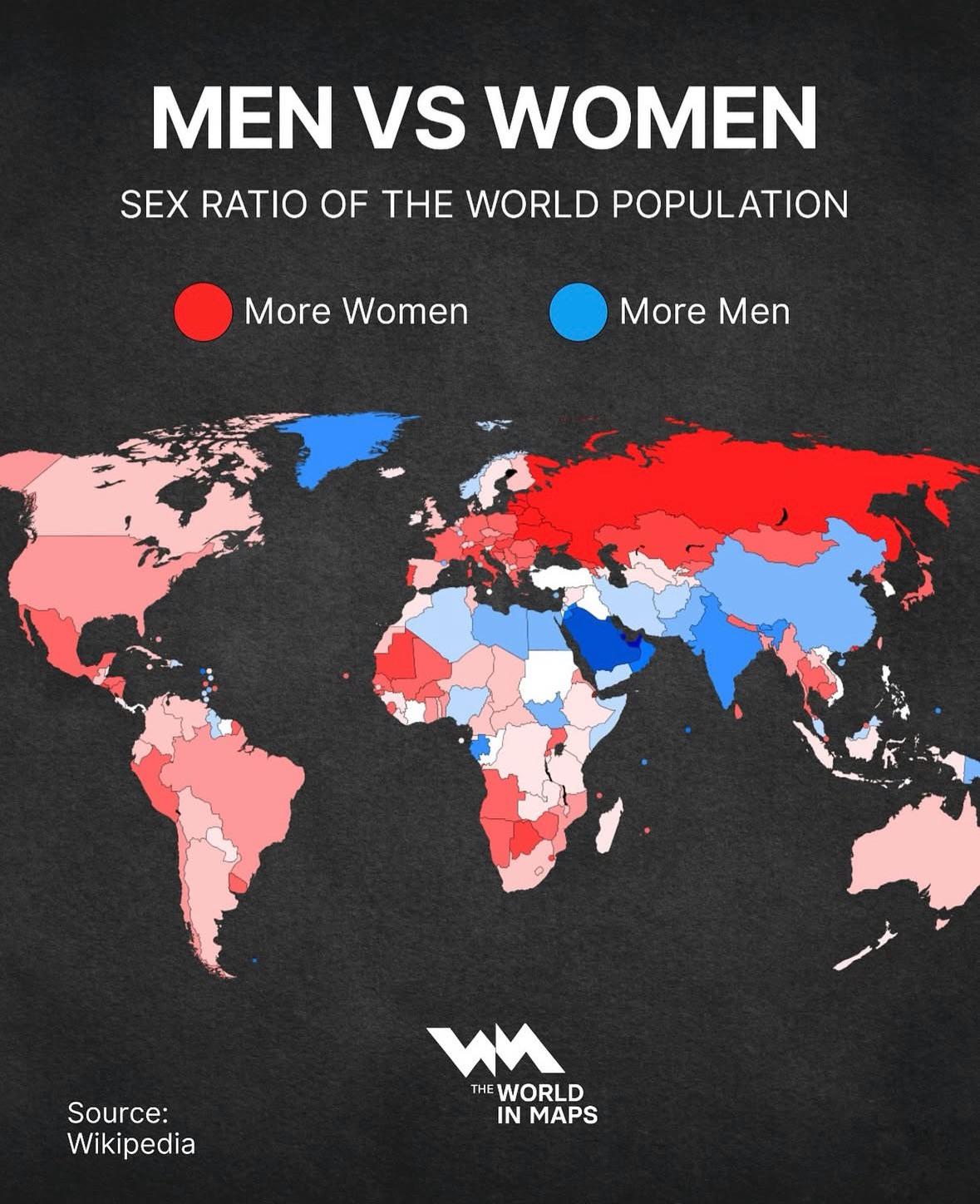
World Population Sex Ratio Map
The "Men vs. Women! Sex Ratio of the World Population" map provides a visual representation of the distribution of males...
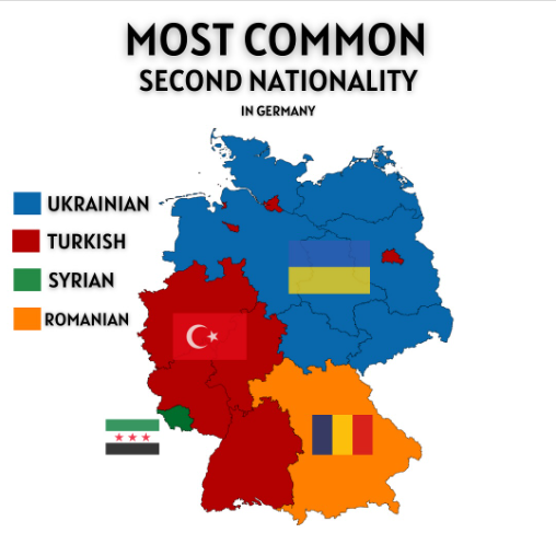
Most Common Second Nationality in Germany Map
The "Most Common Second Nationality in Germany" map provides a visual representation of the various nationalities that i...
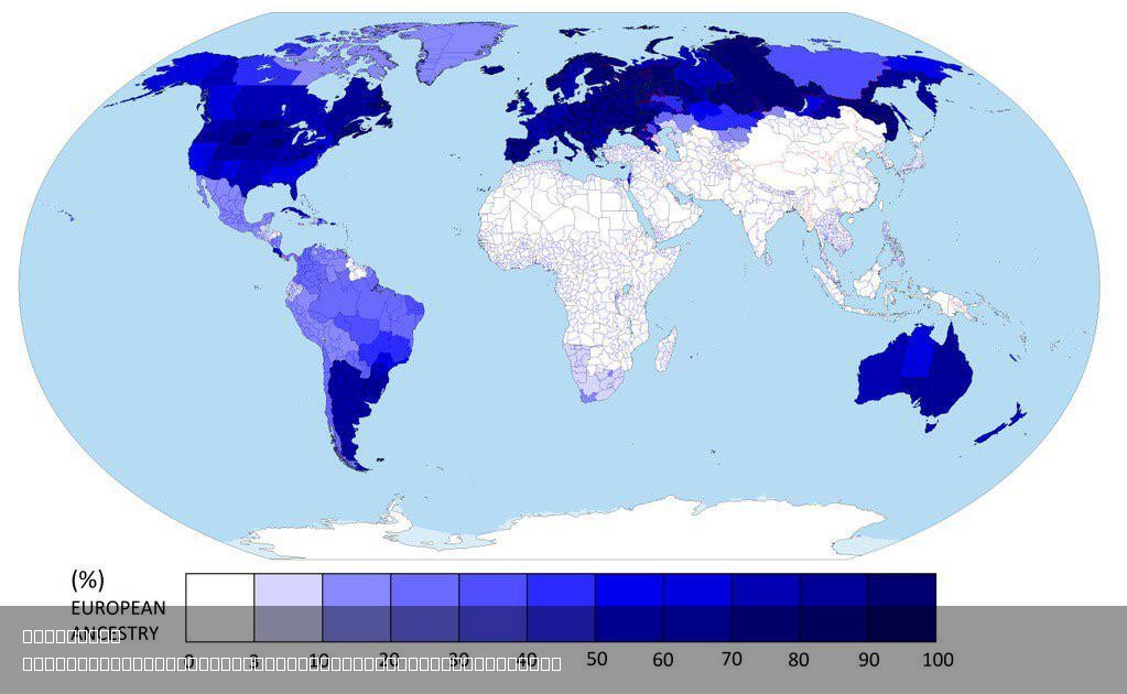
Percentage of European Ancestry Around the Globe Map
The \...
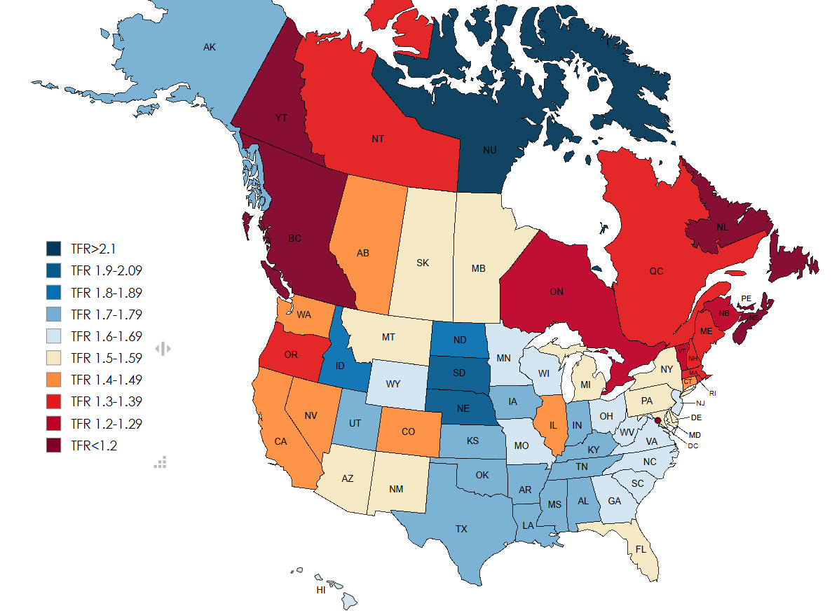
Fertility Rates in US and Canada 2024 Map
The "Fertility Rates in US and Canada 2024 Map" provides a comprehensive visualization of the fertility rates across dif...
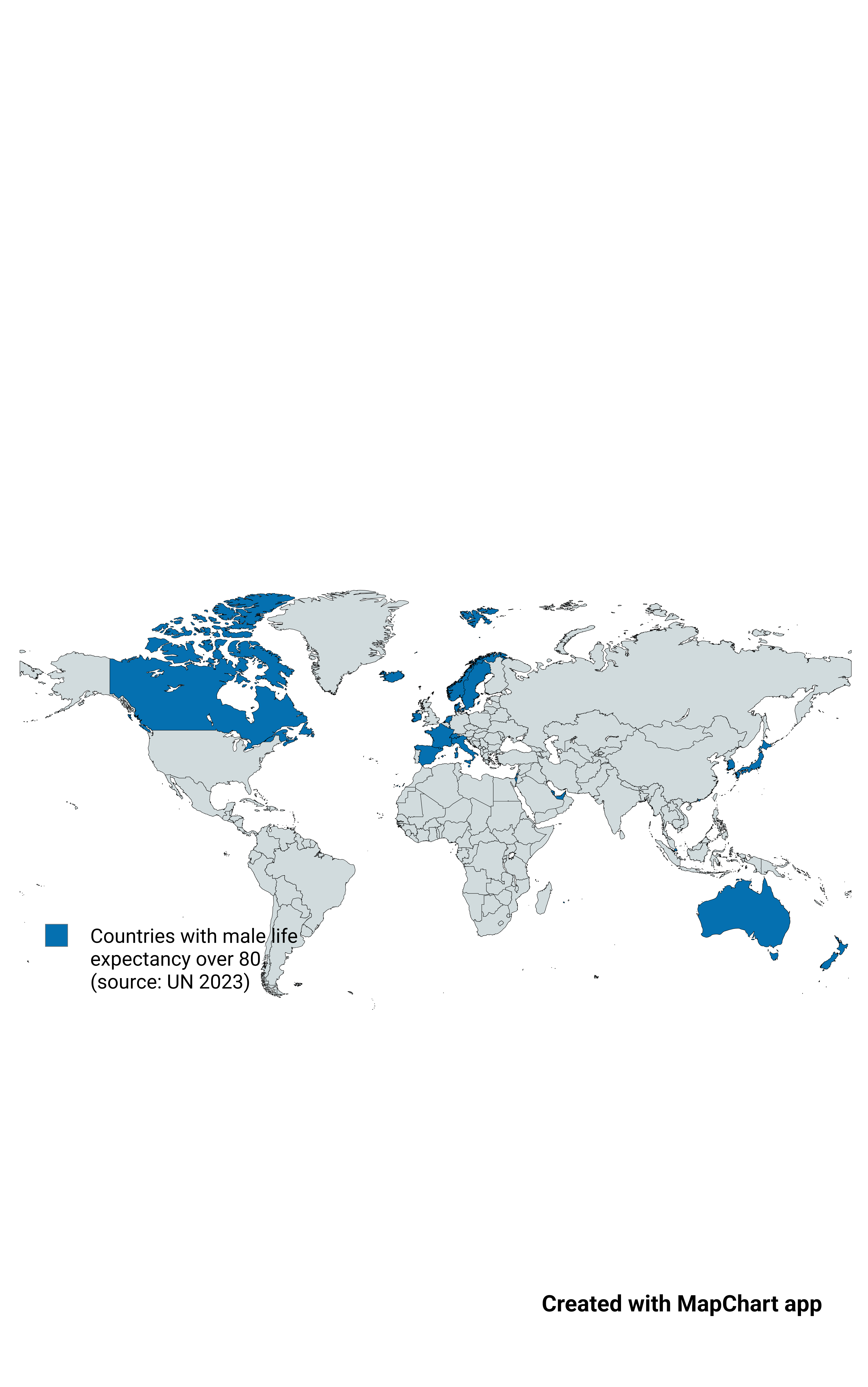
Map of Countries with Male Life Expectancy Over 80
This map highlights countries where male life expectancy exceeds 80 years, a more stringent criterion compared to the ge...
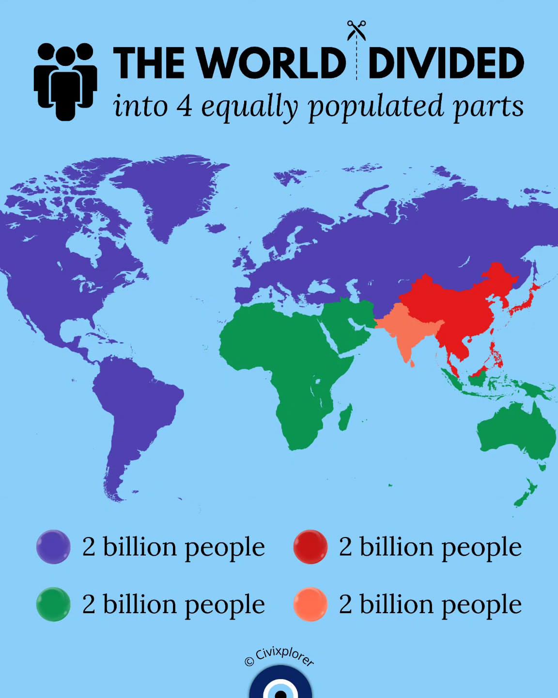
World Population Distribution Map
This map illustrates a fascinating concept: the world divided into four equally populated parts. It visualizes how Earth...

2025 Trump Peace Plan for Gaza Map
The "2025 Trump Peace Plan for Gaza Map" visualizes the proposed territorial divisions and administrative changes sugges...
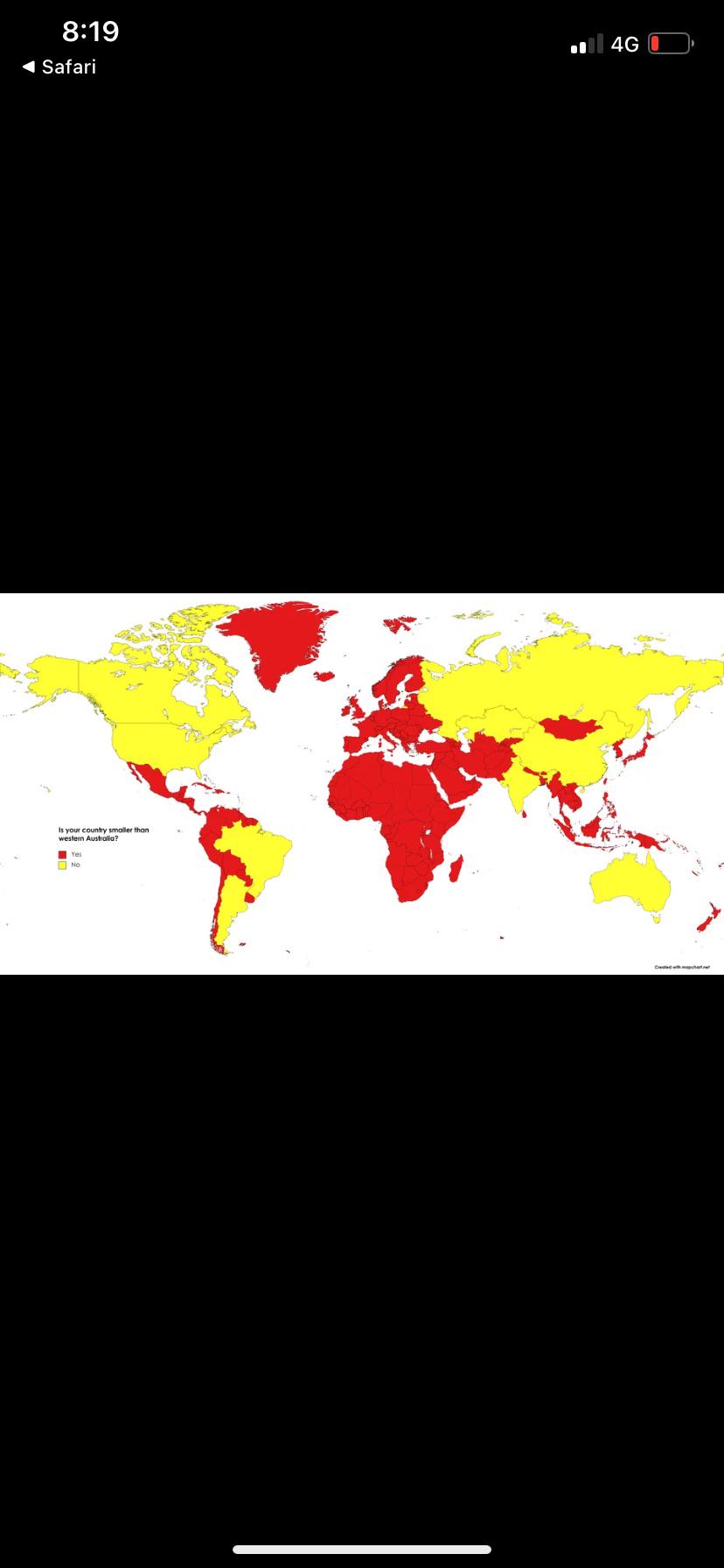
Country Size Comparison Map with Western Australia
The visualization titled "Is your country smaller than the state of Western Australia?" provides a striking comparison o...
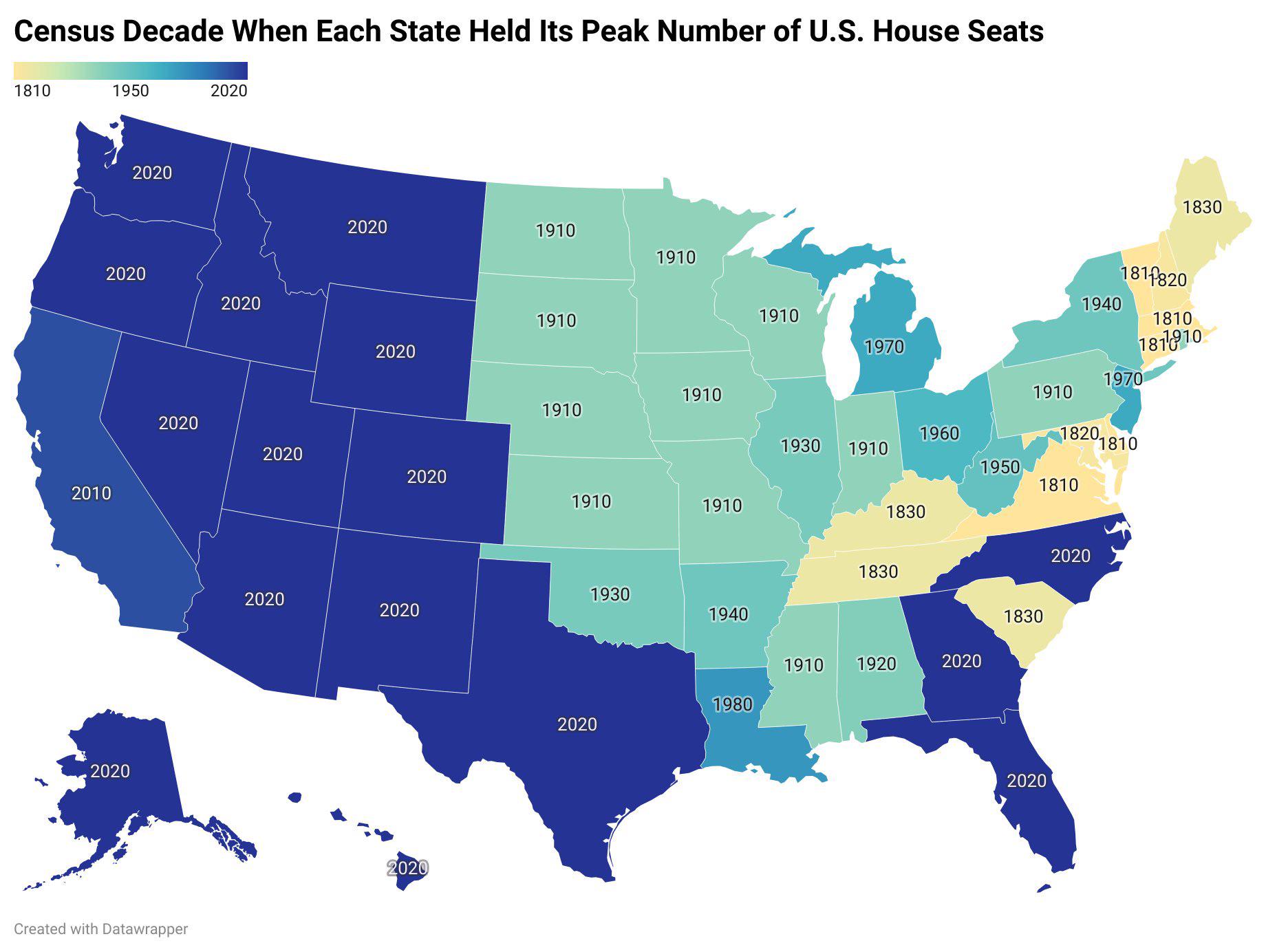
US States Peak House Seats Decade Map
This map visually represents the decade in which each U.S. state reached its maximum number of congressional House seats...

Golan Heights Historical Map Overview
The visualization titled "Golan Heights, then and now" presents a compelling comparison of the Golan Heights region, hig...
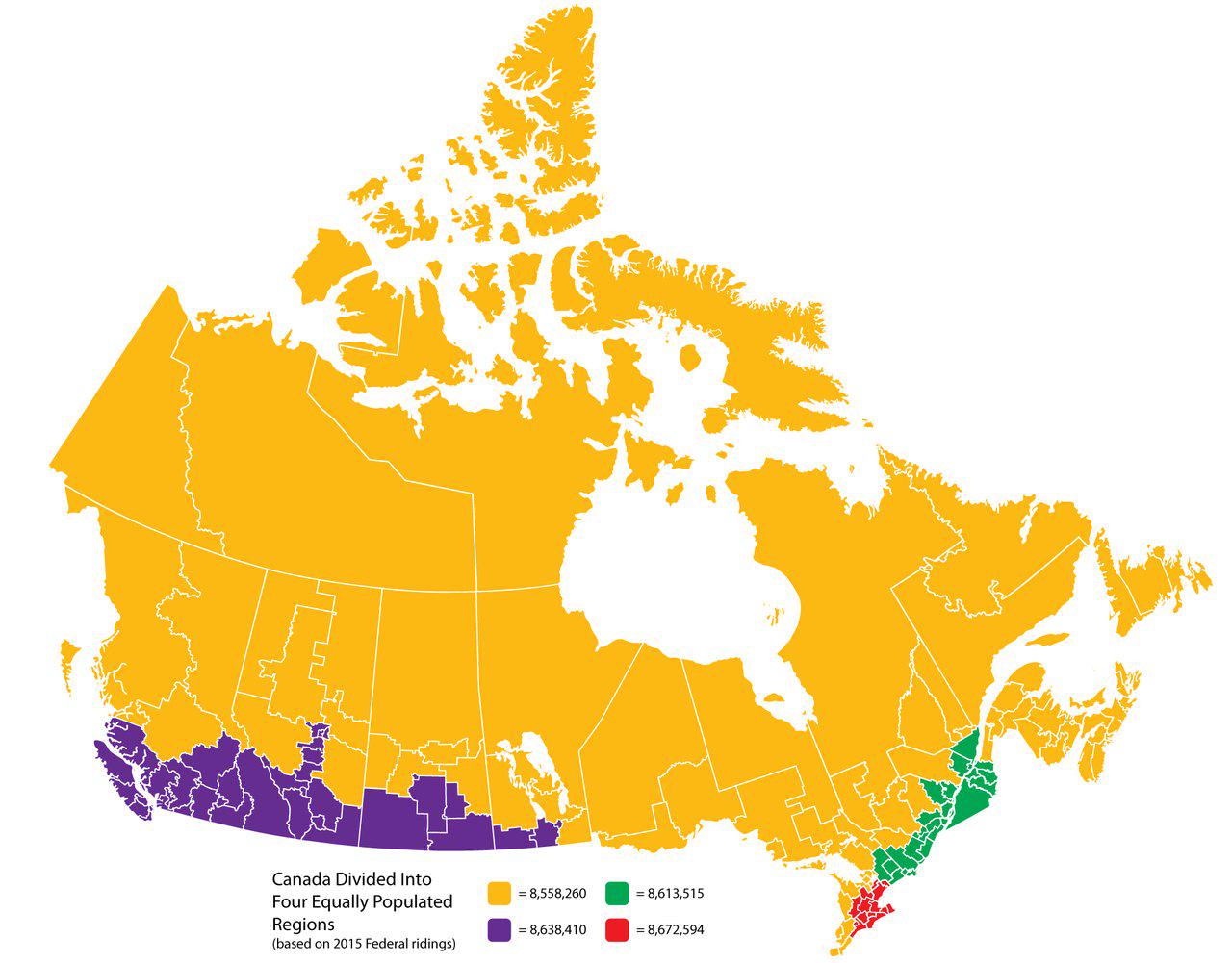
Canada Divided Into Four Equally Populated Regions Map
This map visualizes Canada divided into four equally populated regions, providing a unique perspective on the distributi...
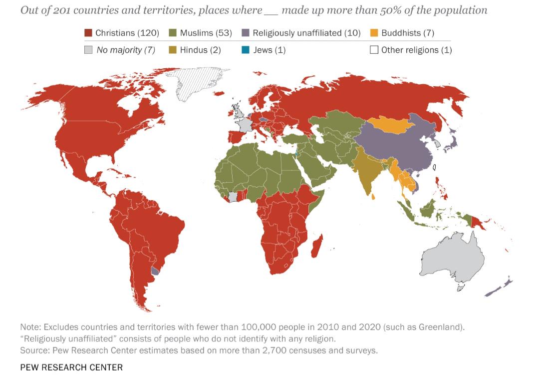
Largest Religious Affiliation by Country Map
The "Largest Religious Affiliation by Country Map" provides a visual representation of the predominant religious beliefs...
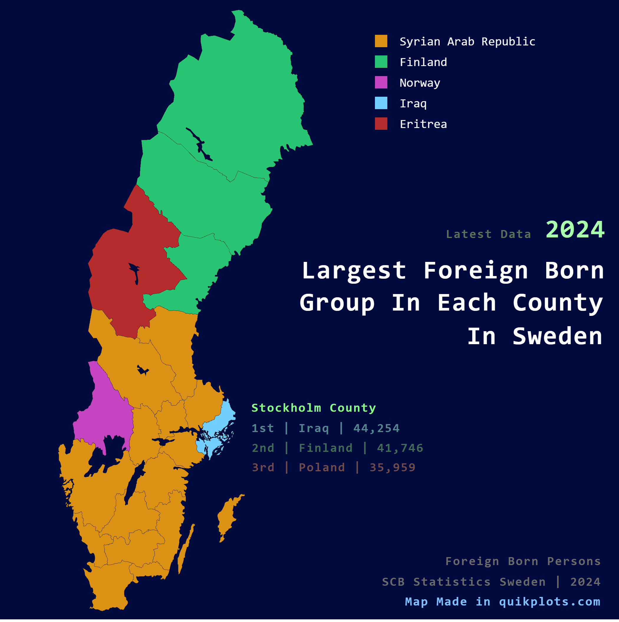
Largest Foreign Born Group per County Map in Sweden
The visualization titled "Largest Foreign Born Group per County in Sweden" presents a detailed breakdown of the predomin...
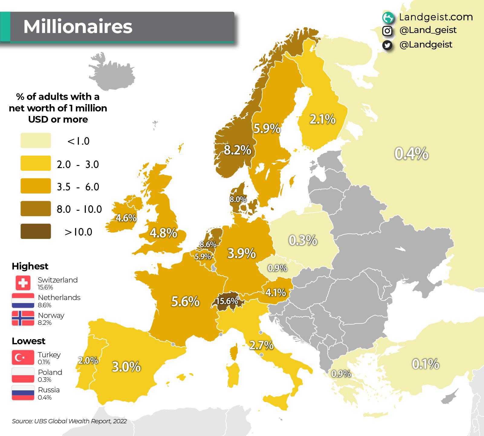
Millionaire Population Percentage Map of Europe
This map visualizes the percentage of millionaires within various European countries, offering a clear perspective on we...
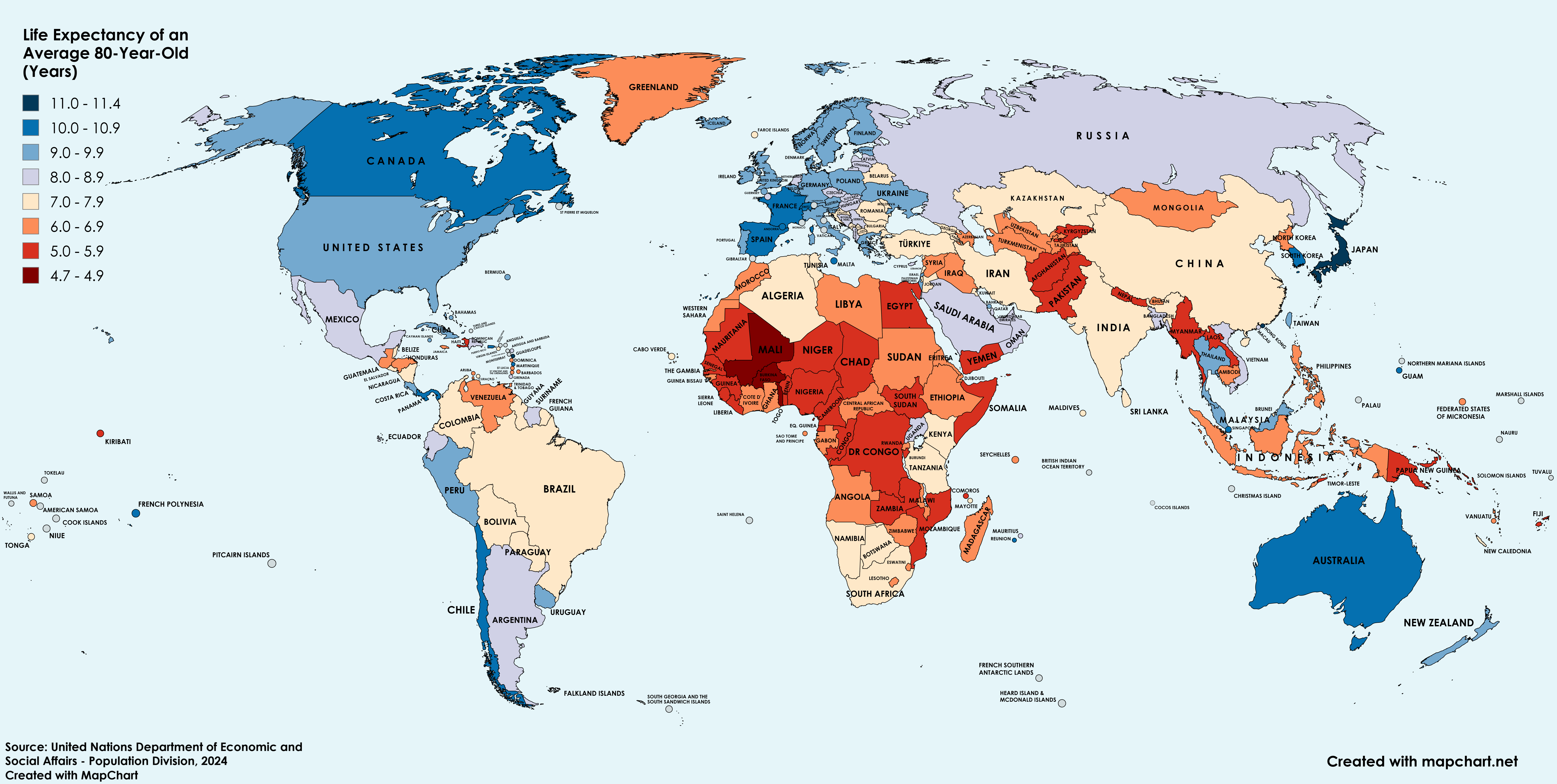
Life Expectancy of an 80-Year-Old Across the World Map
The map titled "Life Expectancy of an 80-Year-Old Across the World" offers an insightful visualization of how long indiv...
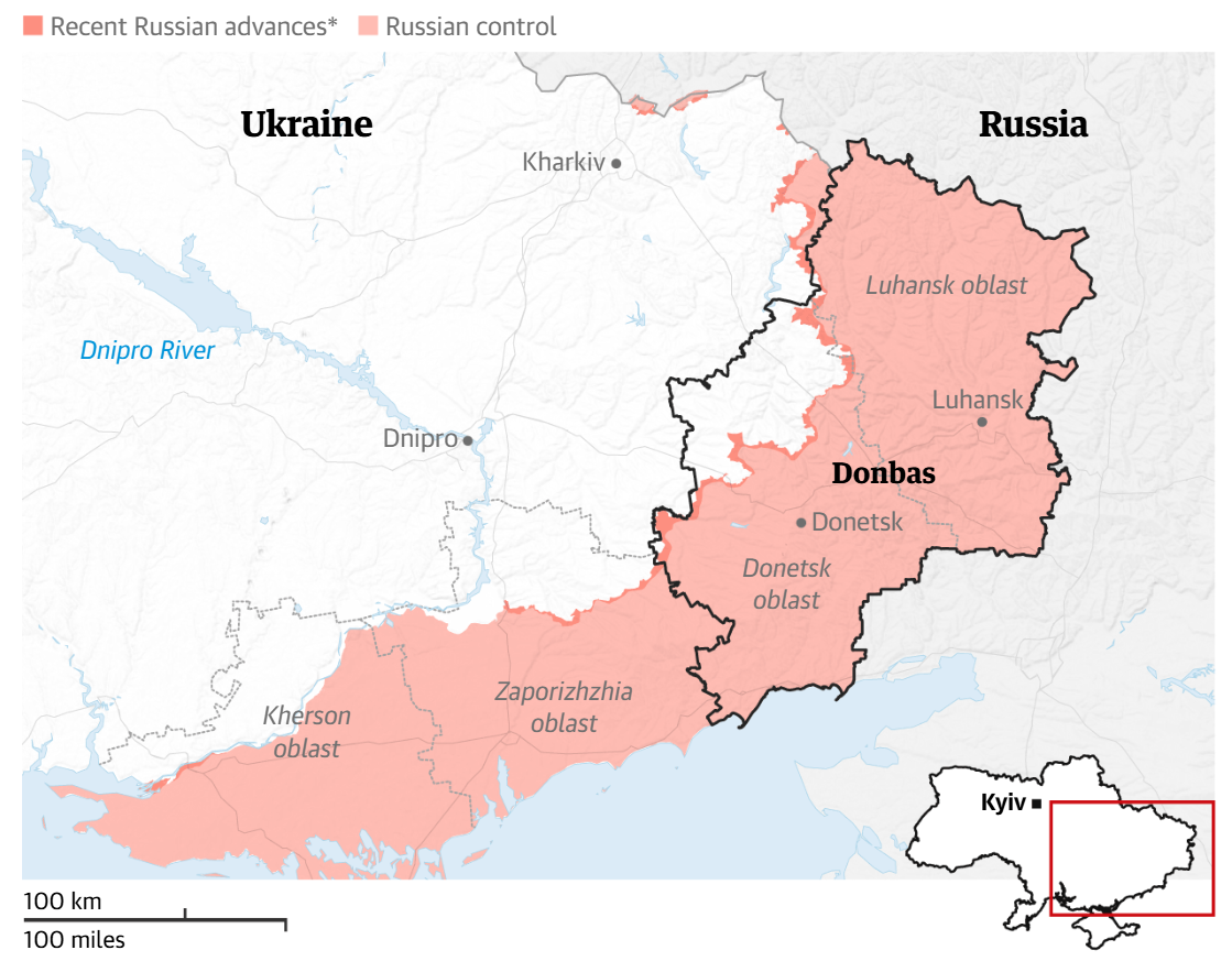
Map of Proposed Donbas Cessions by Putin
The map titled "Map of Proposed Donbas Cessions by Putin" visually represents the regions in eastern Ukraine that Russia...
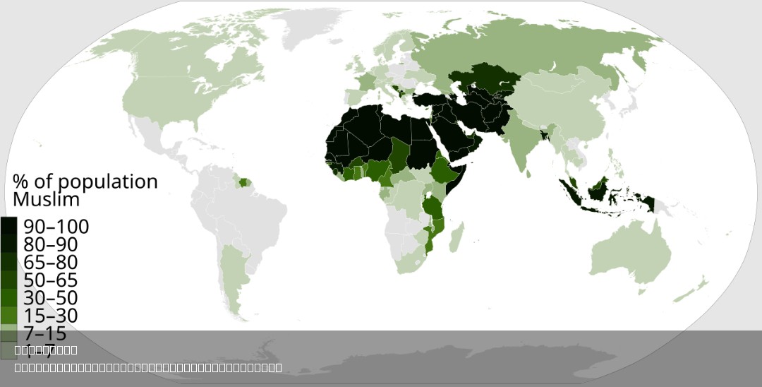
% of Muslim Population by Country Map
This map visually represents the percentage of the Muslim population in each country around the world. By highlighting t...
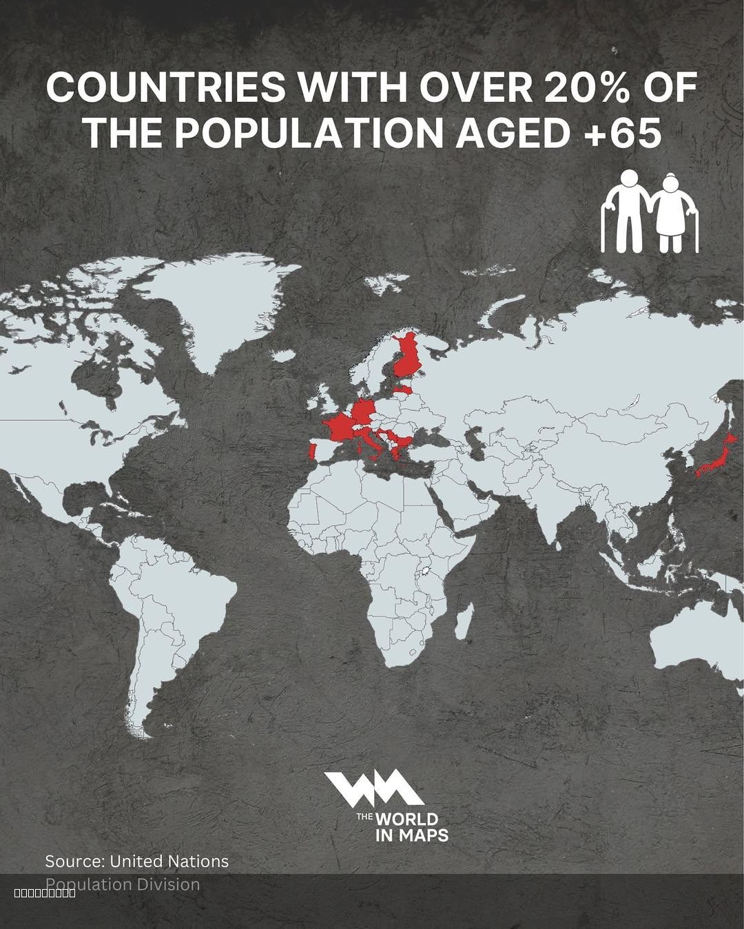
Countries with Over 20% Population Aged 65+ Map
This map illustrates the countries where over 20% of the population is aged 65 years and older. This demographic visuali...
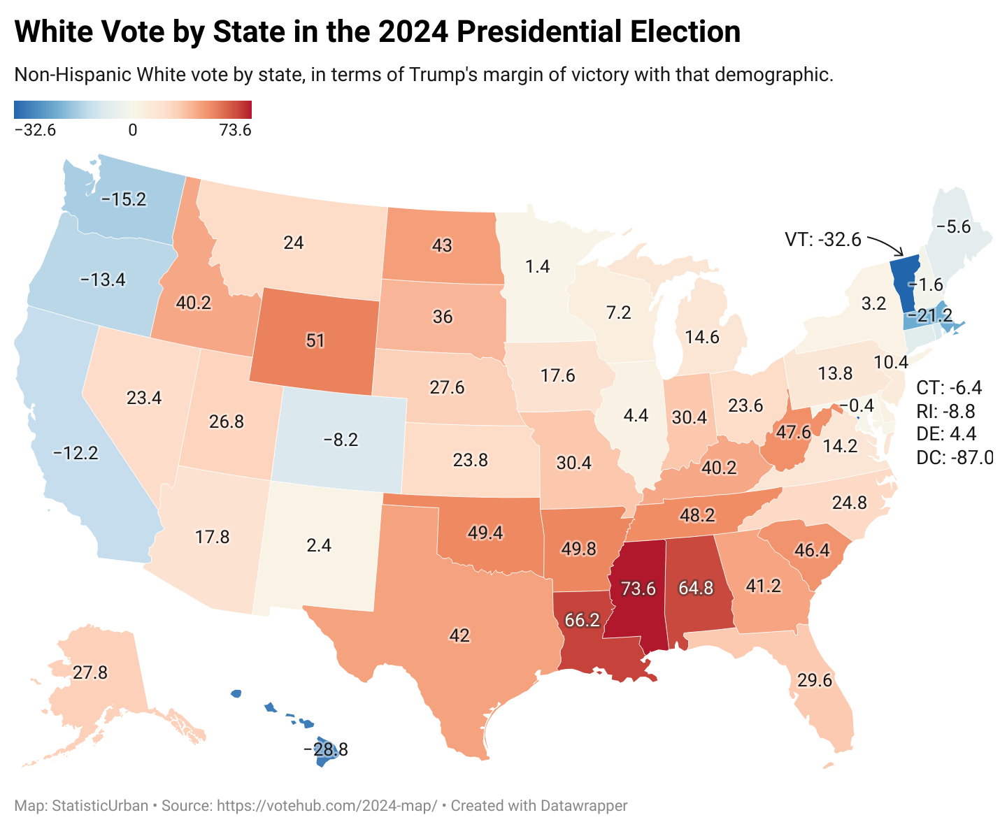
Voting Patterns Map of White Americans 2024
The map titled "How White Americans Voted in 2024" provides a detailed visual representation of voting behaviors among W...
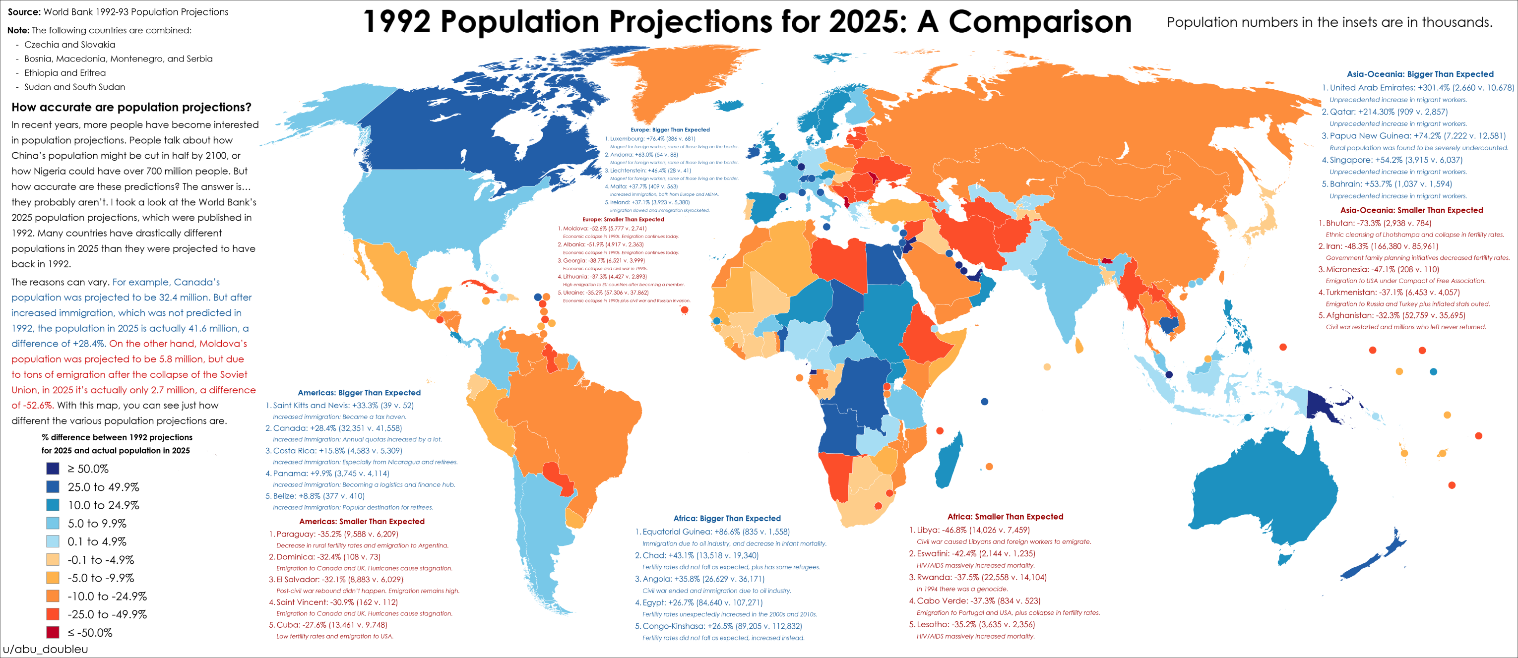
2025 Population Projections Accuracy Map
The map titled "How accurate were 2025 population projections from 1992?" provides a striking visual representation of t...
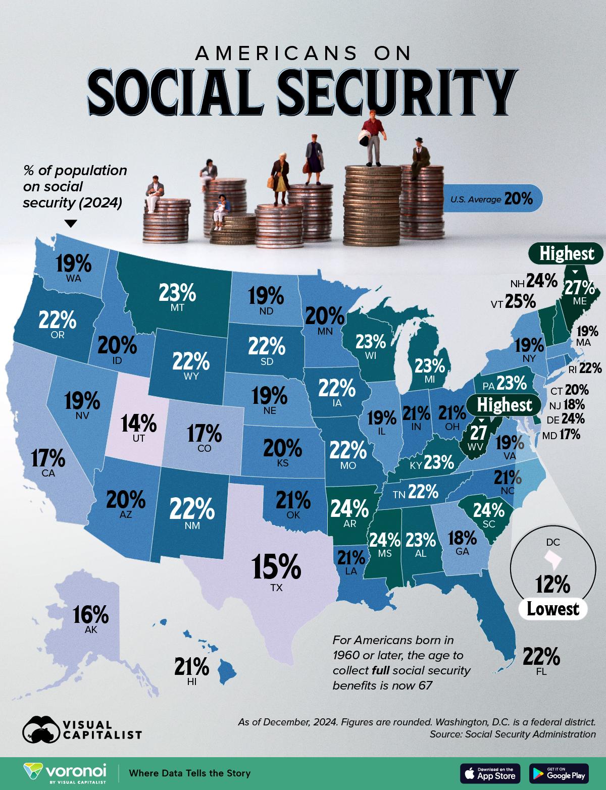
Social Security Recipients by State Map
The "Where Americans Receive Social Security, by State" map provides a visual representation of the distribution of Soci...
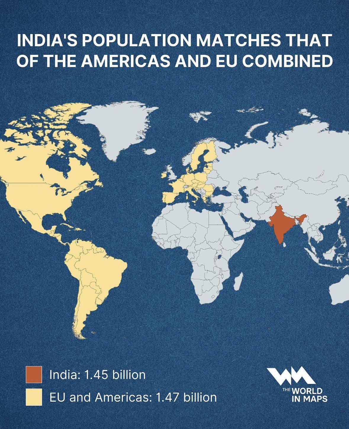
India Population Compared to Americas & EU Map
This map illustrates a striking demographic milestone: India’s population, standing at approximately 1.45 billion, now n...
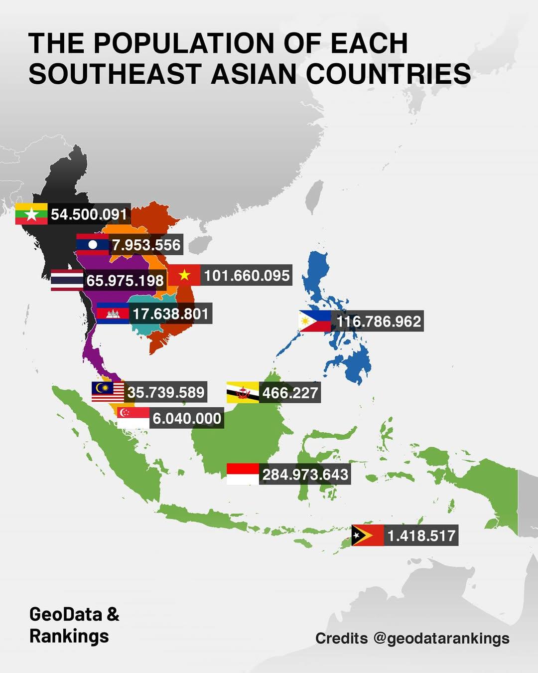
Population Map of Southeast Asian Countries
The "Population Map of Southeast Asian Countries" provides a clear visual representation of the population distribution ...