middle east Maps
71 geographic visualizations tagged with "middle east"
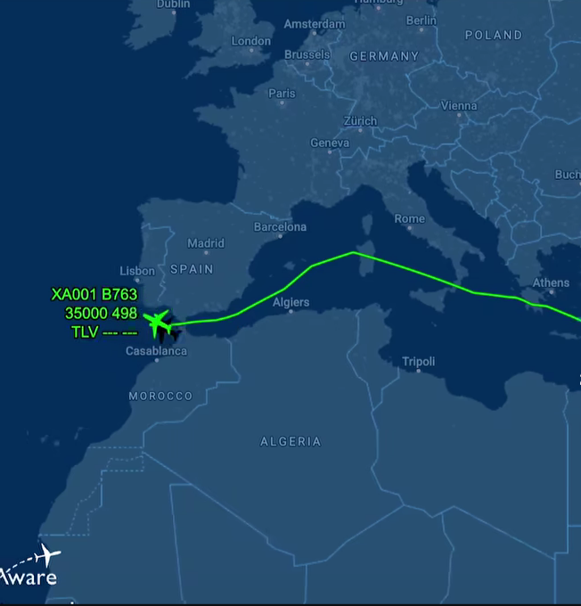
Netanyahu's Flight Path Avoidance Map
This map visualizes the flight path of Israeli Prime Minister Benjamin Netanyahu as he travels to the United States, hig...
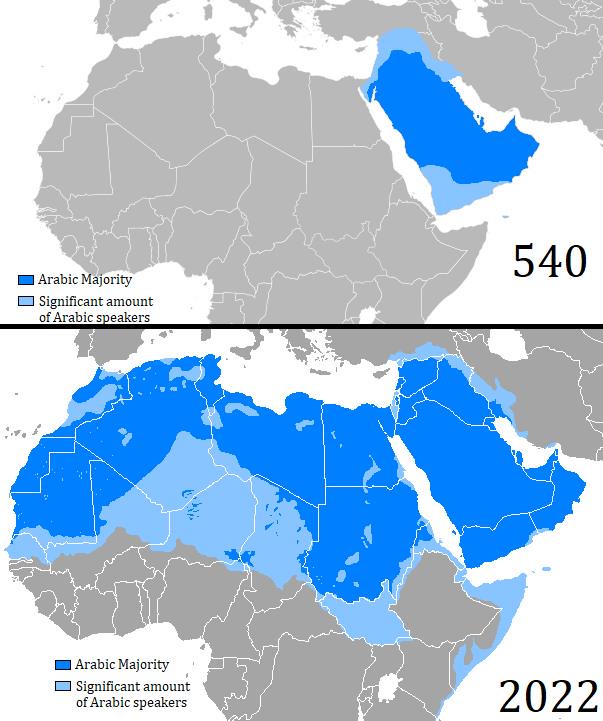
Map of Arabic Language Expansion from 540 to 2022
The map titled "Map of Arabic Language Expansion between 540 and 2022" visually illustrates the geographical spread of t...
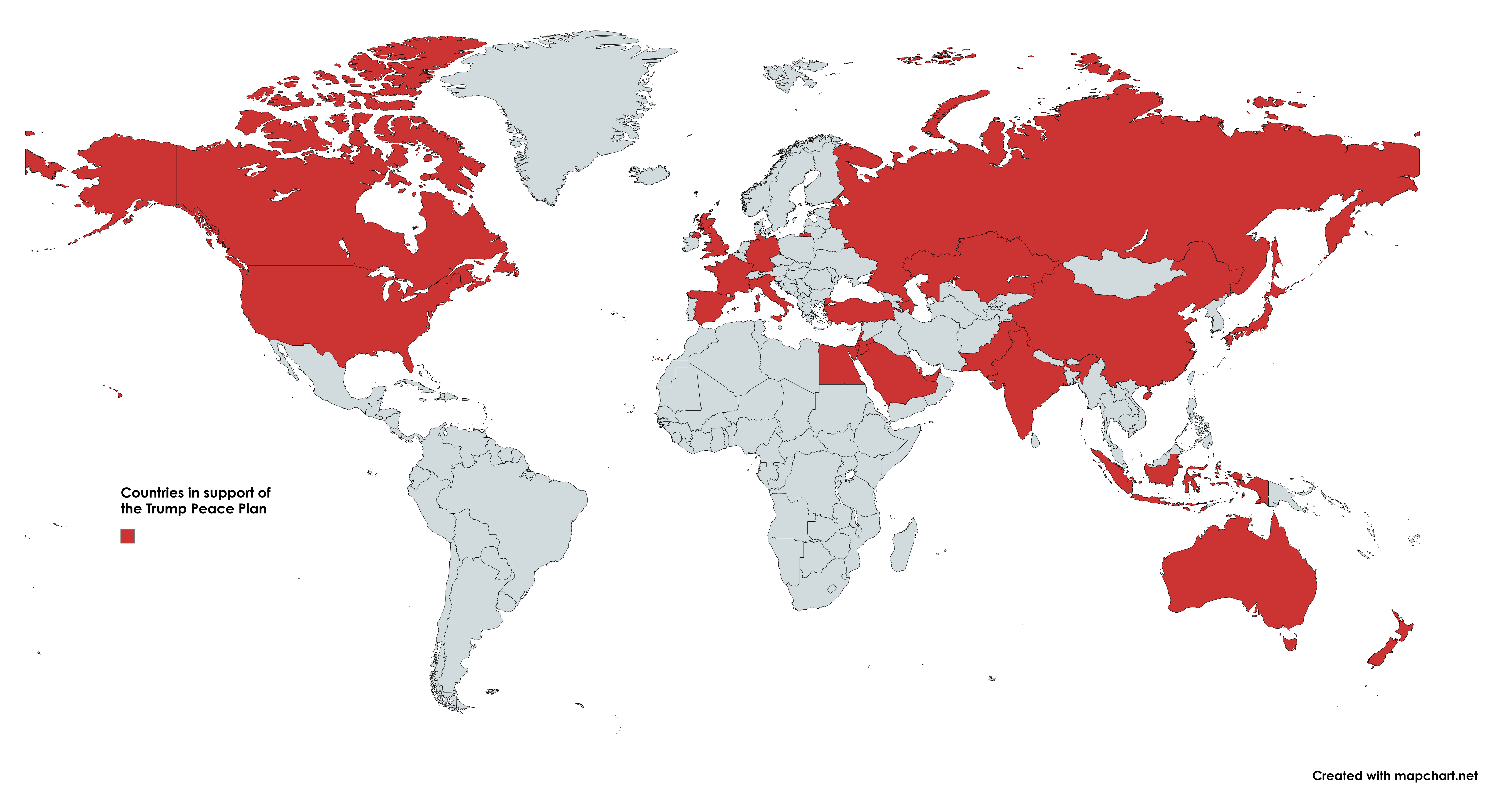
Countries Supporting the Trump Peace Plan for Gaza Map
This map illustrates the various countries that have expressed support for the Trump Peace Plan, specifically regarding ...
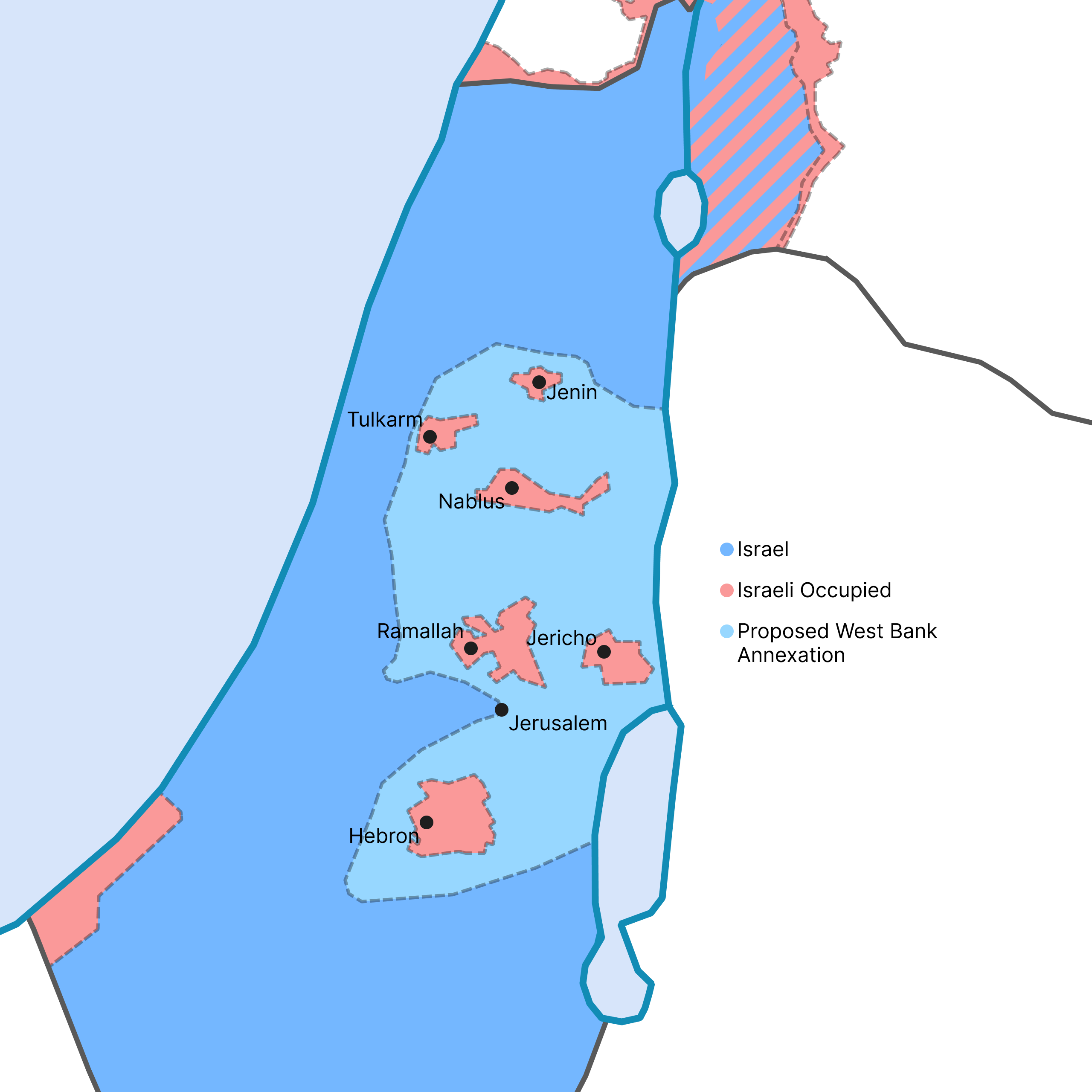
West Bank Annexation Proposal Map
This map visualizes the potential outcome of the Israeli government's recent proposal to annex a significant portion of ...
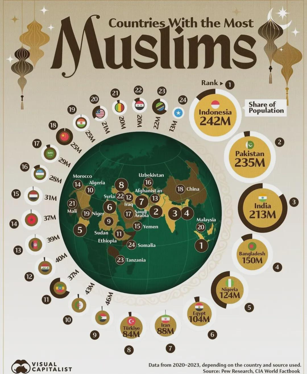
Countries With The Most Muslims Map
This map illustrates the distribution of Muslim populations across the globe, highlighting the countries with the larges...
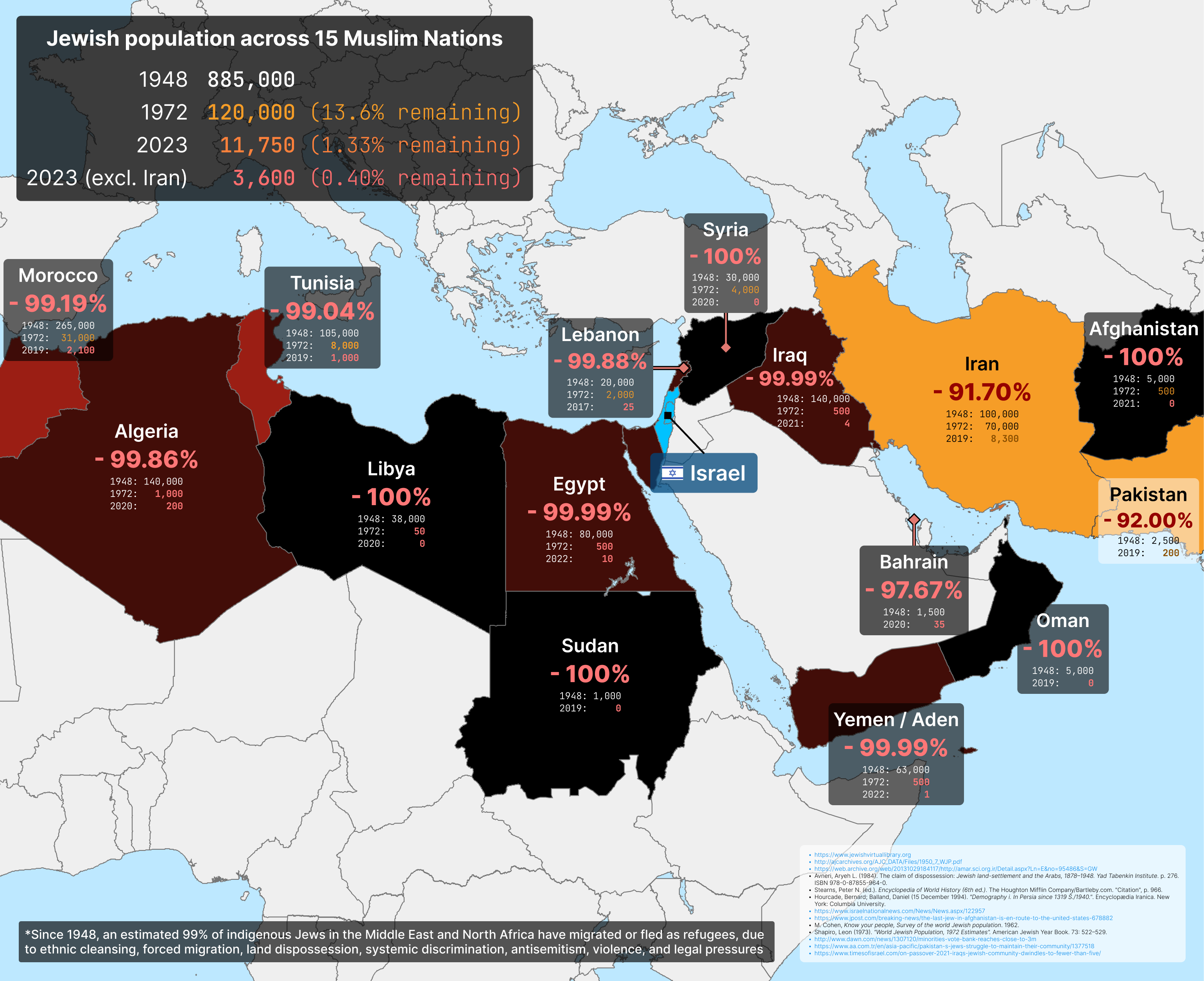
Jews in the Middle East Map
The Jewish community in Iran has faced significant challenges, particularly following the 1979 Islamic Revolution, which...
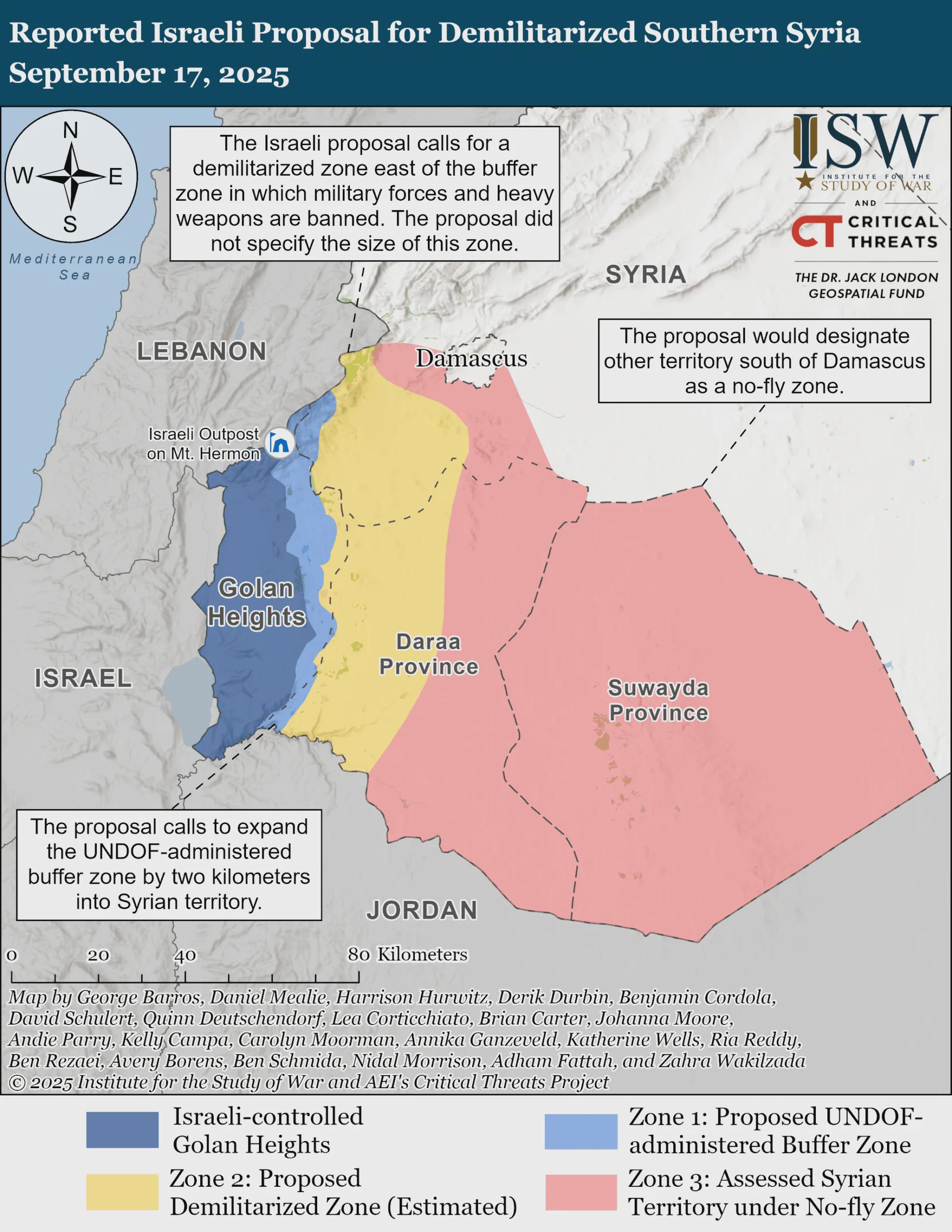
Demilitarized Southern Syria Proposal Map
The visualization titled "Reported Israeli Proposal for Demilitarized Southern Syria, September 17, 2025" provides a geo...
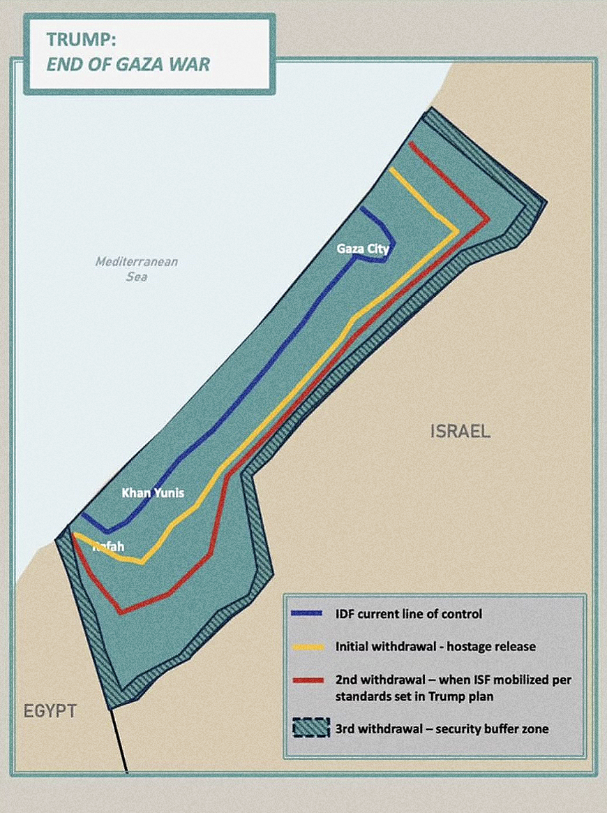
Trump's Gaza Withdrawal Map Analysis
The "Trump’s Gaza Withdrawal Map" published by the White House visualizes the proposed territorial changes and withdrawa...
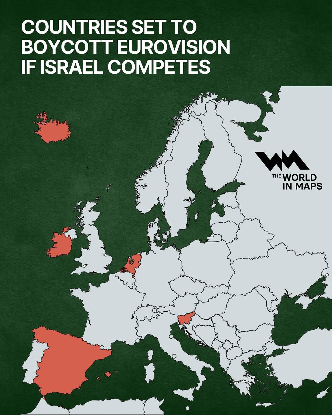
Boycotting Countries Map for Eurovision Israel
The visualization titled "Countries Set to Boycott Eurovision if Israel Competes" provides a geographical overview of th...
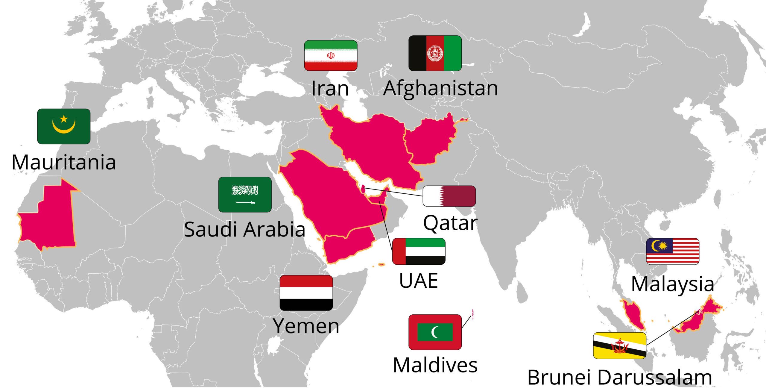
Apostasy Punishable by Death Countries Map
This map visually represents countries where apostasy, the act of leaving one’s religion, is punishable by death. It hig...
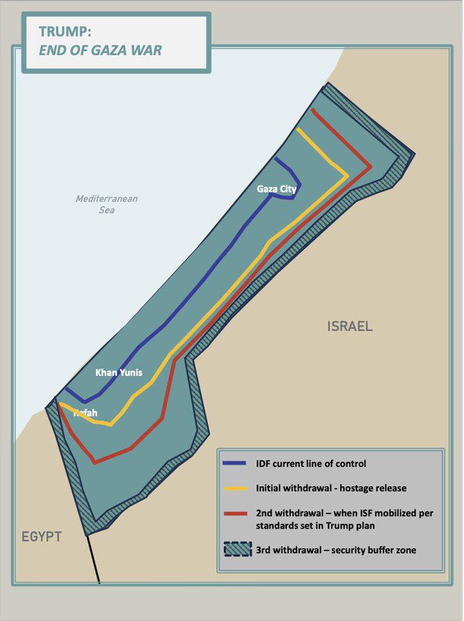
2025 Trump Peace Plan for Gaza Map
The "2025 Trump Peace Plan for Gaza Map" visualizes the proposed territorial divisions and administrative changes sugges...
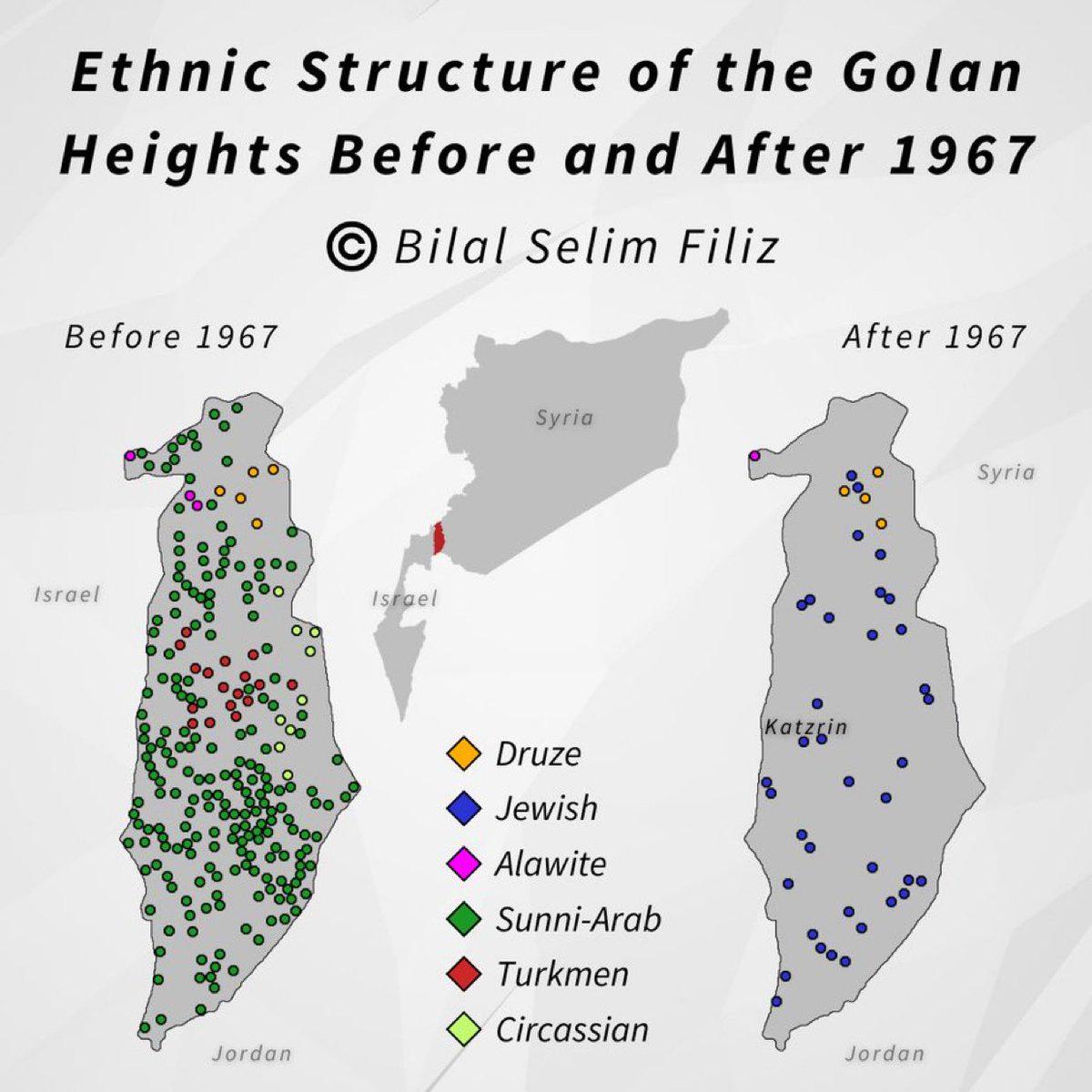
Golan Heights Historical Map Overview
The visualization titled "Golan Heights, then and now" presents a compelling comparison of the Golan Heights region, hig...
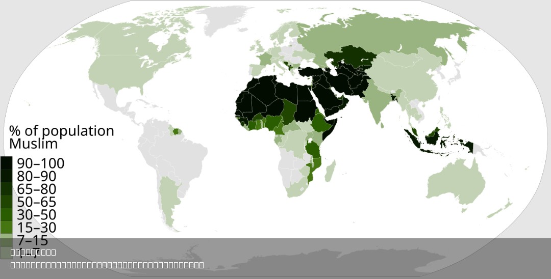
% of Muslim Population by Country Map
This map visually represents the percentage of the Muslim population in each country around the world. By highlighting t...
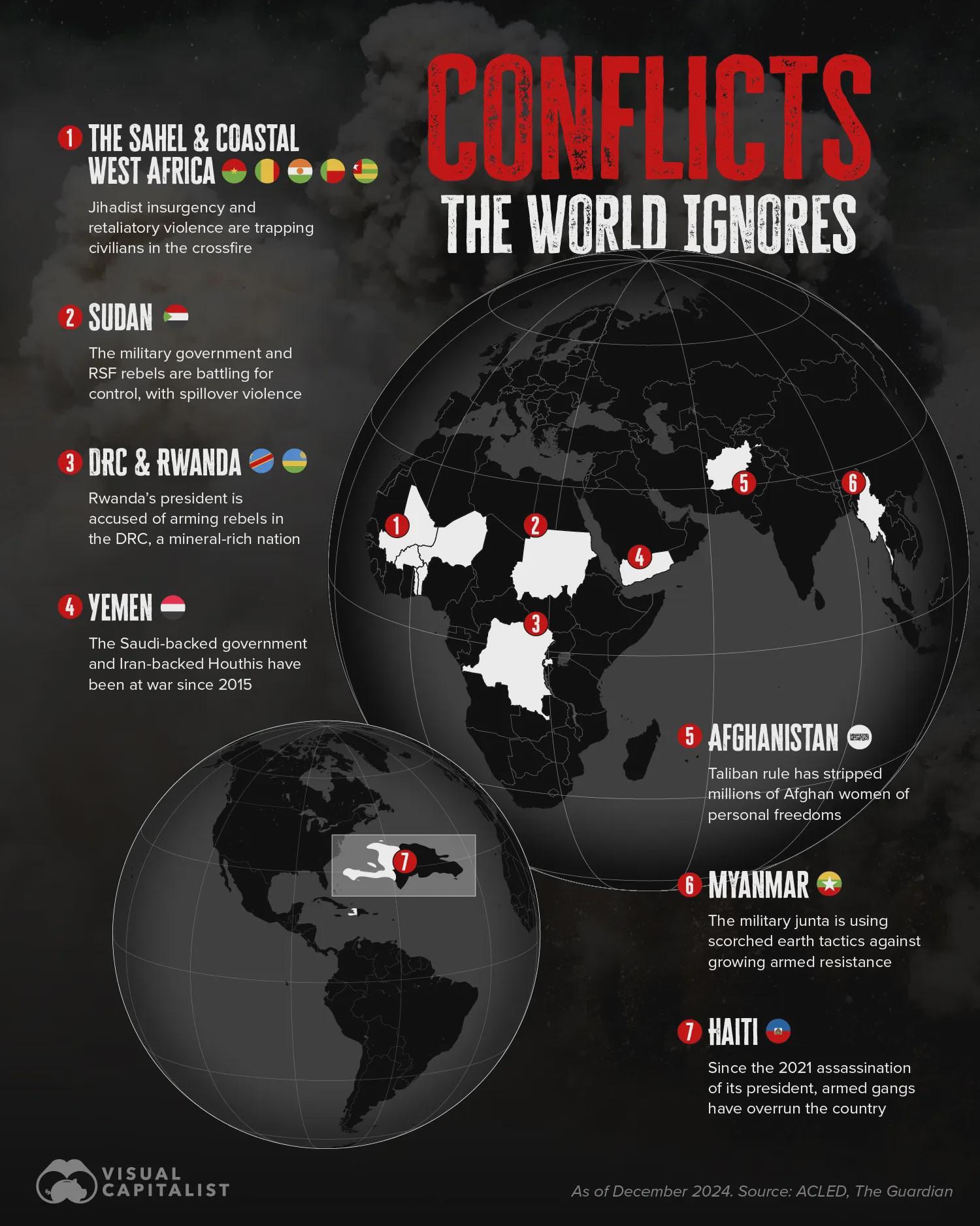
Ongoing Conflicts Map Beyond Ukraine and Palestine
The map titled "Ongoing Overlooked Conflicts in the World Beyond Ukraine/Russia and Palestine/Israel" highlights various...
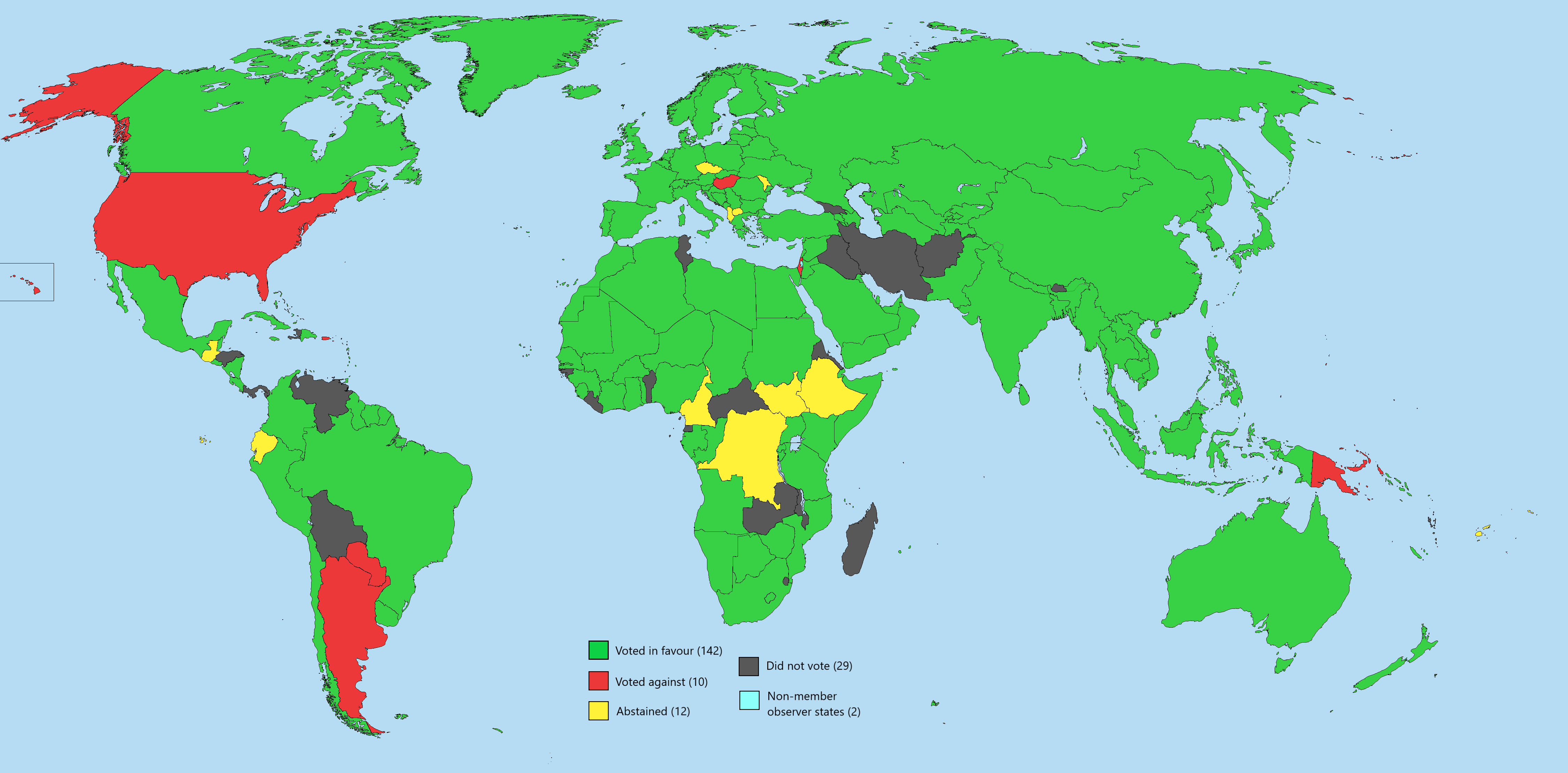
UN General Assembly Vote Two-State Solution Map
The map titled "UN General Assembly Vote on Implementing a Two-State Solution Free of Hamas" visually represents the vot...
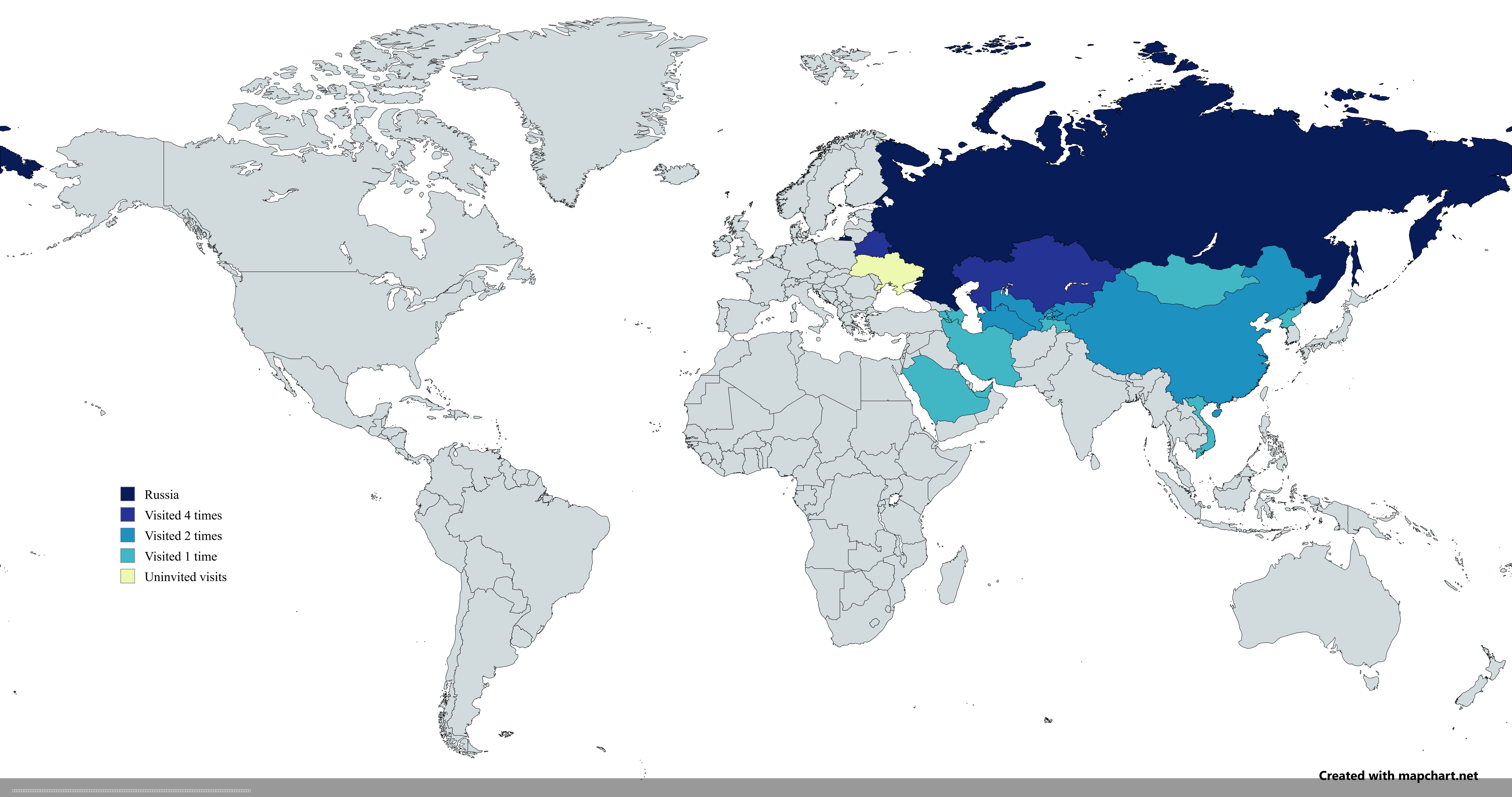
Map of Countries Visited by Vladimir Putin Post-2022 Invasion
The map titled "Countries Visited by Russian President Vladimir Putin After the 2022 Russian Invasion of Ukraine" provid...
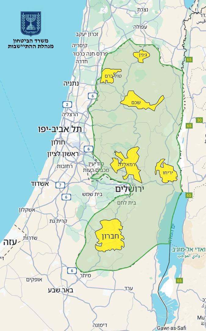
Israel Annexation Map of 82% West Bank
The map presented by Finance Minister Bezalel Smotrich highlights a proposed annexation plan that seeks to incorporate 8...
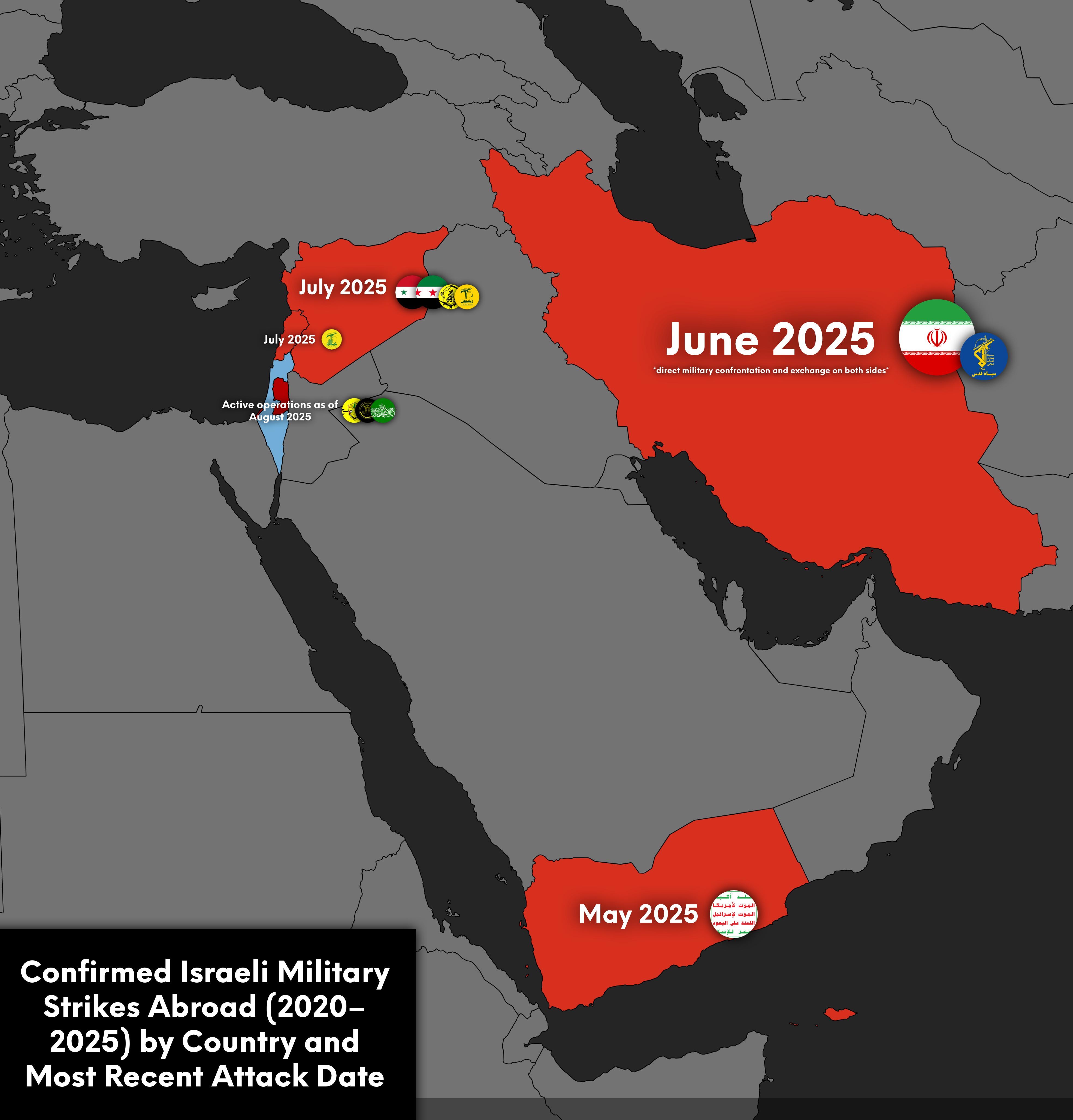
Confirmed Israeli Military Strikes Abroad Map 2020-2025
The visualization titled "Confirmed Israeli Military Strikes Abroad (2020–2025) by Country and Most Recent Attack Date" ...
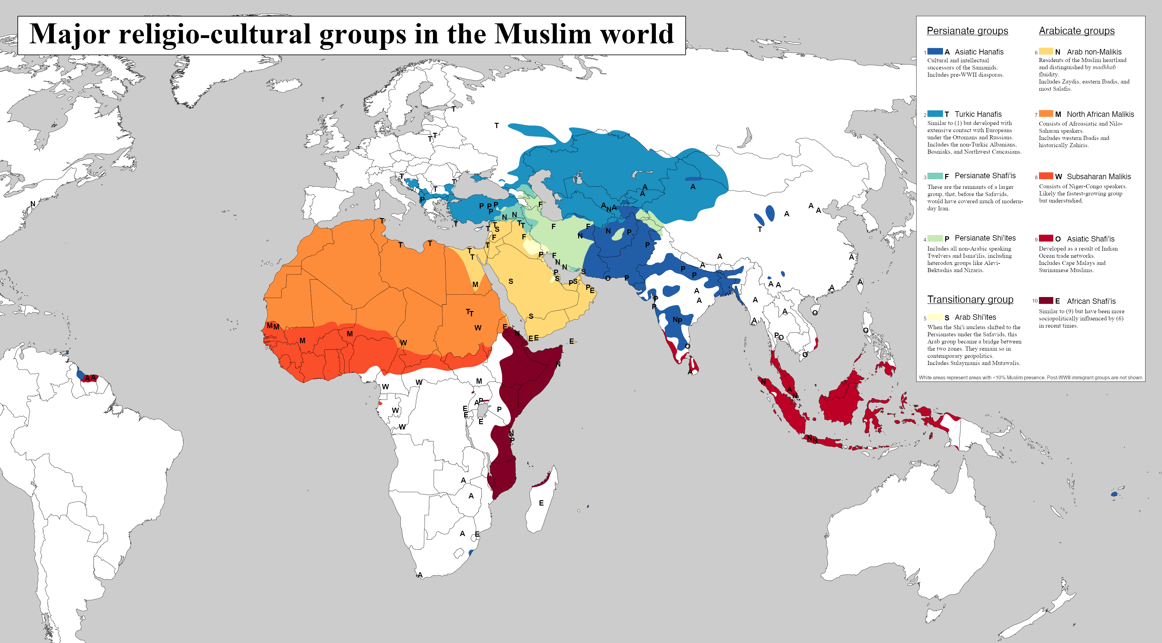
Major Religio-Cultural Groups in the Muslim World Map
This map titled 'Major Religio-Cultural Groups in the Muslim World' illustrates the diverse landscape of religious and c...
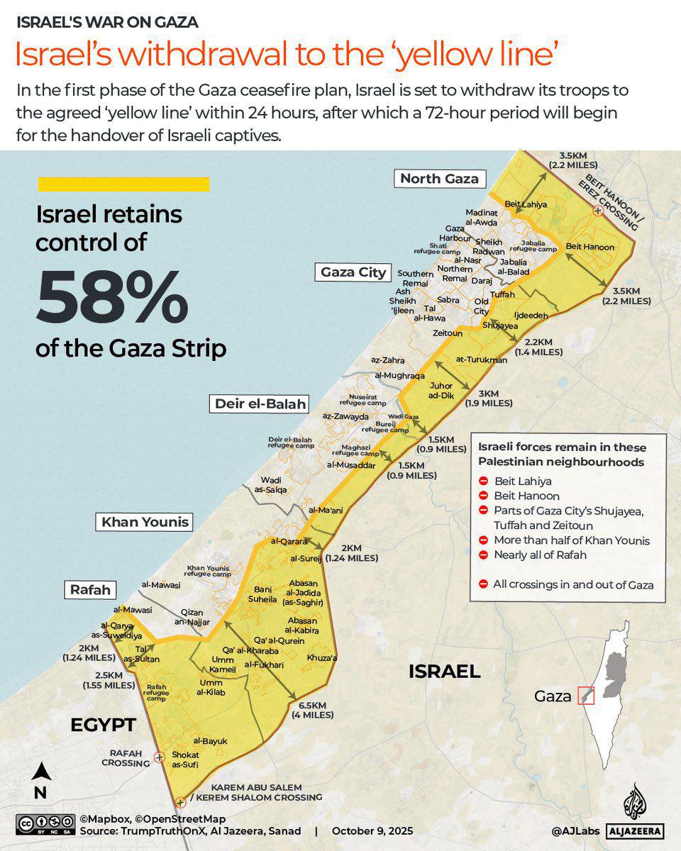
Gaza Withdrawal to Yellow Line Map
This map illustrates the geographical implications of Israel's withdrawal from the Gaza Strip, highlighting the yellow l...
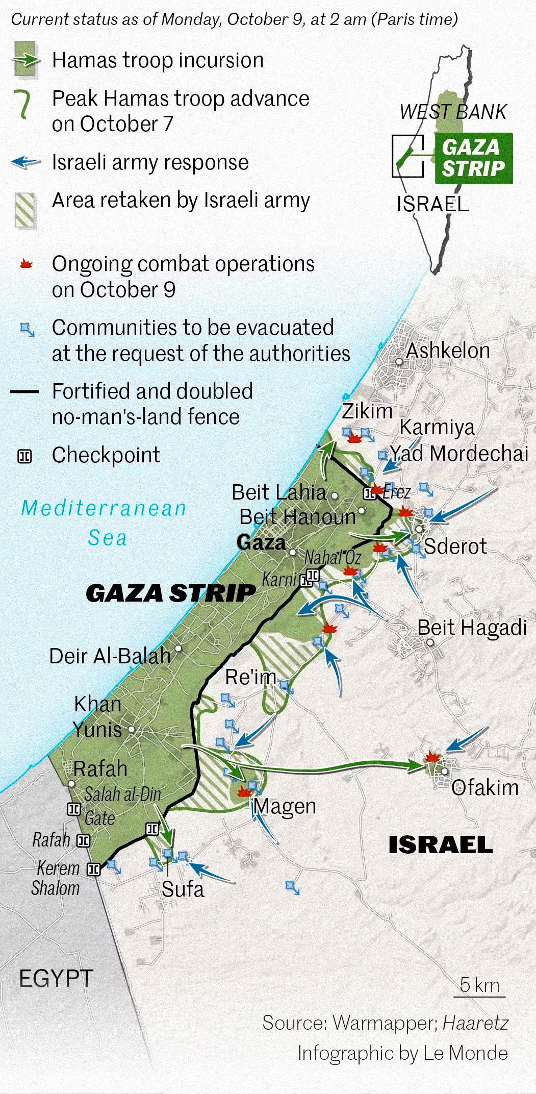
Map of Operation Al-Aqsa Flood Attacks Overview
As tensions escalated, this map serves as a crucial tool in understanding the geographical dynamics of the conflict. It ...
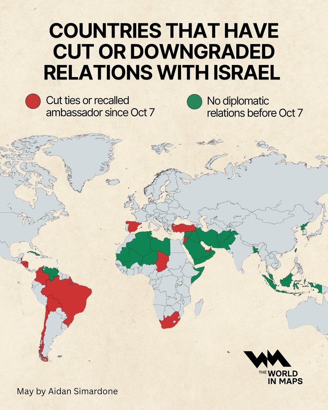
Countries That Have Cut or Downgraded Relations with Israel Map
This map visualizes the countries that have recently cut or downgraded their diplomatic relations with Israel. It highli...
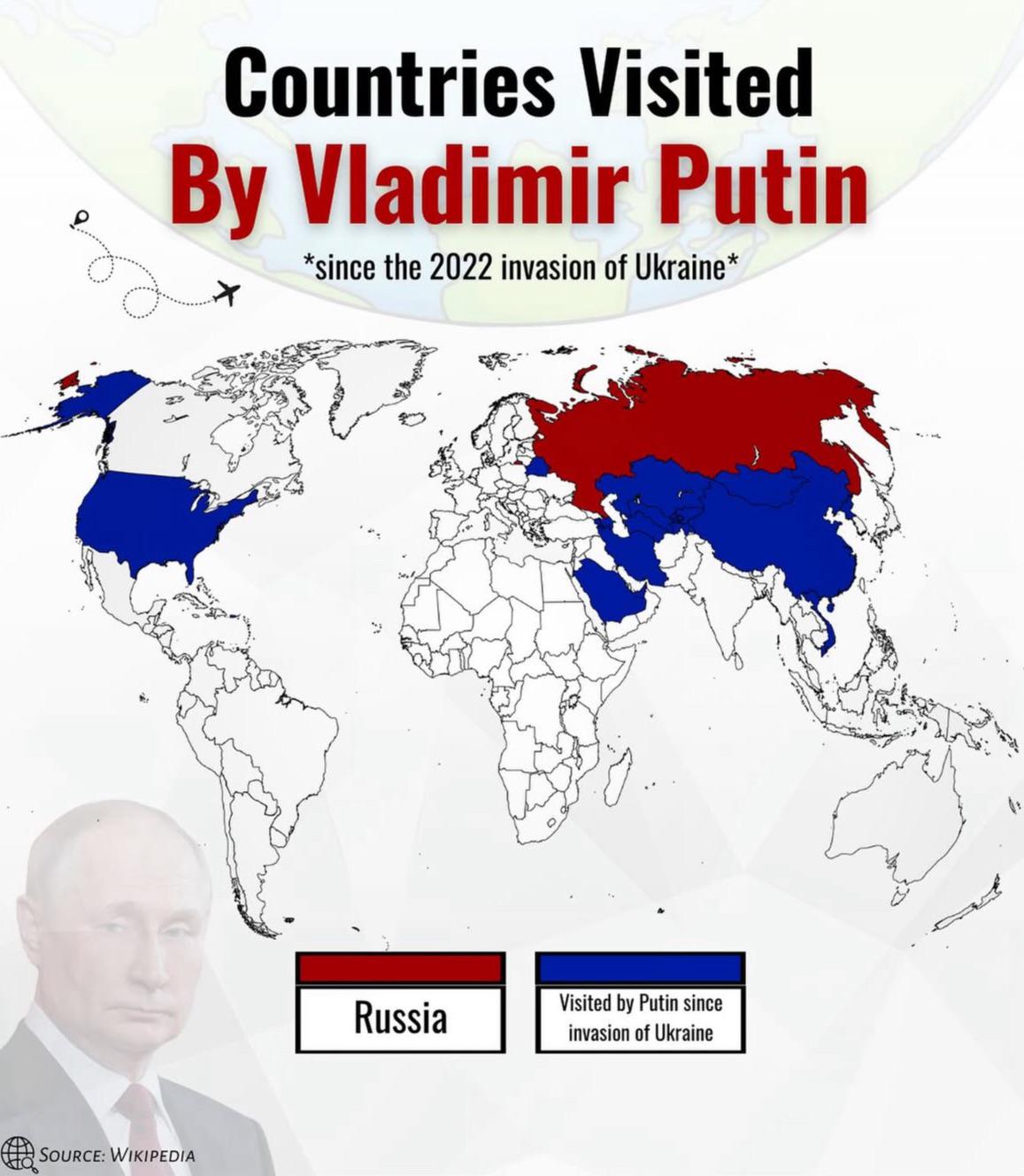
Countries Visited by Putin Since 2022 Invasion of Ukraine Map
The visualization titled "Countries Visited by Putin Since 2022 Invasion of Ukraine" displays a detailed overview of the...
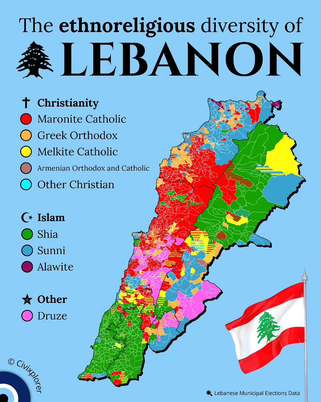
Ethnoreligious Diversity Map of Lebanon
This map illustrates the ethnoreligious diversity of Lebanon, highlighting the various religious sects and ethnic groups...
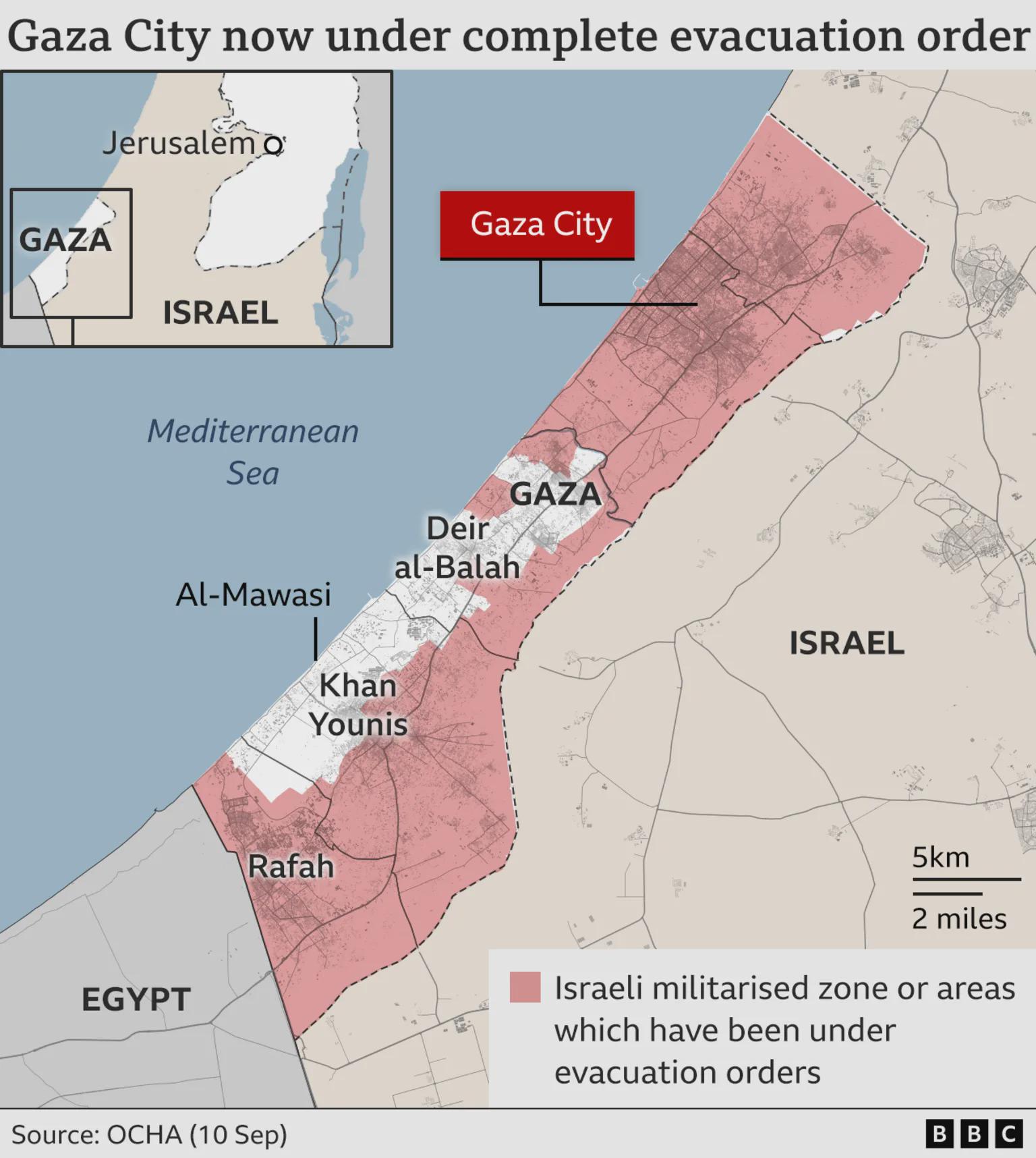
Gaza Evacuation Order Map
Interestingly, Gaza's geography plays a significant role in its challenges. The narrow strip of land is bordered by the ...
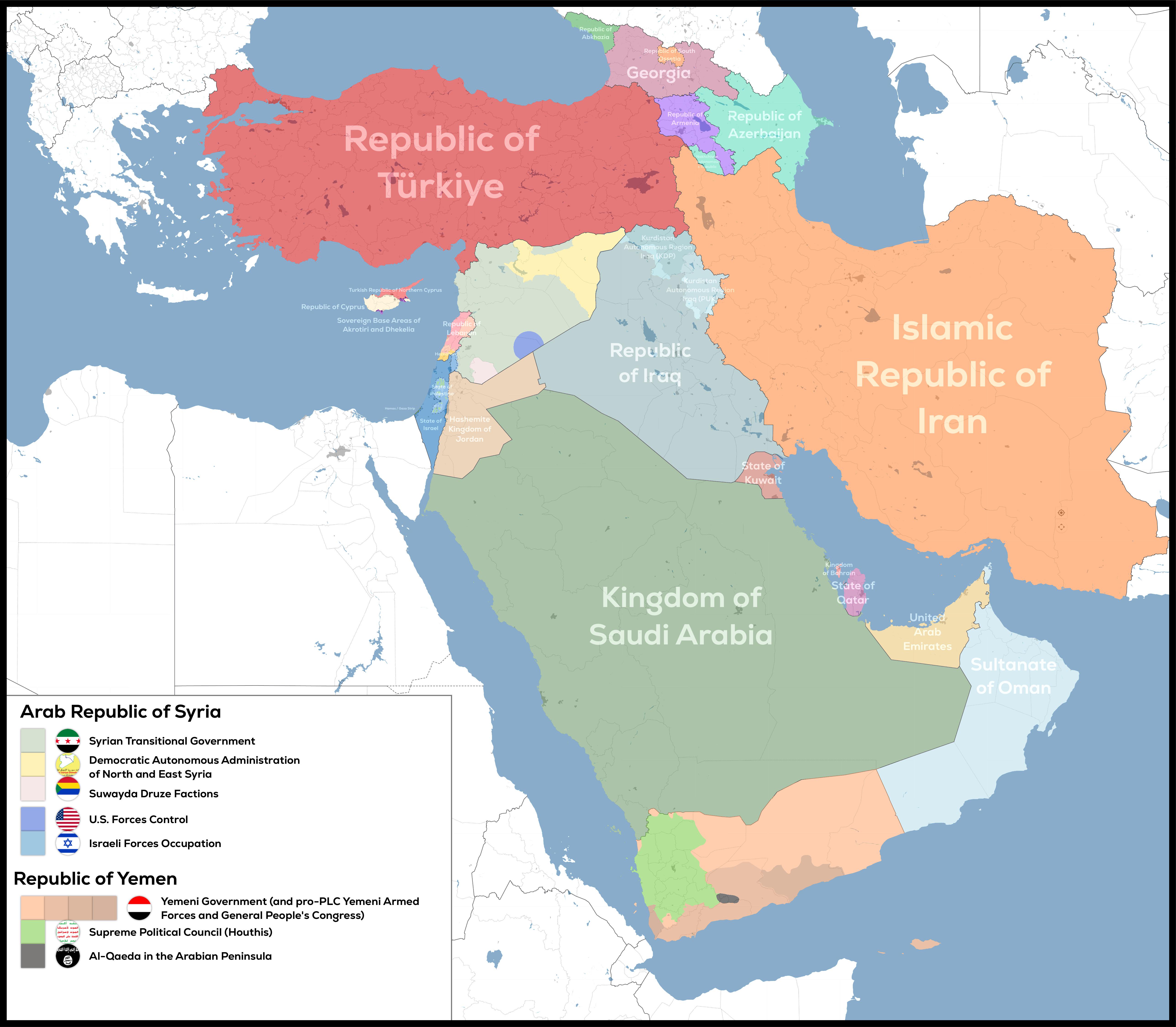
De Facto Geopolitical Map of West Asia
The "De-Facto Geopolitical Map of West Asia" provides a striking illustration of the current territorial control in this...
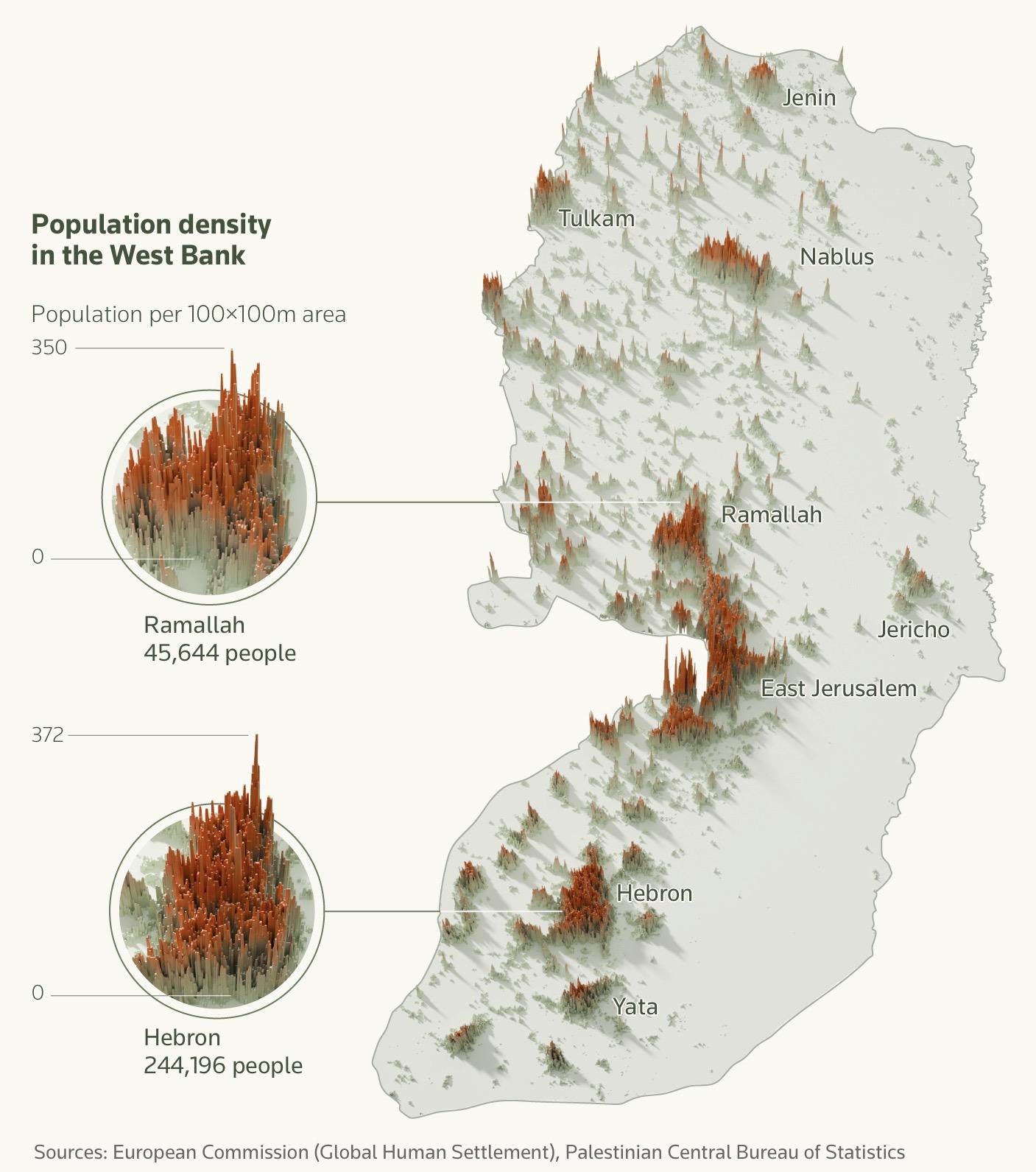
Population Density Map of the West Bank
The "Population Density Map of the West Bank" provides a detailed visualization of the distribution of people across thi...
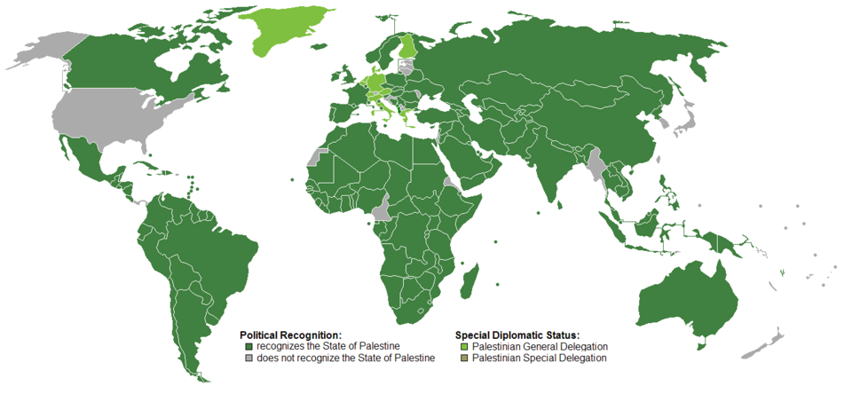
Recognition of the State of Palestine Map
Interestingly, the Palestinian territories comprise two main areas: the West Bank and Gaza Strip. The West Bank is under...
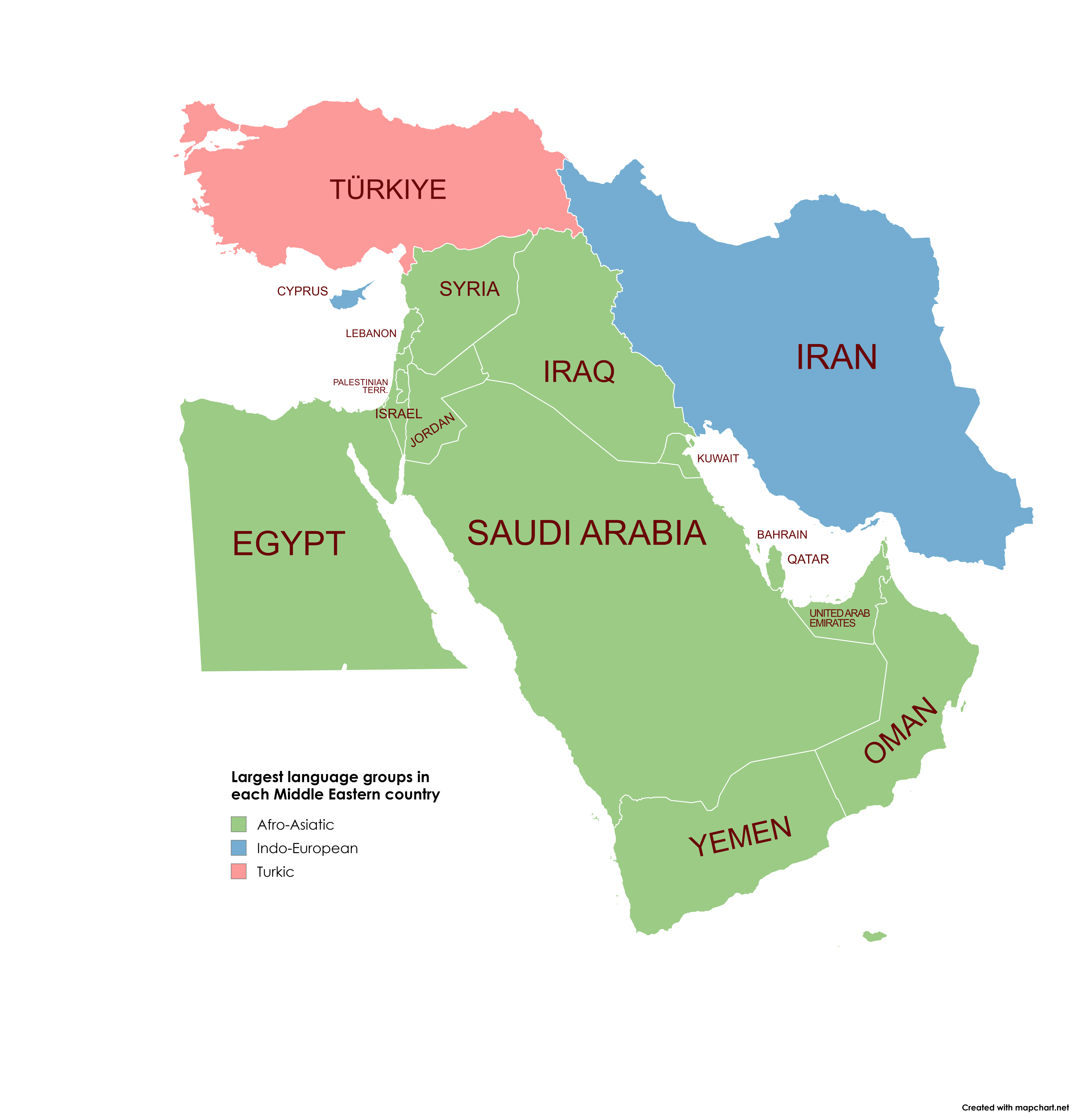
Largest Language Groups in Middle Eastern Countries Map
This map visually represents the largest language groups spoken in each Middle Eastern country. By examining this map, y...
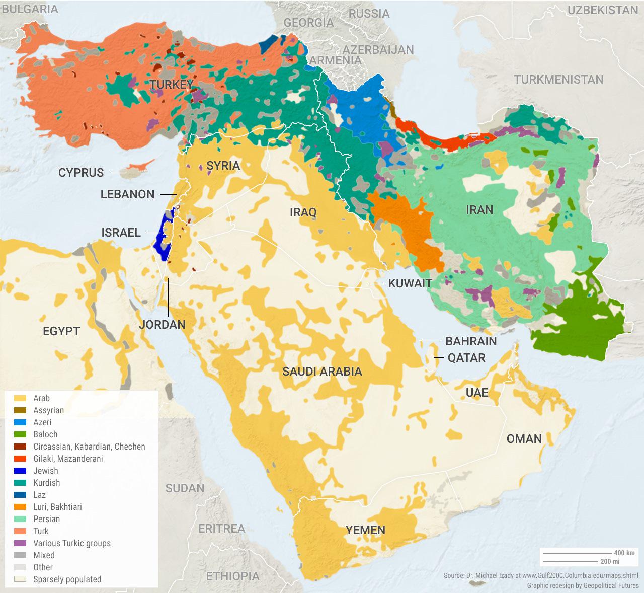
Ethnic Composition of the Middle East Map
The "Ethnic Composition of the Middle East" map provides a detailed overview of the diverse ethnic groups residing in th...
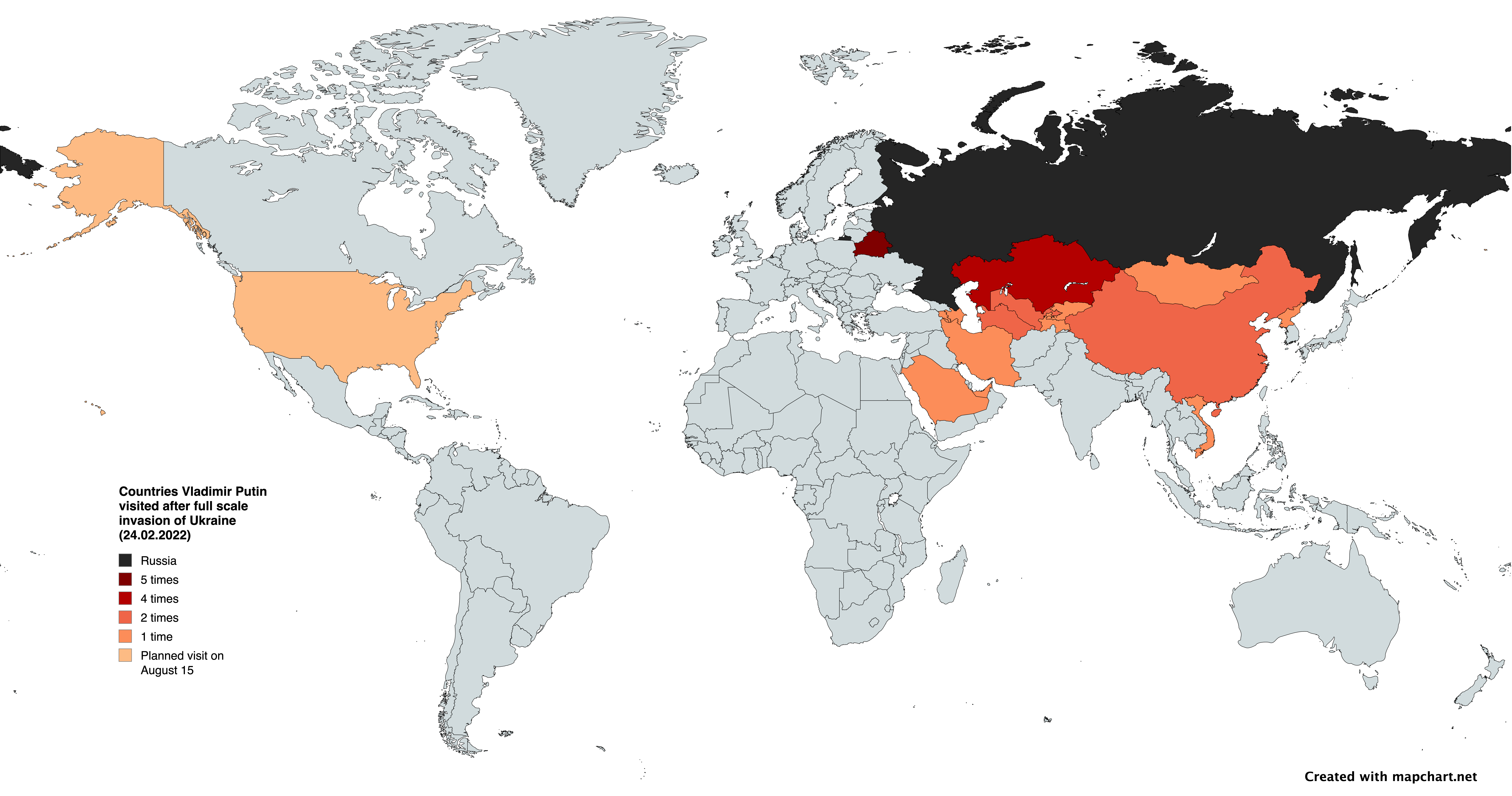
Map of Countries Vladimir Putin Visited Post-Invasion of Ukraine
This map provides a clear visualization of the countries that Russian President Vladimir Putin visited following the ful...
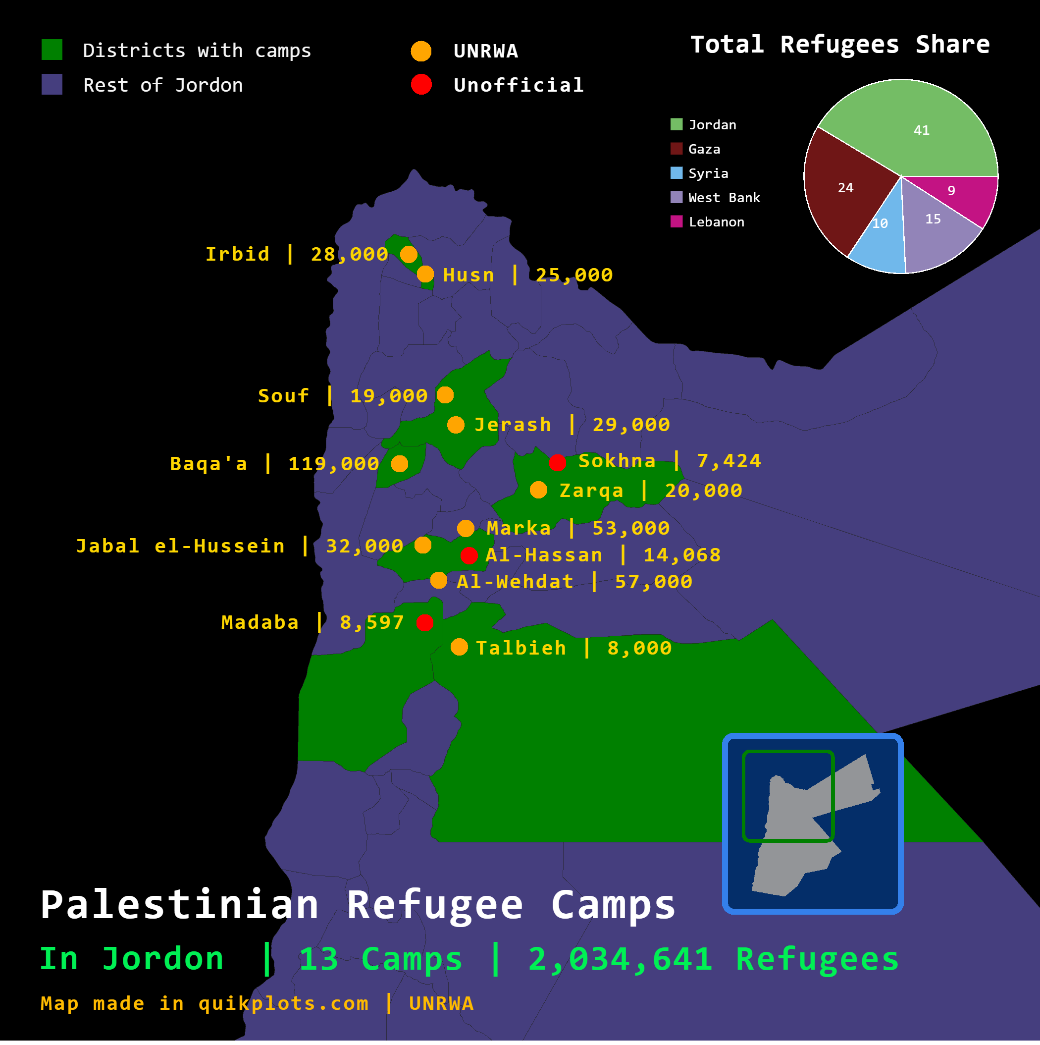
Palestinian Refugee Camps in Jordan Map
This map visually represents the distribution of Palestinian refugee camps across Jordan, providing a clear overview of ...
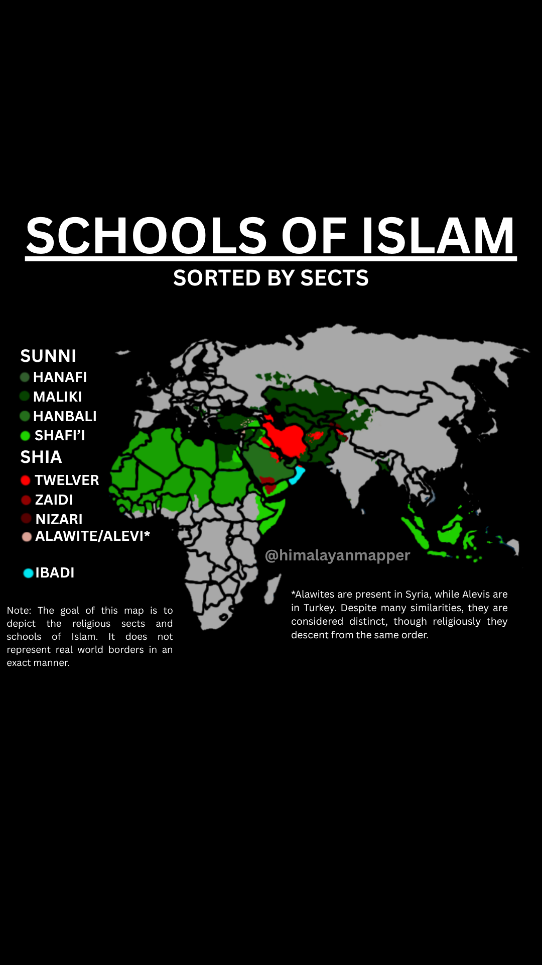
Schools of Islam by Sects Map
The "Schools of Islam by Sects Map" provides a visual representation of the various sects within Islam, illustrating how...
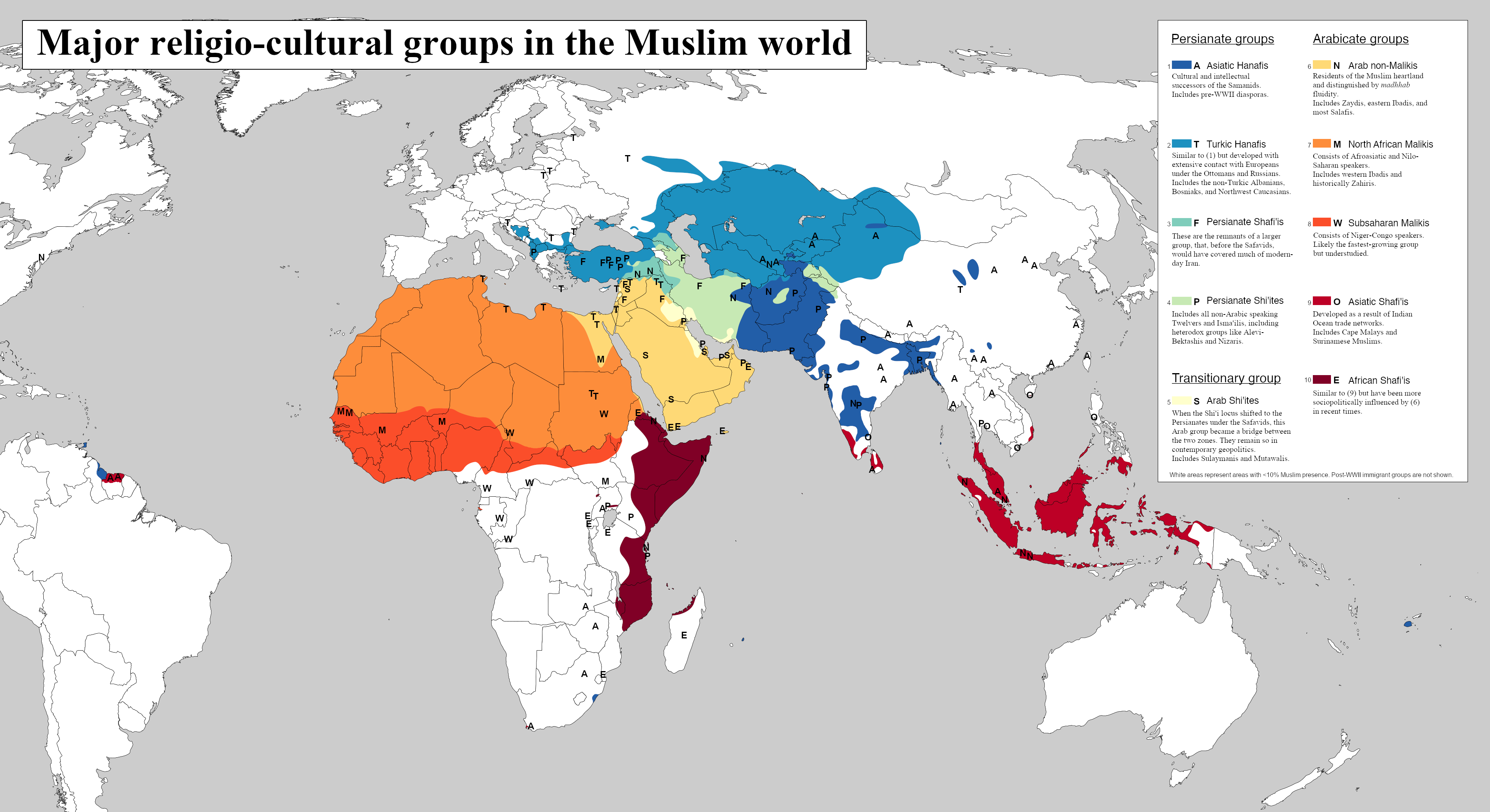
Major Religio-Cultural Groups in the Muslim World Map
The visualization titled \...
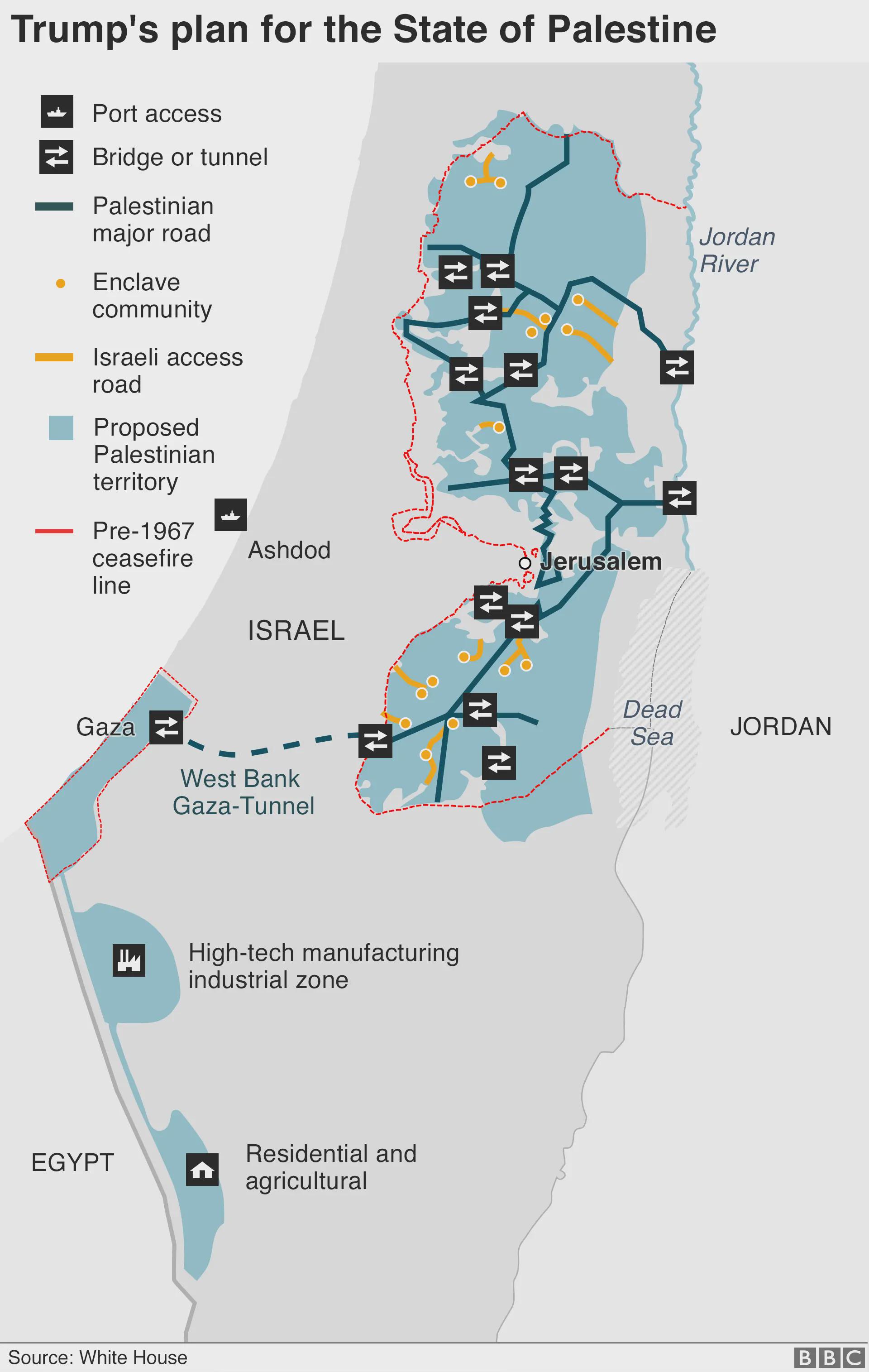
Trump's Plan for the State of Palestine Map
The map titled "Trump's Plan for the State of Palestine 2020" presents a proposed framework for the future of Palestine ...
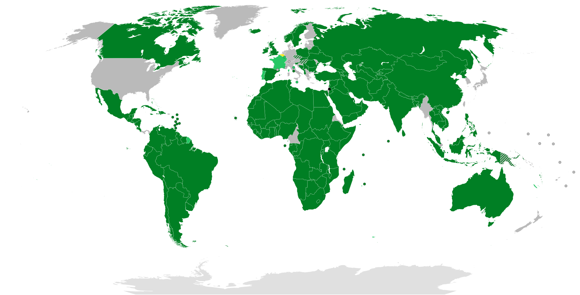
International Recognition of the State of Palestine Map
This visualization highlights the international recognition of the State of Palestine by various countries around the wo...
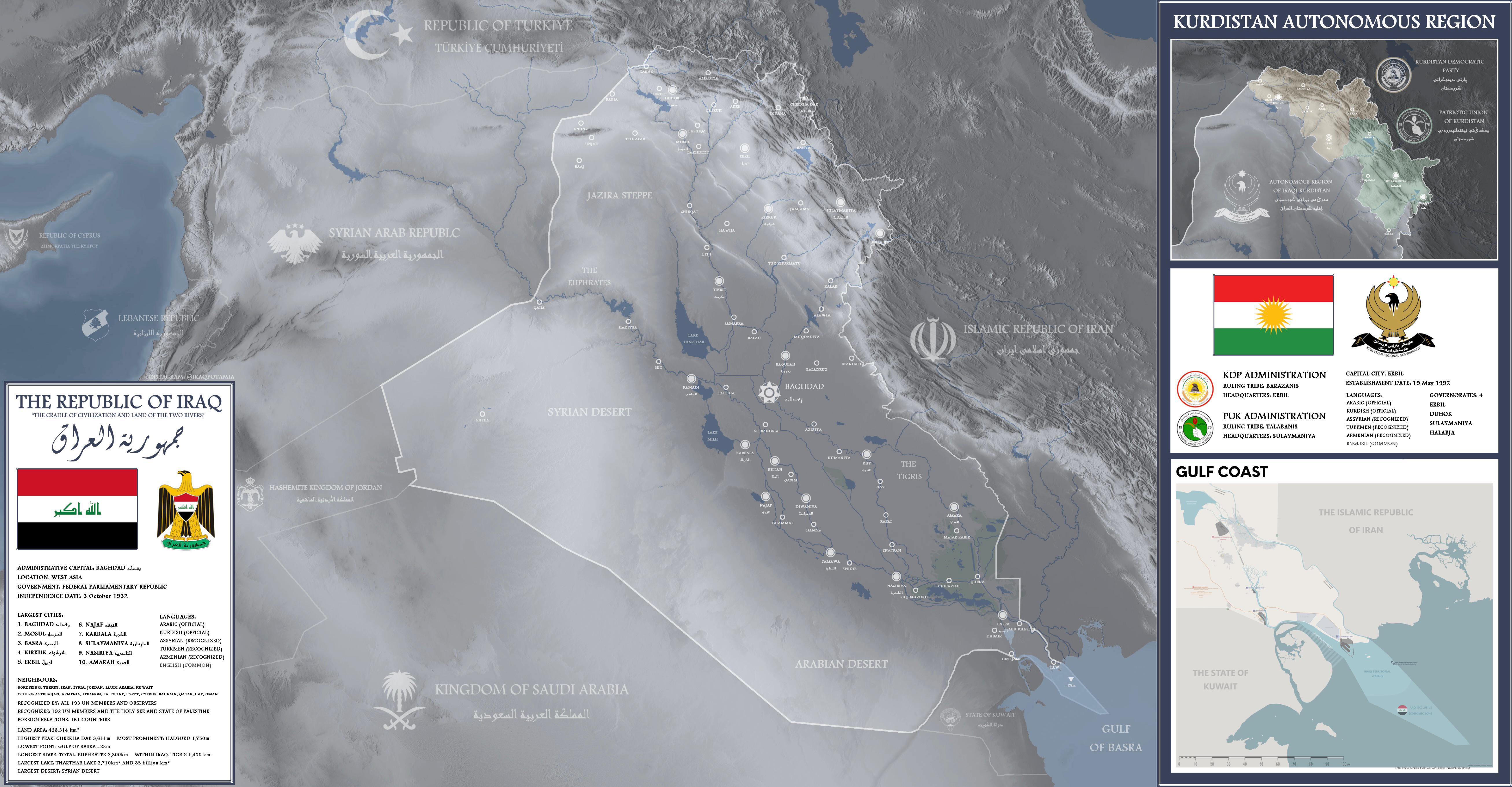
Detailed Map of Iraq
This detailed map of Iraq provides a comprehensive overview of the country's geographical features, including major citi...
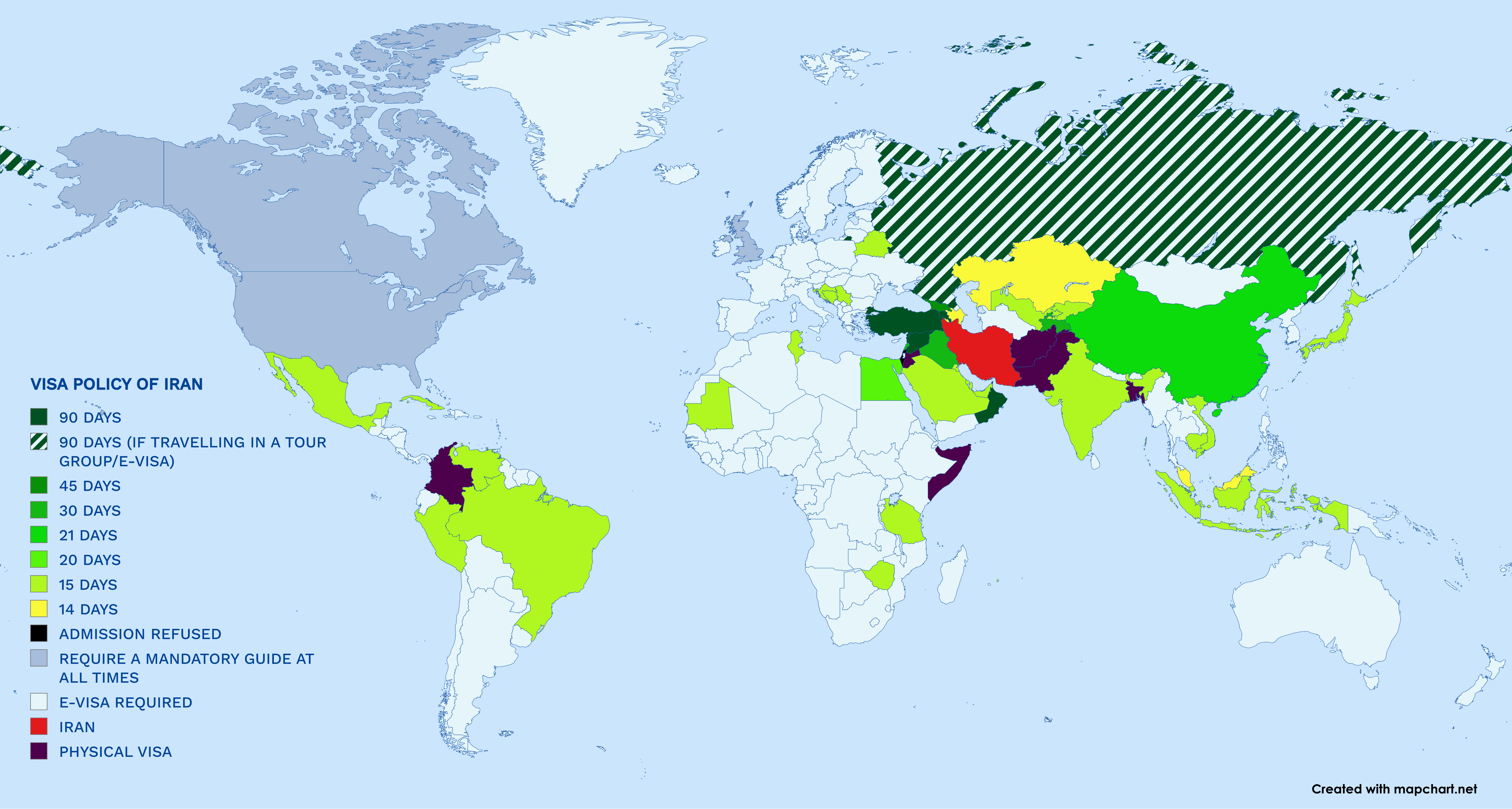
Visa Requirements Map for Entering Iran 2025
The map titled "Who Needs A Visa to Enter Iran in 2025?" presents a comprehensive overview of the visa requirements for ...
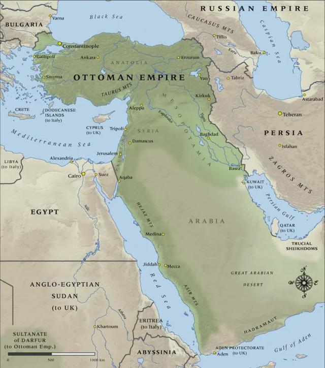
Ottoman Empire Territorial Map 1914
The "Map of the Ottoman Empire in 1914" vividly illustrates the territorial expanse of one of history's most influential...
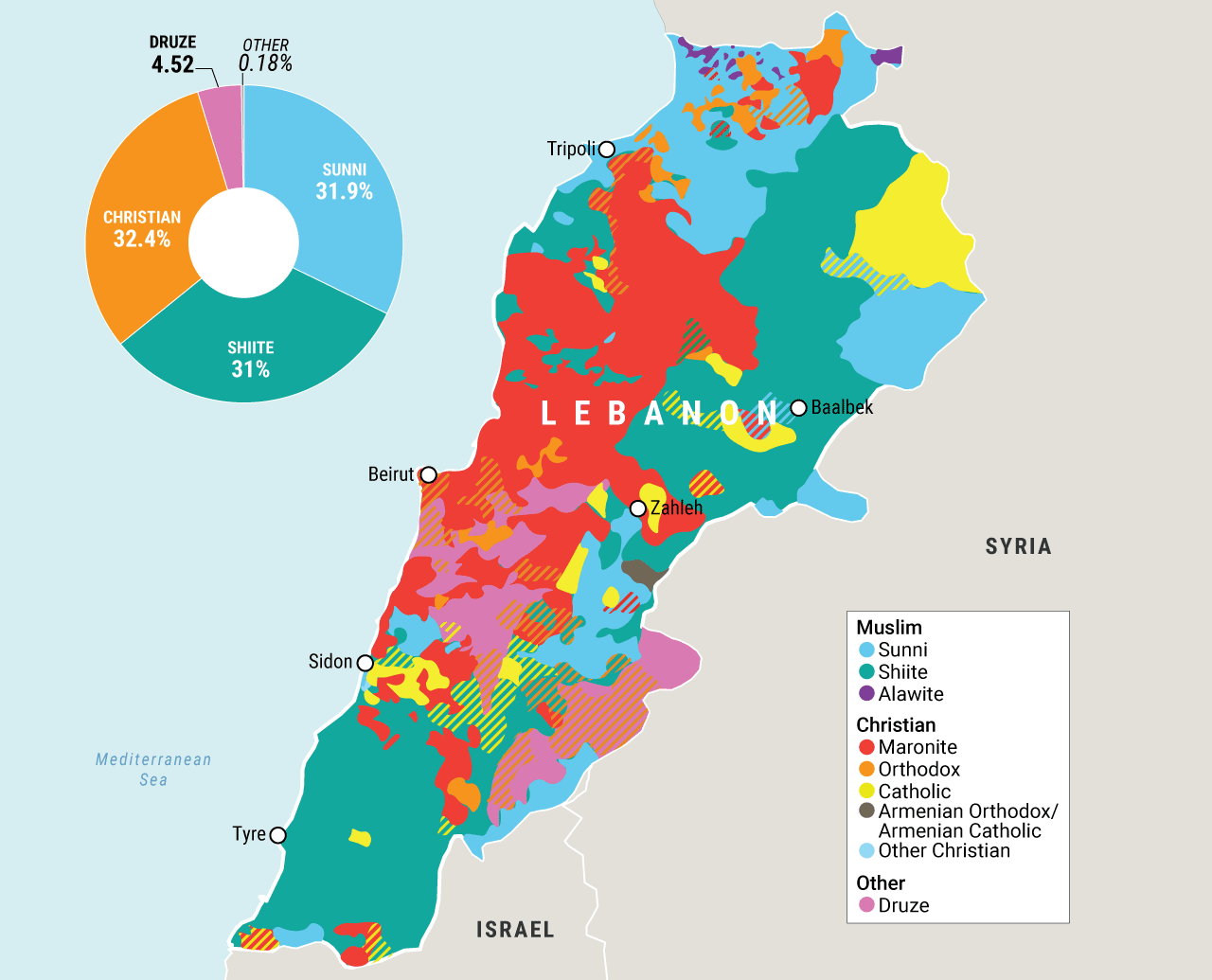
Lebanon's Religious Demographics Map
The map titled "Lebanon's Religious Demographics" by Statistics Lebanon provides a detailed representation of the religi...
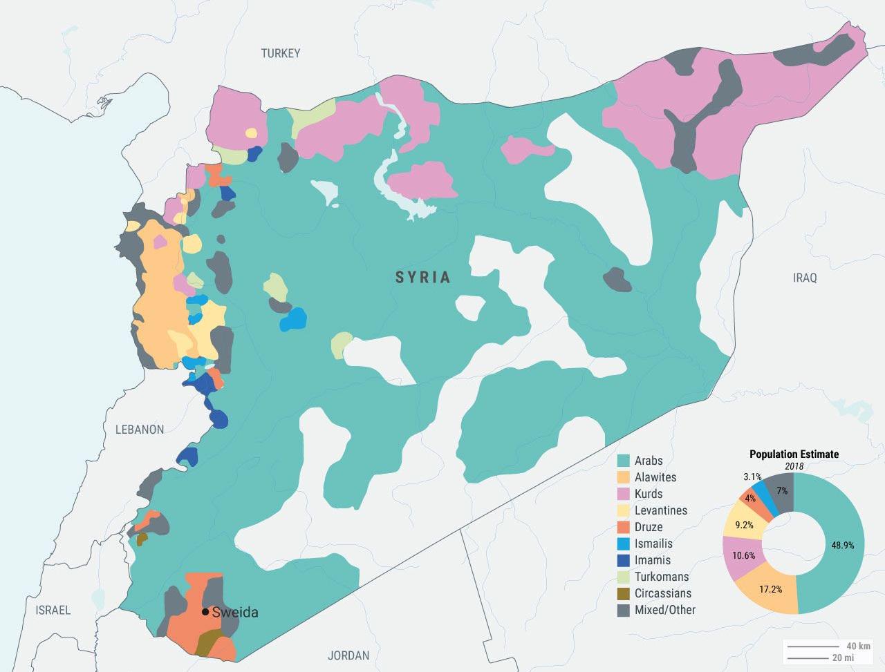
Syrian Ethnic and Sectarian Groups Map
The "Syrian Ethnic and Sectarian Groups Map" provides a visual representation of the complex tapestry of ethnic and reli...
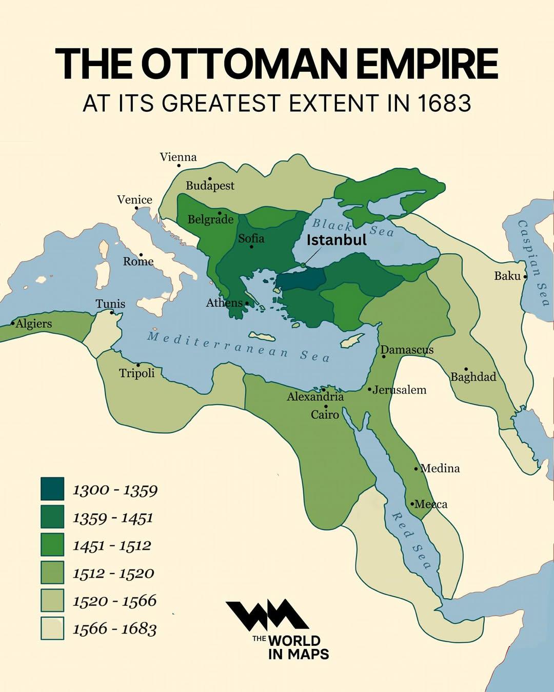
Ottoman Empire Map at Its Greatest Extent 1683
The map titled "The Ottoman Empire at its Greatest Extent in 1683" visually represents the vast territories controlled b...
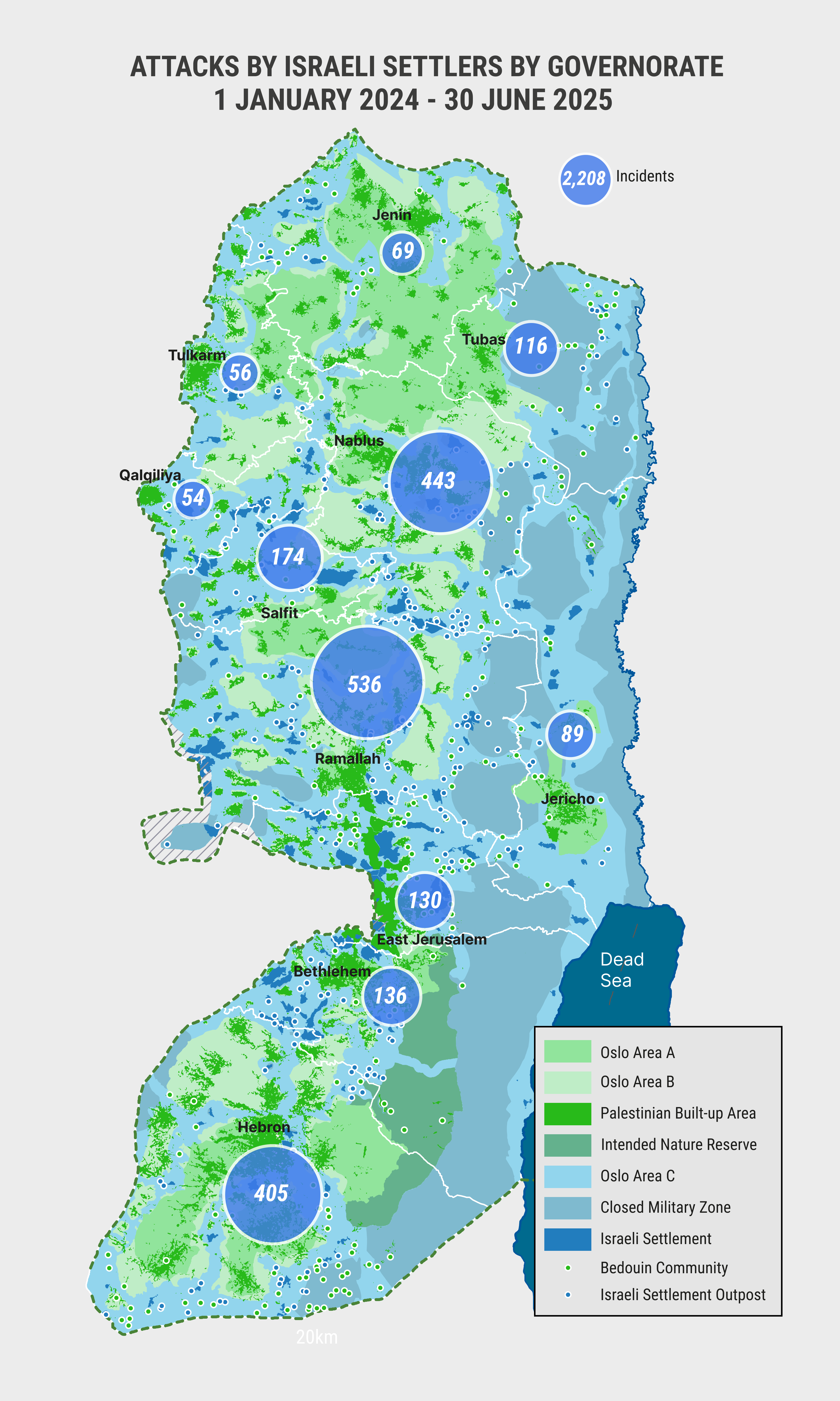
Map of West Bank Attacks by Israeli Settlers
The visualization titled "West Bank Attacks by Israeli Settlers by Governate (January 2024 to June 2025)" provides a det...
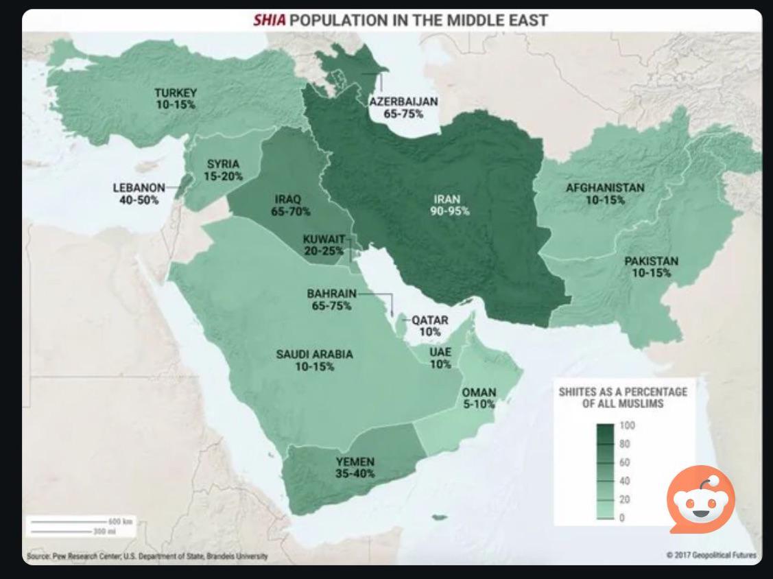
% of Shia Muslims in Middle East Countries Map
The visual representation titled \...
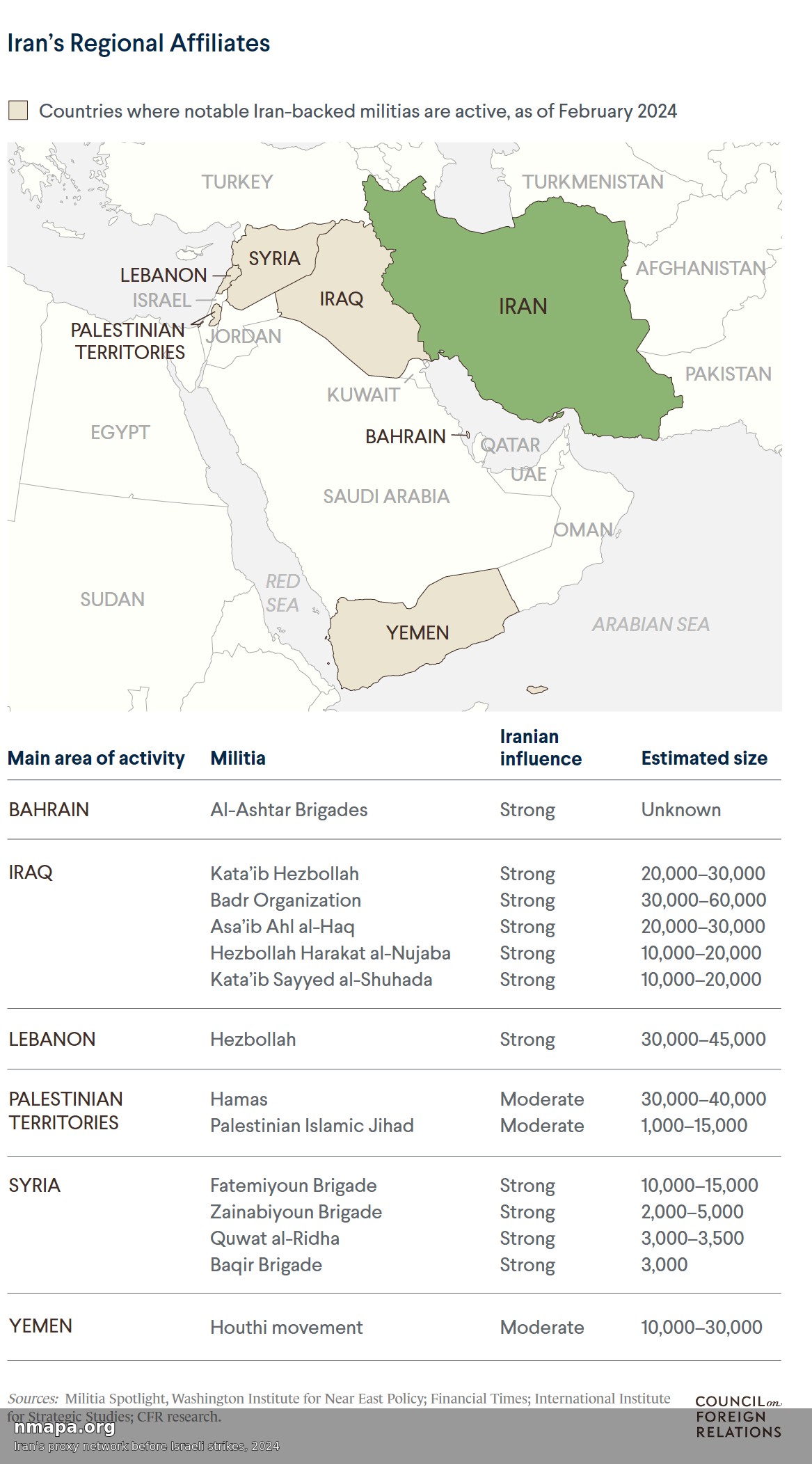
Iran's Proxy Network Map Before Israeli Strikes, 2024
The visualization titled "Iran's Proxy Network Map Before Israeli Strikes, 2024" offers a detailed overview of Iran's ex...
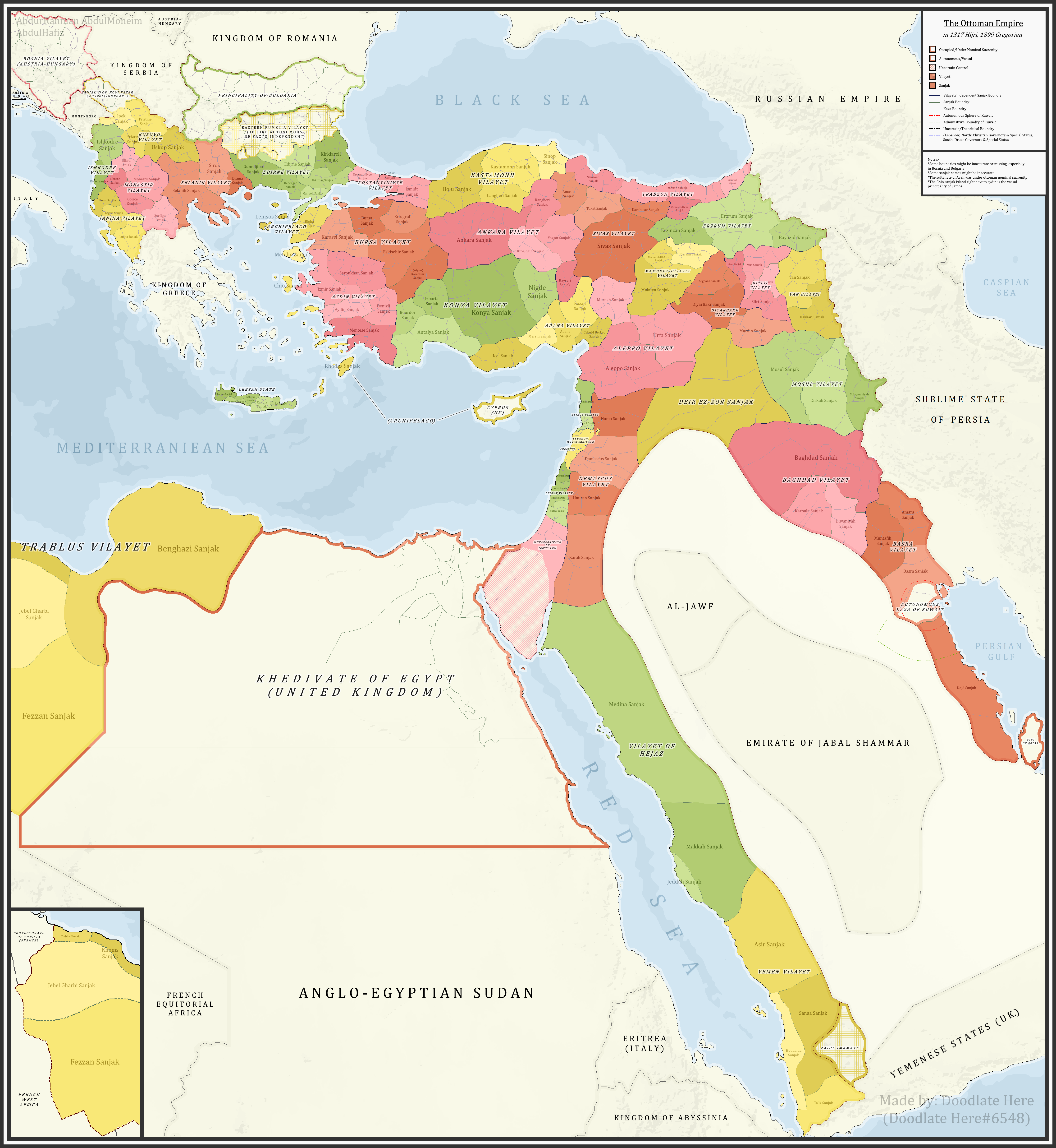
Ottoman Sanjaks in 1899 Map
...
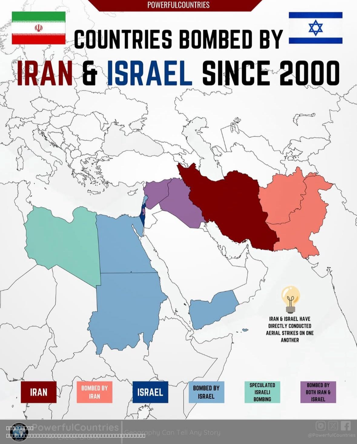
Countries Bombed by Israel and Iran Since 2000 Map
The map titled "Countries Bombed by Israel and Iran Since 2000" provides a visual representation of the nations that hav...
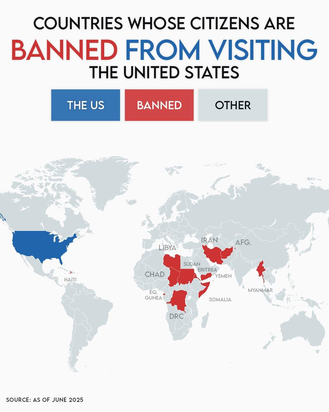
Countries Whose Citizens Are Banned from Entering the United States Map
The visualization at hand provides a clear depiction of countries whose citizens currently face restrictions preventing ...
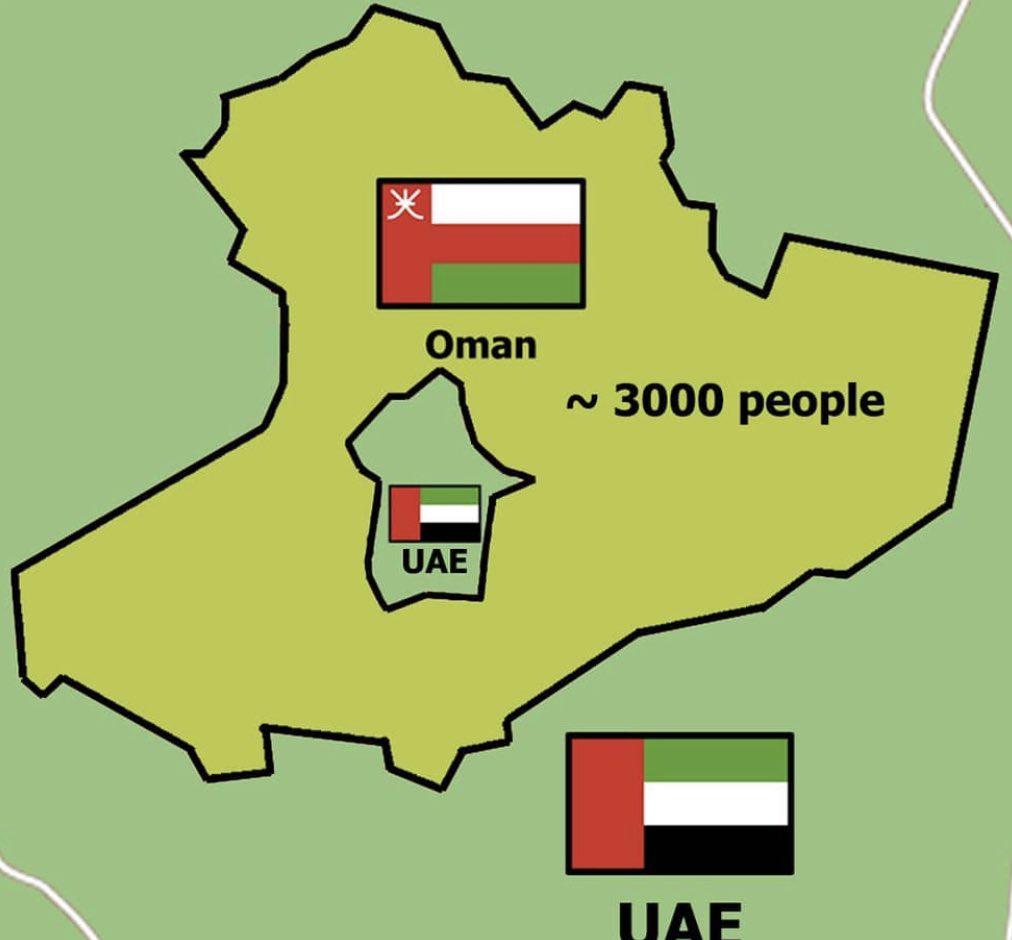
Map of UAE-Oman Donut-shaped Enclave
This map visualizes one of the most intriguing border anomalies in the world: the donut-shaped enclave formed by the Uni...
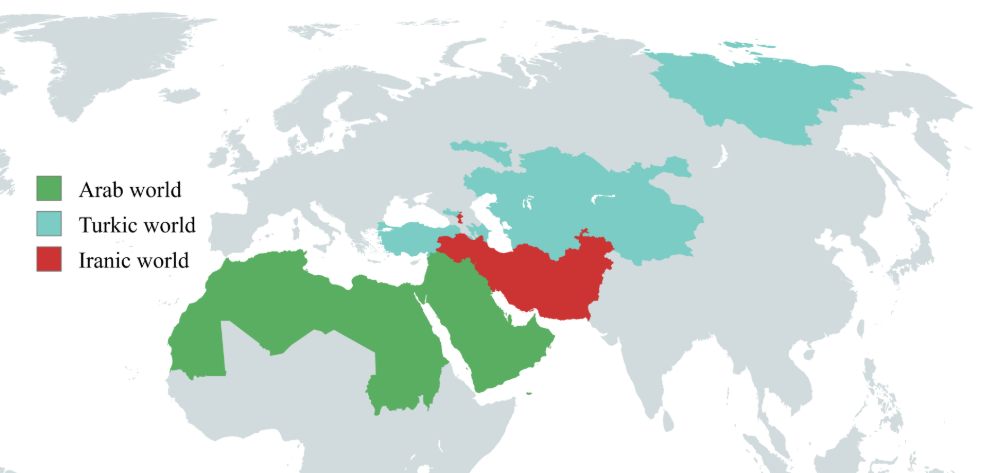
Arab, Turkic and Iranic Worlds Map
The "Arab, Turkic and Iranic Worlds Map" provides a comprehensive visualization of the regions and territories predomina...