cultural identity Maps
120 geographic visualizations tagged with "cultural identity"
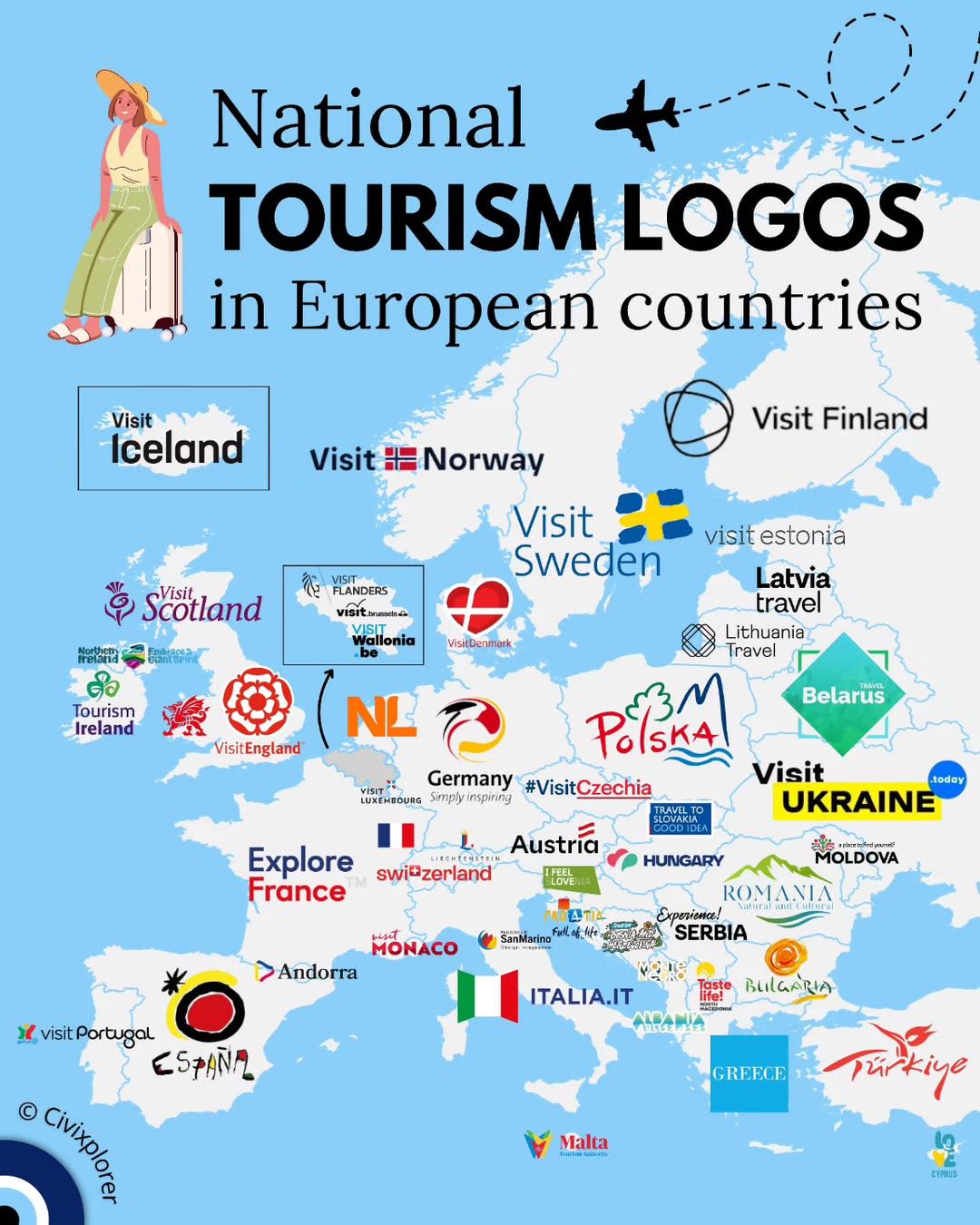
National Tourism Logos in European Countries Map
The "National Tourism Logos in European Countries Map" provides a visual representation of the distinct logos that repre...
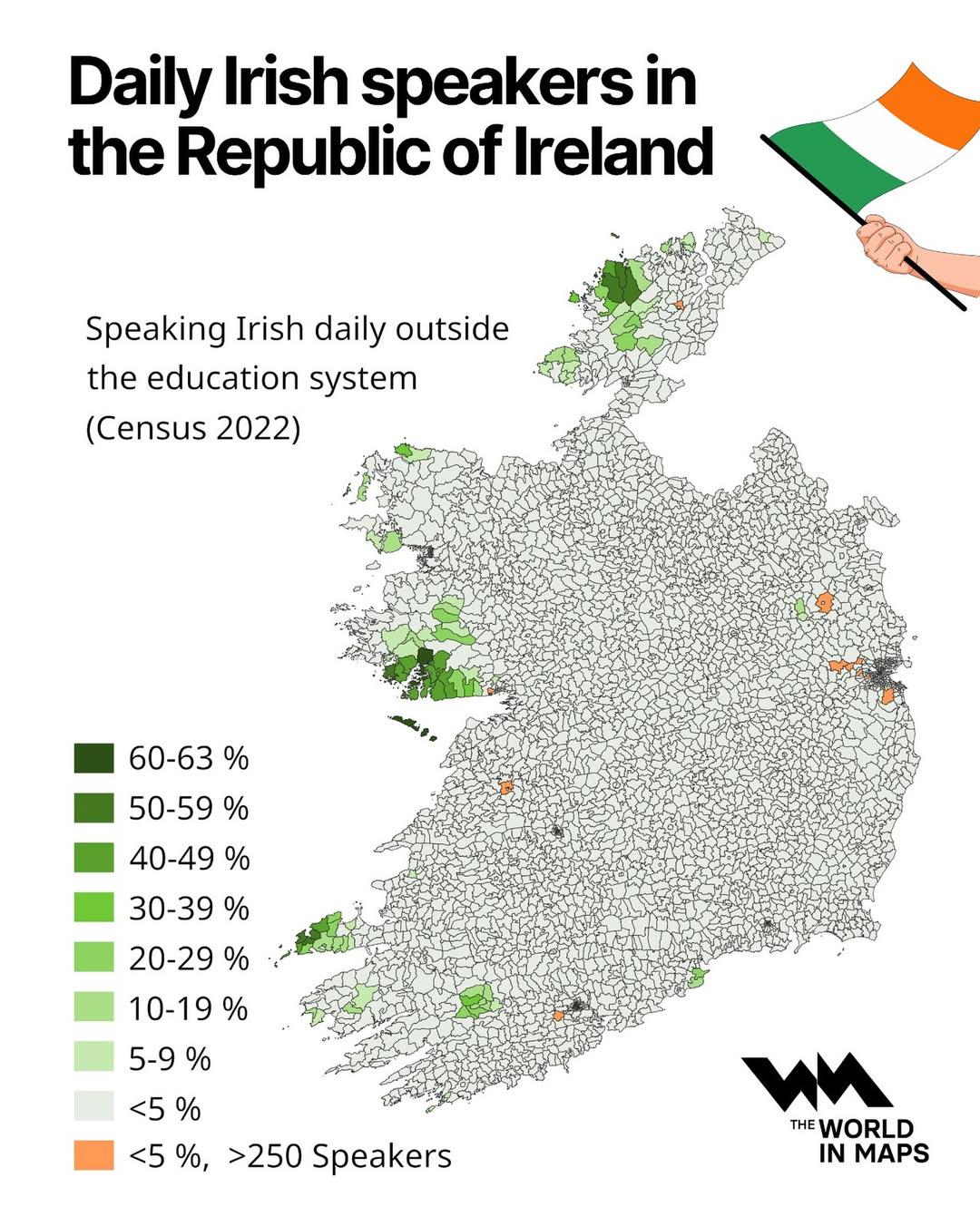
Daily Irish Speakers in the Republic of Ireland Map
The visualization titled "Daily Irish Speakers in the Republic of Ireland" provides a comprehensive overview of the dist...
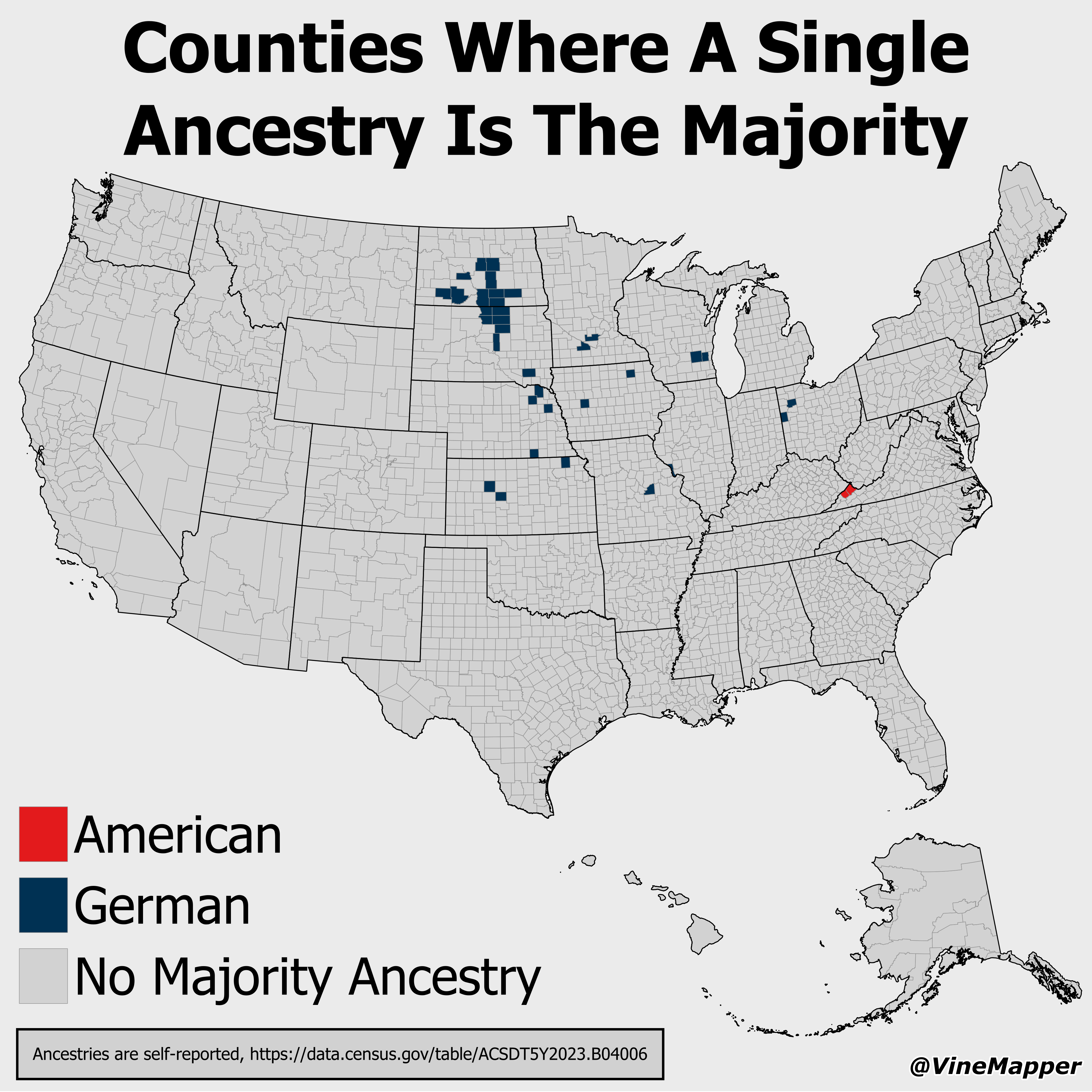
Counties Where A Single Ancestry Is The Majority Map
This map visualizes counties across the United States where one specific ancestry group constitutes the majority of the ...
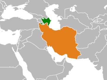
Map of Countries with Large Diasporas
This map highlights a fascinating demographic phenomenon: it illustrates countries where a significant portion of their ...
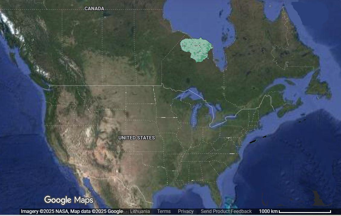
Lithuania Relocation 6000km West Map
This visualization intriguingly displays the geographical consequences of relocating Lithuania approximately 6,000 kilom...
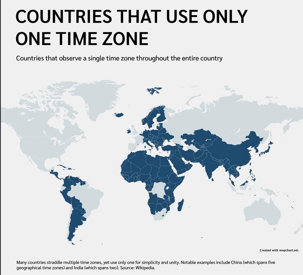
Countries That Use One Time Zone Map
This map visually represents the countries that operate within a single time zone. It highlights nations that, despite t...
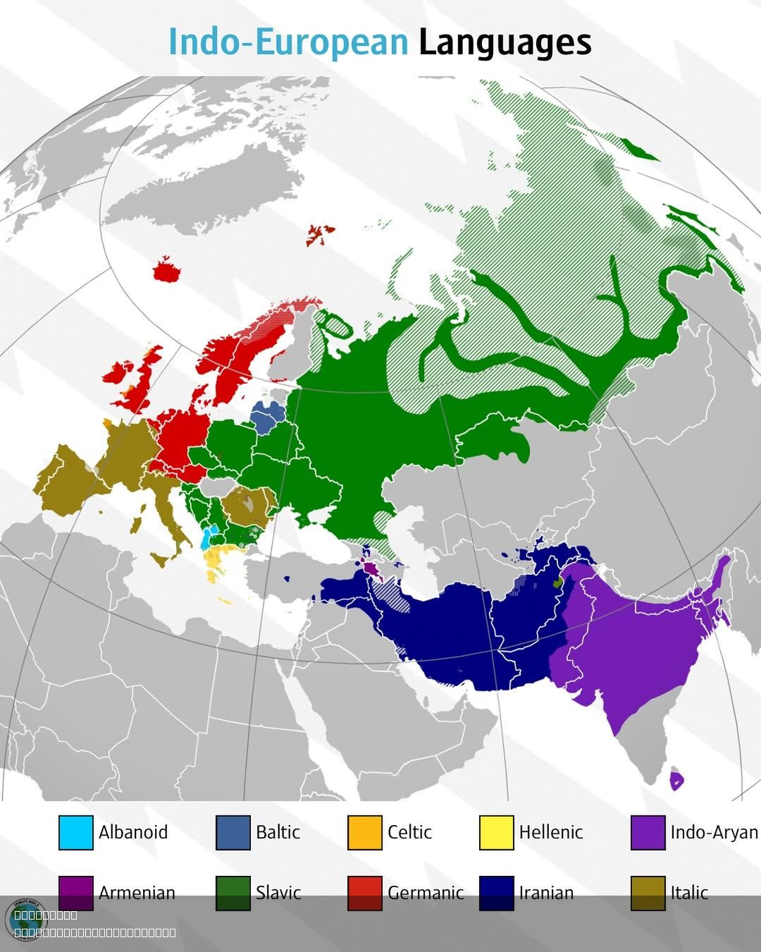
Indo-European Languages Map
The "Indo-European Languages Map" provides a detailed visualization of the linguistic distribution of Indo-European lang...
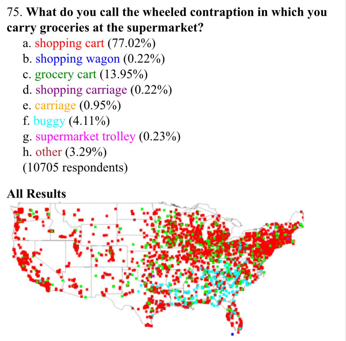
Shopping Cart Terminology in the United States Map
The visualization titled "What Americans Call Shopping Carts" provides an intriguing look into the regional variations o...
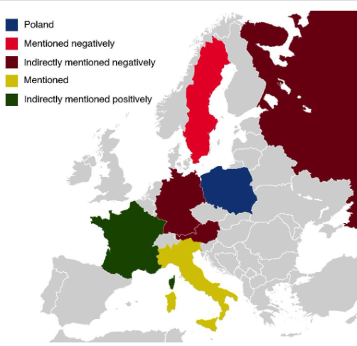
Countries Mentioned in the Polish National Anthem Map
The map titled "All The Countries Mentioned In The Polish National Anthem" provides a unique geographical insight into t...
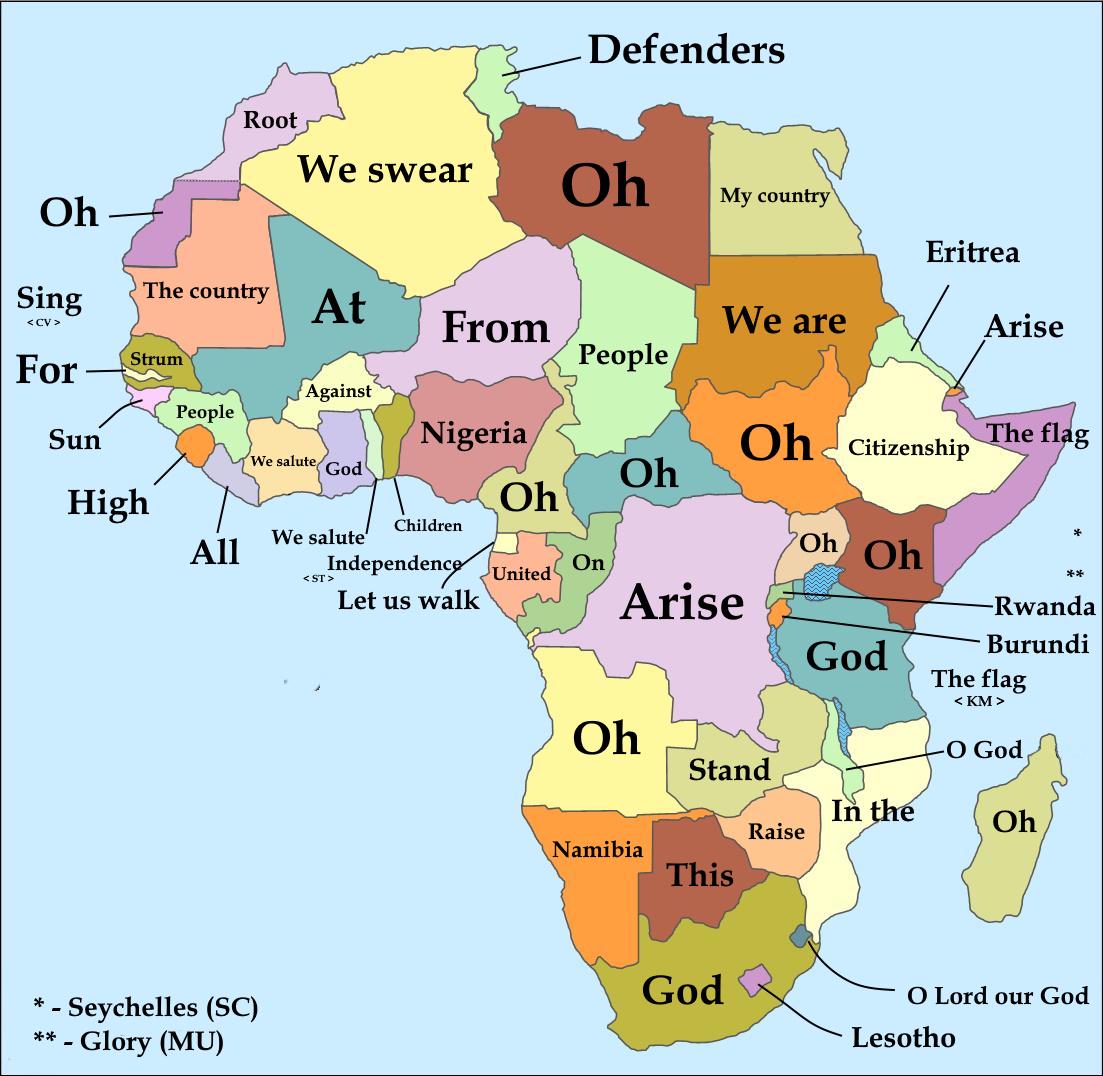
First Words of National Anthems of African Countries Map
This captivating map illustrates the first words of national anthems from various African countries, translated into Eng...
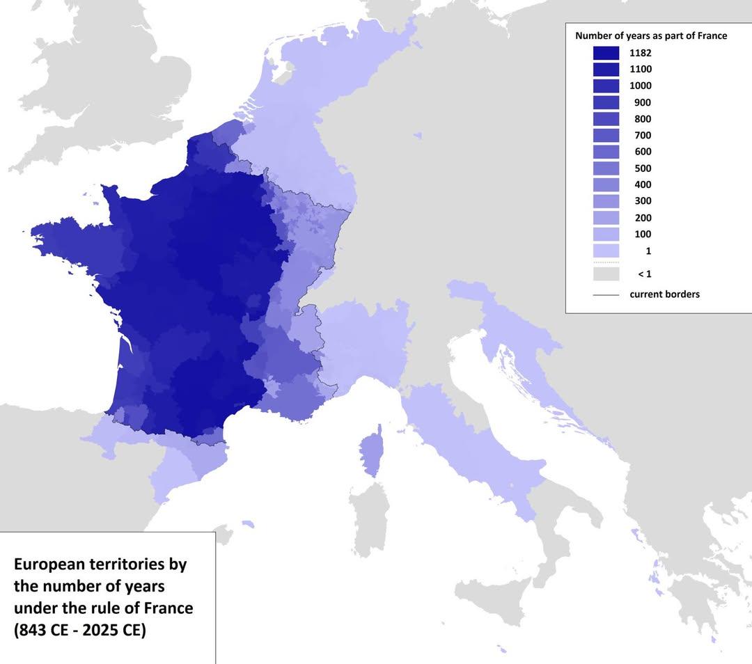
Map of European Territories By Years Under France
The visualization titled 'Map of European Territories By The Number of Years Spent Being Part of France' offers a compre...
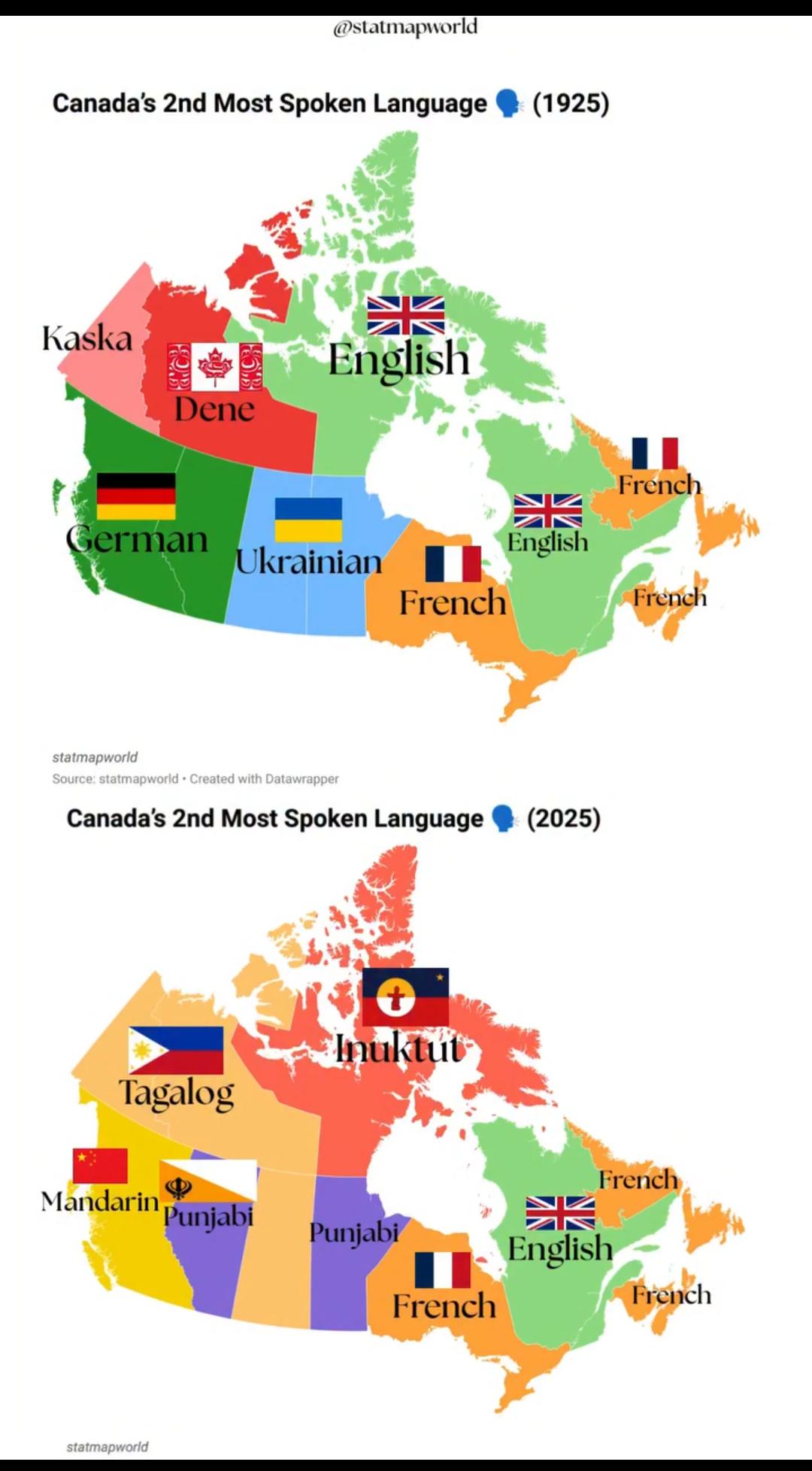
Canada's 2nd Most Spoken Language Map 1925 vs 2025
The visualization titled "Canada's 2nd Most Spoken Language 1925 vs 2025" illustrates the evolution of language demograp...
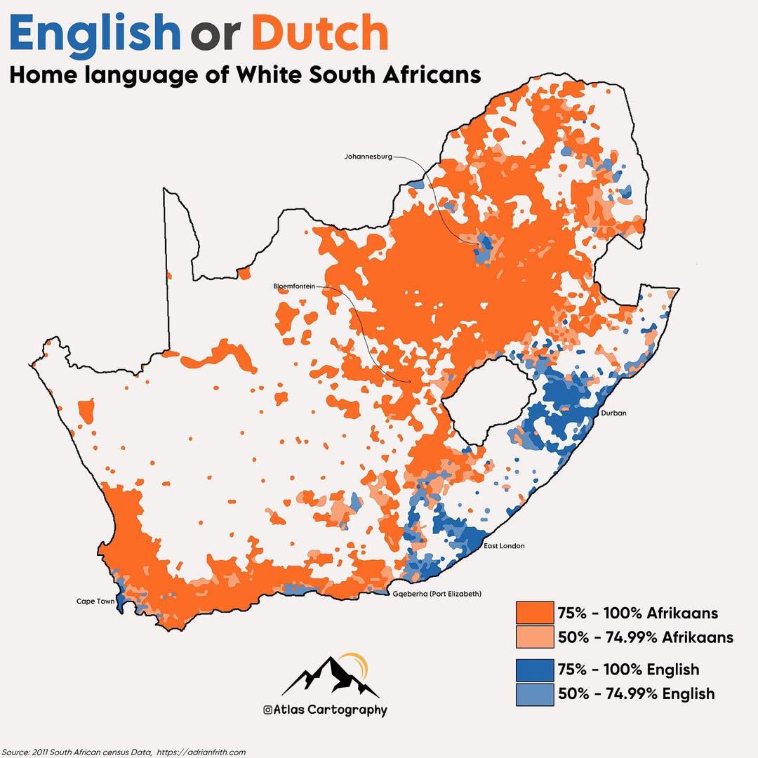
Home Language Map of White South Africans
The map titled "Home Language of White South Africans" visually represents the primary languages spoken at home by the W...
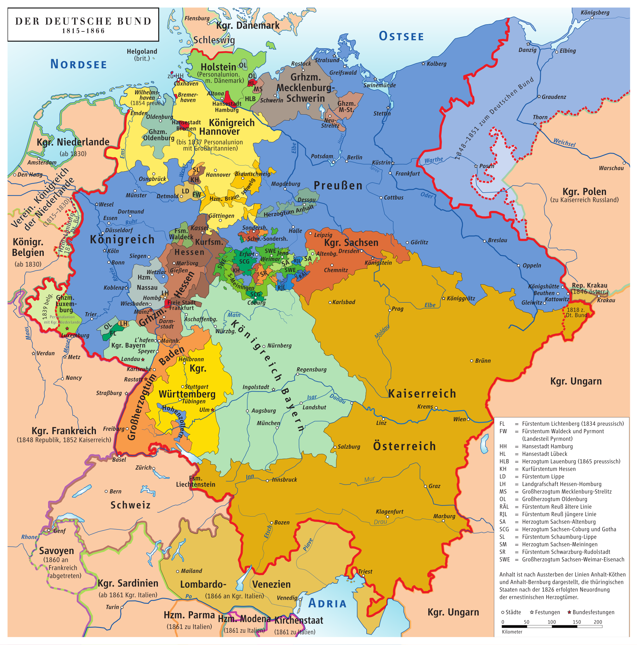
Map of Germany Before Unification (1815-1866)
This map titled "Germany Before Being Germany (1815-1866)" provides a detailed visualization of the political landscape ...
Humorous Regional Stereotypes Map
This visualization humorously depicts regional stereotypes across various parts of the world. The map highlights how dif...
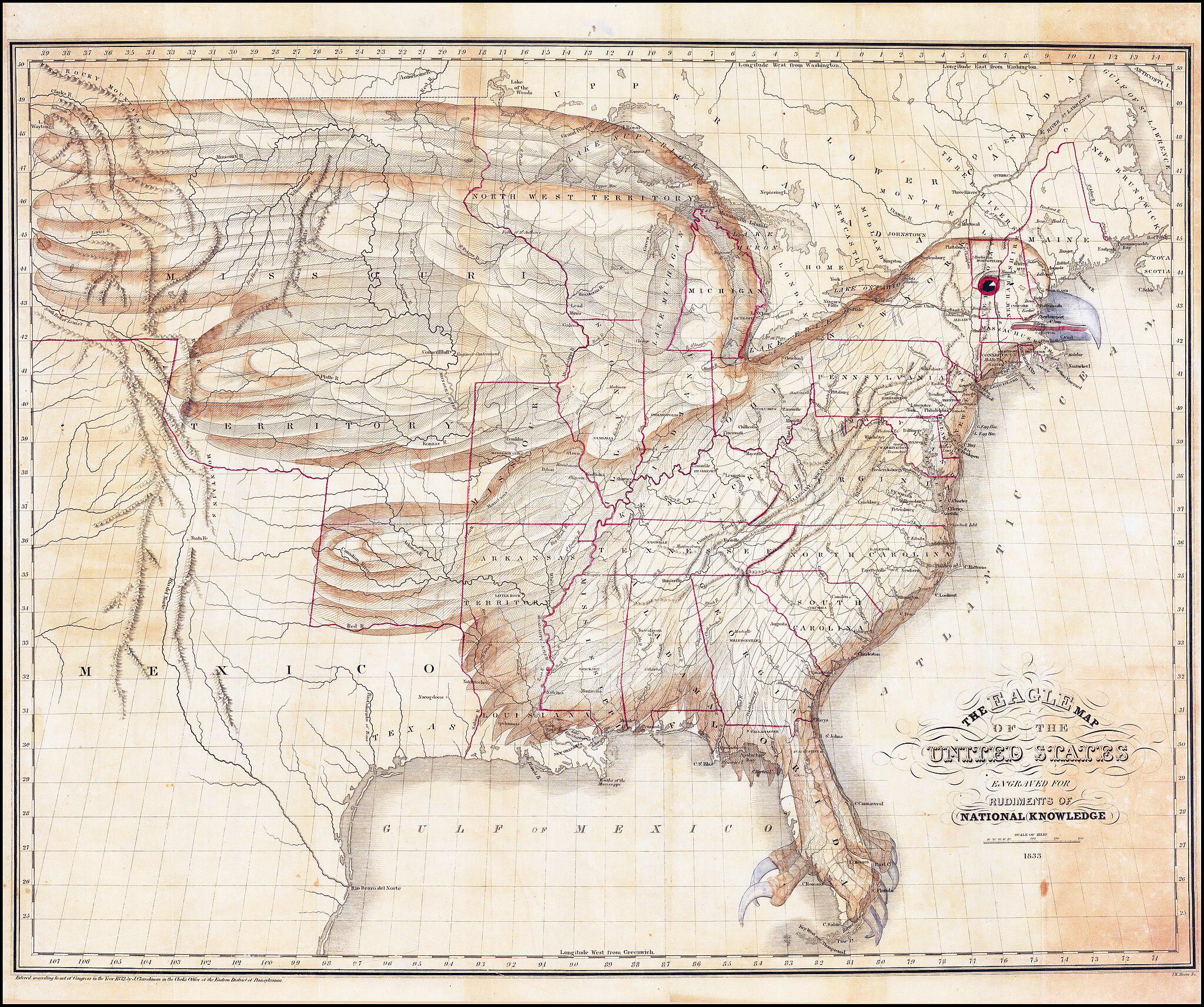
Map of the United States as an Eagle (1833)
The \...
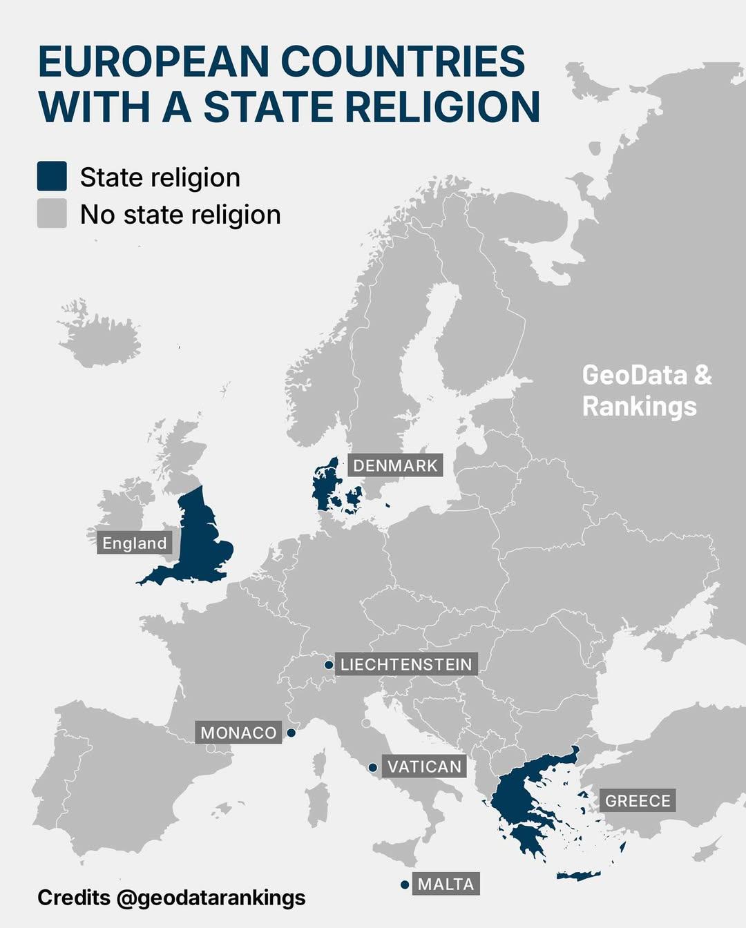
Map of European Countries with State Religion
This map illustrates the seven European countries that officially recognize a state religion. Each country is marked to ...
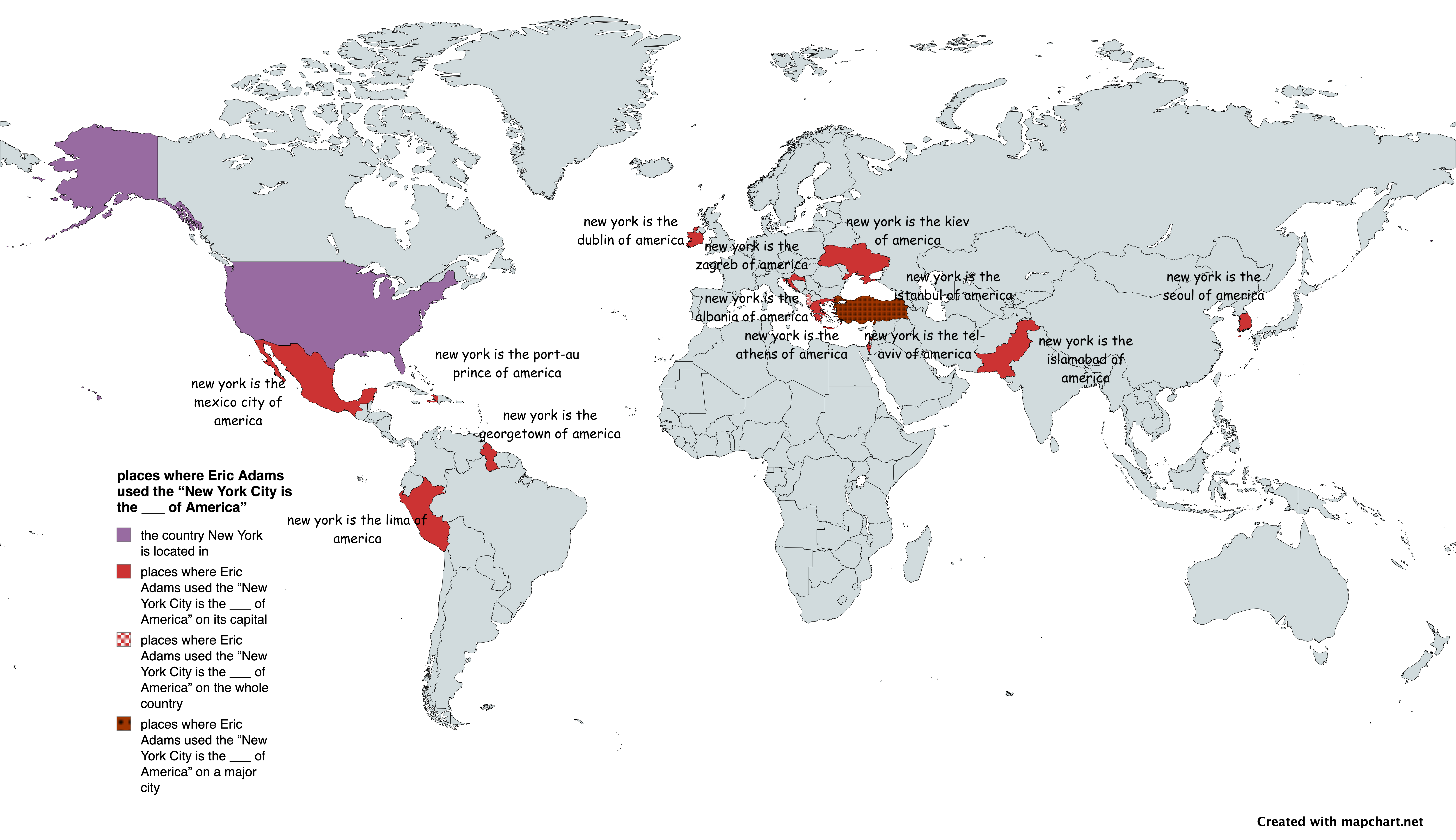
Map of Places Eric Adams Called NYC the ___ of America
This map visually represents various locations where New York City Mayor Eric Adams has proclaimed that "New York City i...
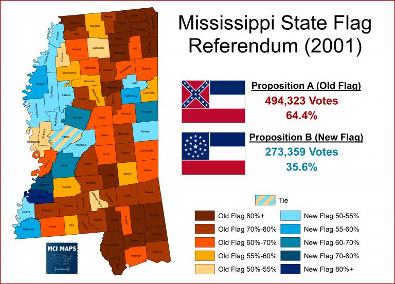
Mississippi Flag Vote 2001 Map
The "Mississippi Flag Vote 2001 Map" visualizes the results of a significant referendum held on November 7, 2001, where ...
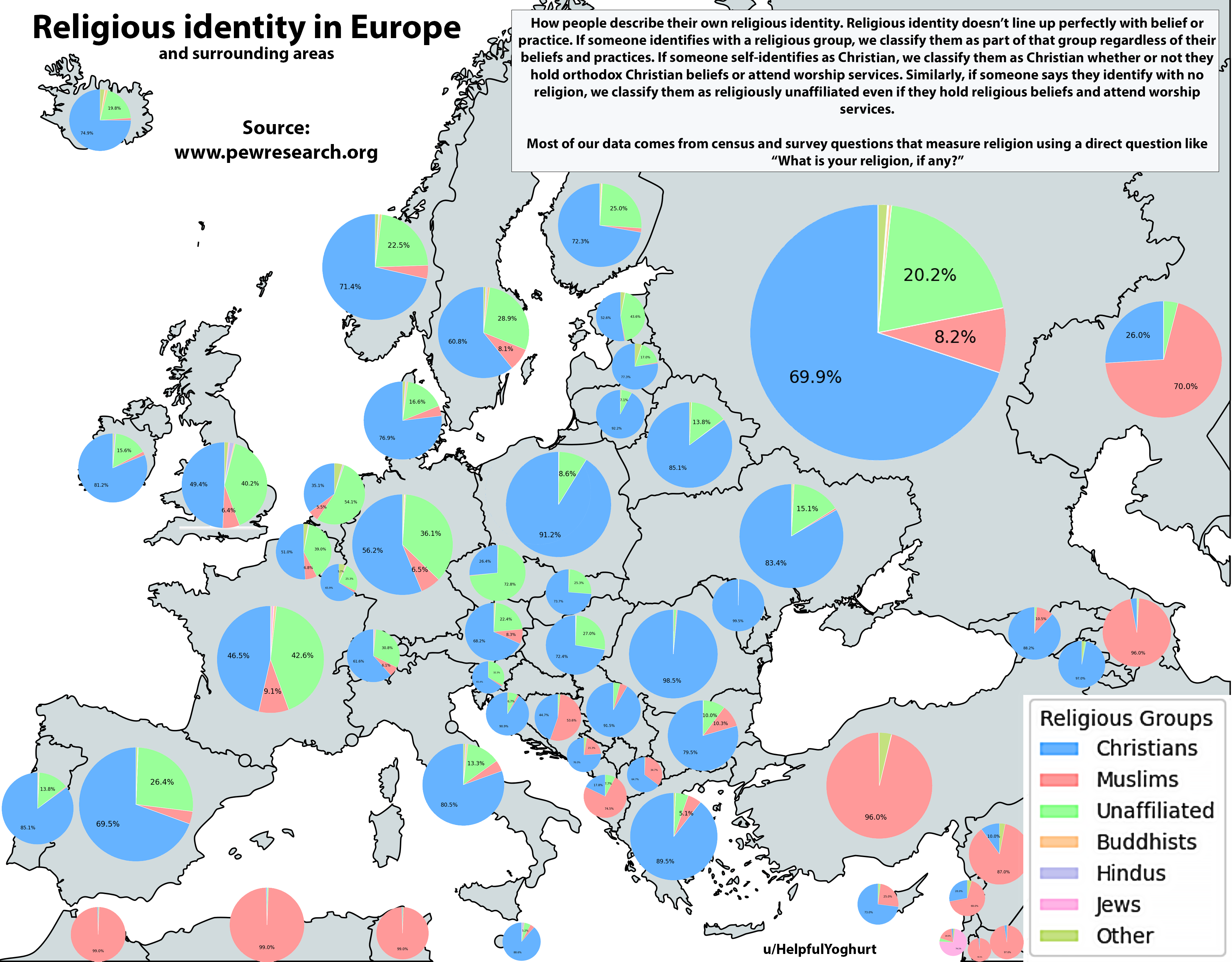
Religious Identity in Europe Map
The "Religious Identity in Europe Map" provides a comprehensive visualization of the religious landscape across the cont...
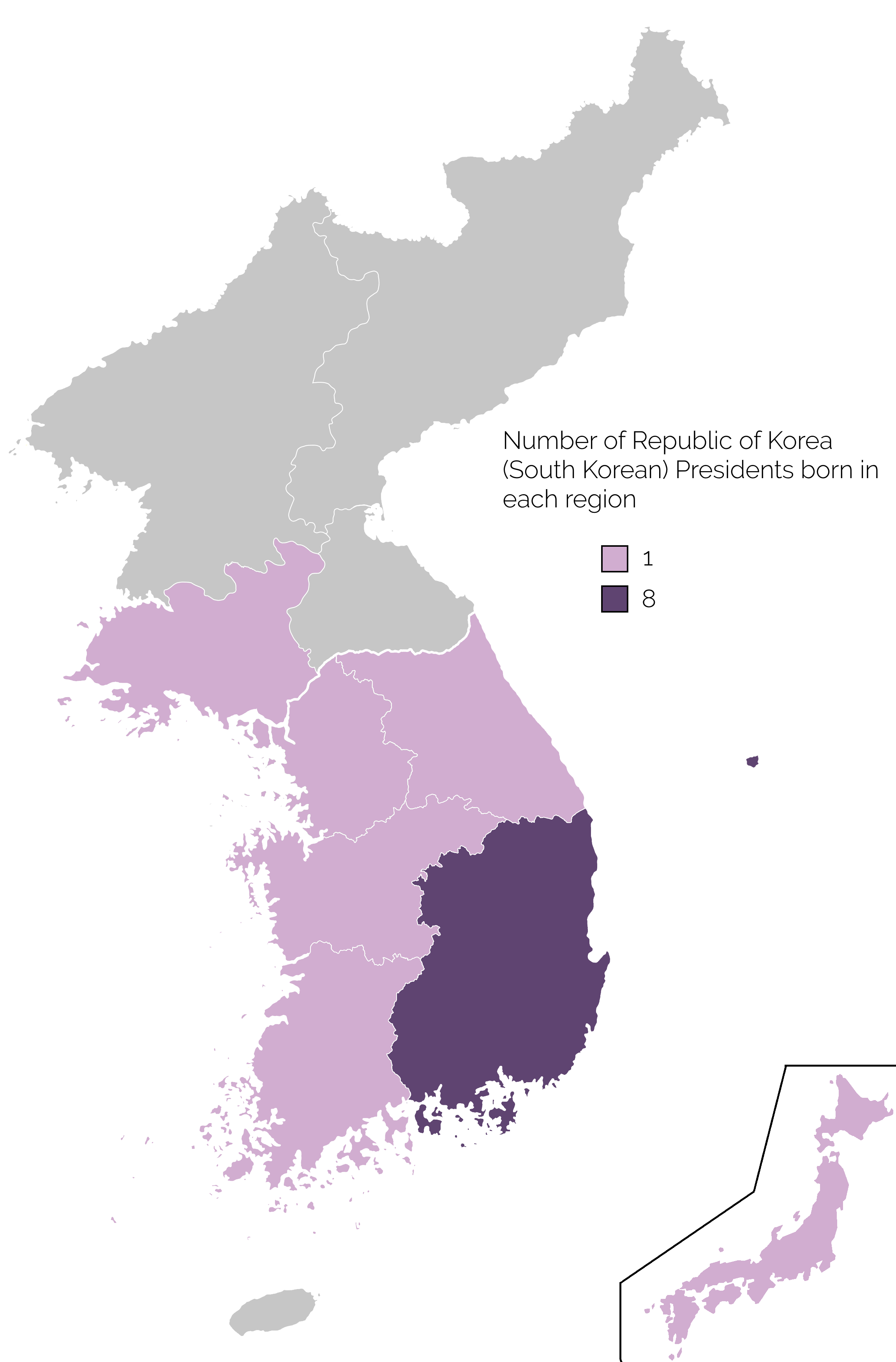
Map of Birthplaces of South Korean Presidents
The map titled 'Birthplace of South Korean Presidents' provides a visual representation of the geographic origins of the...
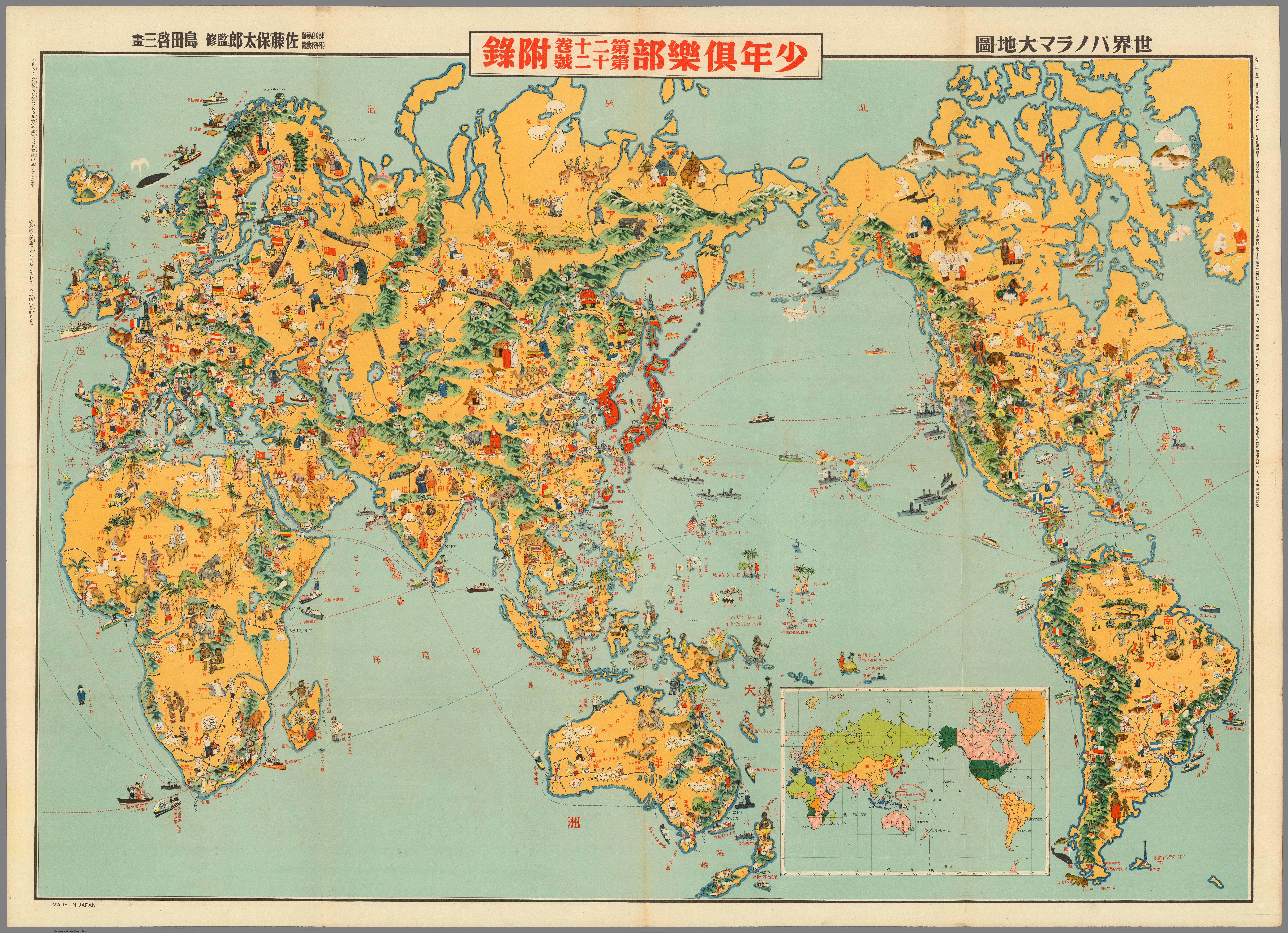
1933 Japanese Pictorial World Map Analysis
The 1933 Japanese pictorial world map is a fascinating representation of the world as seen through the lens of Japanese ...
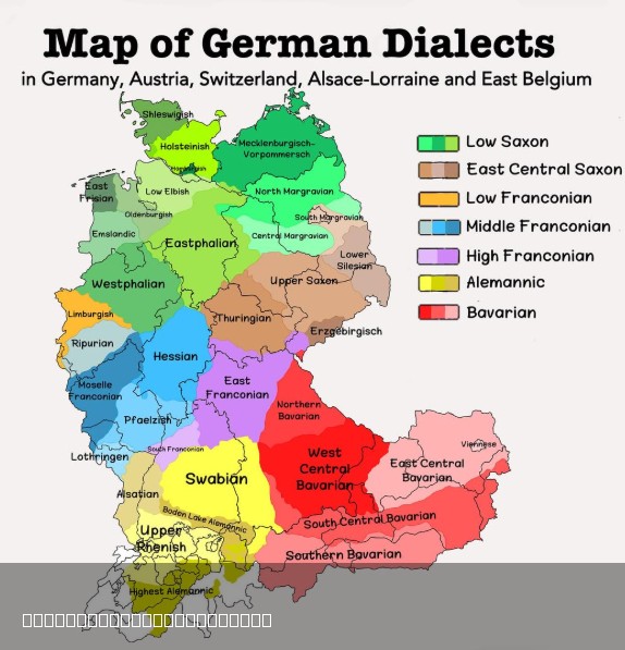
Map of German Dialects in Europe
This visual representation provides a comprehensive overview of the various German dialects spoken across Germany, Switz...
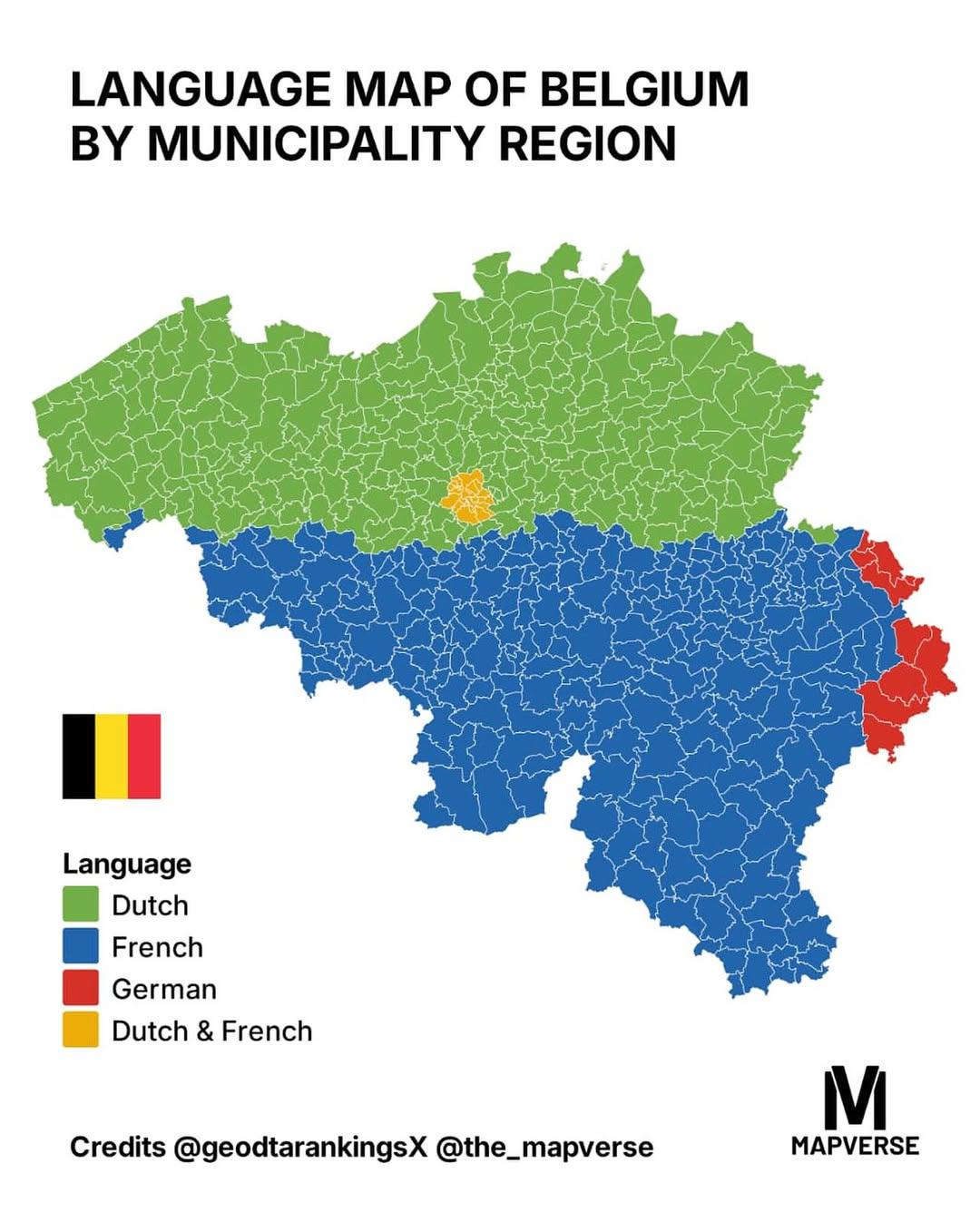
Language Map of Belgium by Municipality Region Map
The \...
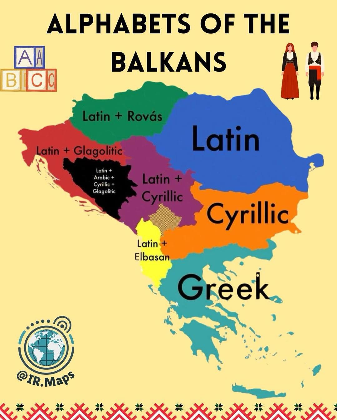
Alphabets of the Balkans Map
The "Alphabets of the Balkans Map" presents a visual representation of the diverse scripts used across the Balkan Penins...
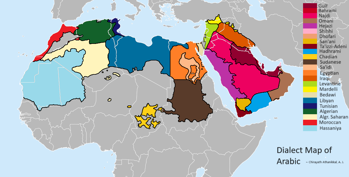
Dialect Map of Arabic
The "Dialect Map of Arabic" provides a visual representation of the various dialects spoken across the Arab world. It hi...
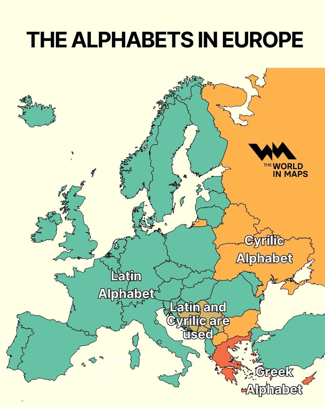
Alphabet Distribution Map of Europe
The "Alphabet Distribution Map of Europe" visually represents the linguistic diversity of the continent by illustrating ...
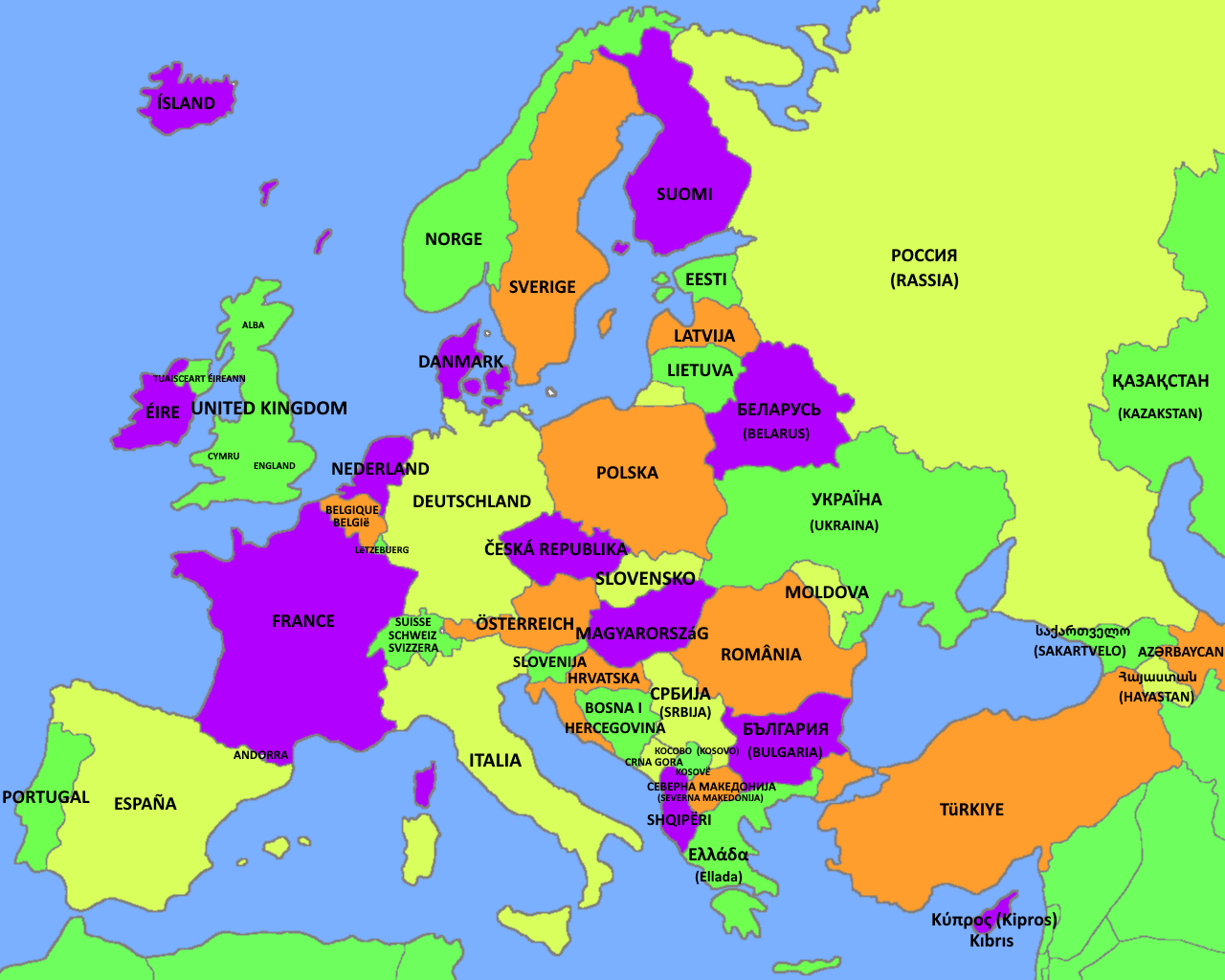
Names of European Countries in Their Native Language Map
The "Names of European Countries in Their Native Language Map" provides a fascinating glimpse into how countries across ...
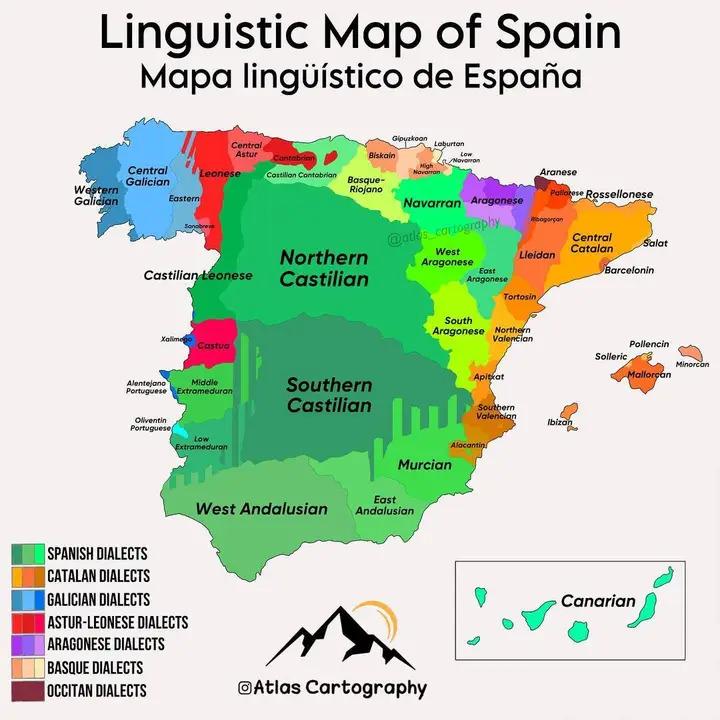
Linguistic Map of Spain
The Linguistic Map of Spain provides a detailed representation of the rich tapestry of languages and dialects spoken acr...
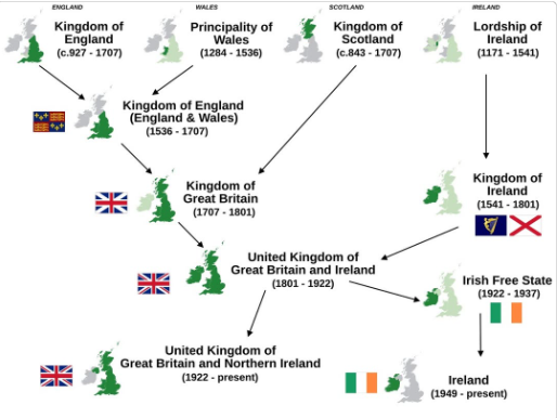
Simplified History Map of The British & Irish Isles
This visualization titled "Simplified History of The 4 Countries Of The British & Irish Isles" provides a clear overview...
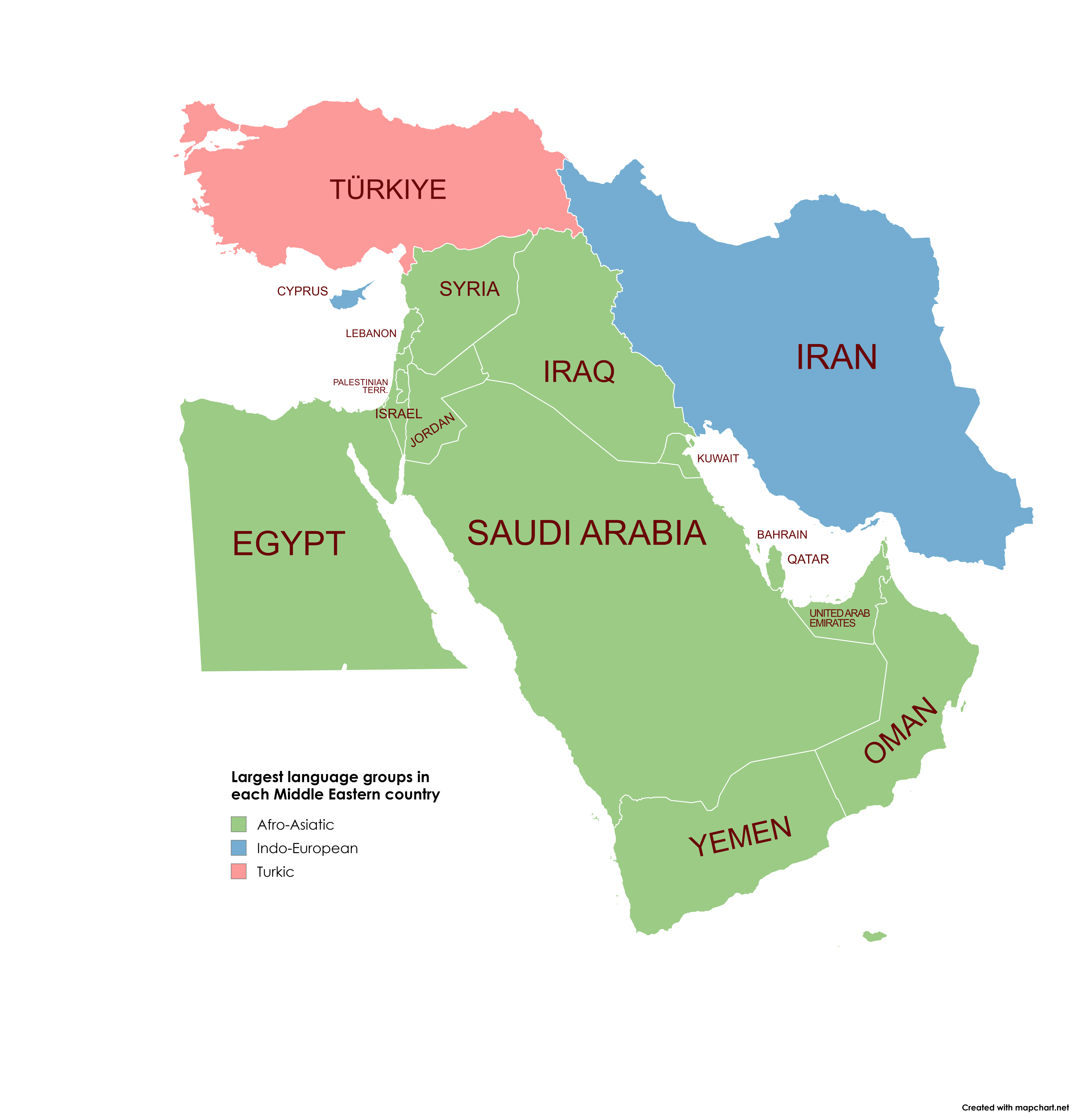
Largest Language Groups in Middle Eastern Countries Map
This map visually represents the largest language groups spoken in each Middle Eastern country. By examining this map, y...
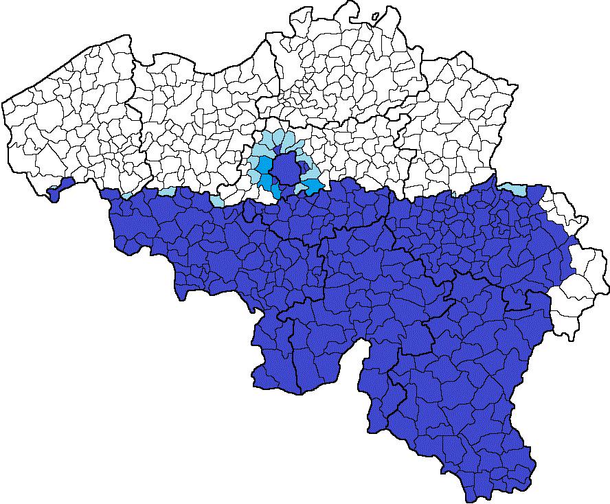
Francophone Presence Map in Belgium
The \...
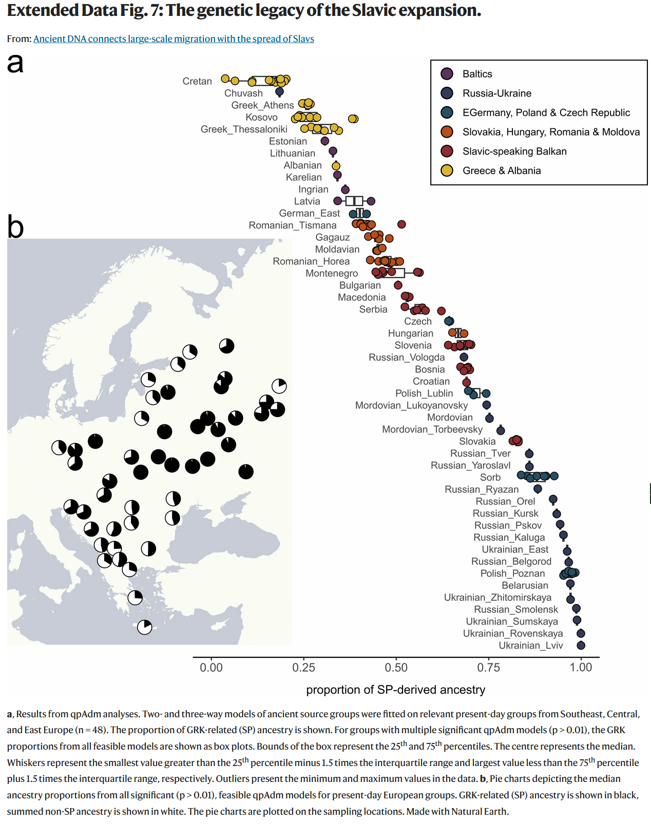
Genetic Legacy of Slavs Map
This map provides an intriguing glimpse into the genetic heritage of the Slavic people, illustrating the distribution of...
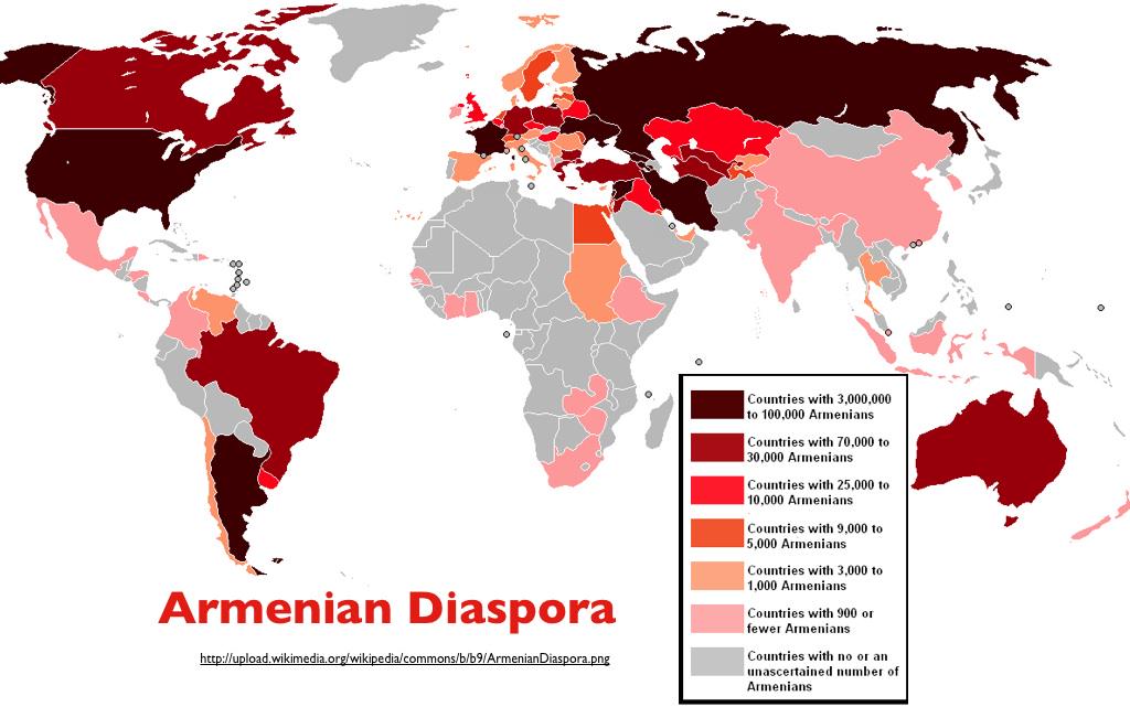
Armenian Diaspora Around the World Map
The "Armenian Diaspora Around the World Map" provides a visual representation of the global distribution of the Armenian...
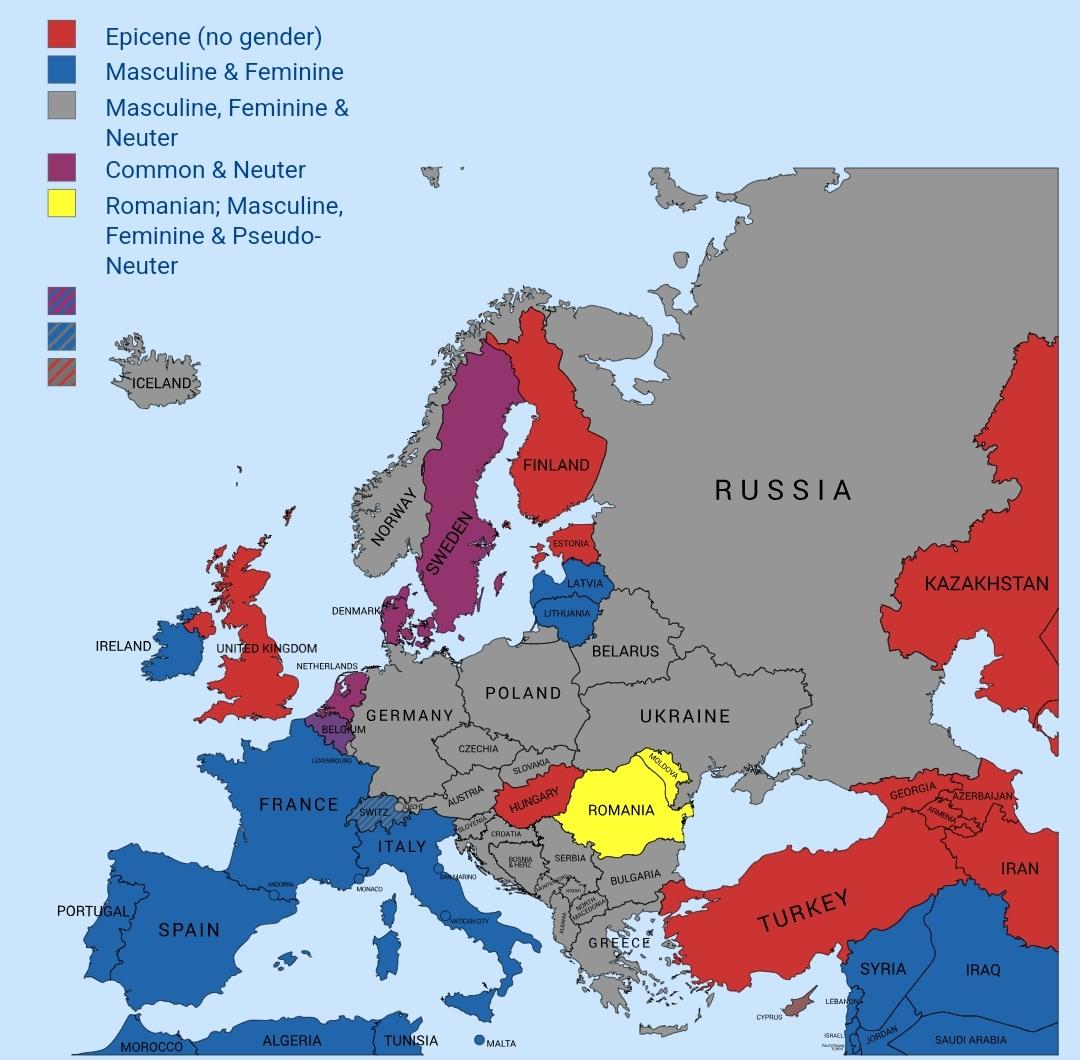
Map of Grammatical Gender in European Languages
The "Map of Grammatical Gender in National Languages of European Countries" visualizes the linguistic feature of grammat...
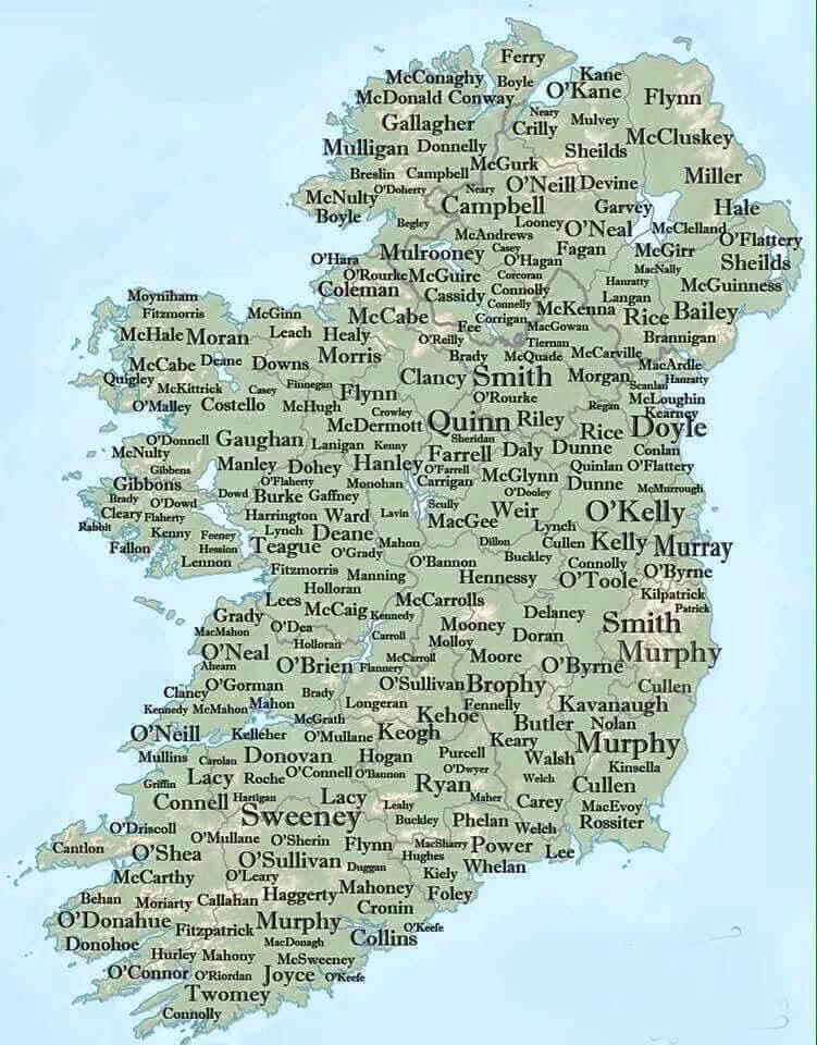
Map of Irish Surnames
The "Map of Irish Surnames" provides a captivating look at the distribution of family names across Ireland, revealing ho...
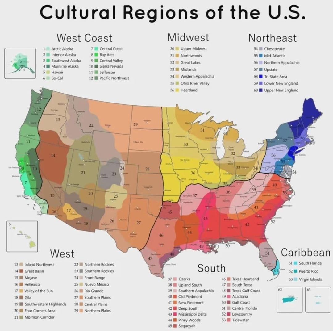
Cultural Regions of America Map
The "Cultural Regions of America Map" visually delineates the diverse cultural landscapes across the United States. It h...
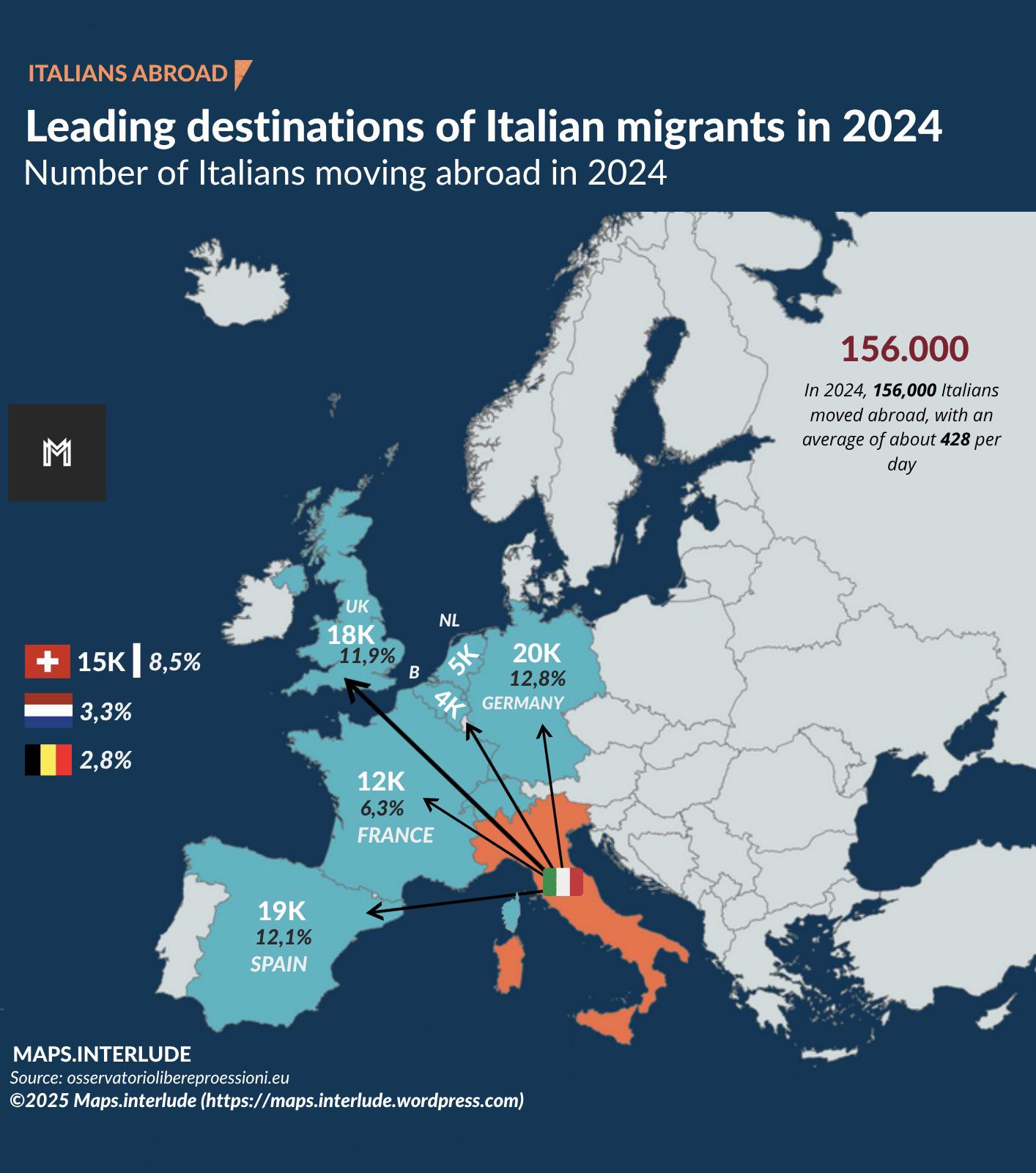
Leading Destinations of Italian Migrants in 2024 Map
The "Leading Destinations of Italian Migrants in 2024 Map" provides a visual representation of the countries where Itali...
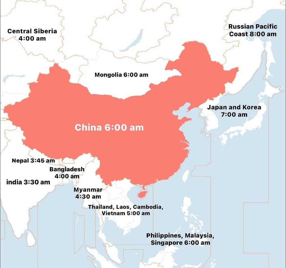
Chinese Time Zones Map
This map displays the various time zones across China, a country known for its vast geographical expanse and cultural di...
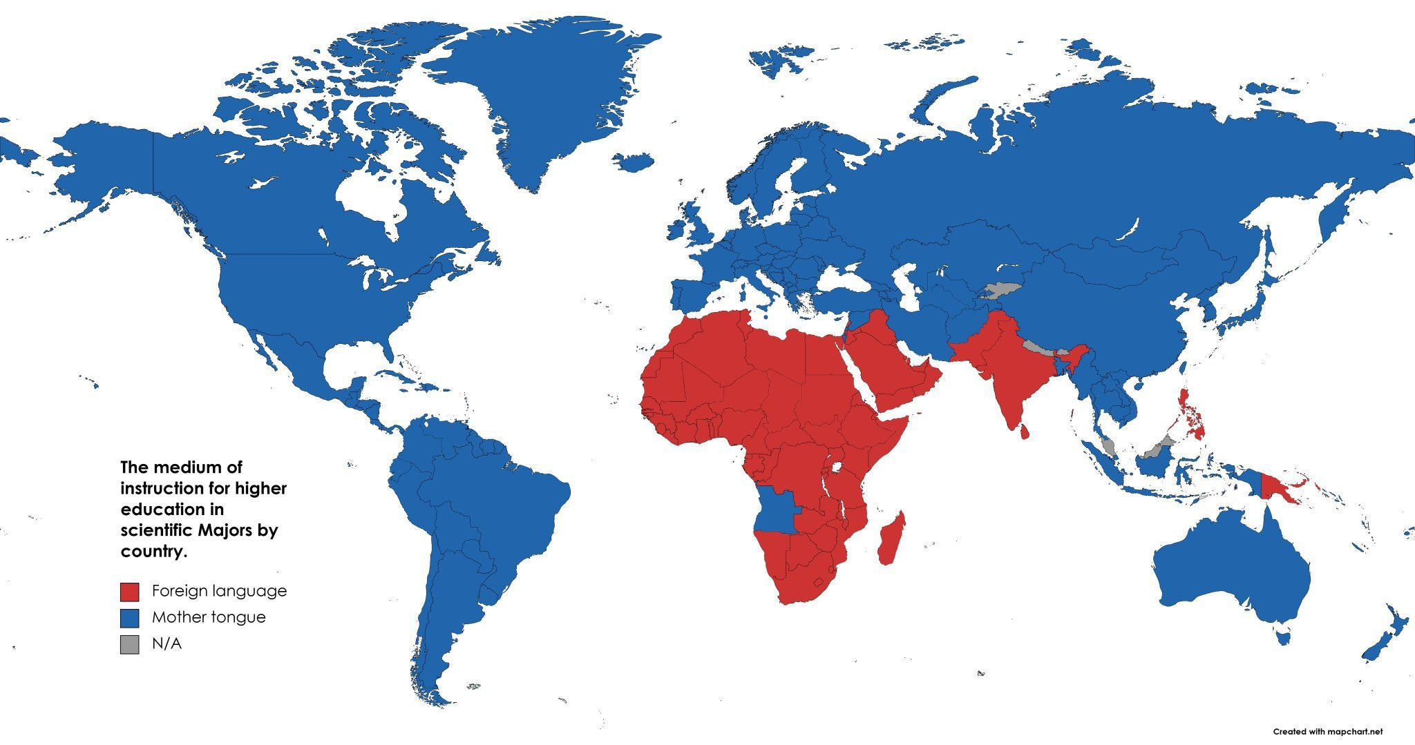
Map of Languages Used in Higher Education for Science
The map titled "Map showing whether countries use a native or foreign language for higher education in scientific fields...
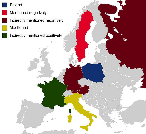
Countries Featured in Poland's Anthem Map
...
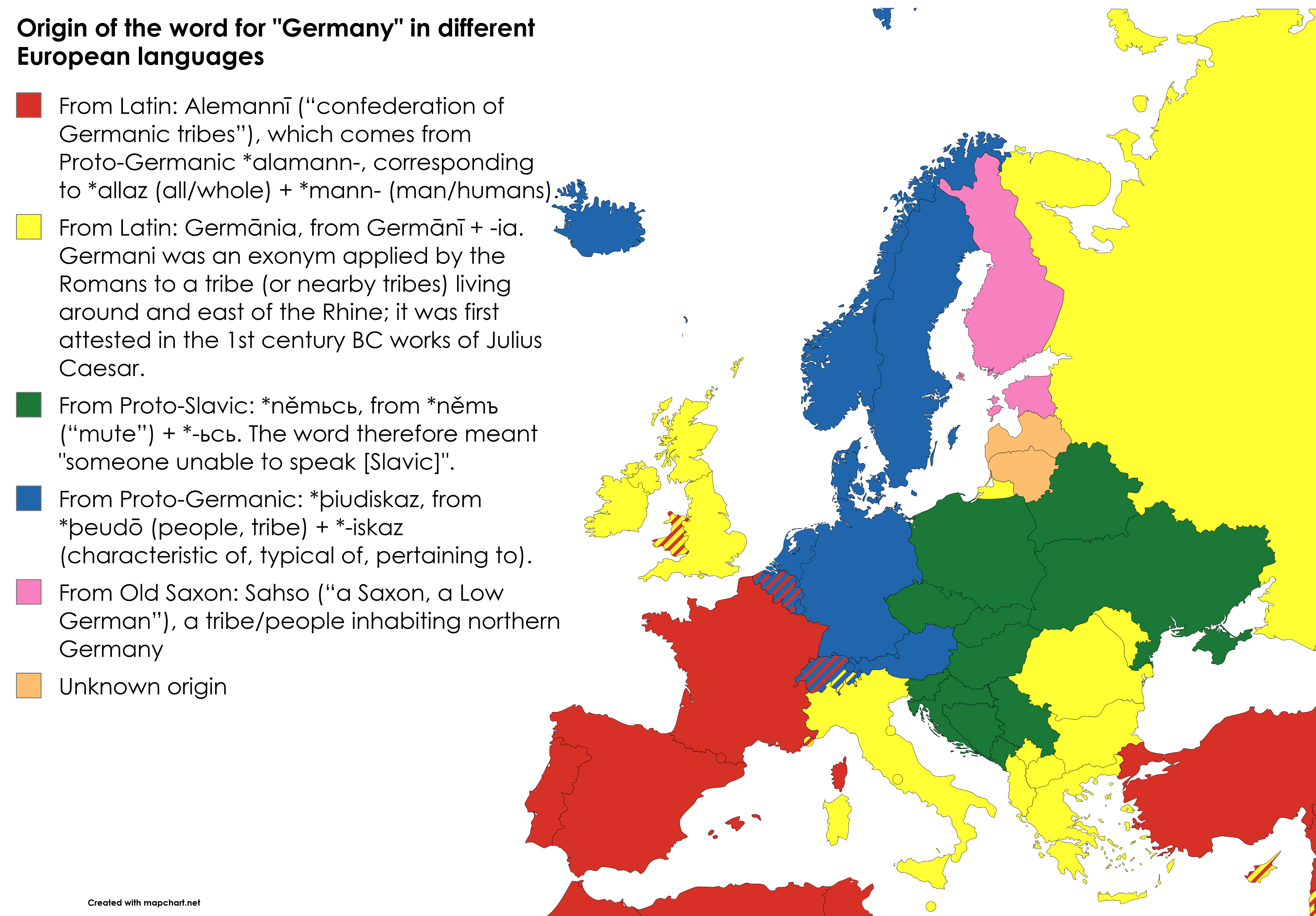
Origin of the Word for Germany in Different Languages Map
This map visualizes the origins of the word for "Germany" as it appears in various European languages. Each language dep...
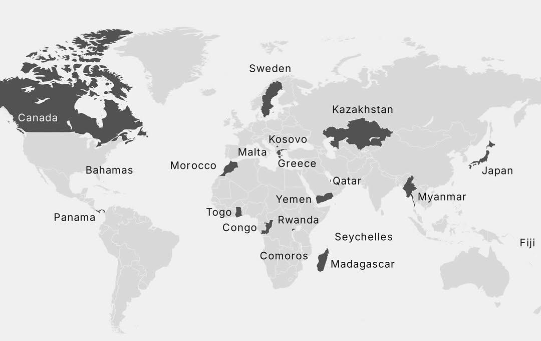
Countries with a Single Repeating Vowel Map
This map presents a unique linguistic feature among countries around the world: those whose names contain a single vowel...
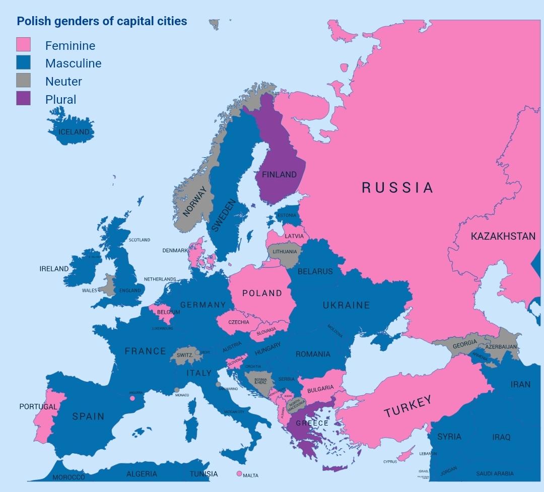
Genders of Capital Cities in Poland Map
The "Genders of Capital Cities in Poland Map" provides a unique perspective on the linguistic aspect of Polish capital c...
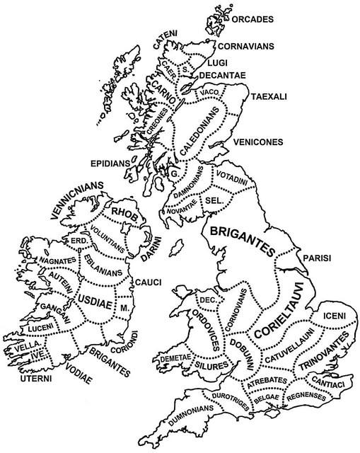
Tribes of Britain and Ireland Map
The "Tribes of Britain and Ireland around the time of Julius Caesar’s invasion" map visually represents the various trib...
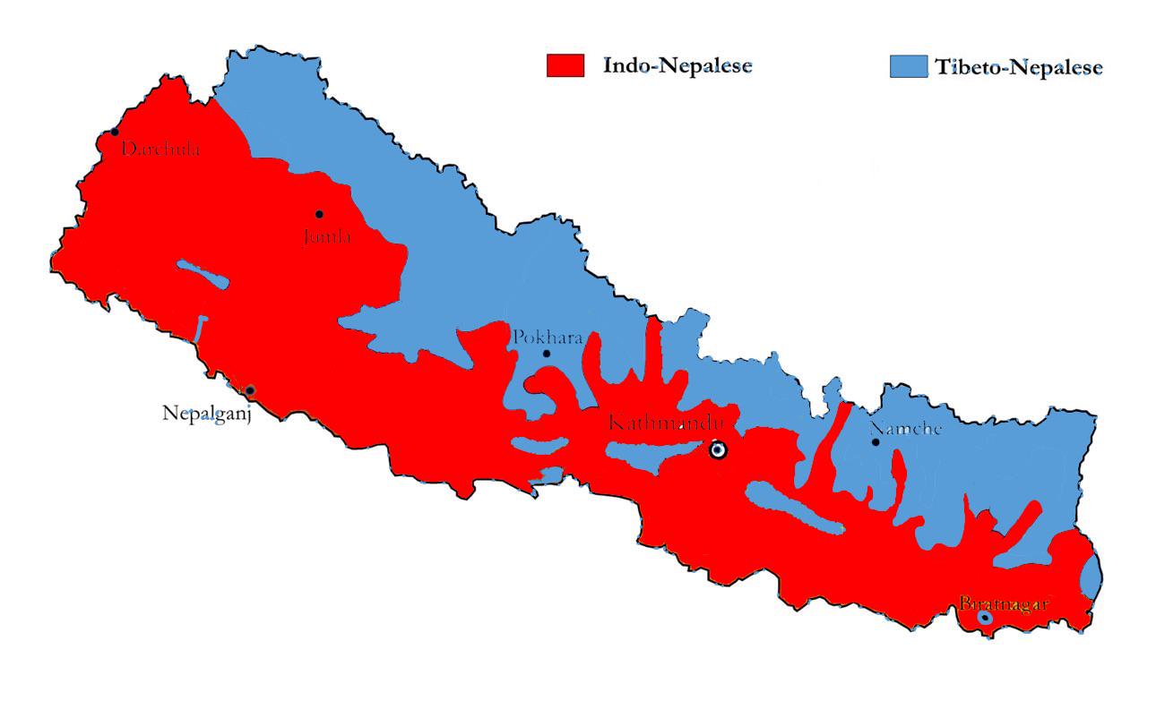
Ethnic Map of Nepal Showing Indo-European and Sino-Tibetan Divide
This ethnic map of Nepal provides a detailed visualization of the demographic divide between Indo-European Nepalese and ...
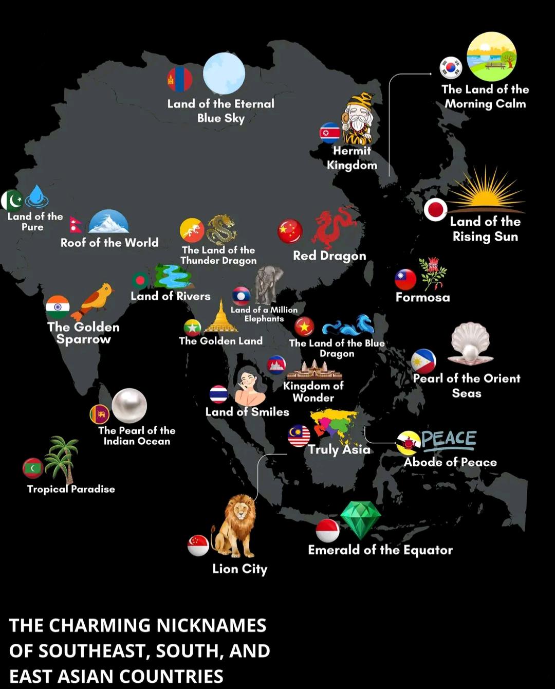
Charming Nicknames Map of Asian Countries
The visualization titled "The Charming Nicknames of Southeast, South, and East Asian Countries" presents a delightful co...
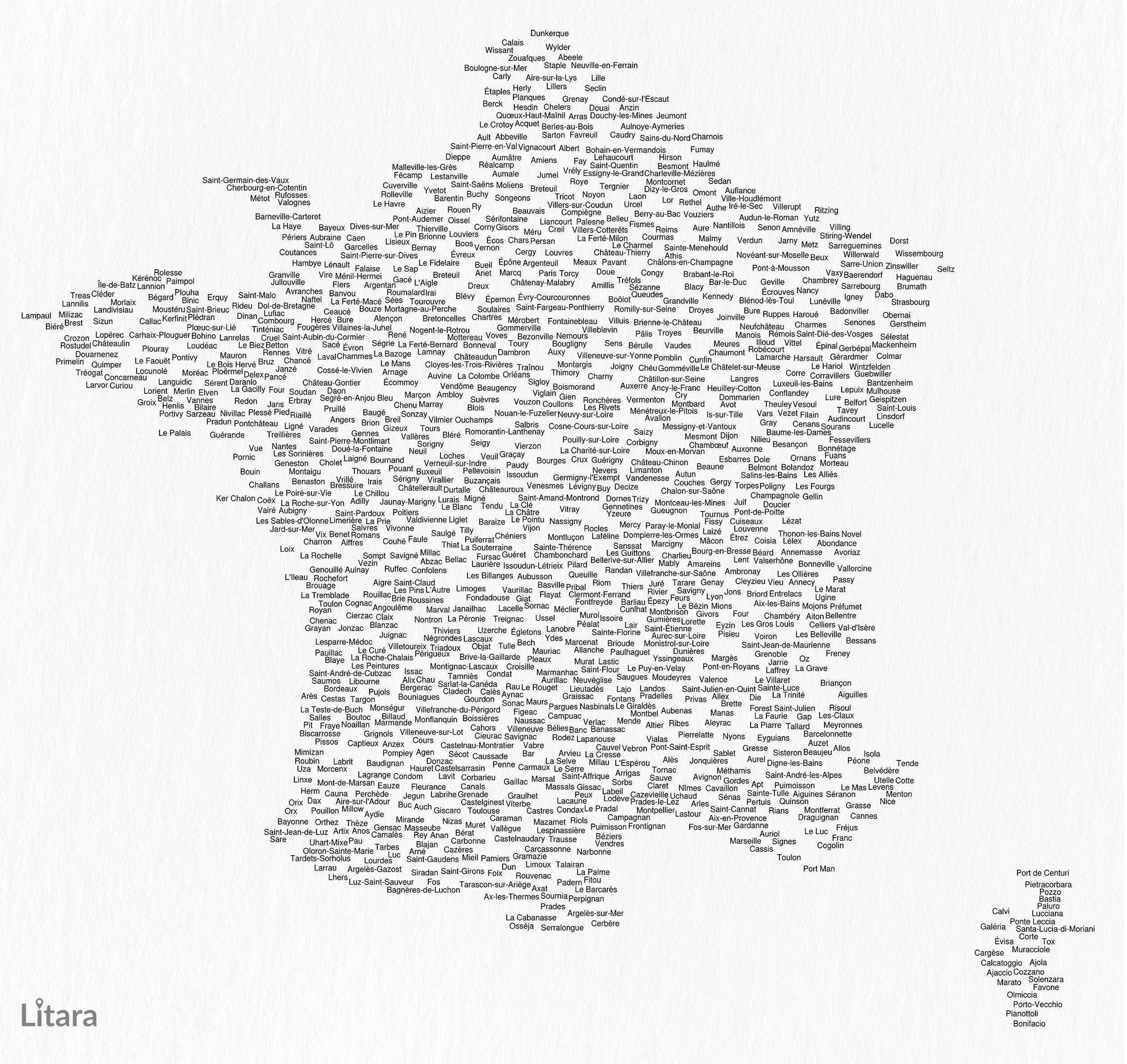
Typographic Map of France's Communes
This unique typographic map of France showcases the names of 1,156 communes, creating a captivating visual representatio...
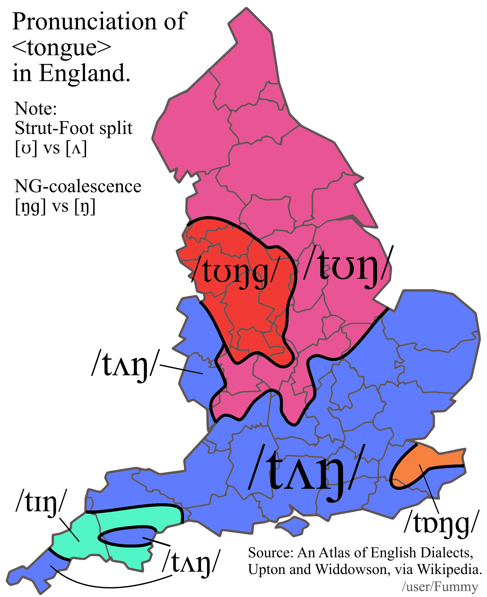
Map of Pronunciation Differences of 'Tongue' in England
This map illustrates the regional variations in the pronunciation of the word "tongue" across different areas of England...
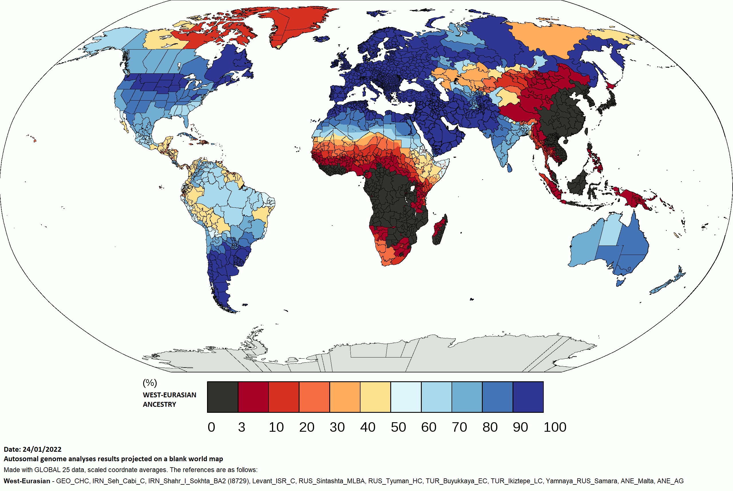
West Eurasian Ancestry by Country Map
The "West Eurasian Ancestry by Country Map" provides a detailed visualization of the distribution of West Eurasian genet...