migration Maps
73 geographic visualizations tagged with "migration"
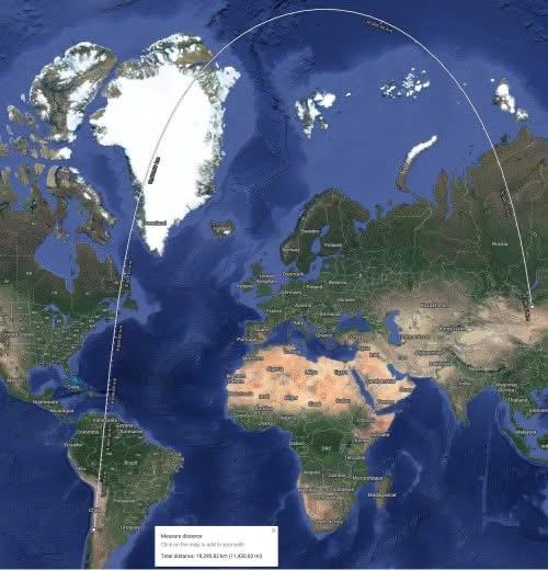
Shortest Route Map from Santiago, Chile to Ulaanbaatar, Mongolia
This map illustrates the shortest route from Santiago, Chile, to Ulaanbaatar, Mongolia, providing a visual representatio...
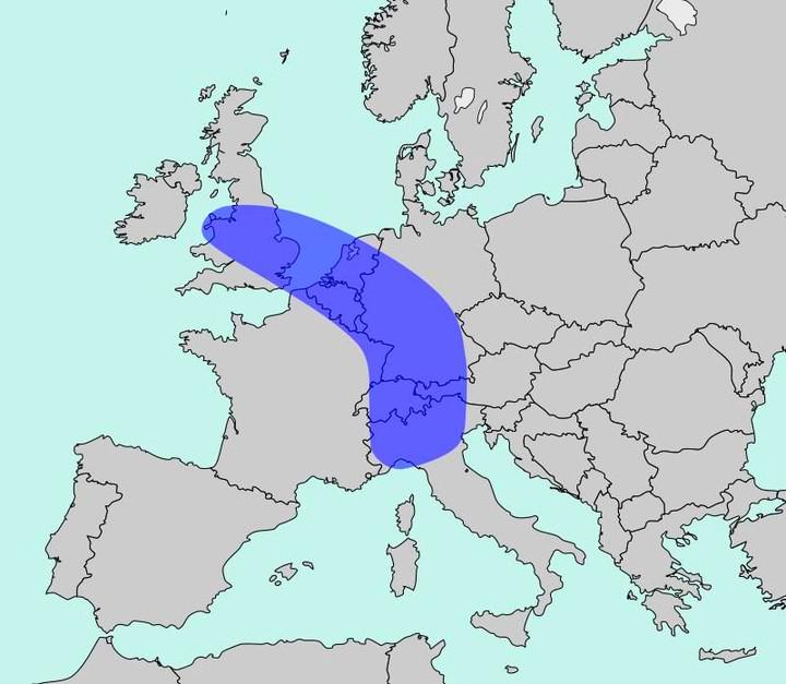
Population Density Map of Europe
The map titled "The Blue Banana" visualizes Europe’s most densely populated corridor, home to approximately 111 million ...
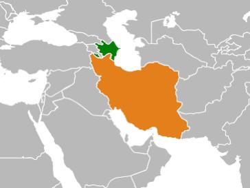
Map of Countries with Large Diasporas
This map highlights a fascinating demographic phenomenon: it illustrates countries where a significant portion of their ...
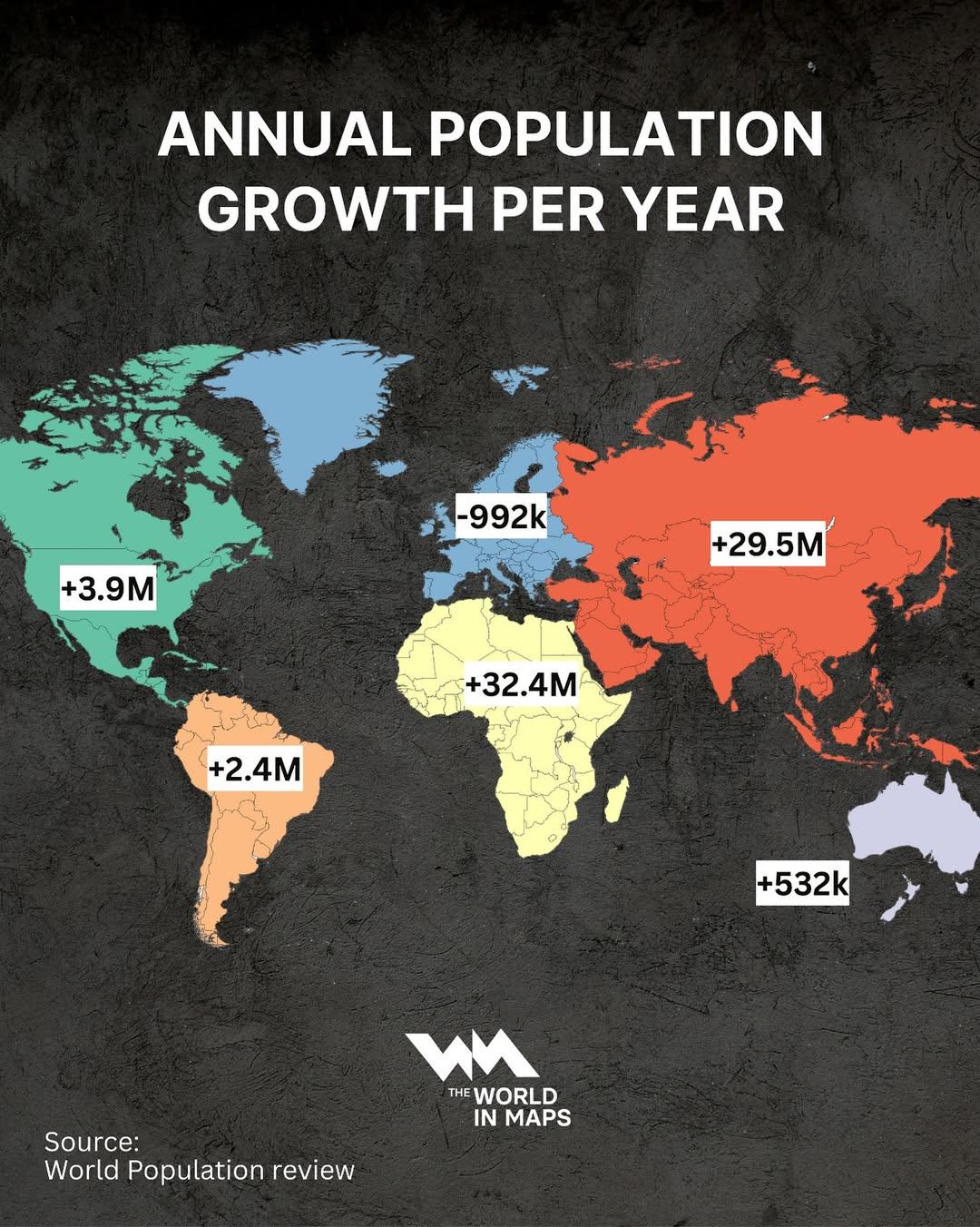
Annual Population Growth by Continent Map
The "Annual Population Growth by Continent Map" visually represents the trends in population increase across different c...
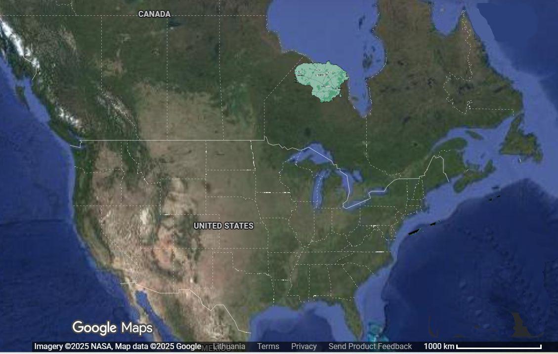
Lithuania Relocation 6000km West Map
This visualization intriguingly displays the geographical consequences of relocating Lithuania approximately 6,000 kilom...
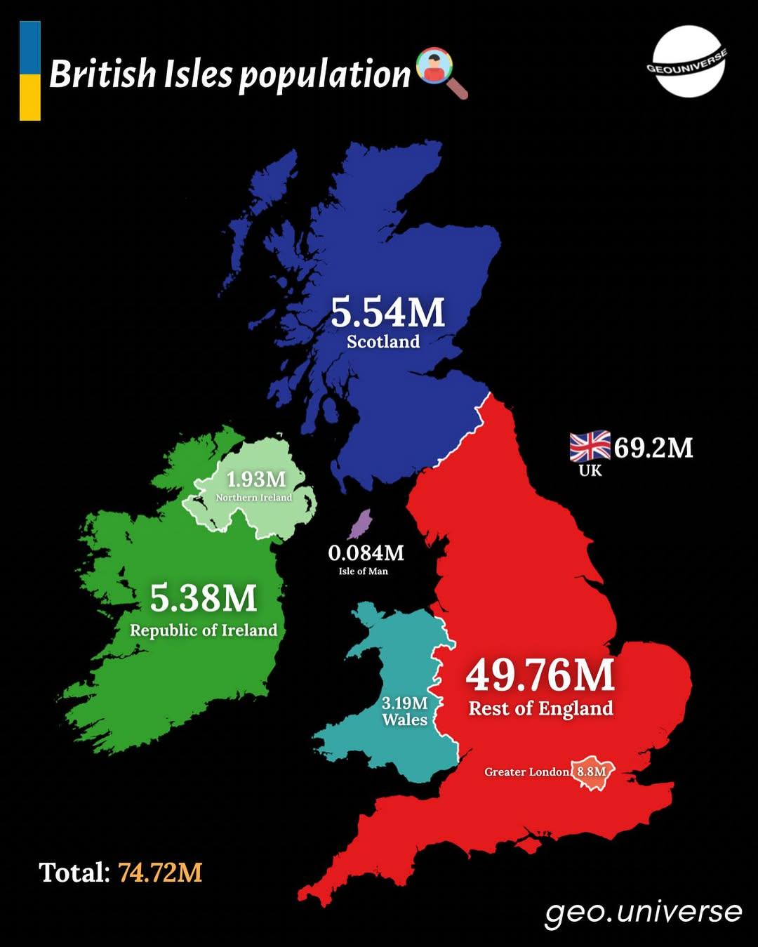
Population Distribution Map of the British Isles
The "British Isles by Population" map presents a detailed visualization of the population distribution across the Britis...
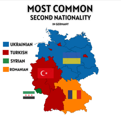
Most Common Second Nationality in Germany Map
The "Most Common Second Nationality in Germany" map provides a visual representation of the various nationalities that i...
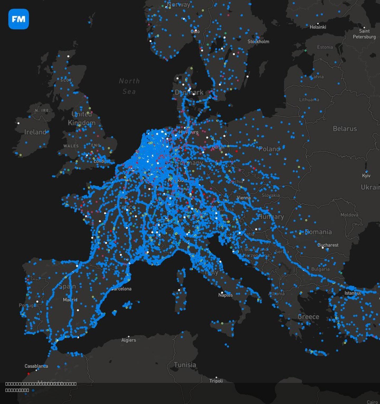
Migration Map of the Dutch for Autumn Season
The "Migration Map of the Dutch for Autumn Season" illustrates the seasonal movement patterns of the Dutch population du...
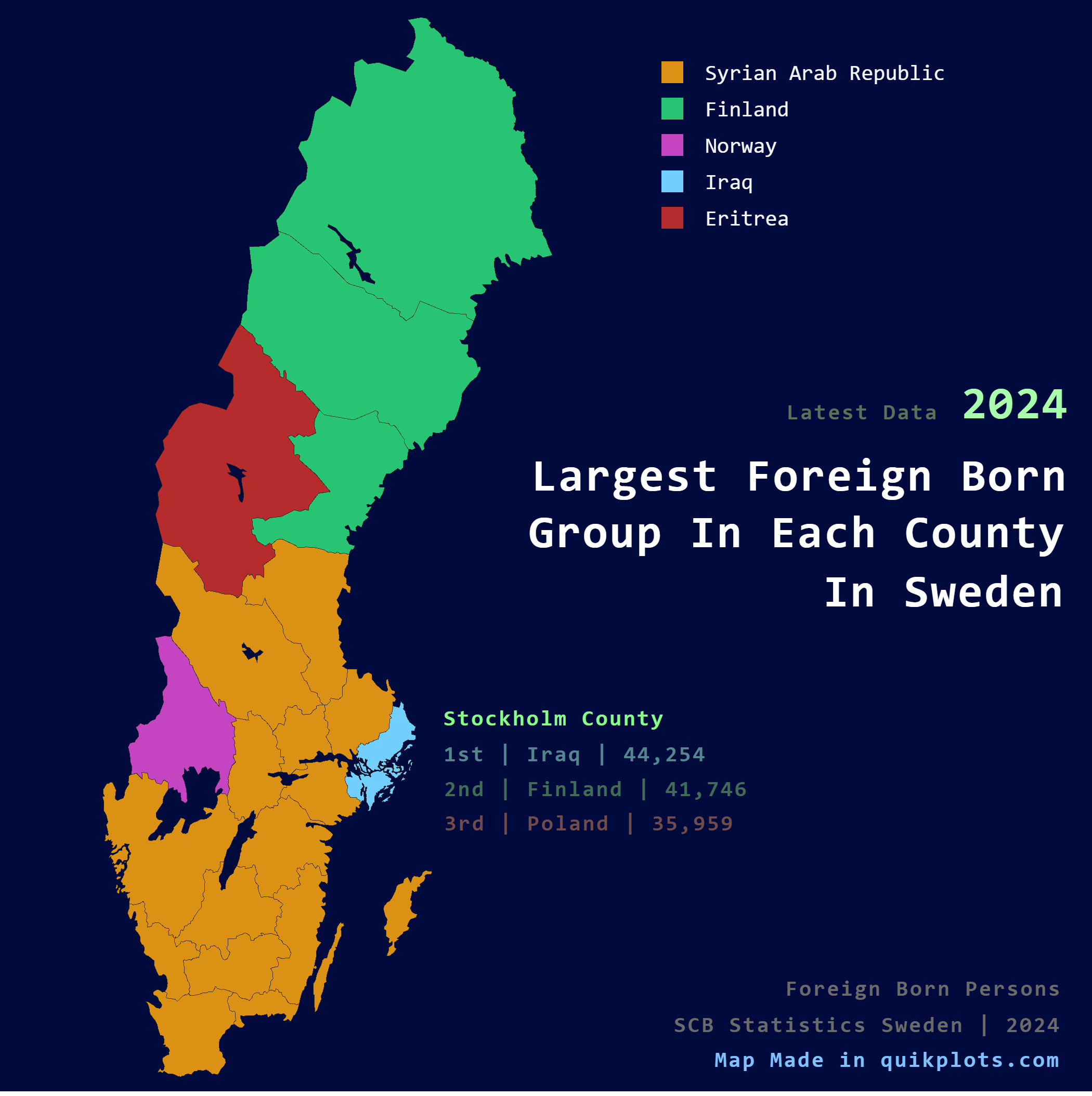
Largest Foreign Born Group per County Map in Sweden
The visualization titled "Largest Foreign Born Group per County in Sweden" presents a detailed breakdown of the predomin...
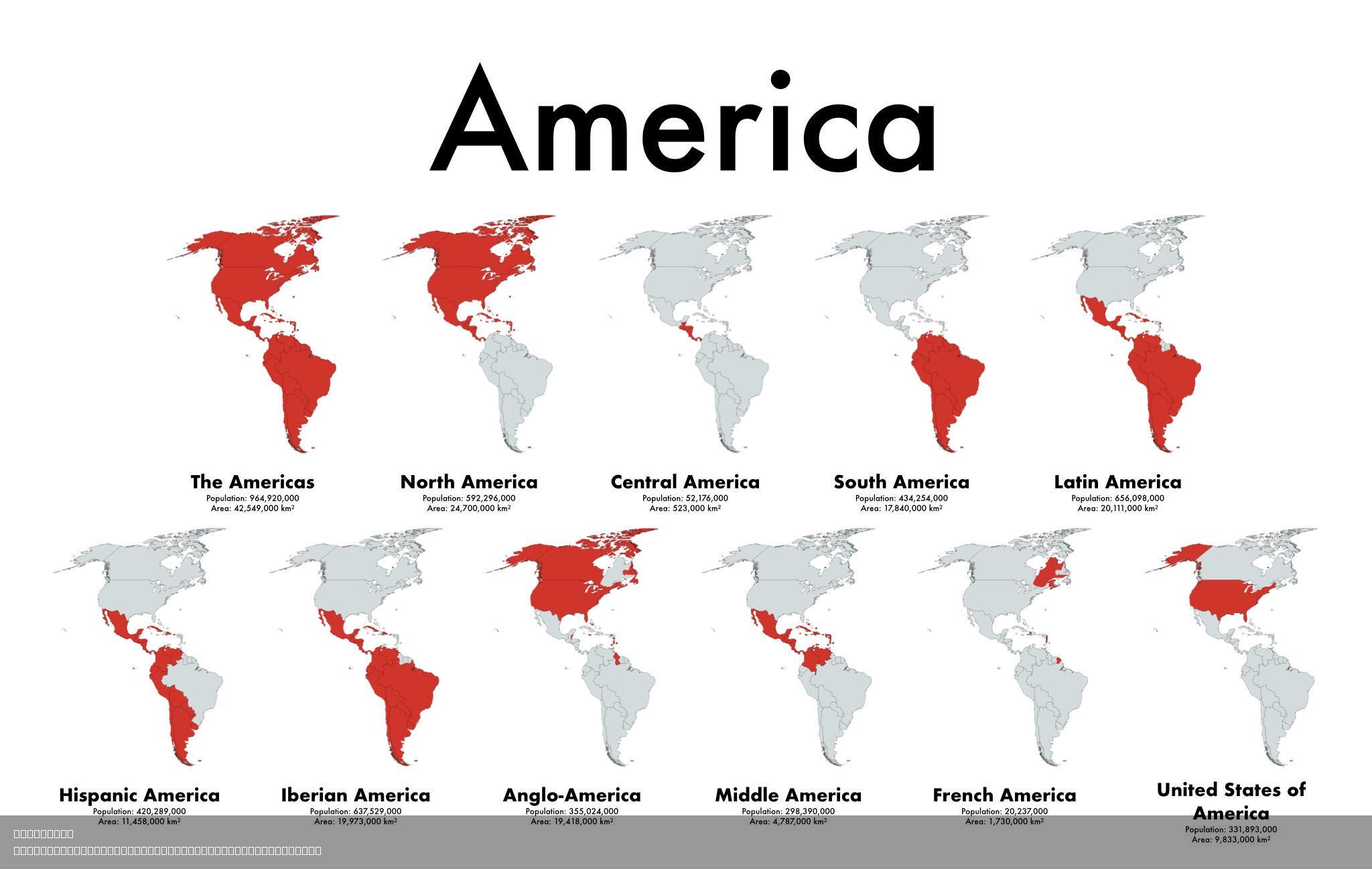
Cultural Diversity Map of the Americas
The visualization titled "11 Maps Show The Different Americas That Exist" presents a multifaceted view of the cultural d...
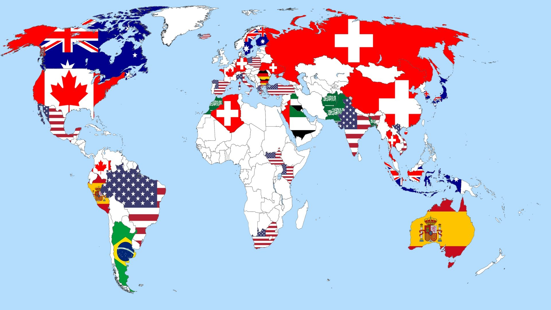
Preferred Countries to Live Map
The visualization titled "If not your country, Which country you want to live in?" presents a captivating glimpse into t...
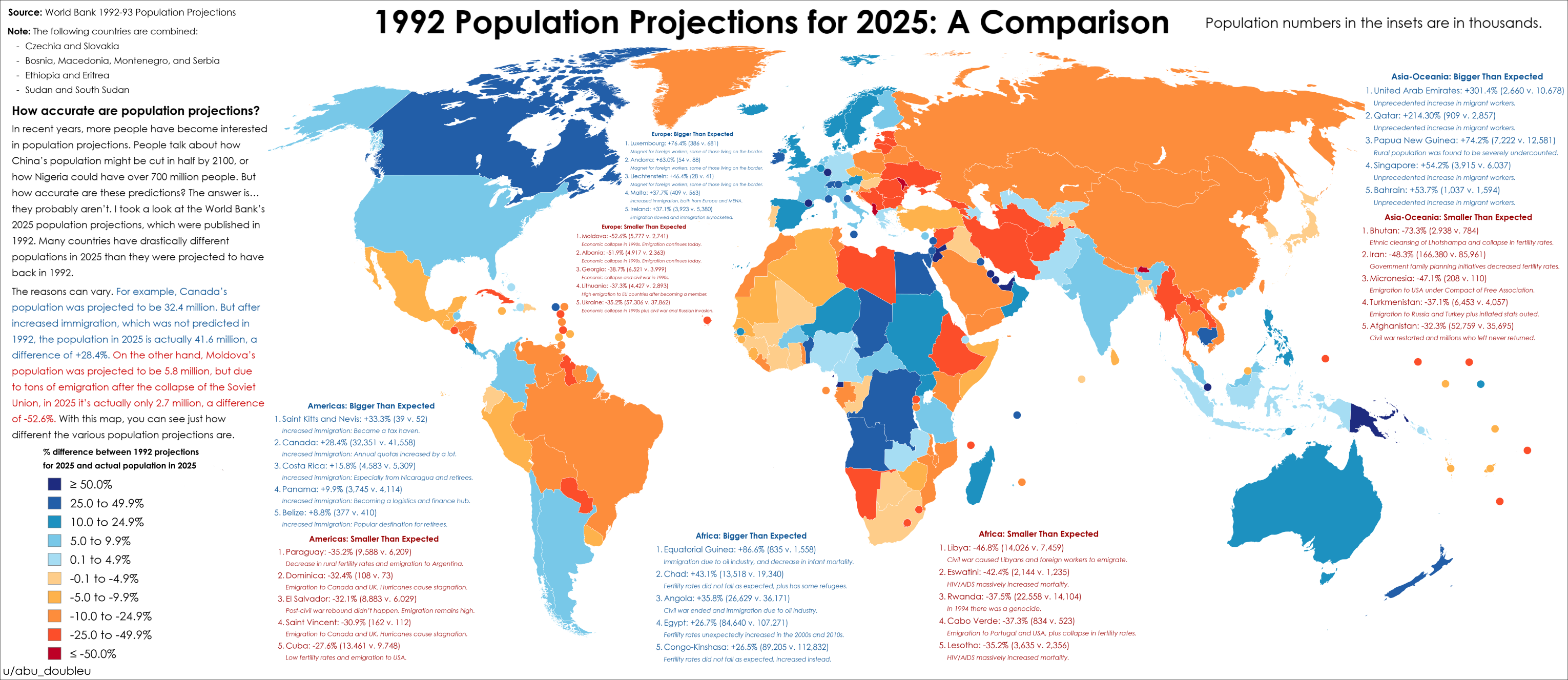
2025 Population Projections Accuracy Map
The map titled "How accurate were 2025 population projections from 1992?" provides a striking visual representation of t...
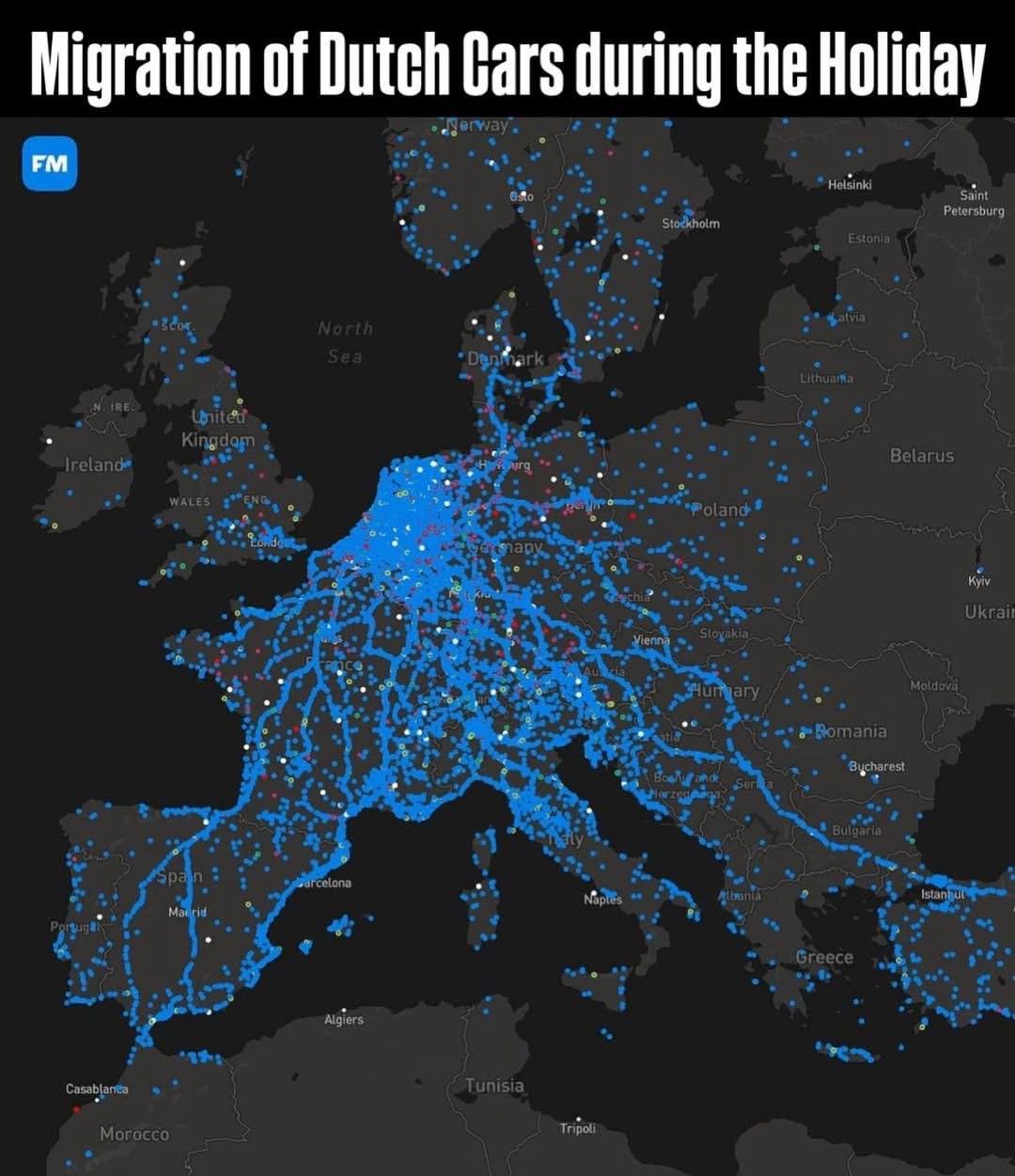
Migration of Dutch Cars During Summer Holiday Map
The "Migration of Dutch Cars During Summer Holiday Map" provides a detailed visualization of how Dutch vehicles travel d...
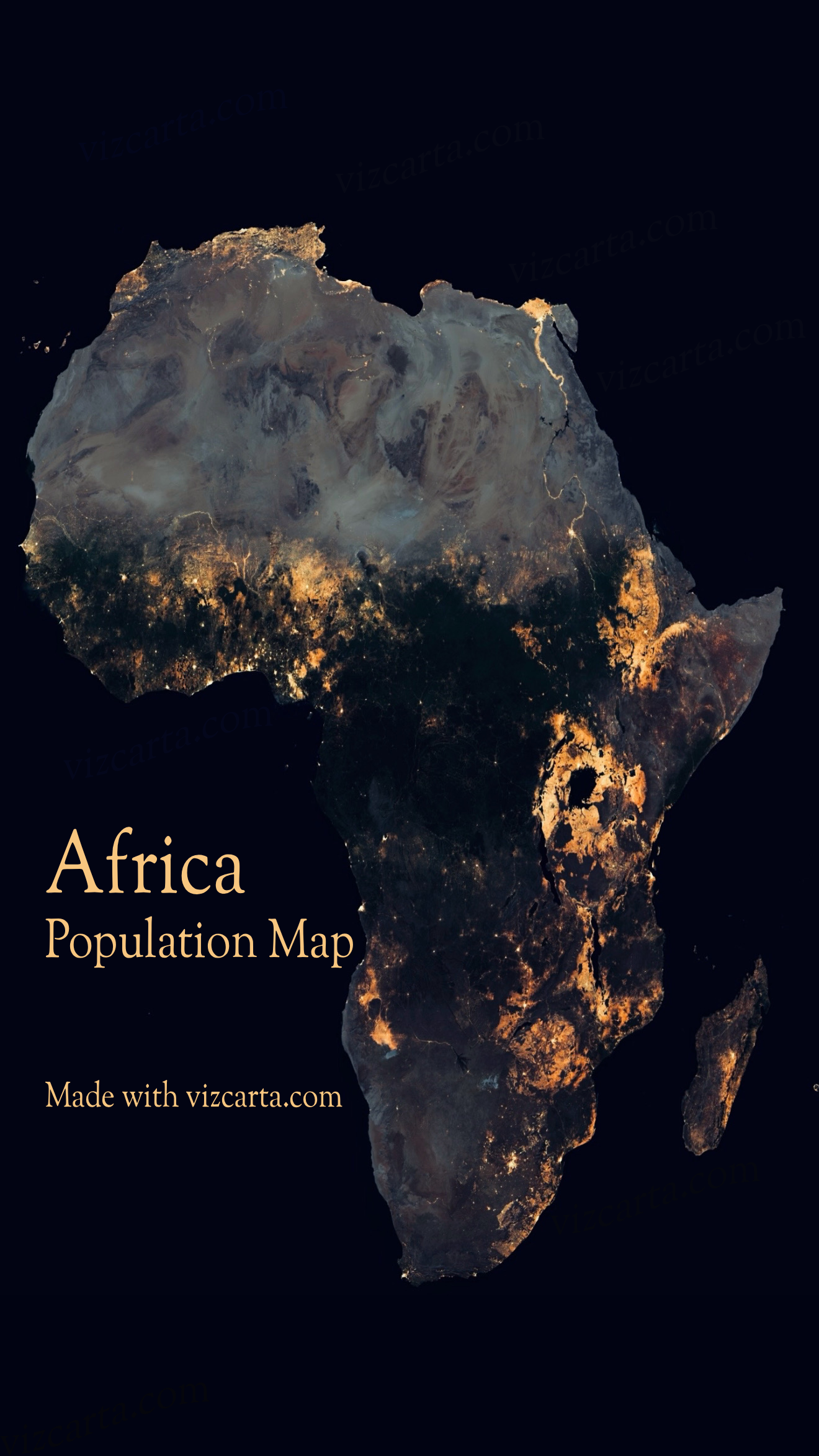
Africa Population Map
The Africa Population Map provides a visual representation of the demographic distribution across the continent. It illu...
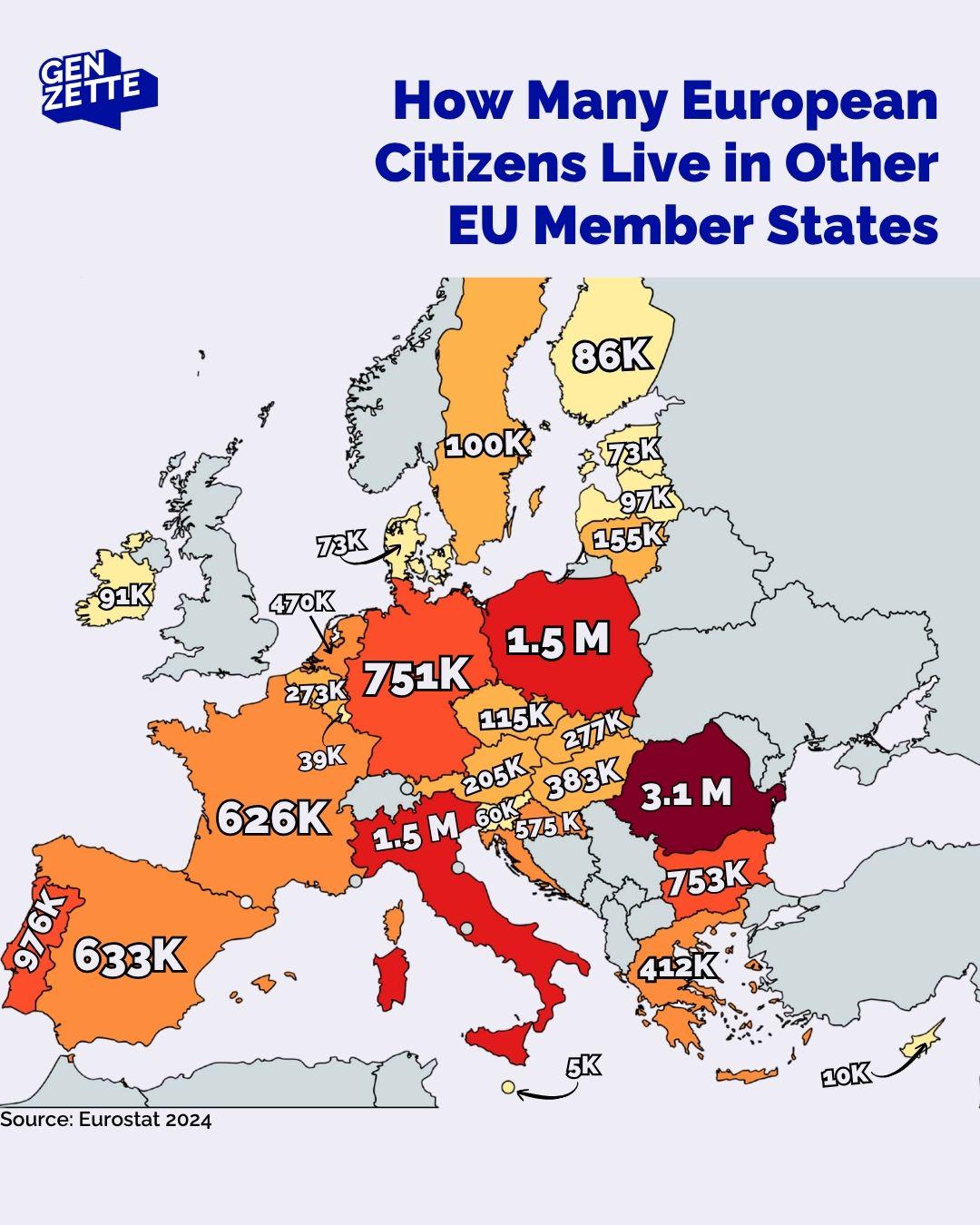
Map of European Citizens Living in Other EU States
This informative map provides a visual representation of the number of European Union (EU) citizens residing in other EU...
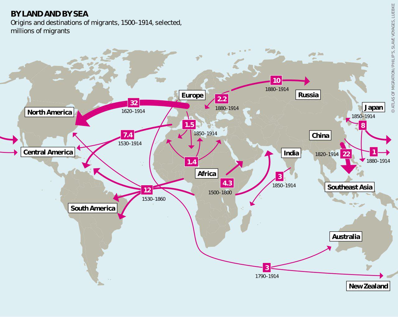
Early Modern Migrations 1500-1914 Map
The "Early Modern Migrations 1500-1914 Map" provides a detailed visualization of the massive movements of people across ...
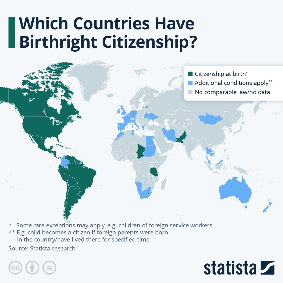
Birthright Citizenship Countries Map
This map provides a visual representation of countries that grant birthright citizenship, a policy that automatically co...
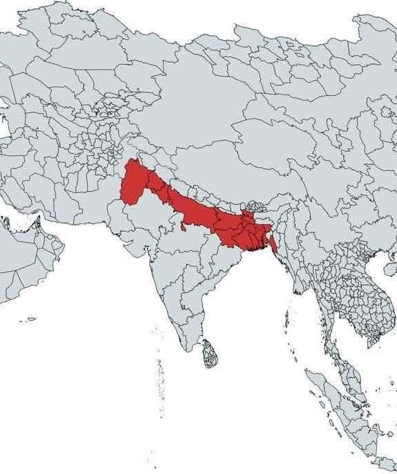
Global Population Distribution Map
The map highlights a significant area in red, representing approximately 890 million people, which is about 11% of the w...
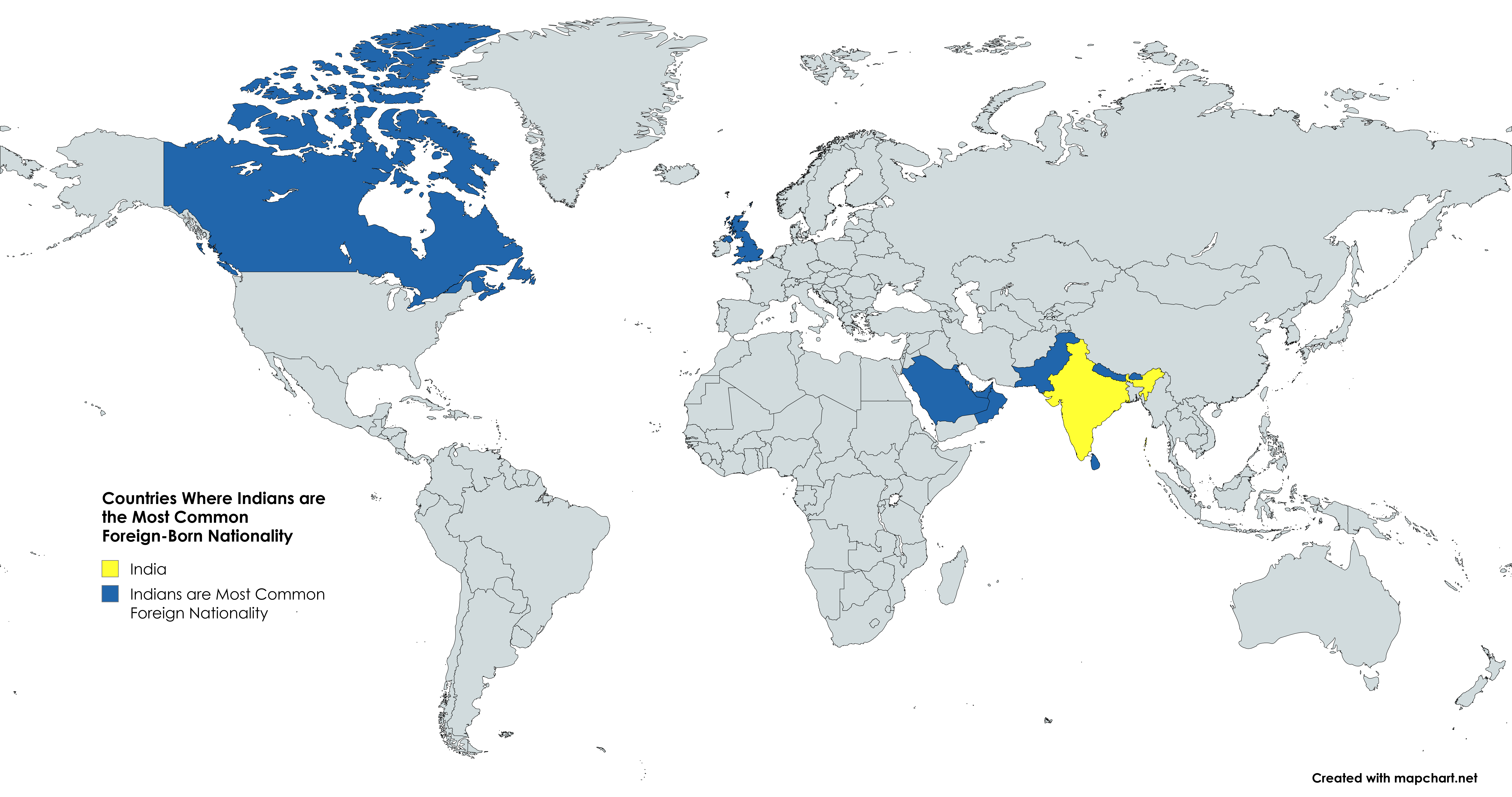
Countries Map Where Indians are the Most Common Foreign-Born Nationality
This map illustrates the countries where Indians constitute the largest segment of the foreign-born population. The visu...
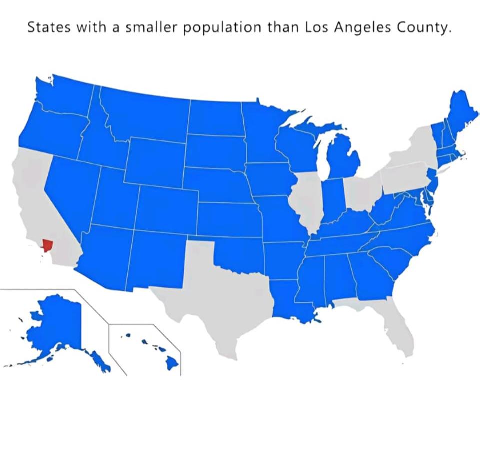
World Population Distribution Map
The "World Population Distribution Map" visualizes where people live across the globe, highlighting the density of popul...
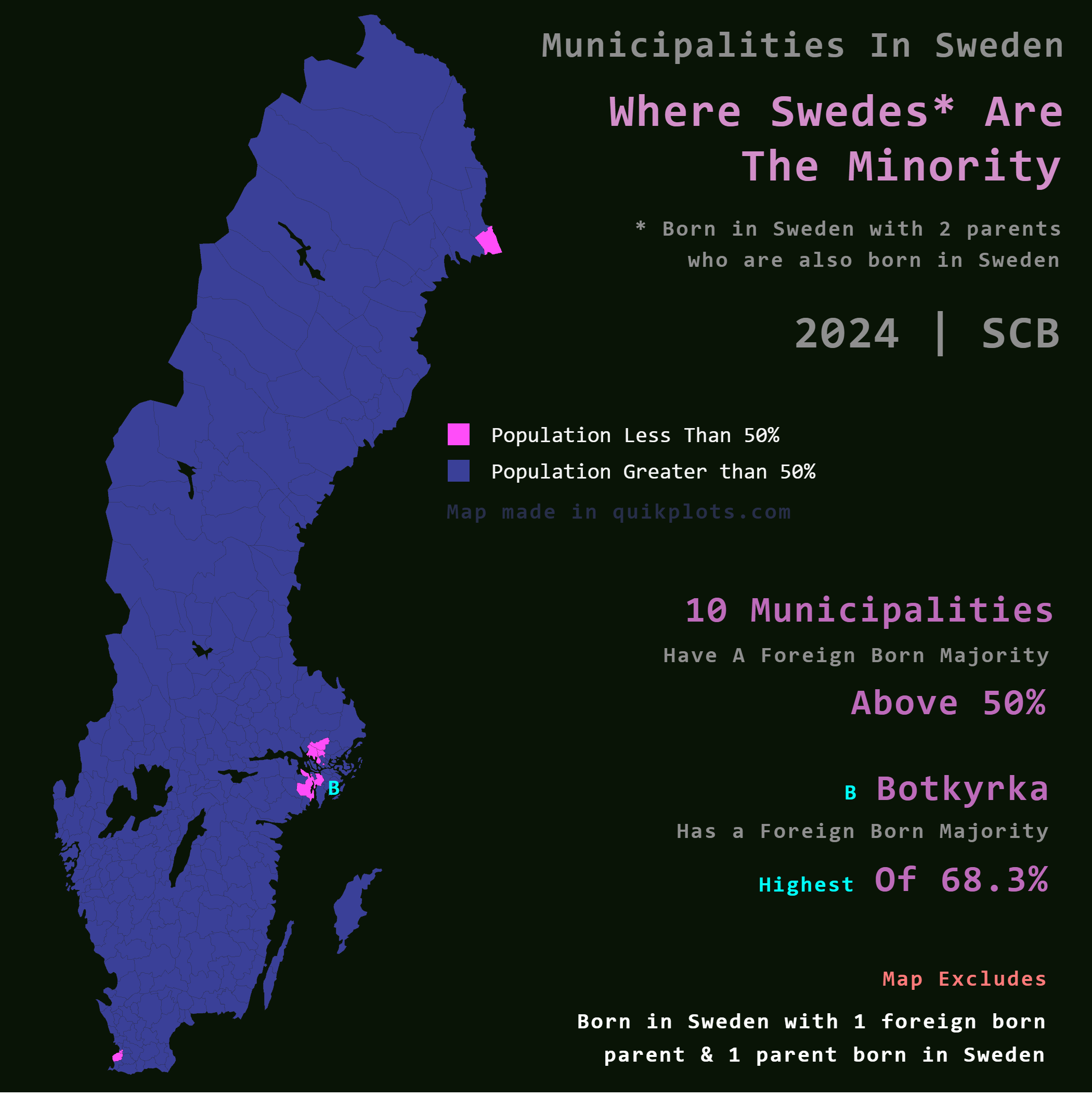
Map of Municipalities with Foreign Majority in Sweden
The map titled "Where Swedes are the Minority in Sweden" provides an intriguing look into the demographic landscape of t...
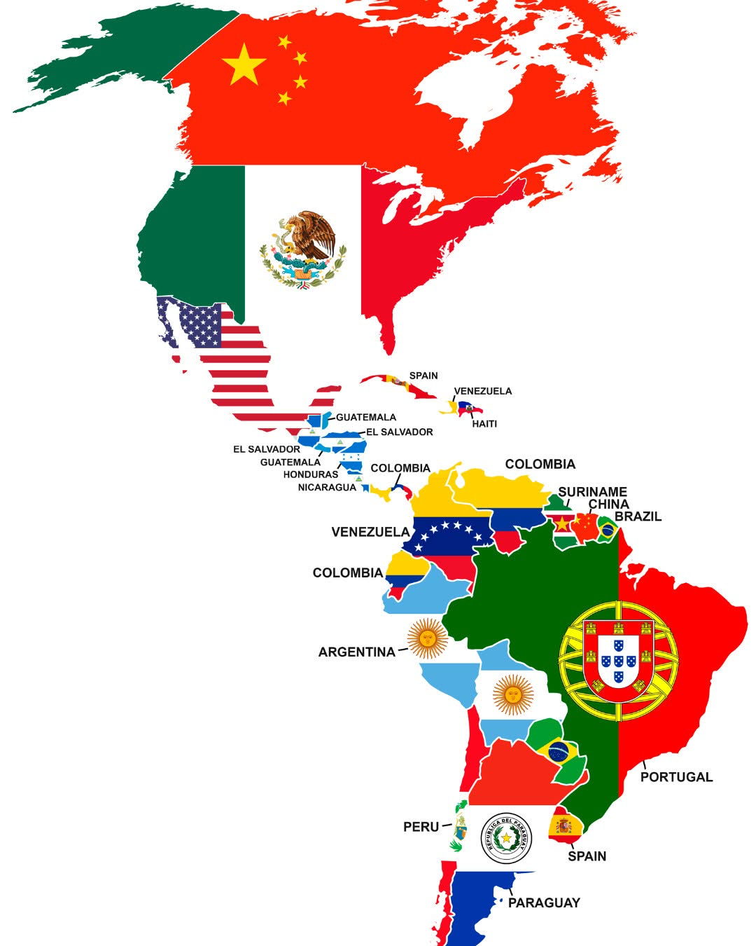
Largest Foreign Nationality in Each American Country Map
The visualization titled "Largest Foreign Nationality in Each American Country" provides a comprehensive view of the pre...
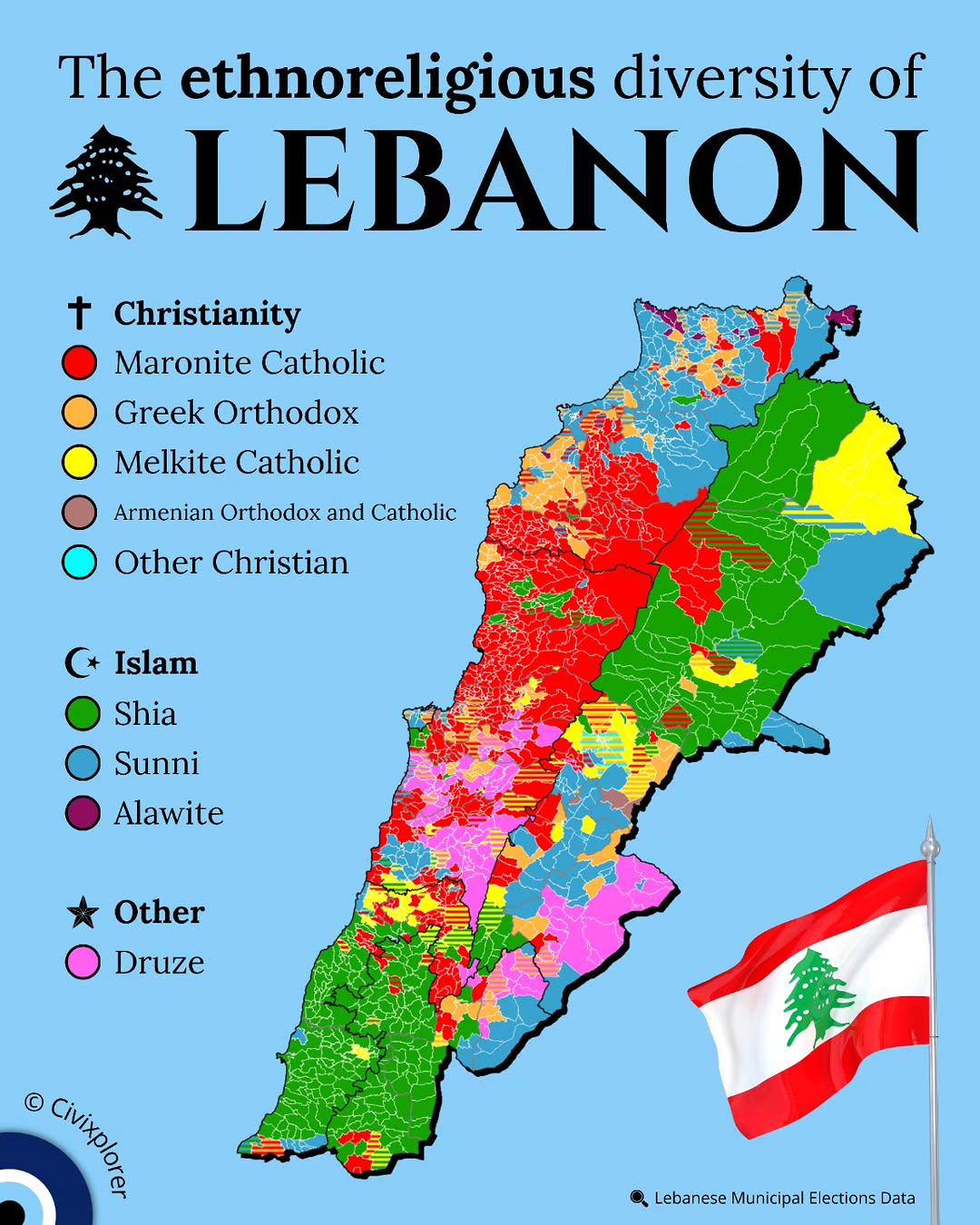
Ethnoreligious Diversity Map of Lebanon
This map illustrates the ethnoreligious diversity of Lebanon, highlighting the various religious sects and ethnic groups...
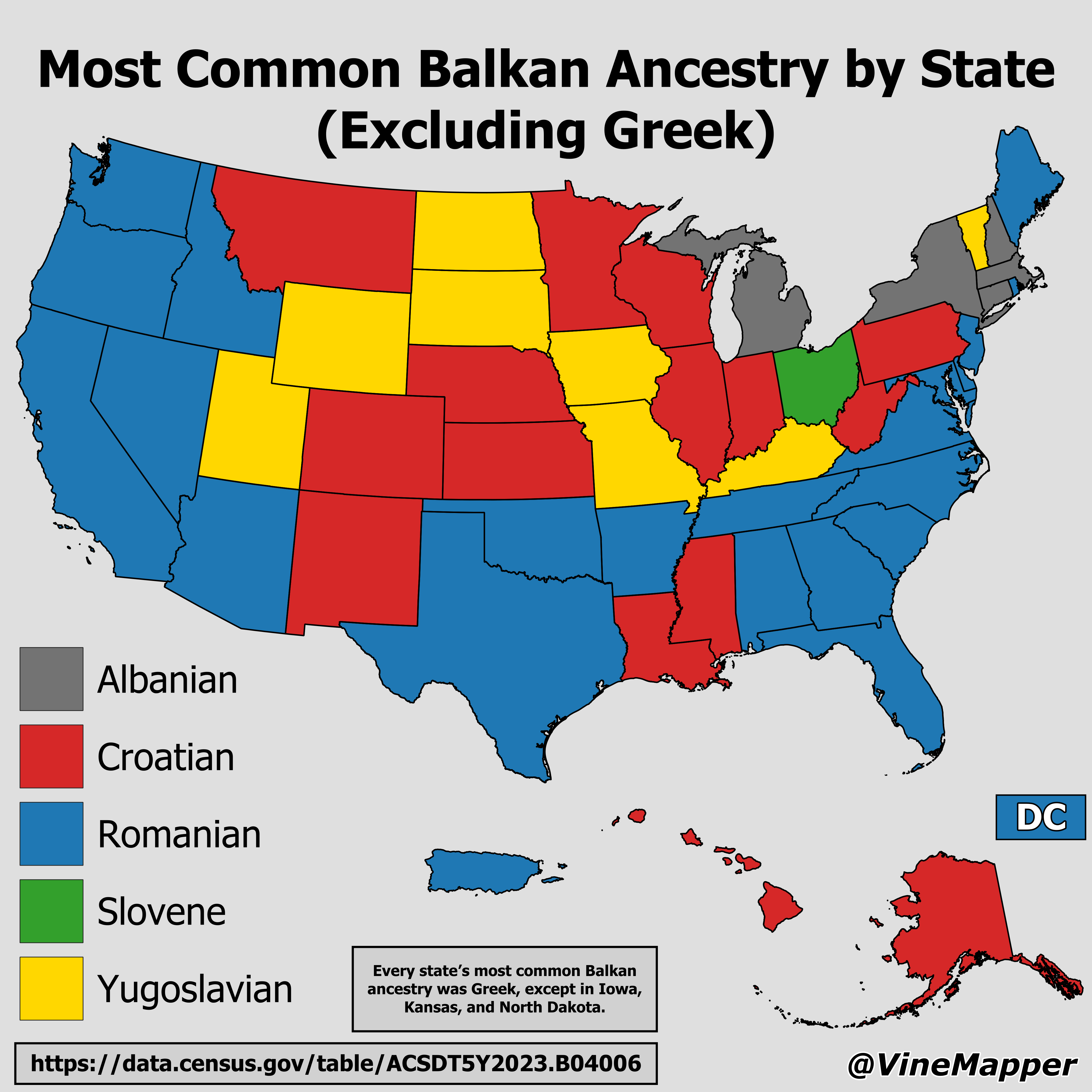
Most Common Balkan Ancestry by State Map
...
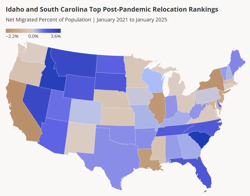
Net Migration Percent of US State Population Map
...
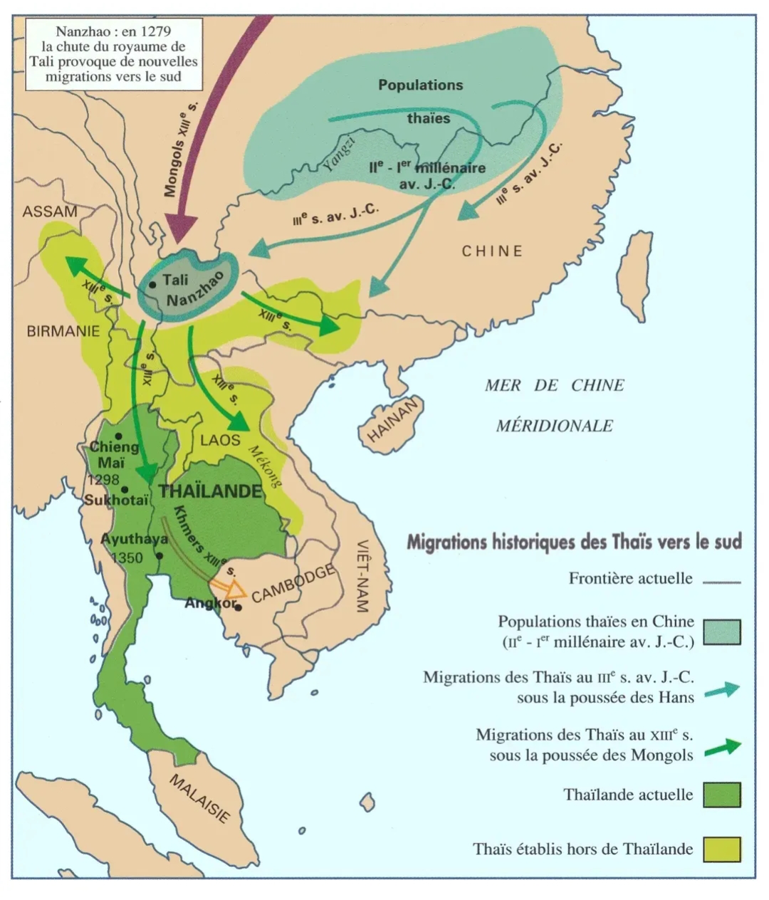
Migration of Thai People to the South Map
This map illustrates the migration patterns of the Thai people towards the southern regions of Thailand. It highlights k...
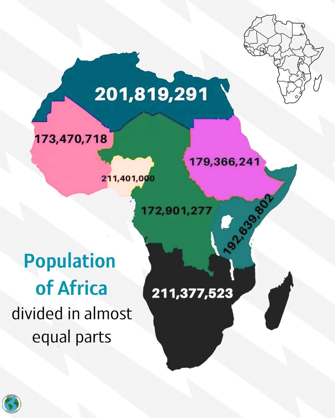
Population Distribution Map of Africa
The visualization titled \...
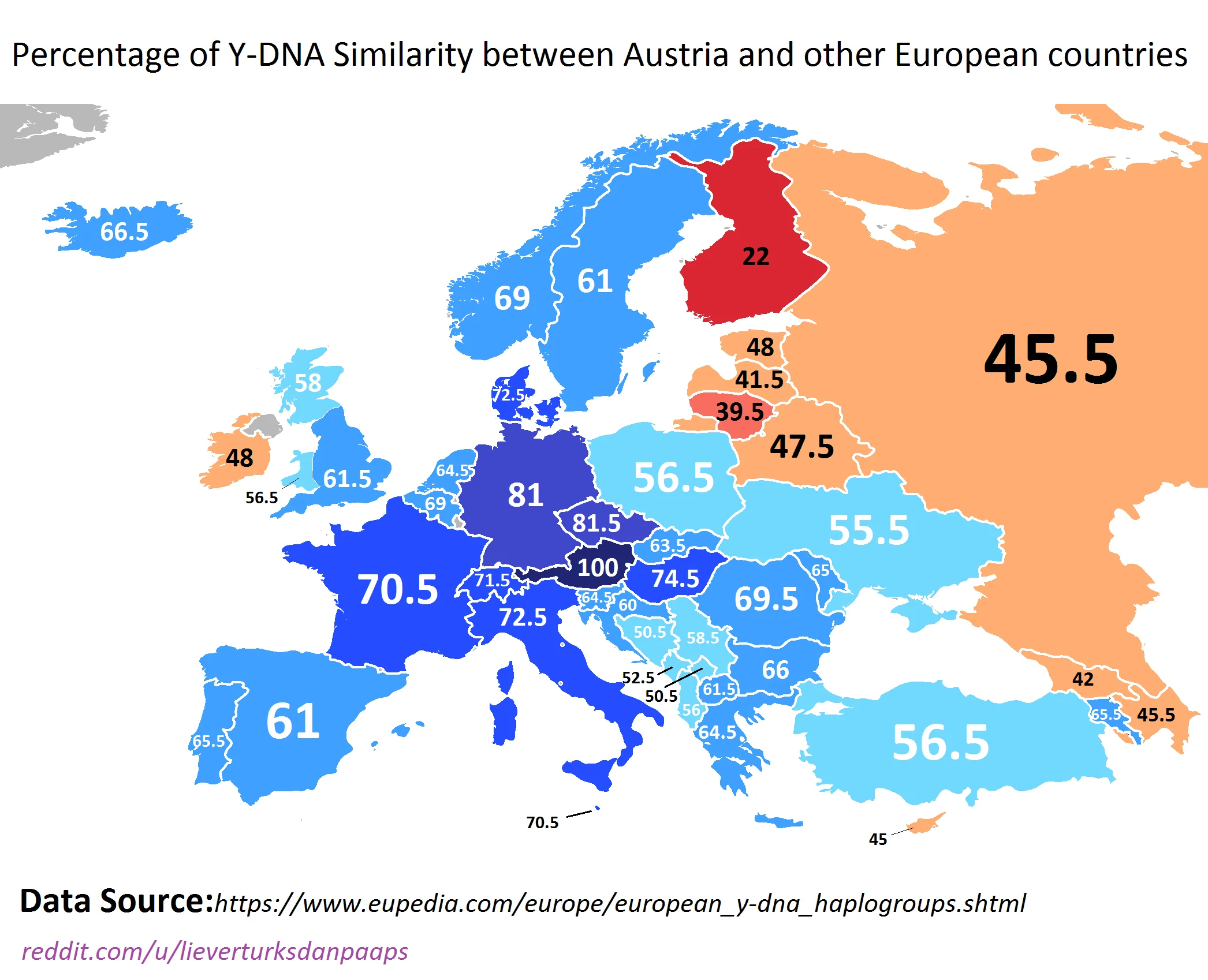
Y-DNA Similarity Map of Austria and Europe
The visualization titled "Percentage of Y-DNA Similarity between Austria and other European countries" illustrates the g...

Most Common Nationality of Foreigners in Europe Map
This map illustrates the most common nationality of foreigners residing in various European countries. Each country is c...
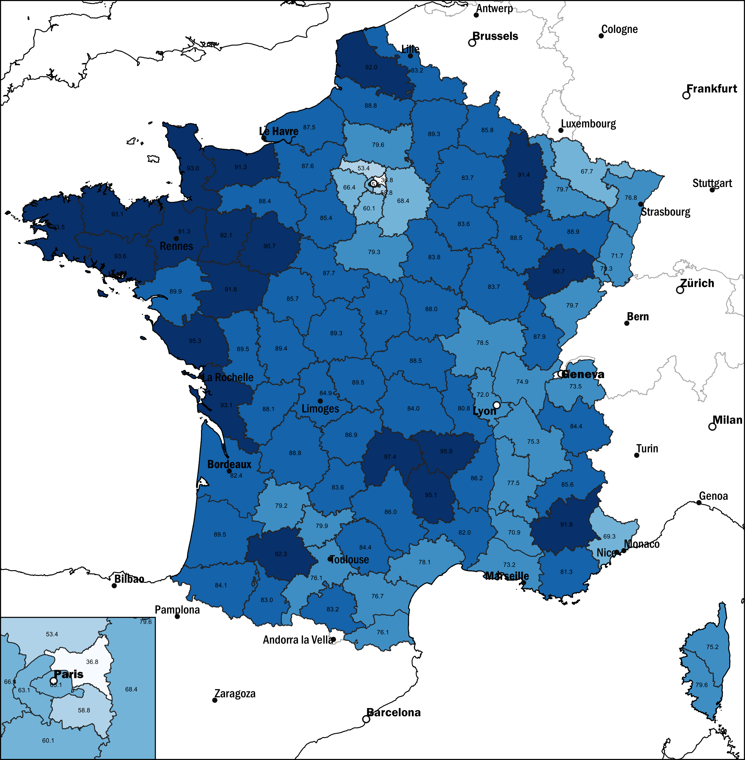
Map of French Population Without Migration Background, 2021
This map displays the percentage of the French population without a migration background as of 2021. It highlights the d...
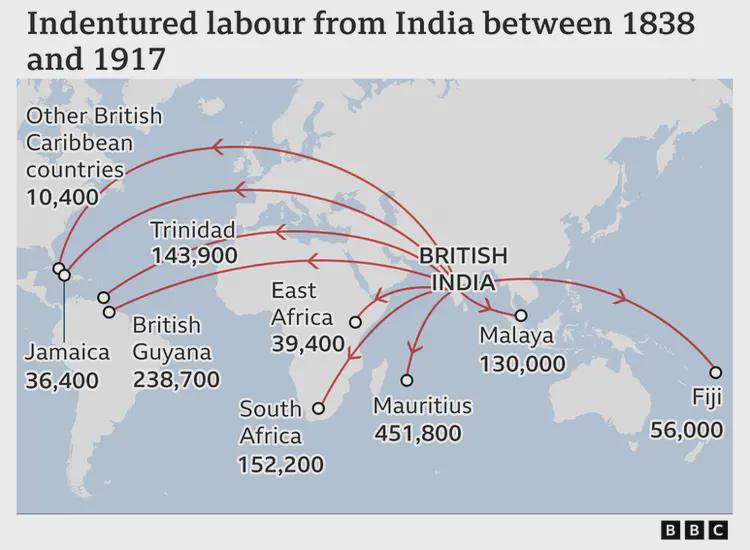
Indian Indentured Labor Map 1838–1917
This map showcases the complex and often harrowing journey of Indian indentured laborers under British rule from 1838 to...
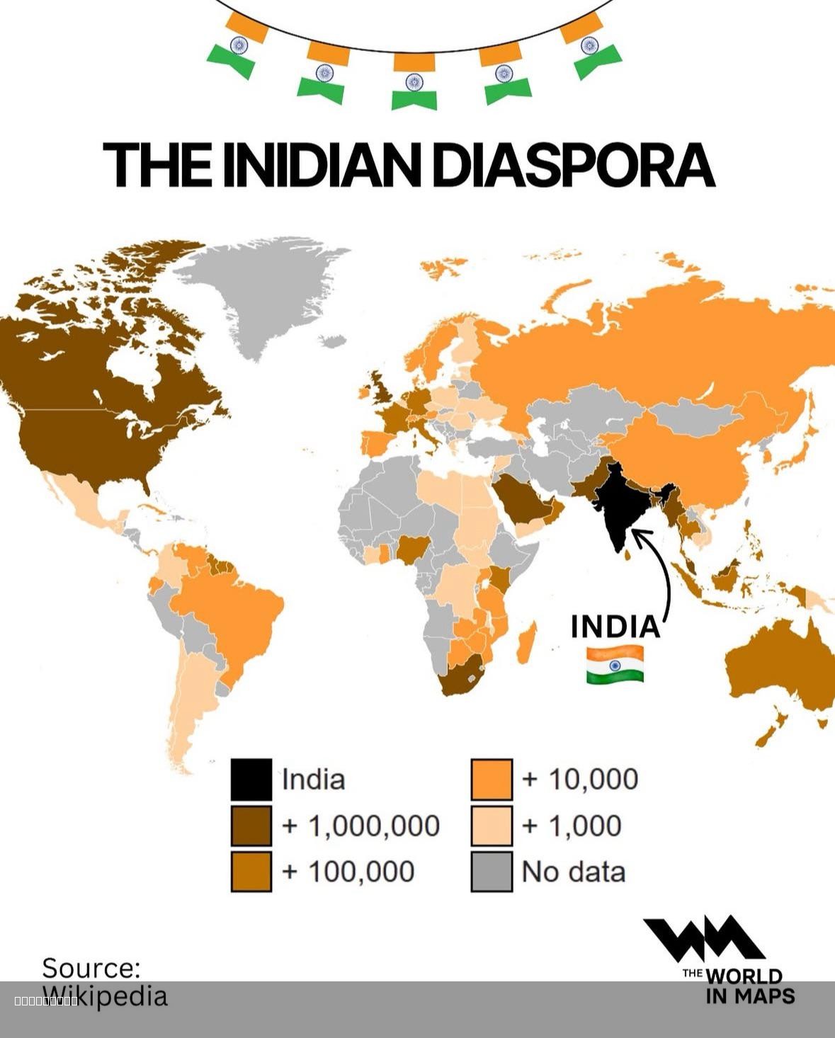
Indian Diaspora Population Distribution Map
The \...
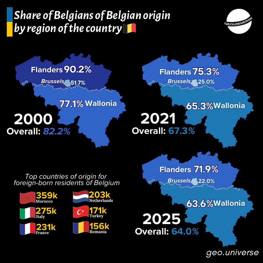
Belgium's Changing Demographics Over Time Map
The "Belgium's Changing Demographics Over Time Map" presents a detailed visualization of the shifts in population distri...
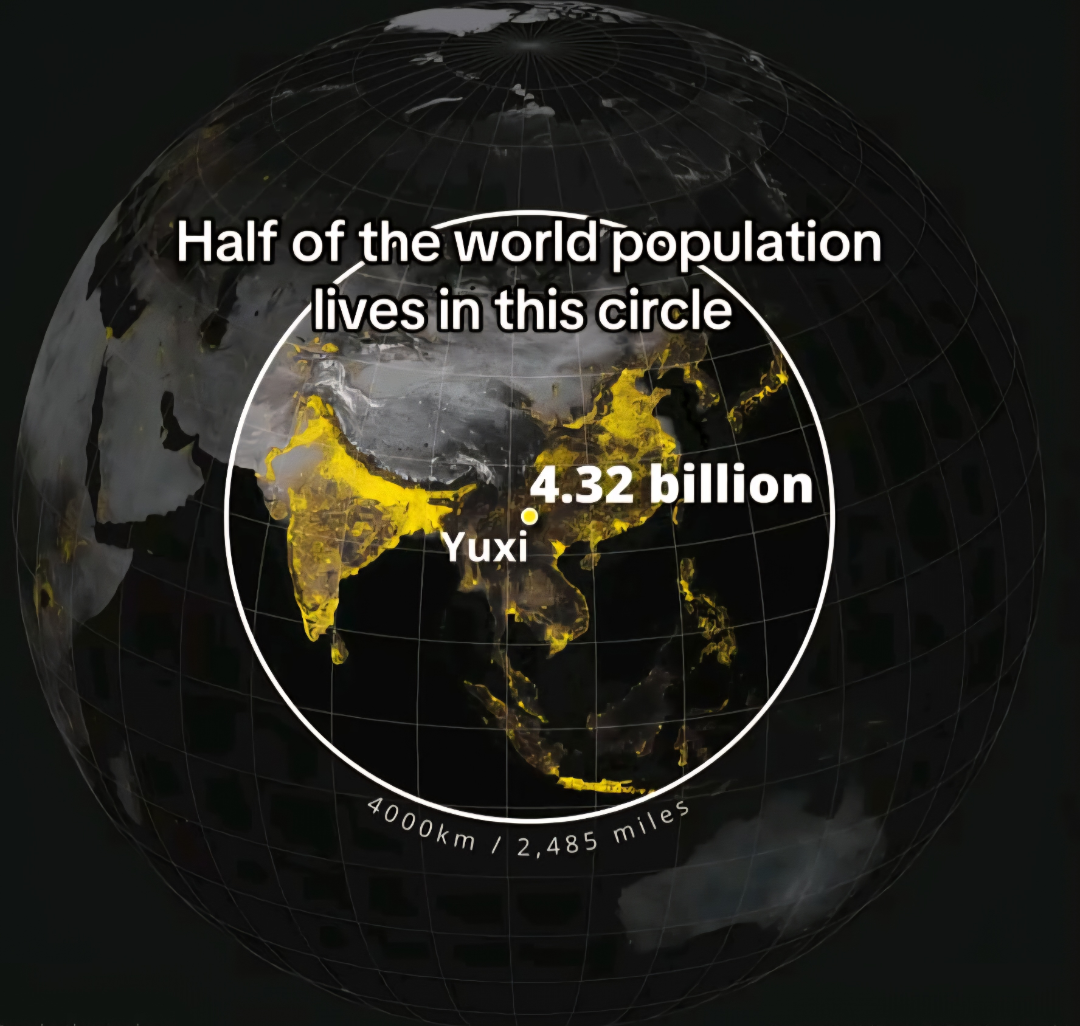
Population Distribution Map of the World
The \...
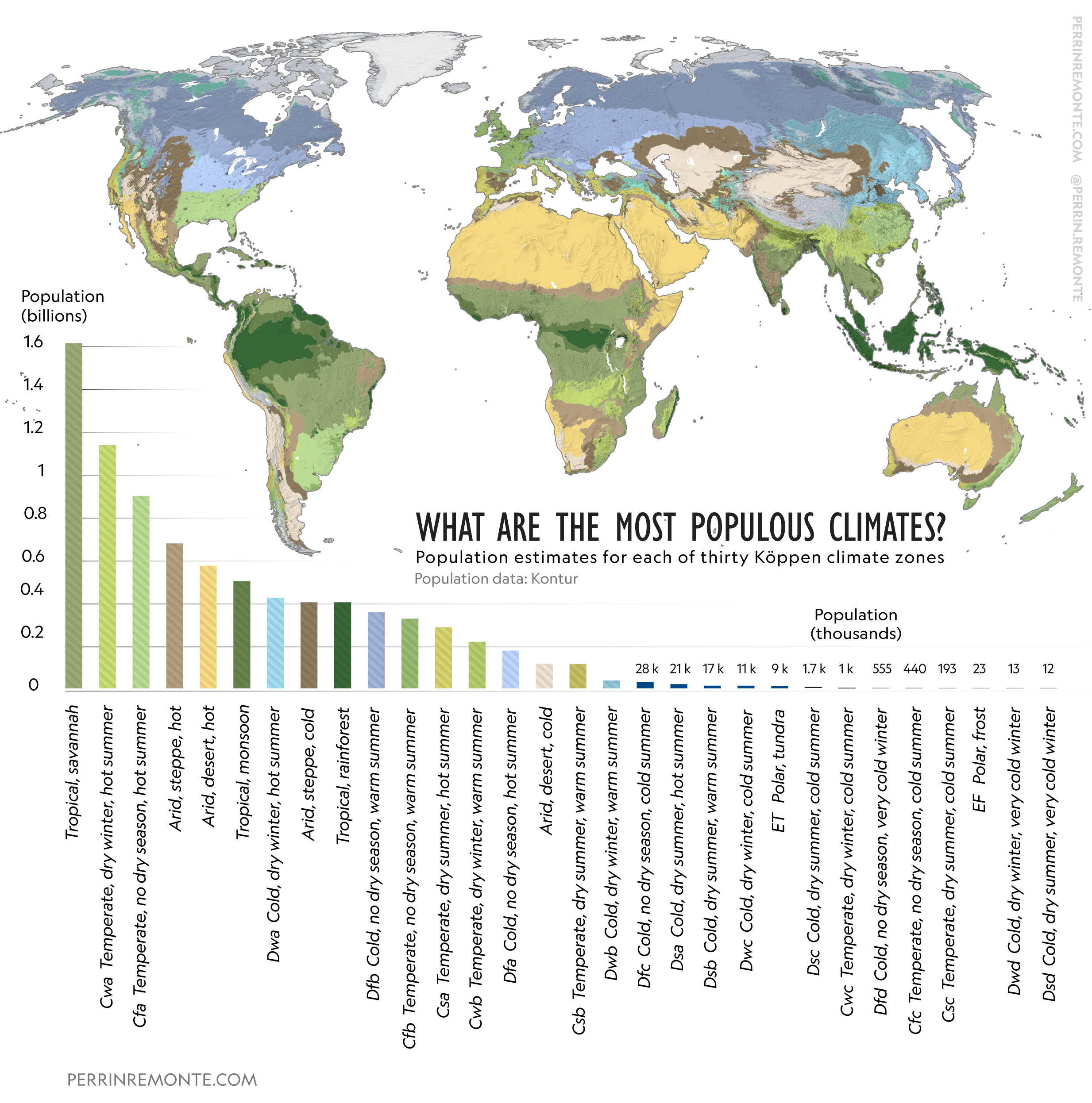
Map of Most Populous Climates
This visualization presents a fascinating overview of the world's most populous climates, illustrating how different cli...
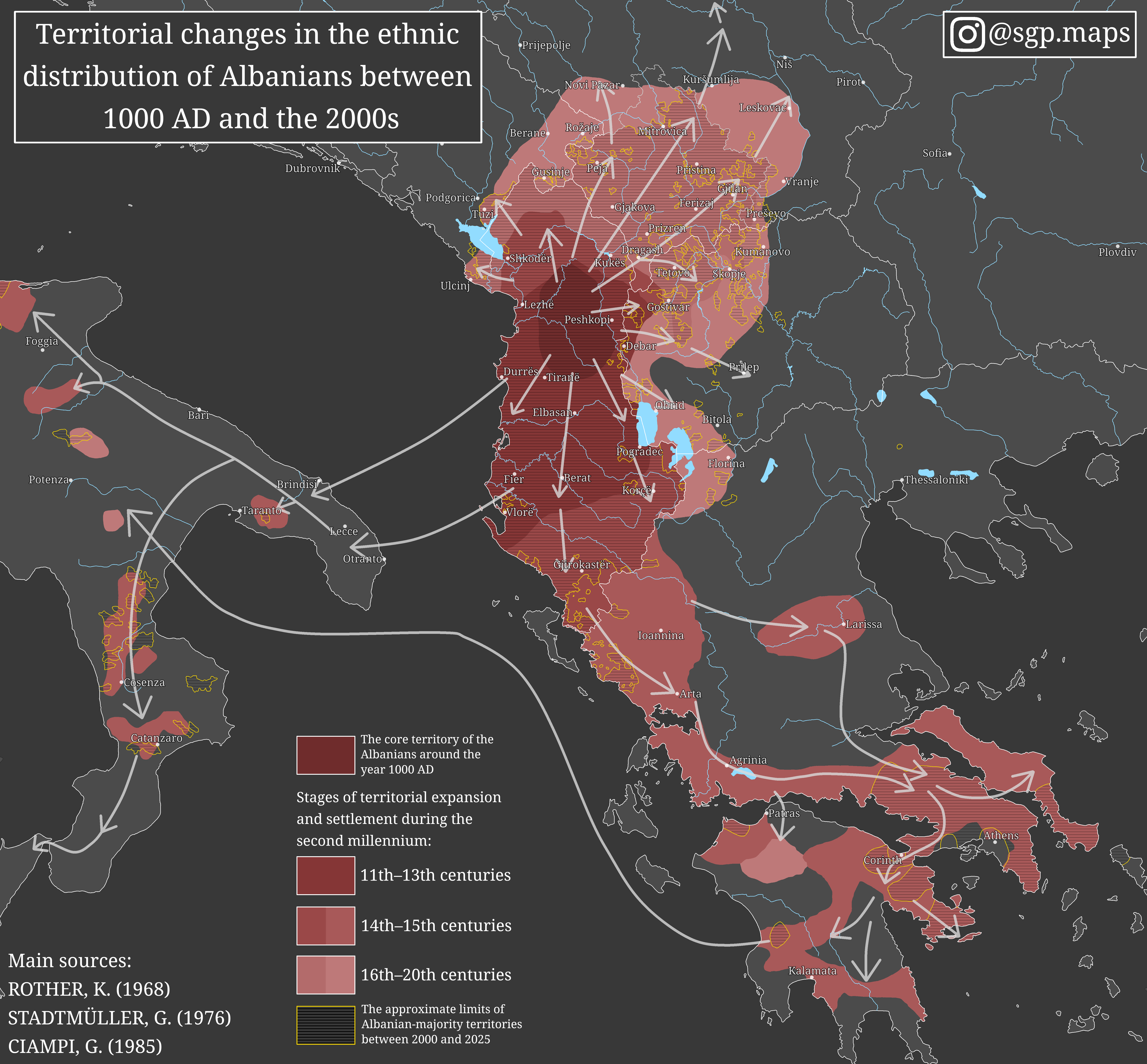
Ethnic Distribution Changes of Albanians Map
The map titled "Territorial changes in the ethnic distribution of Albanians between 1000 AD and the 2000s" provides an i...
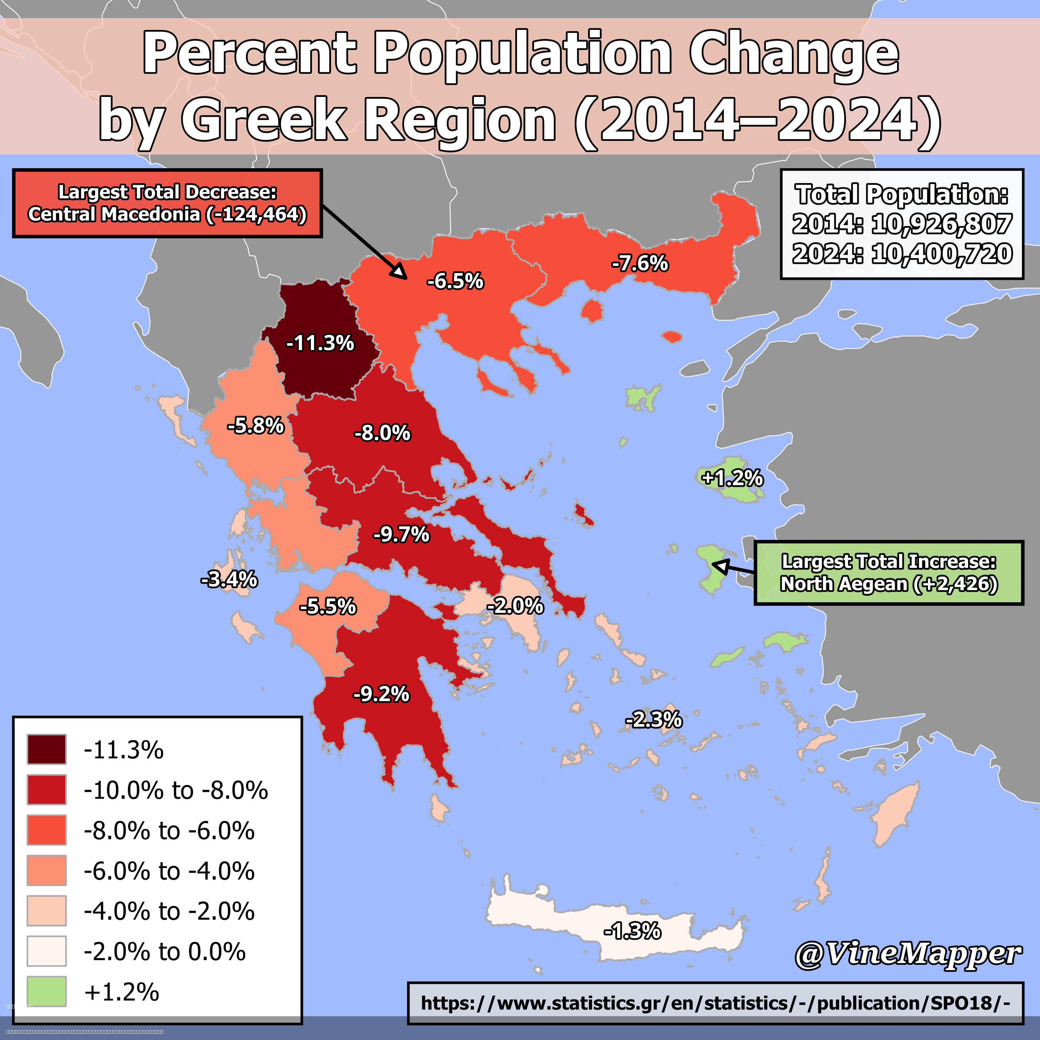
Percent Population Change by Greek Region Map
The "Percent Population Change By Greek Region (2014-2024)" map provides a clear visualization of how the population dyn...
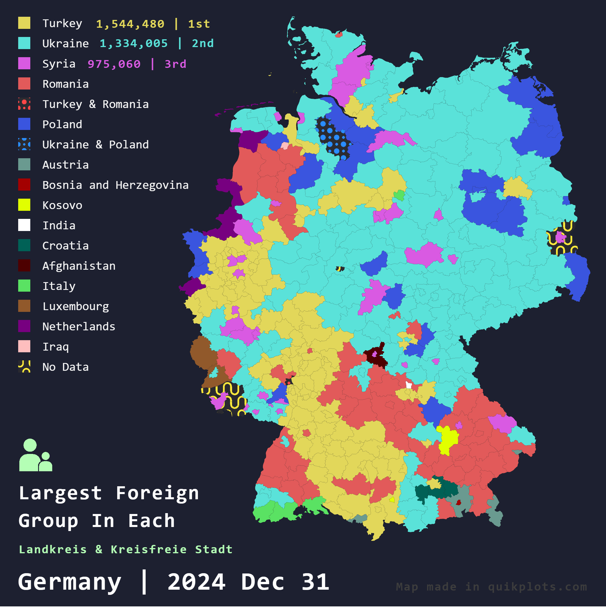
Largest Foreign Groups in Germany Map
The "Largest Foreign Groups in Germany Map" provides a comprehensive overview of the foreign population distribution acr...
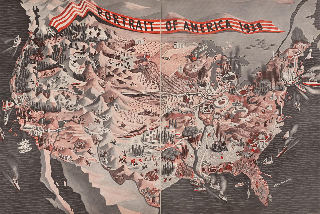
Demographics and Population Map of America 1939
The "Portrait of America (1939)" map provides a rich visual representation of the demographic landscape of the United St...
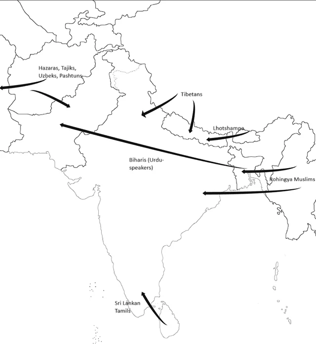
Ethnic Exodus Map of South Asia Post-1970
This map titled "South Asia’s Ethnic Exodus: Tracking Persecution-Triggered Migrations After 1970" visually represents t...
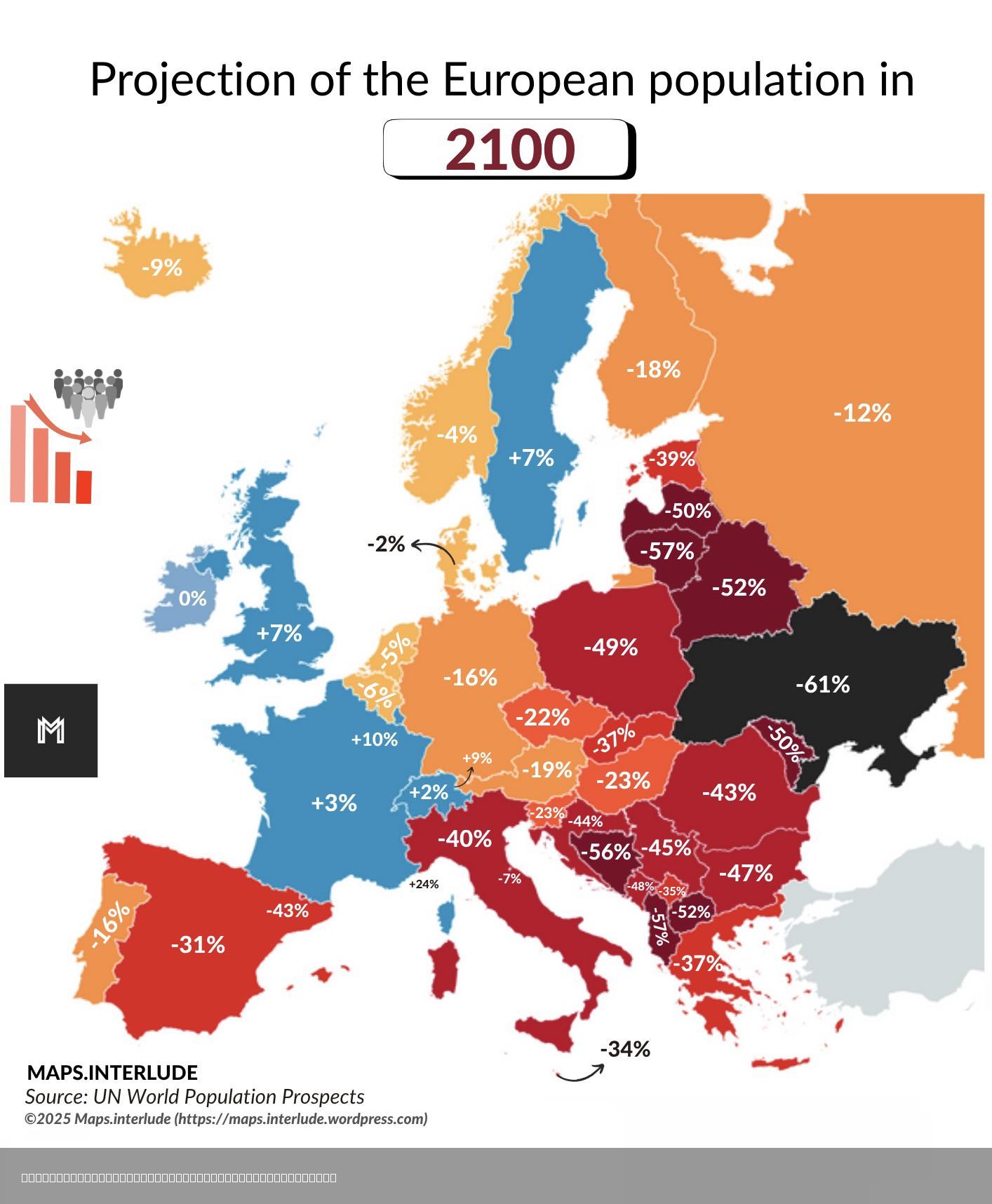
European Population Projection Map for 2100
...
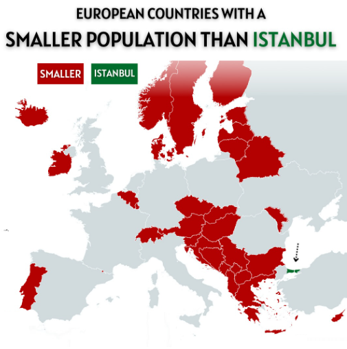
European Countries with Smaller Population than Istanbul Map
The visualization titled "European Countries with a Smaller Population than Istanbul" presents a striking comparison bet...
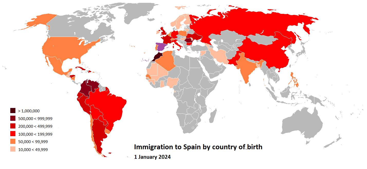
Map of Migrants in Spain by Country 2024
The "Map of Migrants in Spain by Country, 2024" provides a comprehensive overview of the diverse origins of migrants res...
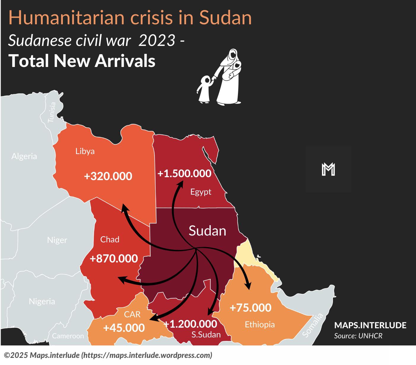
Map of New Arrivals After Civil War in Sudan
...
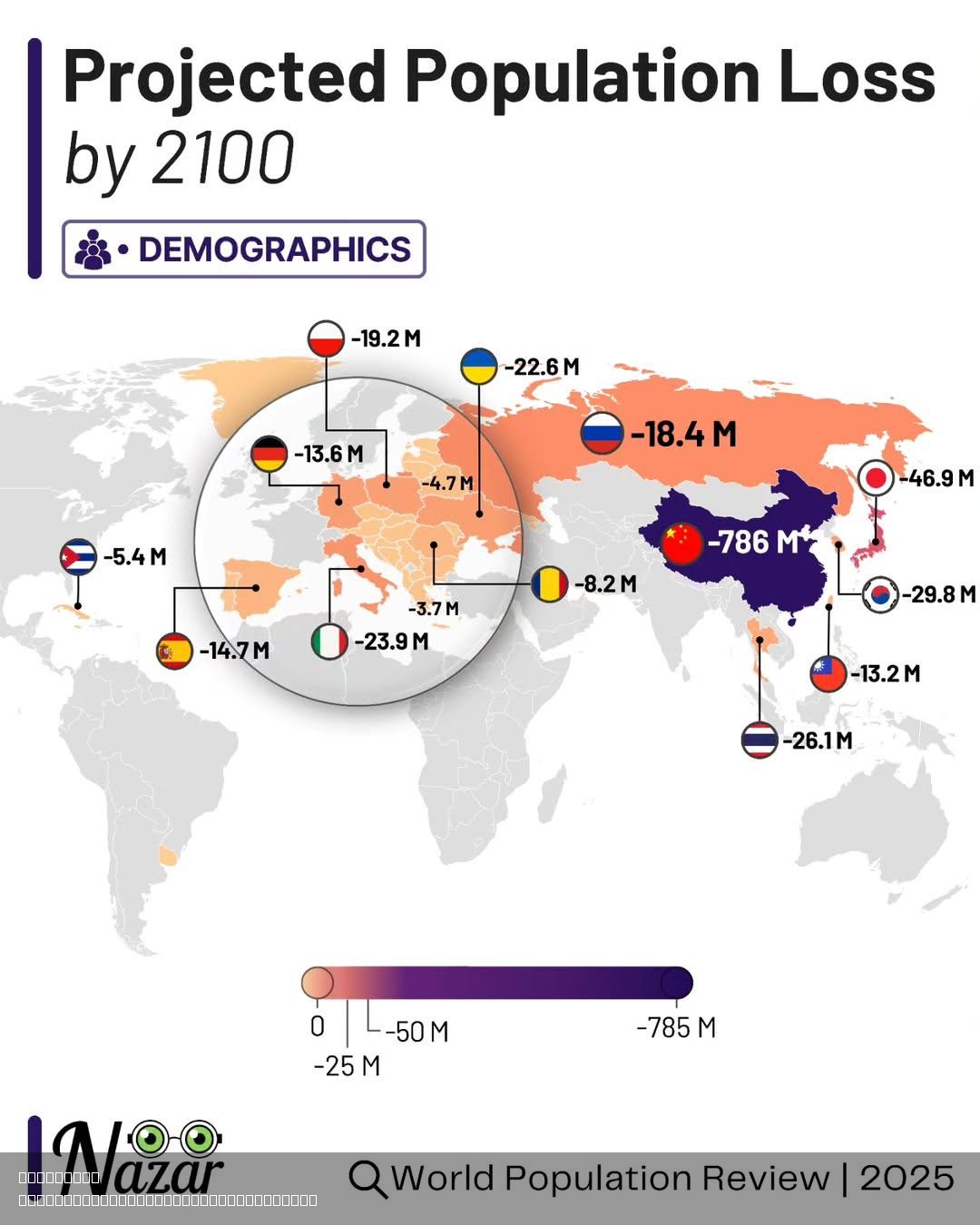
Projected Population Loss by 2100 Map
The "Projected Population Loss by 2100" map provides a visual representation of anticipated demographic changes across t...
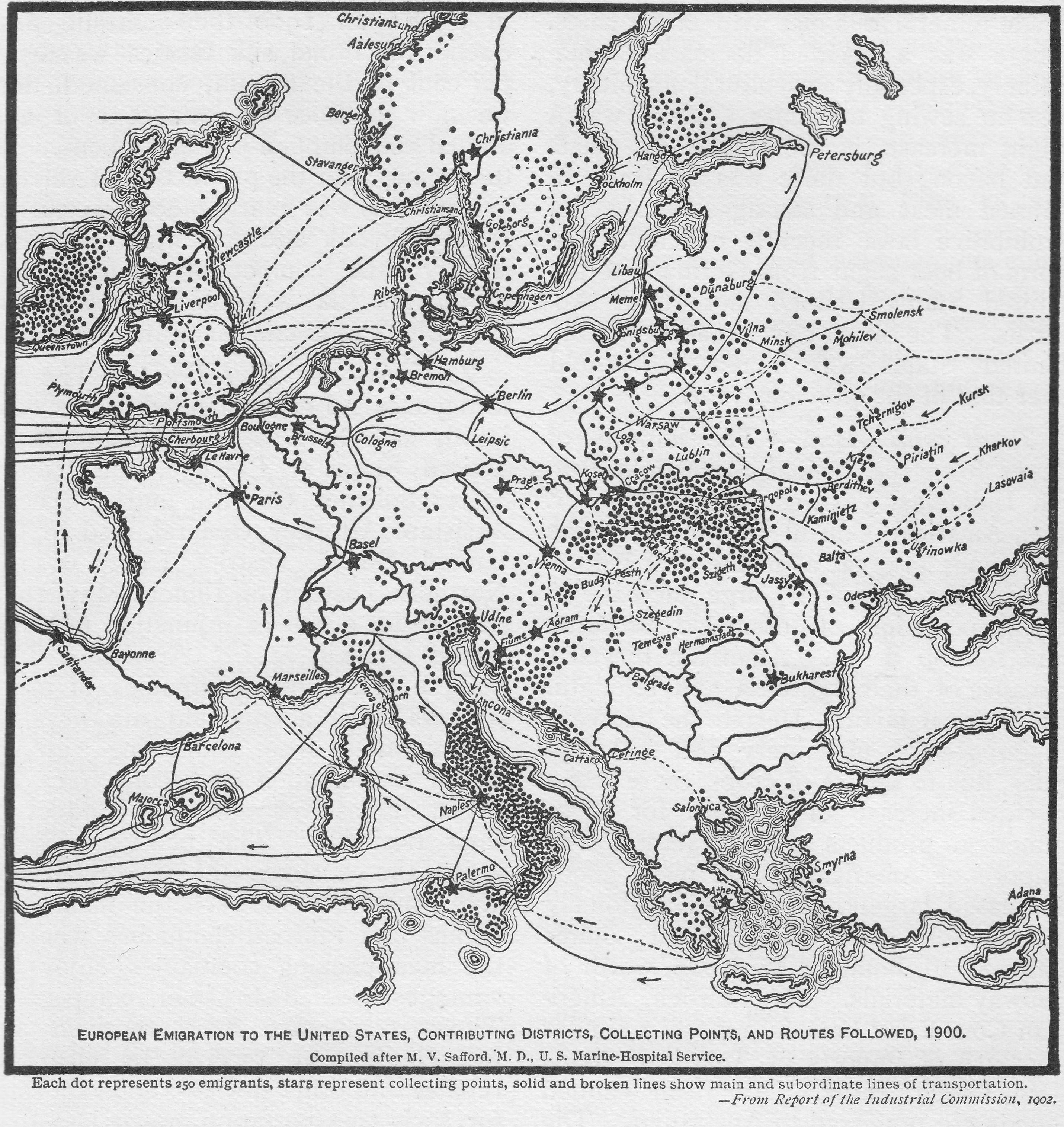
European Emigration to the USA Map
The map titled "European Emigration to the USA, 1900" provides a visual representation of the migration patterns from va...
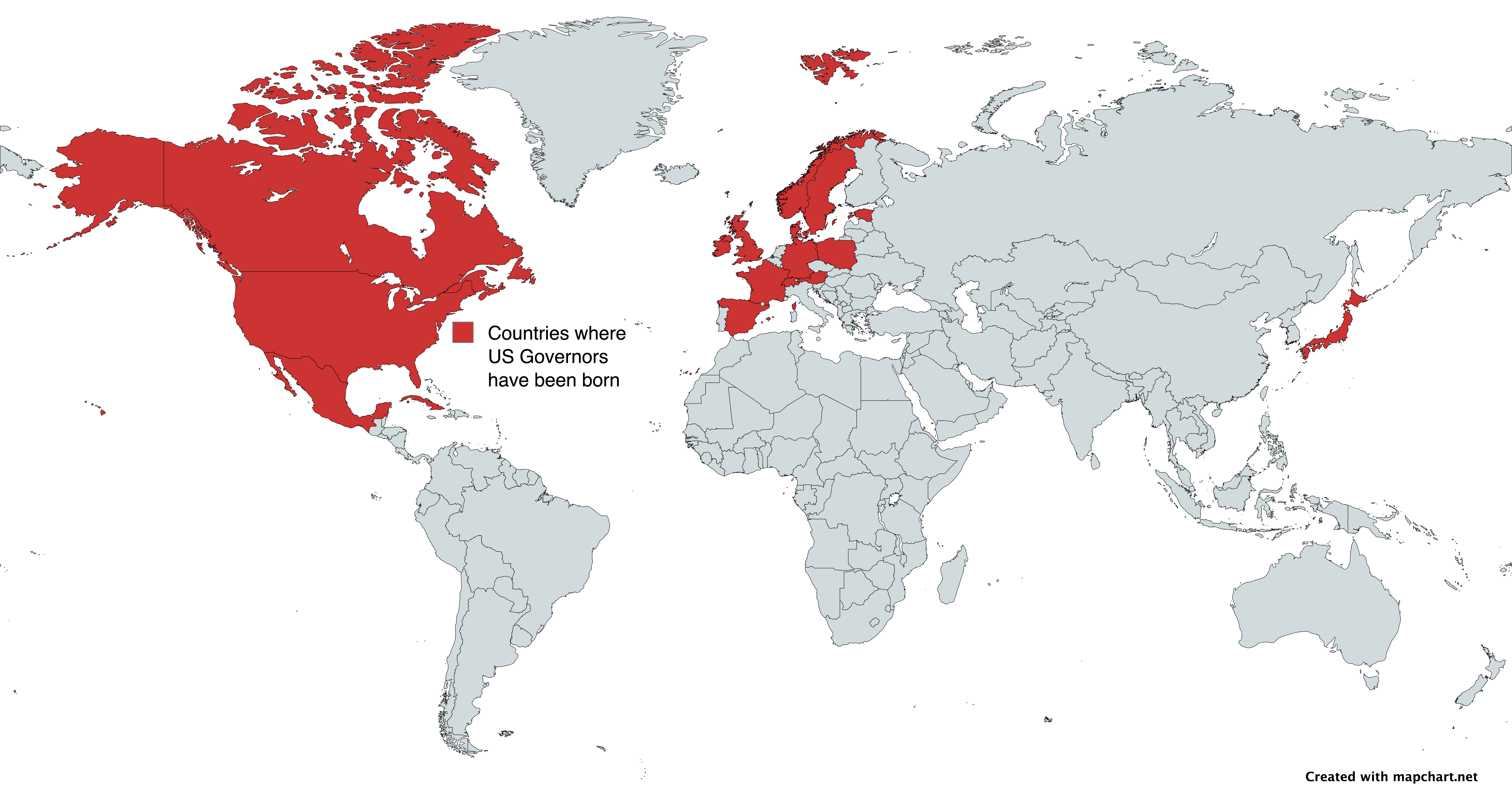
Map of Countries Where USA State Governors Were Born
This map vividly illustrates the countries of birth for state governors in the United States, offering a unique perspect...
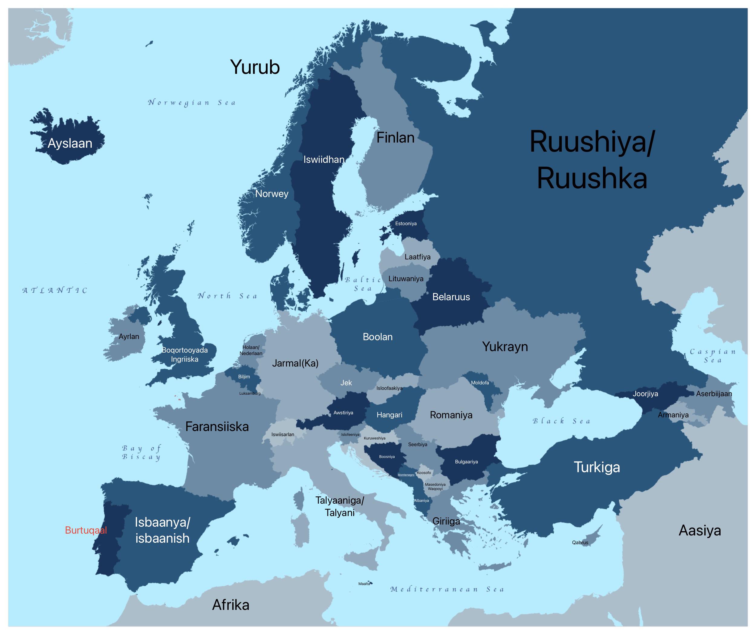
European Countries in AfSomali Map
The "European Countries in AfSomali Map" is an intriguing visualization that presents the names of European nations tran...
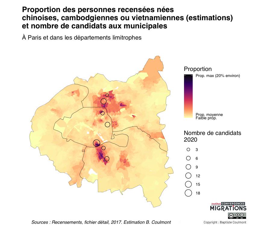
Map of Chinese, Vietnamese, and Cambodian Birthplaces in Paris
This map illustrates the percentage of people born in China, Vietnam, or Cambodia across Paris and its surrounding subur...
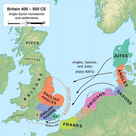
Anglo-Saxon Migration and Settlement Map
Interestingly, the Anglo-Saxons did not migrate as a single wave; instead, they arrived in several groups and settled in...