weather patterns Maps
13 geographic visualizations tagged with "weather patterns"
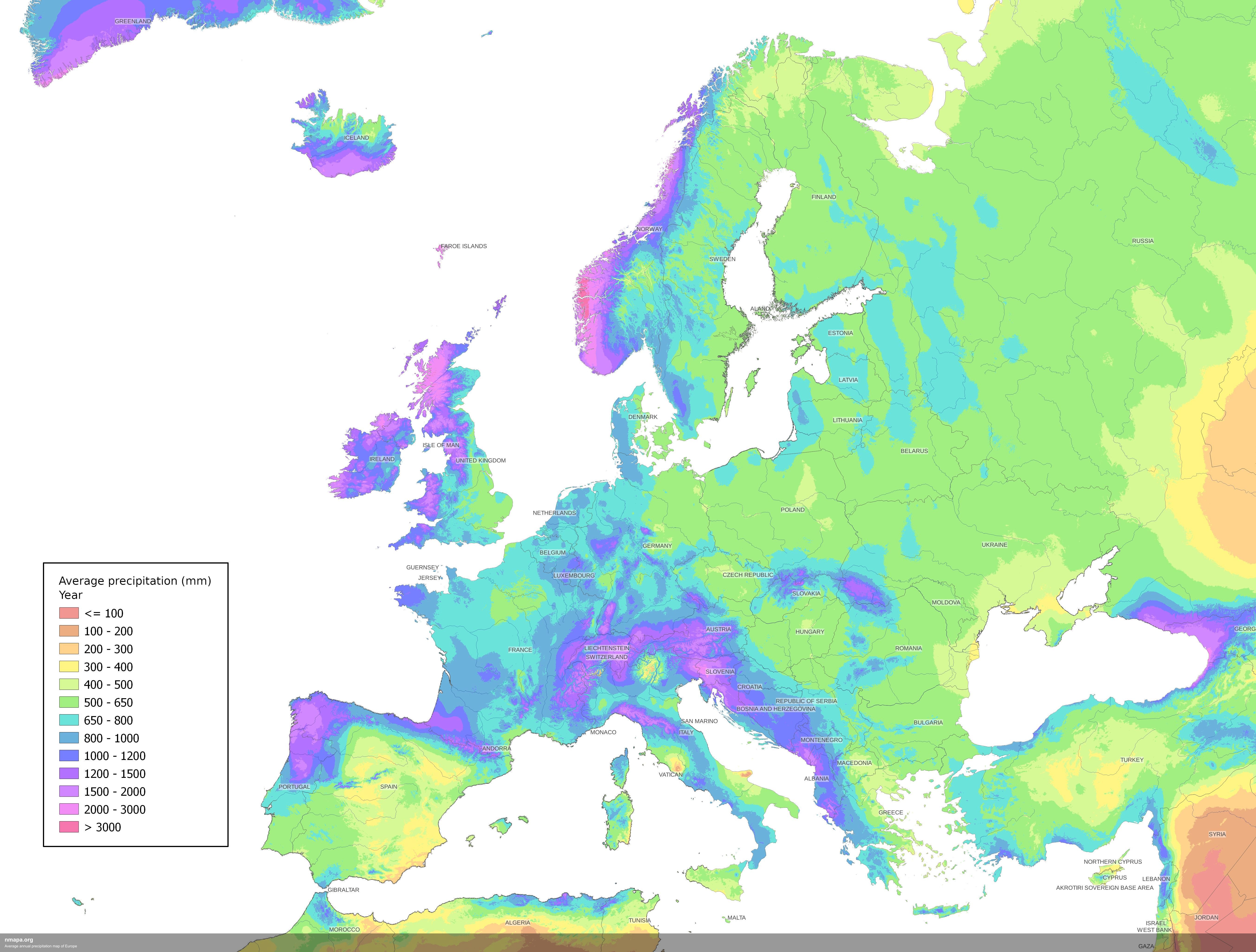
Average Annual Precipitation Map of Europe
The Average Annual Precipitation Map of Europe offers a detailed visualization of rainfall patterns across the continent...
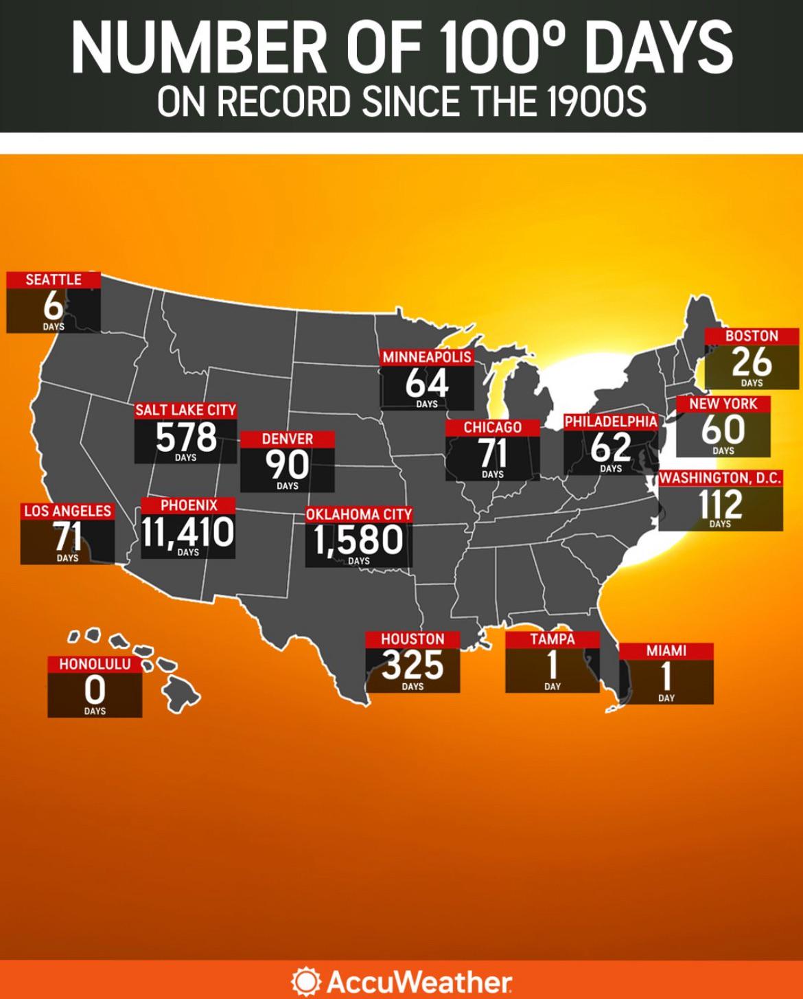
Map of 100° Days Recorded Since 1900
The map titled 'Number of 100° Days on Record Since the 1900s' visually represents the frequency of extreme heat days ac...
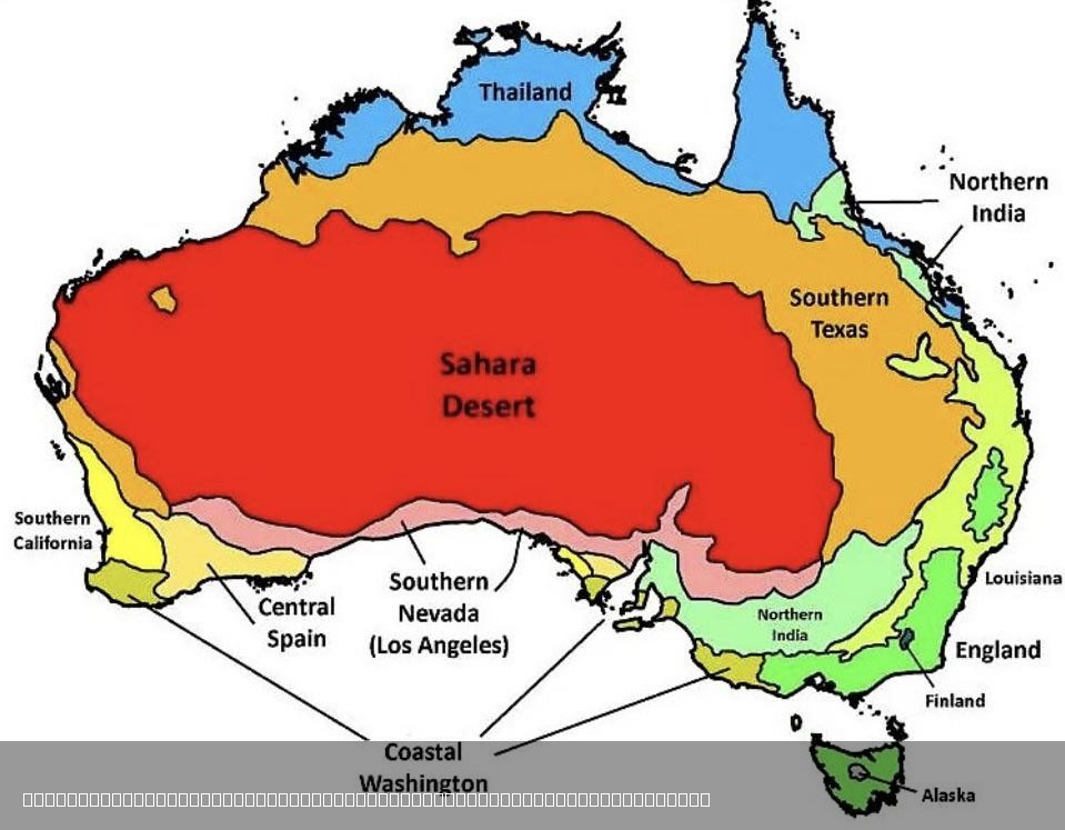
Climate Comparison Map of Australia and the World
The visualization titled "The Climate in Australia Compared to Other Places in the World" presents a comprehensive overv...
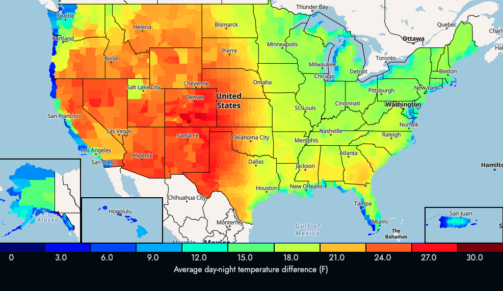
US Average Day-Night Temperature Change Map
The visualization titled "US Average Day-Night Temperature Change in F" illustrates the differences between daytime and ...
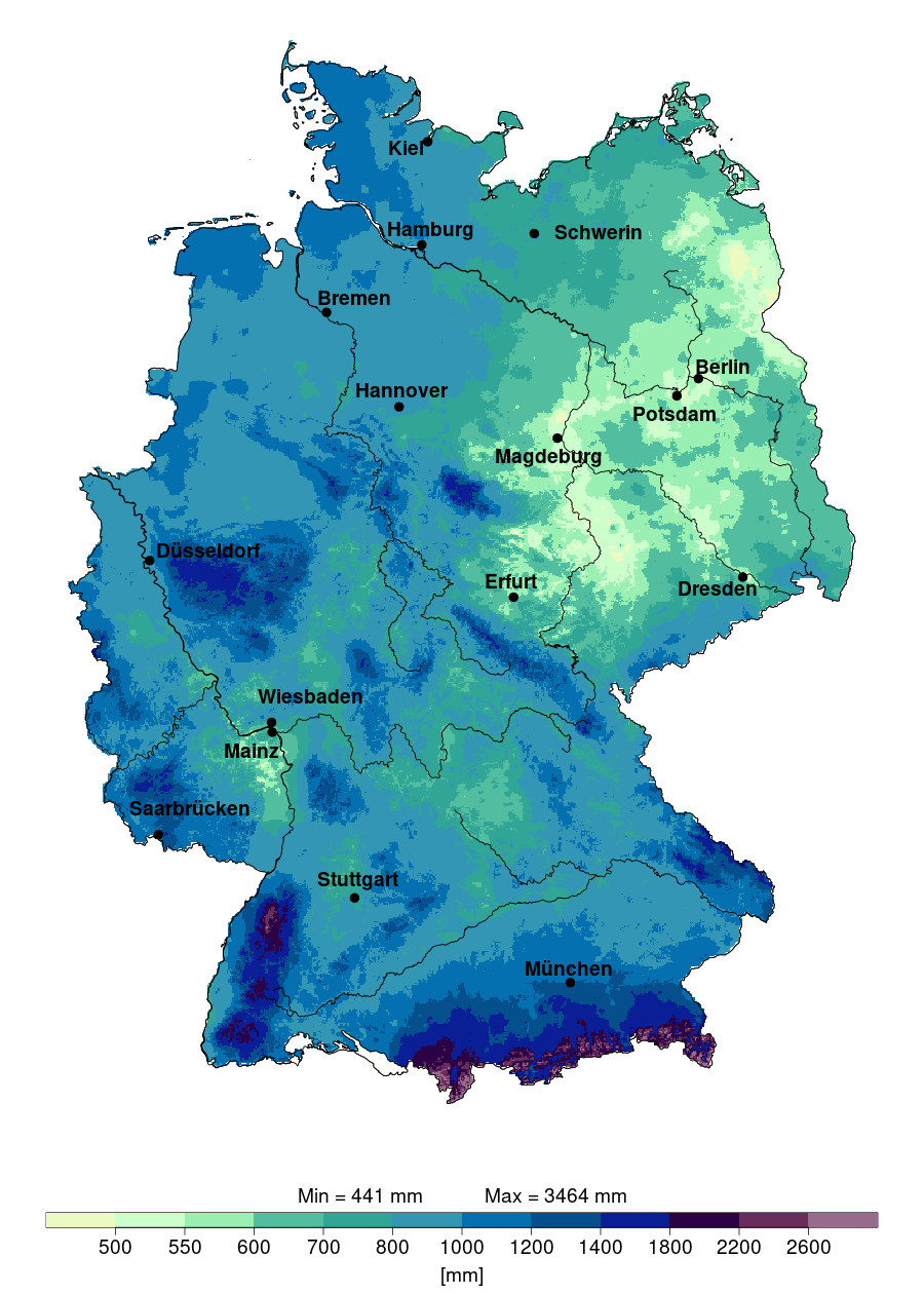
Annual Precipitation Map of Germany 2024
The "Annual Precipitation in Germany in 2024" map provides a detailed visualization of the expected rainfall distributio...
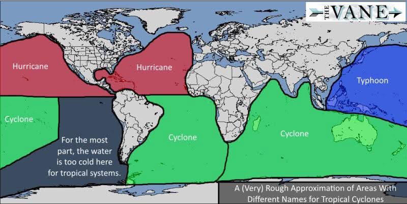
Tropical Cyclone Naming Map Around the World
This map illustrates how tropical cyclones are named around the globe, highlighting the diverse systems and conventions ...
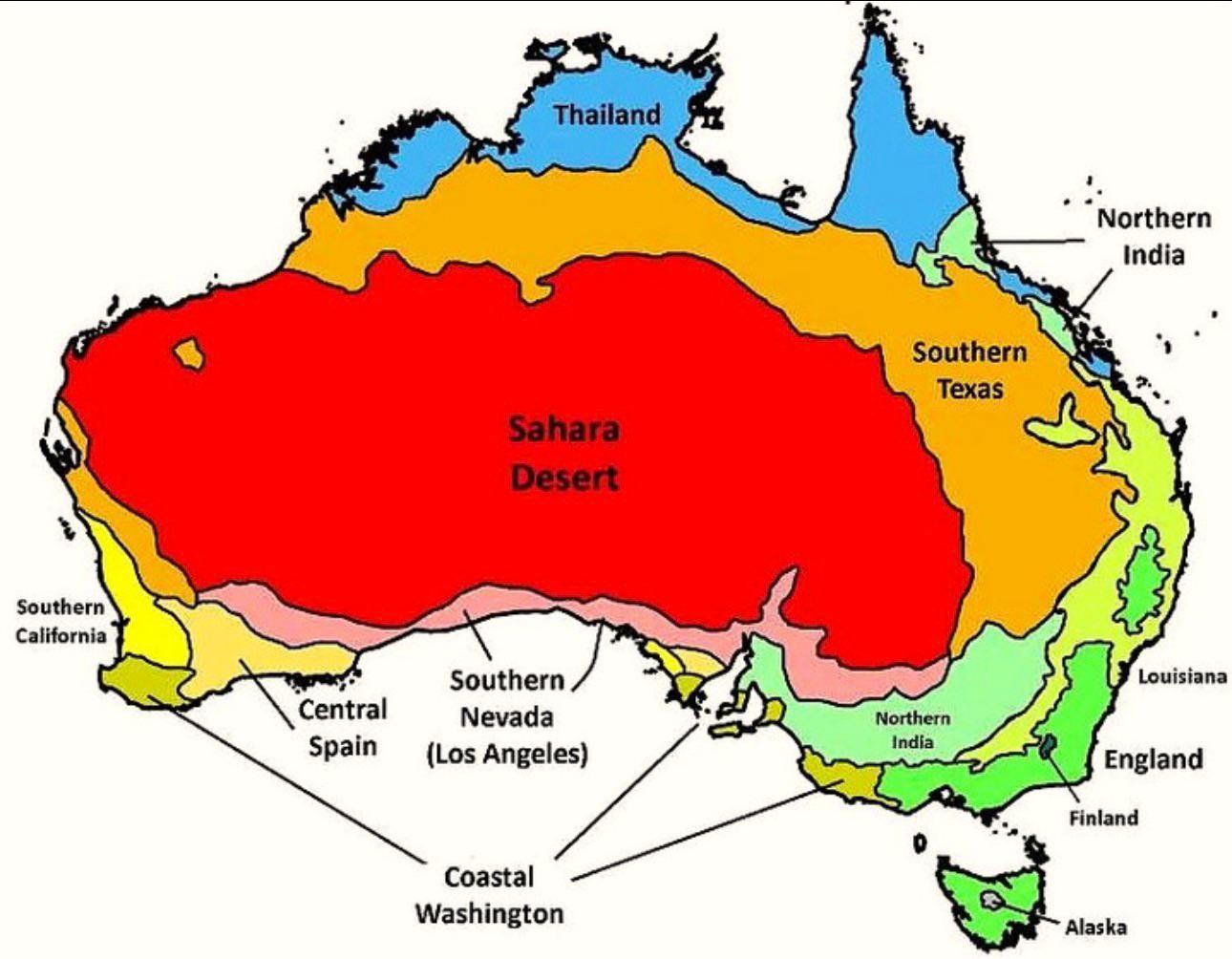
Australia’s Climate Compared to Other Countries Map
The map titled "Australia’s Climate Compared to Other Countries" provides a detailed look at how Australia's climate sta...

Climate Zones Map of the World
This climate zones map of the world provides a visual representation of the various climate classifications across diffe...
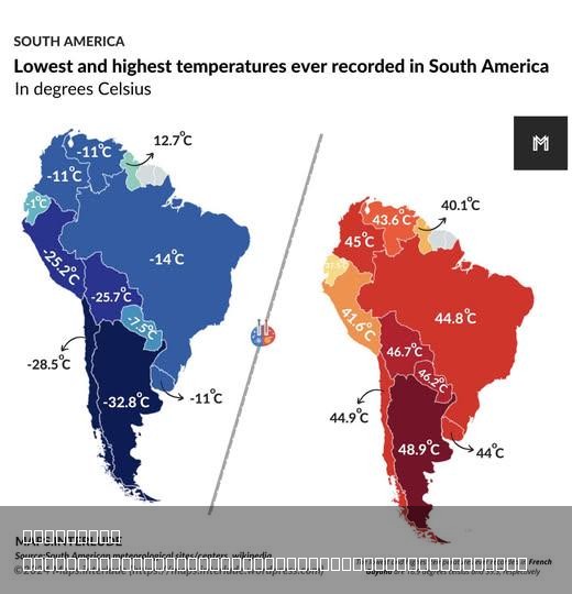
Highest & Lowest Temperatures Ever Recorded in South America Map
The visualization titled "Highest & Lowest Temperatures Ever Recorded in South America" showcases the extreme temperatur...
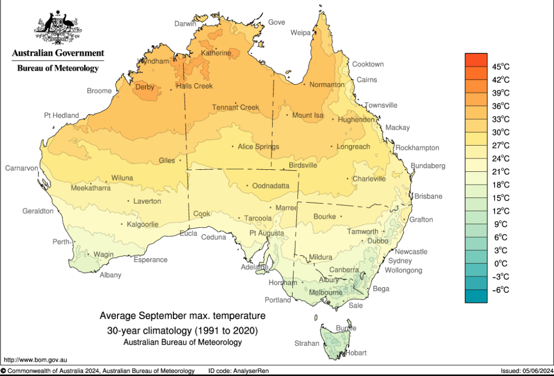
Average Maximum September Temperature Map of Australia
The "Average Maximum September Temperature in Australia" map provides a visual representation of the temperature variati...
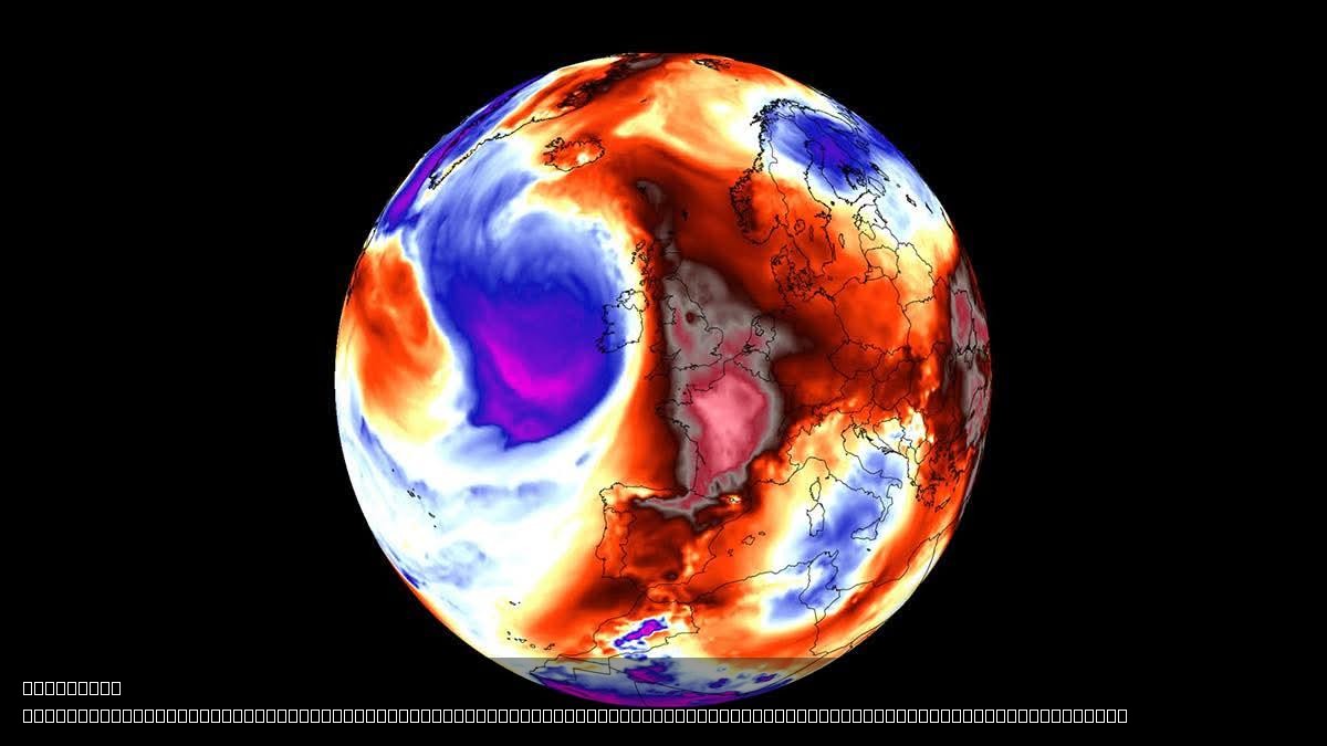
Heatwave Map of Europe 2023
This visualization presents a detailed map highlighting the regions of Europe currently affected by a significant heatwa...
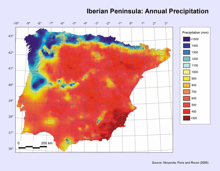
Rainfall Distribution Map of Spain
The visualization titled "The rain in Spain falls mainly on the...mountainous north coast" provides a detailed look at t...
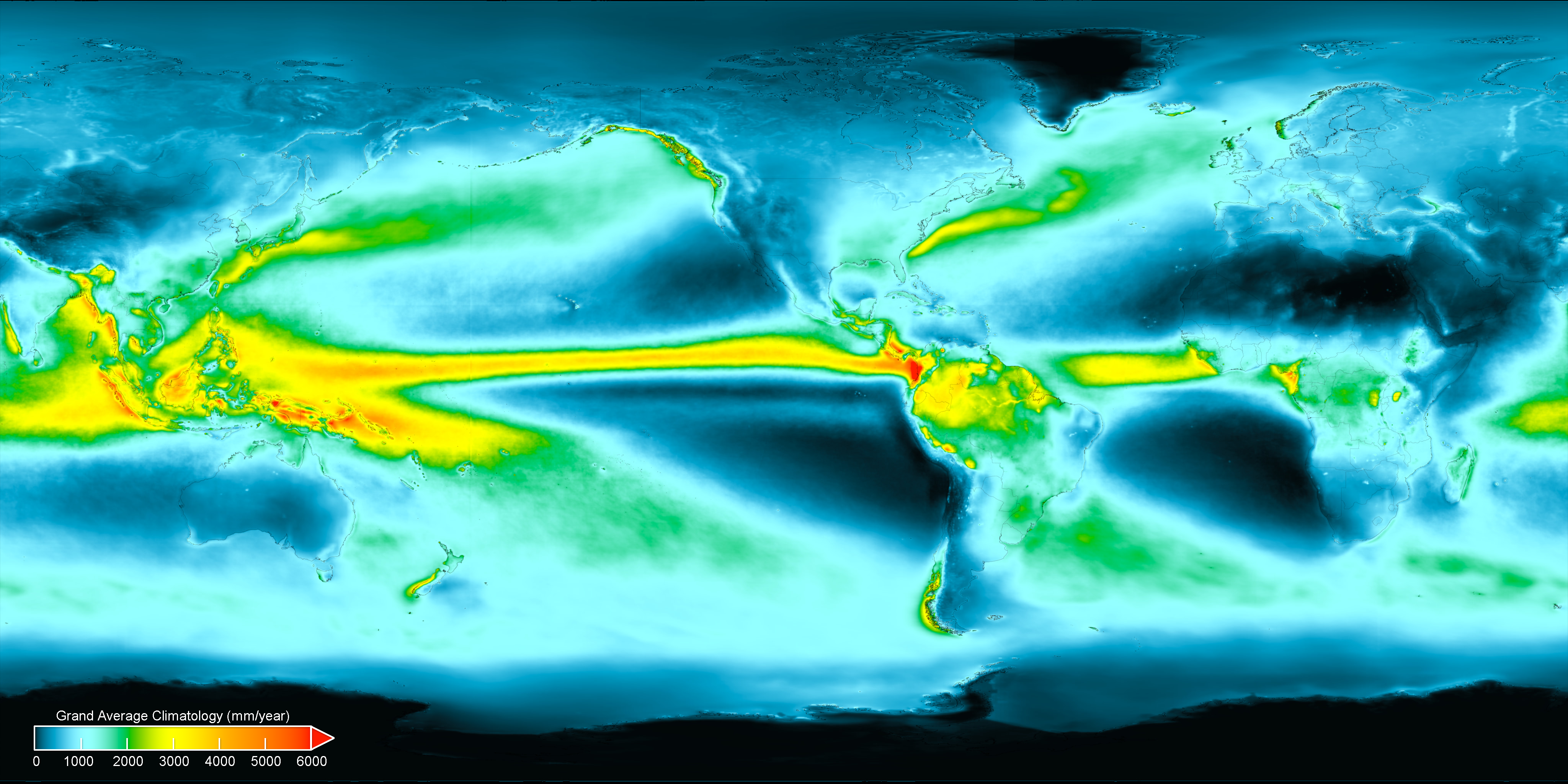
Average Annual Precipitation World Map
Interestingly, precipitation can be categorized into two main types: rain and snow. In warmer climates, rain is the prim...