transportation Maps
71 geographic visualizations tagged with "transportation"
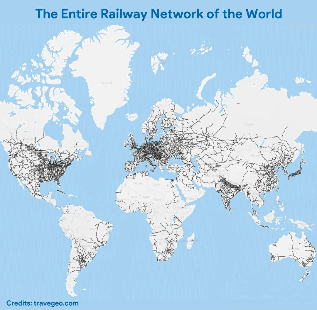
World Railway Network Map
The visualization titled "The Entire Railway Network of the World" offers a comprehensive look at the vast and intricate...
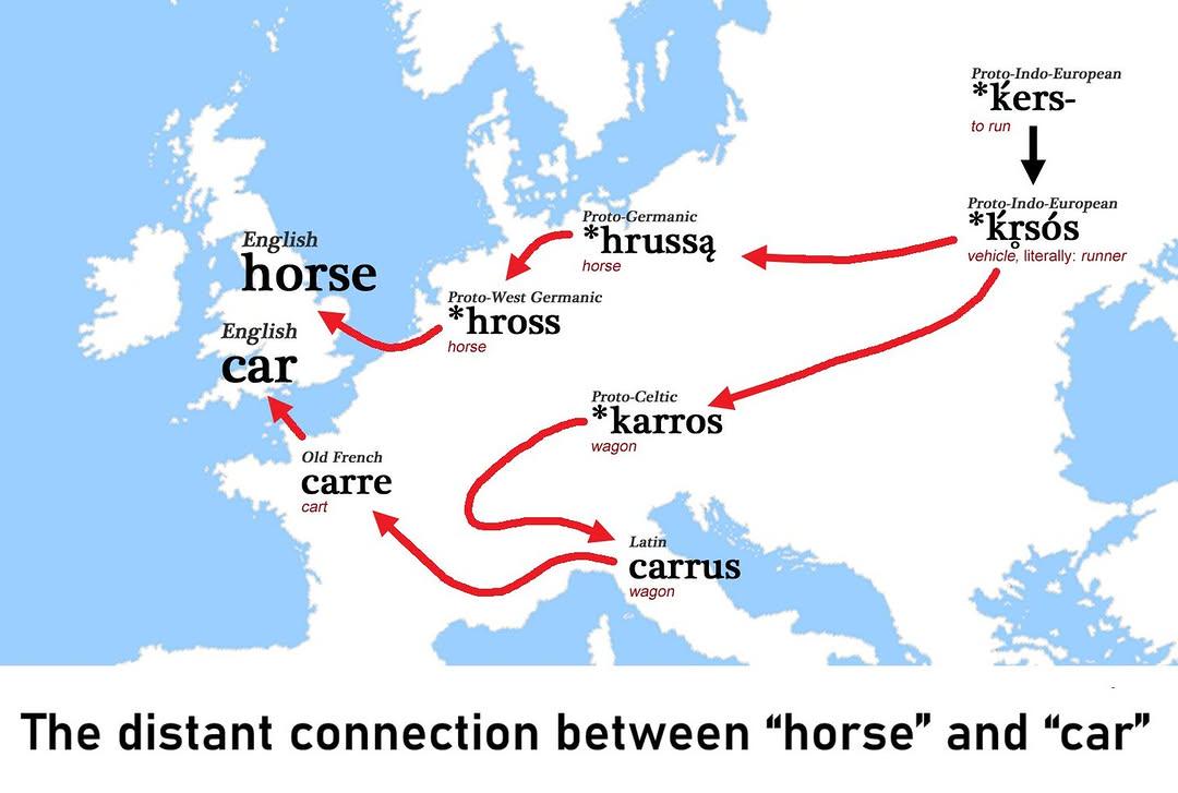
Etymology Map of Horse and Car
This visualization illustrates the linguistic connections between the words "horse" and "car," showcasing their distant ...
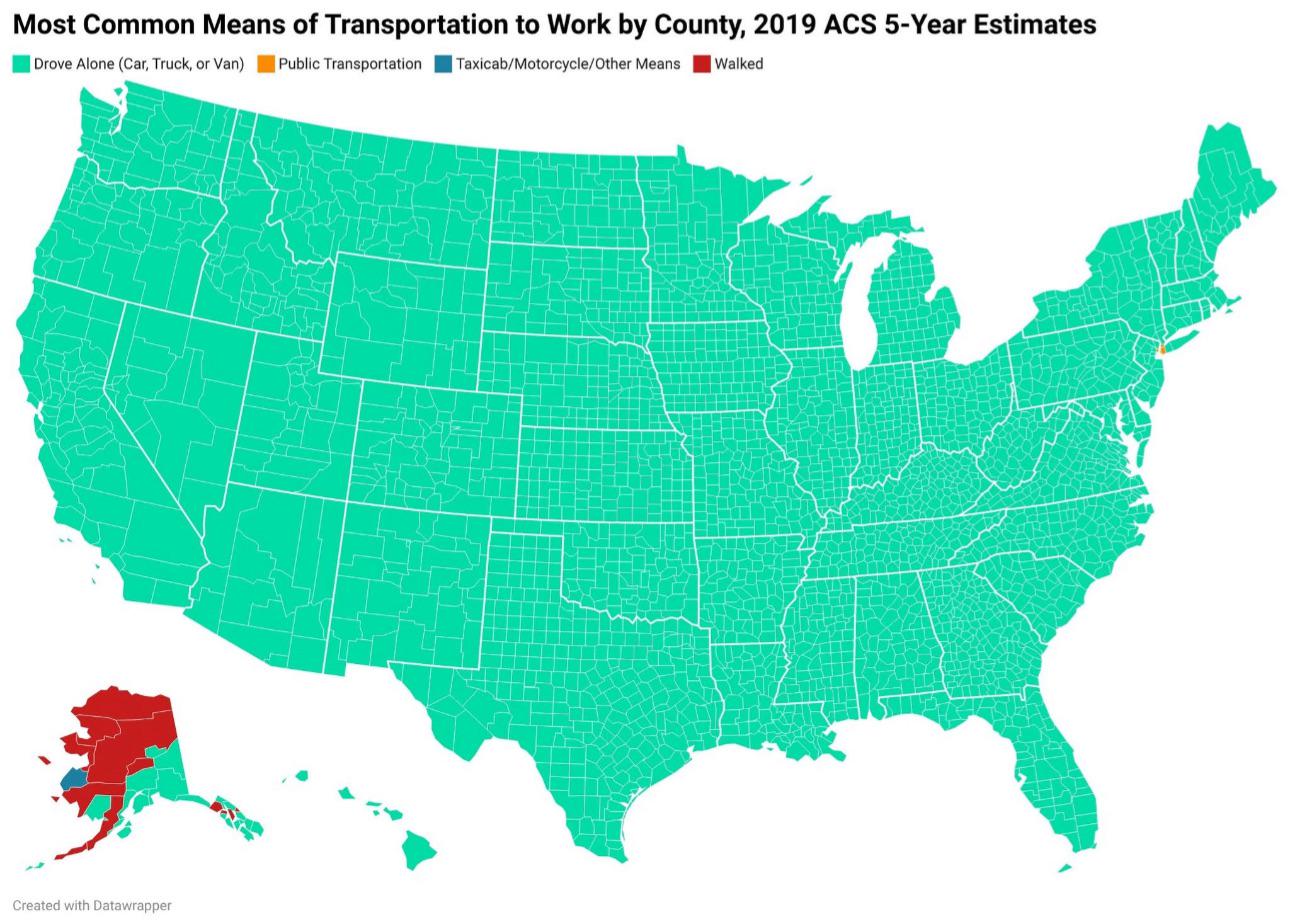
How Americans Get to Work Map
This map provides a visual representation of the various modes of transportation that Americans utilize to commute to wo...
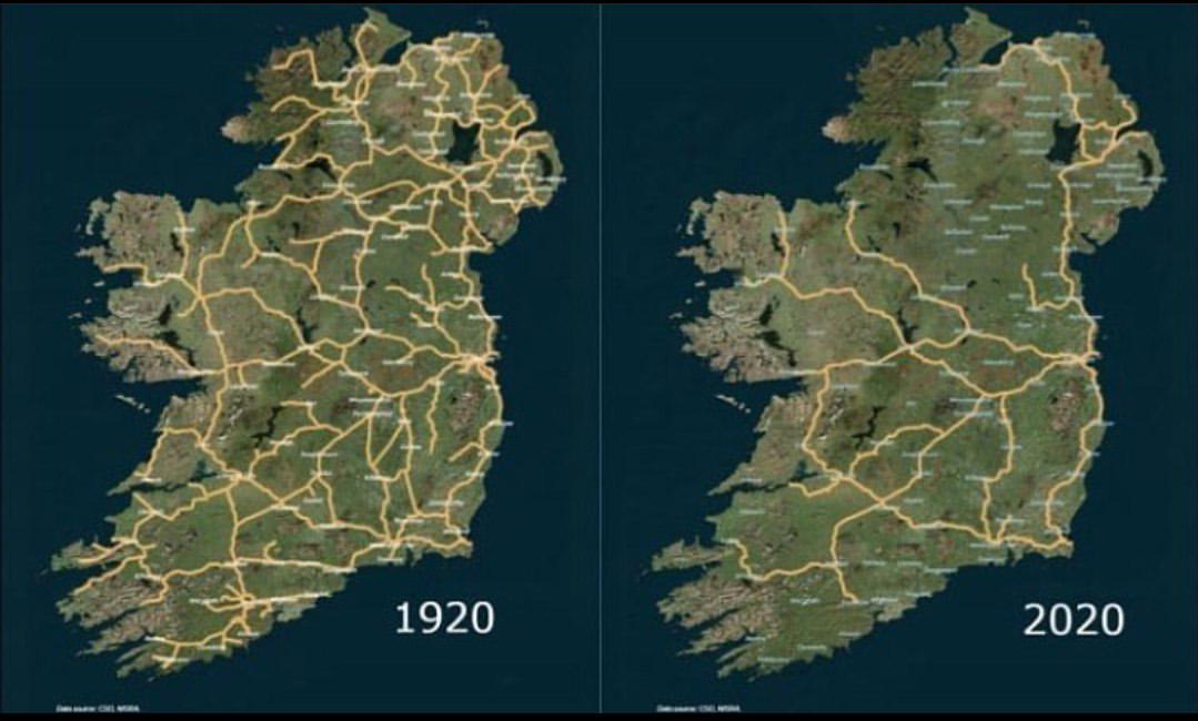
Irish Railway System Map 1920 to 2020
The map titled 'The Irish Railway System between 1920 and 2020' provides a comprehensive visualization of the railway in...
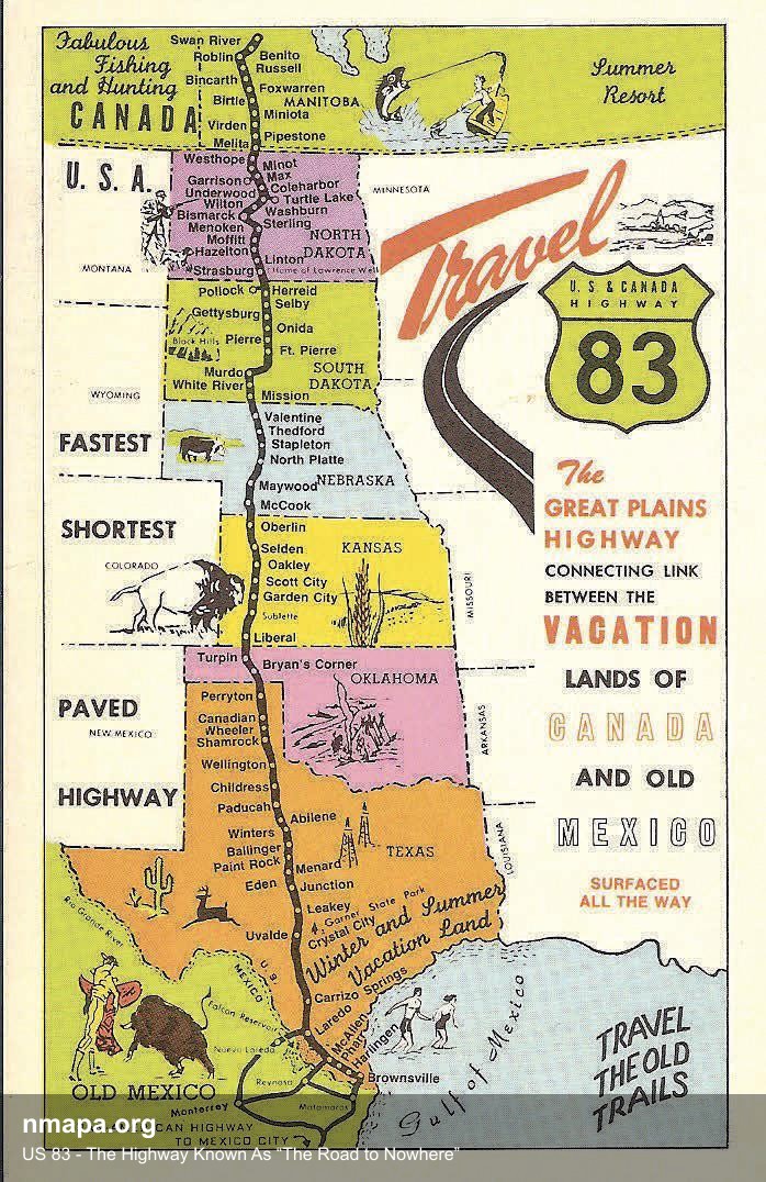
US 83 - The Highway Known As “The Road to Nowhere” Map
This geographical visualization presents "US 83 - The Highway Known As “The Road to Nowhere”" as a comprehensive map tha...
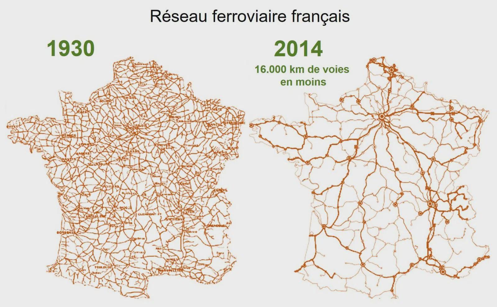
Map of the Declining French Railway Network
...
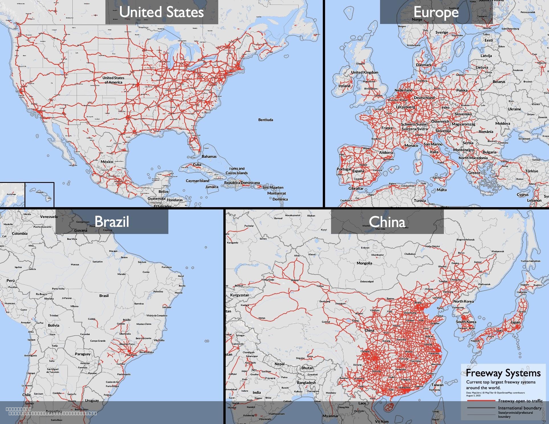
Largest Freeway Systems in 2025 Map
The "Largest Freeway Systems in 2025 Map" provides a comprehensive visualization of major freeway networks across the gl...
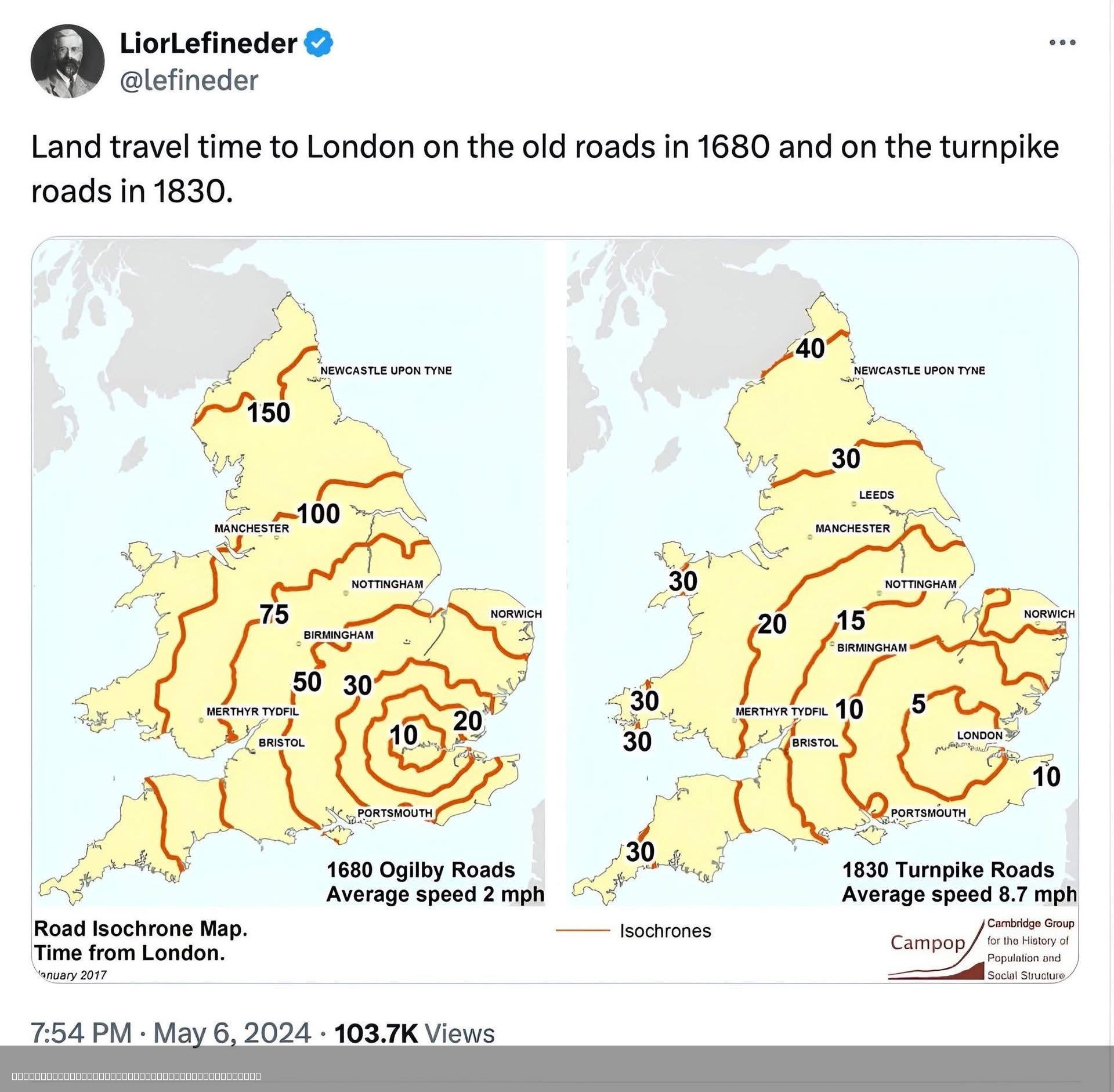
Travel Time to London 1680 vs 1830 Map
The visualization titled "Travel Time to London 1680 vs 1830 Map" illustrates the varying travel times from different re...
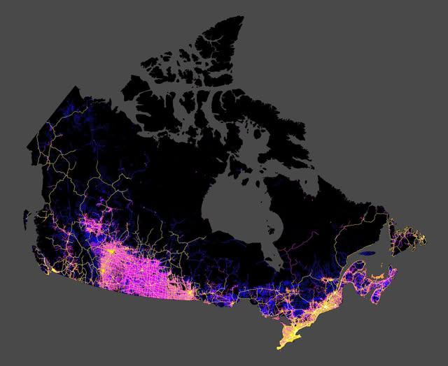
Roads in Canada Map
The map shared by Col. Chris Hadfield on Facebook provides a comprehensive visualization of all the roads in Canada. It ...
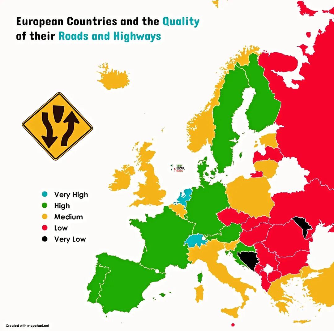
Road Quality by European Country Map
This map illustrates the quality of roads and highways across various European countries, highlighting the differences i...
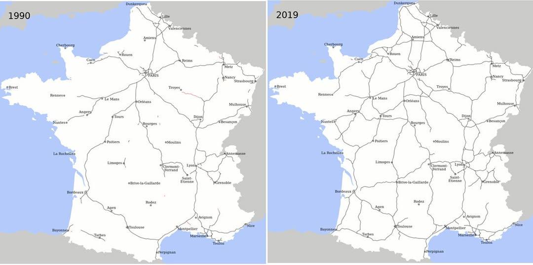
Motorway Construction Comparison Map: France vs. UK
This map effectively illustrates a striking statistic: over the last 25 years, France has constructed more miles of moto...
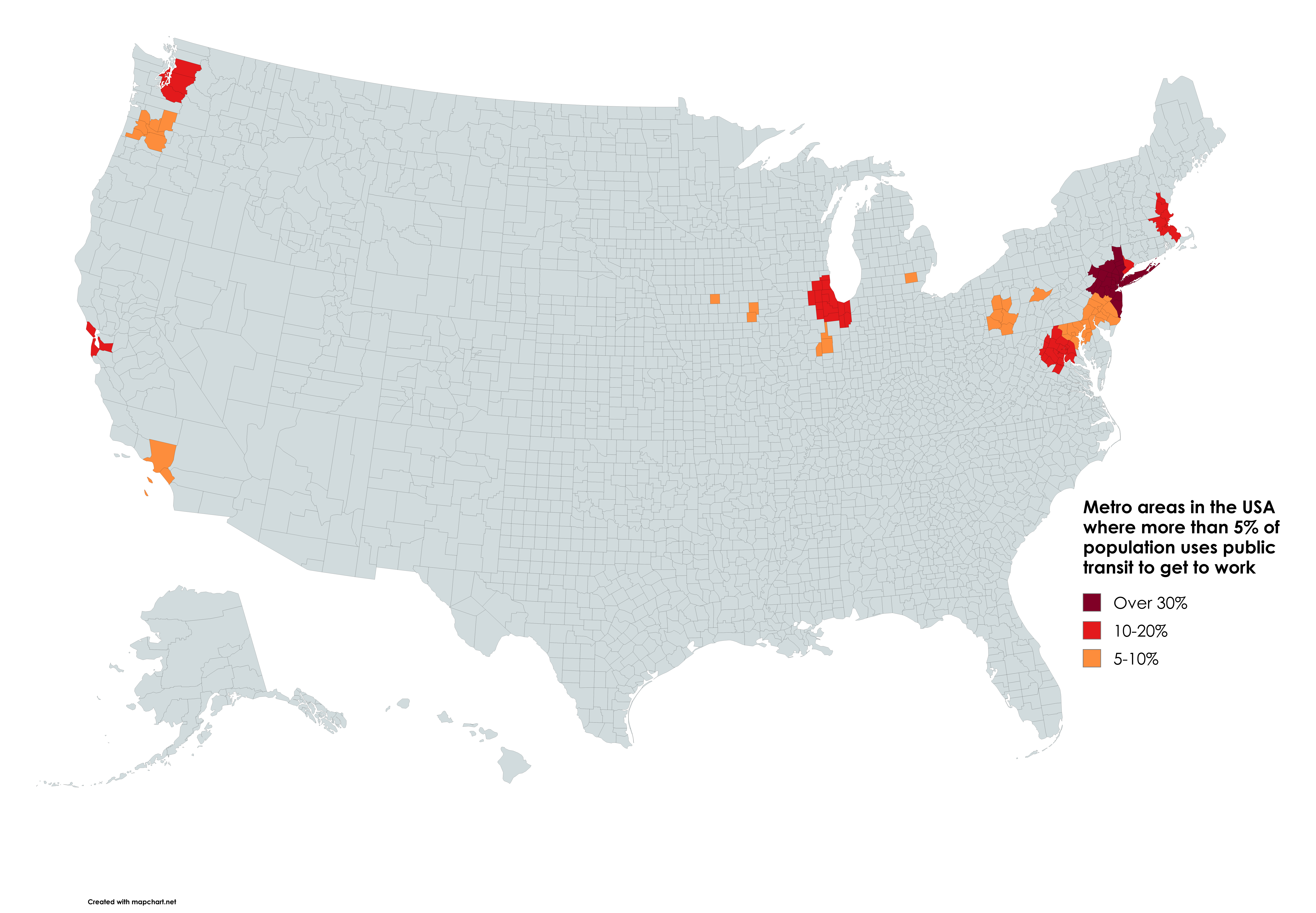
Public Transit Usage by Metro Area Map
According to the latest data from the U.S. Census Bureau, cities like New York, San Francisco, and Washington D.C. showc...
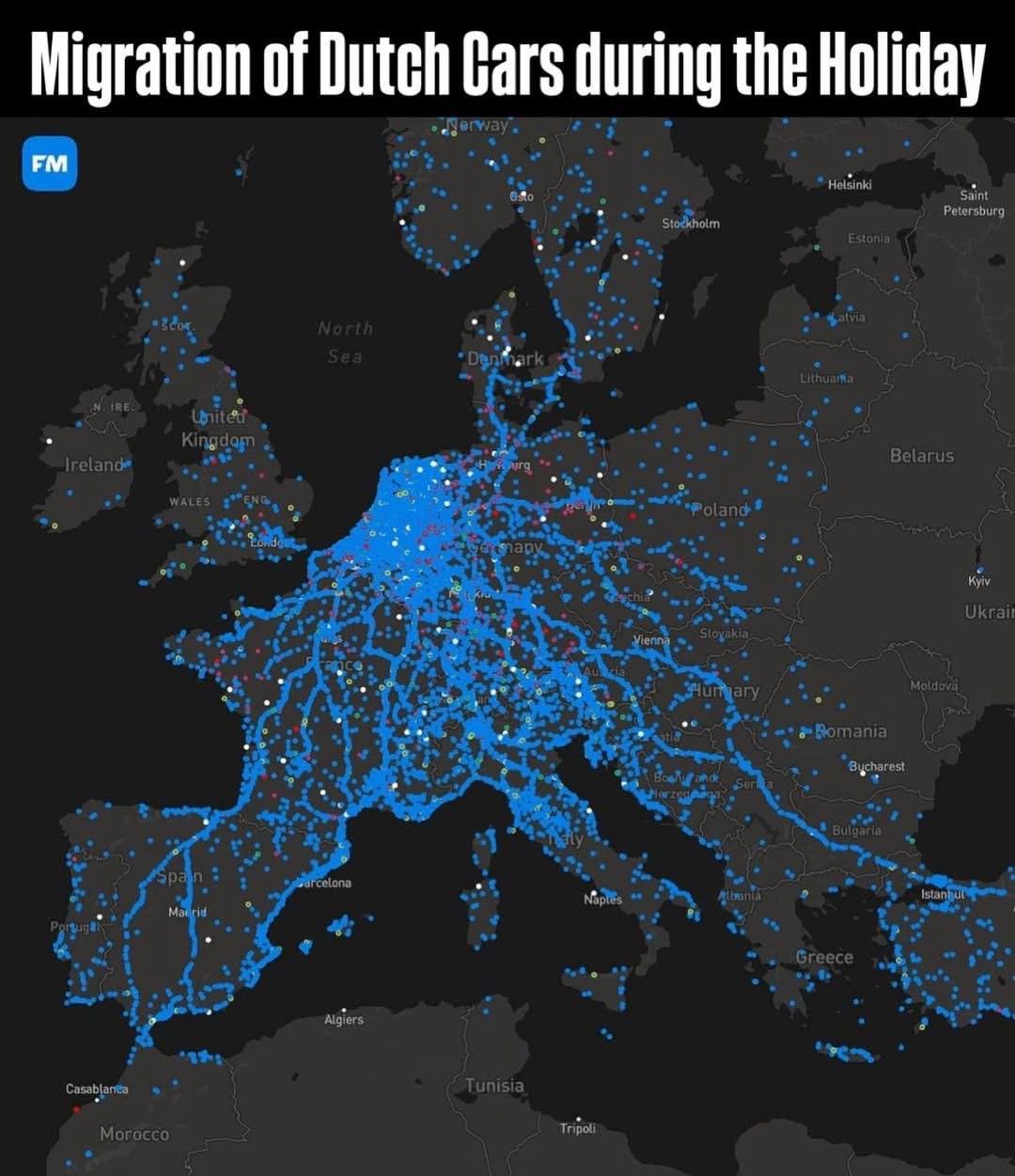
Migration of Dutch Cars During Summer Holiday Map
The "Migration of Dutch Cars During Summer Holiday Map" provides a detailed visualization of how Dutch vehicles travel d...
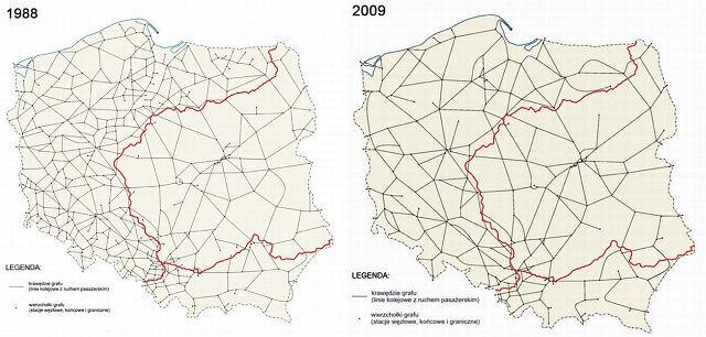
Downgrade of Polish Railway System Map
The "Downgrade of Polish Railway System Map" provides a stark visual representation of the decline in railway infrastruc...
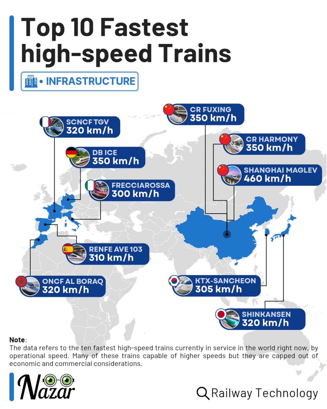
Top 10 Fastest High-Speed Trains Map
This map showcases the fastest high-speed trains in the world, ranking them based on their maximum operational speeds. F...
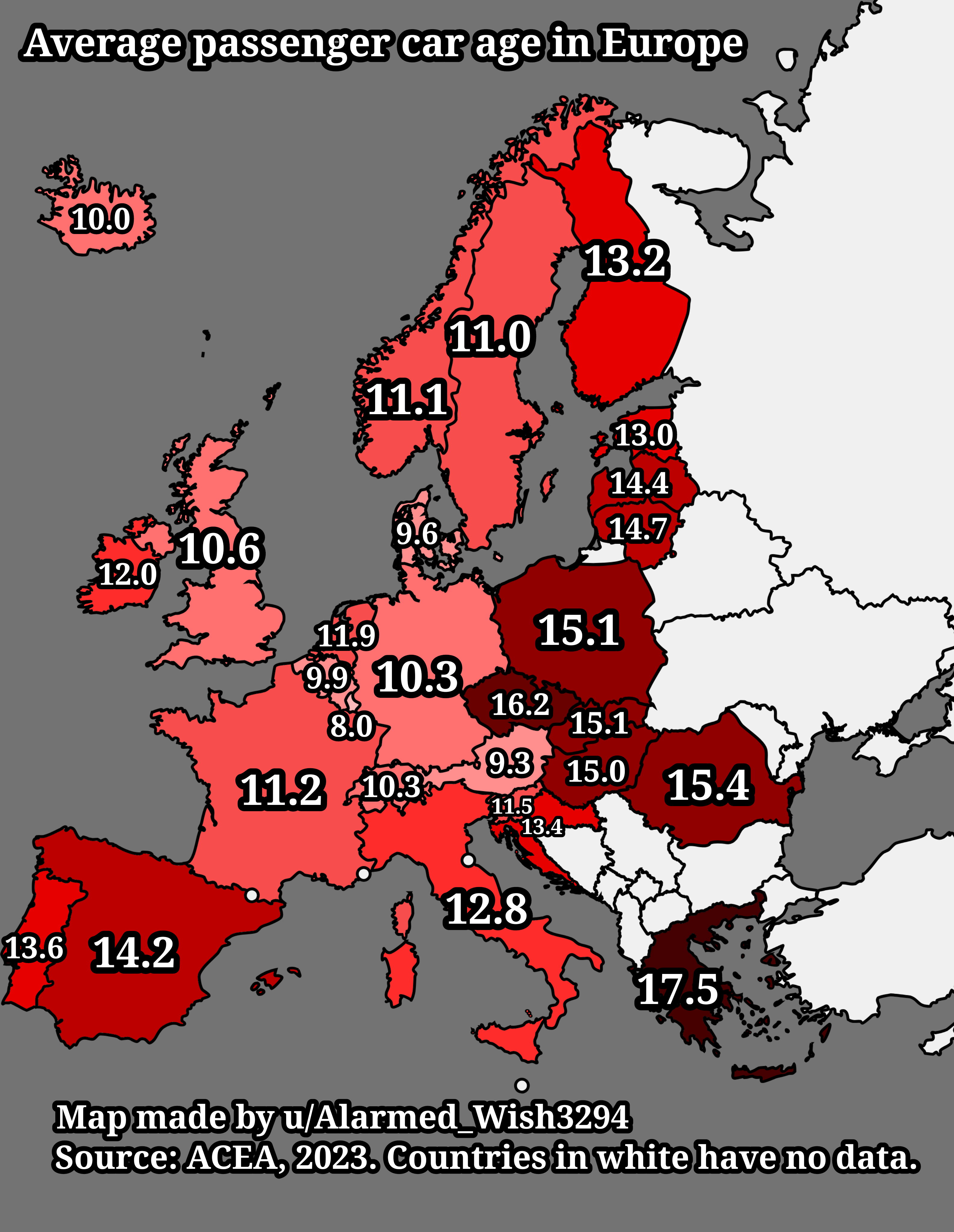
Average Passenger Car Age in Europe Map
The "Average Passenger Car Age in Europe Map" provides a visual representation of the average age of passenger vehicles ...
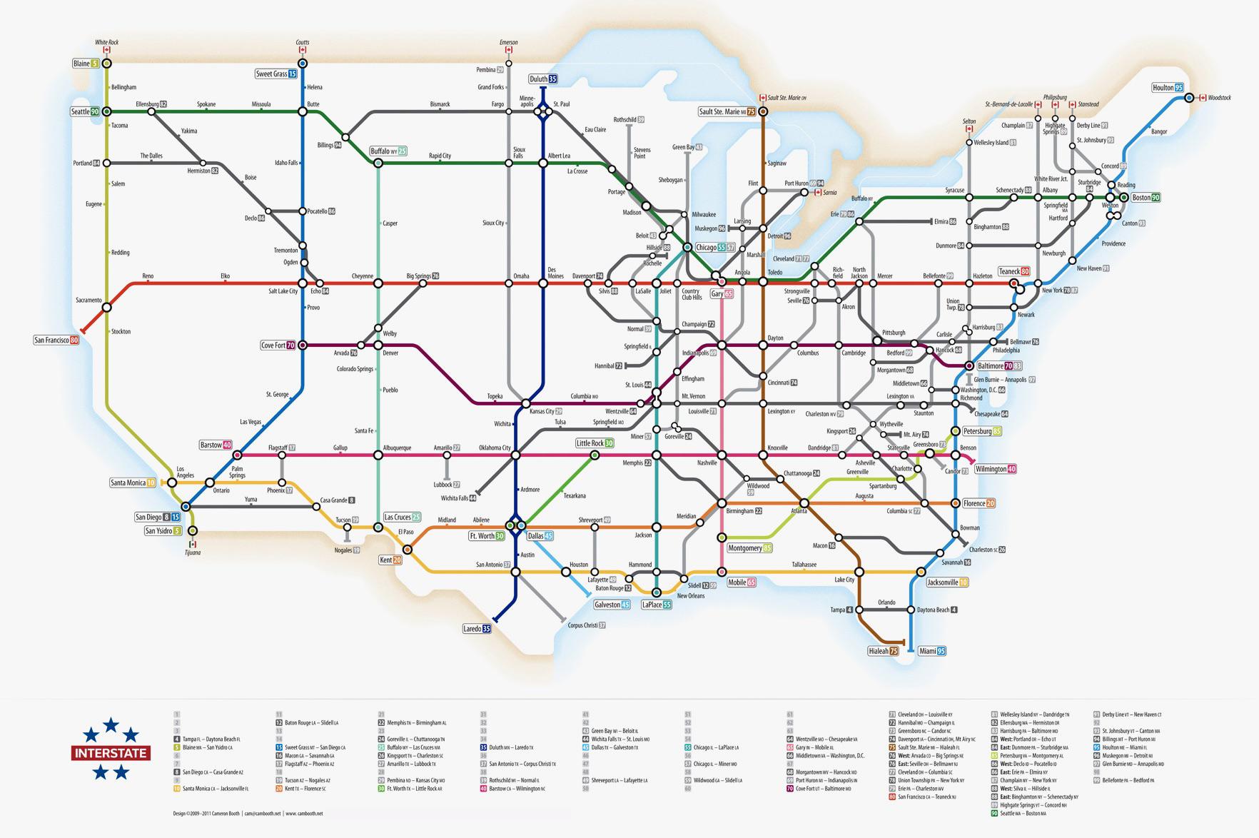
US Interstate Highway System Transit Map
The visualization titled "The US Interstate Highway System as a transit map" presents a comprehensive layout of the exte...
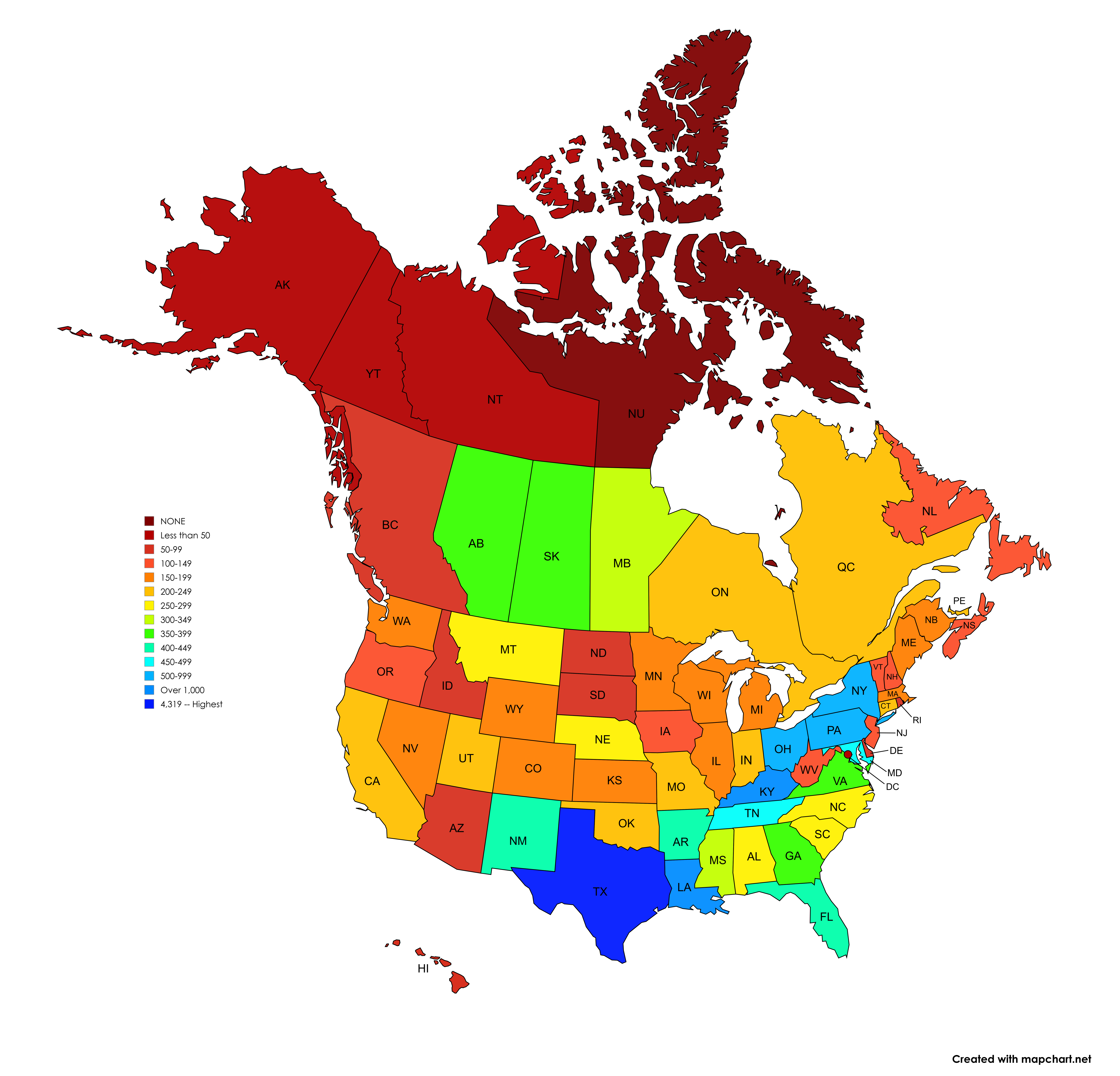
Number of Signed Highways Map by U.S. State and Canadian Province
The visualization titled 'Number of Signed Highways in each U.S. State and Canadian Province' presents a detailed count ...
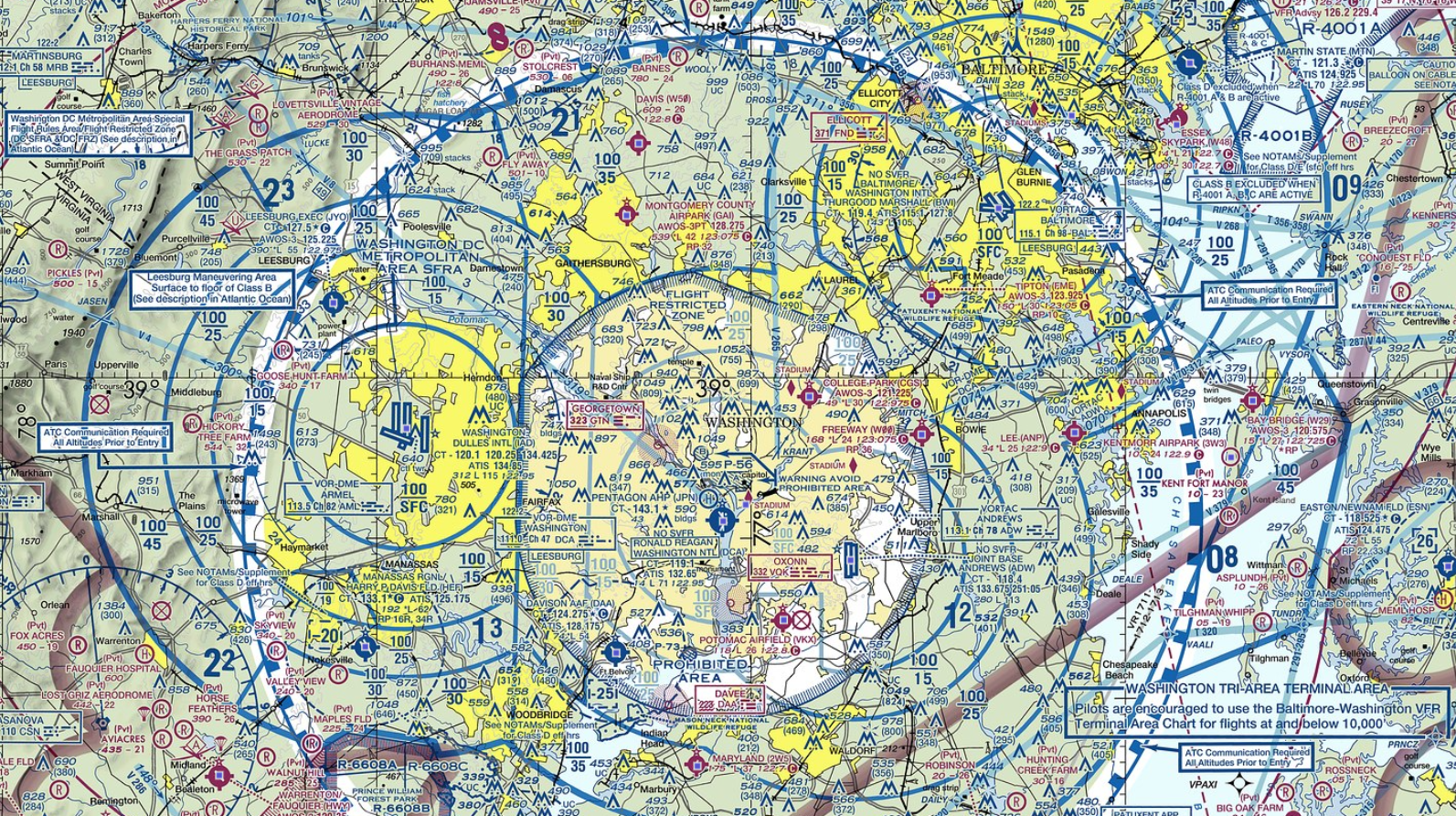
Air Traffic Routes Map of Washington DC and Baltimore
The map of Washington DC and Baltimore provides a detailed overview of air traffic routes in the region. It highlights t...
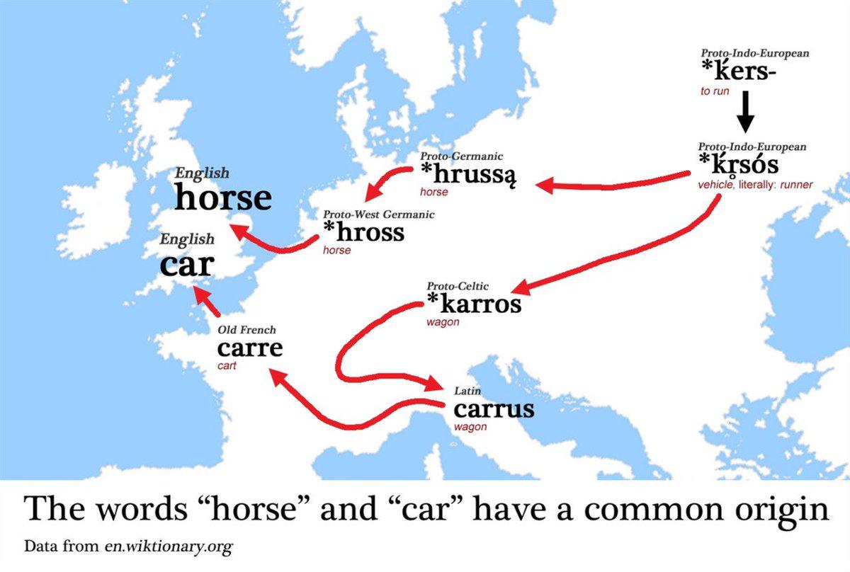
Map of Word Origins for Car and Horse
This map visualizes the etymological origins of the words "car" and "horse" across various languages and regions. It pro...
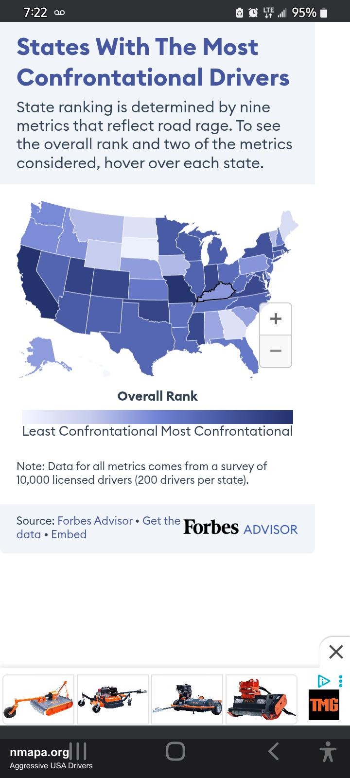
Aggressive Drivers Map of the USA
The "Aggressive Drivers Map of the USA" presents a striking visualization of driving behaviors across various states, hi...
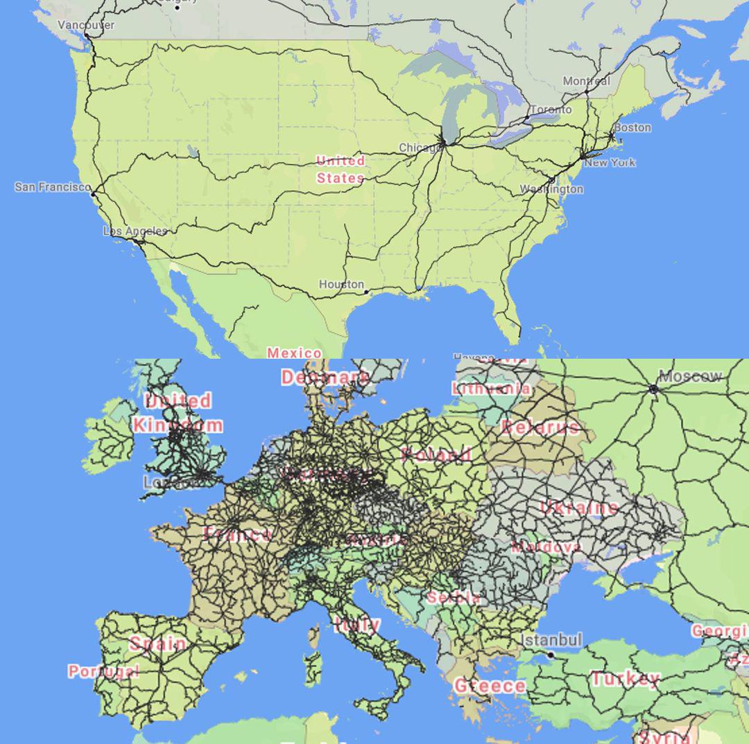
Passenger Trains Map of the United States vs Europe
Interestingly, Europe's rail systems are often complemented by an integrated approach to public transport, including bus...
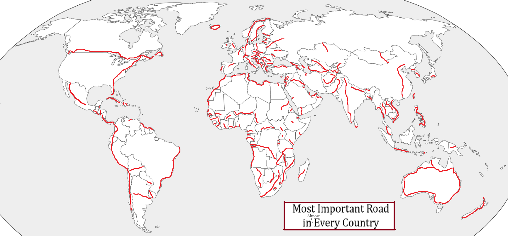
Most Important Road by Country Map
This intriguing map visualizes the most important road in nearly every country around the globe, evaluated through vario...
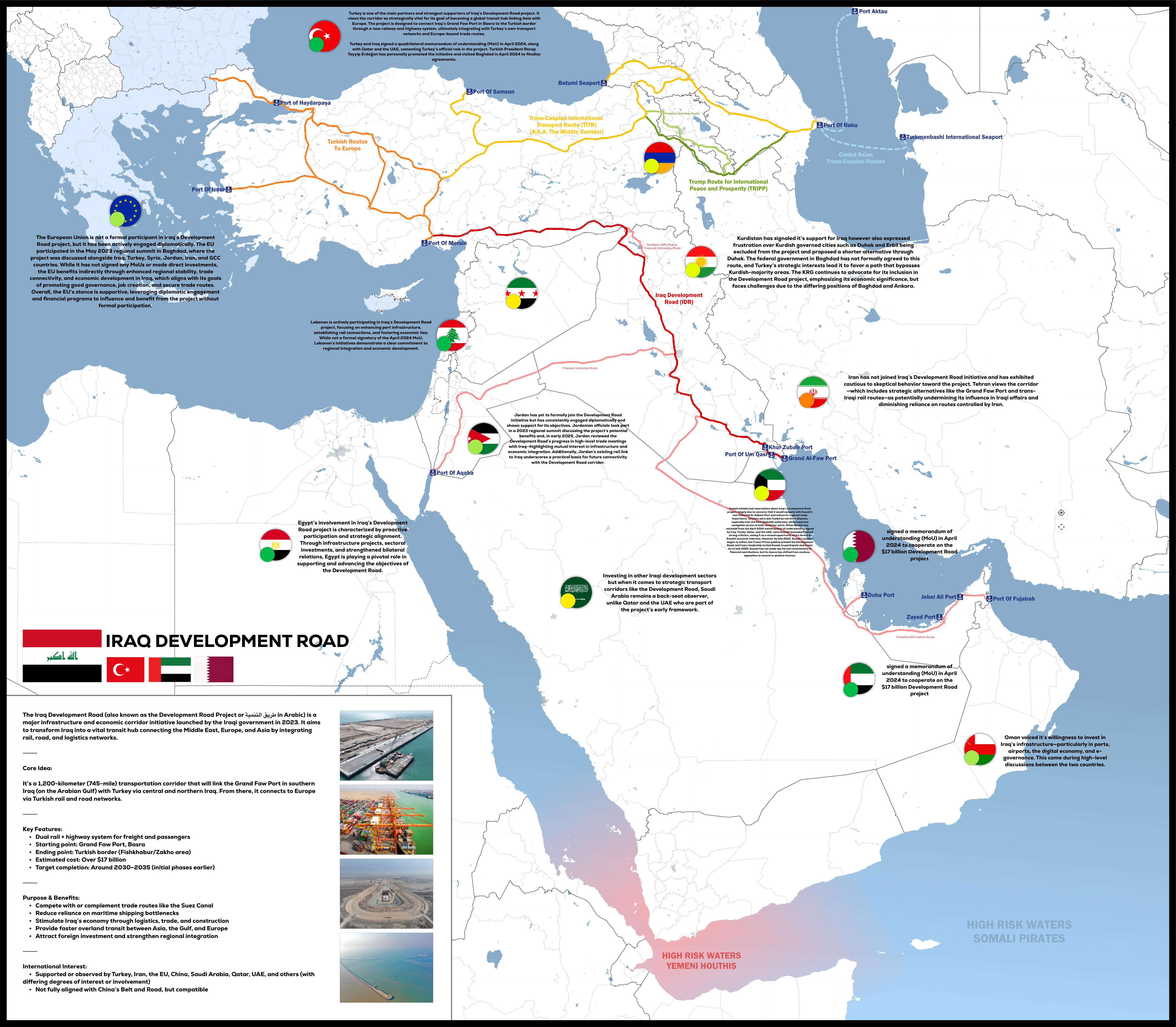
Iraq Development Road Project Map 2025
The "Iraq Development Road Project 2025" map provides a detailed visualization of the planned infrastructure development...
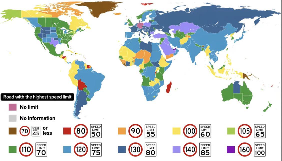
Max Speed Limit by Country Map
The "Max Speed Limit by Country Map" provides a visual representation of the maximum speed limits set across different n...
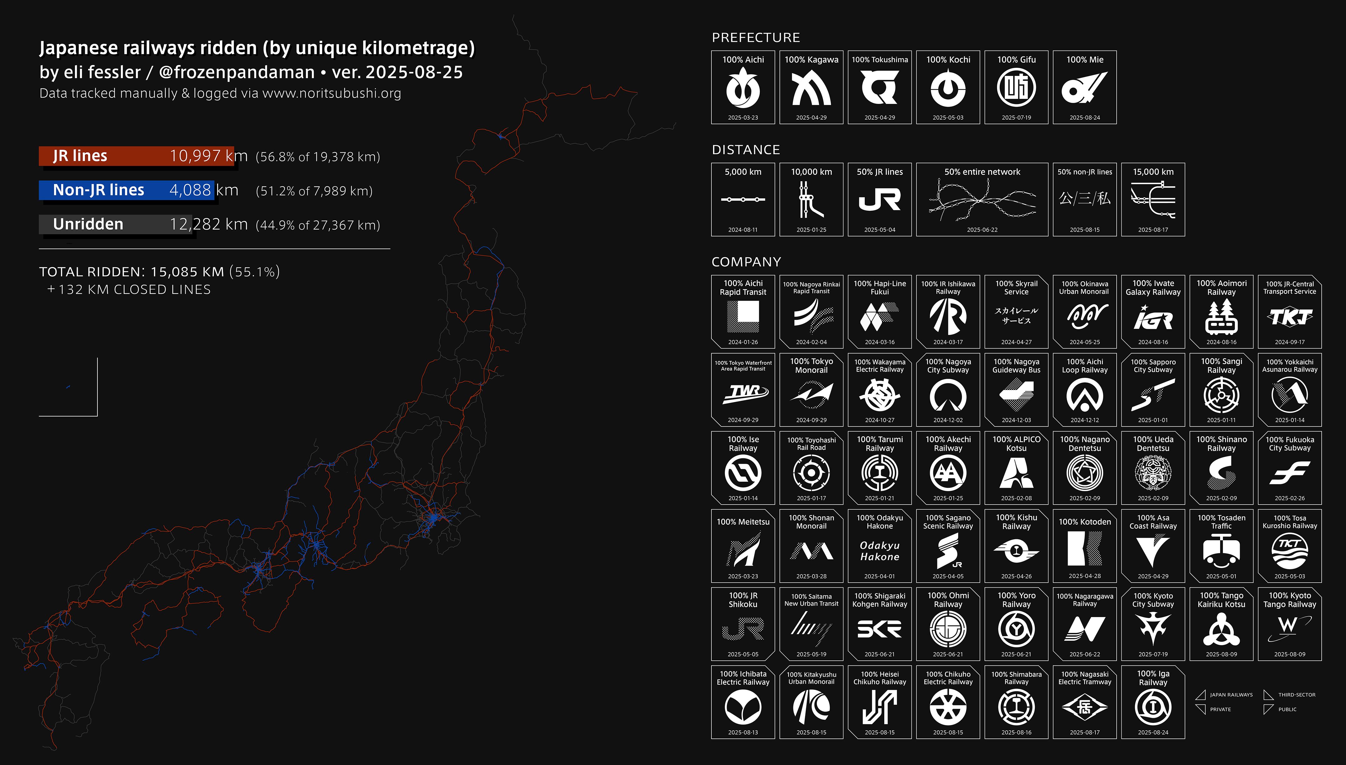
Railway Network Map of Japan
This engaging visualization highlights an impressive journey through Japan’s extensive railway network, showcasing a rem...
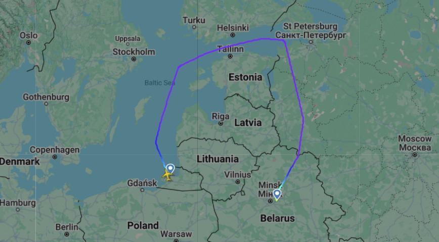
Flight Route Map Between Kaliningrad and Minsk Airports
This map illustrates the flight route between Kaliningrad (KGD) and Minsk (MSQ) airports, providing a clear visual repre...
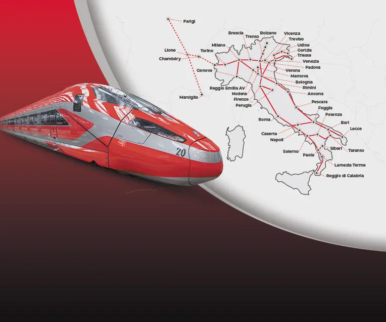
Frecciarossa High Speed Train Routes Map
The "Routes of the Frecciarossa High-Speed Trains in Italy and France" map provides a detailed visualization of the exte...
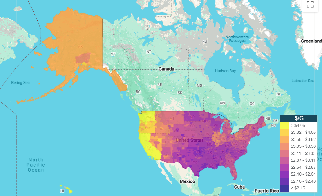
Gas Prices Across the United States Map
Today on GasBuddy, we find ourselves looking at a revealing map that showcases the gas prices across different regions o...
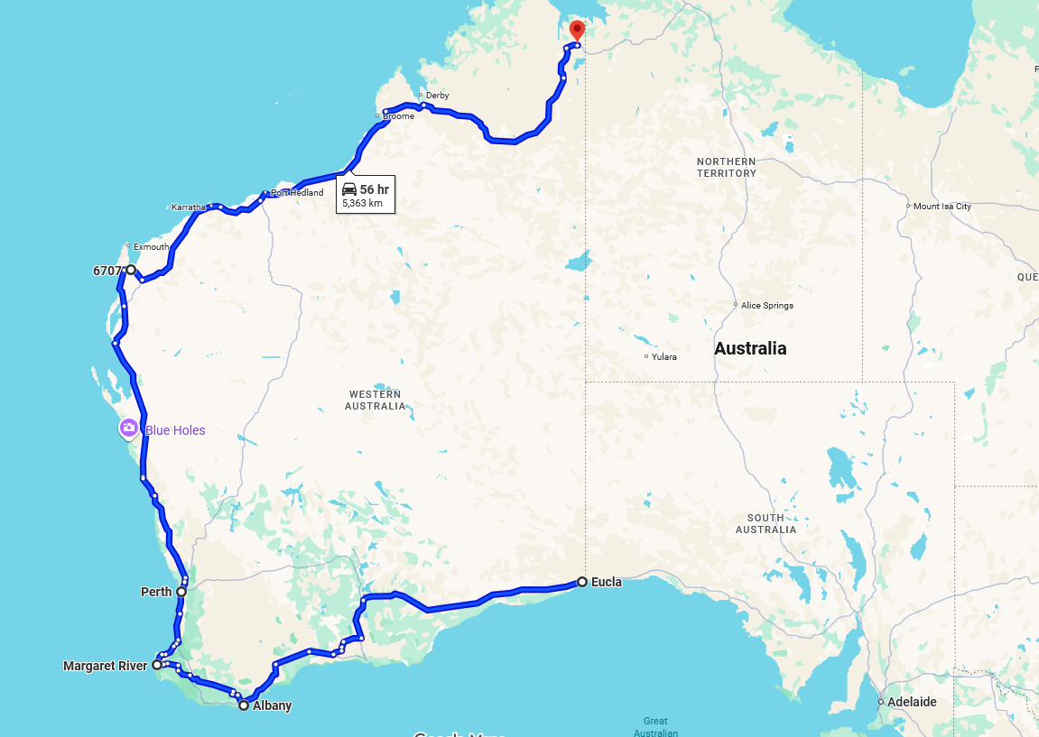
Longest One-Province Road Map
This map visualizes the longest one-province/state road in the world, stretching an impressive 5,363 kilometers and taki...
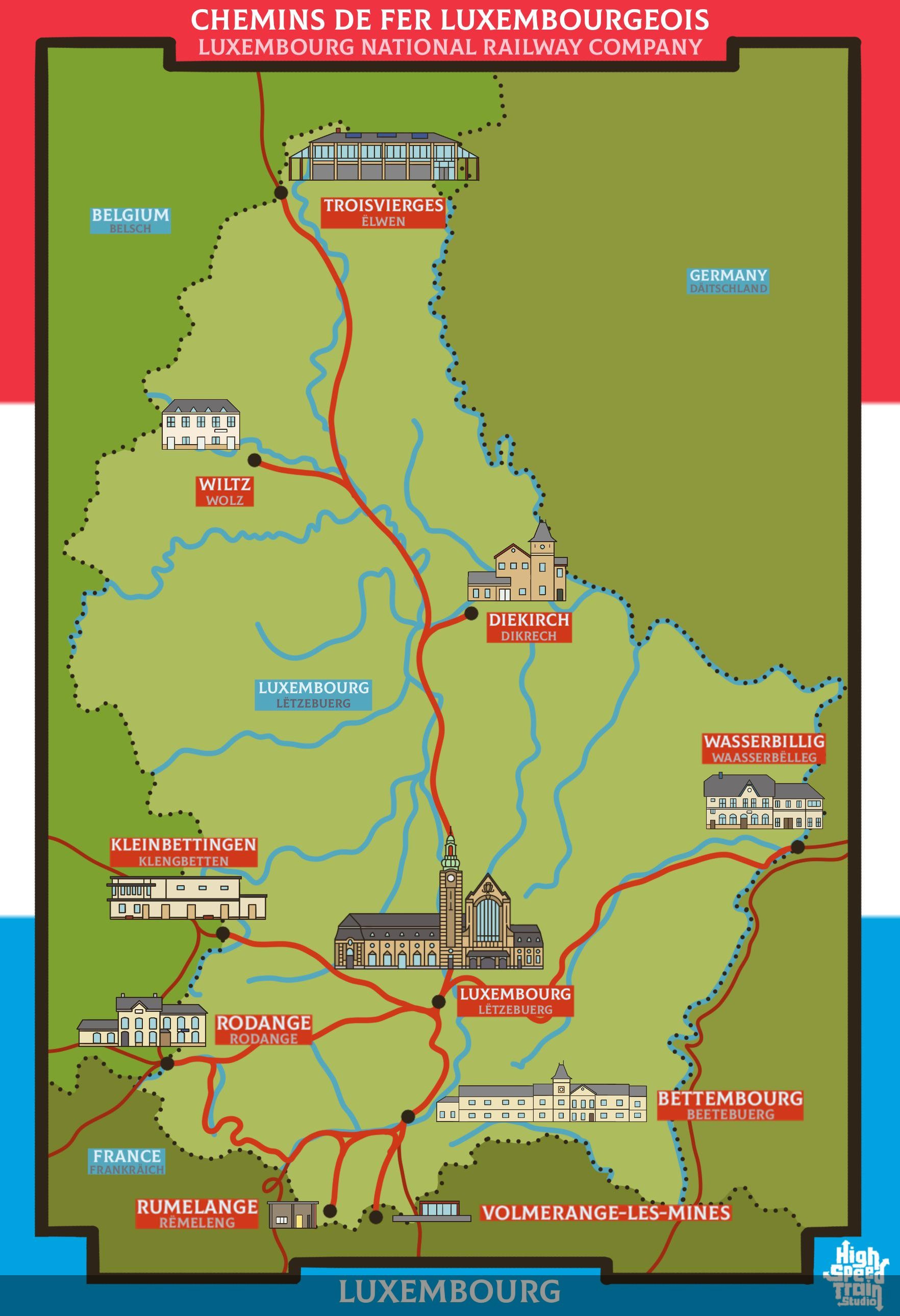
Rail Network Map of Luxembourg
The rail network map of Luxembourg provides a comprehensive view of the country's railway infrastructure, highlighting t...
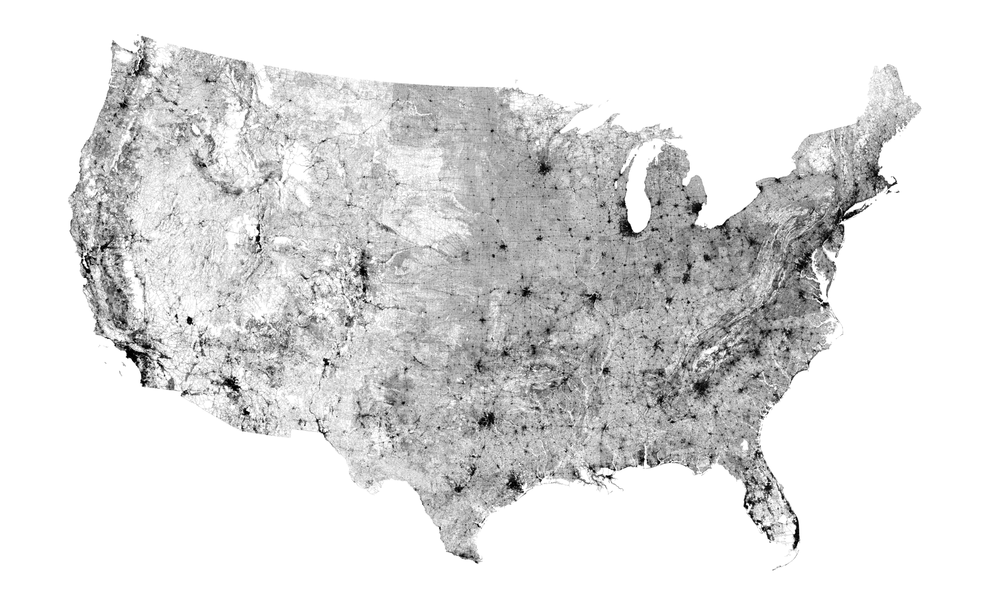
Public Road Map of the US (2018)
...
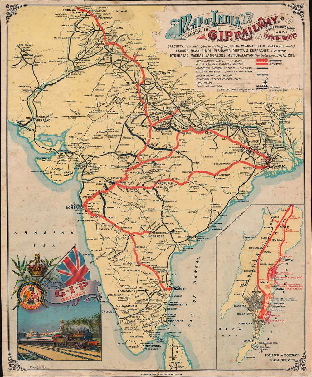
Railway Map of British India in 1911
This visualization presents the railway network of British India as it stood in 1911, reflecting a significant period du...
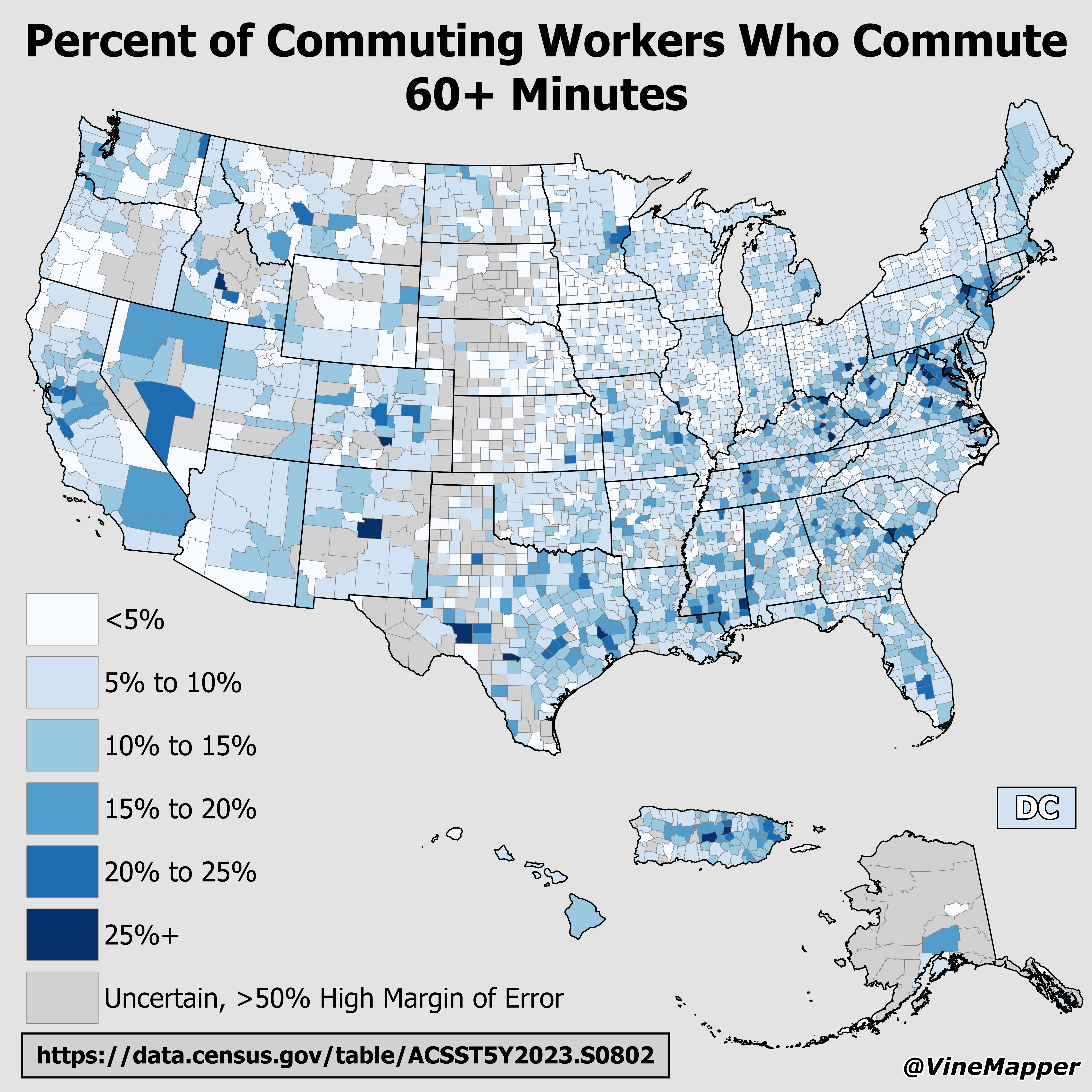
Map of Percent of Commuting Workers Who Commute 60+ Minutes
The visualization titled "Percent of Commuting Workers Who Commute 60+ Minutes" provides a clear illustration of the sta...
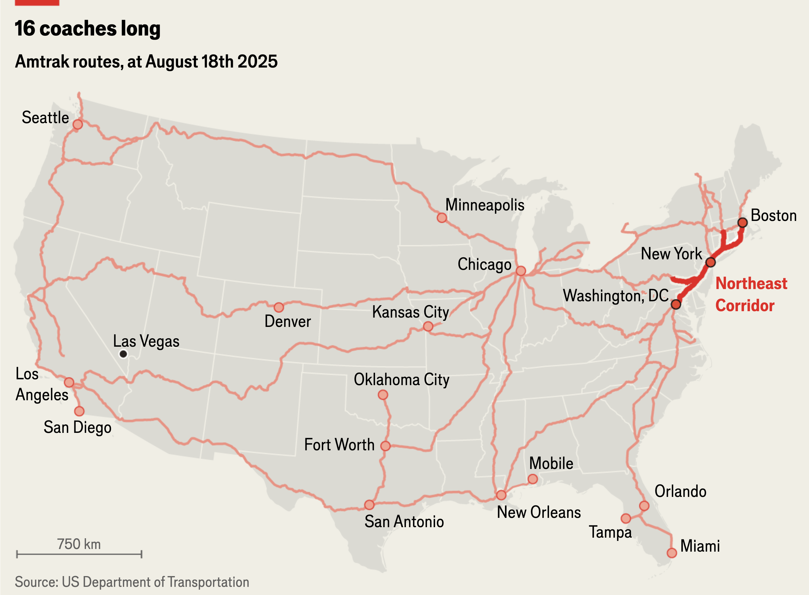
Amtrak Rail Routes Map August 2025
The "Amtrak Rail Routes Map (August 2025)" provides a comprehensive overview of the rail network operated by Amtrak acro...
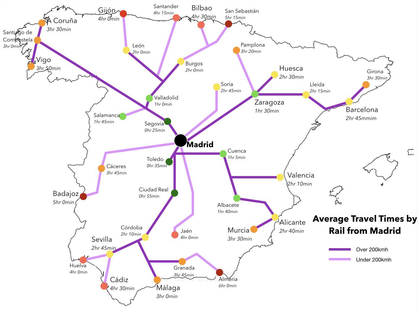
Average Travel Times by Rail from Madrid Map
The "Average Travel Times by Rail from Madrid" map visually represents the rail connectivity of Spain's capital, highlig...
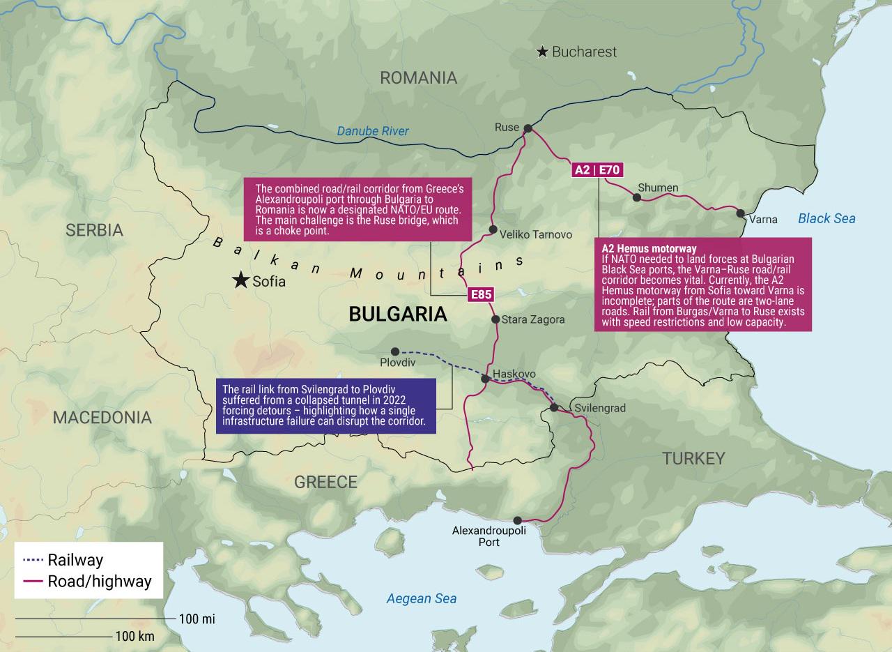
Bulgaria's Infrastructure Pain Points for NATO Map
The "Bulgaria's Infrastructure Pain Points for NATO Map" provides a visual representation of the critical areas within B...
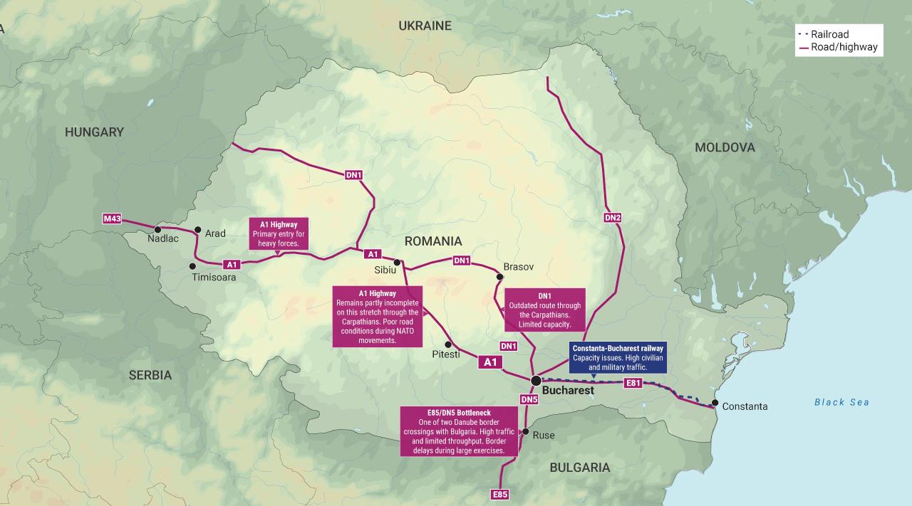
Romania Infrastructure Pain Points for NATO Map
The "Romania Infrastructure Pain Points for NATO Map" visualizes critical vulnerabilities in Romania's infrastructure th...

Map of Love's Gas Stations in the U.S.
This map provides a comprehensive overview of all Love's gas stations located across the United States. Love's Travel St...
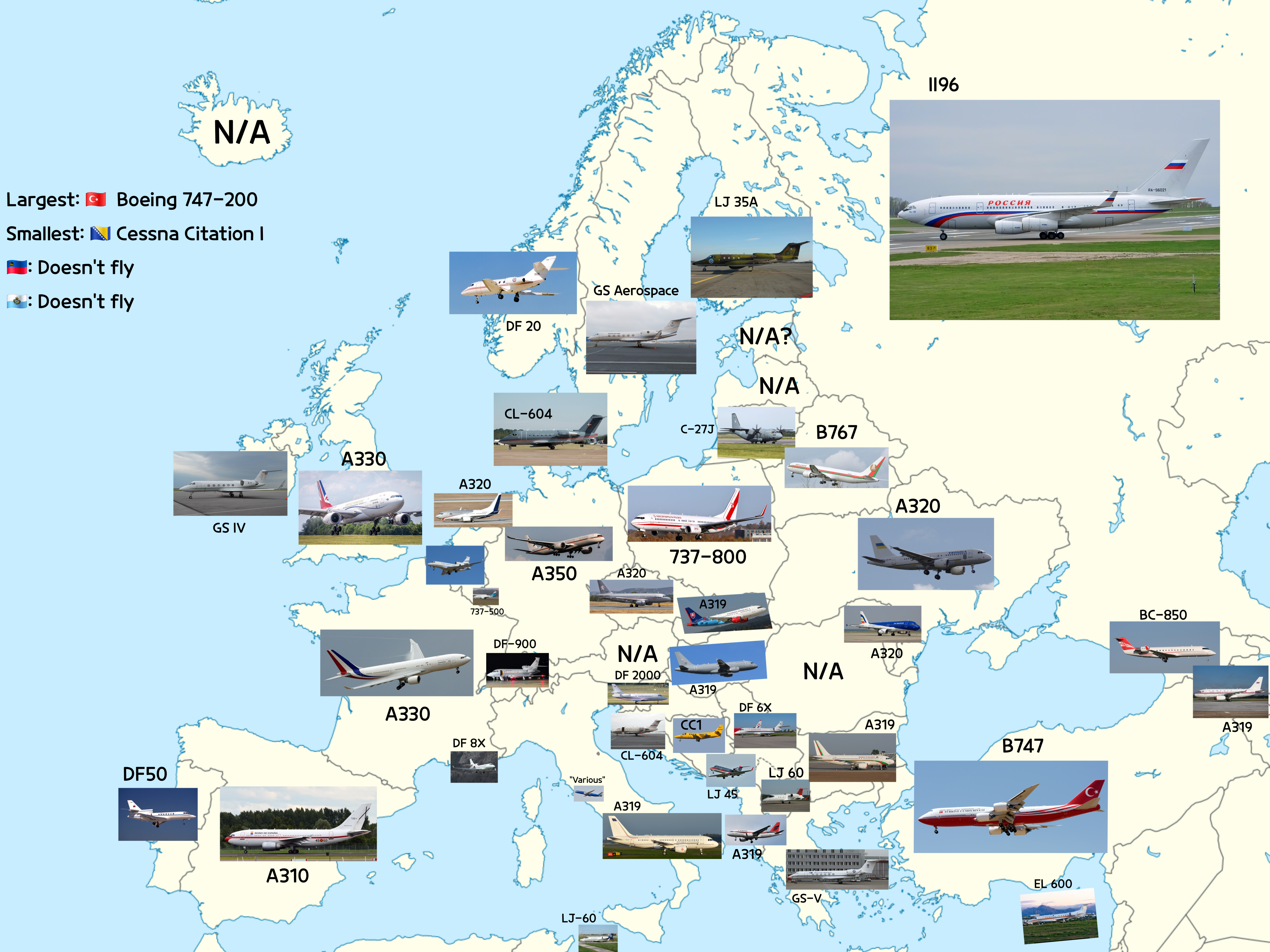
Map of Aircraft Types Heads of State Fly in Europe
The visualization titled "The Types of Aircraft Heads of State Fly in Europe" provides an intriguing look into the aviat...
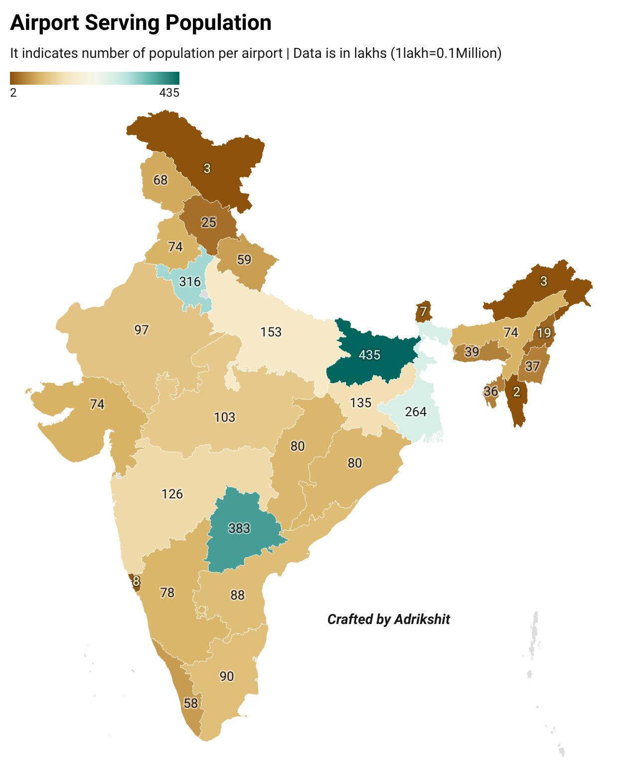
Airport Serving Population in India Map
This map displays the relationship between airports and the populations they serve across India. It highlights the acces...
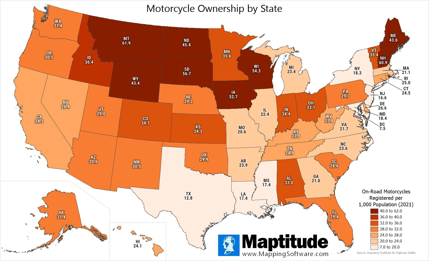
Motorcycle Ownership by U.S. State Map
The "Motorcycle Ownership by U.S. State" map presents a fascinating look into the distribution of registered, on-road mo...
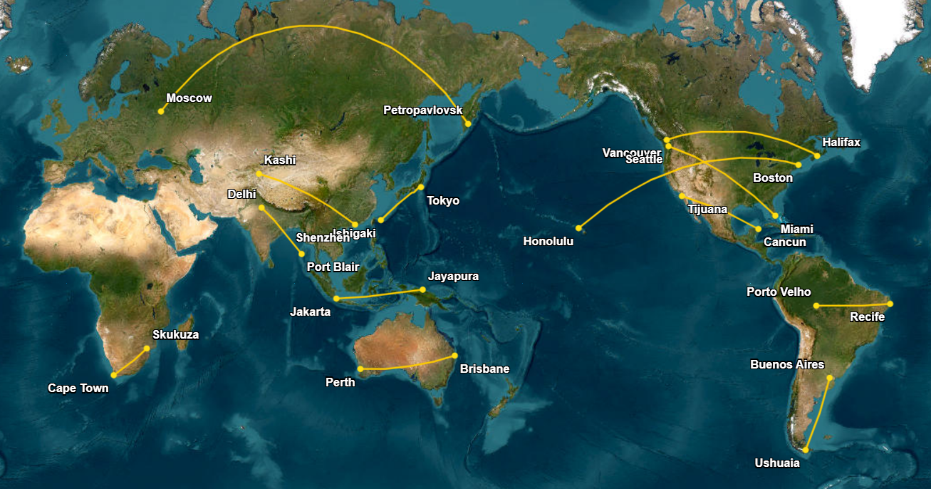
Longest Domestic Flights Map
In Russia, the flight from Moscow to Petropavlovsk on the Kamchatka Peninsula lasts about 8 hours and 40 minutes. This j...
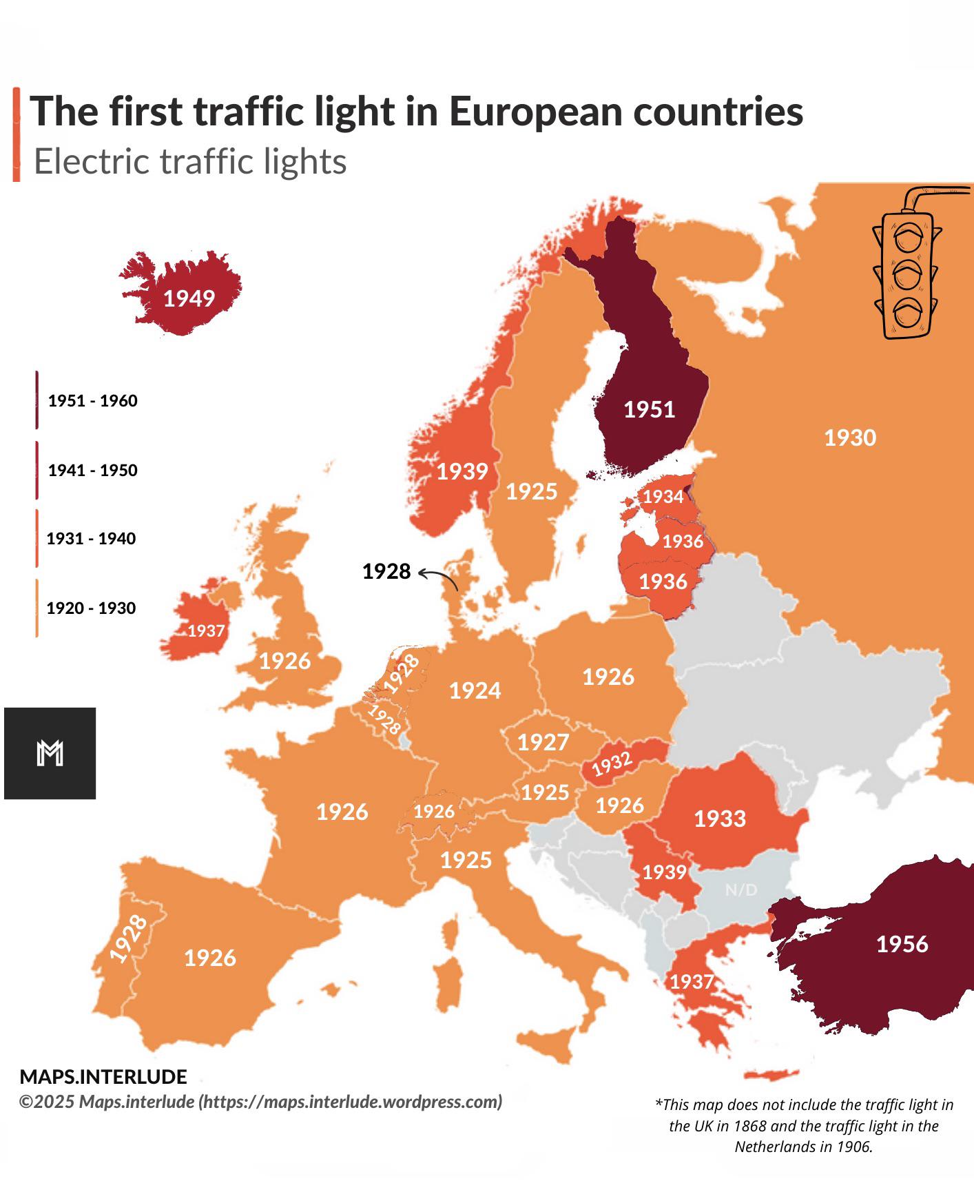
First Traffic Light Locations Map in Europe
This map outlines the locations of the first traffic lights installed in various European countries, providing a fascina...
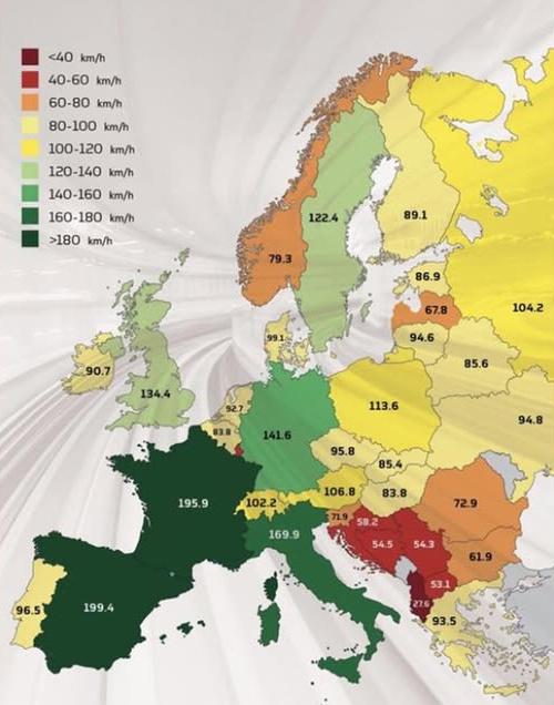
Average Train Speeds in Europe Map
This map visualizes the average train speeds in kilometers per hour (kph) across various countries in Europe, providing ...
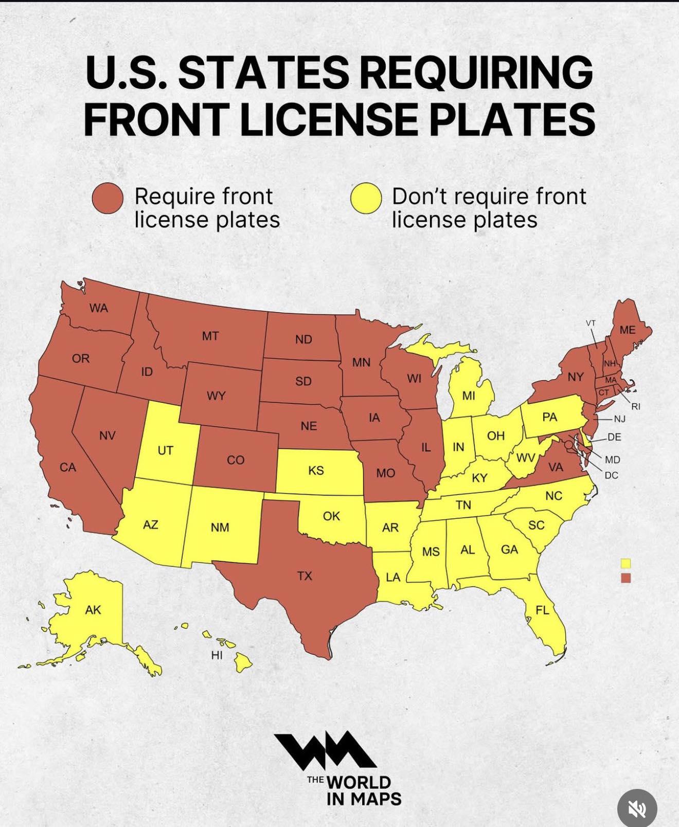
Car Ownership Distribution Map by Region
This map illustrates the distribution of car ownership across various regions, highlighting the number of vehicles per c...
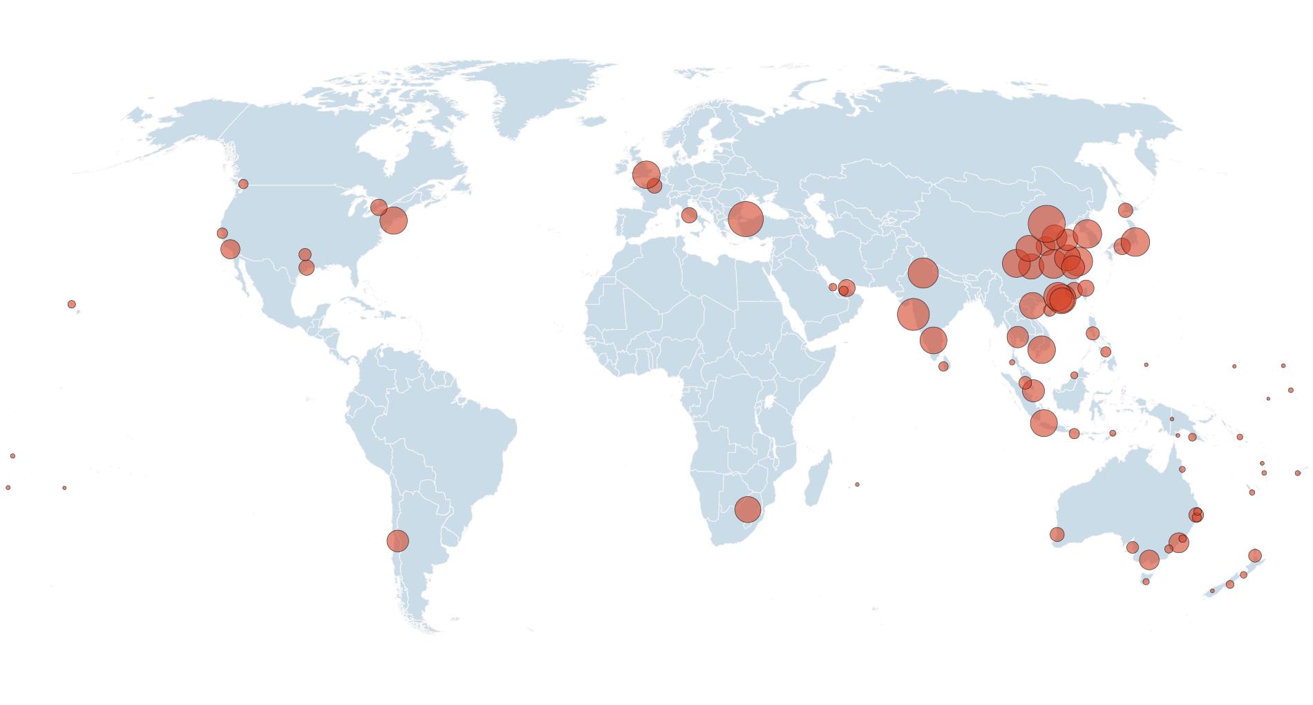
Direct Flights to/from Australia Map
This visualization presents a comprehensive overview of airports that offer direct flights to and from Australia. Each a...
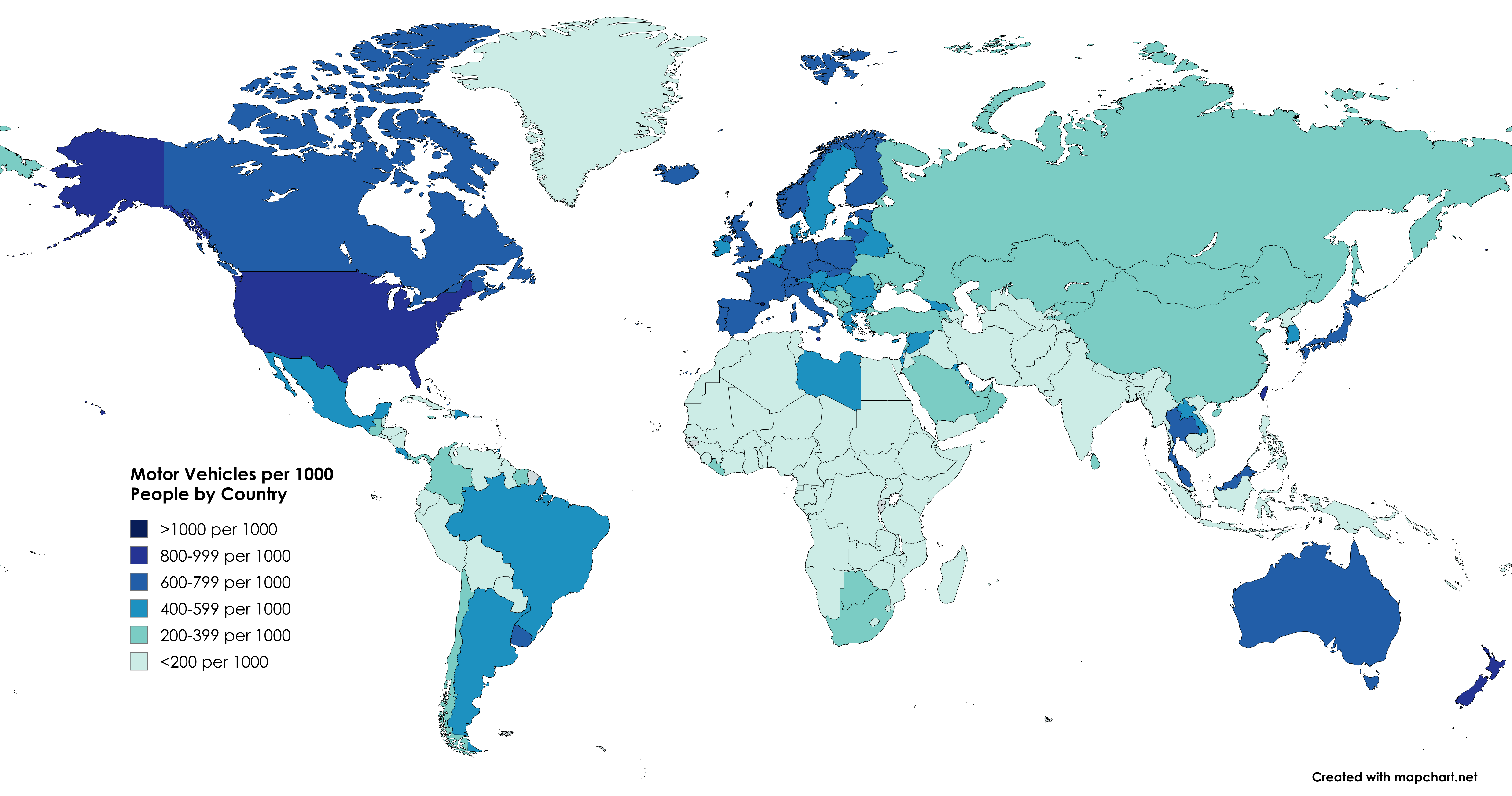
Motor Vehicles Per 1000 People by Country Map
This map displays the number of motor vehicles per 1,000 people by country, providing a clear visual representation of v...
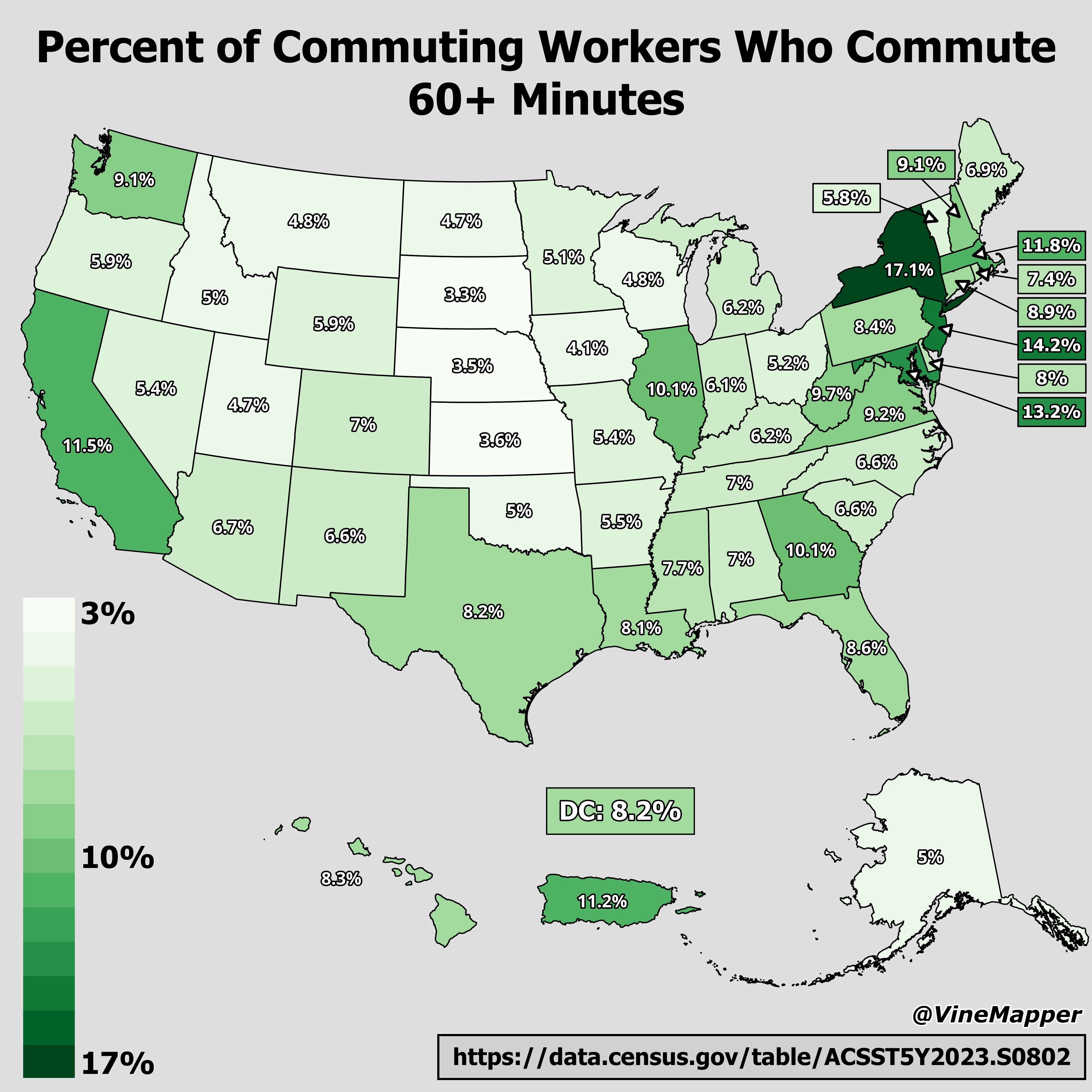
Map of Workers Commuting Over 60 Minutes
Interestingly, long-distance commutes are often linked to housing affordability. Many individuals choose to live in subu...

Memphis Chamber of Commerce Map 1916
The 1916 Chamber of Commerce map vividly illustrates Memphis's promotional efforts to position itself as the emerging ec...