medieval history Maps
19 geographic visualizations tagged with "medieval history"
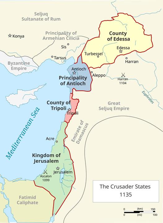
Map of the 4 Catholic Crusader States in 1135
The "Map of the 4 Catholic Crusader States in 1135" provides a snapshot of a pivotal period in medieval history, highlig...
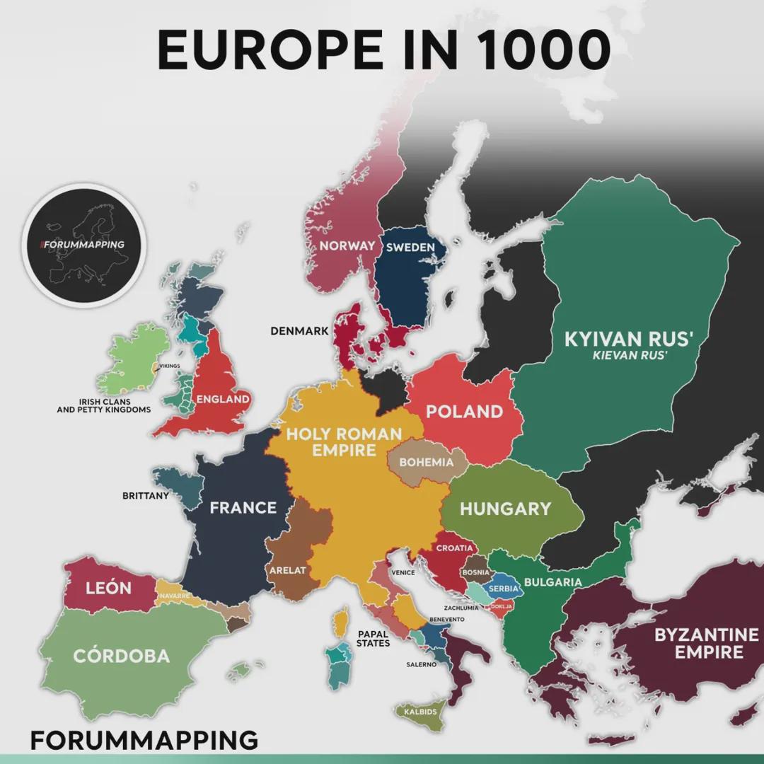
Map of Europe in 1000
The map titled "Europe in 1000" provides a fascinating glimpse into the political and cultural landscape of Europe at th...
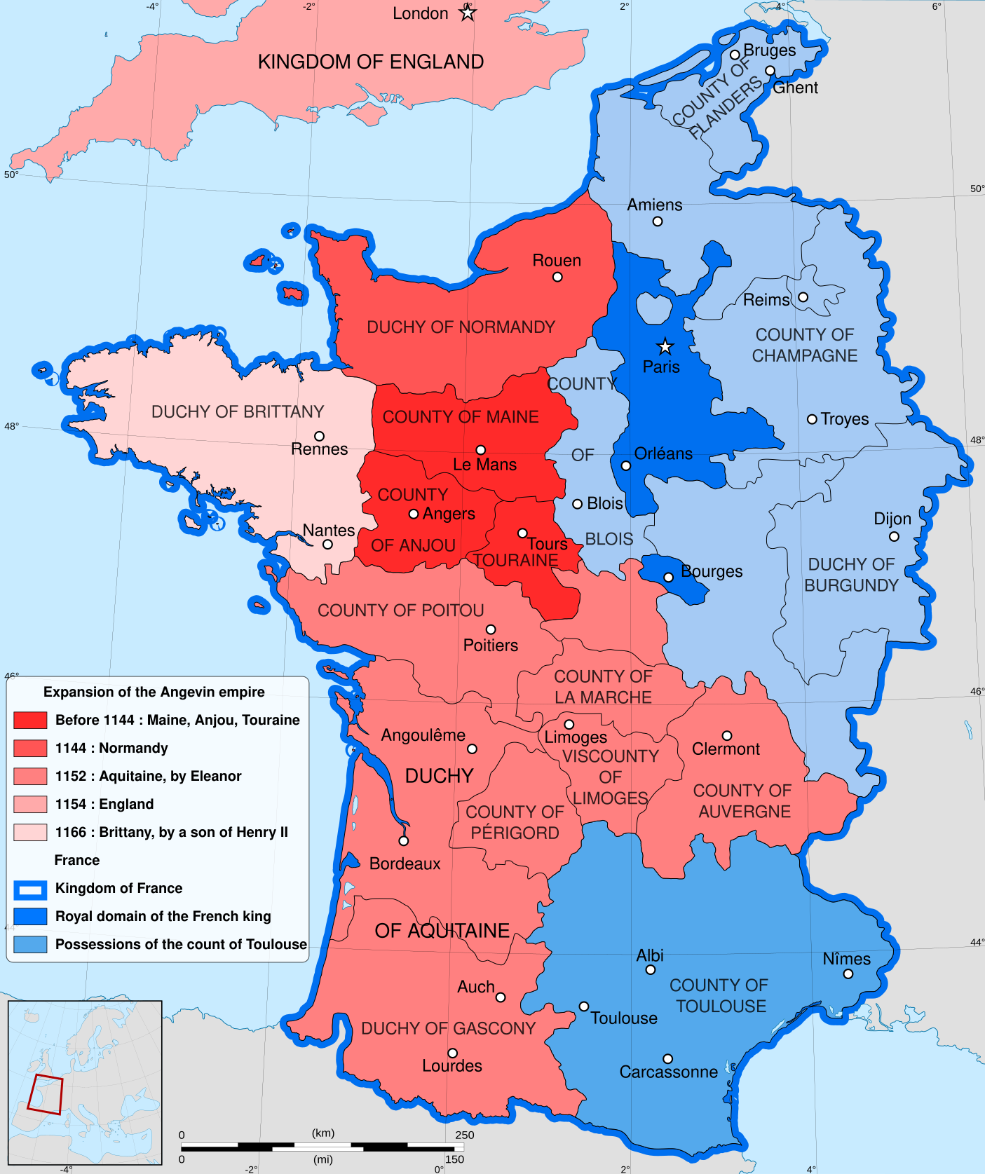
Map of English Possessions in France 1166
The visualization titled "English Possessions in France in 1166" provides a detailed look at the territories controlled ...
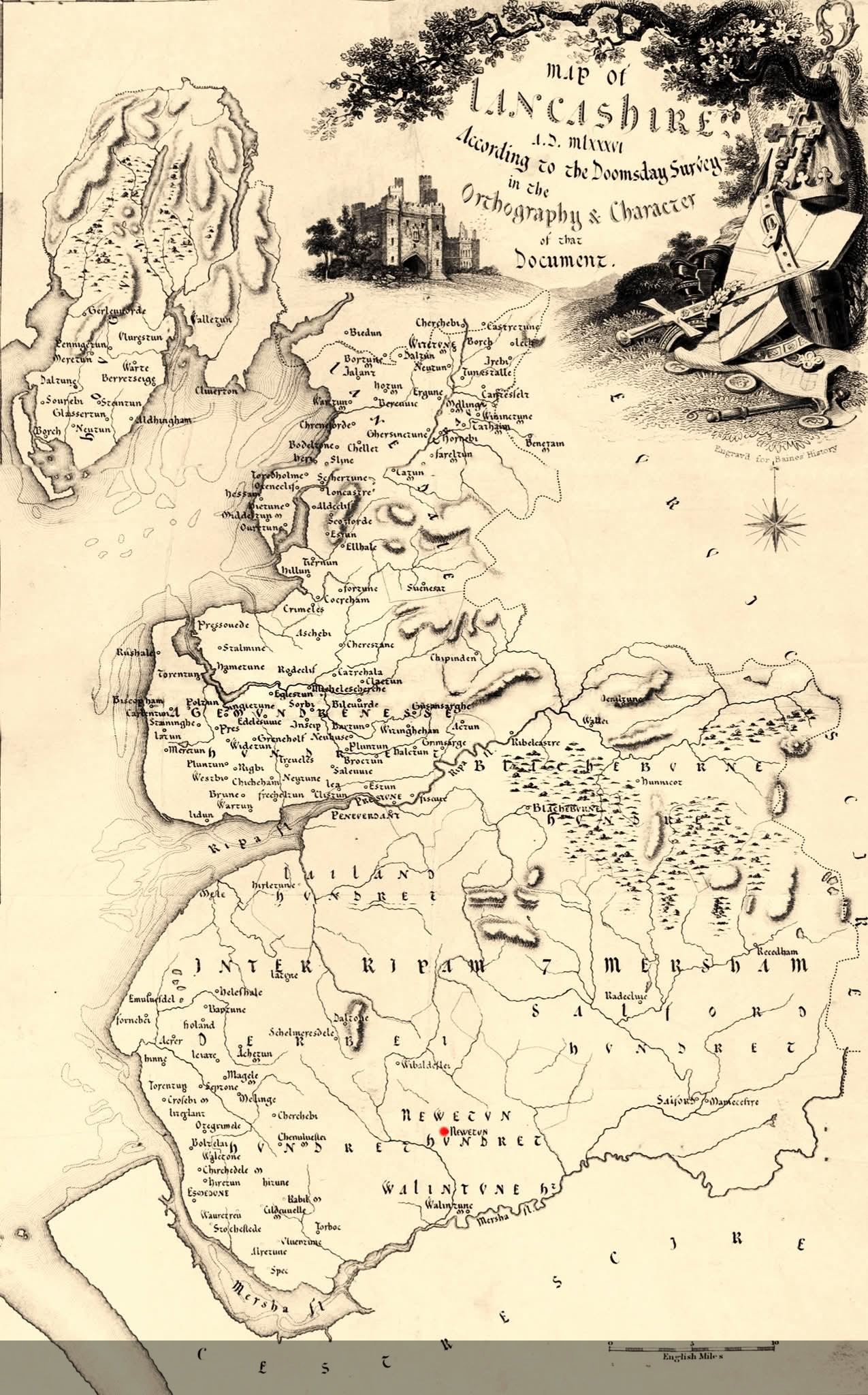
Map of Lancashire, England, from the 1086 Domesday Survey
The "Map of Lancashire, England, according to the 1086 Domesday Survey" presents a fascinating glimpse into the socio-ec...
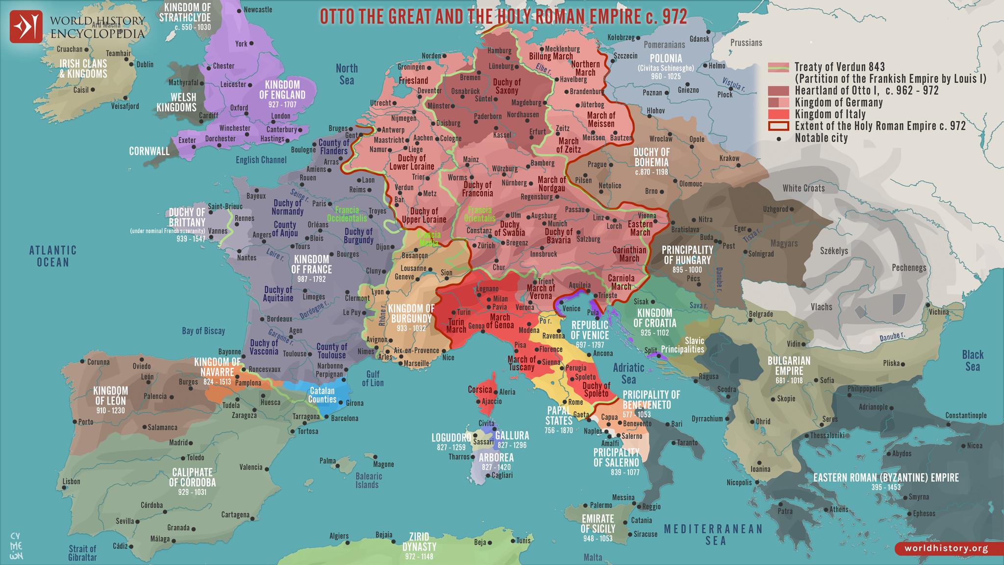
Political Map of Europe in 972
The "Map of Europe in 972" provides a fascinating glimpse into the political landscape of medieval Europe, depicting the...
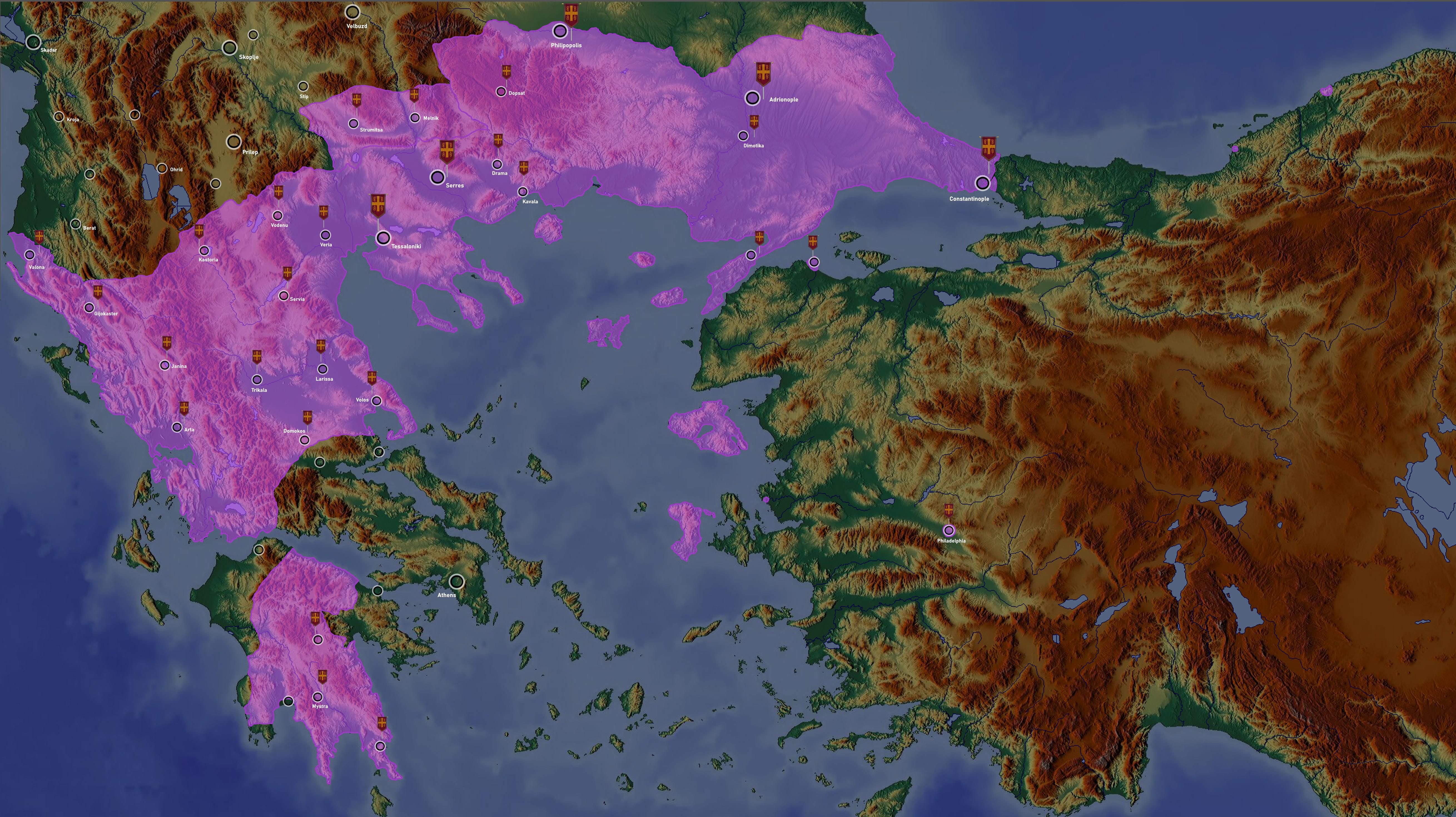
Eastern Roman Empire Map in 1341
The map titled "Eastern Roman Empire in 1341 (at death of Andronikos III)" illustrates the territorial expanse of the By...
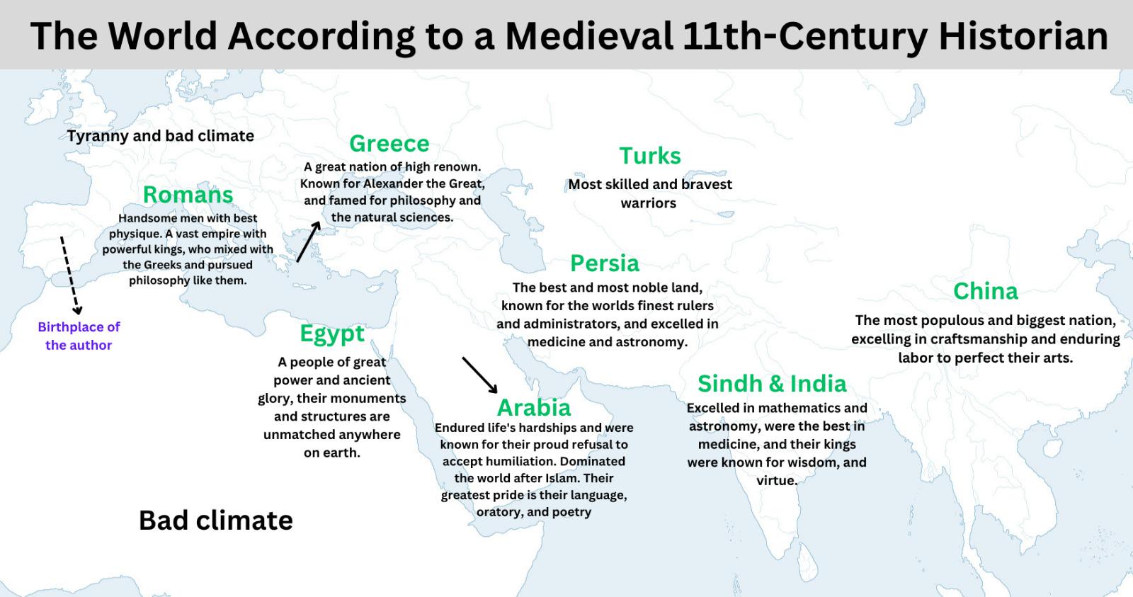
Medieval World Map by Historian Said al-Andalusi
...
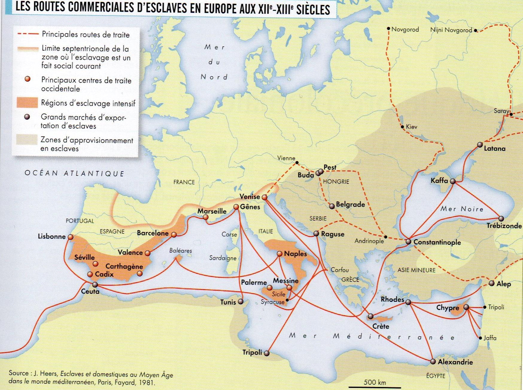
Map of the Slavic Slave Trade in Europe
This map presents a detailed overview of the Slavic slave trade that took place in Europe during the 12th and 13th centu...
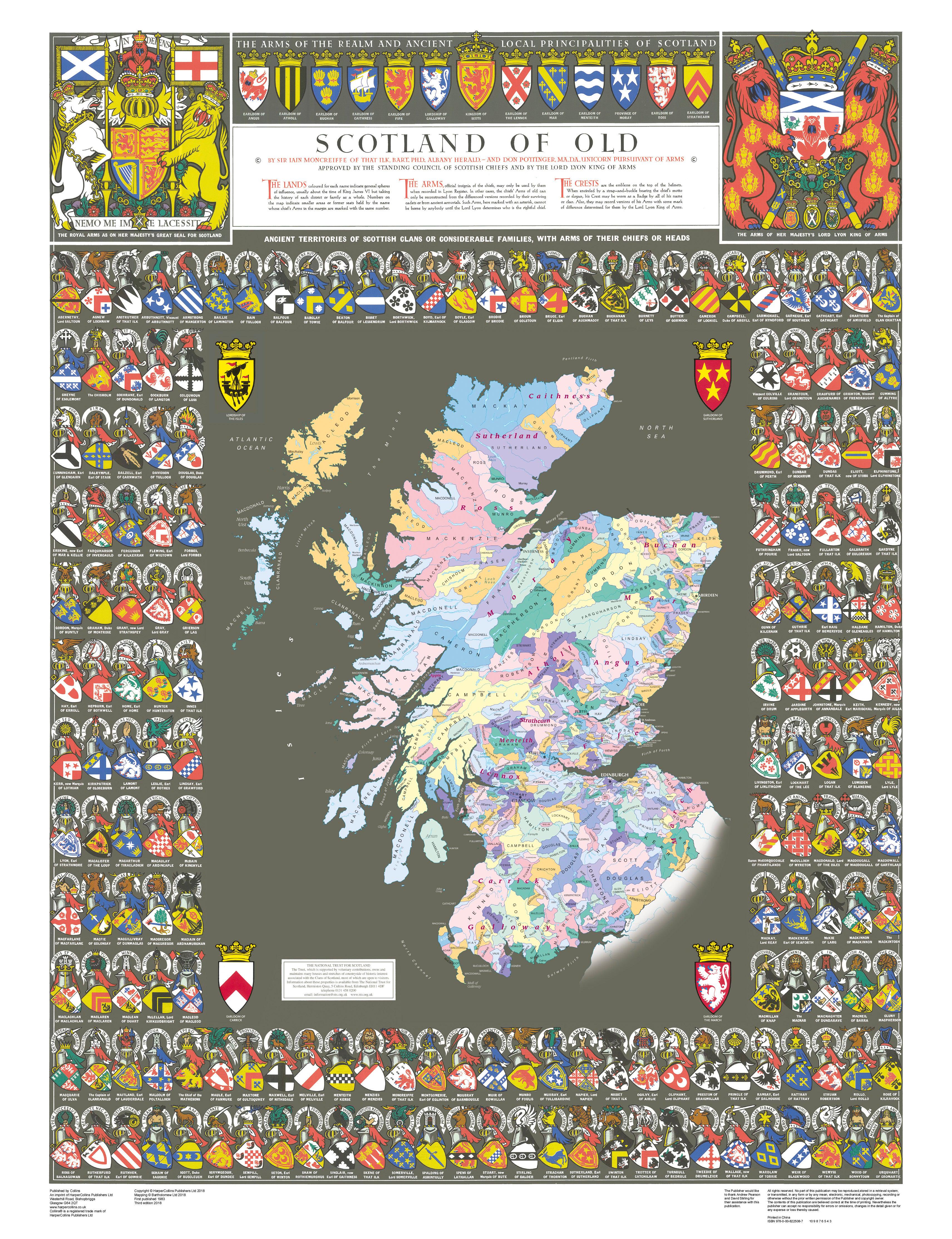
Historical Clan Map of Medieval Scotland
This high-resolution Historical Clan Map of Medieval Scotland visually represents the territorial divisions and influenc...
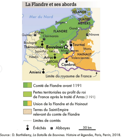
Flanders County Map in the 12th Century
This map depicts the county of Flanders in the 12th century, providing a detailed representation of the geographical bou...
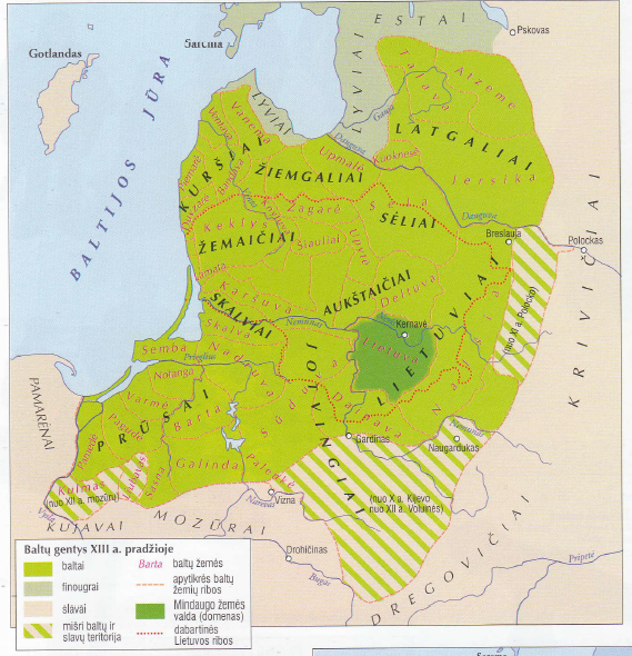
Map of Baltic Tribes in the 13th Century
...
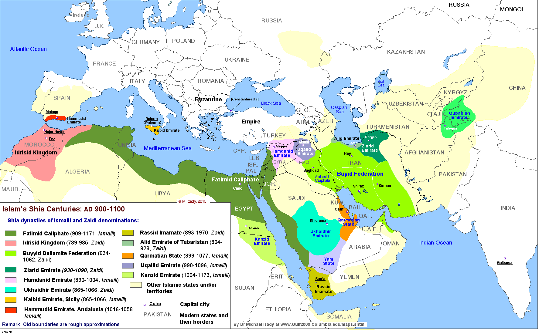
Islamic Shia States Established 900-1100 Map
This map visualizes the Islamic Shia states that emerged between AD 900 and 1100, highlighting their geographical locati...
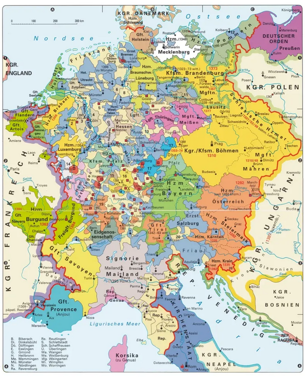
Map of the Holy Roman Empire in 1387
The "Map of the Holy Roman Empire in 1387" provides a detailed representation of the political landscape of Central Euro...
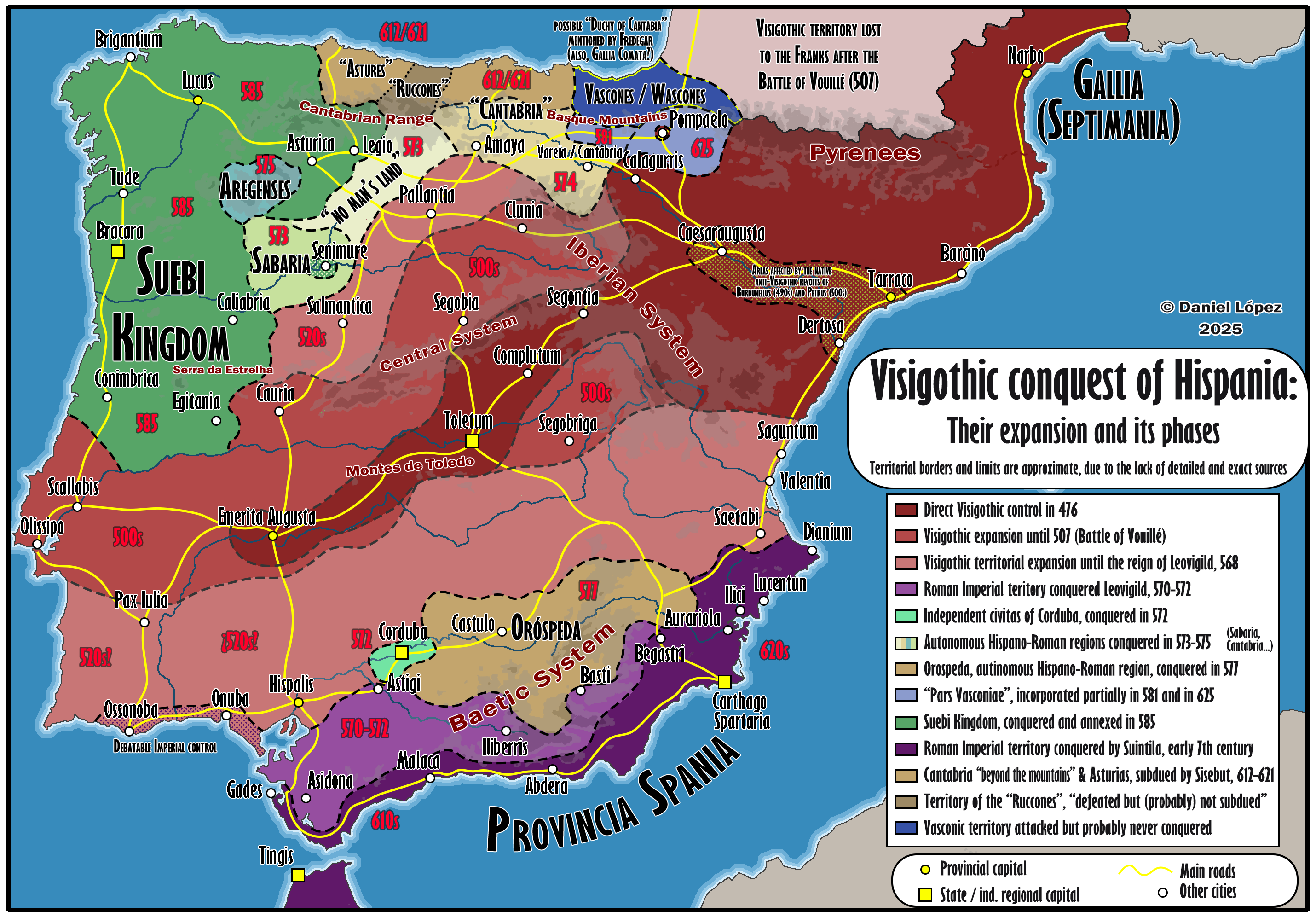
Visigothic Conquest of Hispania Map
This visualization illustrates the phases of the Visigothic conquest of Hispania, highlighting the territorial expansion...
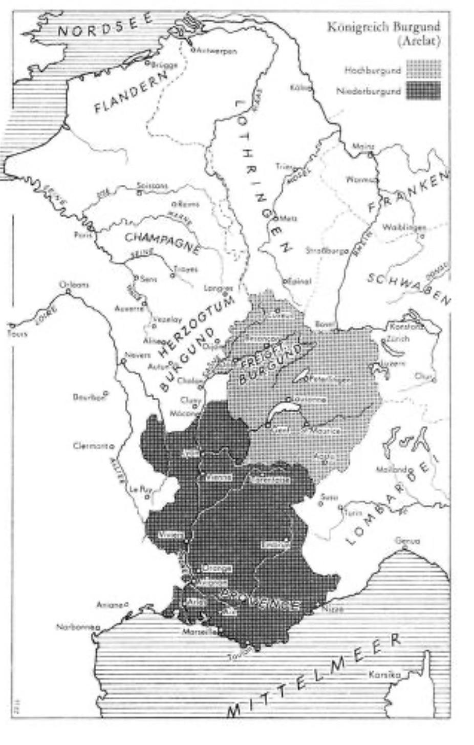
Map of the Kingdom of Burgundy Arelat, 10th–11th Century
This map provides a detailed representation of the Kingdom of Burgundy, known as Arelat, during the 10th and 11th centur...
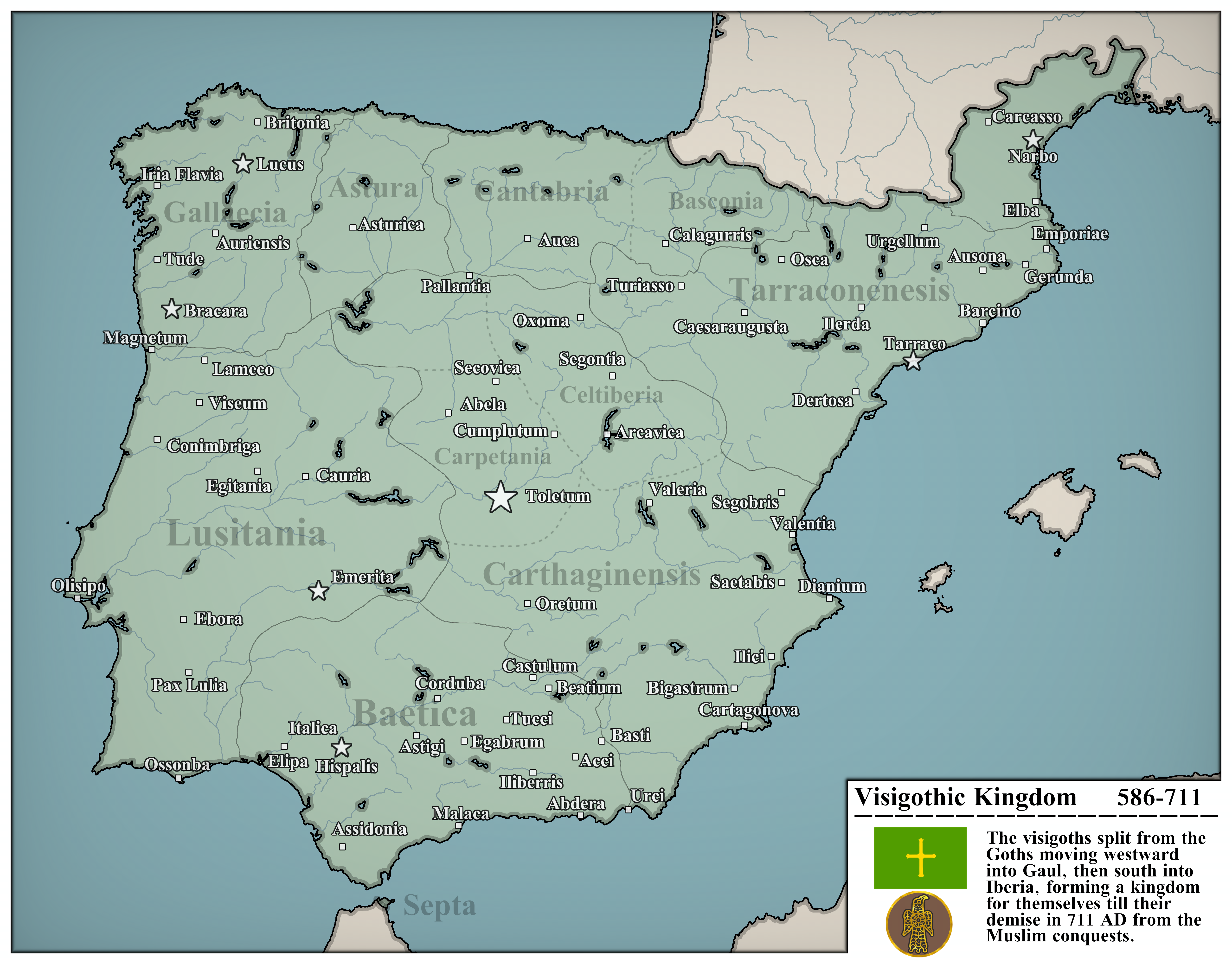
Visigothic Kingdom Map 586-711 AD
The visualization titled "Visigothic Kingdom 586-711 AD" illustrates the territorial extent and influence of the Visigot...
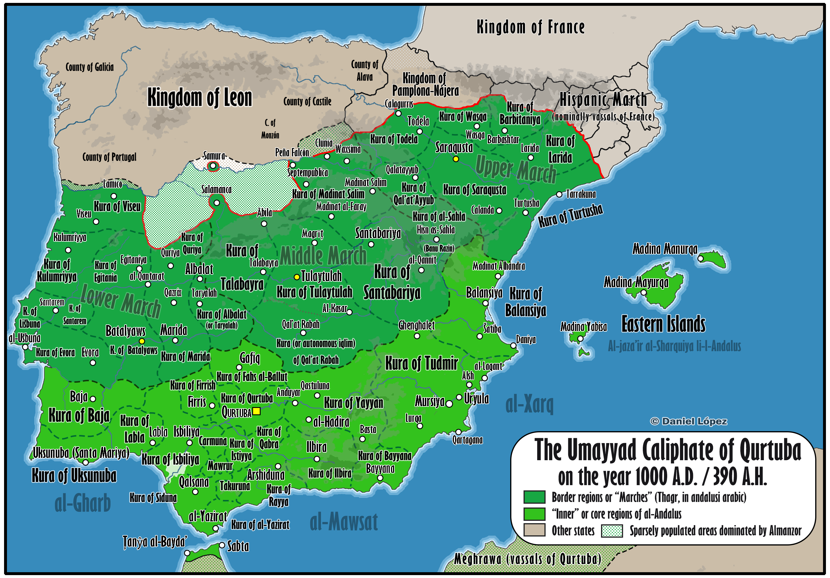
Map of the Caliphate of Qurtuba (Córdoba) at Its Greatest Extent
Interestingly, the caliphate served as a melting pot of cultures, where Muslims, Christians, and Jews coexisted, leading...
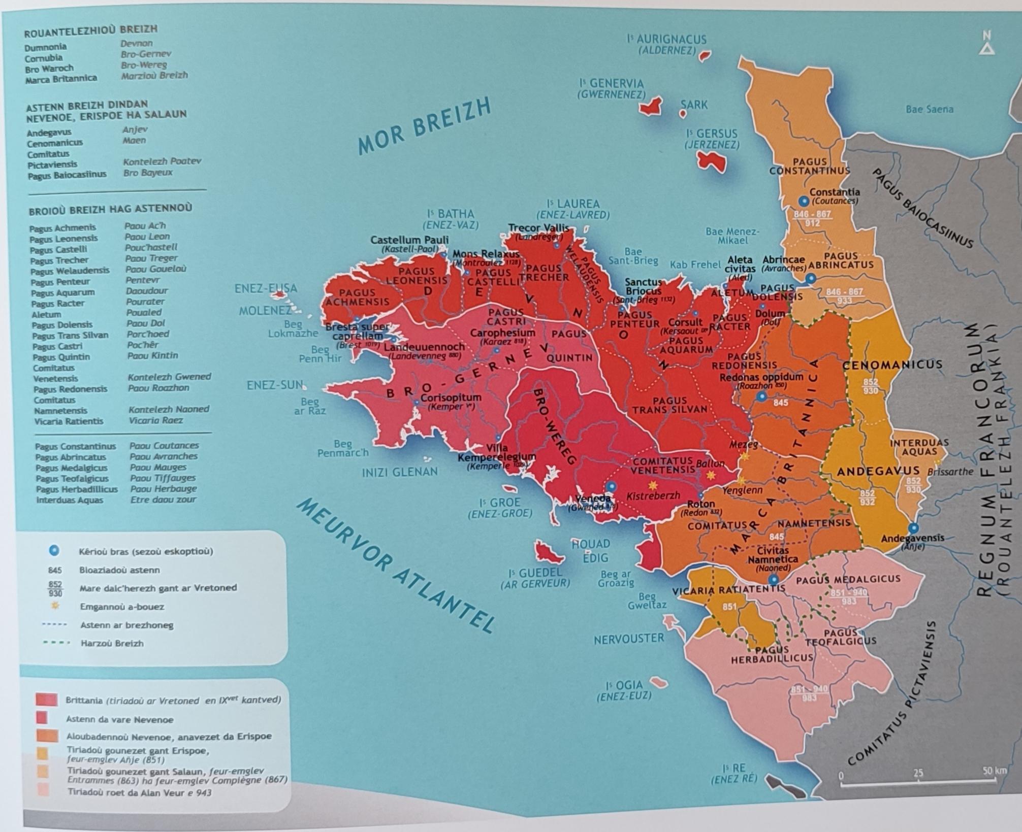
Territorial Extent Map of the Kingdom of Brittany (9th-10th Century AD)
The map titled "Territorial Extent of the Kingdom of Brittany (9th-10th Century AD)" provides a detailed portrayal of th...
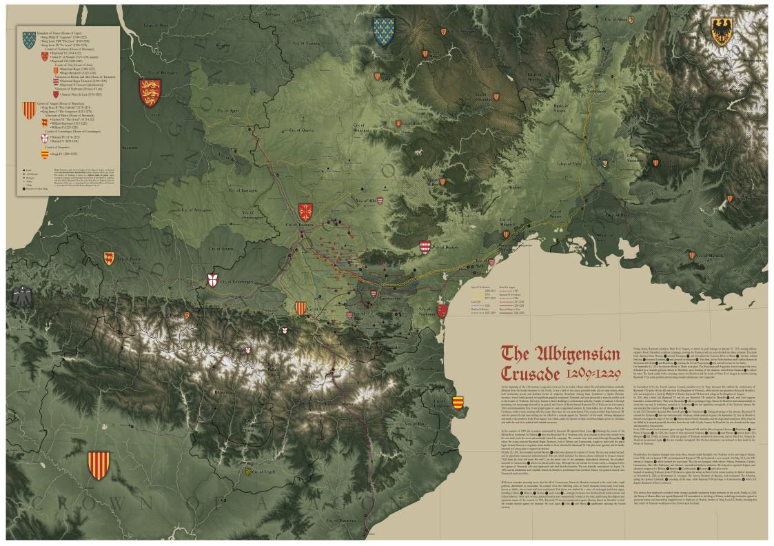
Albigensian Crusade Geography Map
The highly detailed map of the Albigensian Crusade (1209–1229) serves as a visual representation of the significant geog...