india Maps
59 geographic visualizations tagged with "india"
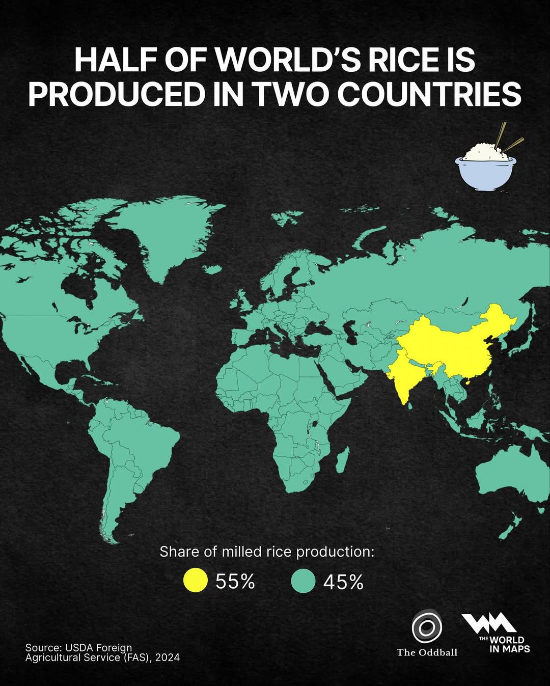
Rice Production Map of the World
This map illustrates a striking reality: more than half of the world’s rice production comes from just two countries—Chi...
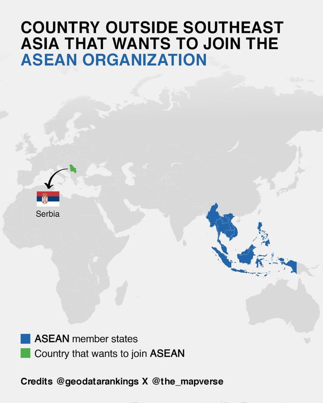
Map of Countries Outside Southeast Asia Wanting to Join ASEAN
This map illustrates the various countries outside of Southeast Asia that have expressed interest in joining the Associa...
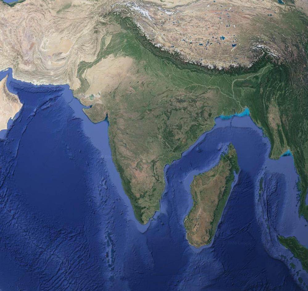
Geographical Comparison Map of Madagascar and India
This map provides a comparative geographical overview of Madagascar and India, two distinct nations that share a fascina...
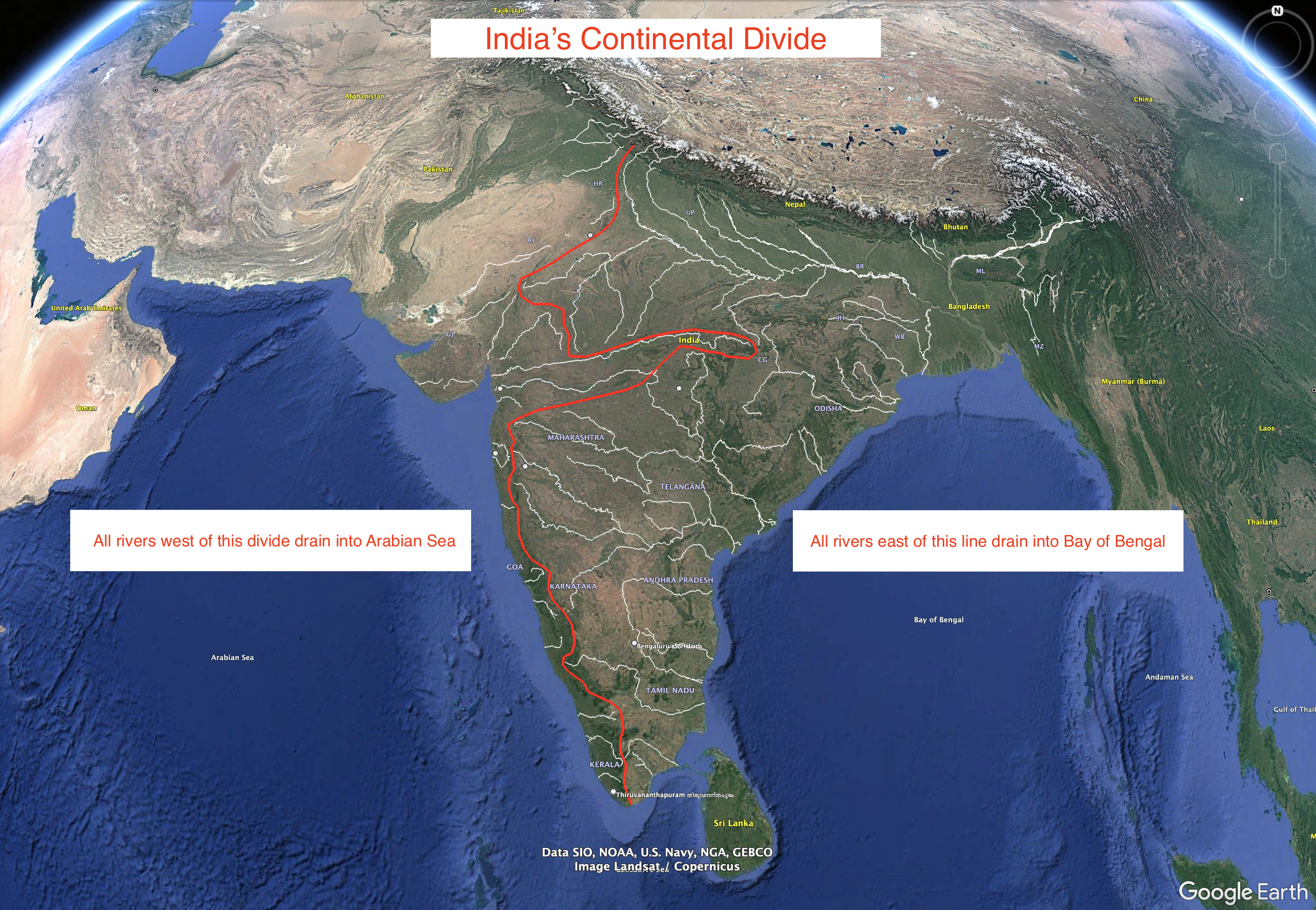
India's Continental Divide Map
This visualization represents an approximation of India's continental divide, illustrating how the landmass is oriented ...
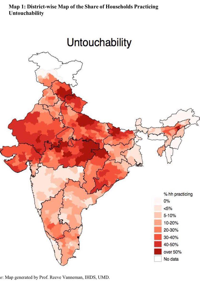
Map of Indian Households' Beliefs on Caste
This map illustrates a sensitive and complex social issue in India: the percentage of households that believe they becom...
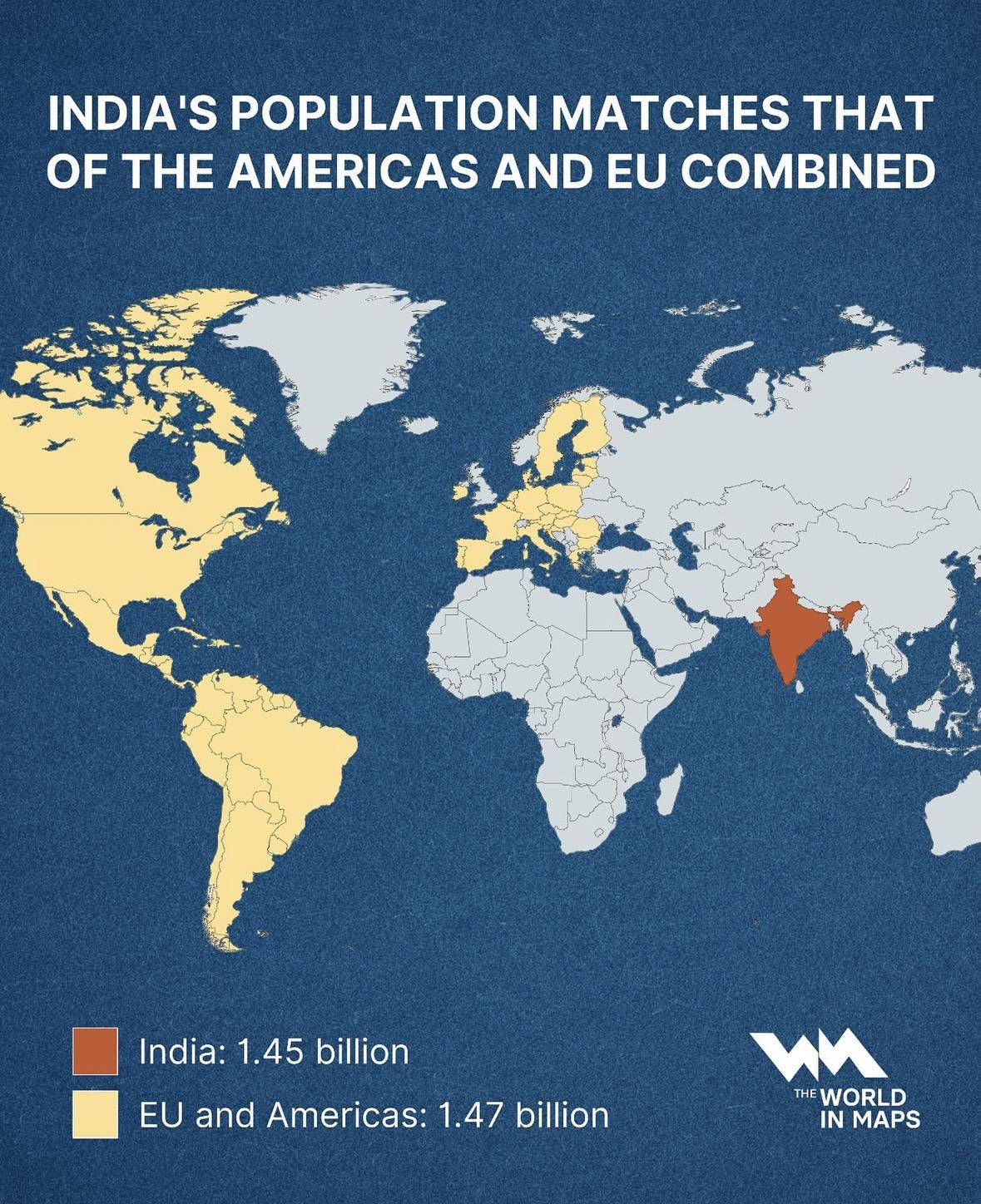
India Population Compared to Americas & EU Map
This map illustrates a striking demographic milestone: India’s population, standing at approximately 1.45 billion, now n...
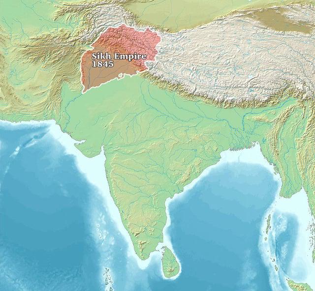
Sikh Empire 1845 Map
The "Sikh Empire 1845 Map" provides a detailed overview of the territorial expanse of the Sikh Empire at its zenith. Spa...
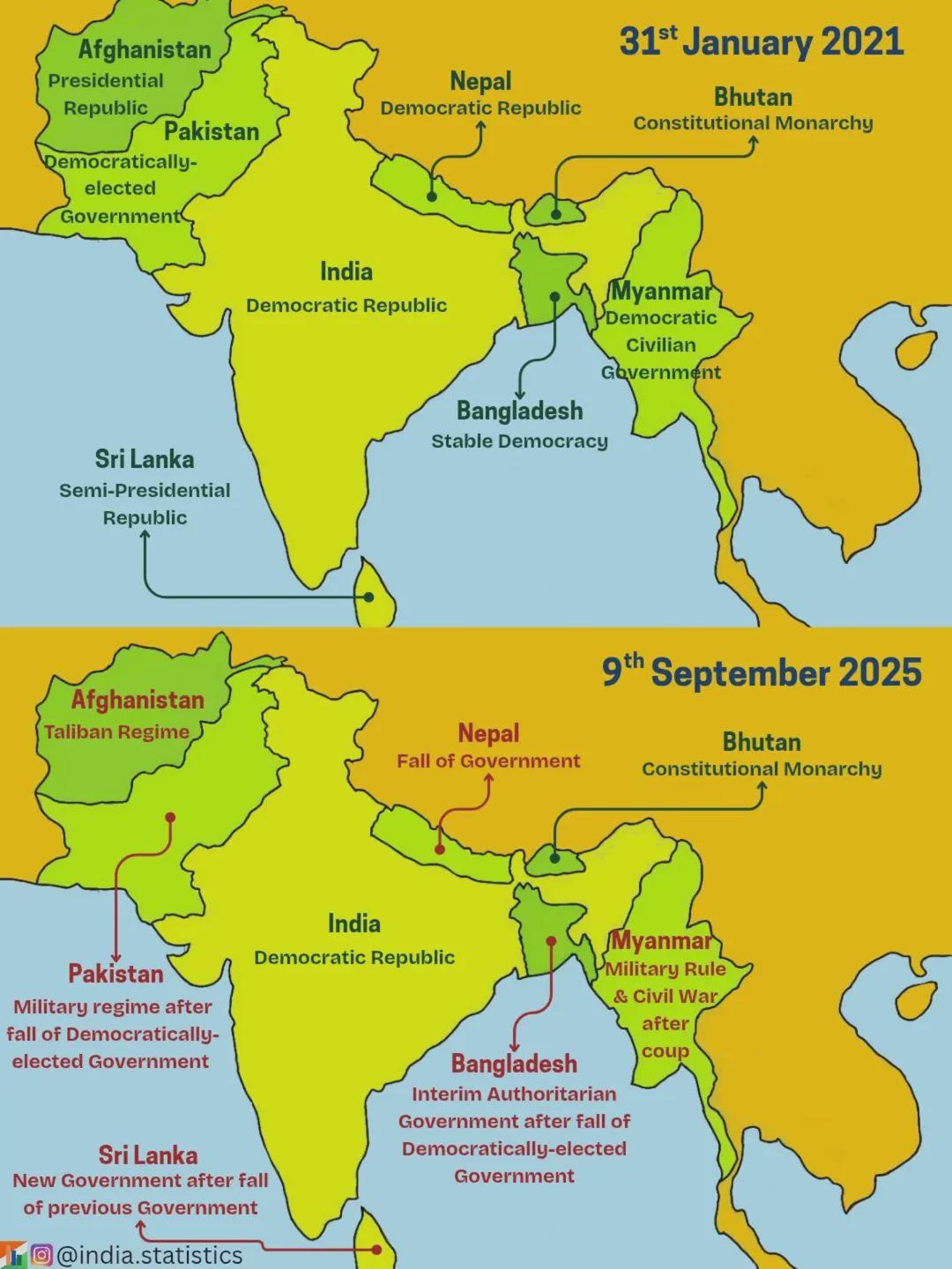
Coups and Crises in South Asia Map
The visualization titled "2021 vs 2025, How coups and crises reshaped South Asia" presents a striking comparison of poli...
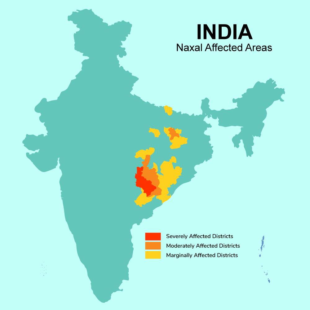
Maoist Insurgency Affected Areas Map in India
The map titled 'Maoist Insurgency Affected Areas in India' provides a stark visual representation of the districts most ...
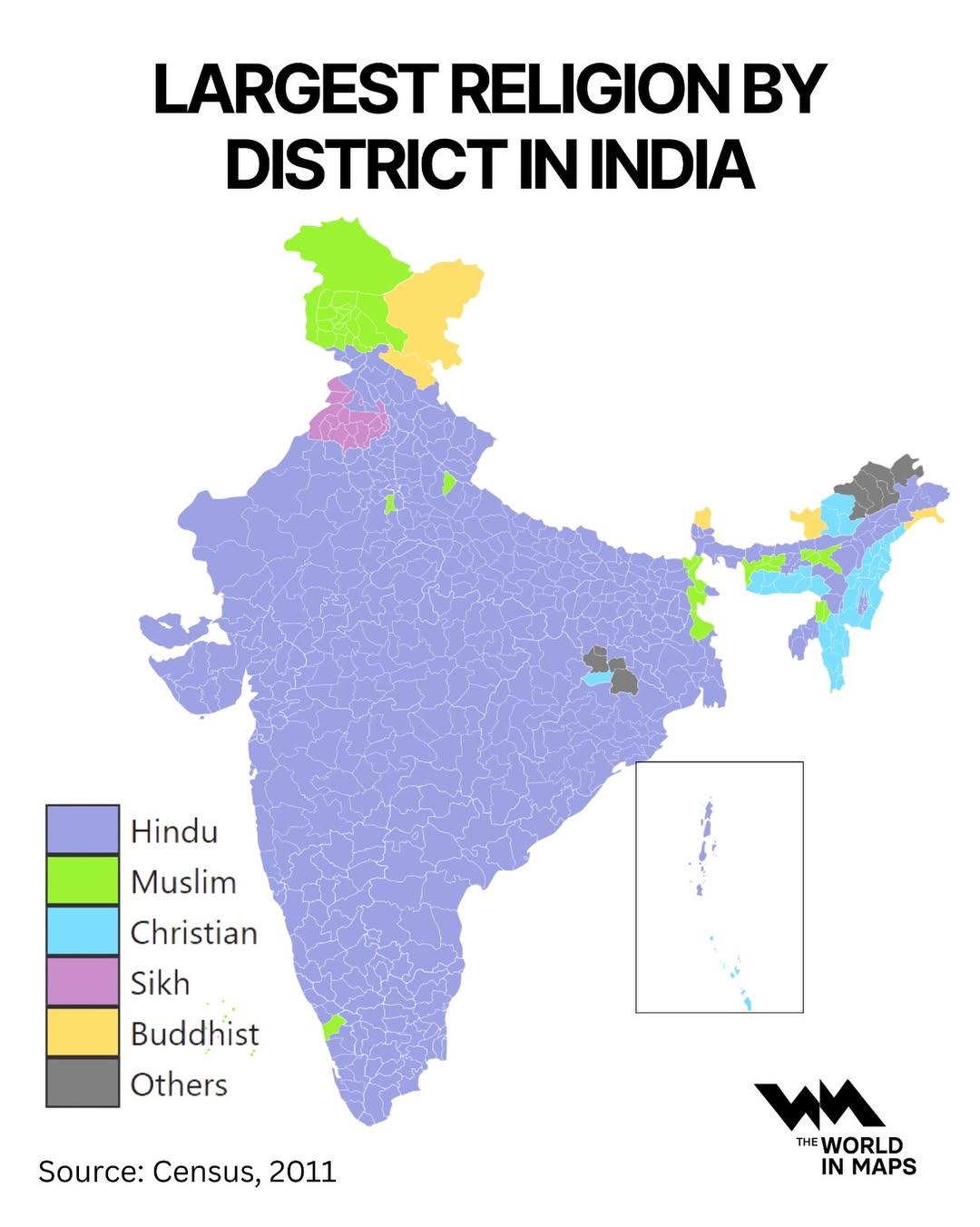
Largest Religion by District in India Map
The "Largest Religion by District in India Map" offers a fascinating look at the religious landscape of India, highlight...
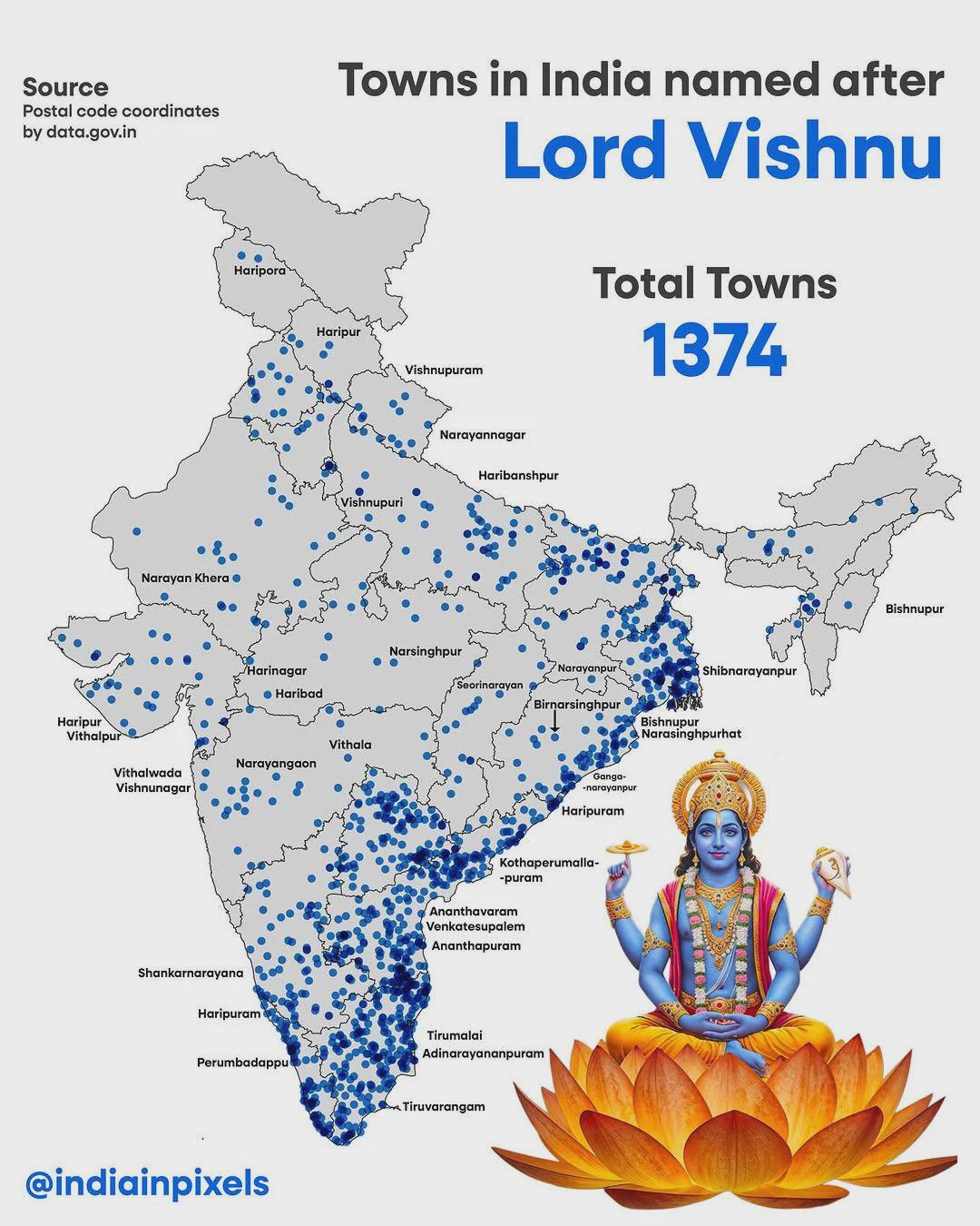
Map of Indian Cities Named After Lord Vishnu
The map titled \...
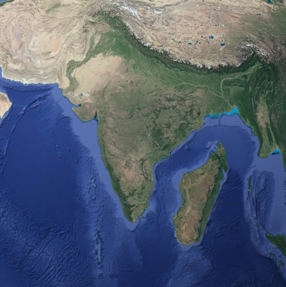
Geographical Map of Madagascar Next to India
The map titled "Geographical Map of Madagascar Next to India" provides a clear visual representation of the spatial rela...
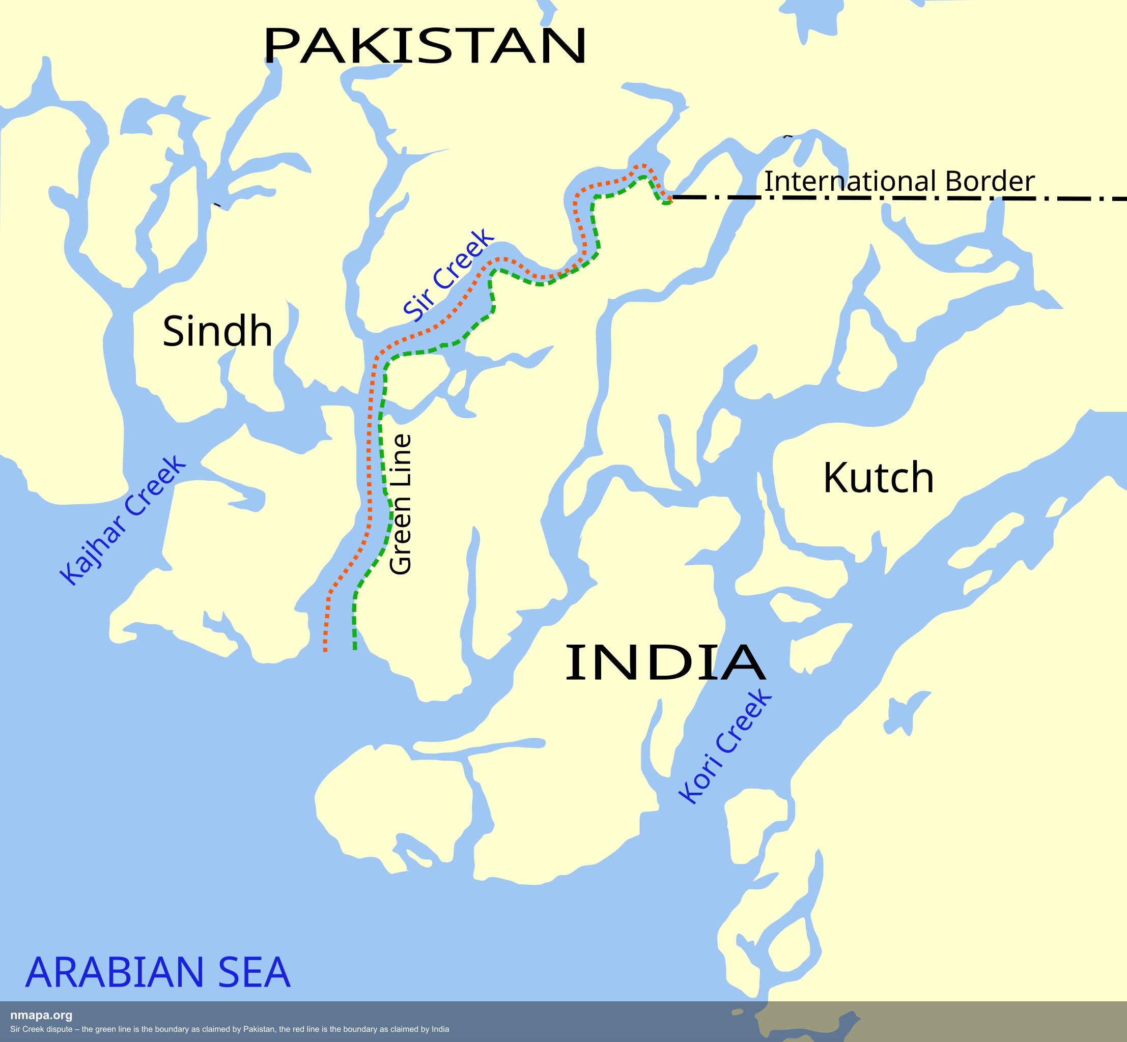
Sir Creek Dispute Boundary Map: Pakistan vs India
The Sir Creek dispute boundary map illustrates the contentious borders between Pakistan and India in the Sir Creek regio...
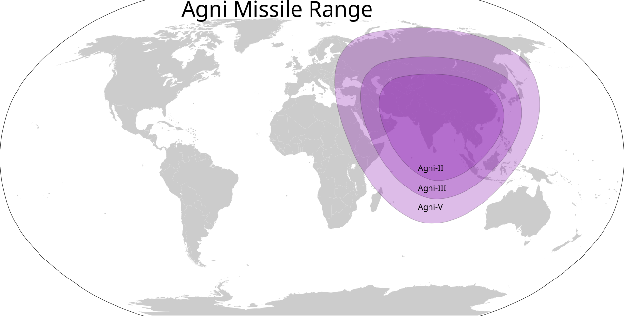
Agni Missile Range Map of India
This map provides a detailed visualization of the range of India's Agni missiles, which are capable of delivering nuclea...
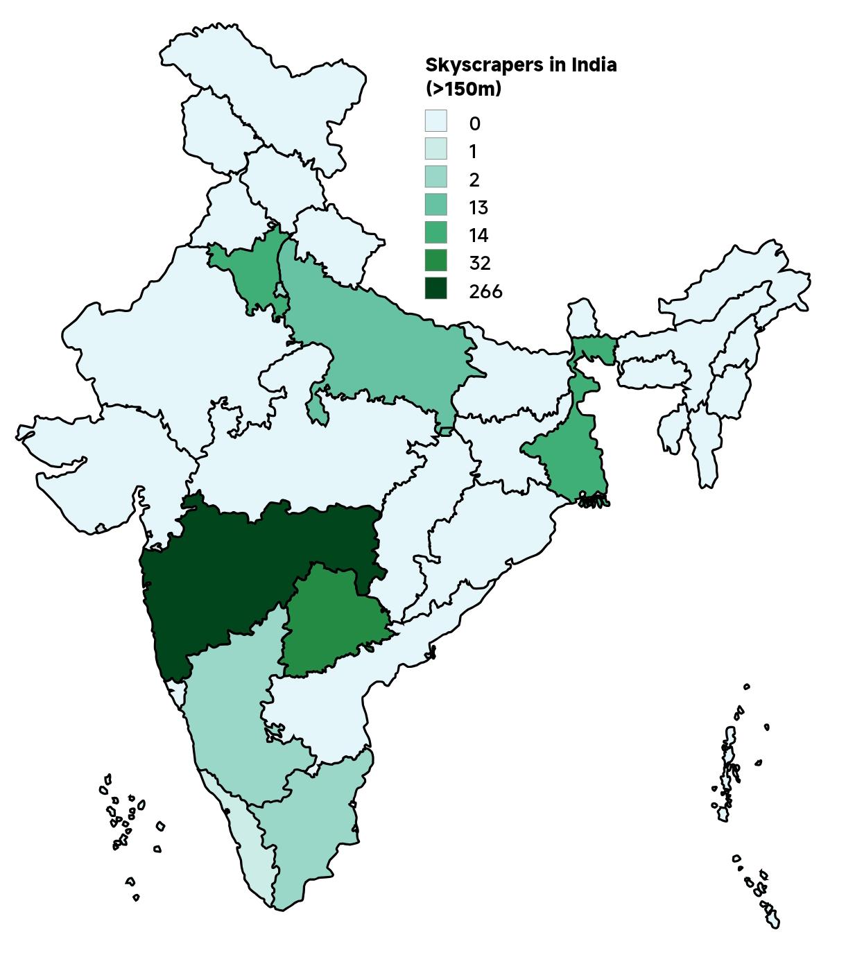
Skyscrapers in India Map 2025
The "Skyscrapers in India Map 2025" provides a comprehensive visualization of the country's towering architectural achie...
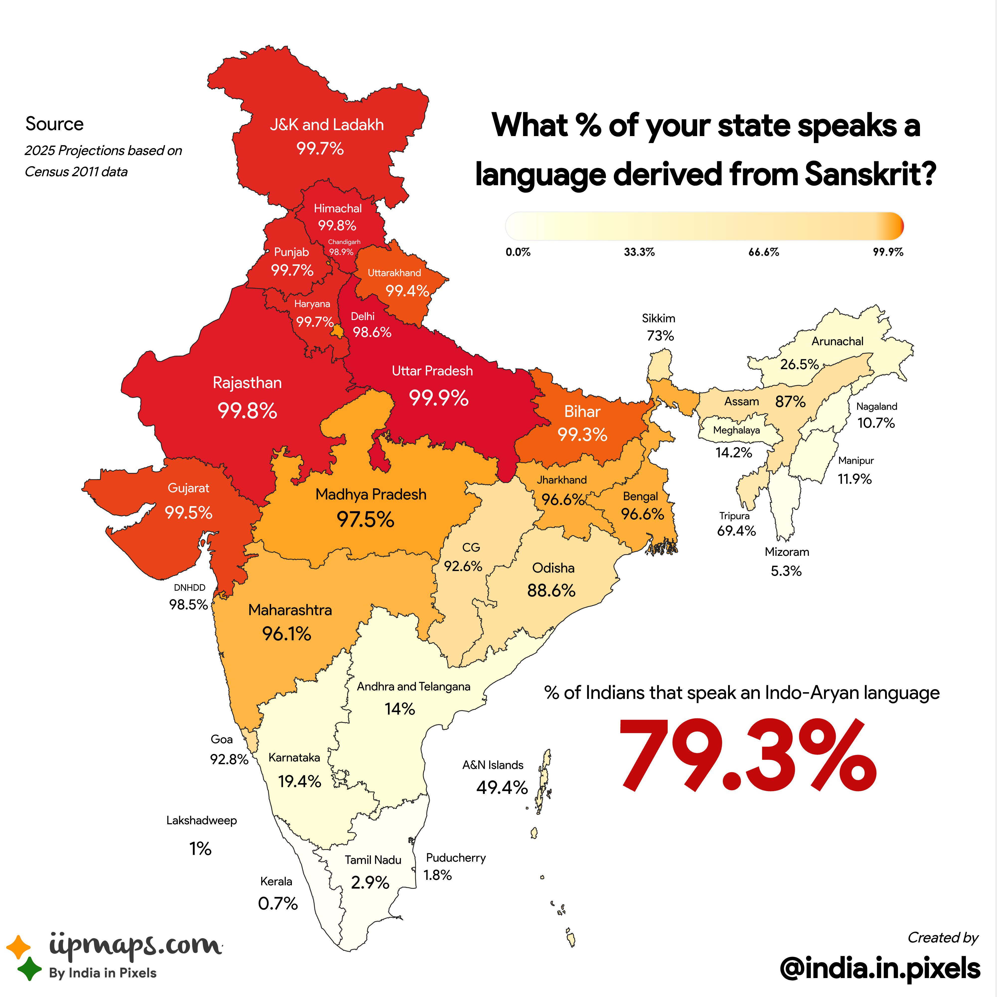
Indo-Aryan Languages Map of India
The visualization titled "The Sanskrit Footprint: A Map of Indo-Aryan Languages Across India" provides a detailed look a...
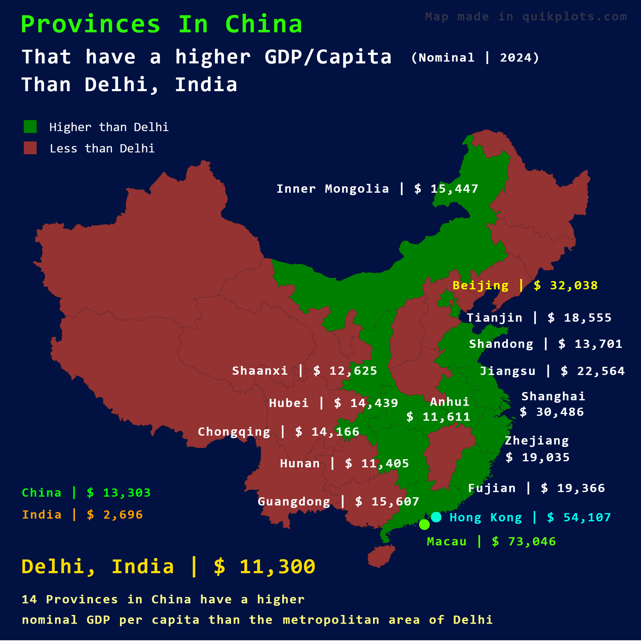
Map of Chinese Provinces with Higher GDP Per Capita than Delhi
This map illustrates which provinces in China have a higher nominal GDP per capita compared to Delhi, India. By placing ...
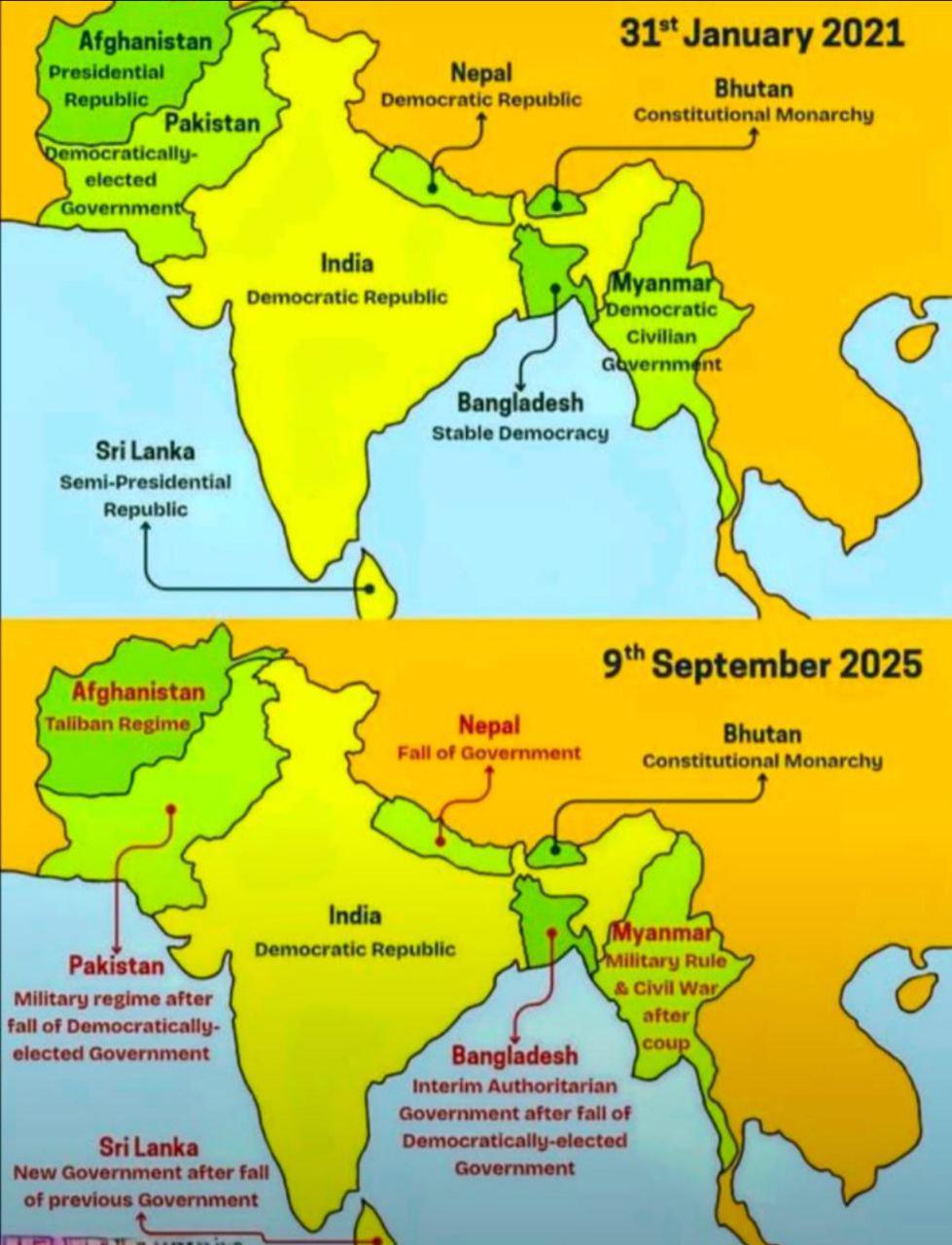
South Asia Polity Map
The "South Asia Polity Map" provides a detailed visualization of the political boundaries and governance structures acro...
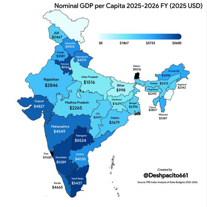
India Nominal GDP per Capita by State Map
The visualization titled "India Nominal GDP per Capita for States 2025-2026 FY (2025 USD)" presents a detailed overview ...
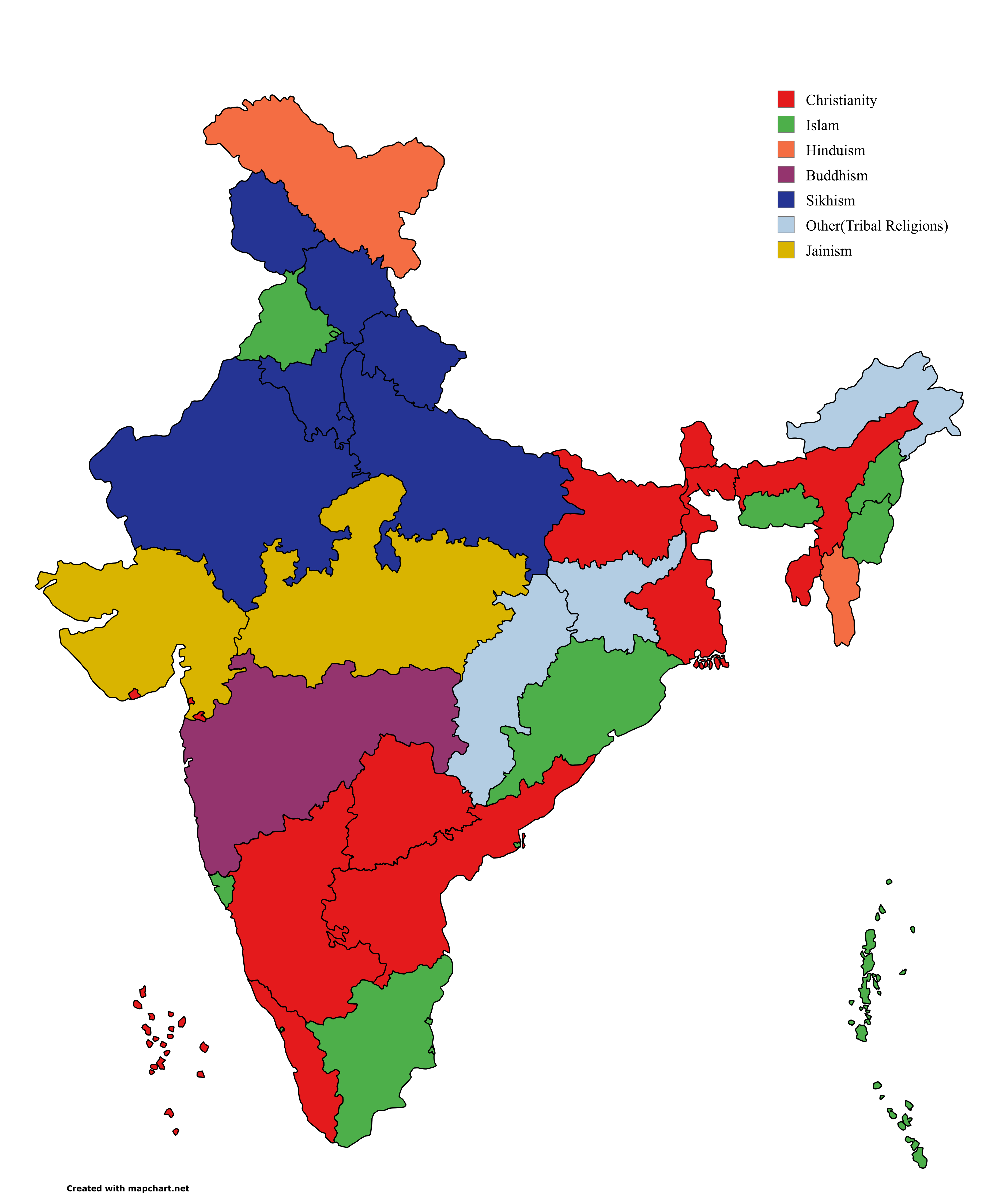
Third Largest Religion in India by State Map
This map provides a visual representation of the third largest religion practiced in each state and union territory of I...
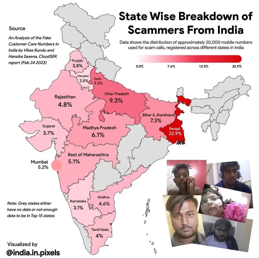
Scammers from India Statewise Map
The "Scammers from India Statewise Map" provides a visual representation of the prevalence of scam-related activities ac...
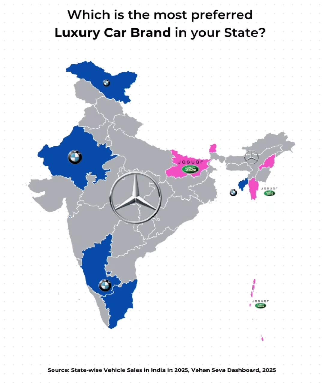
Luxury Car Brand Preference Map of India
The visualization titled "Most Preferred Luxury Car Brand in India (Statewise)" provides a clear depiction of the luxury...
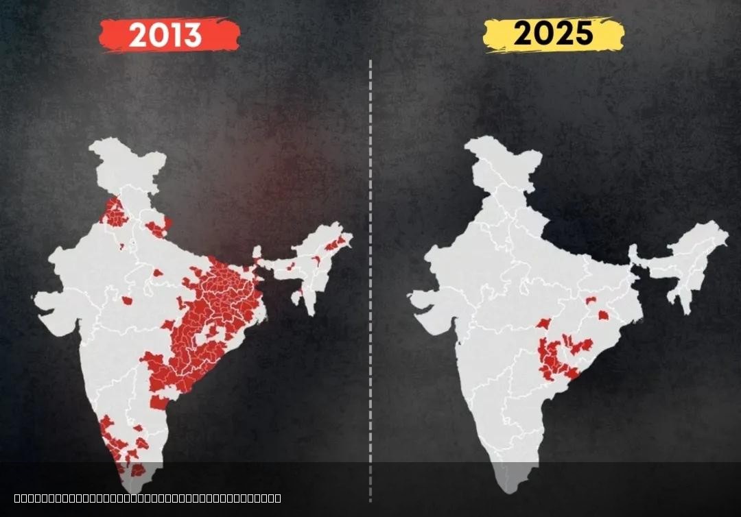
Decline of Left Wing Extremism in India Map
The "Decline of Left Wing Extremism in India Map" visually represents the reduction of left-wing extremist activities ac...
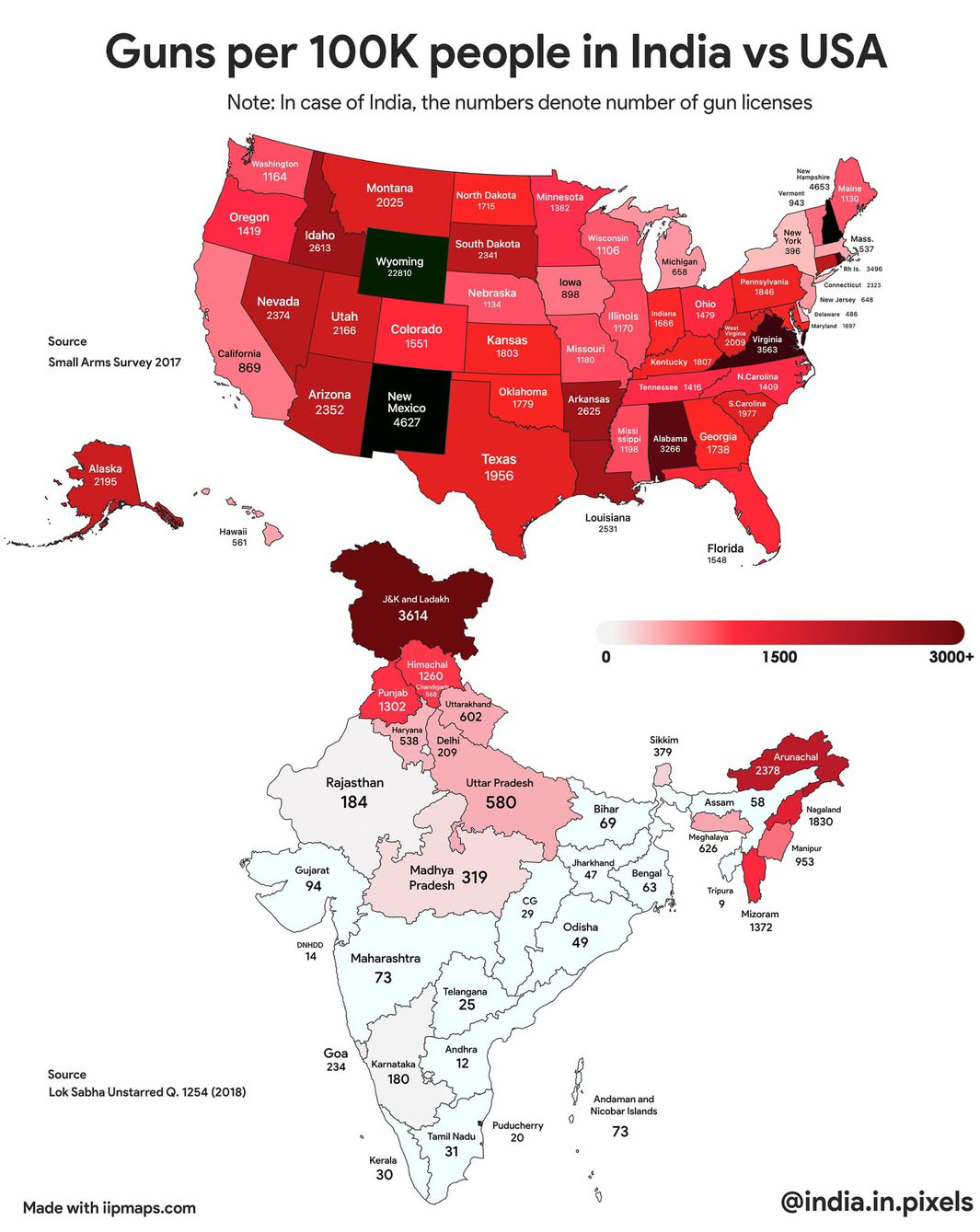
Guns Per 100K People Map: India vs USA
...
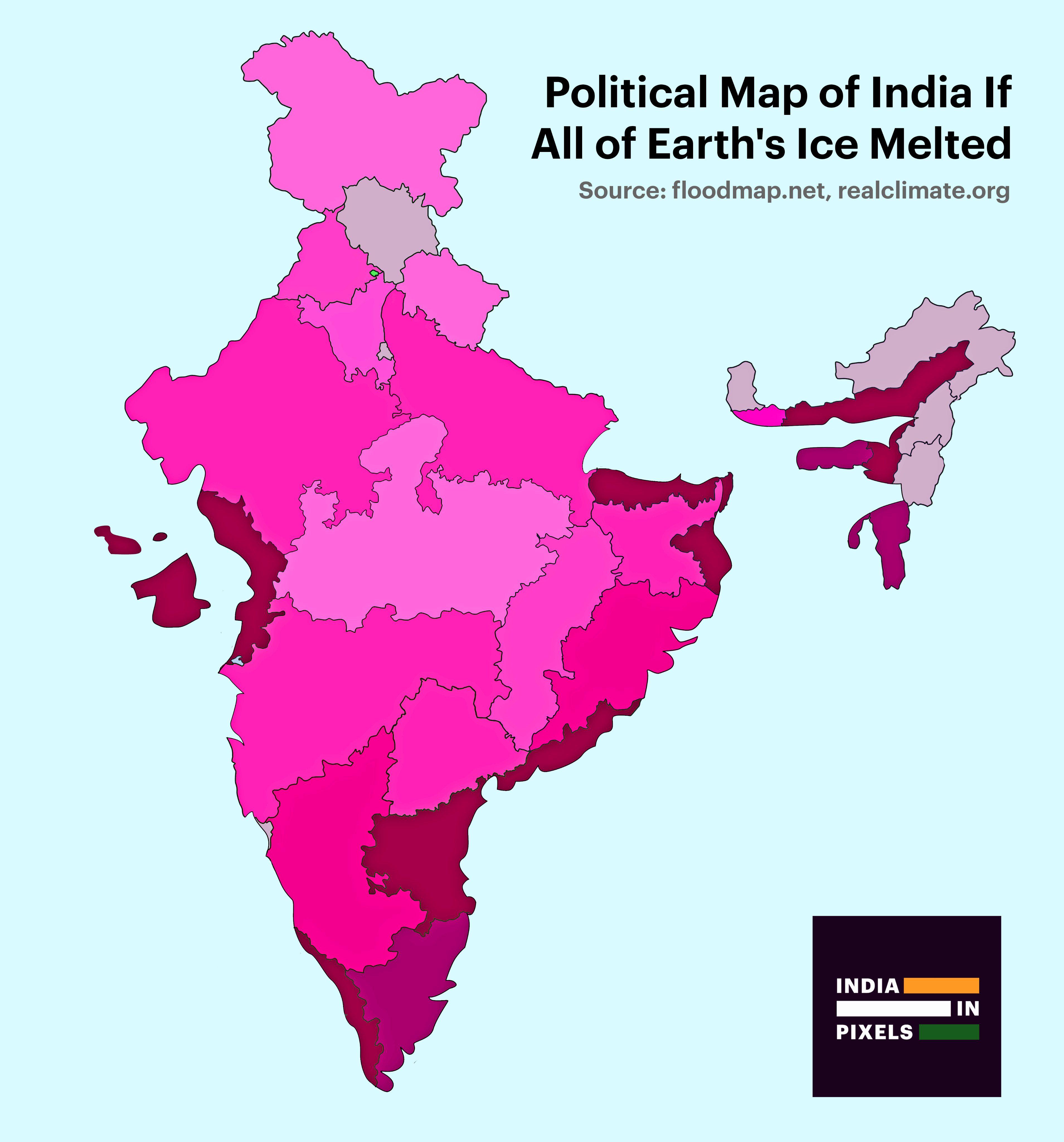
Political Map of India If All Ice Melted Map
This visualization presents a striking political map of India under the hypothetical scenario of complete ice melt acros...
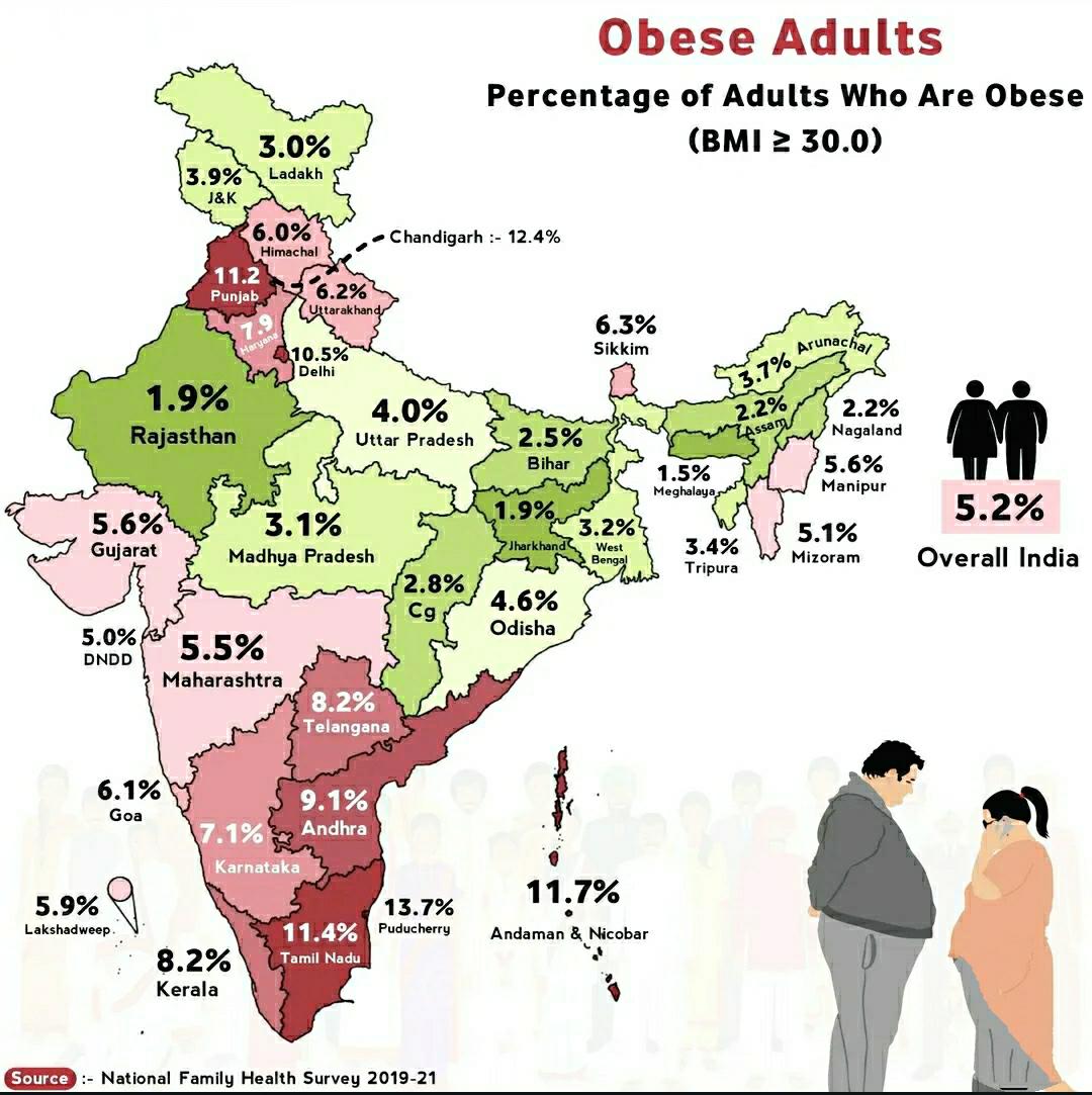
Obese Adults in India Map
The "Obese Adults in India Map" provides a visual representation of the prevalence of obesity among adults across variou...
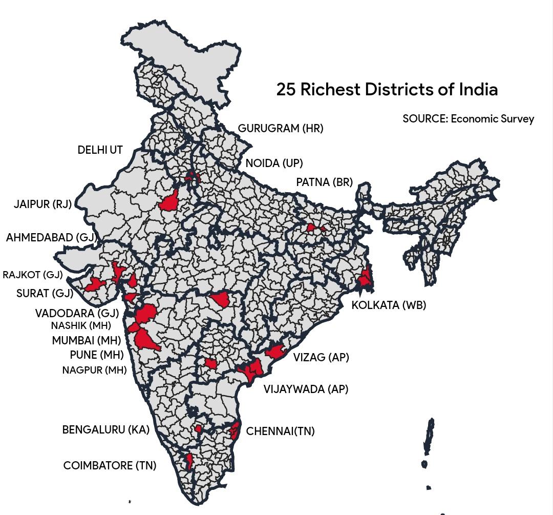
GDP Contribution by Districts in India Map
The visualization titled "Almost 1/3rd of India's $4 trillion GDP comes from these 25 districts" highlights the economic...
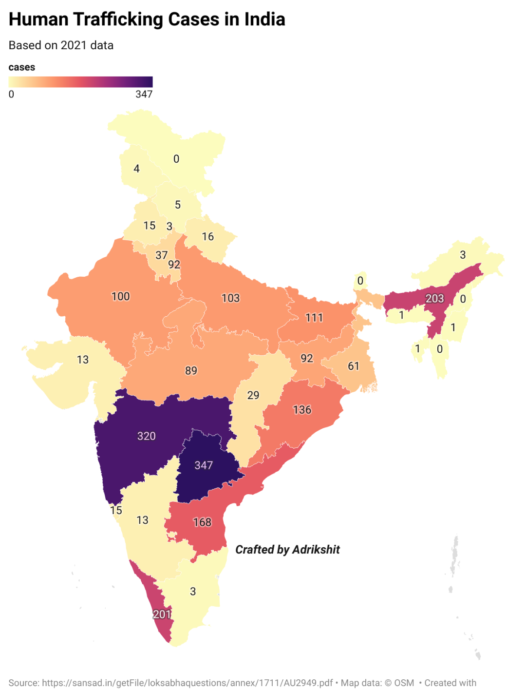
Human Trafficking Cases in India Map
Human trafficking, often referred to as modern slavery, encompasses a range of abuses, including forced labor, sexual ex...
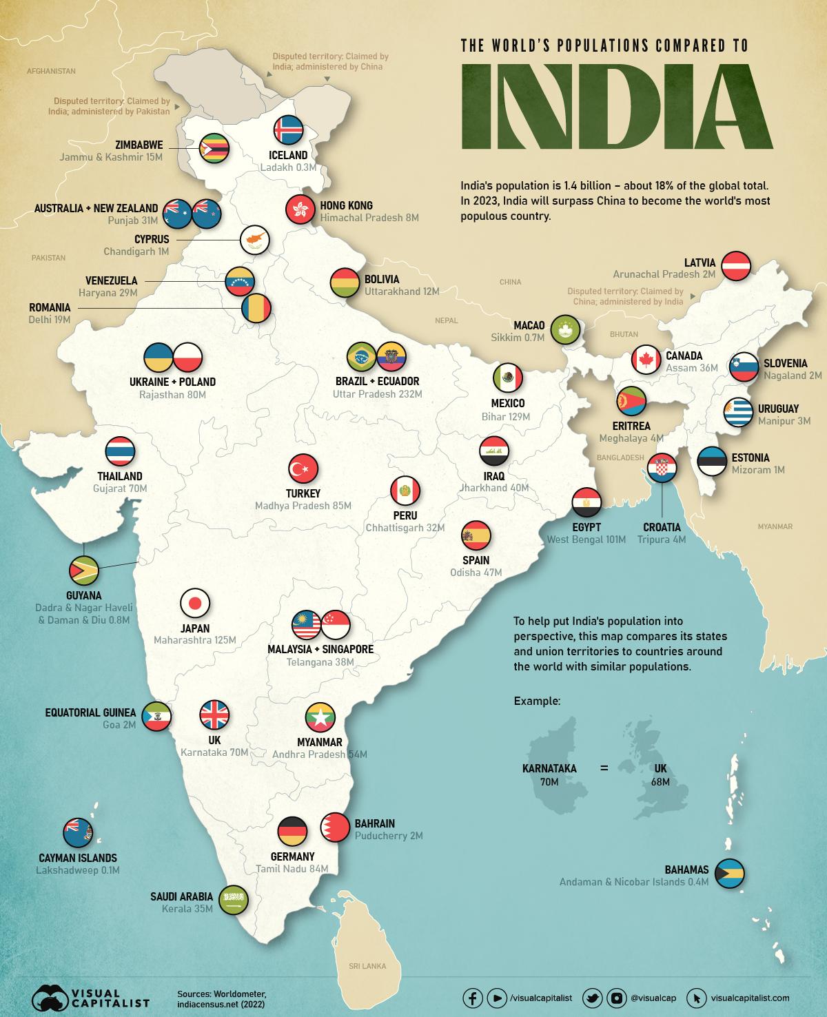
World Population Compared to India Map
This map provides a compelling visualization of the world's populations compared to that of India. It highlights how Ind...
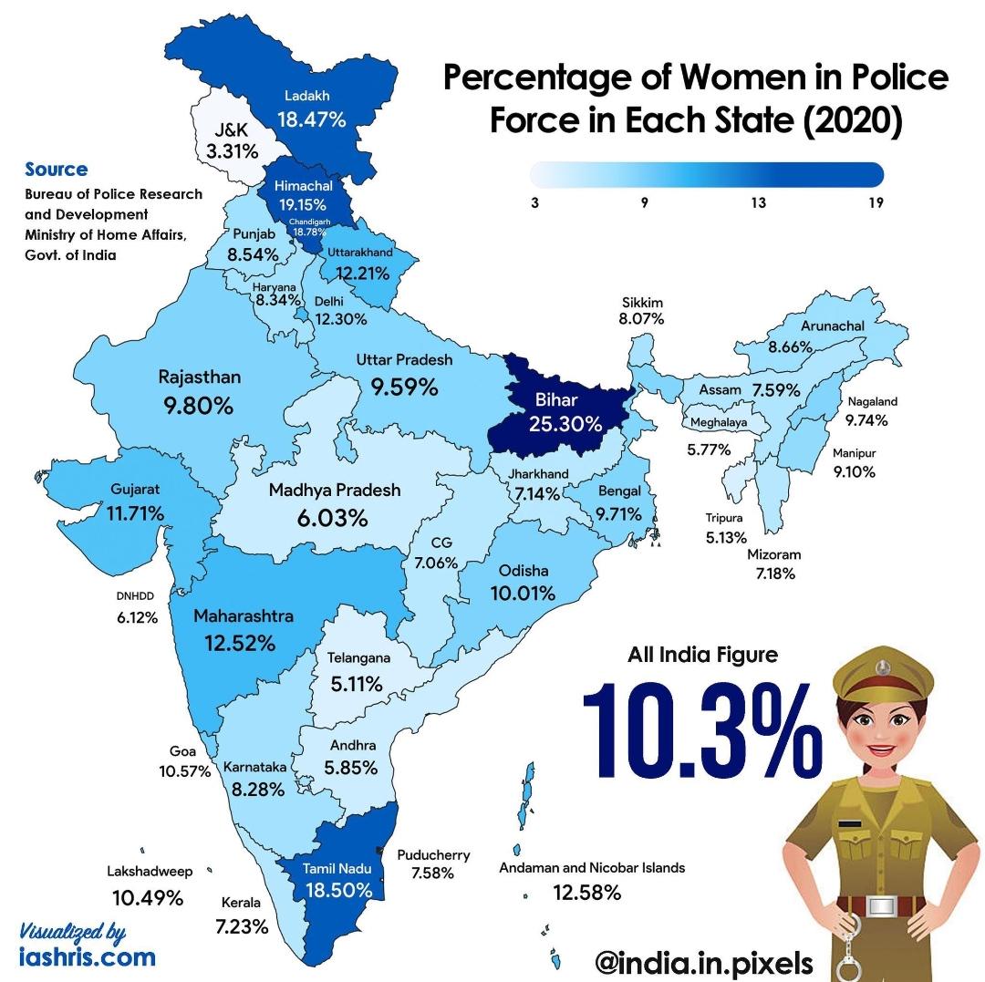
India Women in Police Percentage by State Map
The 'India: % of Women in Police (Statewise) Map' provides a visual representation of the percentage of women serving in...
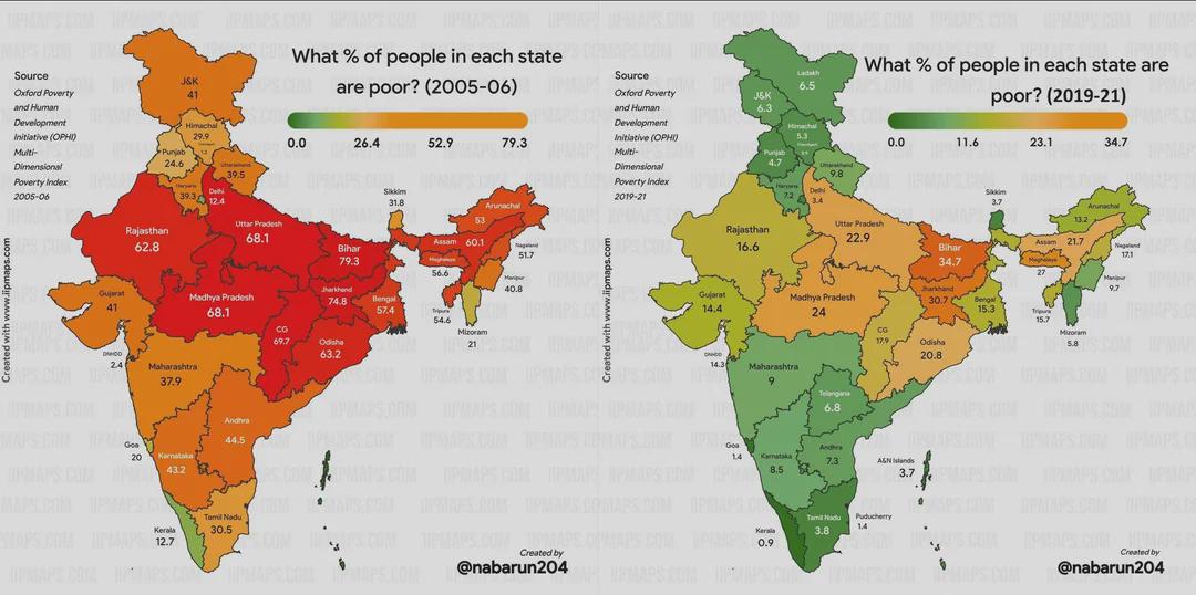
Poverty Change in India Over 15 Years Map
This map visualizes the changes in poverty levels across India over a span of 15 years. It highlights shifts in poverty ...
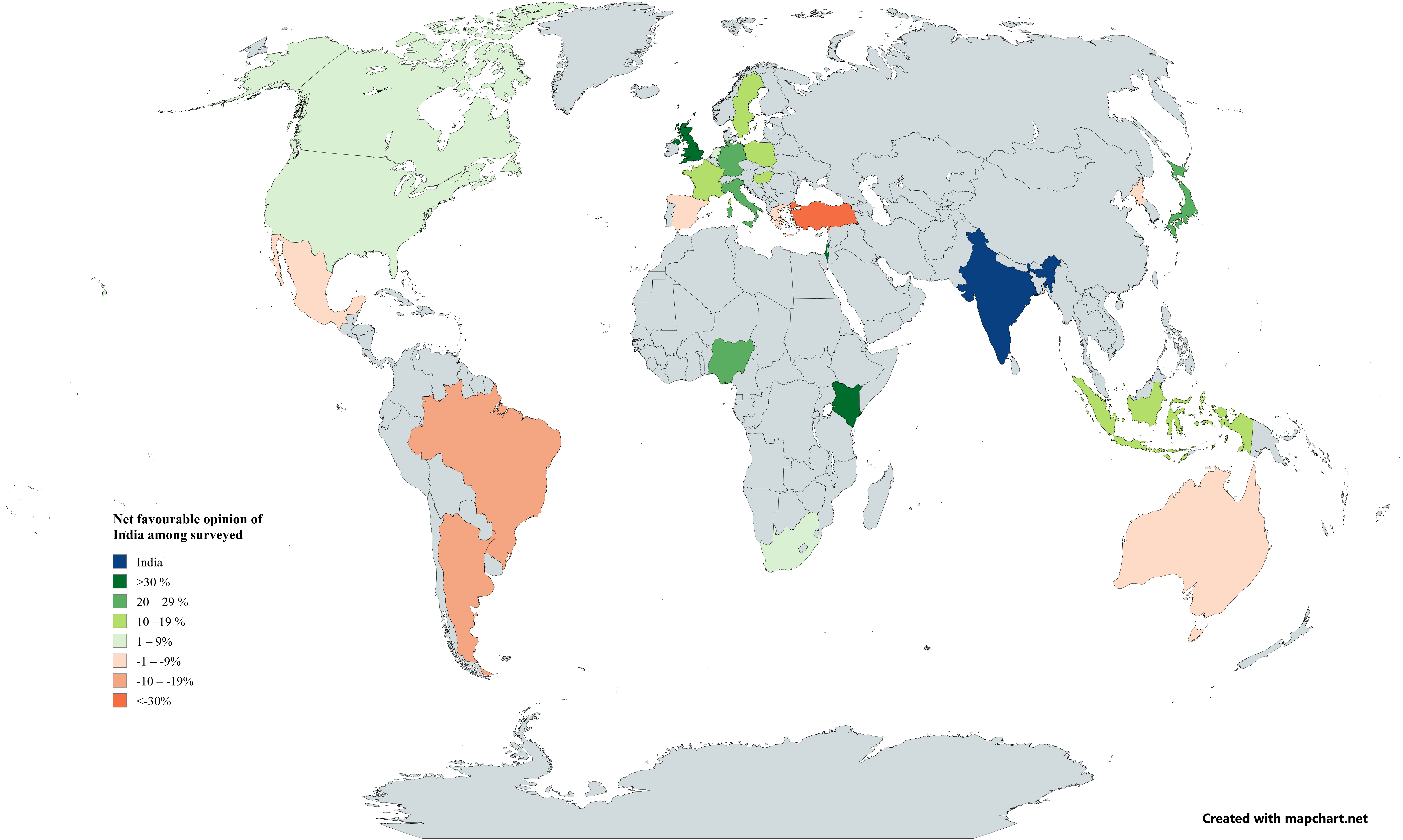
International Opinion of India Map 2025
The map titled "International Opinion of India among Countries Surveyed by Pew in Early 2025" visually represents the at...
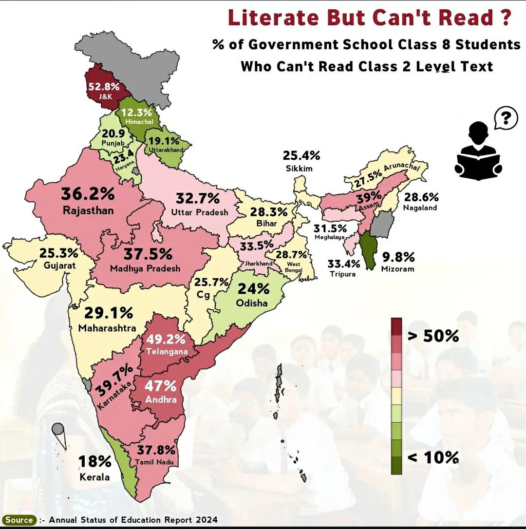
Map of Students Who Can't Read Grade 2 Text in India
This map highlights a critical issue in India's educational landscape: the percentage of students who are unable to read...
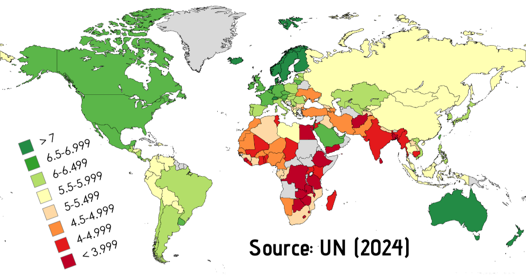
World Happiness Index Map Analysis
The "World Happiness Index Map" provides a comprehensive visualization of global happiness levels as reported by residen...
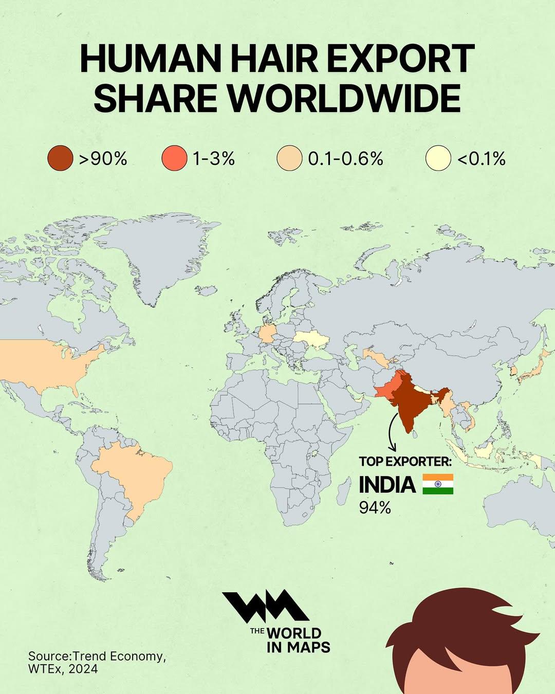
Human Hair Export by Share Worldwide Map
The "Human Hair Export by Share Worldwide Map" provides a clear visual representation of the global trade in human hair,...
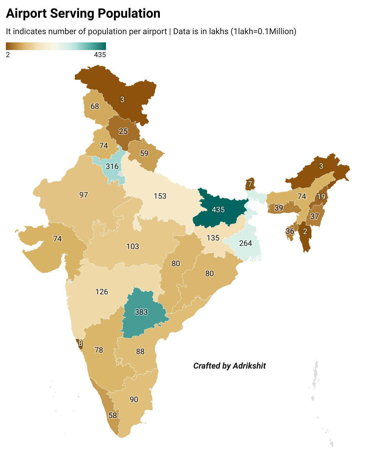
Airport Serving Population in India Map
This map displays the relationship between airports and the populations they serve across India. It highlights the acces...
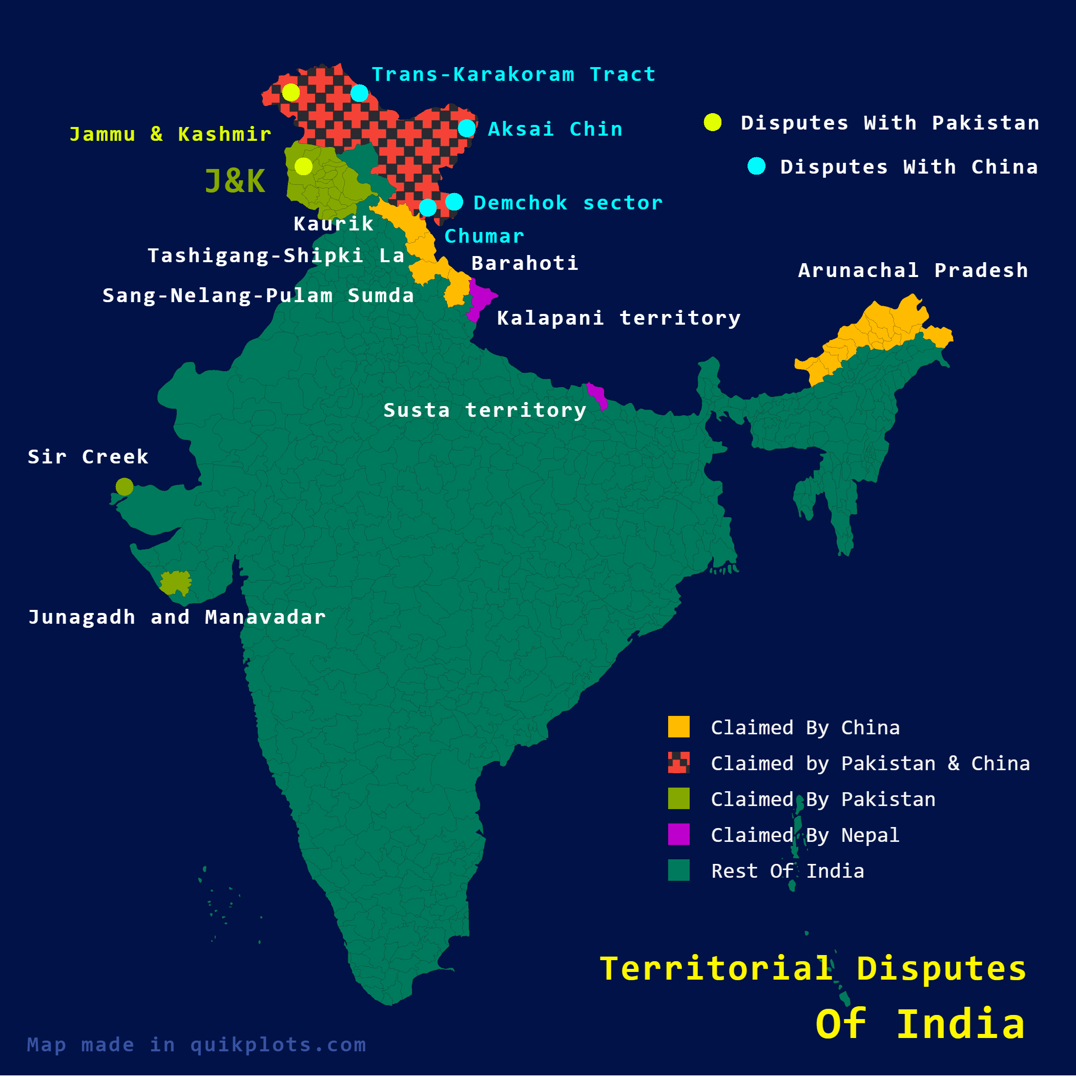
Territorial Disputes of India Map
The map titled "Territorial Disputes of India" provides a comprehensive visualization of the various territorial claims ...
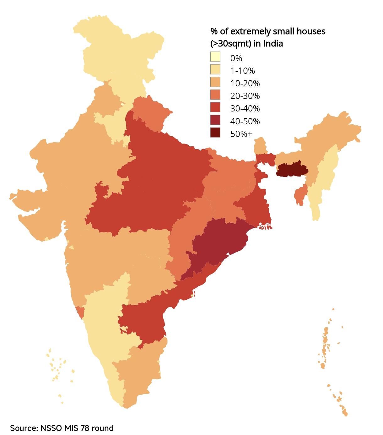
Percentage of Extremely Small Houses in India Map
The map titled "Percentage of Extremely Small Houses in India" visualizes the distribution and prevalence of houses meas...
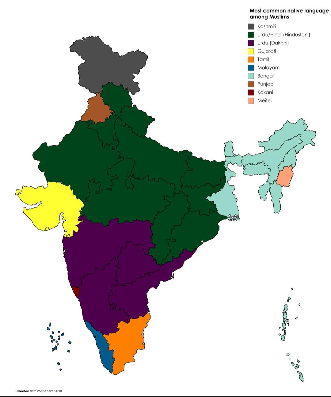
Common Language Among Muslims in India Map
The visualization titled "Most Common Language Among Muslims in India" offers a detailed representation of linguistic di...
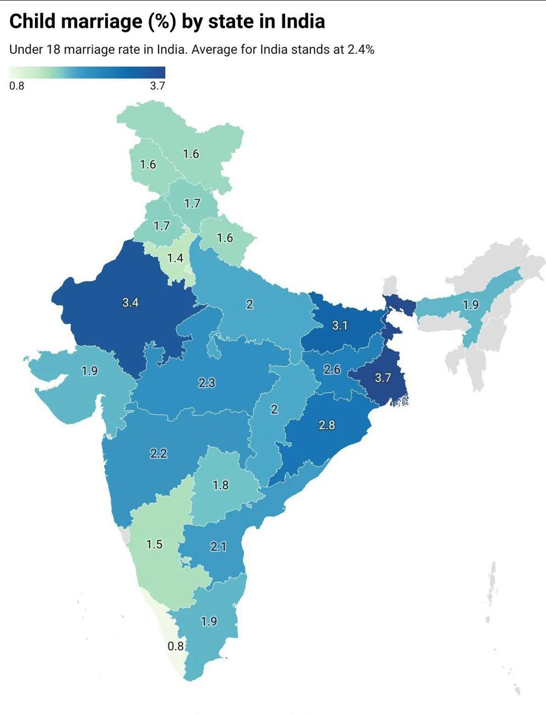
Child Marriage in India Map
...
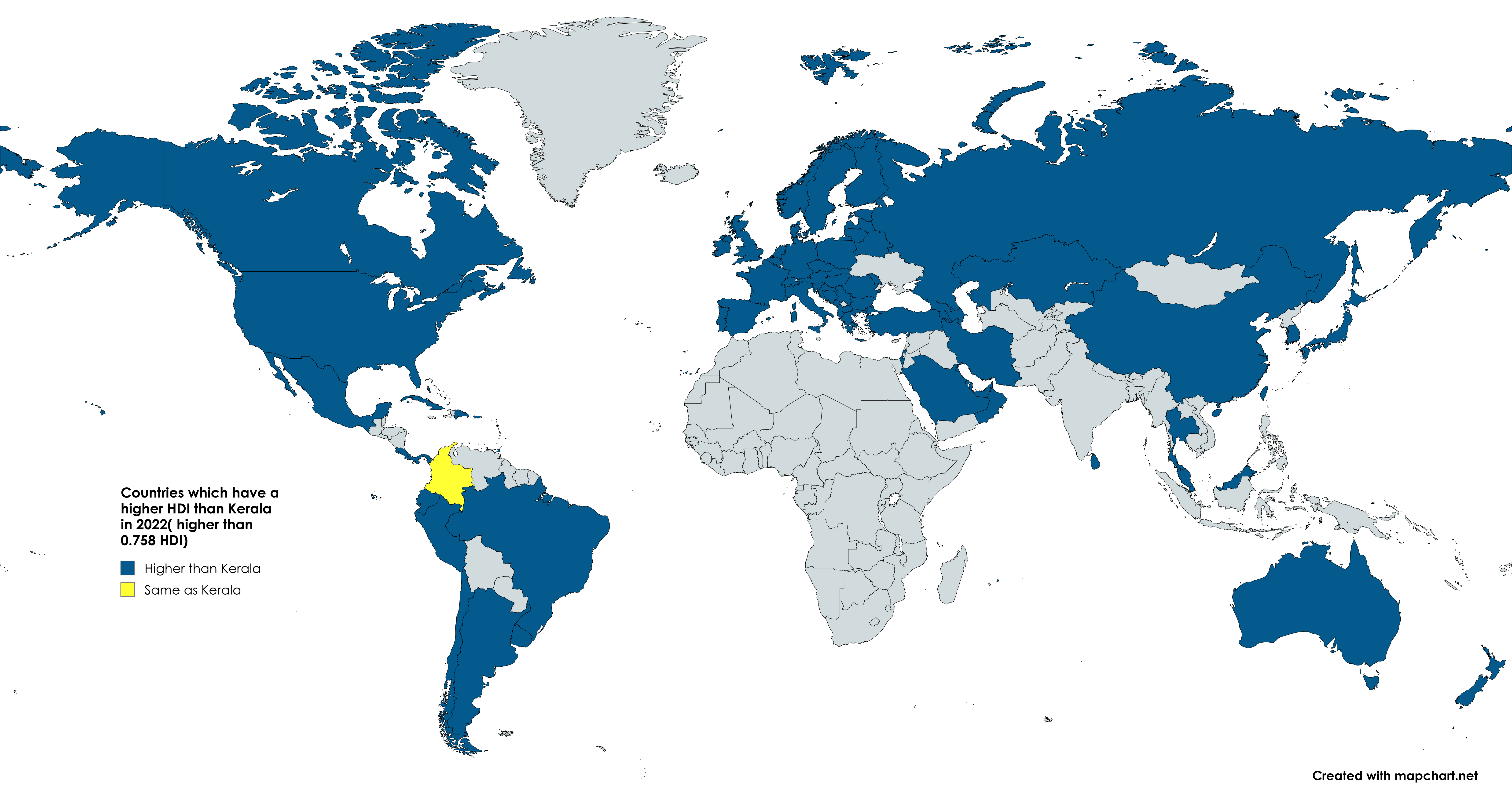
Kerala vs World HDI Map 2022
The map titled "Yesterday there was a post about Bihar. Now we will have the Indian state of Kerala vs the whole world" ...
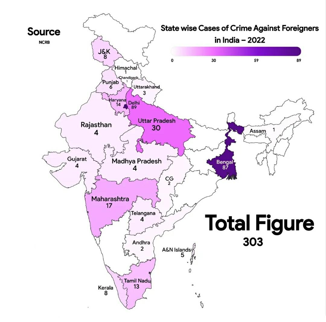
Crime Against Foreigners in India Map
...
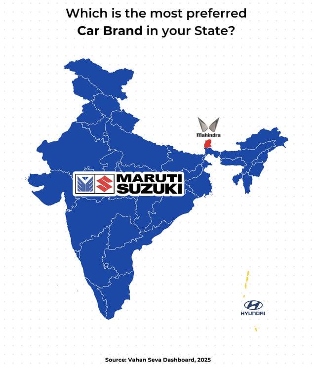
Preferred Car Brand by State in India Map
This map displays the preferred car brand in each Indian state and union territory, highlighting the diverse automotive ...
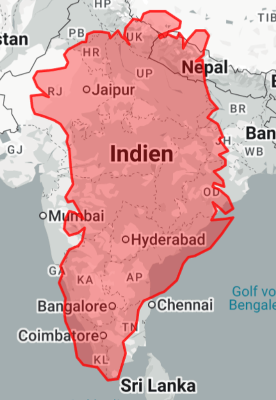
Greenland Overlay Map of India and Nepal
The visualization titled "Greenland on top of India (and Nepal)" demonstrates a unique perspective by overlaying the vas...
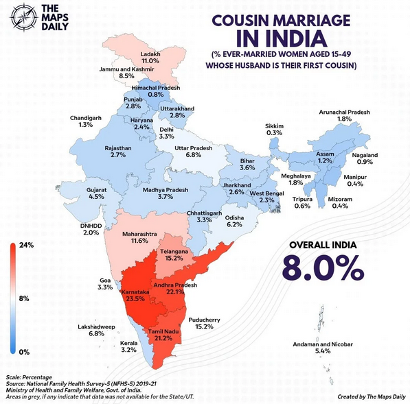
Cousin Marriages in India Map
The "Cousin Marriages in India Map" provides a fascinating glimpse into the cultural practices surrounding marriage in d...
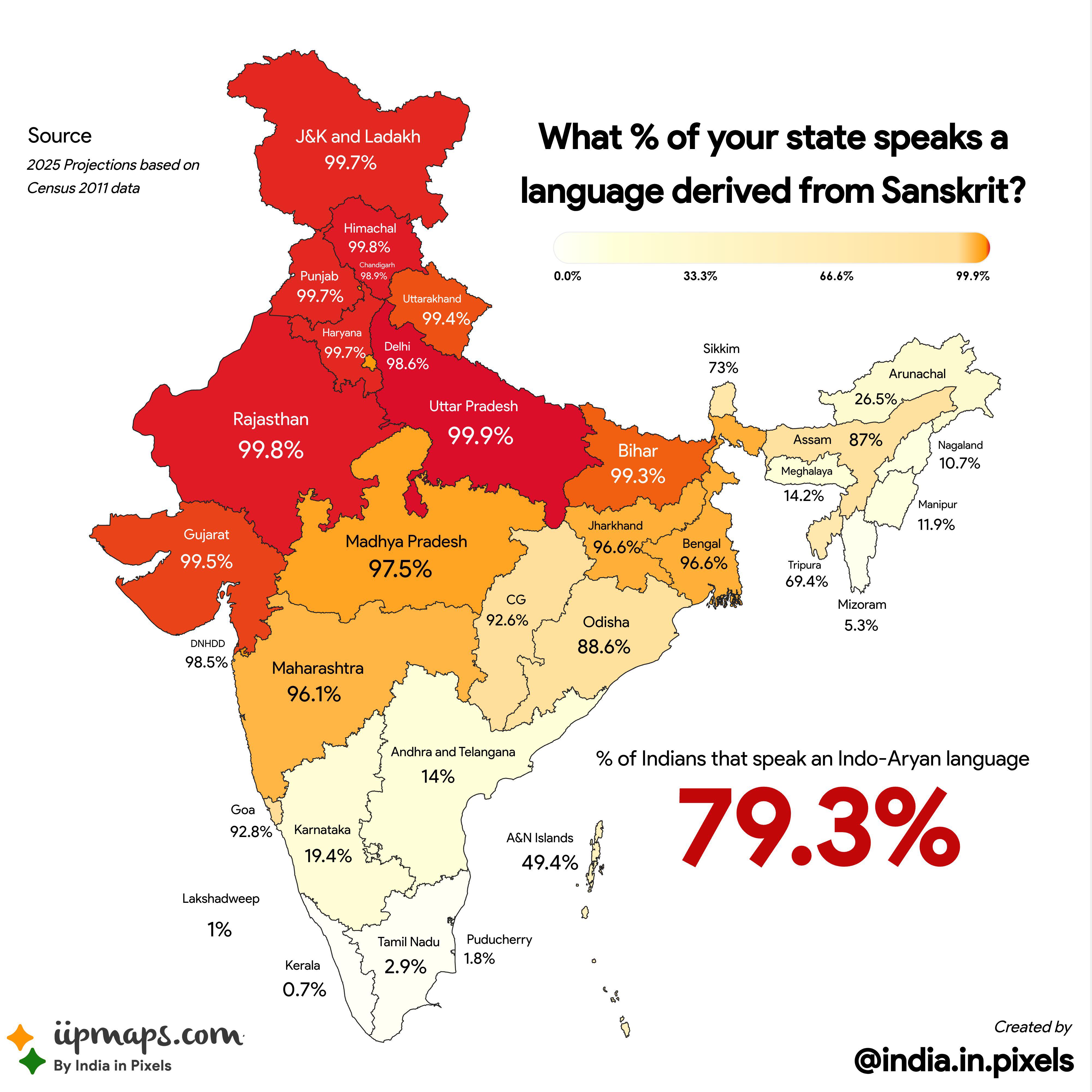
Sanskrit-Derived Language Speakers by Indian State Map
This map illustrates the percentage of speakers of languages derived from Sanskrit across different states in India. It ...
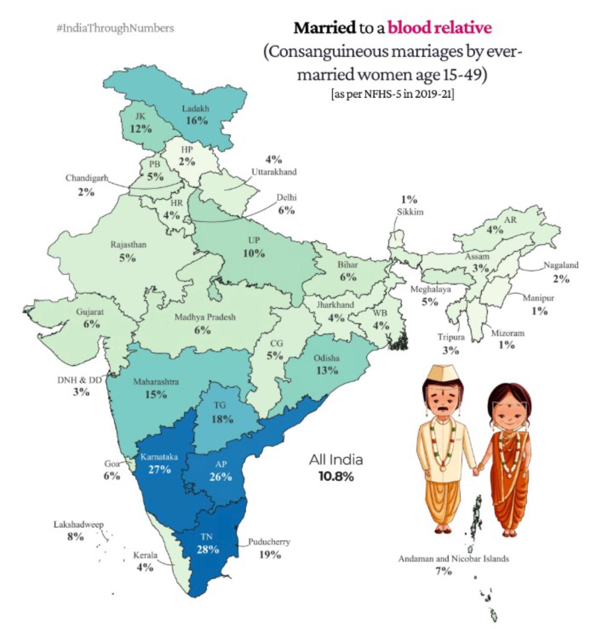
Cousin Marriages in India Map
The "Cousin Marriages in India Map" provides a visual representation of the prevalence of cousin marriages across variou...
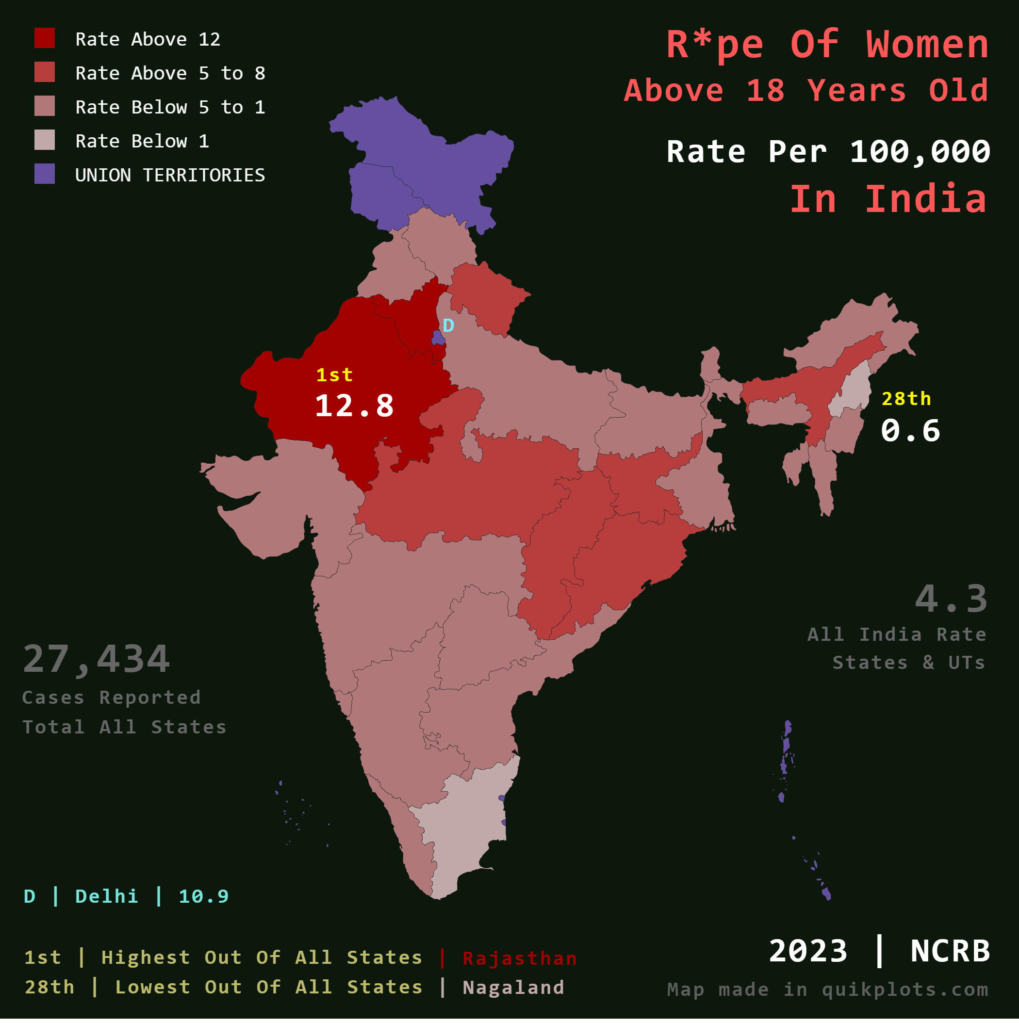
R*pe of Women Above 18 in India Map
The map titled "R*pe of Women Above 18 in India" illustrates the incidence rate of reported r*pe cases per 100,000 popul...
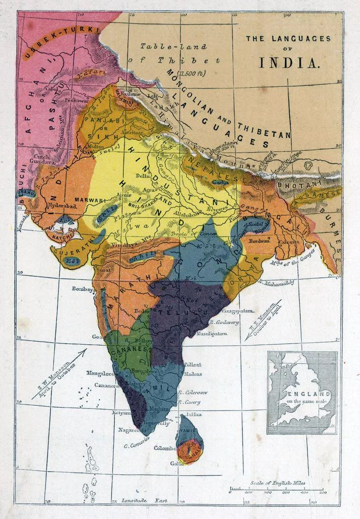
Linguistic Map of India 1862
...
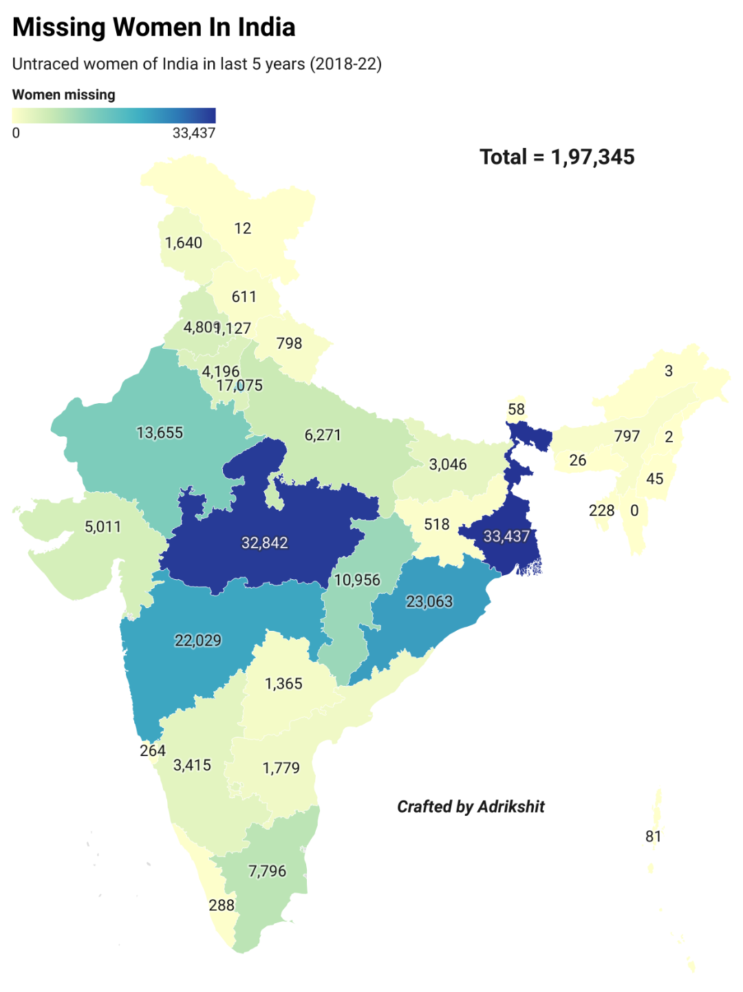
Missing Women in India Map
The "Missing Women in India Map" visualizes the unsettling reality of gender disparities within the nation, specifically...