roman empire Maps
13 geographic visualizations tagged with "roman empire"
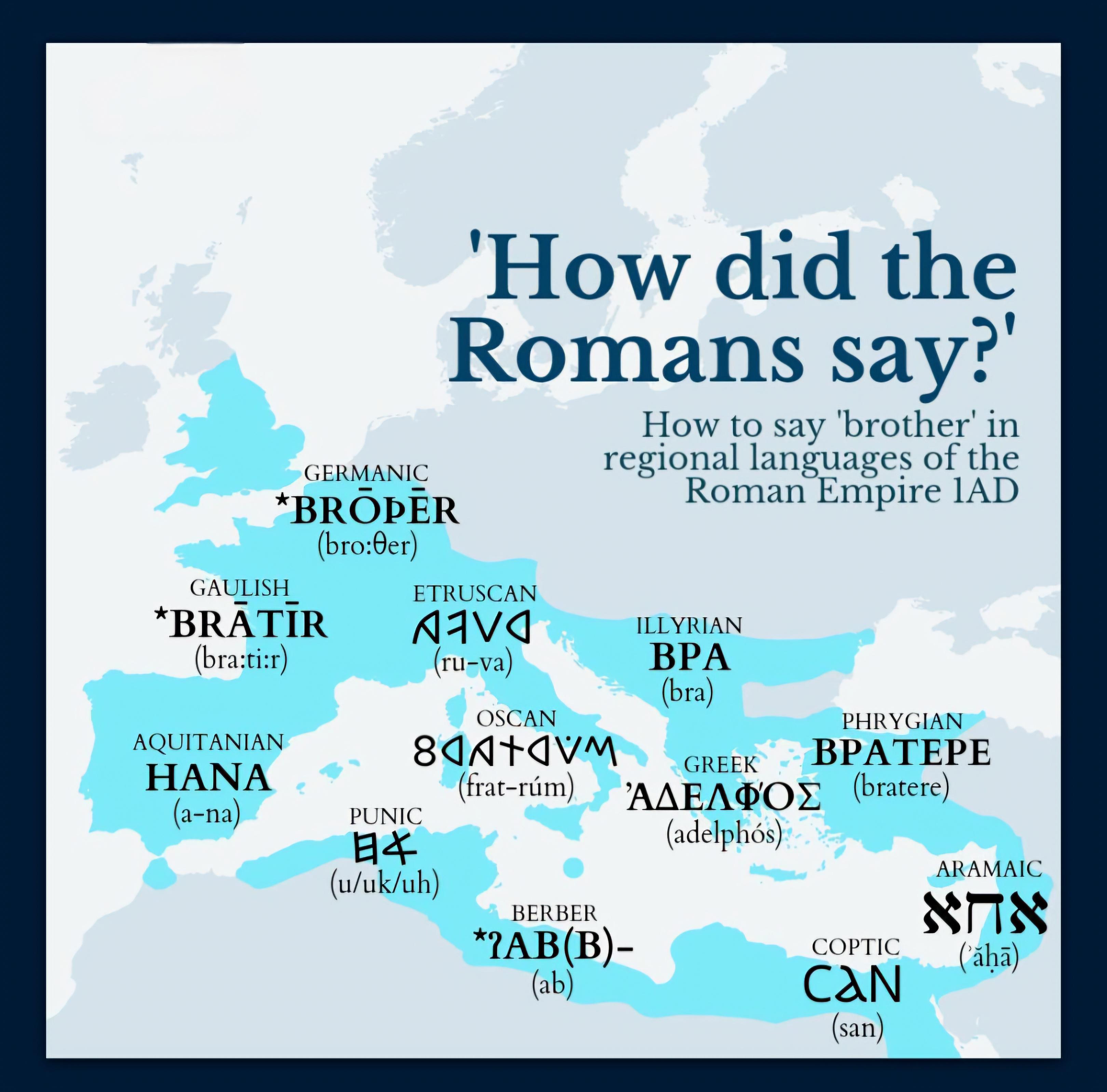
Map of How to Say 'Brother' in Roman Empire Languages
This map visualizes how the word 'brother' is expressed across various regional languages spoken during the Roman Empire...
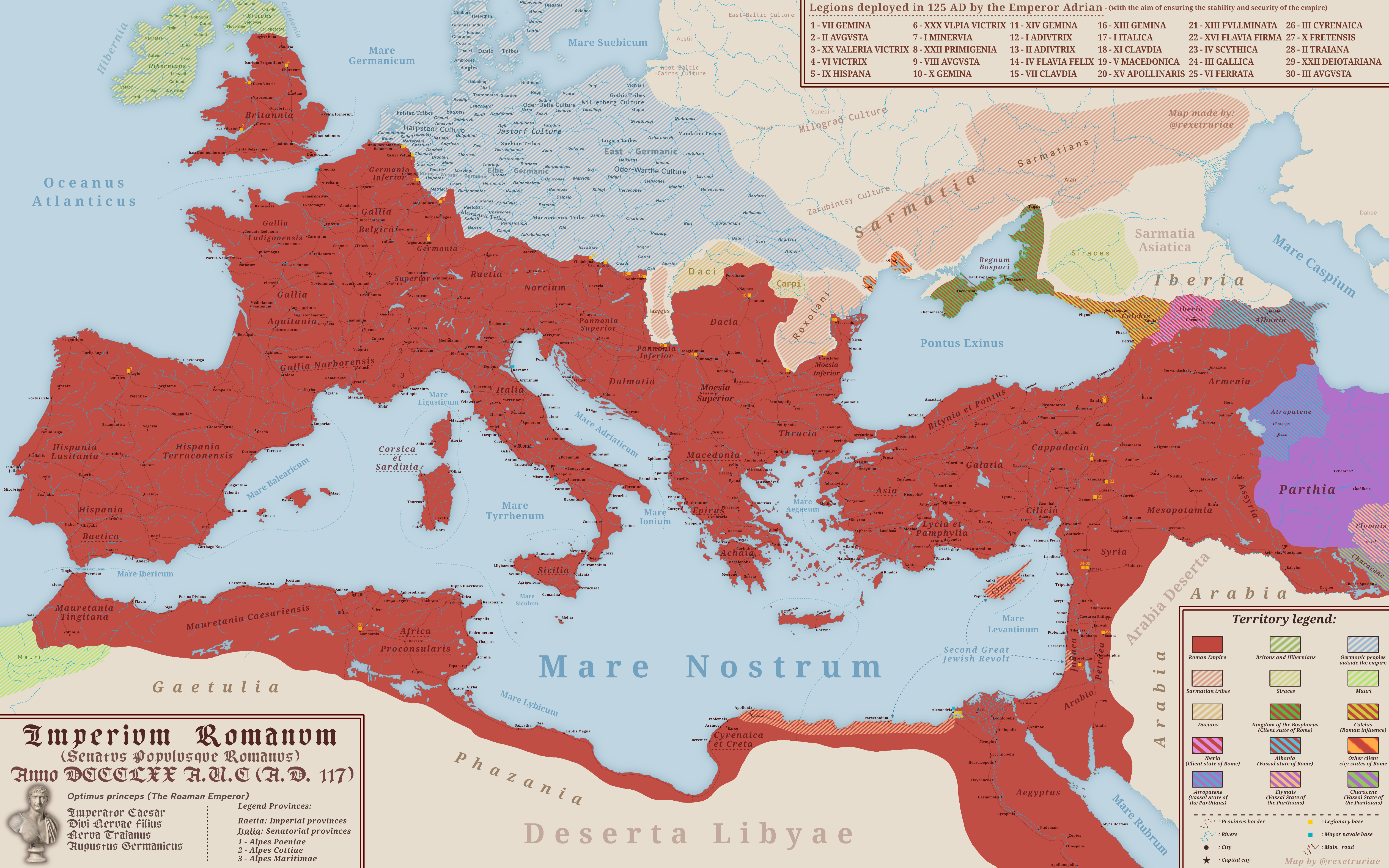
Map of the Roman Empire at Its Peak 117 A.D.
The map titled "The Roman Empire at Its Peak 117 A.D." illustrates the vast territorial expanse of one of history's most...
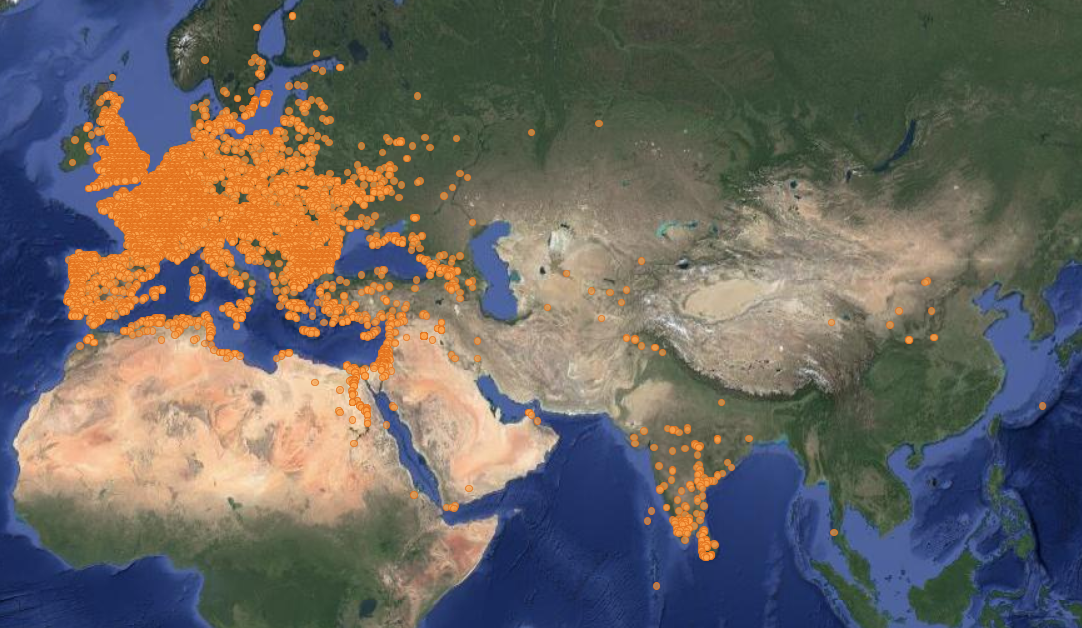
Map of Locations of Unearthed Roman Coins
This map illustrates the locations where Roman coins have been unearthed across various regions of Europe and the Medite...
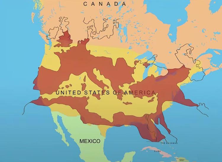
Map of the Roman Empire at its Peak Over the U.S.
This fascinating map overlays the boundaries of the Roman Empire at its zenith around 117 AD with the geographical layou...
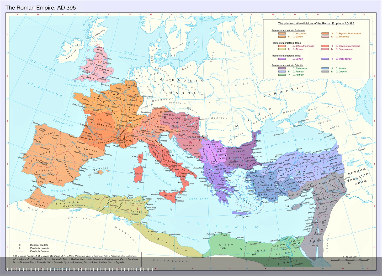
Territorial Organization of the Late Roman Empire Map
The map titled "The Territorial Organization of the Late Roman Empire (395 AD)" provides a detailed visualization of the...
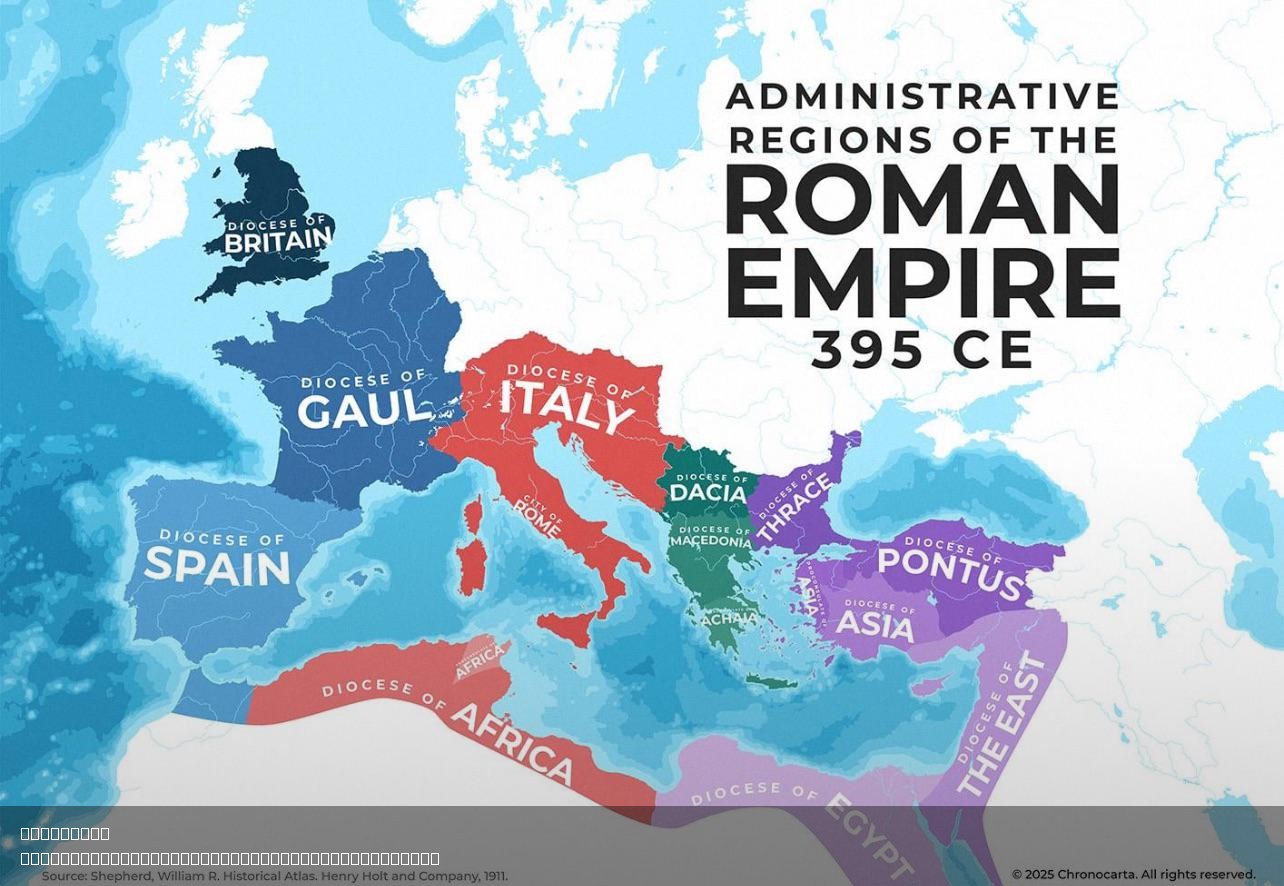
Administrative Regions of the Roman Empire Map
The "Administrative Regions of the Roman Empire Map" provides a detailed representation of the vast territories governed...
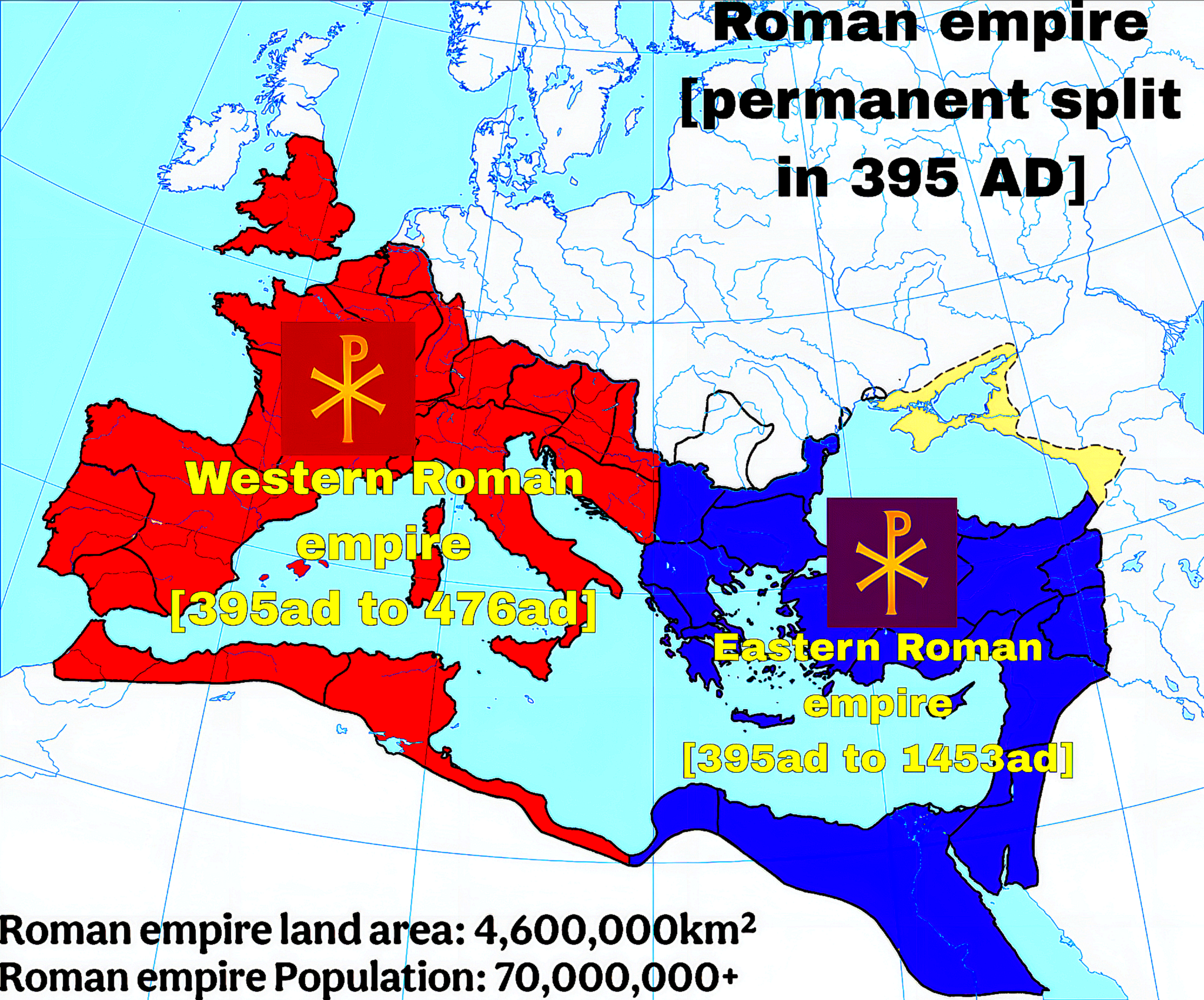
Map of the Permanent Split of the Roman Empire in 395 AD
The map titled "The Permanent Split of the Roman Empire in 395 AD" visually delineates the division of the Roman Empire ...
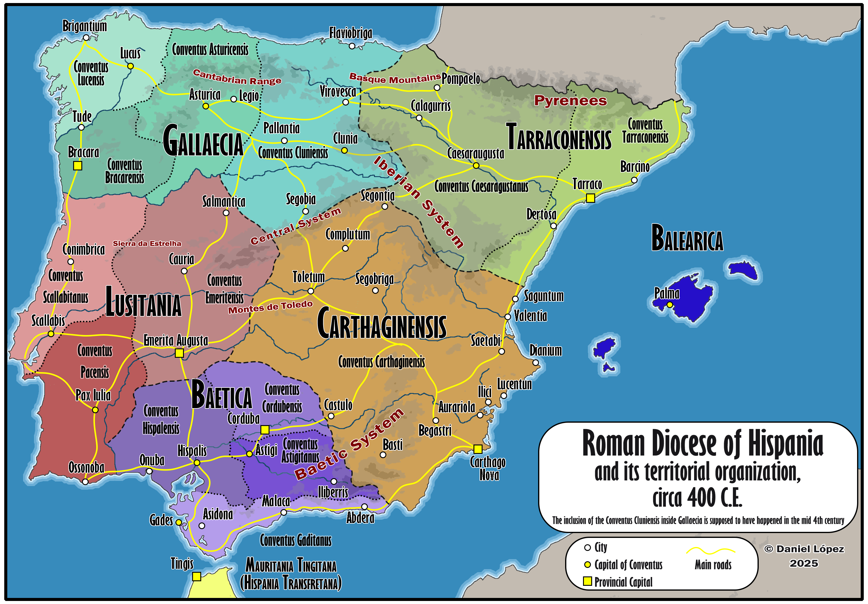
Map of Roman Hispania Circa 400
The 'Detailed Map of Roman Hispania (c. 400)' provides a rich visual representation of the Iberian Peninsula during a cr...
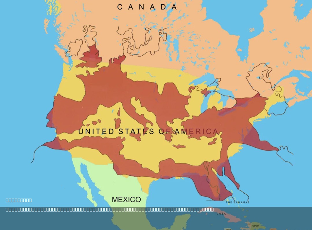
Roman Empire Size Comparison Map with USA
The map titled "The Size of the Roman Empire at Its Height Compared to the United States" visually compares the vast ter...
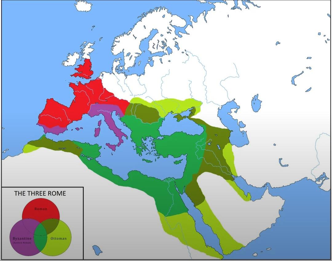
Map of Overlapping Borders of Ottoman and Roman Empires
This map illustrates the overlapping borders of the Ottoman Empire and the Roman Empire, providing a visual representati...
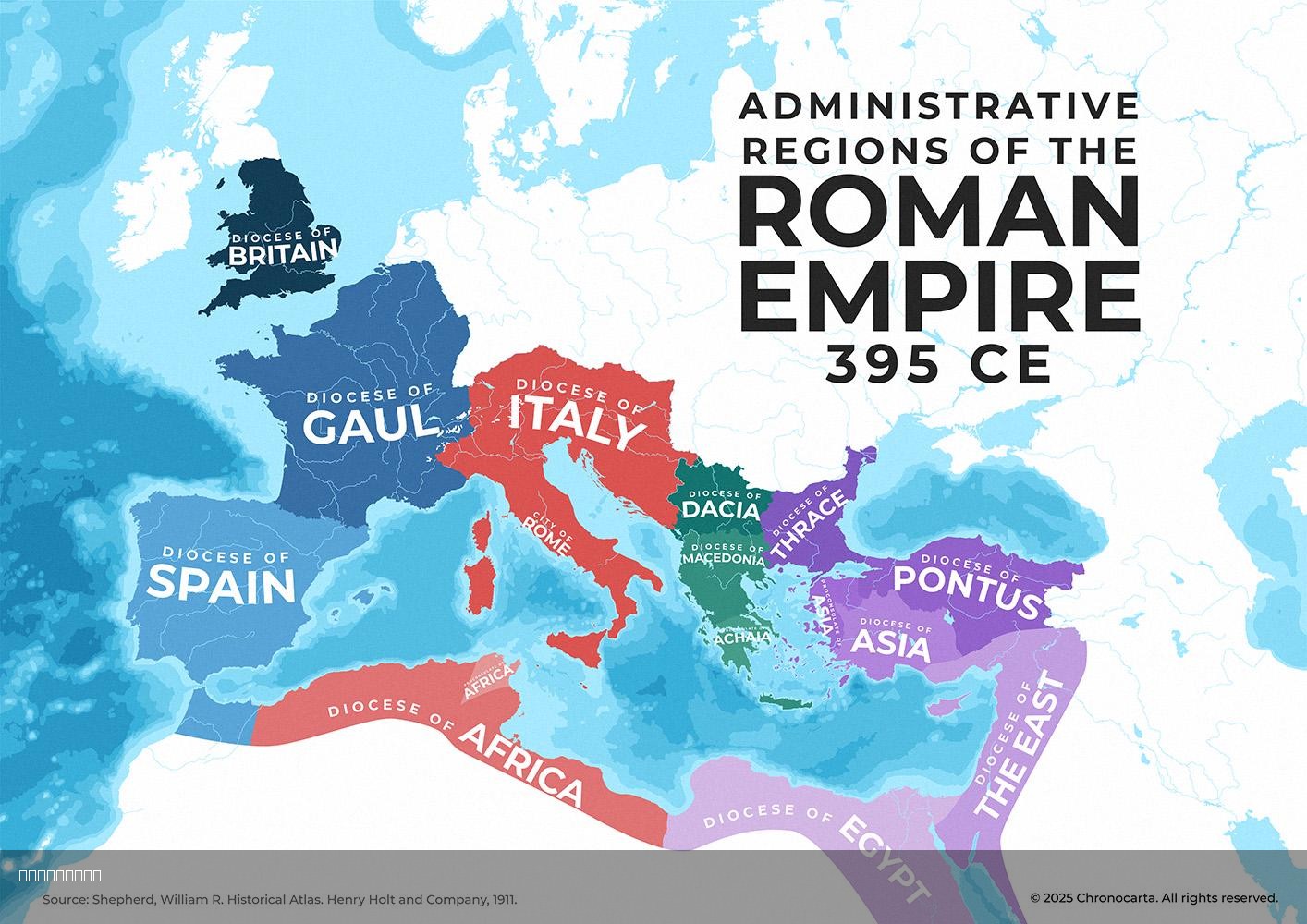
Administrative Dioceses of the Roman Empire Map
The visualization titled "Administrative Dioceses of the Roman Empire in 395 CE with Proconsular Provinces Highlighted" ...
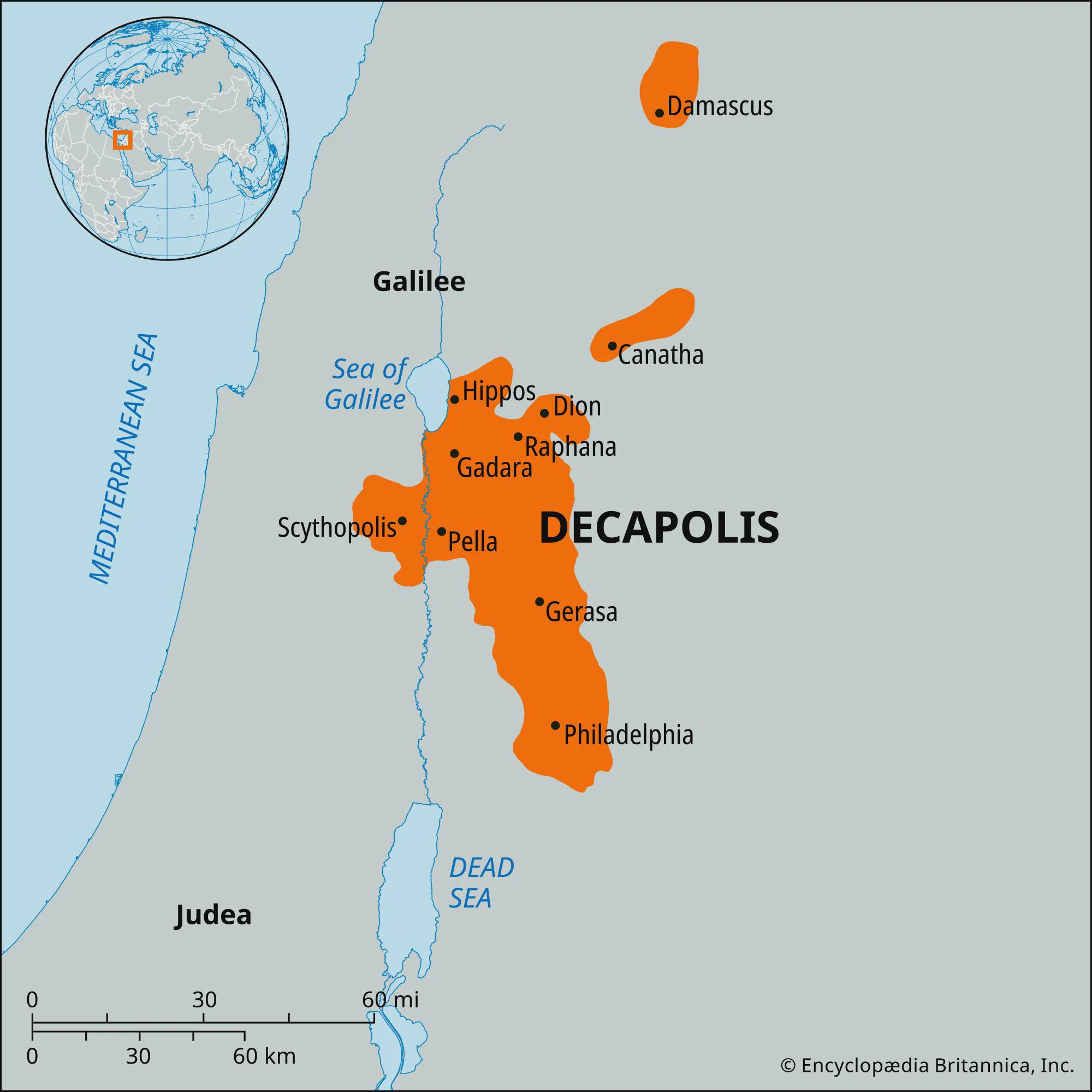
Map of the Decapolis: Greek Colonies in the Levant
The "Map of the Decapolis" presents a fascinating glimpse into the geographic layout of ten significant Greek cities, kn...
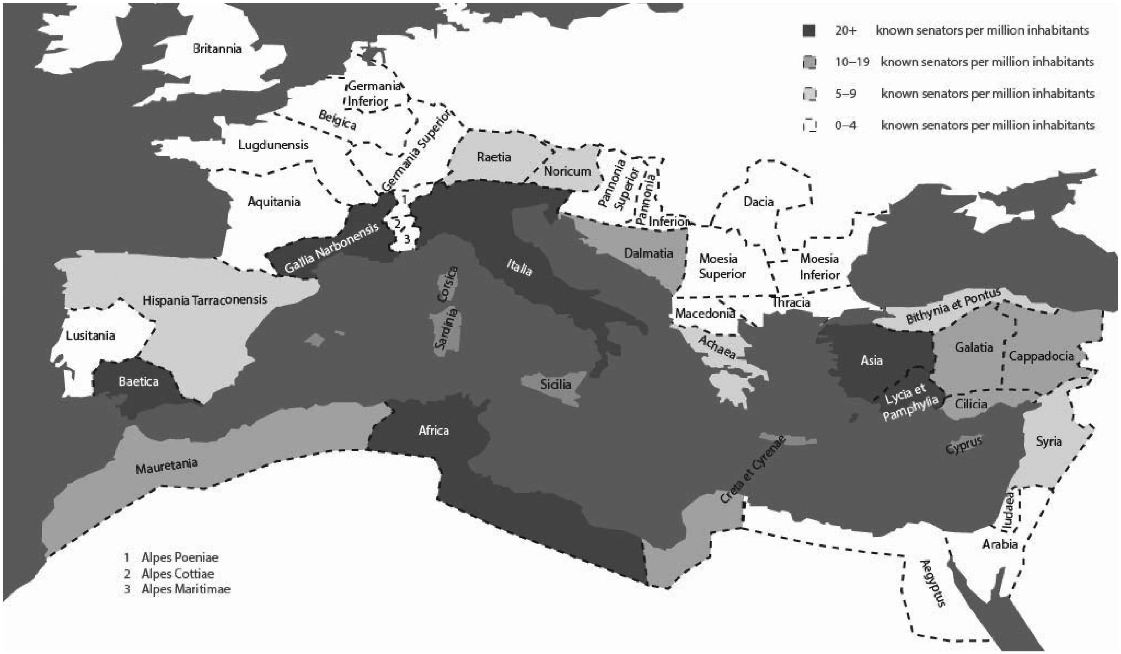
Map of Provincial Origins of Senators During Pax Romana
This map illustrates the diverse provincial origins of senators during the Pax Romana, a period of relative peace and st...