ecology Maps
31 geographic visualizations tagged with "ecology"
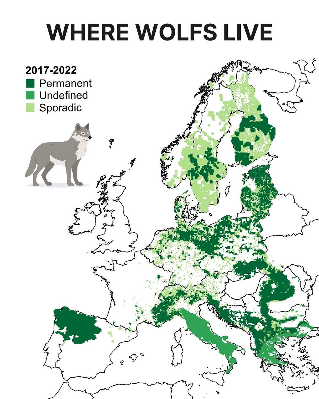
Wolf Distribution Map in Europe
The "Where Wolves Live in Europe" map provides a detailed visual representation of the current distribution of wolf popu...
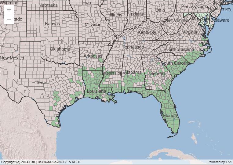
Range of Spanish Moss in the USA Map
The "Range of Spanish Moss in the USA Map" visually depicts the geographic distribution of Spanish moss (Tillandsia usne...
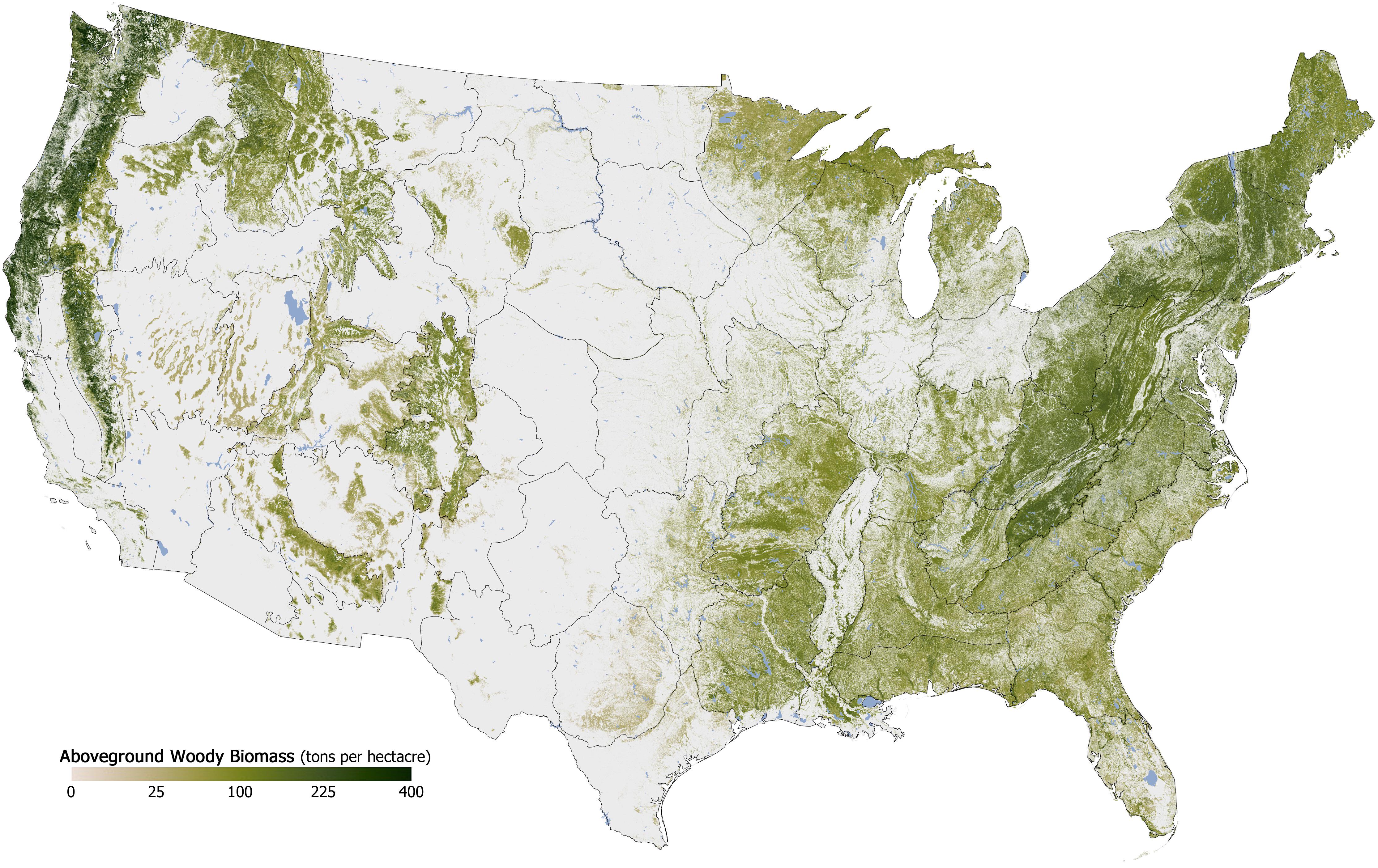
Forest Cover in the U.S. Map
The "Forest Cover in the U.S. Map" provides a detailed visualization of the distribution and density of forested areas a...
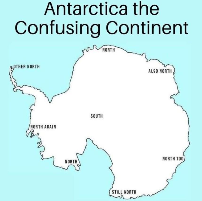
Western United States Geographic Features Map
The "Let's go west 😀" visualization provides a detailed overview of the geographic features of the Western United State...
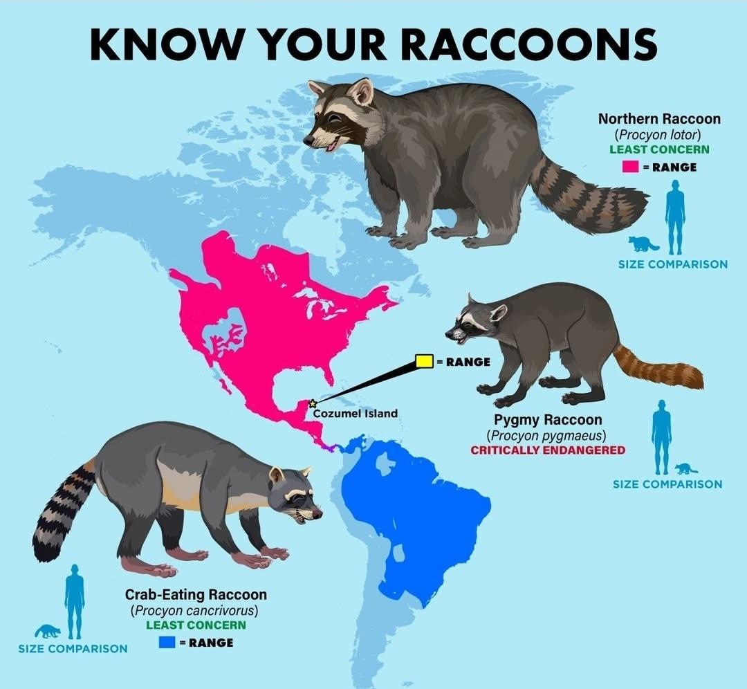
Raccoon Habitat Distribution Map
This visualization displays the habitat distribution of raccoons across various regions, highlighting their presence in ...
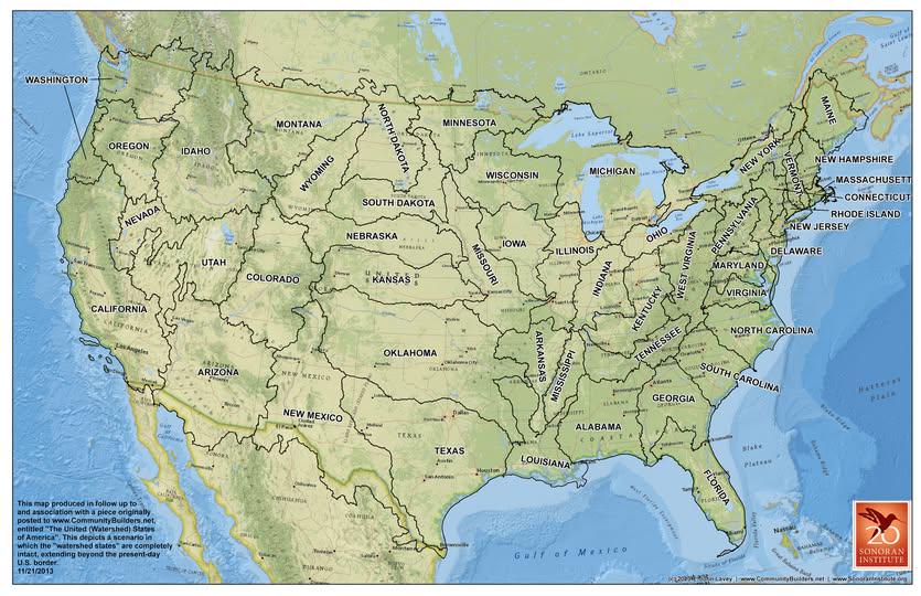
Watershed Boundaries Map Proposal for the U.S.
Understanding the significance of watersheds begins with recognizing their hydrological cycle. When it rains, water does...
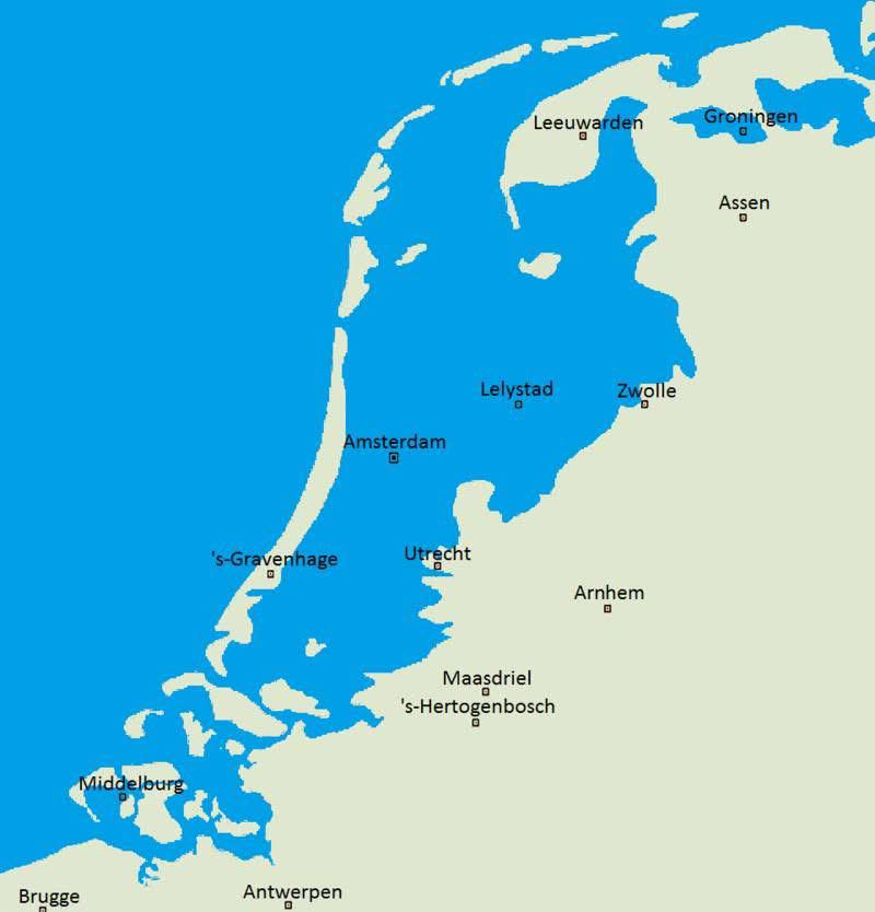
Netherlands Natural Landscape Map Without Dikes
This map vividly illustrates what the Netherlands might look like if dikes and other flood prevention measures had never...
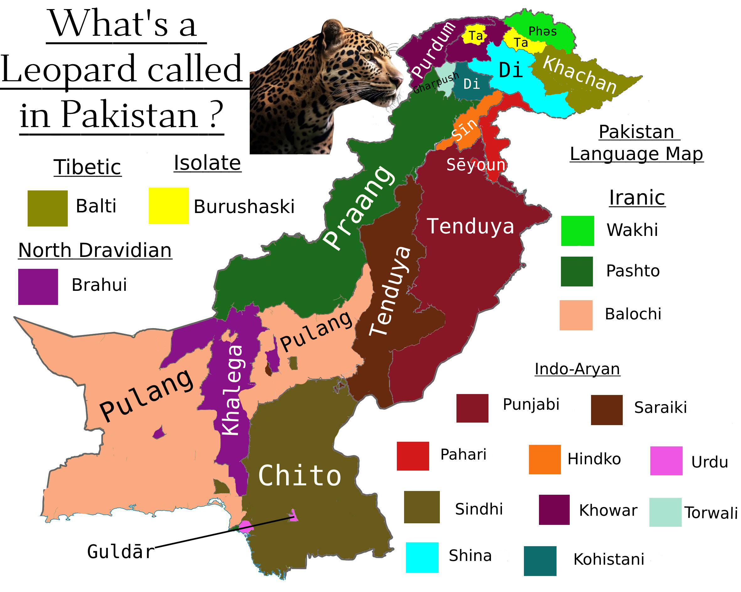
What is a Leopard Called in Pakistan Map
This map visualizes the various names and local terms used for leopards across different regions of Pakistan. It highlig...
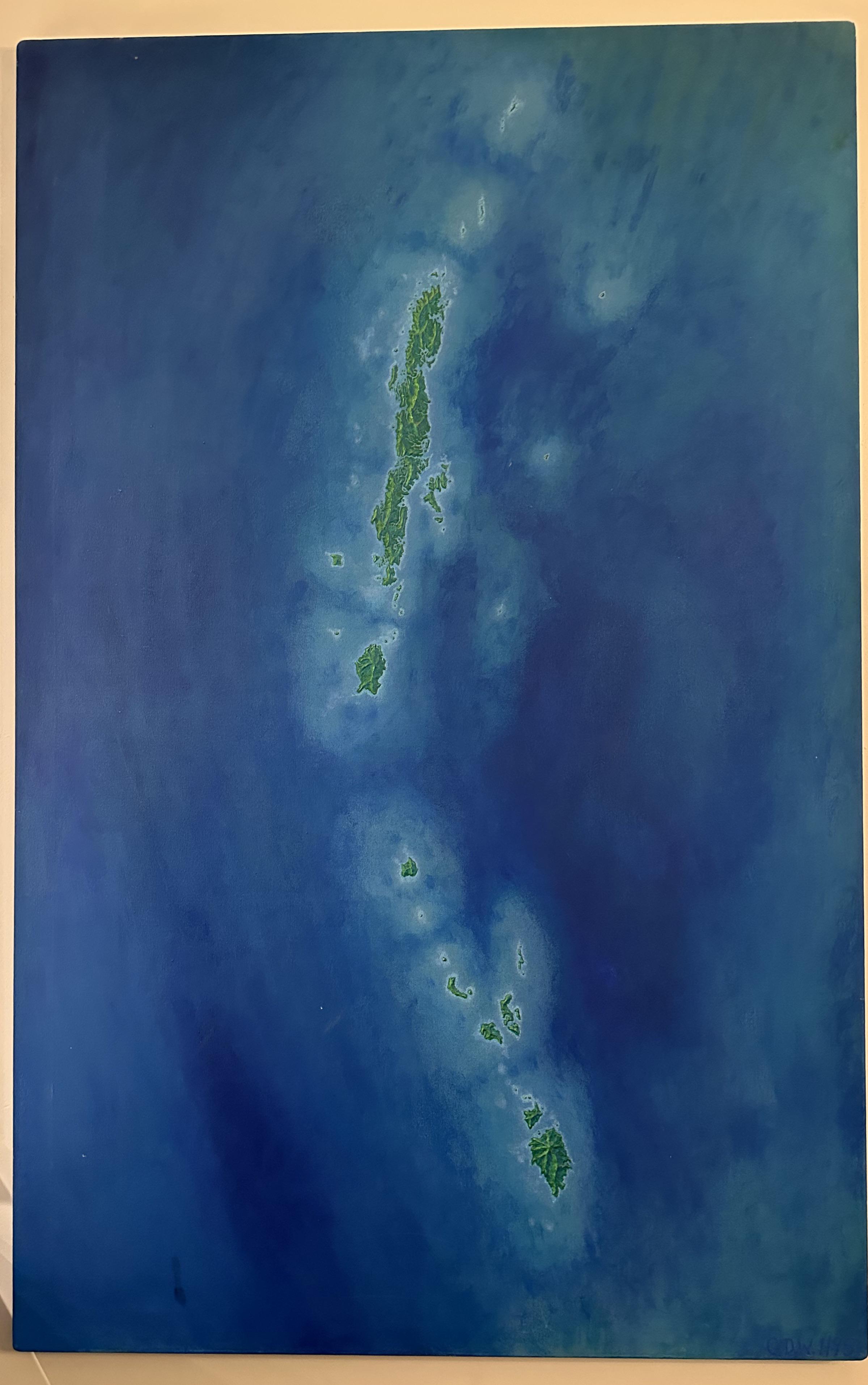
Islands in the Stream Map
The "Islands in the Stream Map" visualizes a unique geographical feature: a series of islands located within a flowing b...
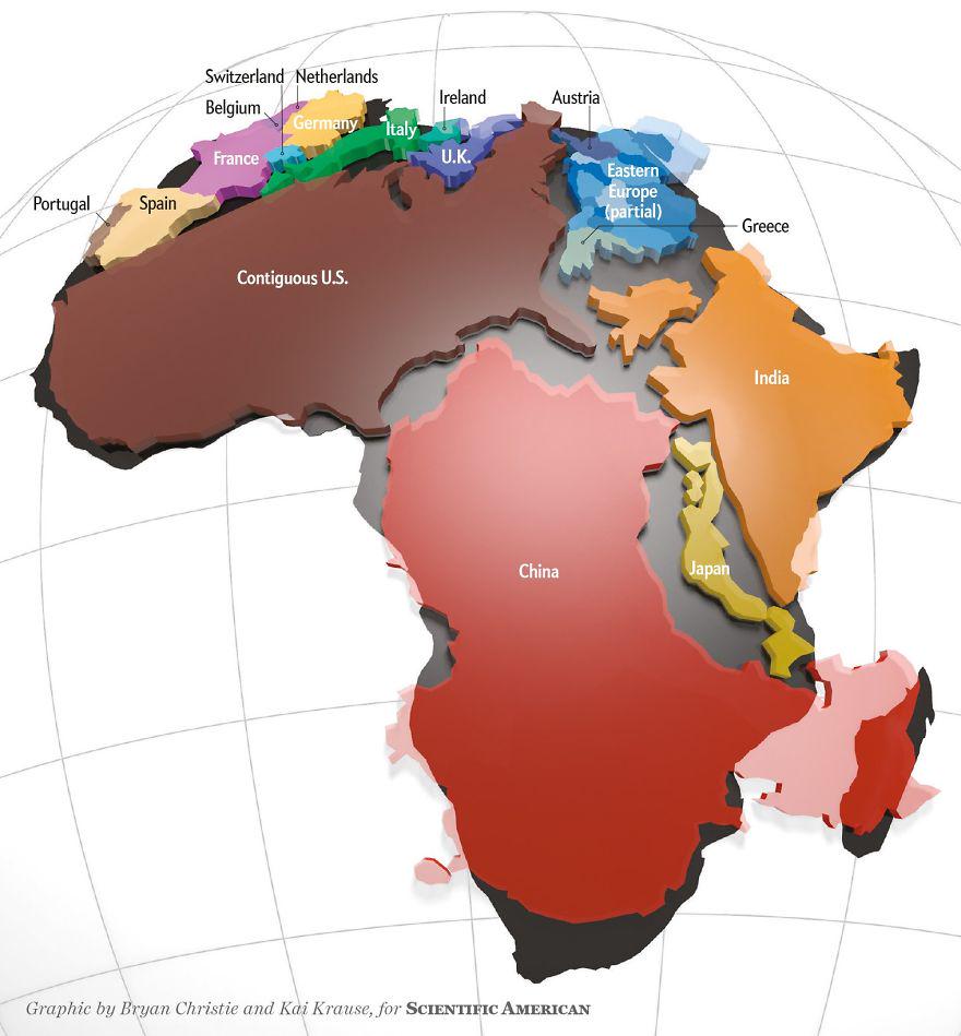
Actual Size of Africa Map
The 'Actual Size of Africa Map' presents a striking visual representation that highlights the continent’s true dimension...
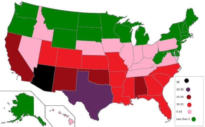
U.S. States with the Highest Number of Venomous Animals Map
The visualization titled "U.S. States with the Highest Number of Venomous Animals Map" provides a striking look at the d...
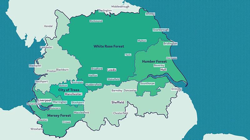
Reforesting Britain Map – The Northern Forest Map
The "Reforesting Britain Map – The Northern Forest" focuses on a significant environmental initiative launched in 2018. ...
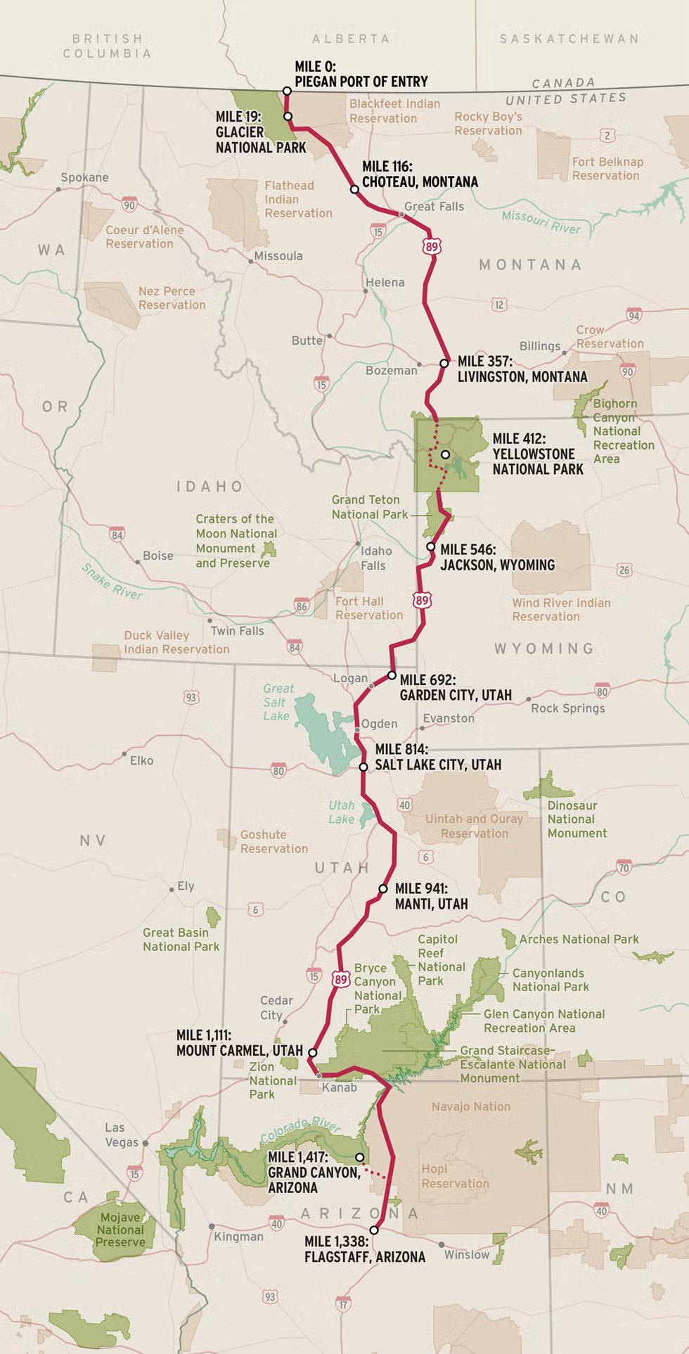
US 89 National Park Highway Map
The "US 89: Known as the National Park Highway" map provides a detailed visualization of one of America's most scenic ro...
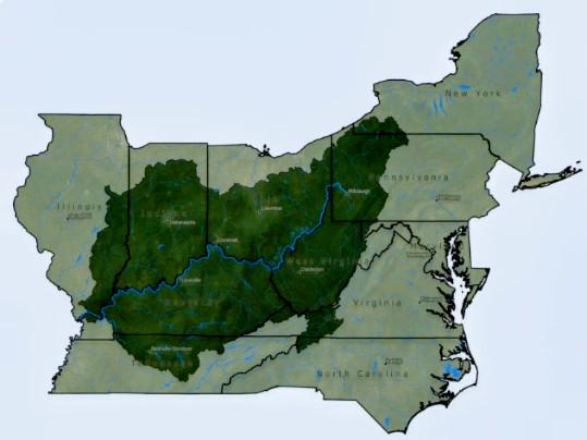
Ohio River Valley Map with State Boundaries
Interestingly, the Ohio River serves as a natural border between several states, impacting both the geography and the go...
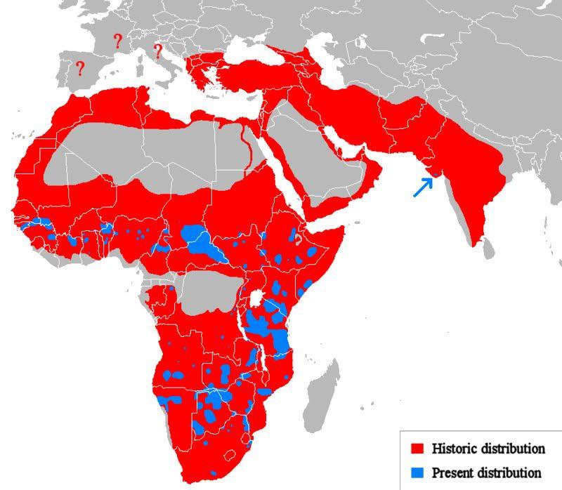
Historic vs Present Distribution of Lions Map
The "Historic vs Present Distribution of Lions" map visually contrasts the past and current range of lion populations ac...
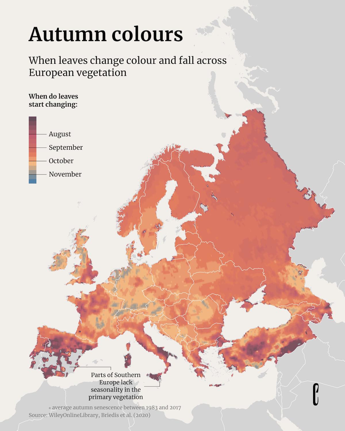
Map of Autumn Leaf Color Changes in Europe
The "When Leaves Change Colour and Fall Across European Vegetation" map provides a visual representation of the seasonal...
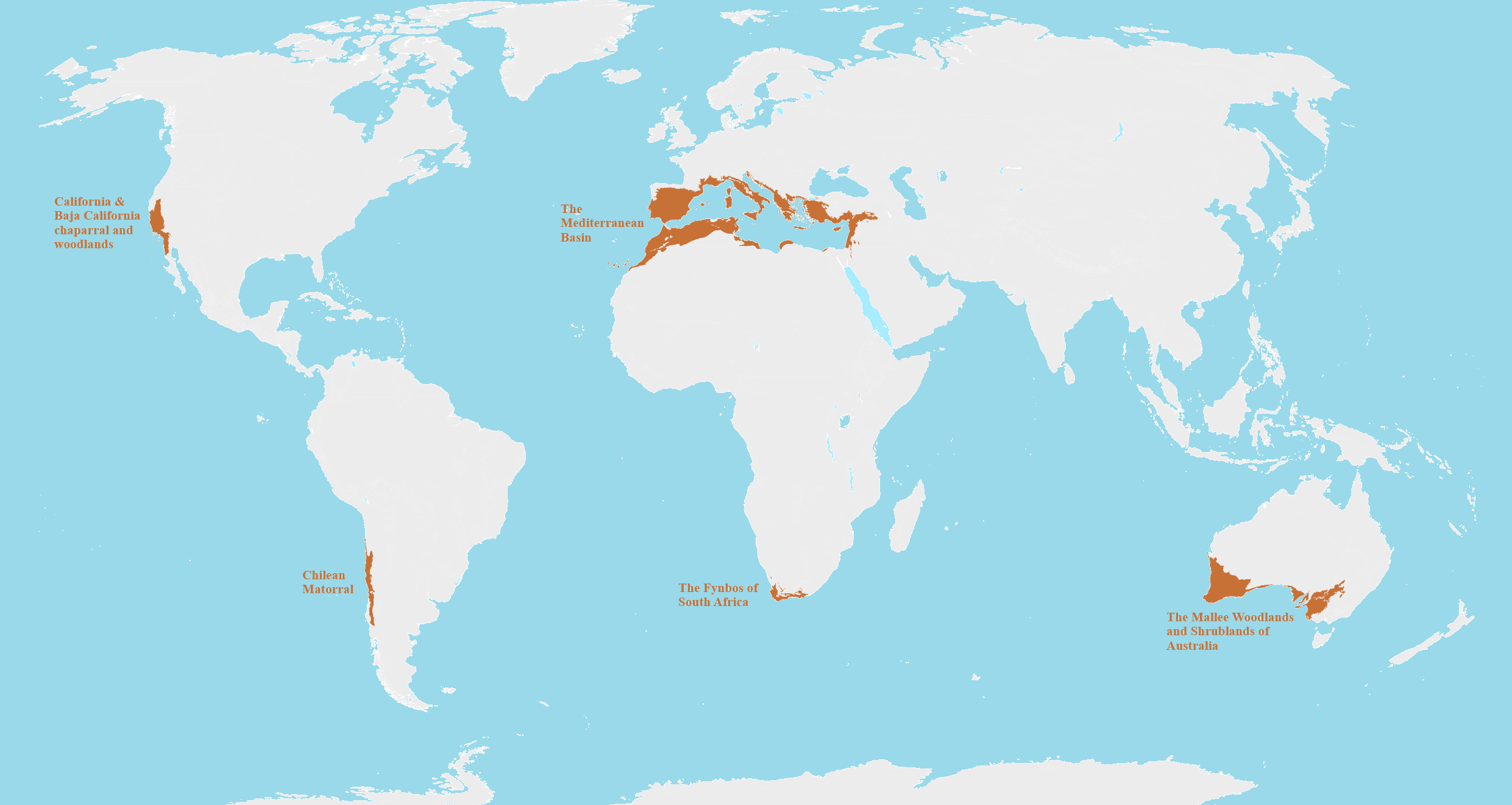
Mediterranean Biomes Around the World Map
This map provides a detailed visualization of Mediterranean biomes across the globe, highlighting regions that share sim...
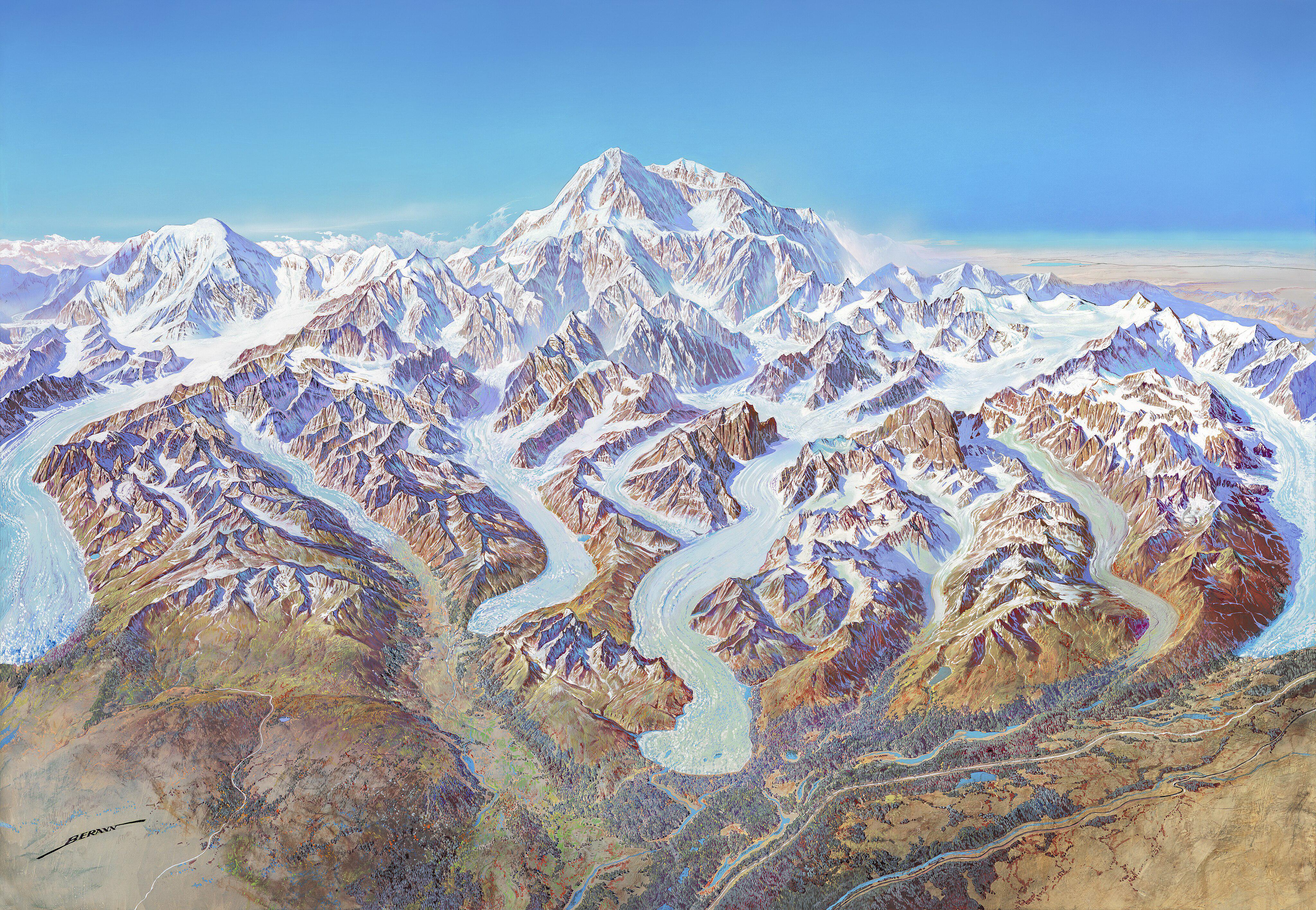
Denali National Park 1994 Map
The "Map of Denali National Park (1994)" offers a detailed visual representation of one of America's most iconic nationa...
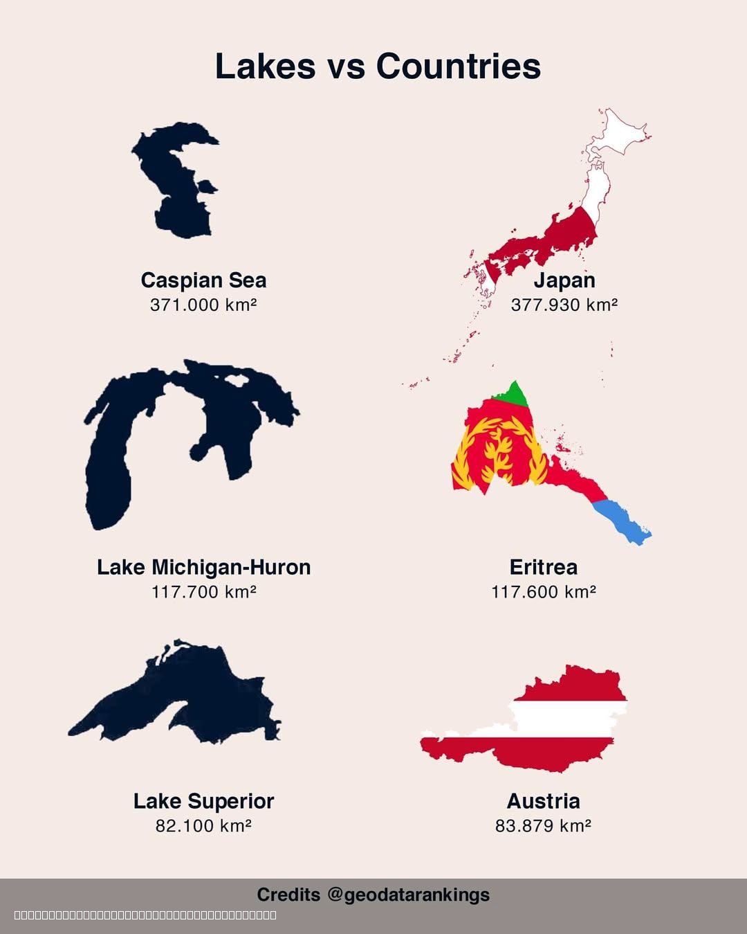
Lakes and Countries Size Comparison Map
The "3 Lakes vs 3 Countries Size Comparison Map" offers a compelling visual representation that juxtaposes the sizes of ...
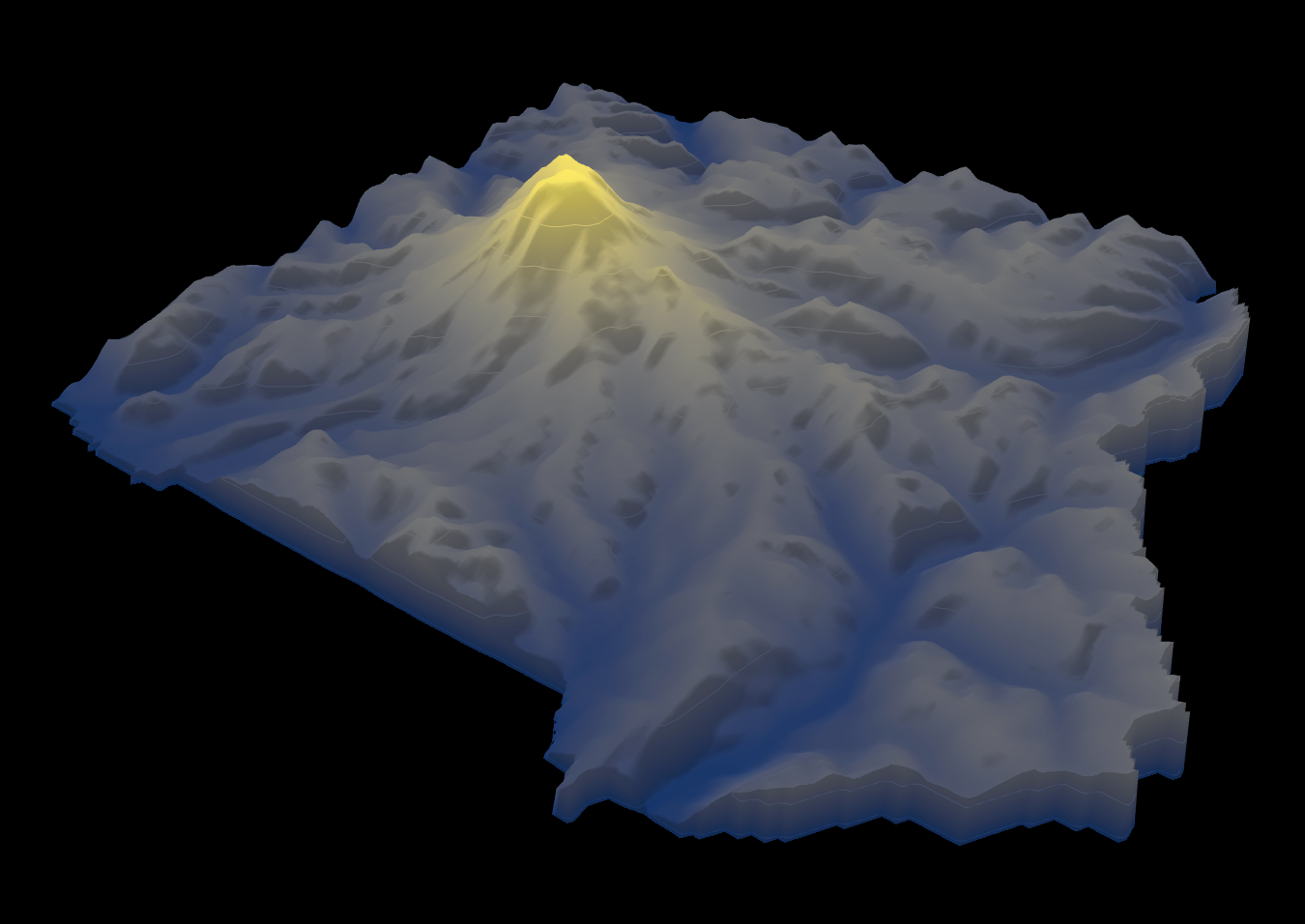
Height Map of Mount Rainier National Park
The height map of Mount Rainier National Park provides a detailed visualization of the elevation changes within this ico...
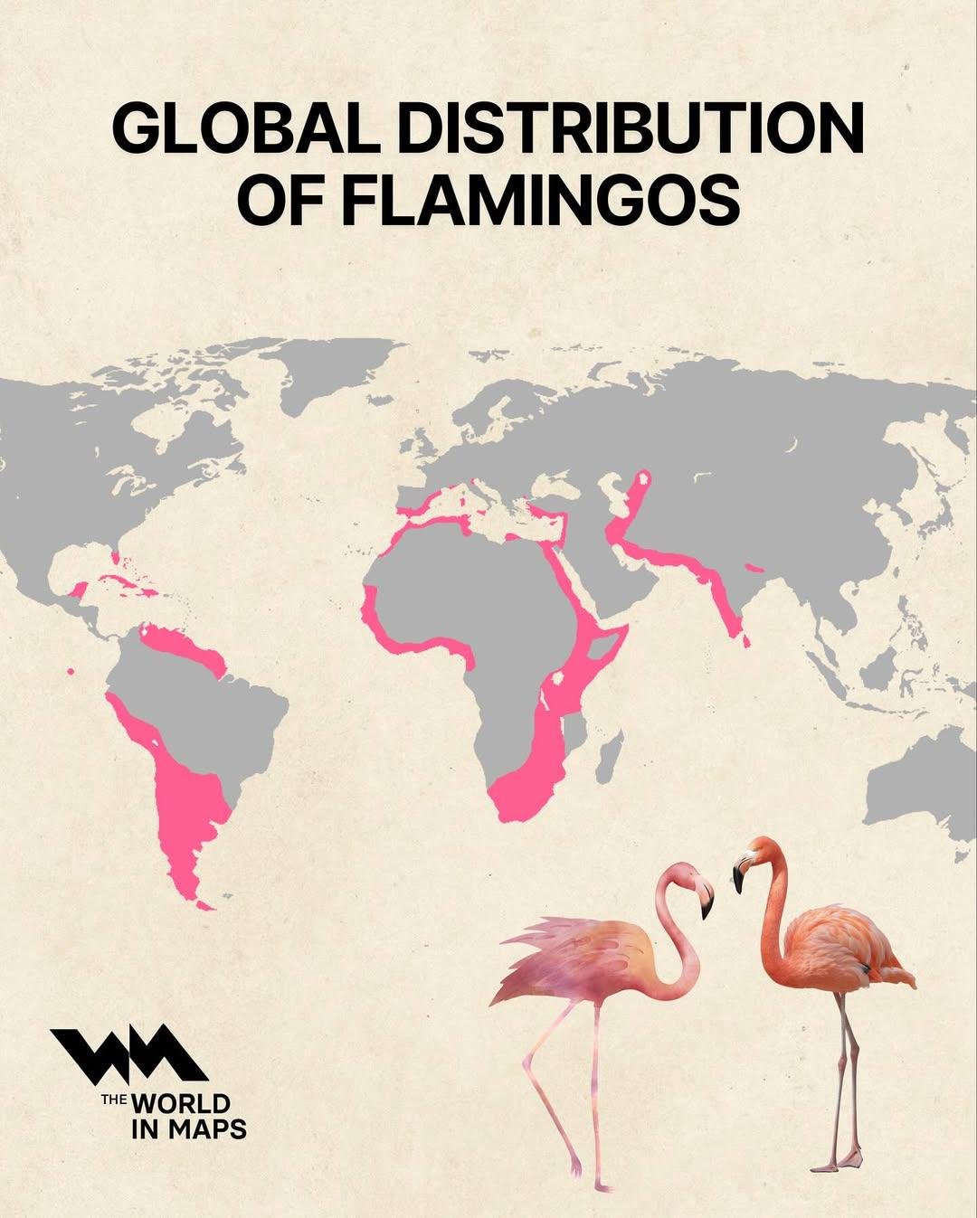
Global Distribution of Flamingos Map
The "Global Distribution of Flamingos Map" visually represents the regions where various species of flamingos are found ...
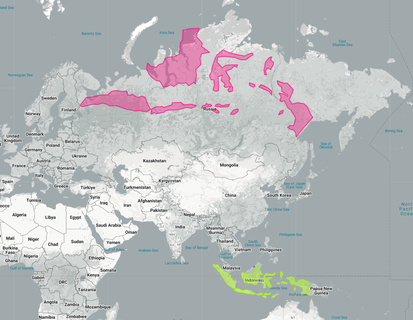
Indonesia Laid Out Over Russia Map
The map titled "Indonesia Laid Out Over Russia" provides a striking visual representation by superimposing the vast arch...
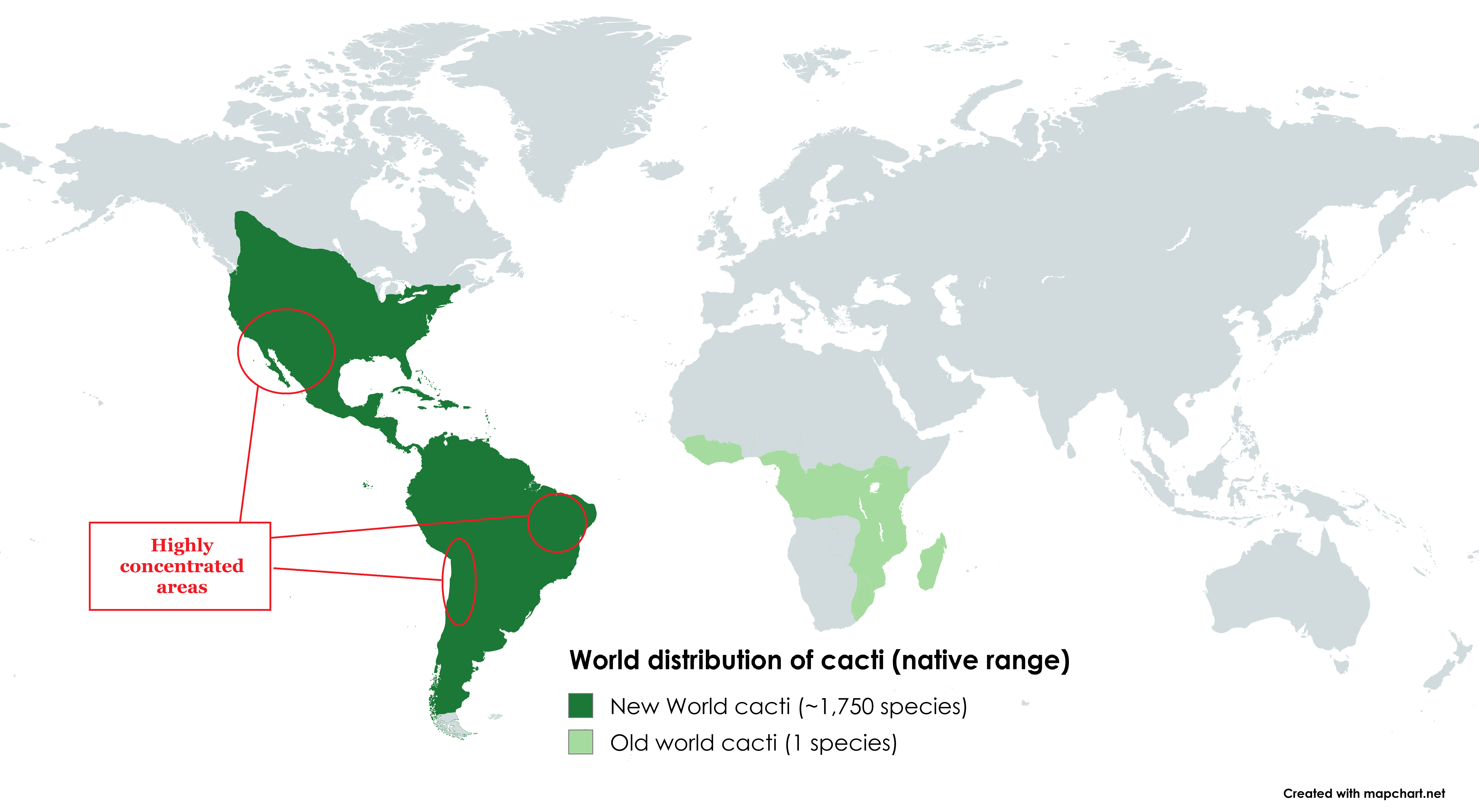
Cacti Native Range Distribution Map
This visualization presents the native distribution of cacti across the globe, highlighting the regions where these fasc...
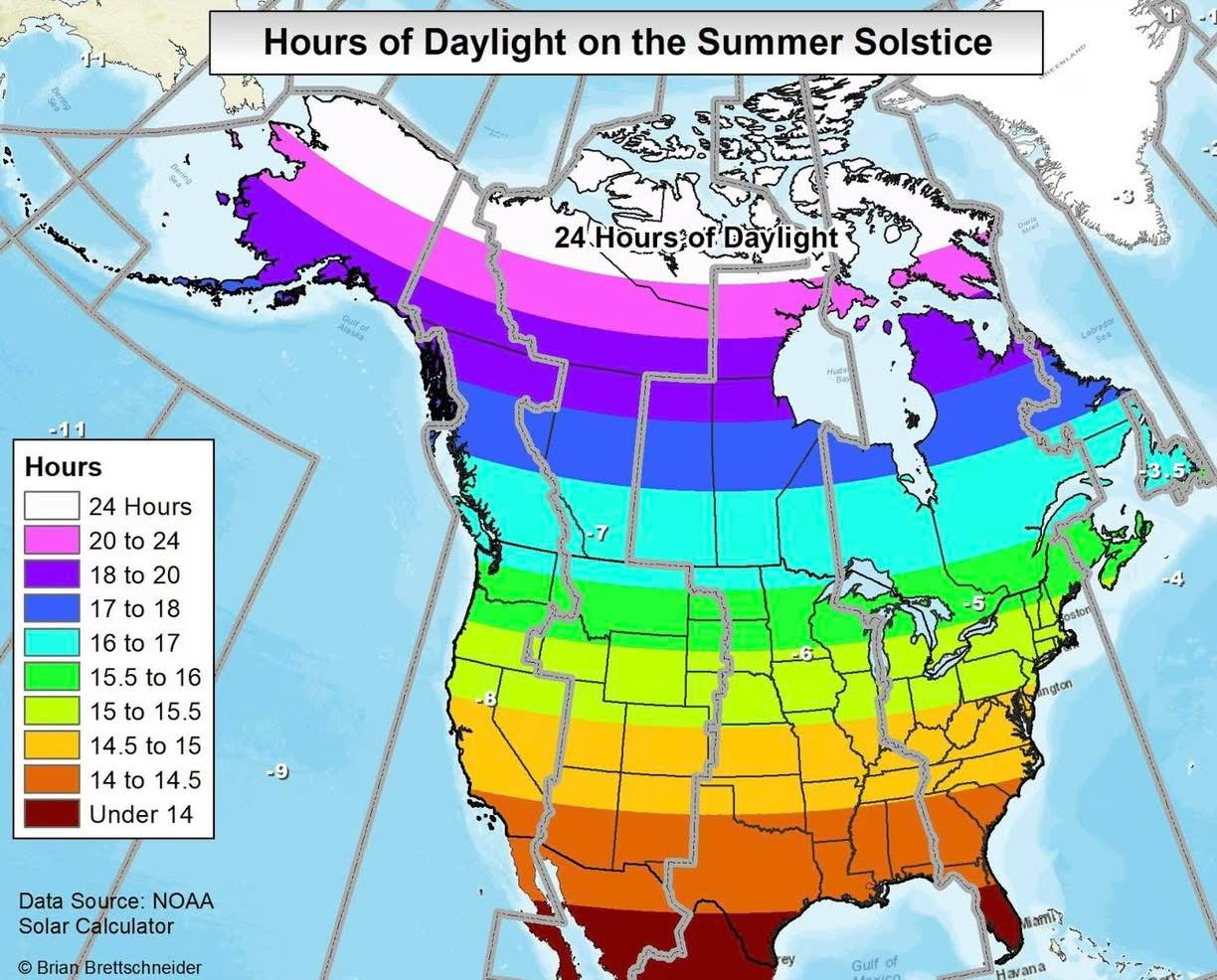
Hours of Daylight on the Summer Solstice Map
The "Hours of Daylight on the Summer Solstice" map provides a visual representation of the varying amounts of daylight e...
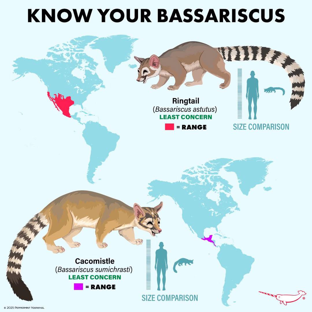
Bassariscus Species Distribution Map
The "Distribution of Bassariscus Species" map provides a detailed visualization of where various species of the genus Ba...
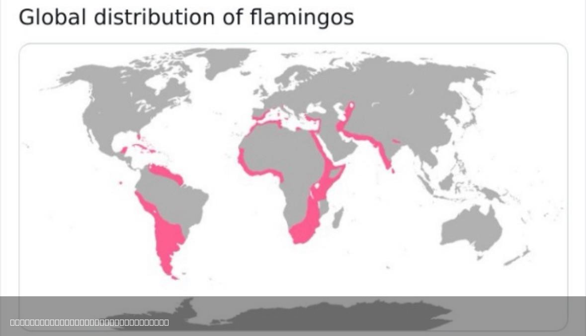
Global Distribution of Flamingos Map
The "Global Distribution of Flamingos Map" illustrates the various regions around the world where flamingos are found. T...
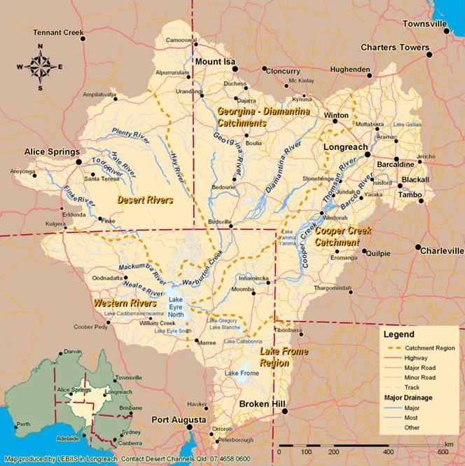
Lake Eyre Basin Map Australia
This visualization focuses on the Lake Eyre Basin, the largest endorheic lake system in Australia. Covering an expansive...
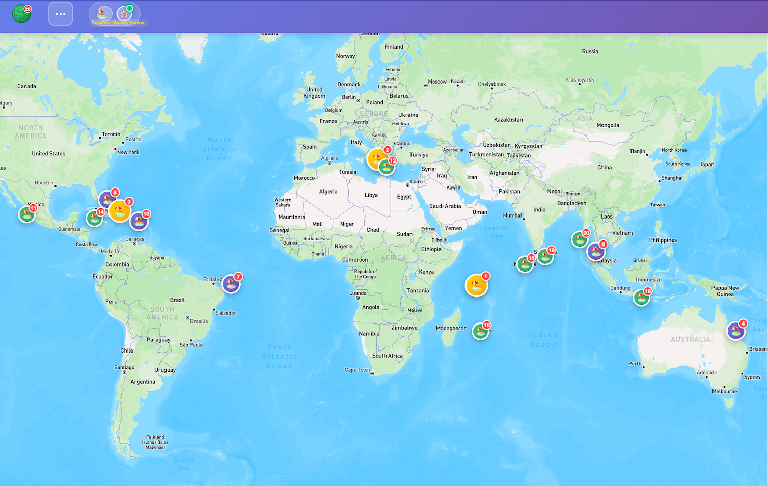
Most Beautiful Beaches in the World Map
This map visualizes the rankings of the most beautiful beaches around the globe, curated by T20APi. It highlights variou...
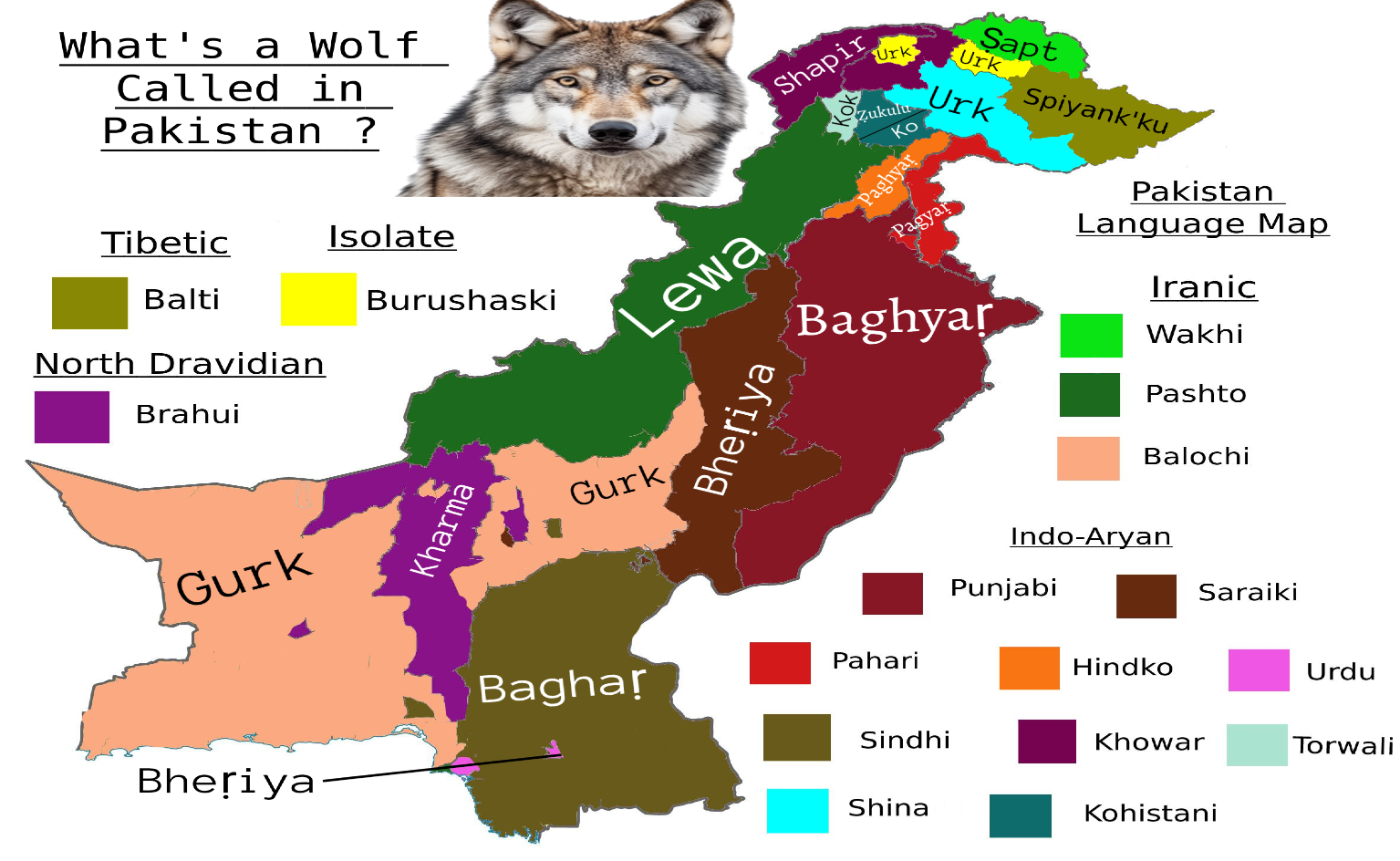
Wolf Species Names Map in Pakistan
Interestingly, in different provinces, wolves are often referred to by unique names that hold cultural significance. For...
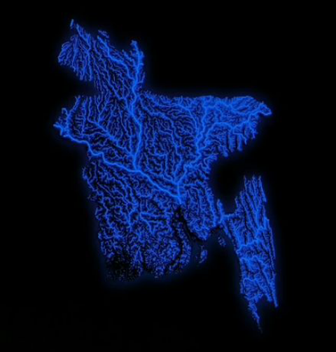
Map of All Bodies of Water in Bangladesh
The map titled "Map of All Bodies of Water in Bangladesh" provides a comprehensive overview of the numerous rivers, lake...

Map of Biological Subrealms by OneEarth
The "Map of Biological Subrealms by OneEarth" provides a detailed visualization of the different biological subrealms ac...