Denali National Park 1994 Map

Alex Cartwright
Senior Cartographer & GIS Specialist
Alex Cartwright is a renowned cartographer and geographic information systems specialist with over 15 years of experience in spatial analysis and data...
Geographic Analysis
What This Map Shows
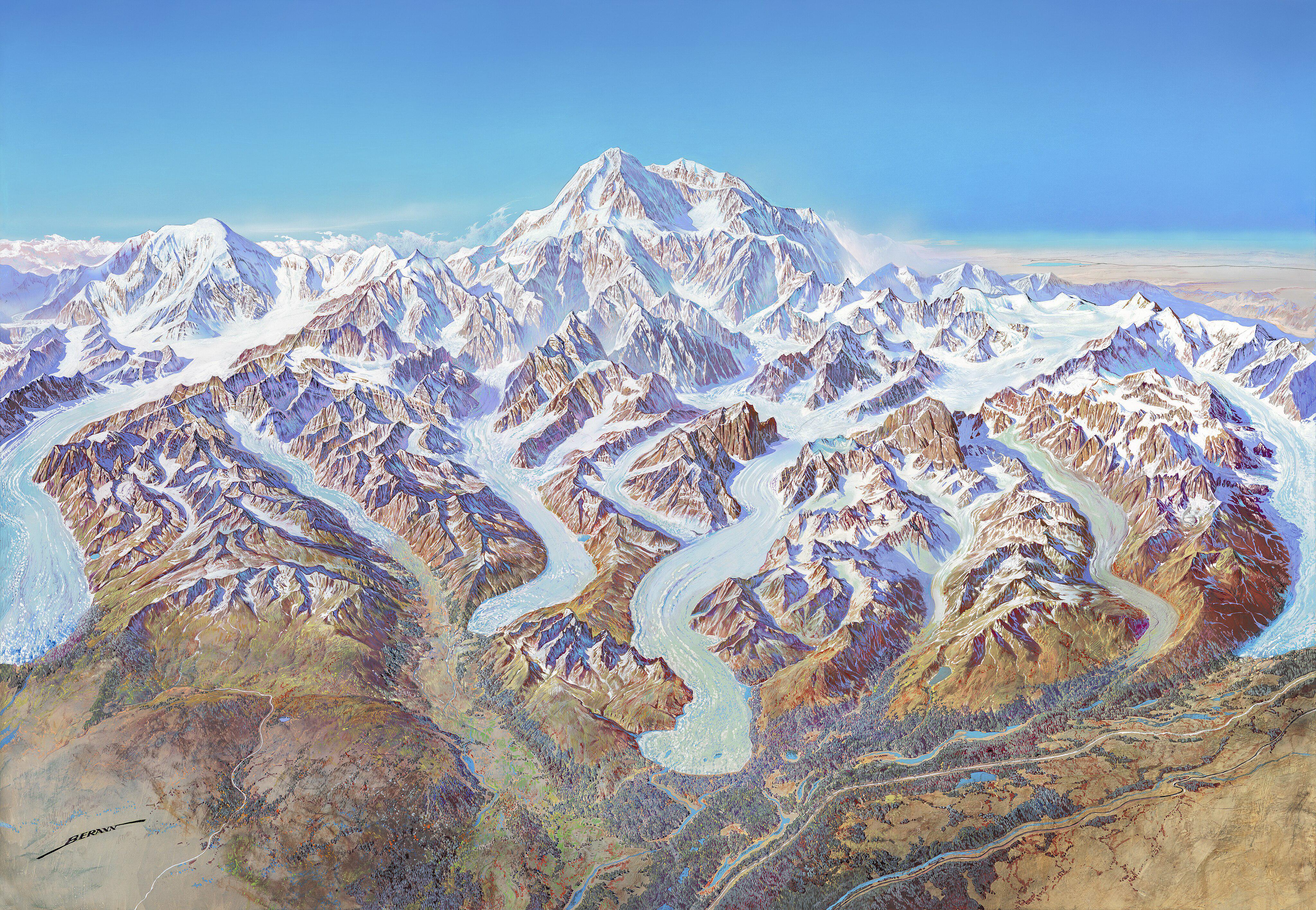
The "Map of Denali National Park (1994)" offers a detailed visual representation of one of America's most iconic national parks, located in Alaska. This map not only highlights the park's diverse terrain, including the majestic peaks of the Alaska Range, but it also outlines trails, campgrounds, and significant landmarks within the park's boundaries. It serves as a historical snapshot of the park's layout during that year, providing insights into how visitors interacted with this wild landscape.
Interestingly, while the map itself is focused on the physical attributes of Denali, it also touches on the ecological and geological features that make this area unique. From the expansive tundras to the glacially carved valleys, the map encapsulates the essence of Denali's natural beauty and ruggedness.
Deep Dive into Denali National Park
Denali National Park is renowned for its stunning landscapes and biological diversity. Covering over six million acres, the park is home to North America's tallest peak, Denali (formerly known as Mount McKinley), which rises to an elevation of 20,310 feet. The park's geography is defined by its varied ecosystems, ranging from dense forested areas to alpine tundra and glacial landscapes.
One of the fascinating aspects of Denali is its rich biodiversity. The park hosts a variety of wildlife, including grizzly bears, moose, caribou, and a plethora of bird species. In fact, Denali is part of an extensive migratory route for several animal species, leveraging the park's unique topography to thrive. Did you know that the park is home to over 1,500 plant species? This variety contributes to the complex food webs that sustain the park's wildlife.
The geological history of Denali is equally compelling. Formed through complex tectonic activity, the Alaska Range, which runs through the park, is a result of the collision between the North American and Pacific tectonic plates. The 1994 map highlights key geological features, including fault lines and glacial formations, which are crucial for understanding the park's natural environment.
However, the park is not just a natural wonder; it is also an area of cultural significance. The Indigenous peoples, including the Athabascan tribes, have lived in harmony with this land for thousands of years. Their rich history and connection to the environment enrich the narrative of Denali National Park.
Regional Analysis
Different areas within Denali National Park exhibit unique ecological features, largely due to variations in elevation and climate. For instance, the lower elevations near the park entrance are characterized by dense boreal forests, while higher altitudes transition into alpine tundra.
In the eastern section of the park, the terrain becomes increasingly rugged, featuring steep cliffs and glacial valleys. This contrasts sharply with the western side, where rolling hills and expansive river valleys are more prevalent. The 1994 map effectively illustrates these variances, providing hikers and visitors with vital information on accessibility and terrain difficulties.
Additionally, when comparing wildlife distribution within the park, one can observe that certain species are more prevalent in specific regions. For example, caribou tend to migrate through the park's northern foothills during the summer months, while grizzly bears are often spotted in the forested areas closer to the visitor center.
Significance and Impact
The significance of Denali National Park extends beyond its breathtaking views and ecological diversity. It plays a crucial role in conservation efforts, helping to protect vital ecosystems and endangered species. As climate change continues to impact natural habitats, parks like Denali are becoming increasingly important for studying ecological resilience.
Interestingly, the park also serves as a critical site for research on climate change. Scientists are closely monitoring glacial retreat and permafrost thawing, both of which have profound implications for global sea levels and local ecosystems. The 1994 map provides a historical baseline against which current changes can be measured, highlighting the importance of long-term ecological studies.
In conclusion, the "Map of Denali National Park (1994)" is much more than just a tool for navigation; it encapsulates a rich tapestry of natural and cultural histories. Understanding the geography of Denali not only enhances our appreciation for this national treasure but also underscores the importance of environmental stewardship in the face of ongoing ecological challenges.
Visualization Details
- Published
- October 4, 2025
- Views
- 44
Comments
Loading comments...