wildlife Maps
14 geographic visualizations tagged with "wildlife"
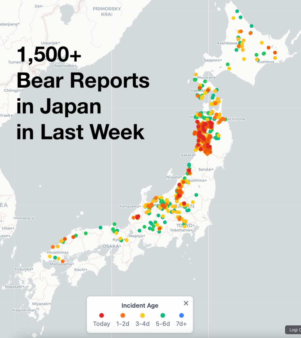
Bear Activity in Japan Map 2025
The "2025 marked the peak bear activity in Japan" map provides a comprehensive visualization of bear sightings and encou...
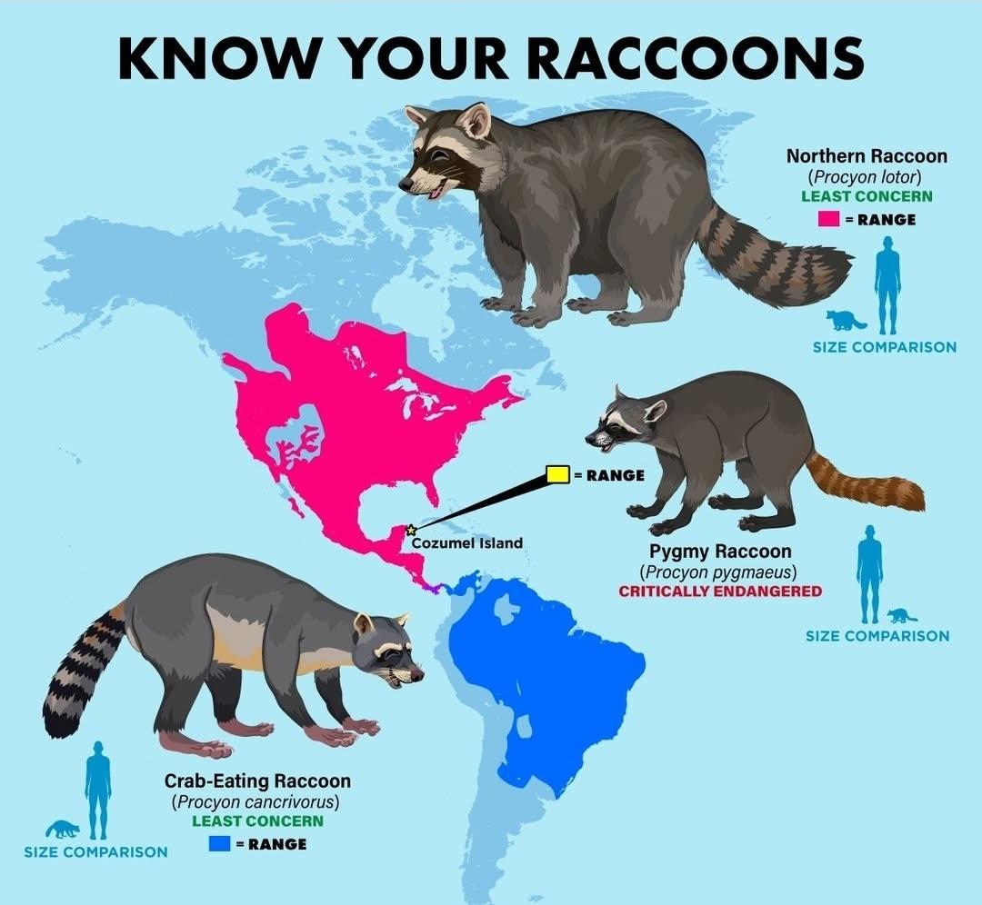
Raccoon Habitat Distribution Map
This visualization displays the habitat distribution of raccoons across various regions, highlighting their presence in ...
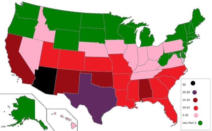
U.S. States with the Highest Number of Venomous Animals Map
The visualization titled "U.S. States with the Highest Number of Venomous Animals Map" provides a striking look at the d...
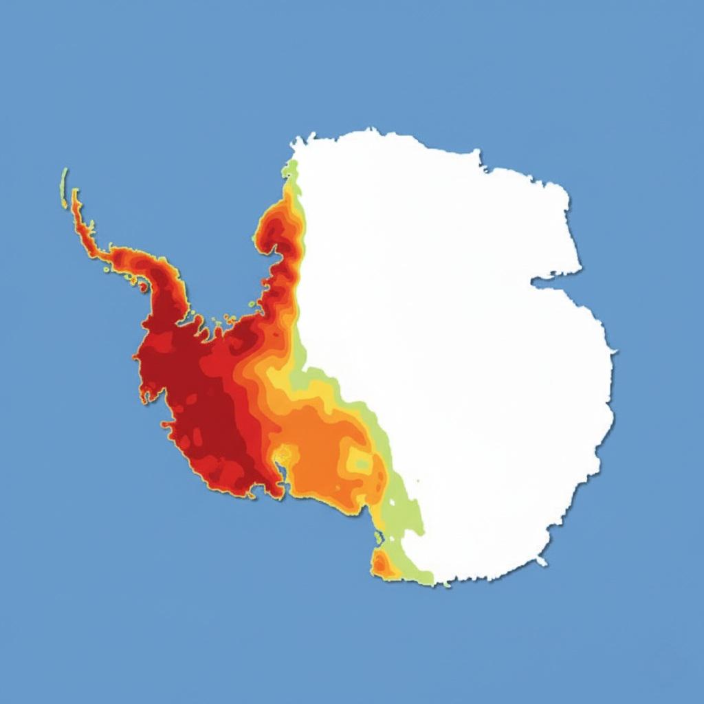
Map of Most Visited Areas of Antarctica
This map visualizes the most visited areas of Antarctica on an annual basis, highlighting the regions that attract the m...
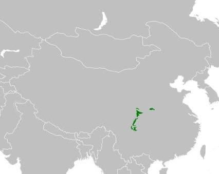
Giant Panda Natural Habitat Map
This map provides a detailed visualization of the natural habitat of the Giant Panda, illustrating the specific regions ...
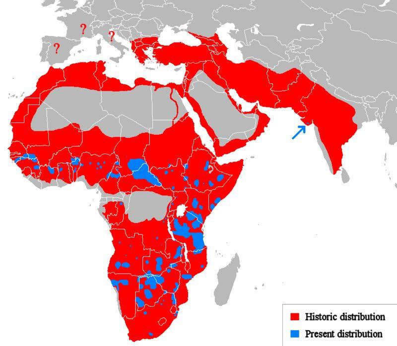
Historic vs Present Distribution of Lions Map
The "Historic vs Present Distribution of Lions" map visually contrasts the past and current range of lion populations ac...
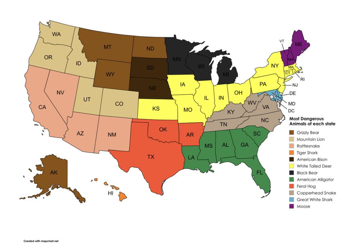
Most Dangerous Animal by State Map
This visualization titled "Most Dangerous Animal by State" provides an intriguing snapshot of the various dangerous anim...
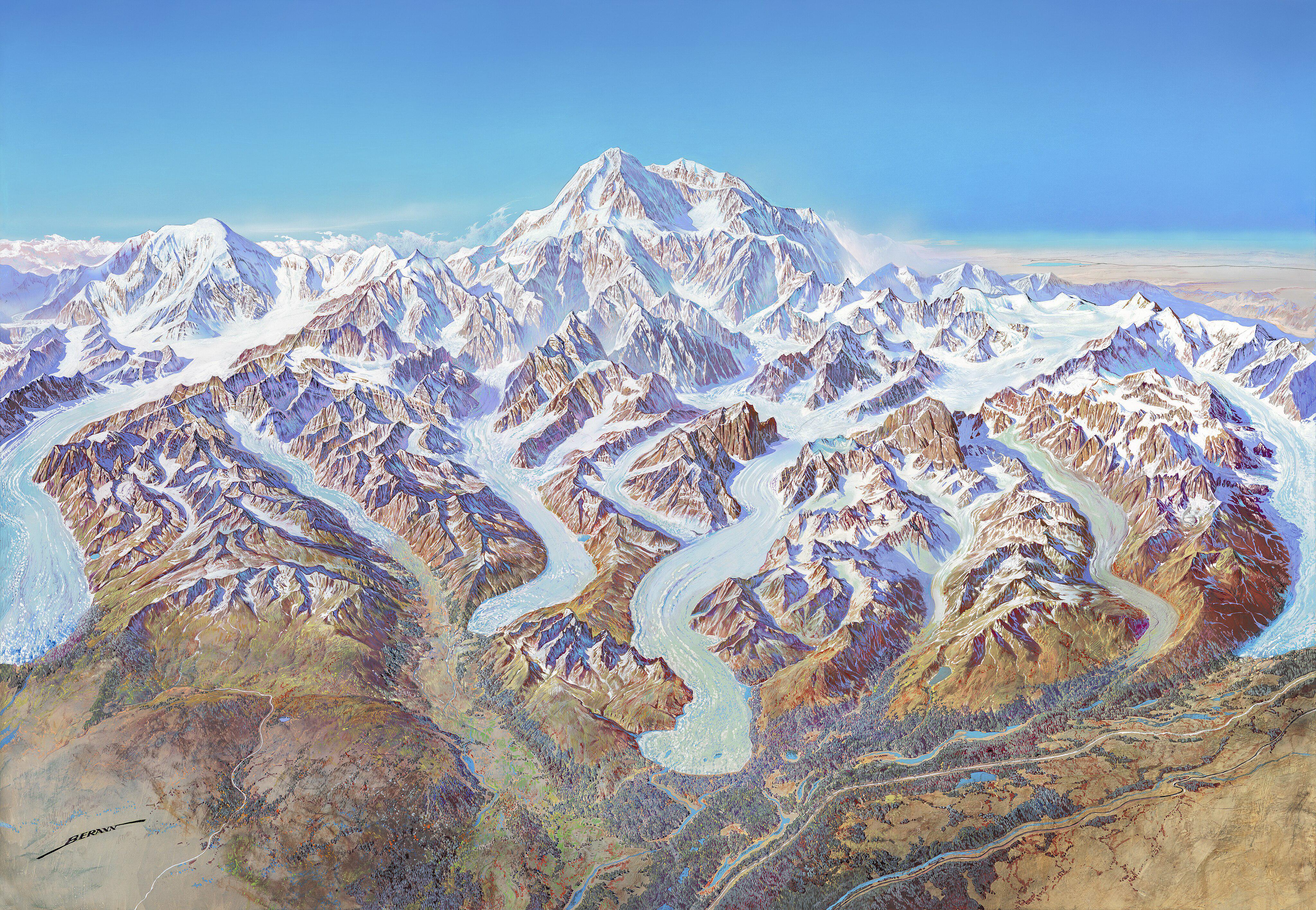
Denali National Park 1994 Map
The "Map of Denali National Park (1994)" offers a detailed visual representation of one of America's most iconic nationa...
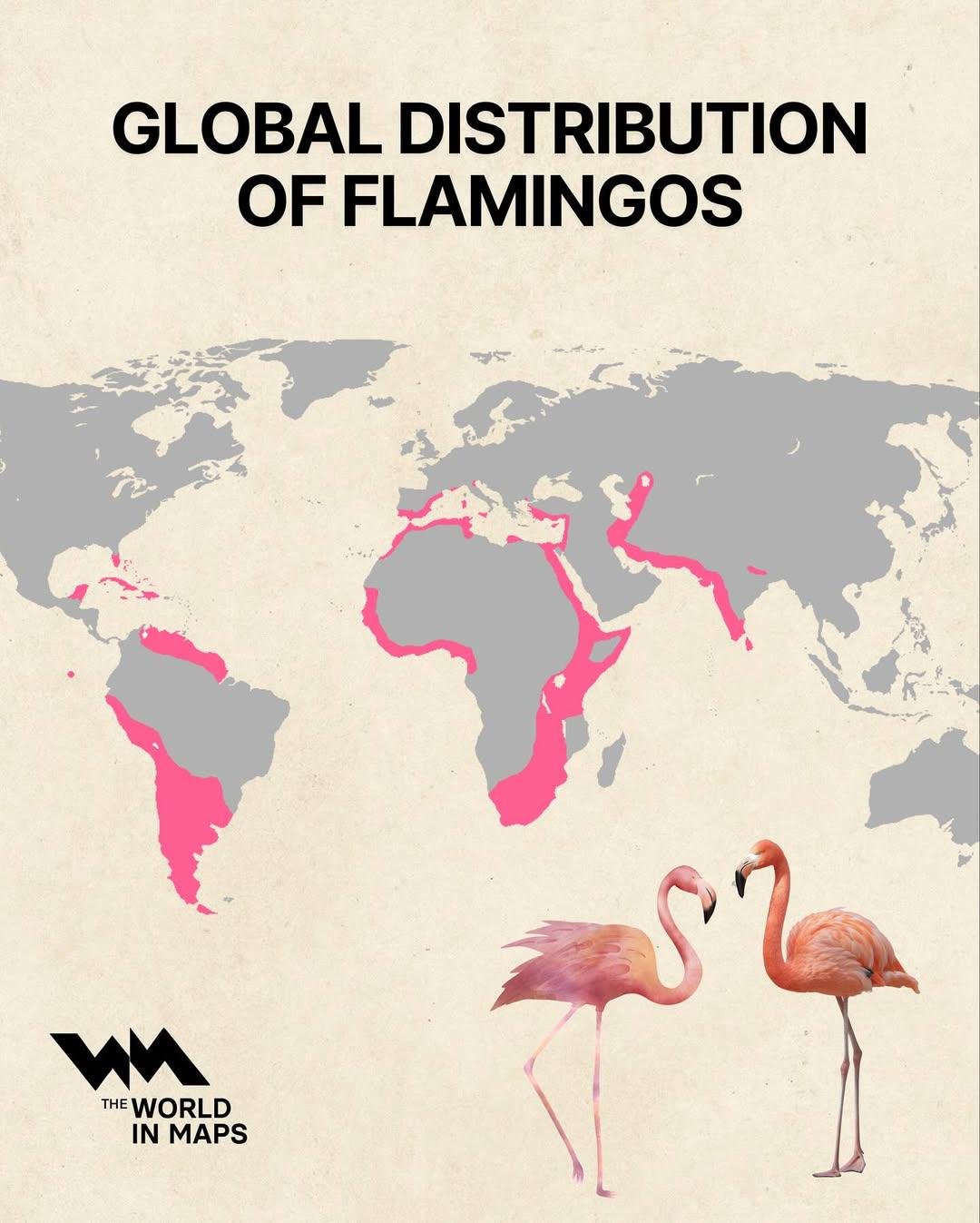
Global Distribution of Flamingos Map
The "Global Distribution of Flamingos Map" visually represents the regions where various species of flamingos are found ...
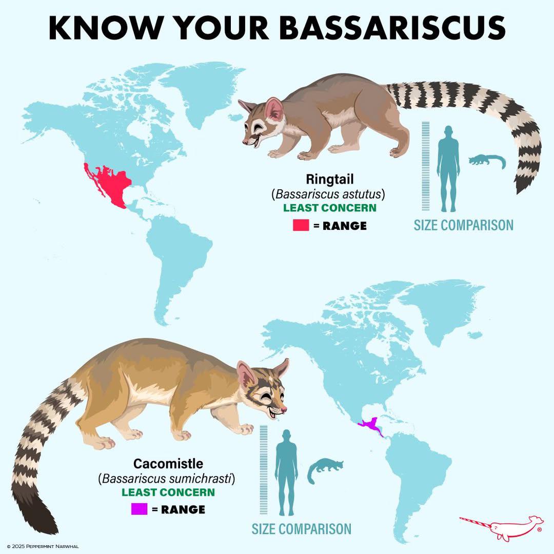
Bassariscus Species Distribution Map
The "Distribution of Bassariscus Species" map provides a detailed visualization of where various species of the genus Ba...
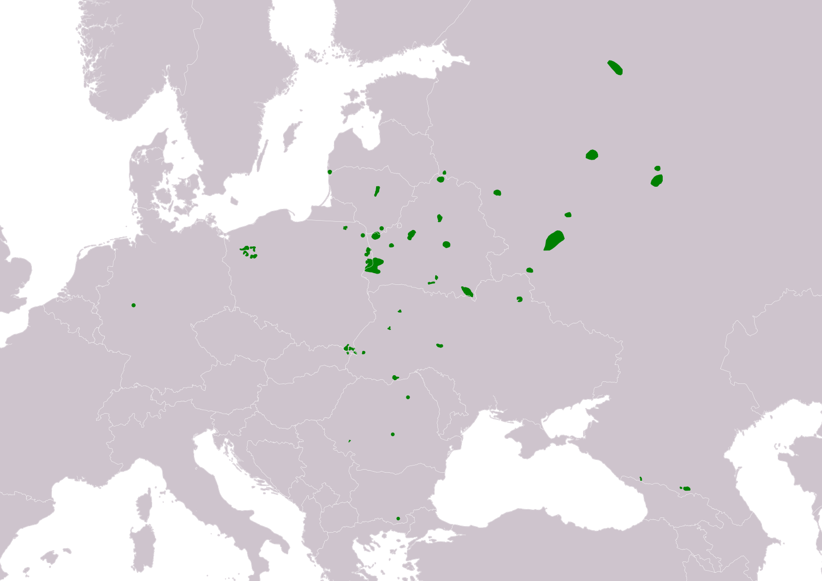
Range of European Bison Map 2020
...
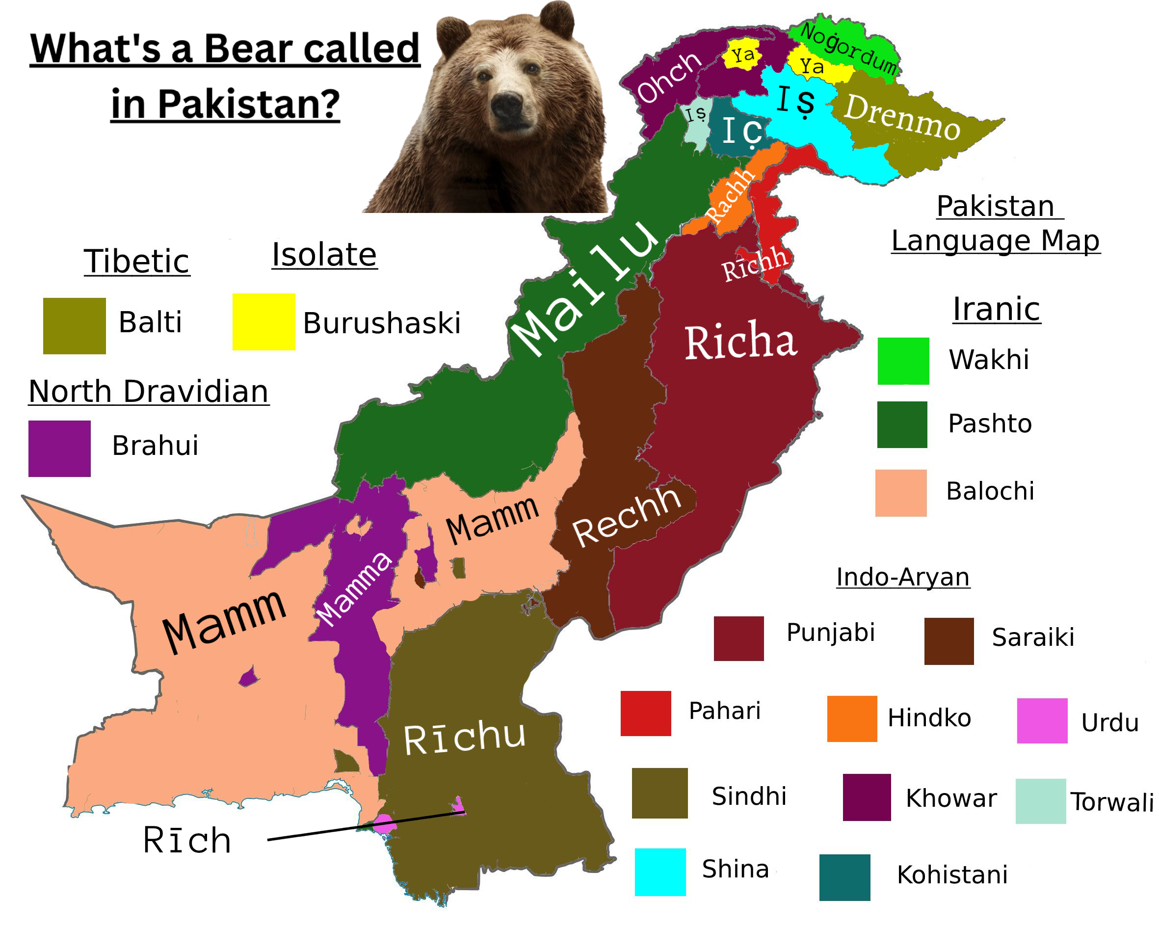
Bear Species Names in Pakistan Map
This map provides a detailed overview of the various names used for bears in different regions of Pakistan. By highlight...
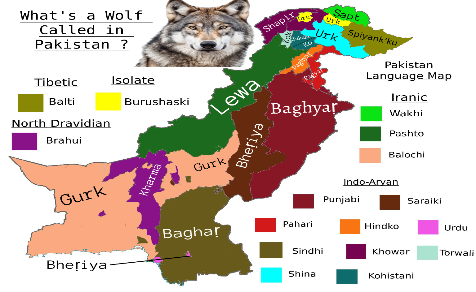
Wolf Species Names Map in Pakistan
Interestingly, in different provinces, wolves are often referred to by unique names that hold cultural significance. For...
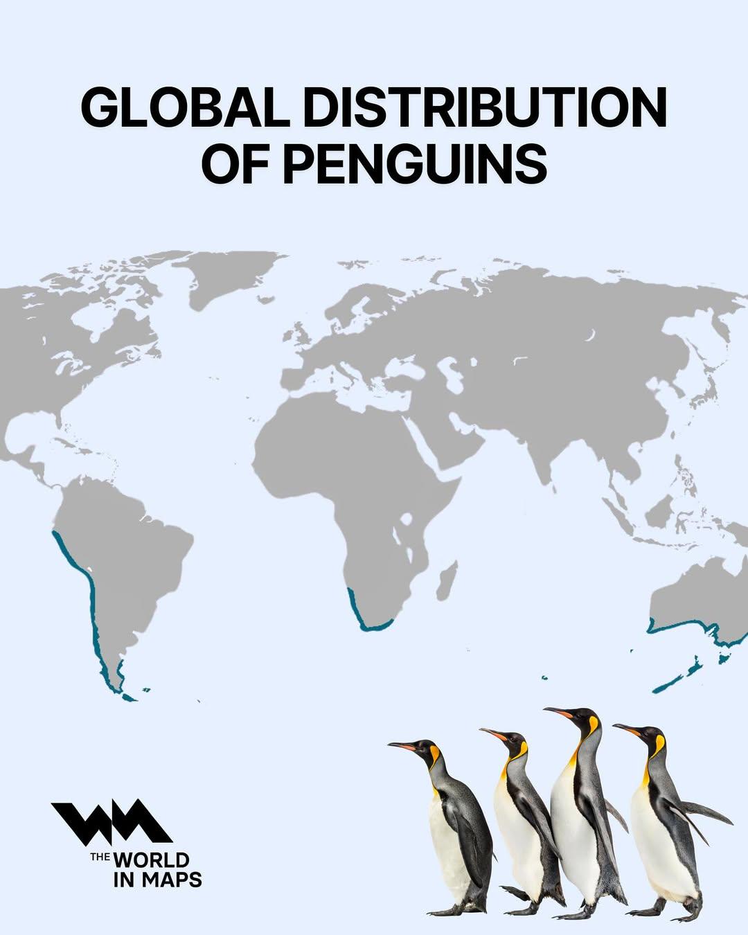
Global Distribution of Penguins Map
The 'Global Distribution of Penguins Map' visually represents the habitats and populations of various penguin species ac...