national parks Maps
7 geographic visualizations tagged with "national parks"
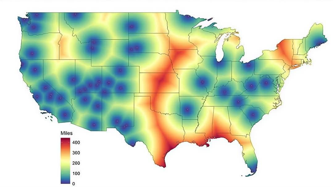
Proximity to the Nearest National Park Map
The "Proximity to the Nearest National Park Map" provides a visual representation of how far individuals live from the n...
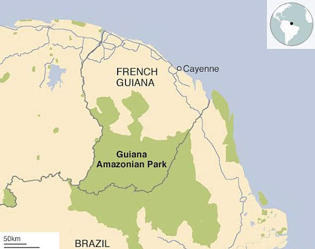
Map of Largest National Park in EU Located in South America
This map highlights an intriguing geographical fact: the largest national park within the European Union is actually sit...

Best Hiking Trails Map Across the USA
The visualization titled "On the off chance there are any hiking aficionados amongst you..." presents a comprehensive ma...
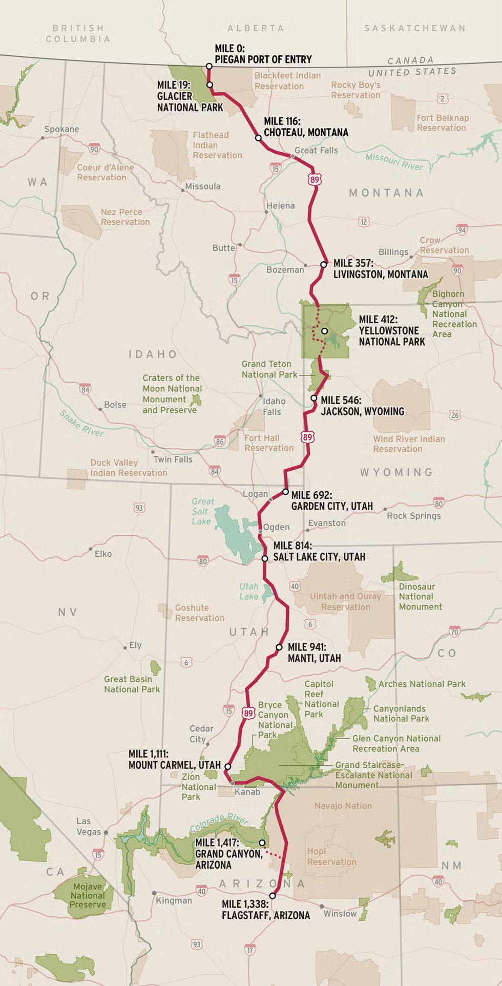
US 89 National Park Highway Map
The "US 89: Known as the National Park Highway" map provides a detailed visualization of one of America's most scenic ro...
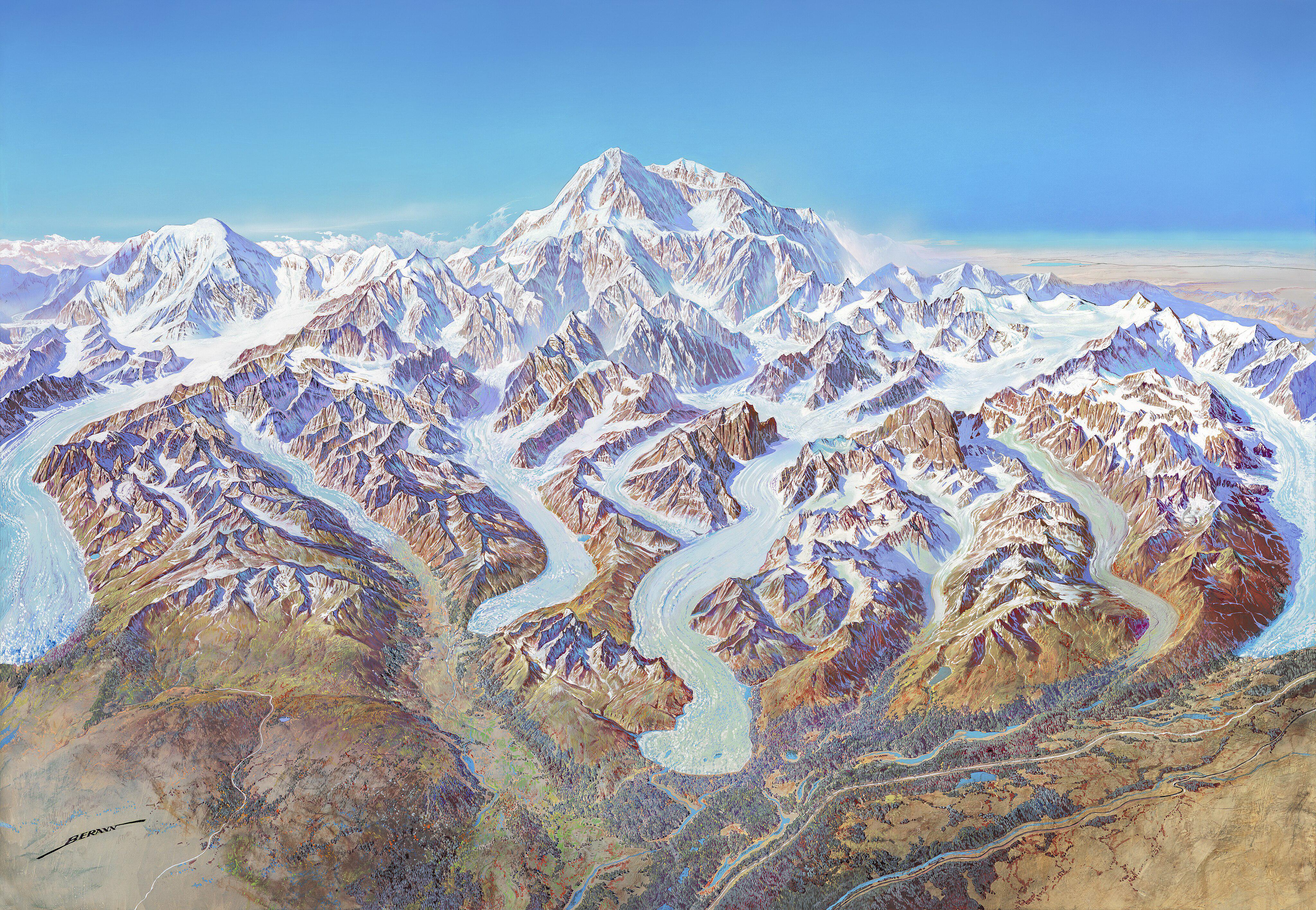
Denali National Park 1994 Map
The "Map of Denali National Park (1994)" offers a detailed visual representation of one of America's most iconic nationa...
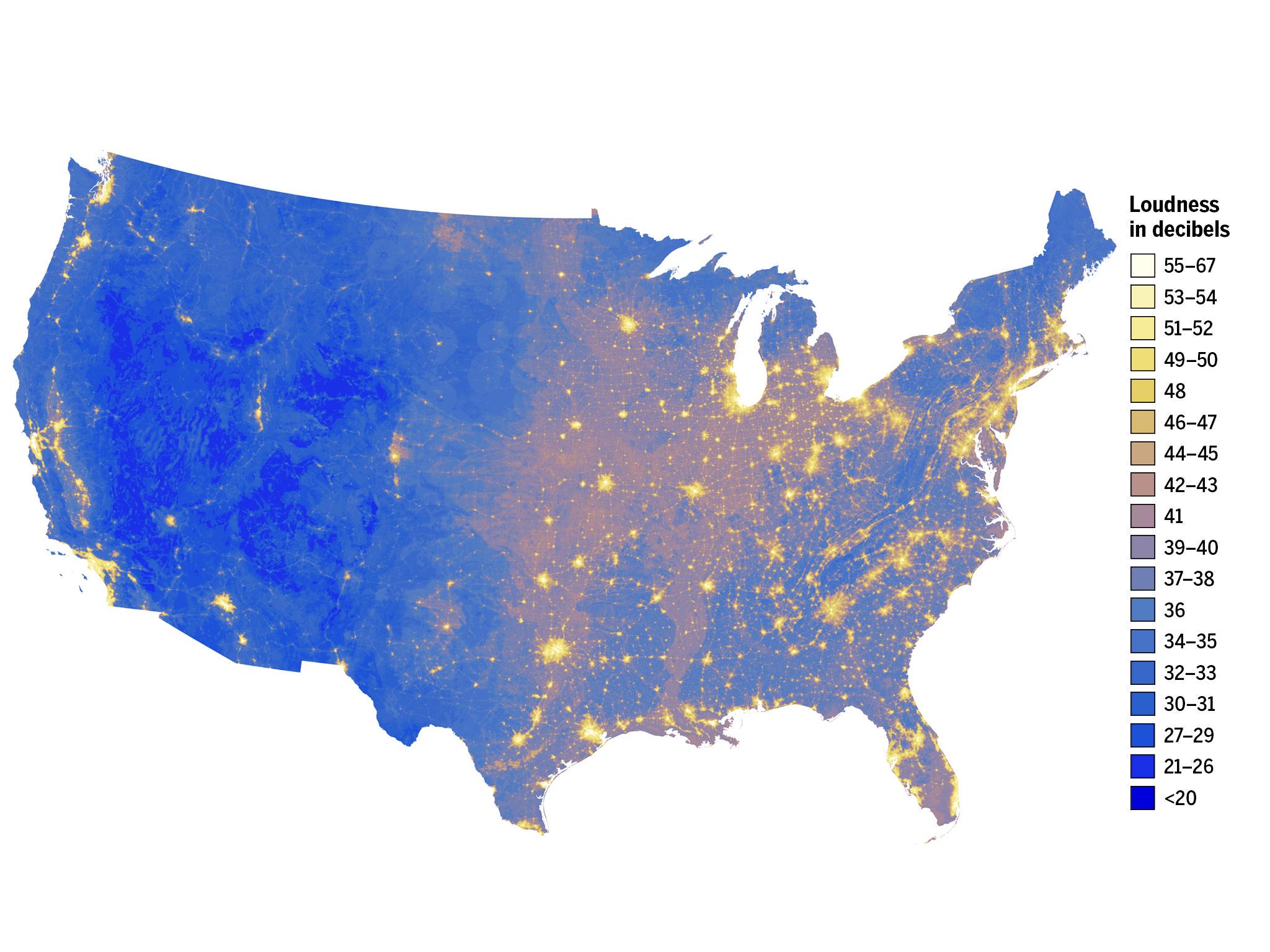
Noisiest and Quietest Areas in the US Map
The 'Noisiest and Quietest Areas in the US' map offers a vivid representation of the sound levels across the United Stat...
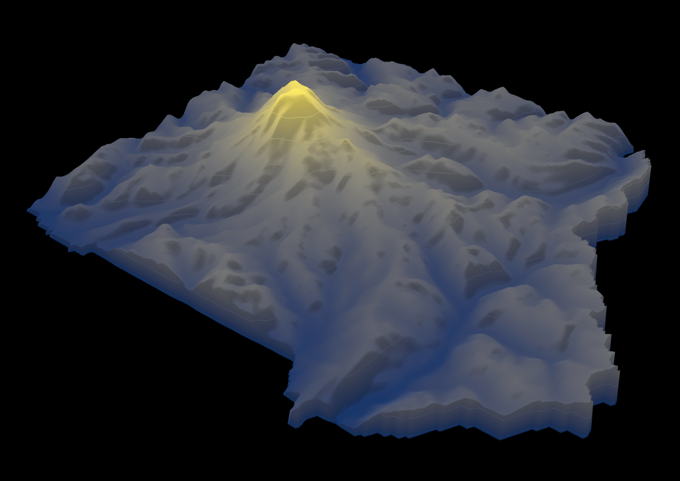
Height Map of Mount Rainier National Park
The height map of Mount Rainier National Park provides a detailed visualization of the elevation changes within this ico...