Geographic Visualizations
Explore our curated collection of fascinating geographic visualizations and cartographic analyses. Discover detailed maps, data visualizations, and geographical insights from around the world.
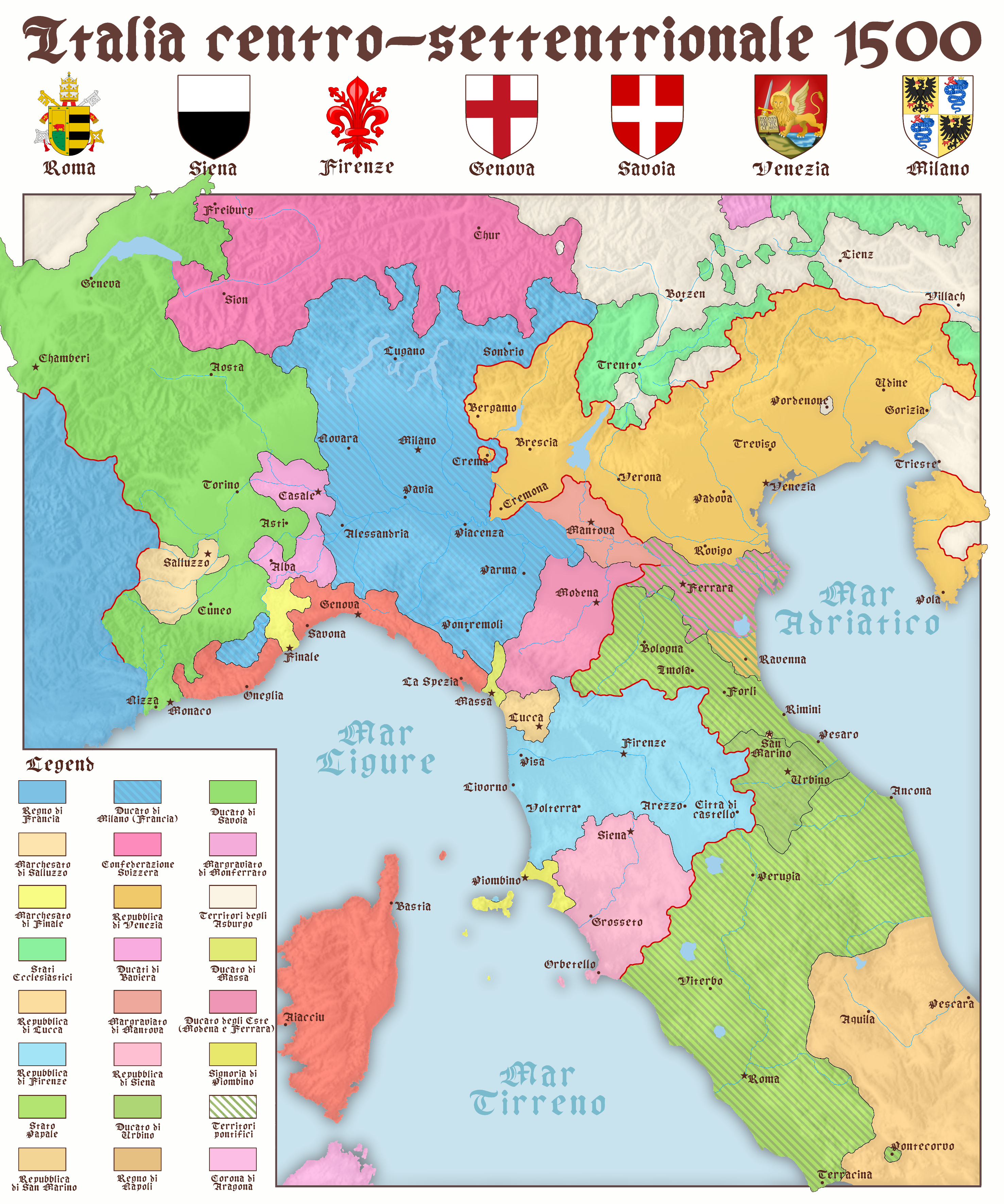
Map of North and Central Italy in 1500
## What This Map Shows...
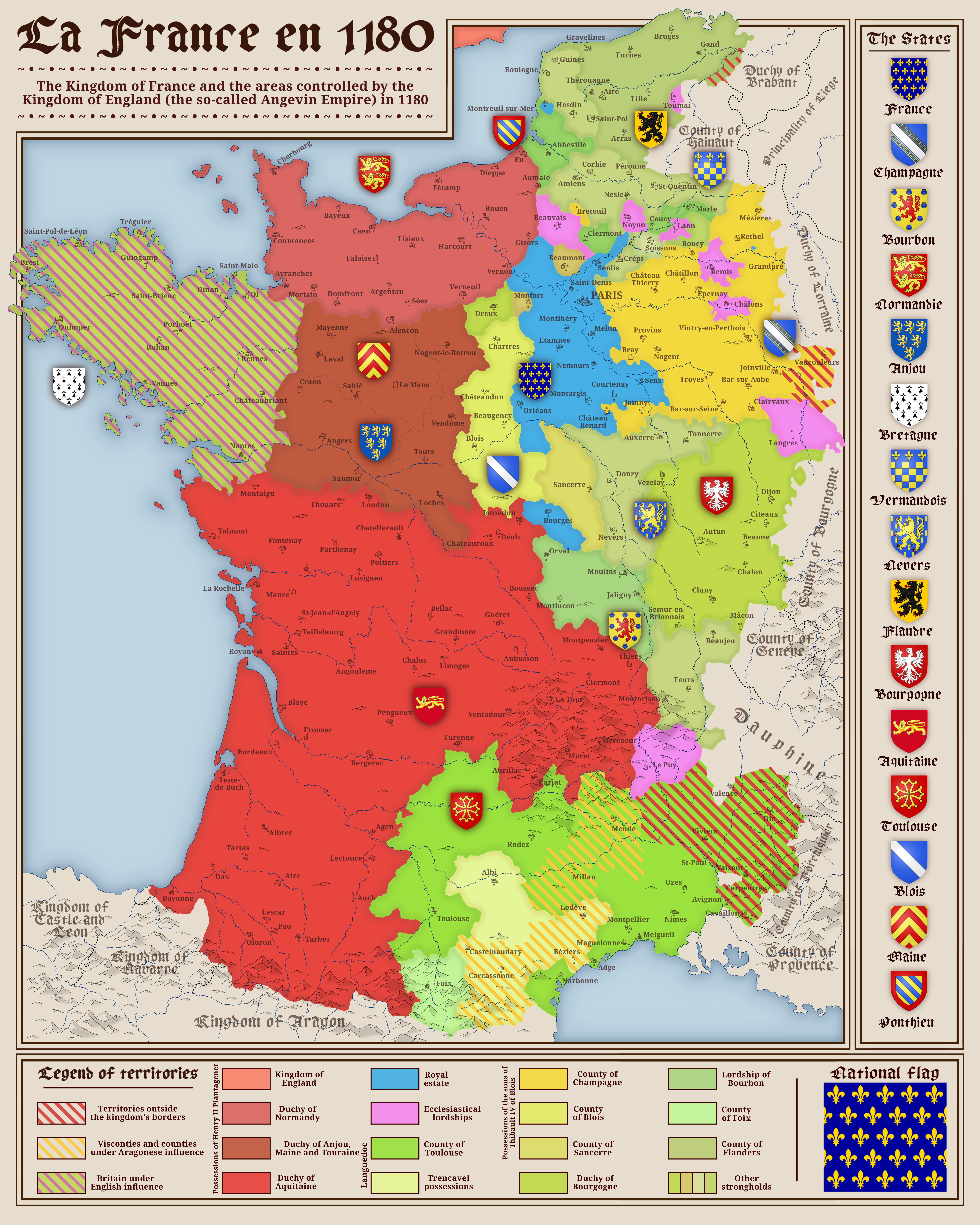
Political Map of France in 1180
## What This Map Shows...
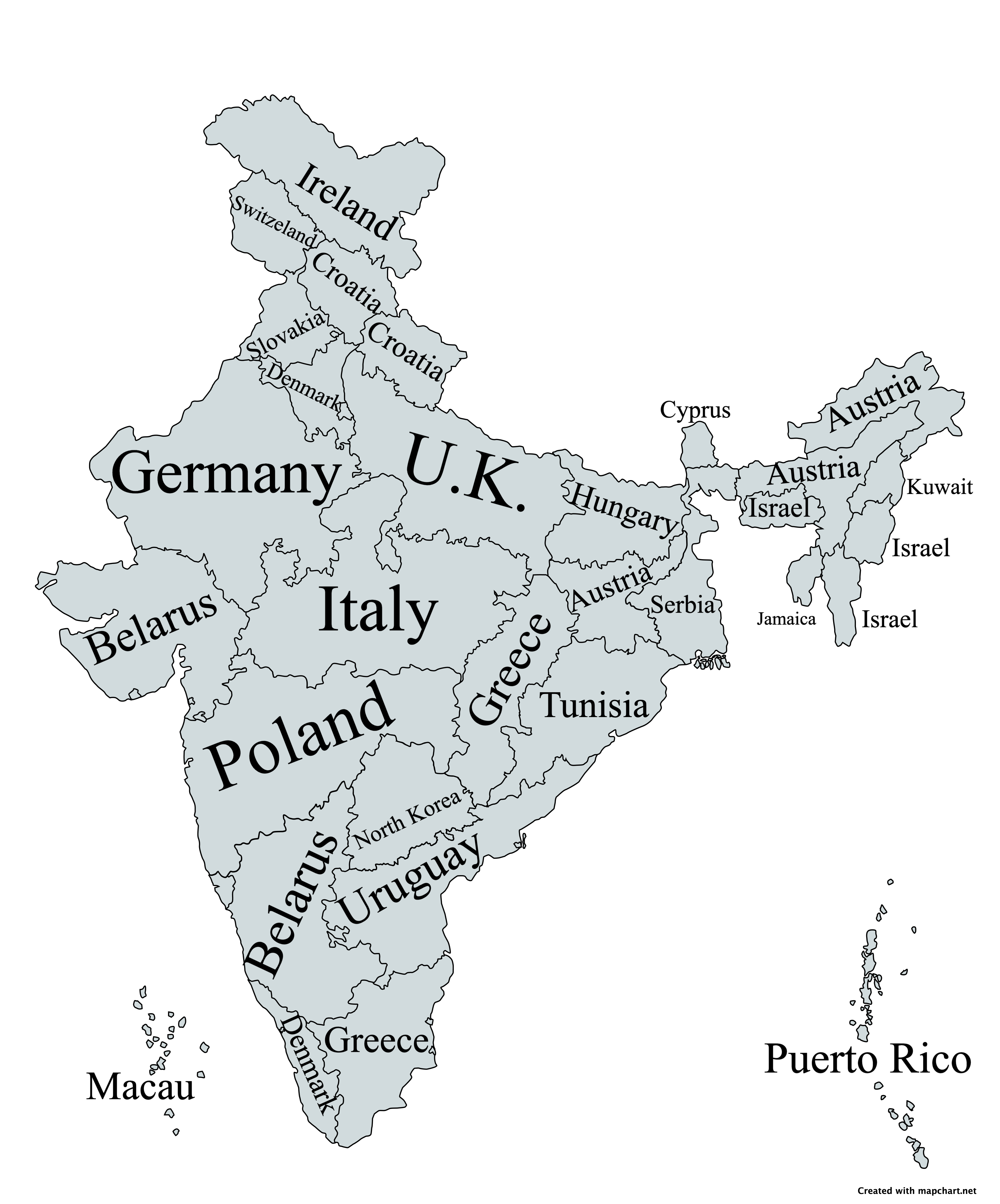
Indian States Compared to Countries by Land Area Map
## What This Map Shows...
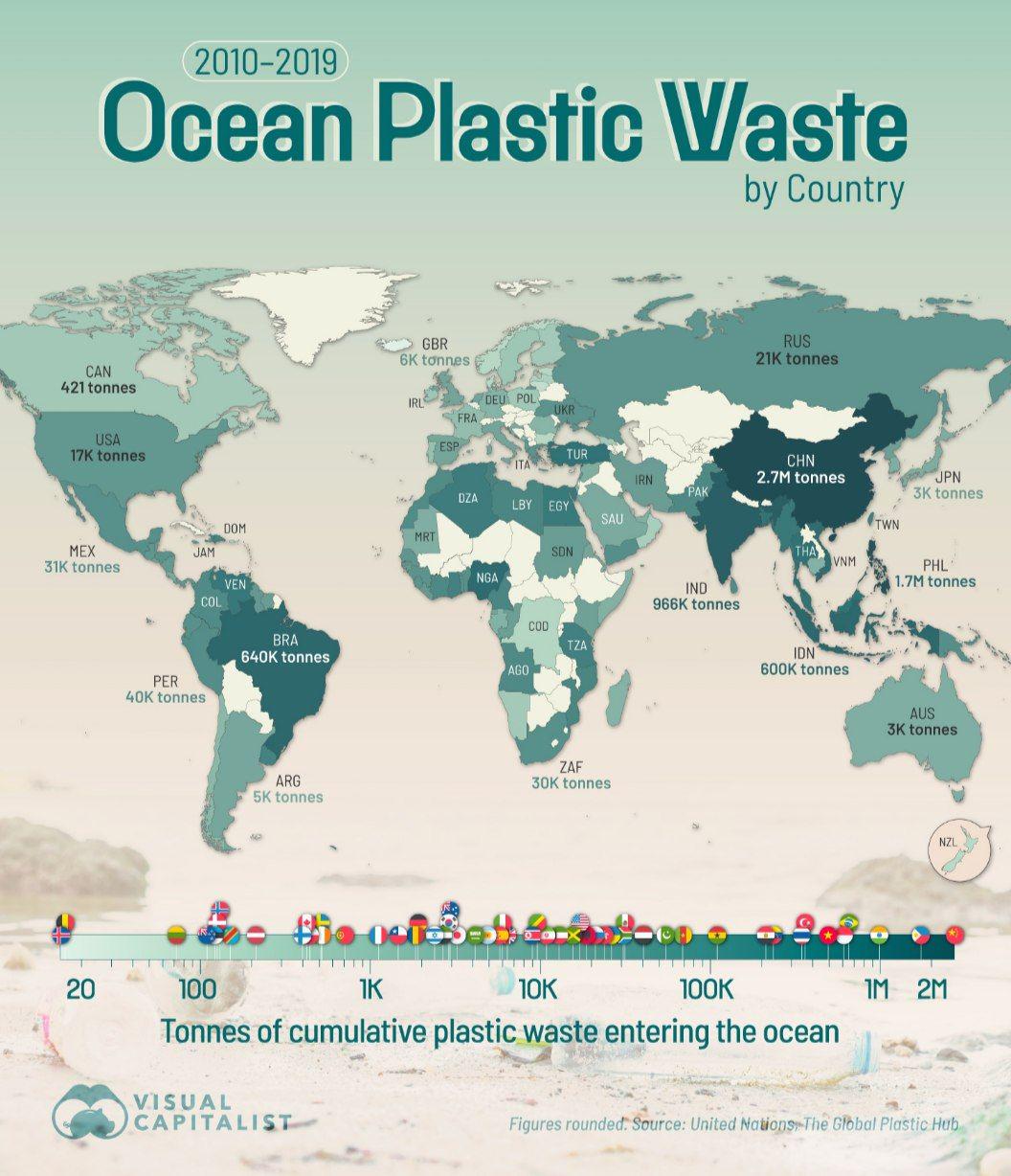
Ocean Plastic Waste by Country Map
## What This Map Shows...
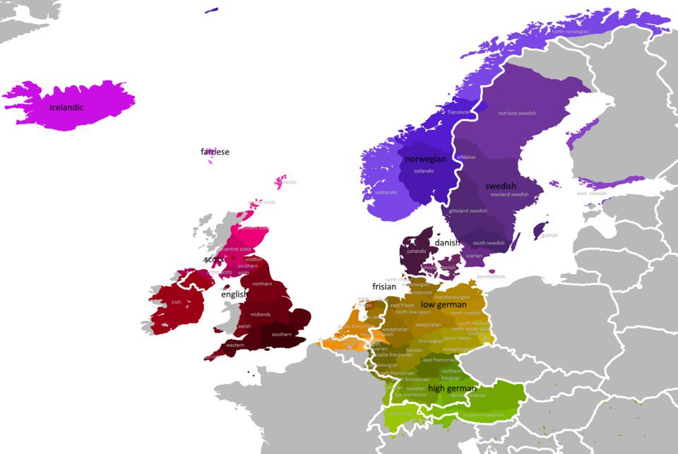
Map of Germanic Languages Distribution in Europe
## What This Map Shows\nThe \...
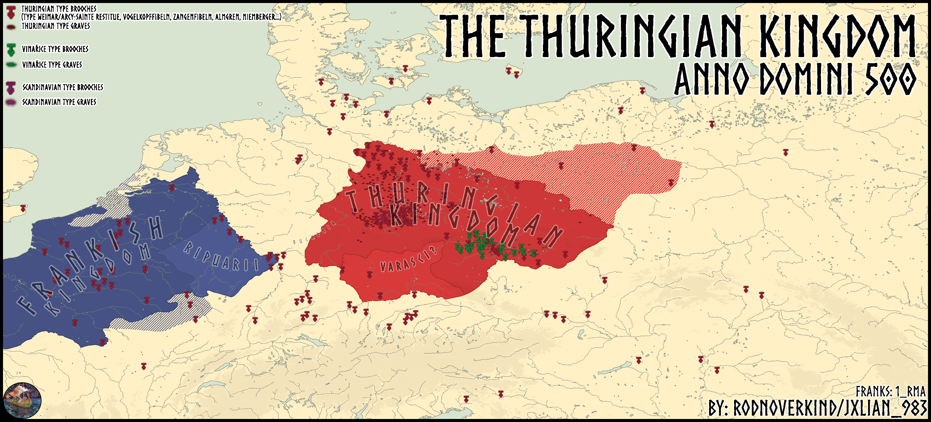
Thuringian Kingdom Map in 500 A.D.
## What This Map Shows...
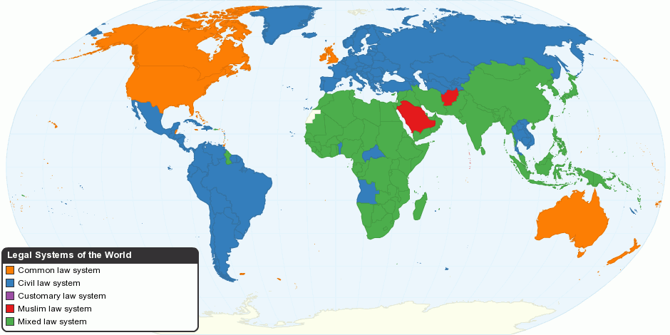
Legal Systems Around the World Map
## What This Map Shows...
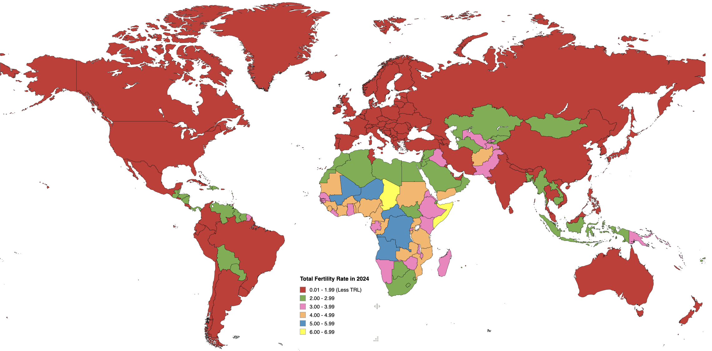
Fertility Rates by Country Map 2024
## What This Map Shows...
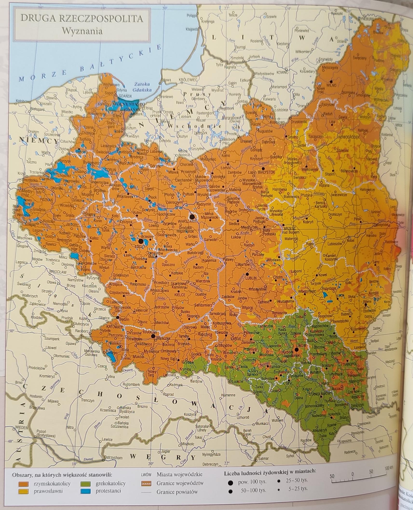
Religions in the Second Polish Republic Map
## What This Map Shows...
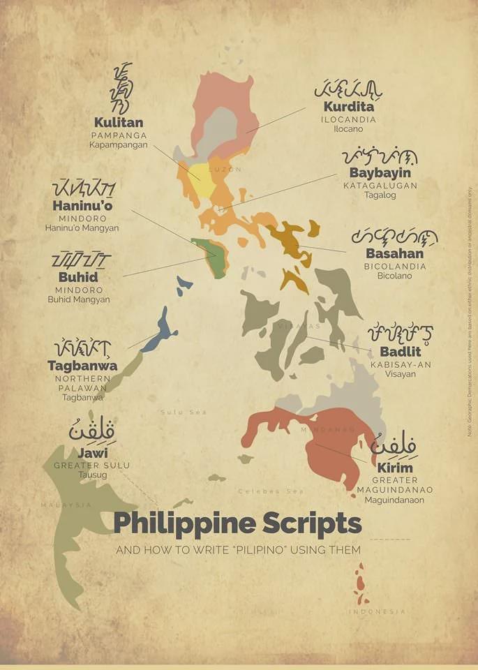
Indigenous Filipino Scripts Map
## What This Map Shows...
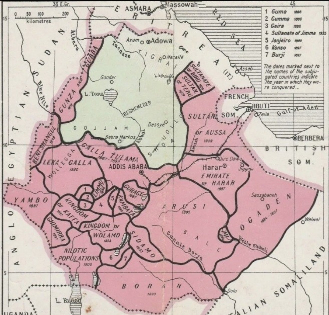
Map of Menelik II's Ethiopia Pre and Post Conquest
## What This Map Shows\nThe map titled \...
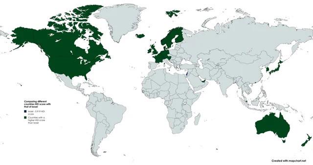
Countries with Higher HDI than Israel Map
## What This Map Shows...
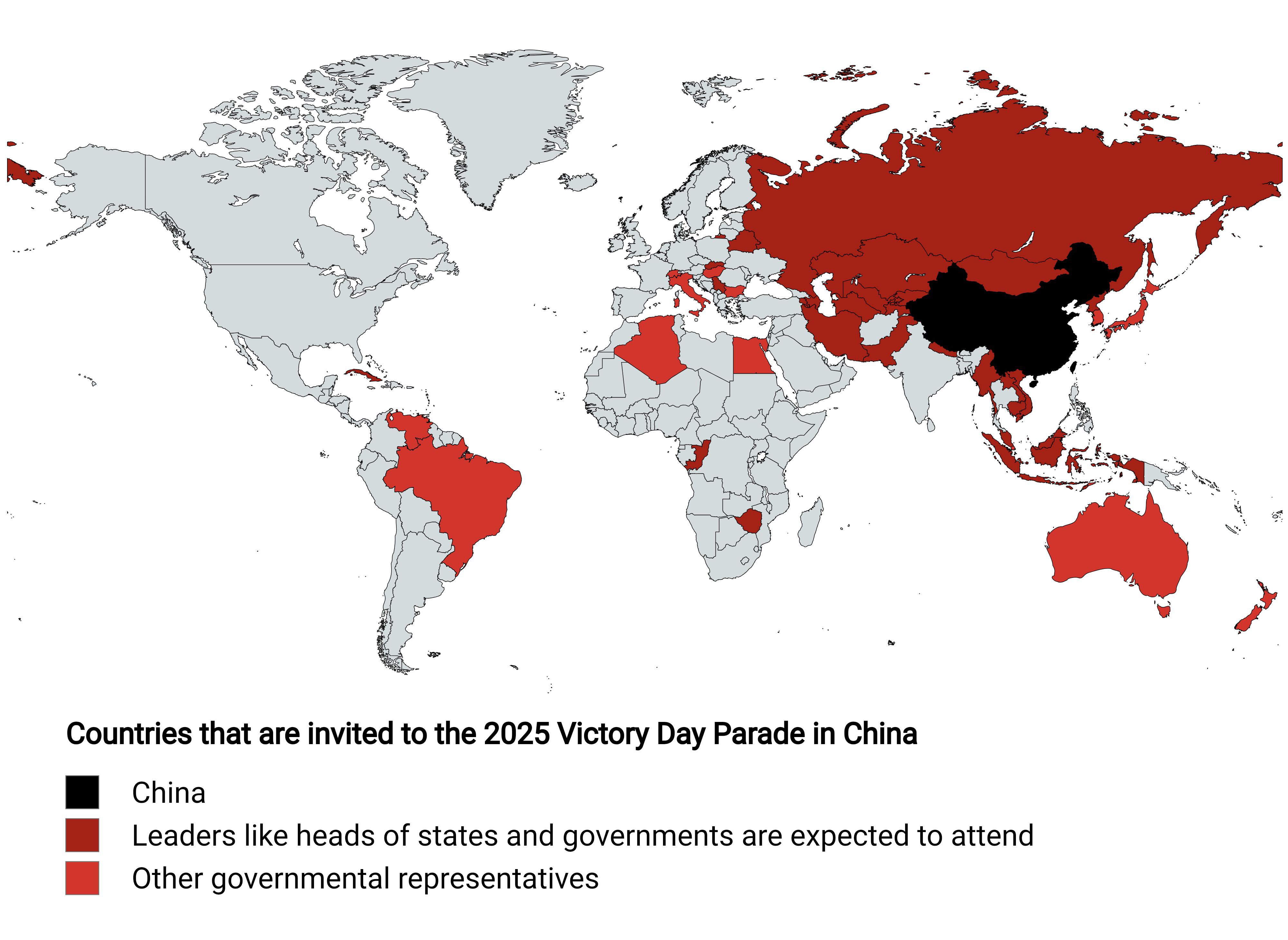
Map of Countries Invited to China's 2025 Victory Day Parade
## What This Map Shows...
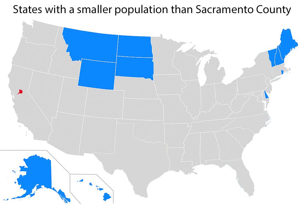
States with Smaller Populations than Sacramento County Map
## What This Map Shows...
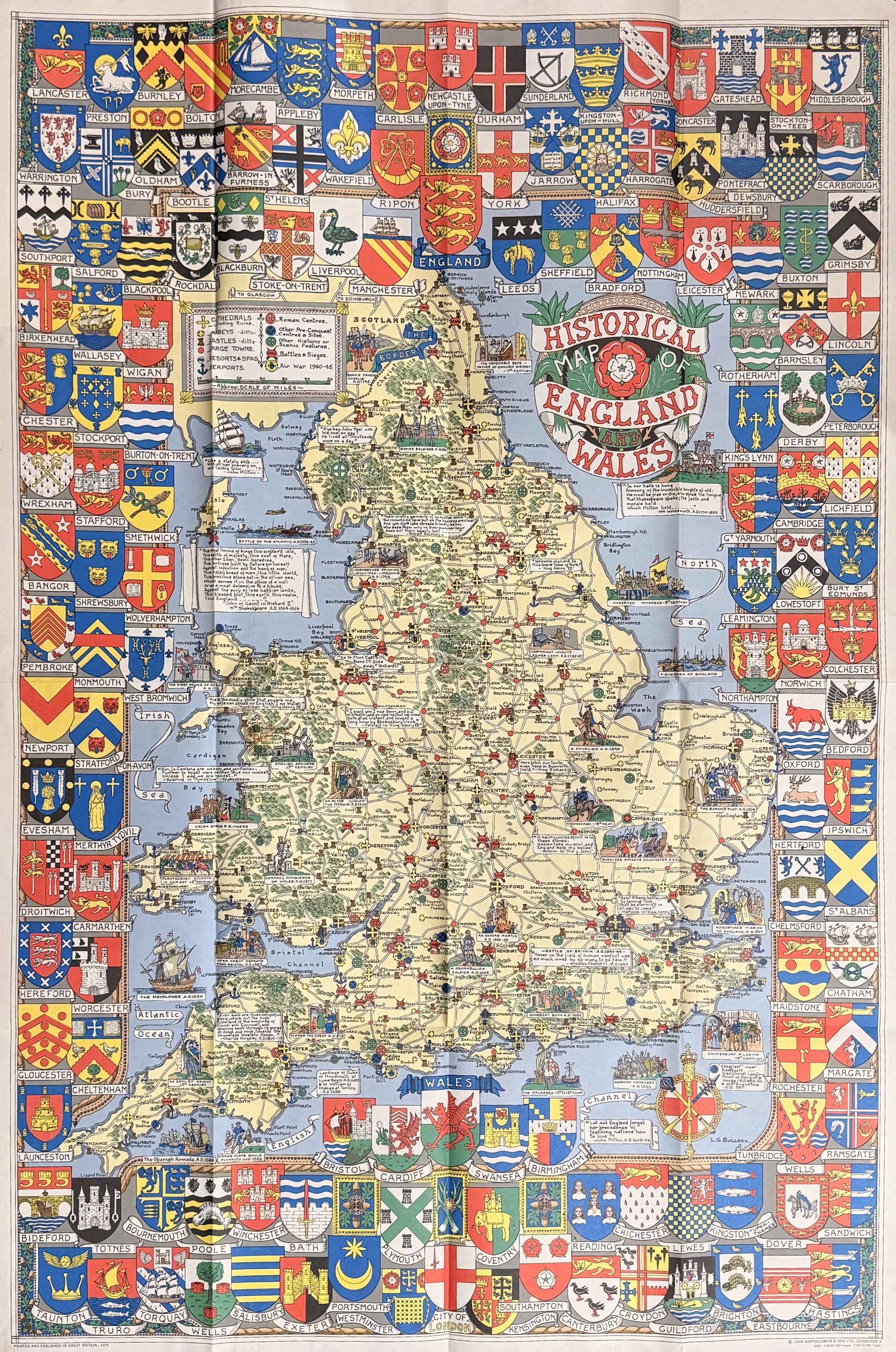
Historical Map of England & Wales from the 1970s
## What This Map Shows...
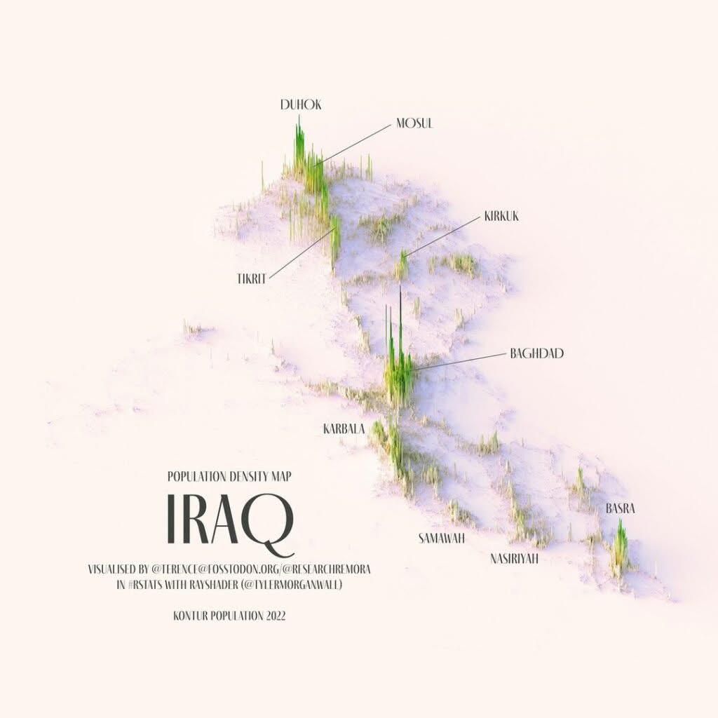
Relief Population Density Map of Iraq
## What This Map Shows\nThe Relief Population Density Map of Iraq provides a clear visualization of how the population i...
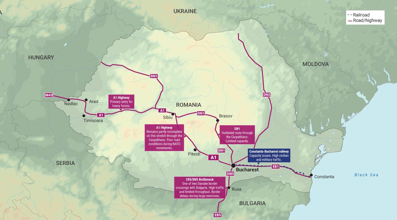
Romania Infrastructure Pain Points for NATO Map
## What This Map Shows...
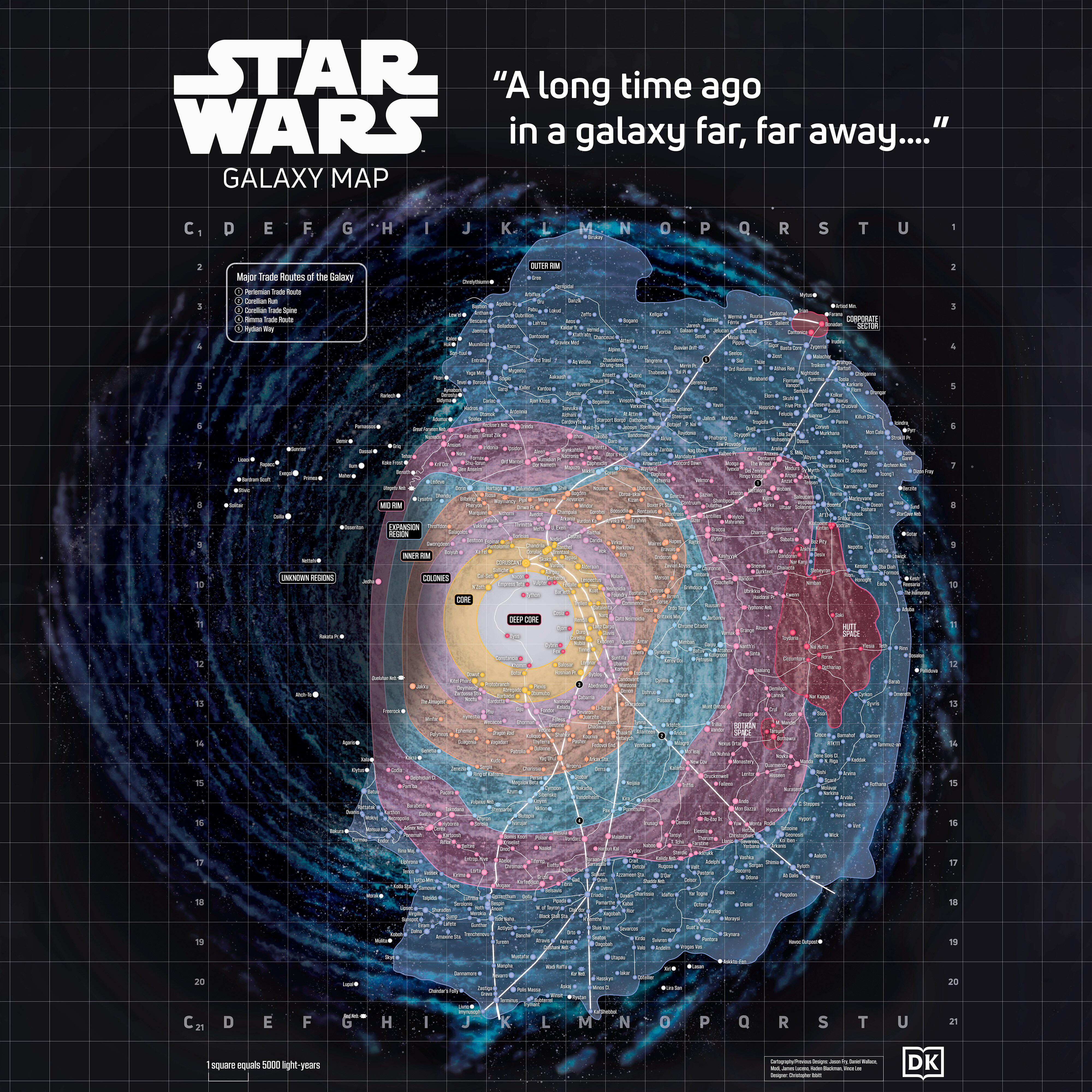
Star Wars Galaxy Map of Locations
## What This Map Shows\nThe \...
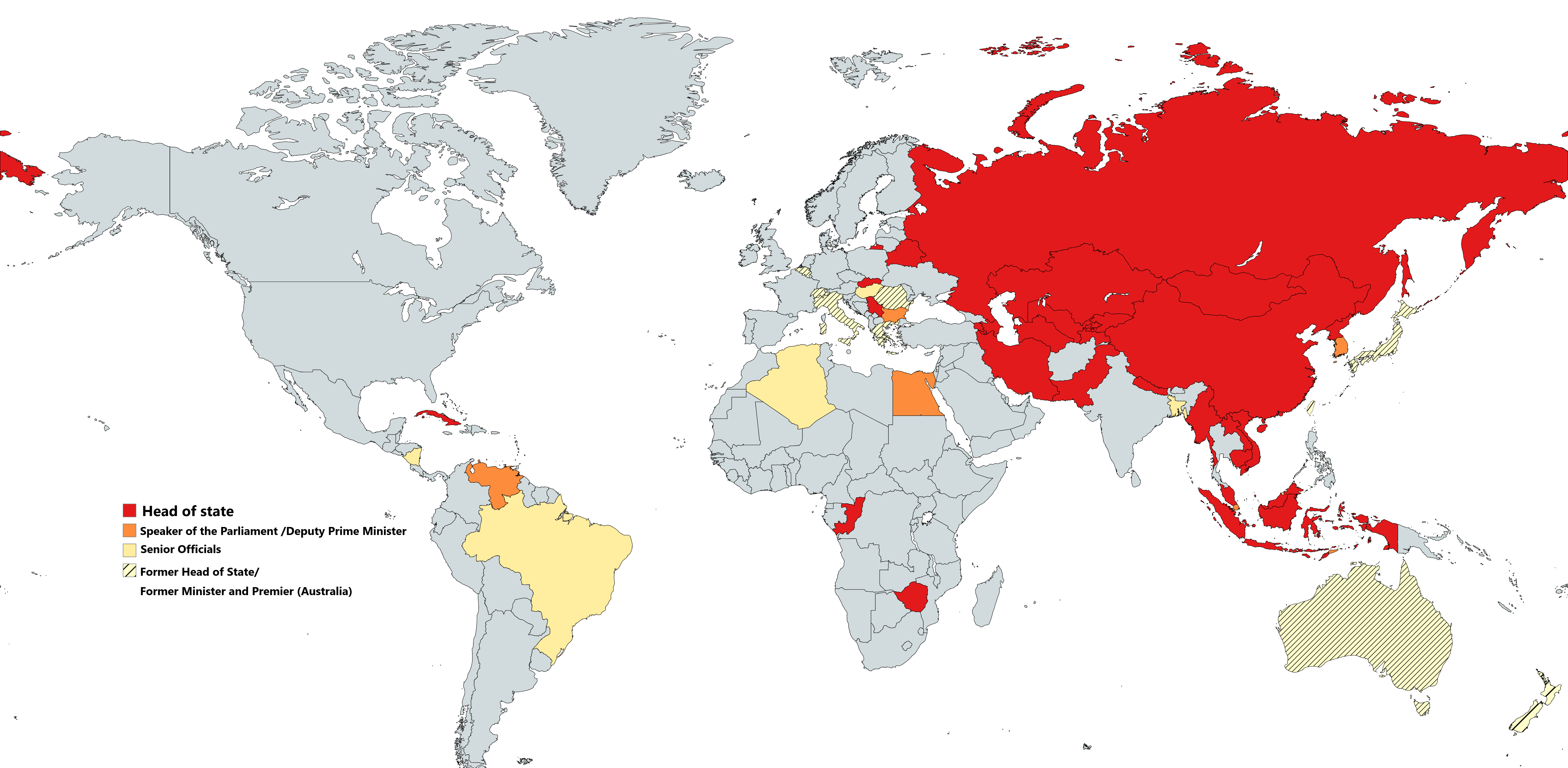
Countries Attending China's Victory Parade Map
## What This Map Shows\nThis map provides a comprehensive overview of the countries that participated in the Victory Par...
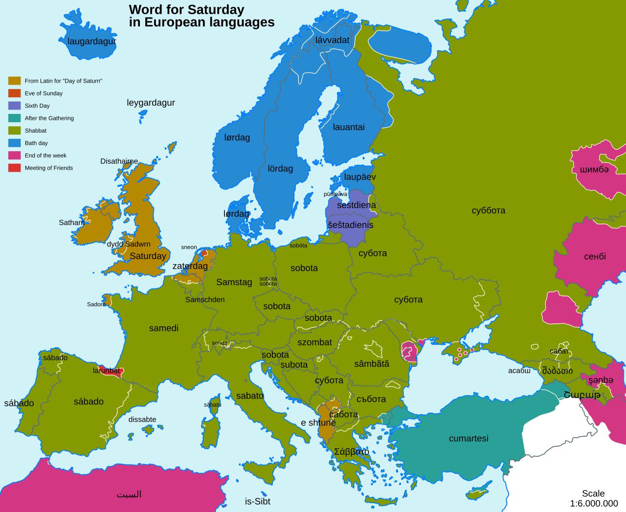
Etymologies of Saturday in Europe Map
## What This Map Shows...