Geographic Visualizations
Explore our curated collection of fascinating geographic visualizations and cartographic analyses. Discover detailed maps, data visualizations, and geographical insights from around the world.

Relief map of the Ottoman Empire at its greatest territorial extant, around 1683, when it encompassed huge swaths of Southeastern Europe, parts of the Middle East, and North Africa.
Geographic Analysis7/31/2025
## What This Map Shows...
62 viewsRead More →
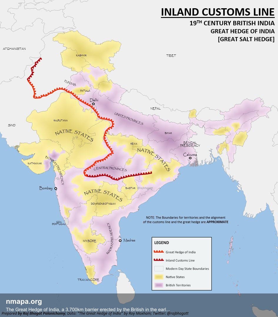
The Great Hedge of India, a 3,700km barrier erected by the British in the early 19th century to prevent people from illegally evading the salt tax by getting salt from the sea. Map
Geographic Analysis7/31/2025
## Geographic Overview...
58 viewsRead More →
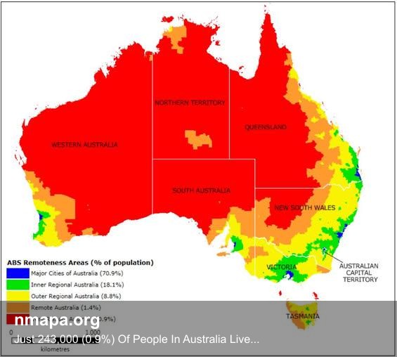
Just 243,000 (0.9%) Of People In Australia Live In The Red Area Map
Geographic Analysis7/31/2025
## What This Map Shows...
56 viewsRead More →
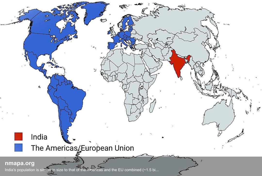
Population Map: India’s population is similar in size to that of the Americas and the EU combined (~1.5 billion)
Geographic Analysis7/31/2025
## What This Map Shows...
86 viewsRead More →
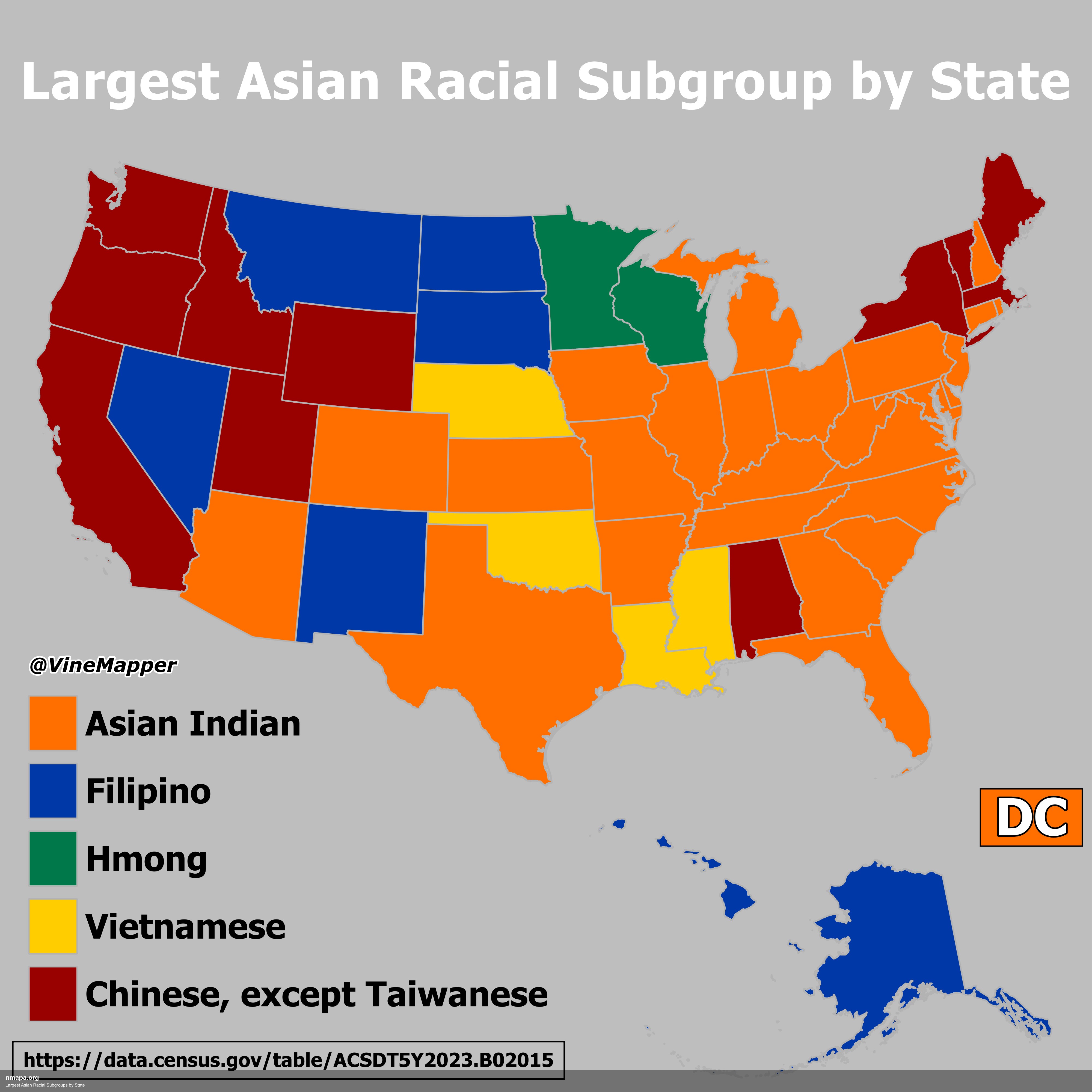
Largest Asian Racial Subgroups by State Map
Geographic Analysis7/31/2025
## What This Map Shows...
78 viewsRead More →
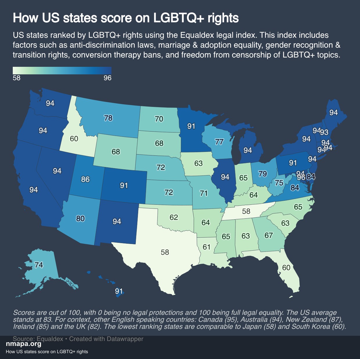
How US states score on LGBTQ+ rights Map
Geographic Analysis7/31/2025
## What This Map Shows...
76 viewsRead More →
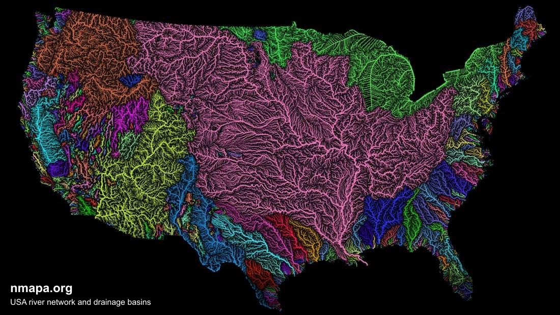
USA river network and drainage basins Map
Geographic Analysis7/31/2025
## What This Map Shows...
164 viewsRead More →
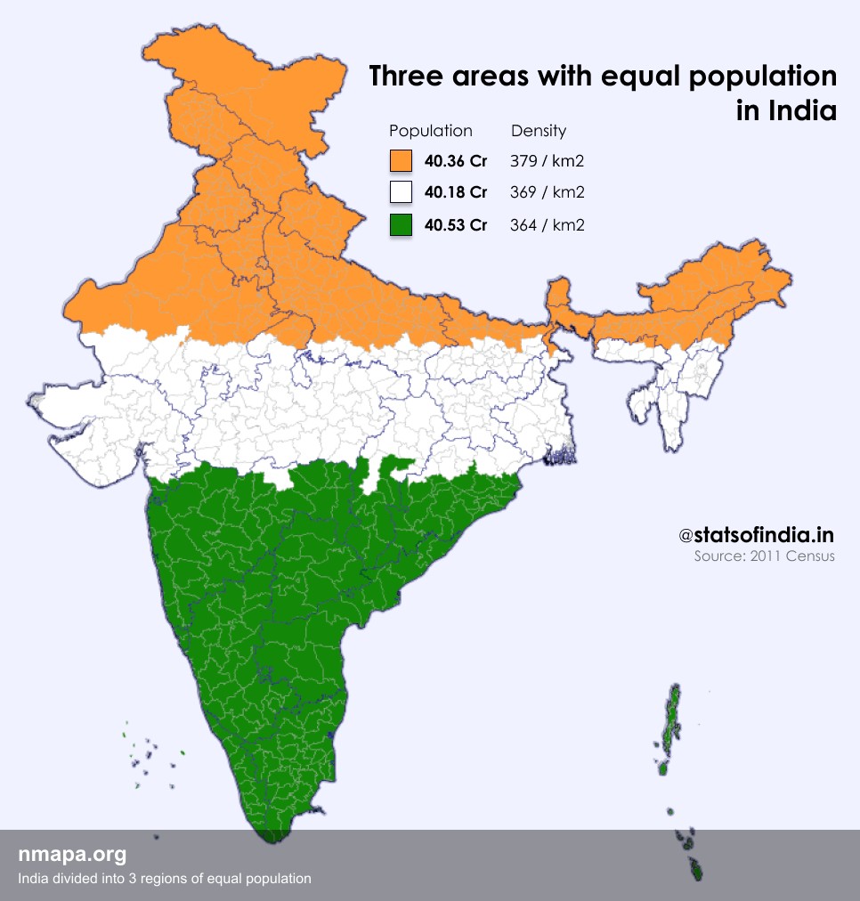
Population Map: India divided into 3 regions of equal population
Geographic Analysis7/31/2025
## What This Map Shows...
68 viewsRead More →