world war ii Maps
28 geographic visualizations tagged with "world war ii"
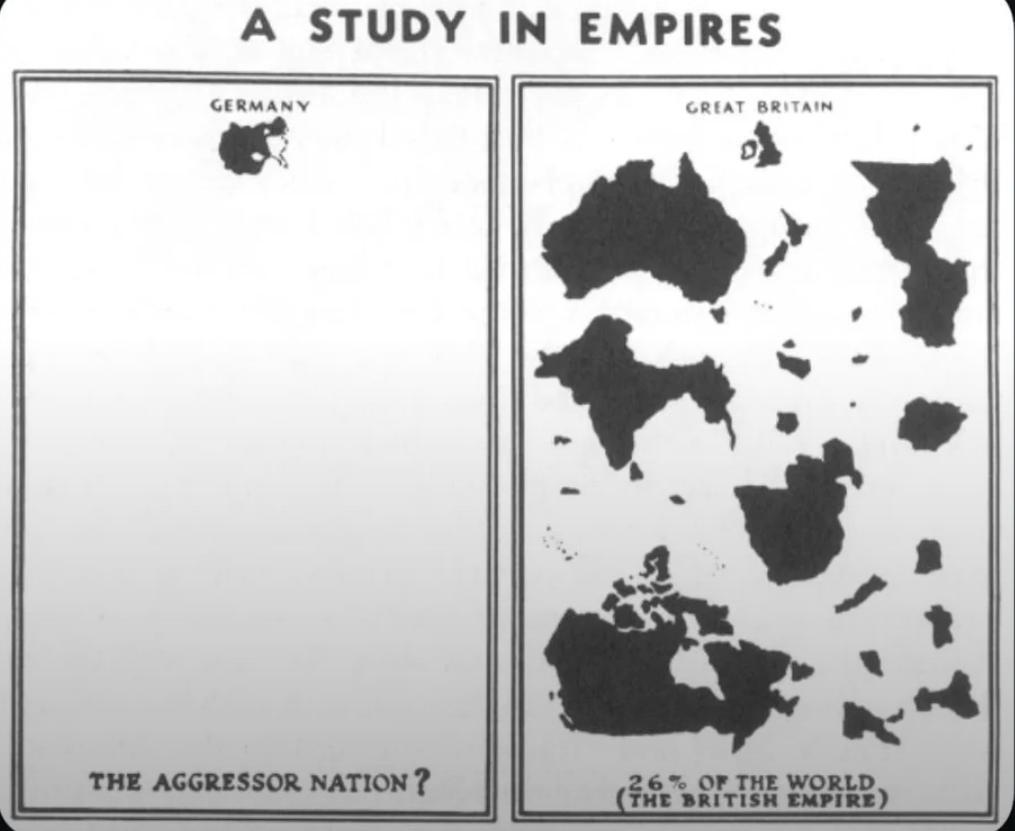
WWII Nazi Propaganda Map of Empires
The visualization titled "WWII Nazi Propaganda Map Comparing British and German Empires" serves as a striking representa...
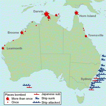
WW2 Attack Sites in Australia Map
The 'Sites in Australia Attacked in WW2' map provides a critical visual representation of the locations across Australia...
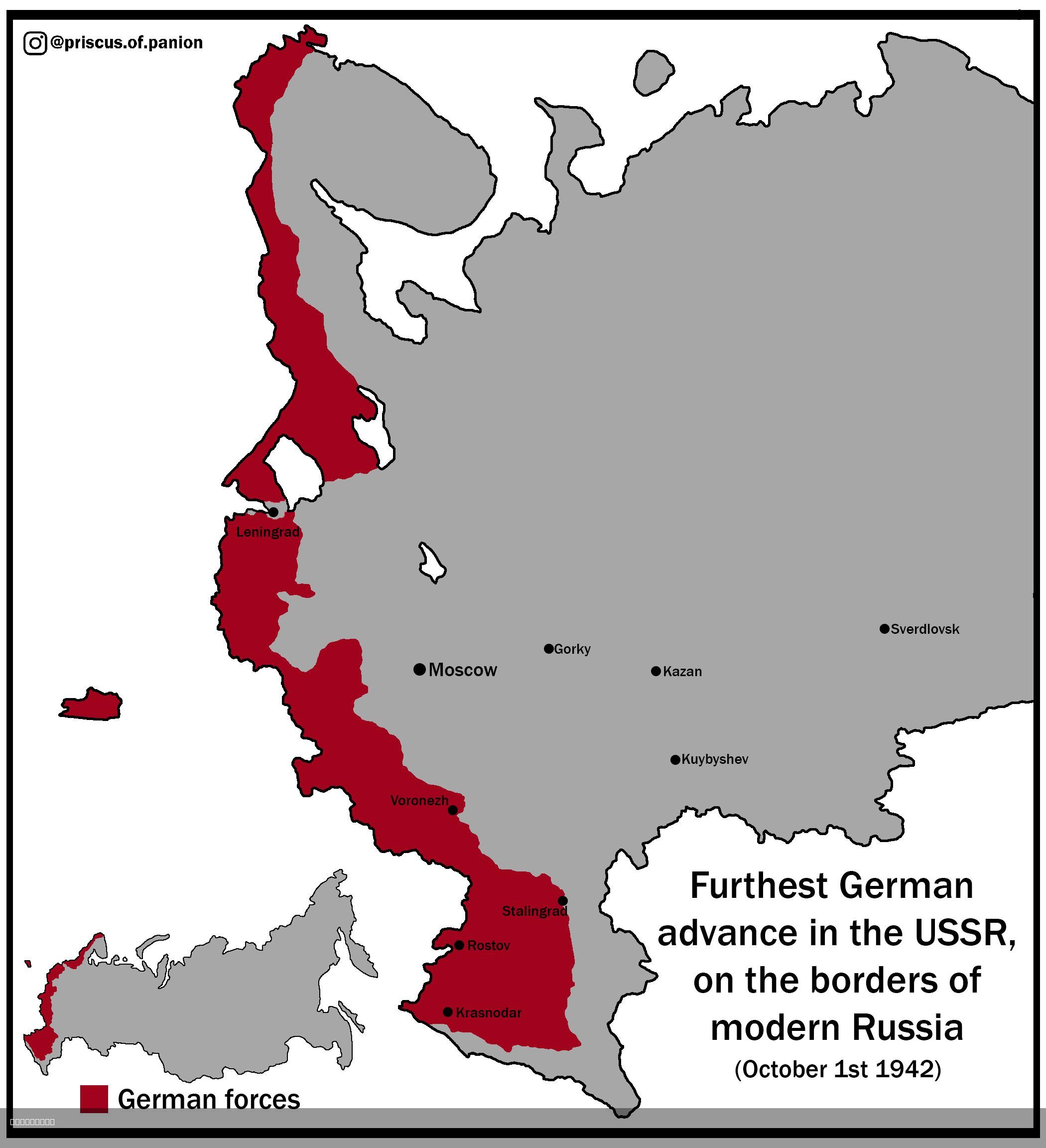
Map of the Furthest German Advance into the USSR
The visualization titled "Map of the Furthest German Advance into the USSR, on the Borders of Modern Russia (1st of Octo...
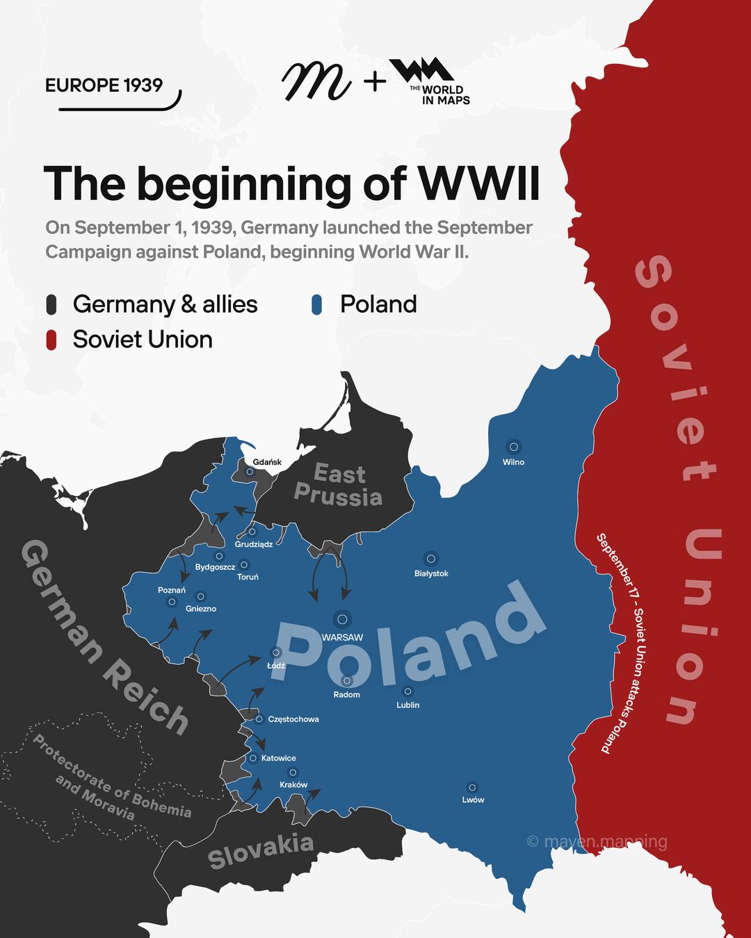
Map of Germany's September Campaign Against Poland
The map titled "On September 1, 1939, Germany launched the September campaign against Poland, beginning WW2" provides a ...
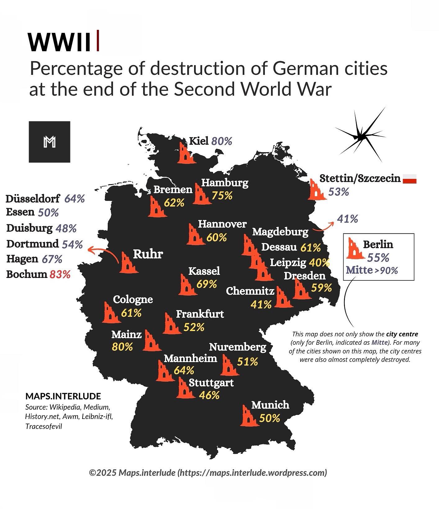
Map of Destruction of German Cities in WWII
The map titled "Percentage of Destruction of German Cities at the End of the Second World War" provides a striking visua...
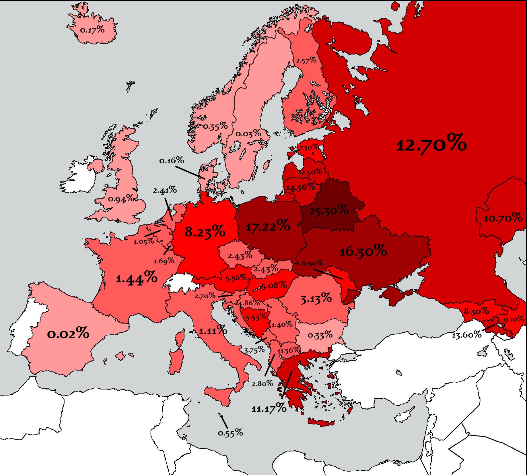
Countries That Lost the Most People in WW2 Map
The map titled "Countries That Lost the Most People in WW2" provides a stark visual representation of the human cost of ...
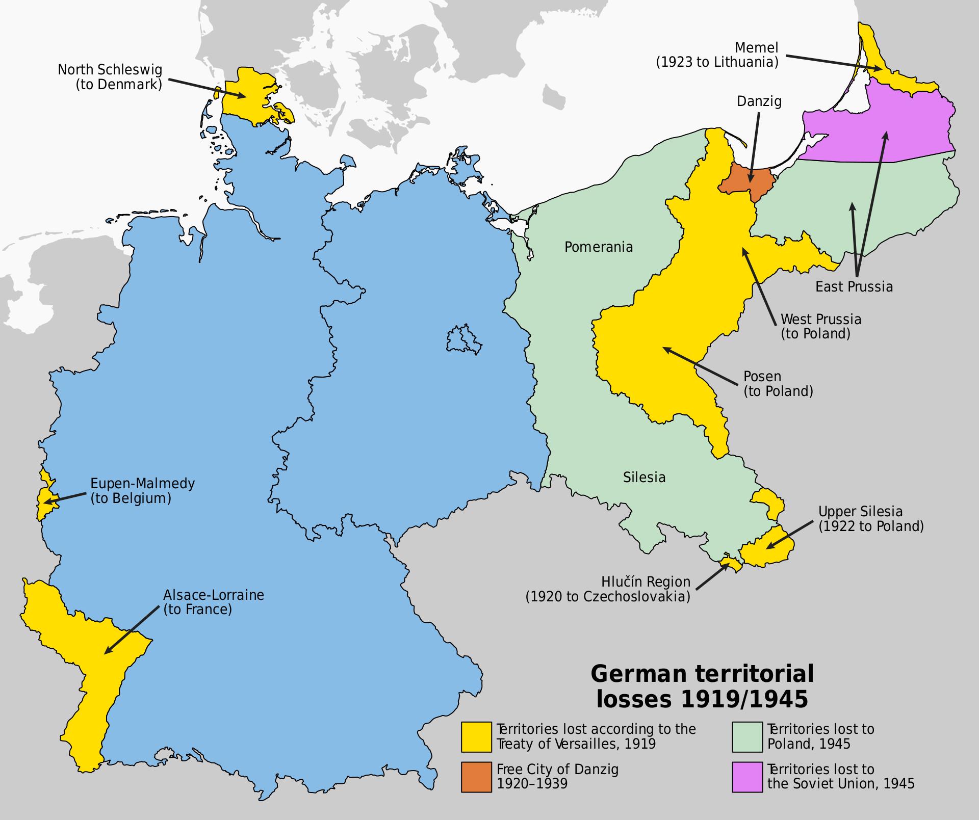
Map of Germany's Territorial Losses After World War Defeats
This map illustrates the significant territorial losses Germany faced following its defeats in both World War I and Worl...
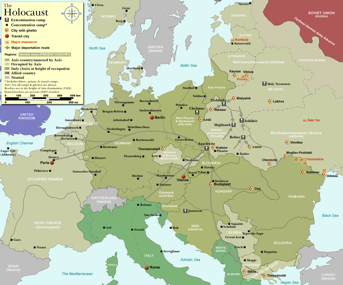
Concentration Camp and Execution Camp Map of Nazi Germany
The map titled "Concentration Camp and Execution Camp Map of Nazi Germany" illustrates the locations and distribution of...
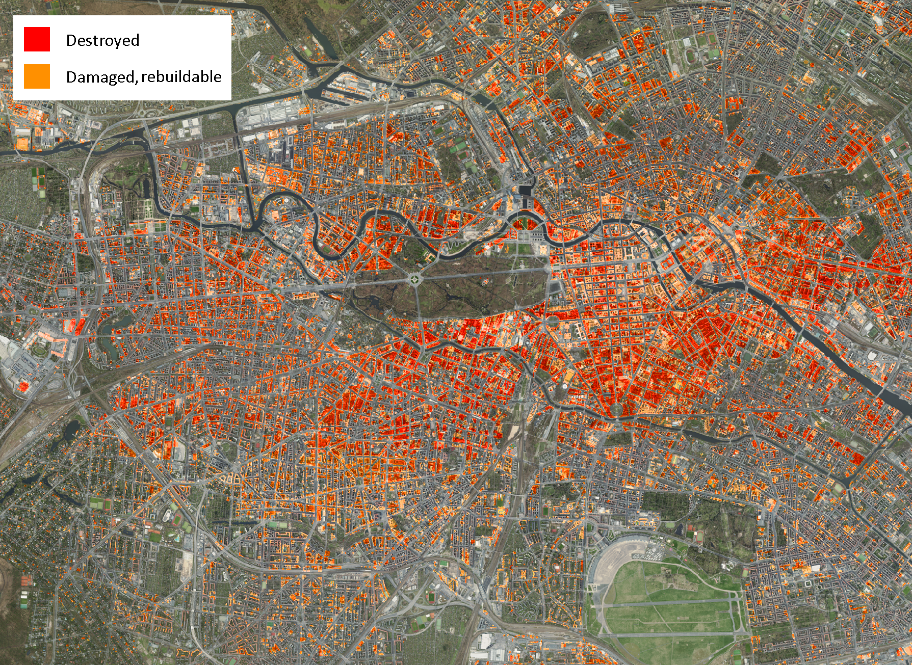
Damage to Buildings Map Berlin 1945
The "Damage to Buildings, Berlin 1945" map provides a stark visual representation of the destruction experienced in Berl...
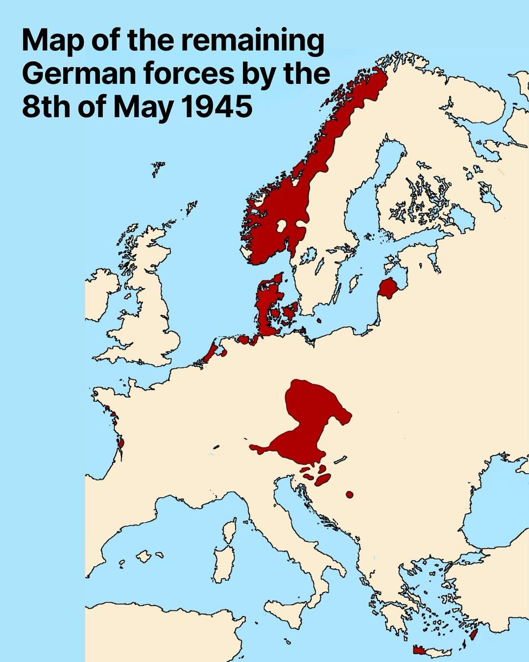
Map of Remaining German Forces on May 8, 1945
The map titled "Map of Remaining German Forces on May 8, 1945" provides a detailed visualization of the geographic distr...
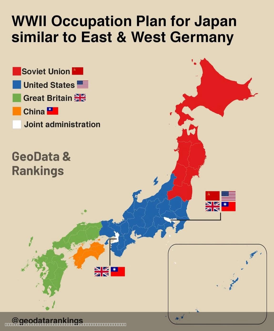
Japan Post-World War 2 Division Map
This map illustrates the proposed division of Japan after World War II, shedding light on the geopolitical landscape tha...
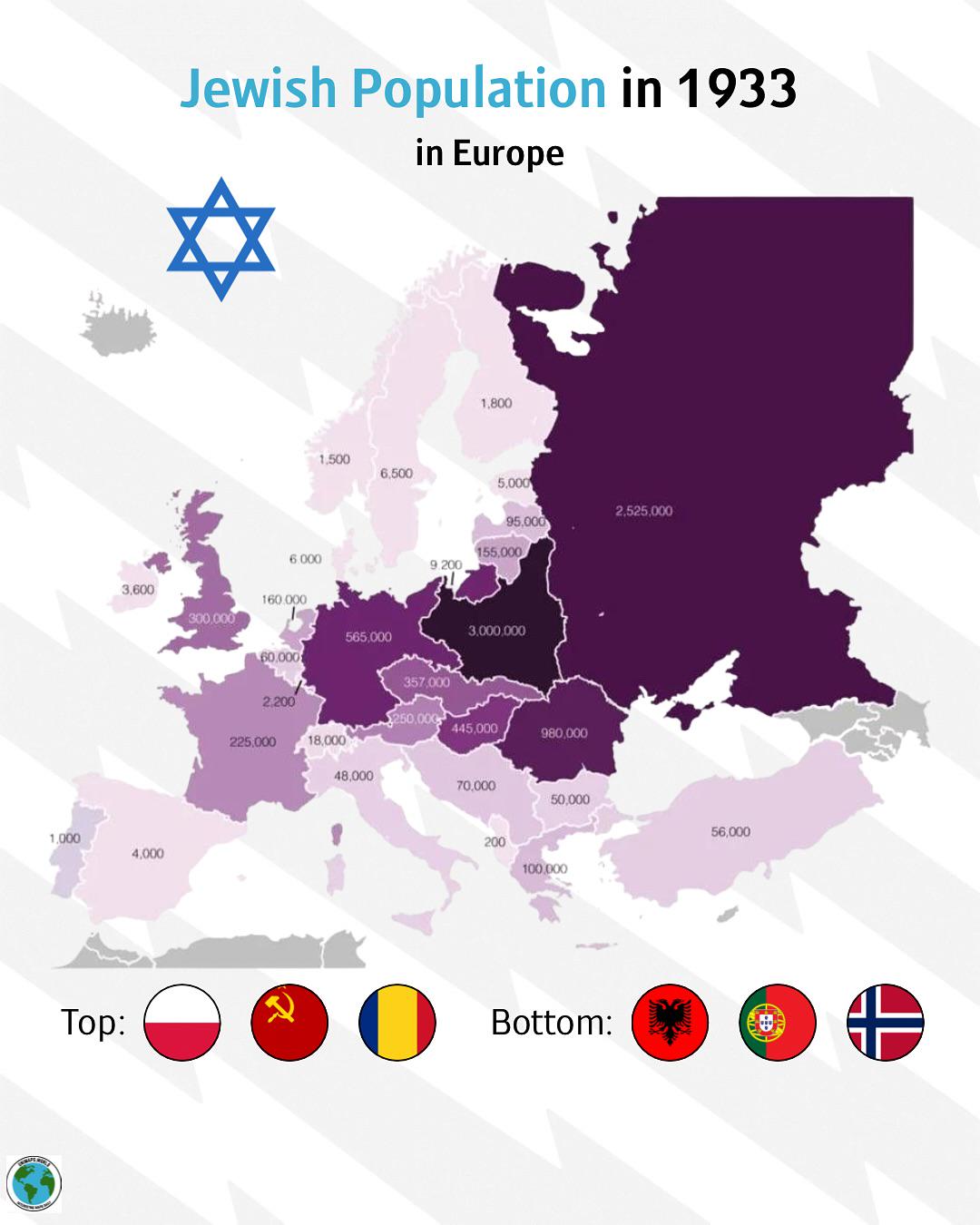
Jewish Population Distribution Map in Europe 1933
The \...
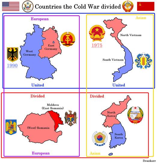
Map of Countries Divided by WW2 and Cold War
This map visually represents the geopolitical divisions of four countries—Germany, Korea, Vietnam, and Poland—resulting ...
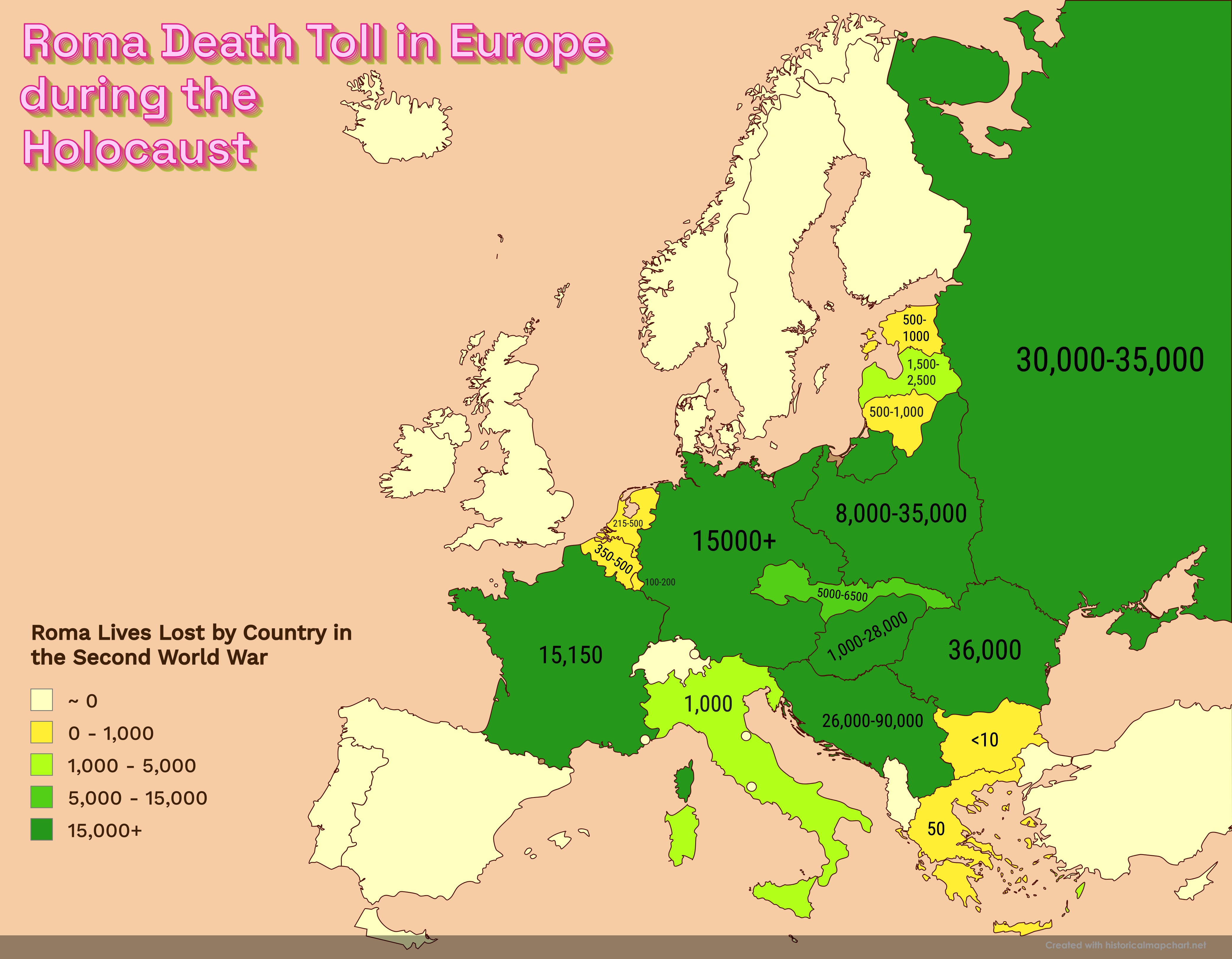
Roma Death Toll in Europe during the Holocaust Map
This powerful visualization highlights the estimated death toll of Roma people across various European countries during ...
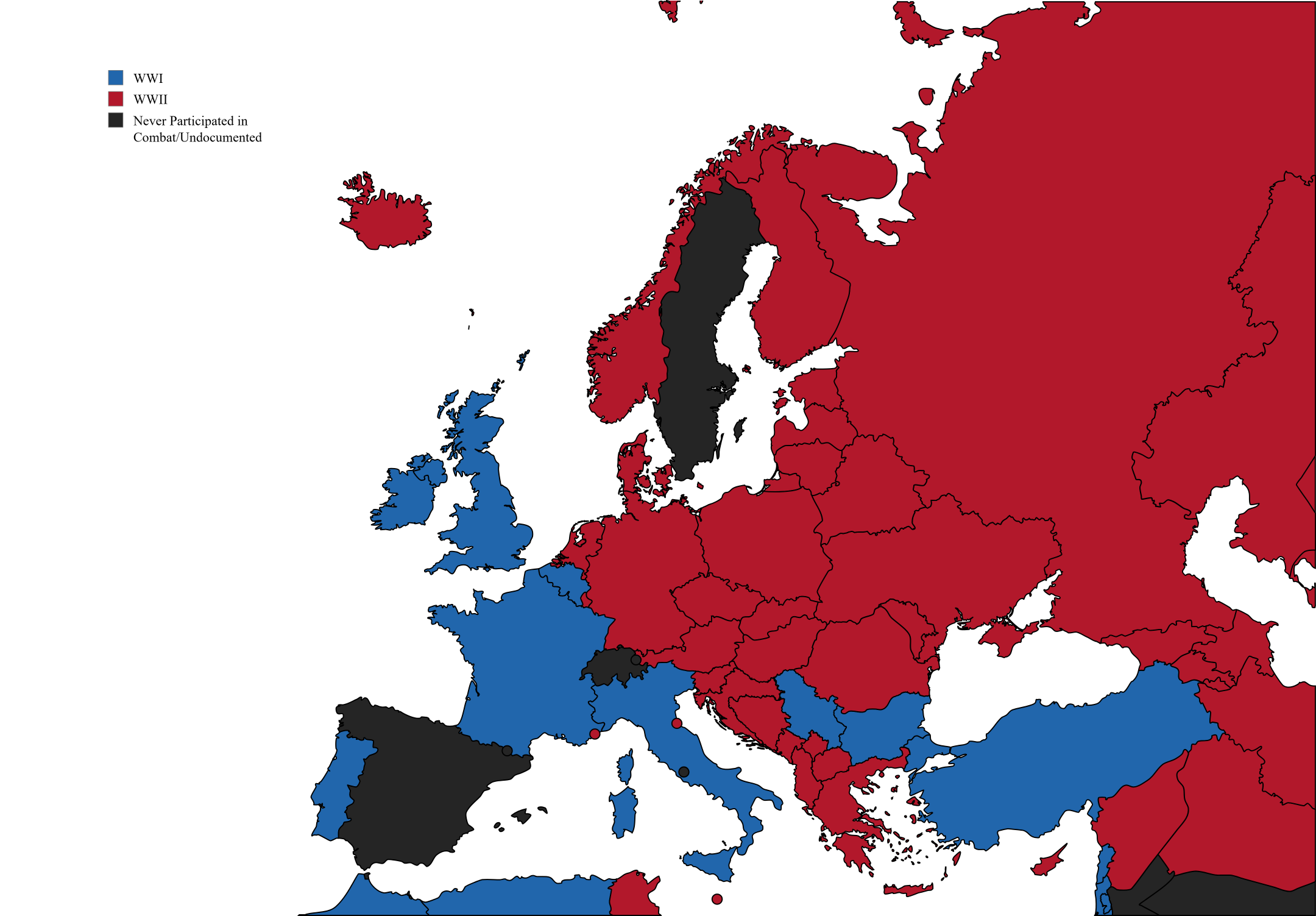
Deaths in Europe During World Wars Map
This map visually represents the estimated number of deaths in various European countries during both the First and Seco...
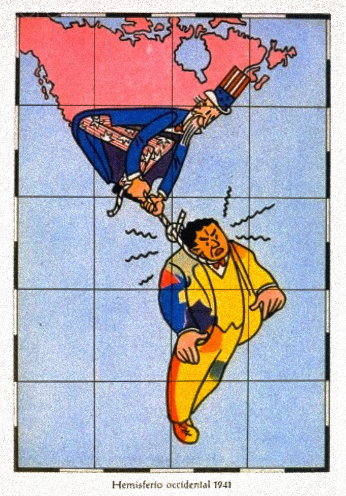
Satirical Map of the Western Hemisphere, c. 1941
The satirical map of the Western Hemisphere from around 1941 presents a unique and humorous perspective on the political...
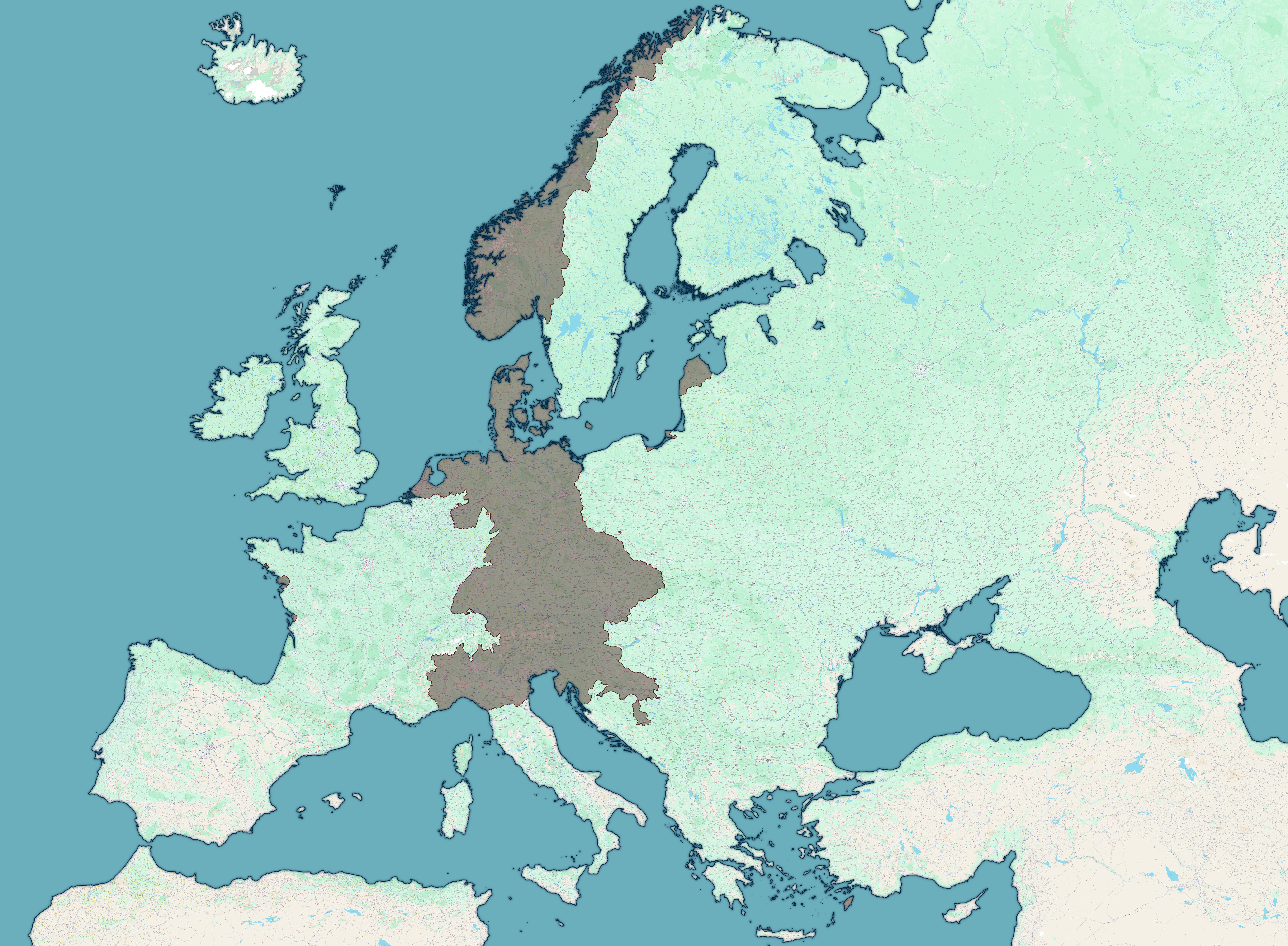
Map of Axis Forces April 1 1945
The "Map of all Axis forces, 1st of April 1945" provides a detailed geographical overview of the military positions and ...
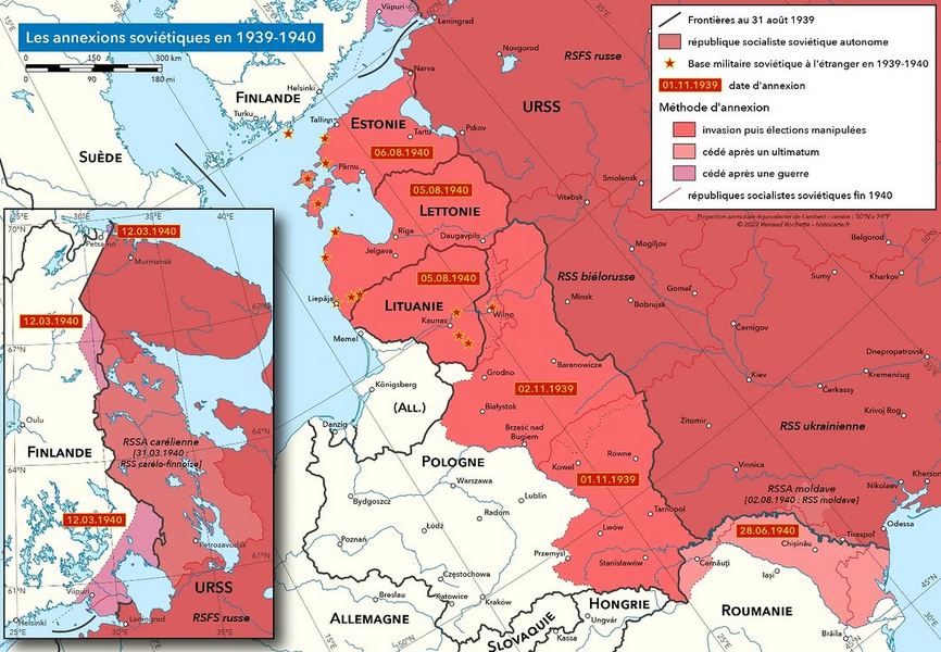
Soviet Annexations in 1939-1940 Map
One of the most significant events was the invasion of Poland in September 1939. The Soviet forces entered from the east...
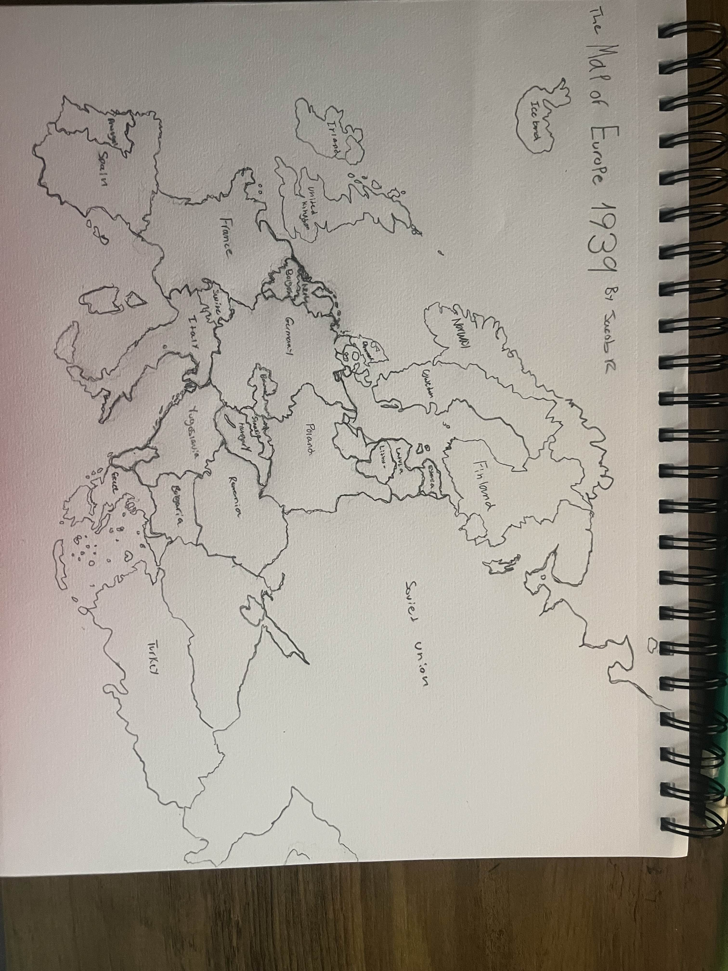
Hand Drawn Map of Europe in 1939
This hand-drawn map of Europe in 1939 visually captures the geopolitical landscape just before one of the most significa...
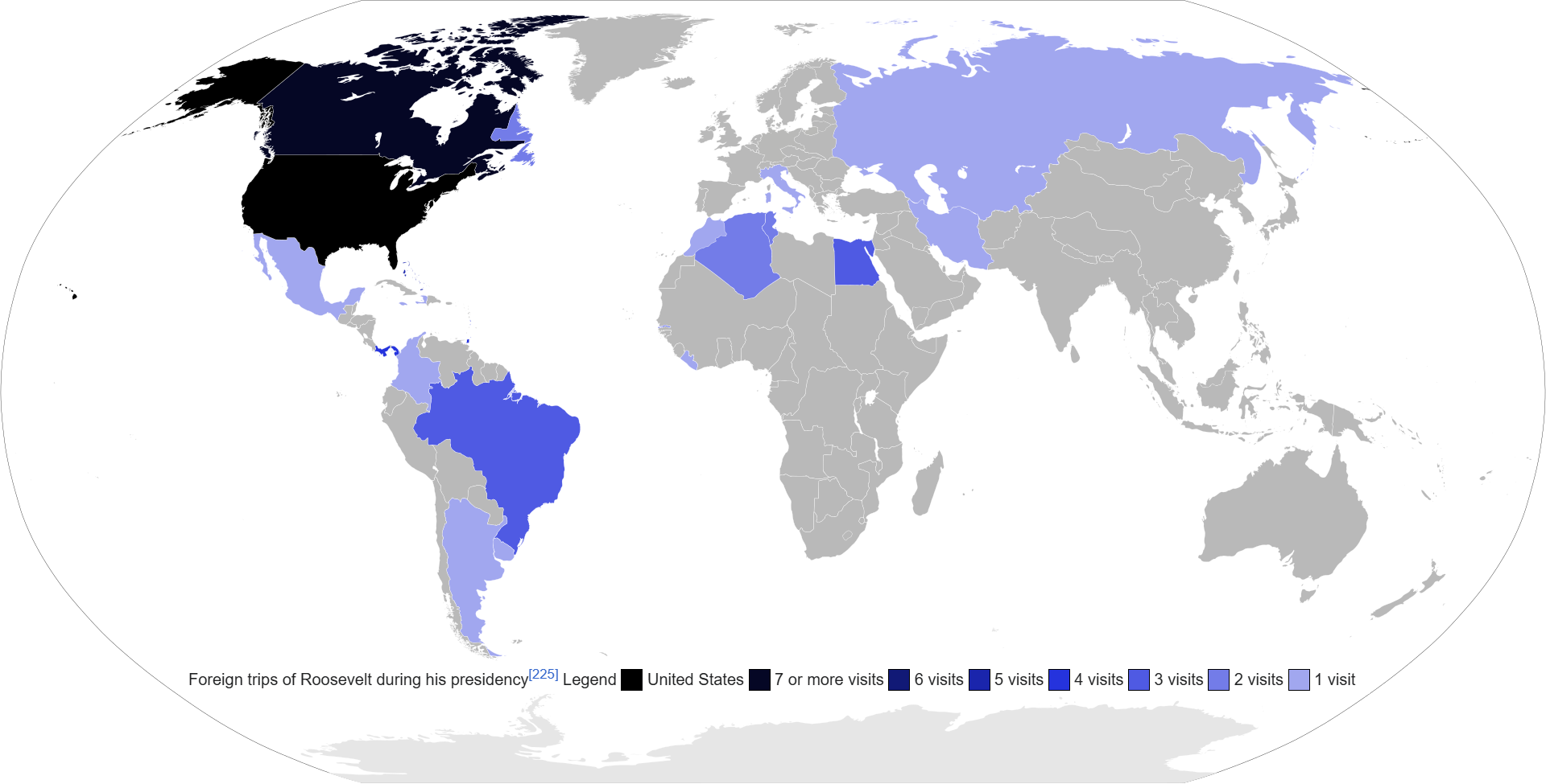
FDR Foreign Trips Map During Presidency
...
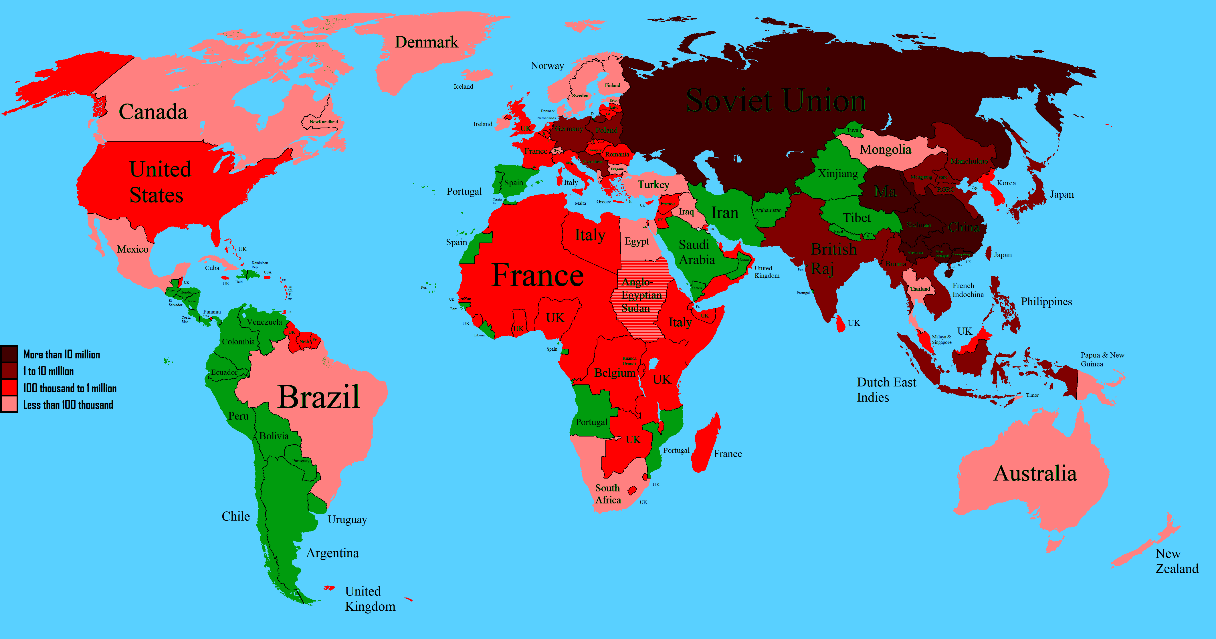
World Map of WW2 Deaths Map
The "World Map of WW2 Deaths (1939 Map)" provides a stark visual representation of the immense human cost of World War I...
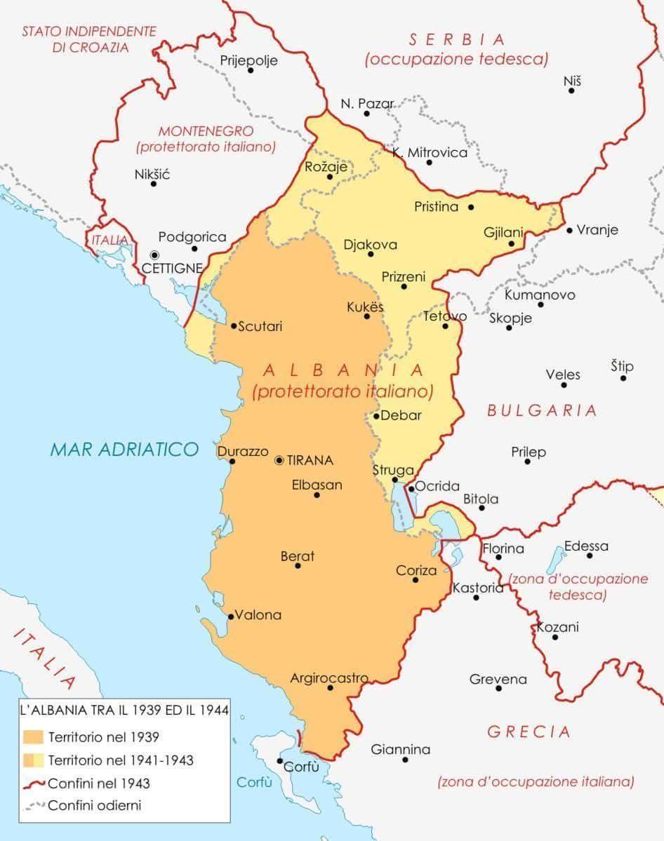
Historical Map of Albania 1939 to 1944
The map titled "Albania Between 1939 and 1944" provides a detailed visualization of Albania's geographical and political...

Troop Numbers Map of the Battle of Normandy
The "Battle of Normandy (D-Day) in 30 Seconds With Troop Numbers" visualization presents a concise overview of troop dep...
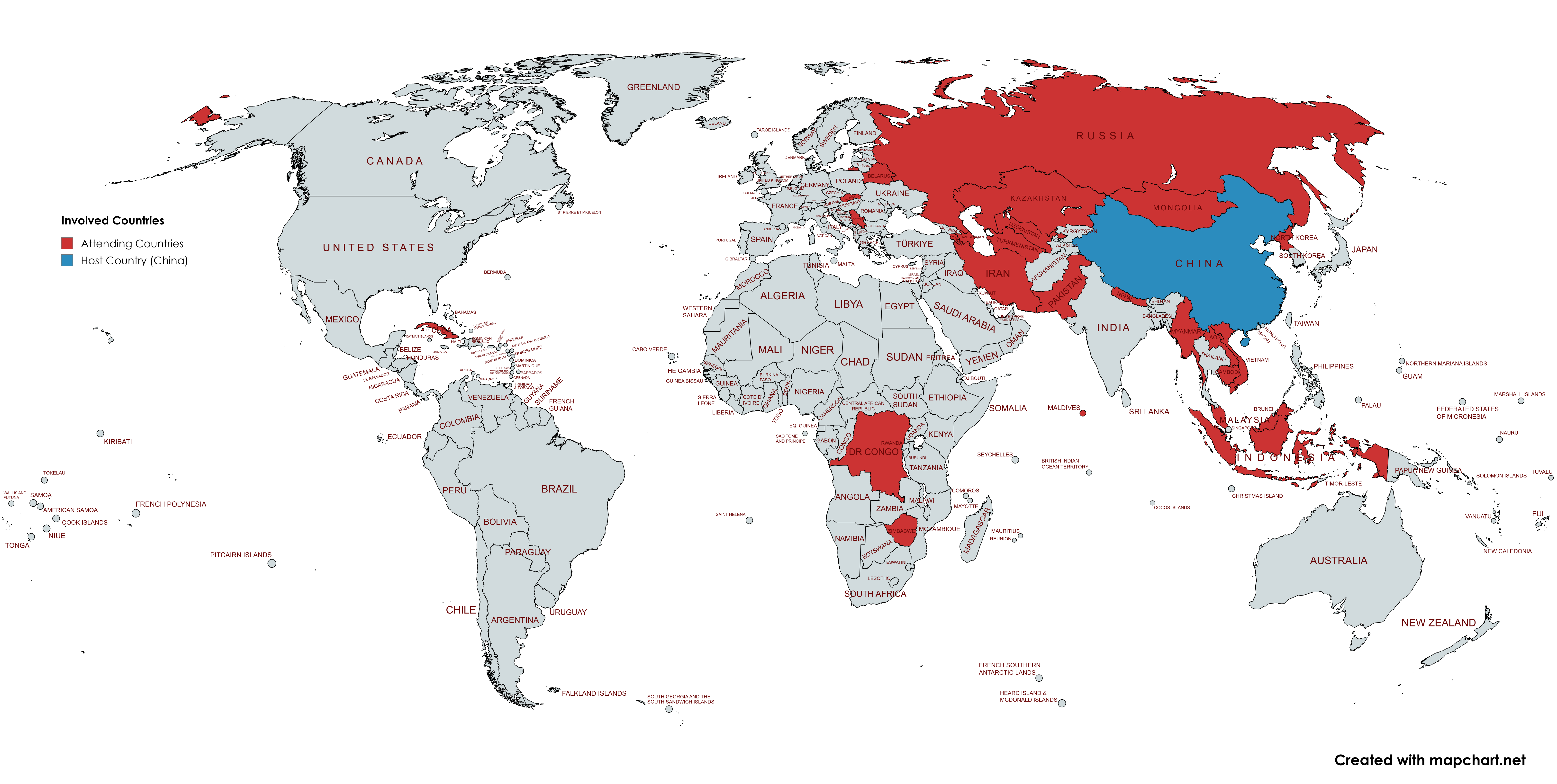
World Leader Attendance Map for China's WW2 Commemoration
This map provides a visual representation of the confirmed attendance of world leaders at the 80th anniversary commemora...
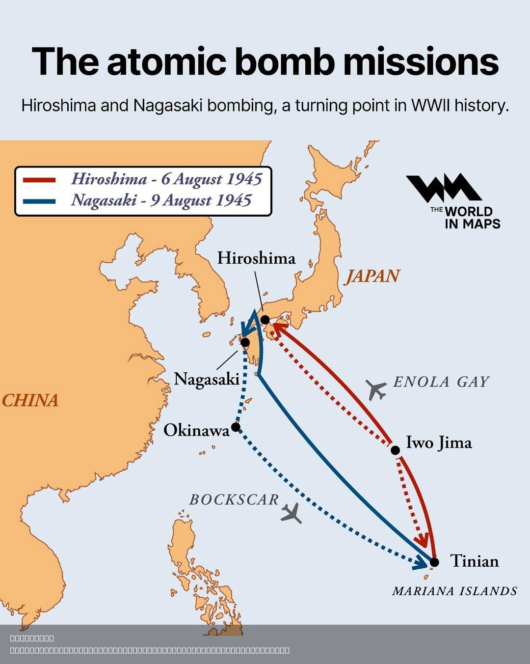
Atomic Bomb Missions Map of Hiroshima and Nagasaki
The Atomic Bomb Missions Map of Hiroshima and Nagasaki provides a detailed visualization of the locations and impact zon...
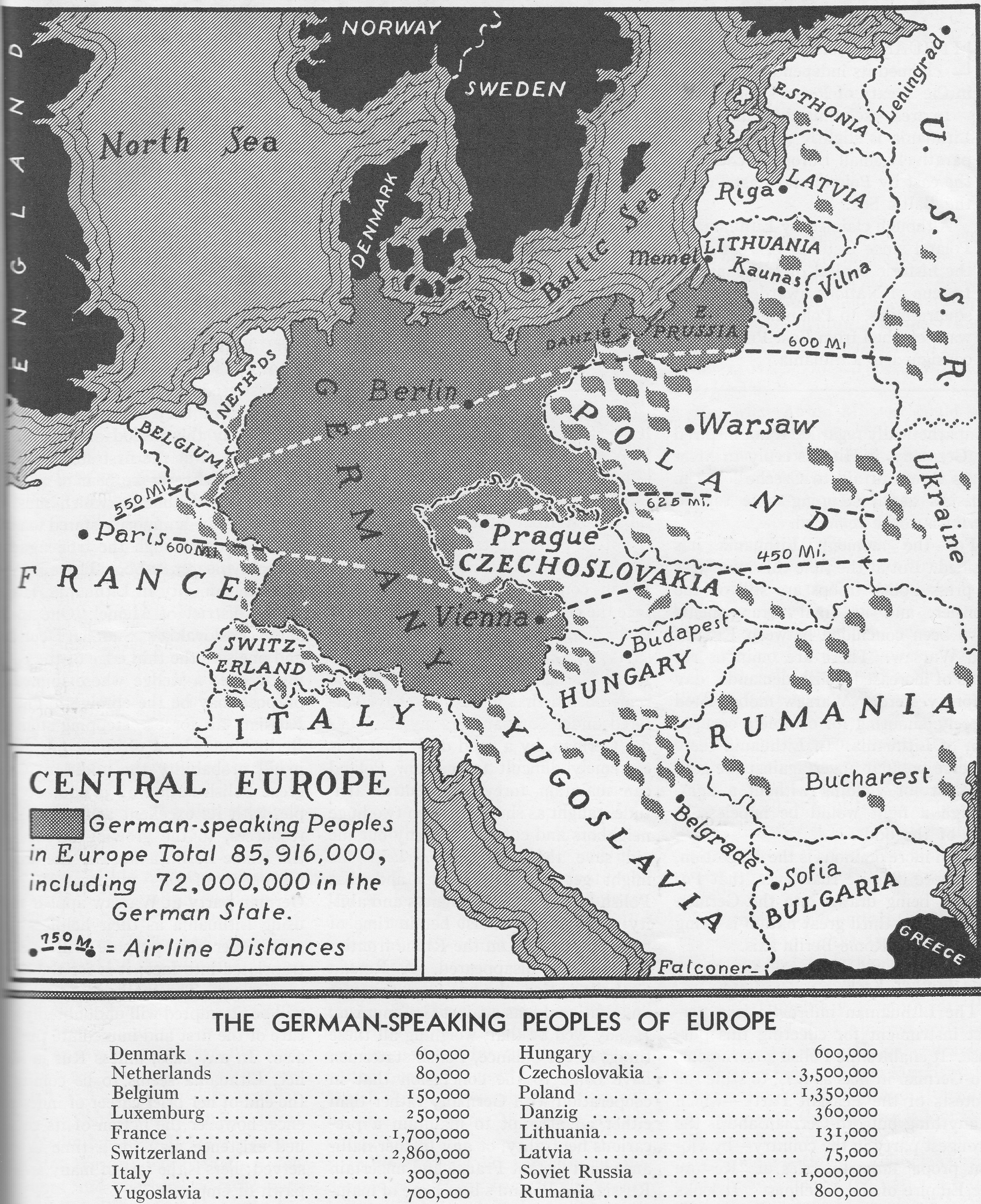
German-speaking Population Map of Europe 1938
The visualization titled "1938 - Where Are the Germans?" illustrates the distribution of German-speaking populations acr...
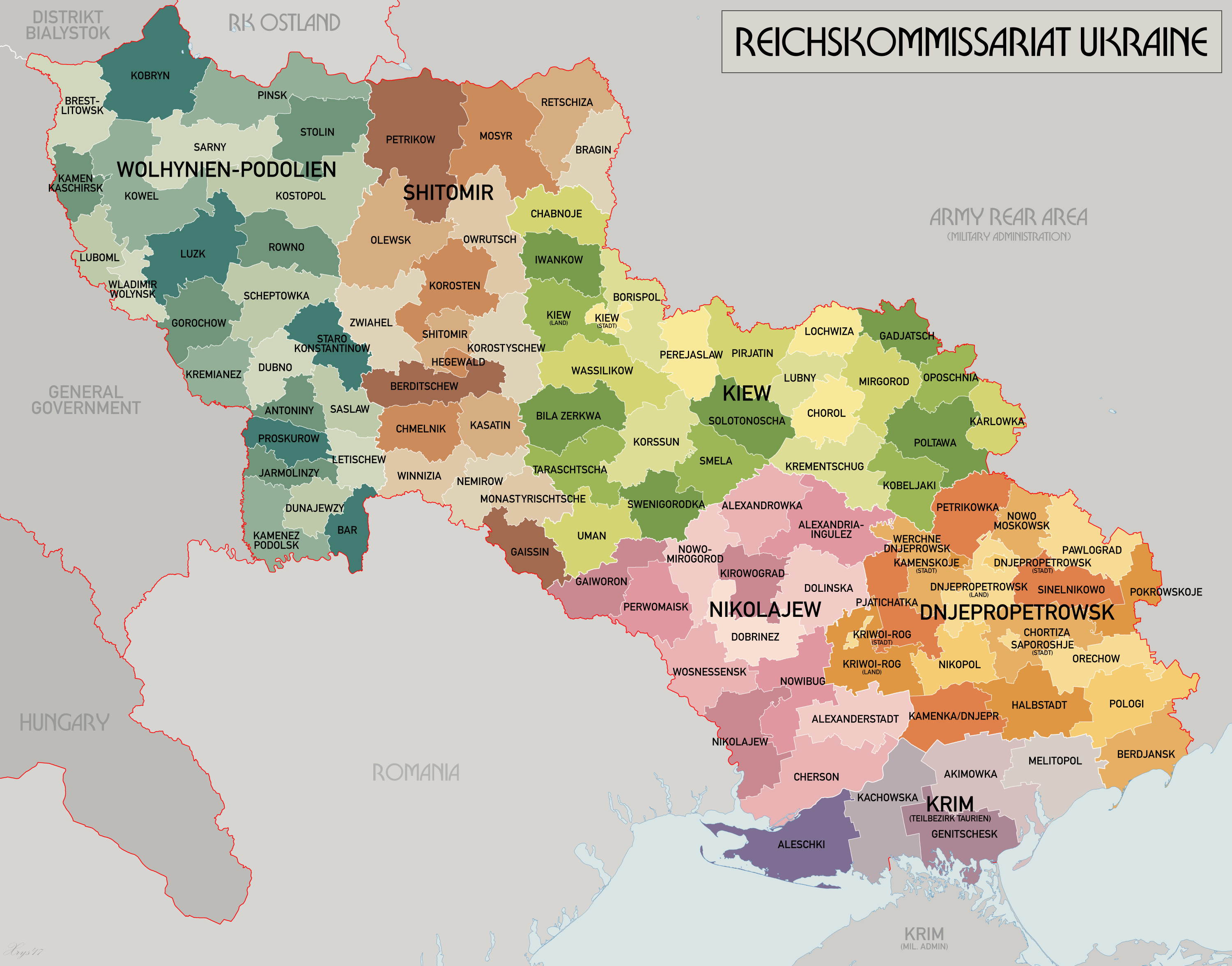
Reichskommissariat Ukraine Map
The "Reichskommissariat Ukraine Map" provides a historical representation of the administrative division established by ...
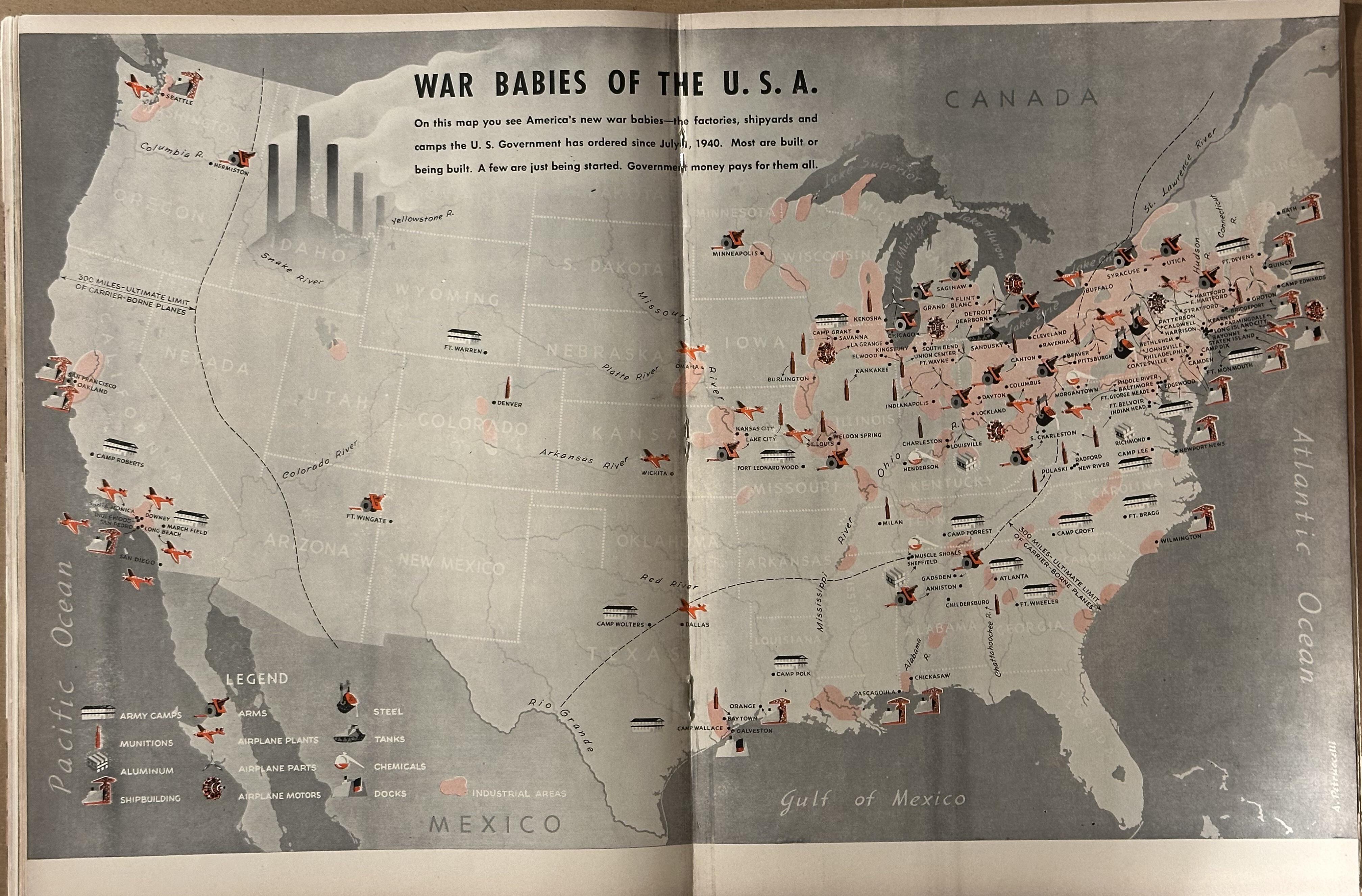
War Babies of the USA Map
The "War Babies of the USA" map, featured in the March 31, 1941, issue of Life Magazine, visually delineates the United ...