Map of Remaining German Forces on May 8, 1945

Marcus Rodriguez
Historical Geography Expert
Marcus Rodriguez specializes in historical cartography and geographic data analysis. With a background in both history and geography, he brings unique...
Geographic Analysis
What This Map Shows
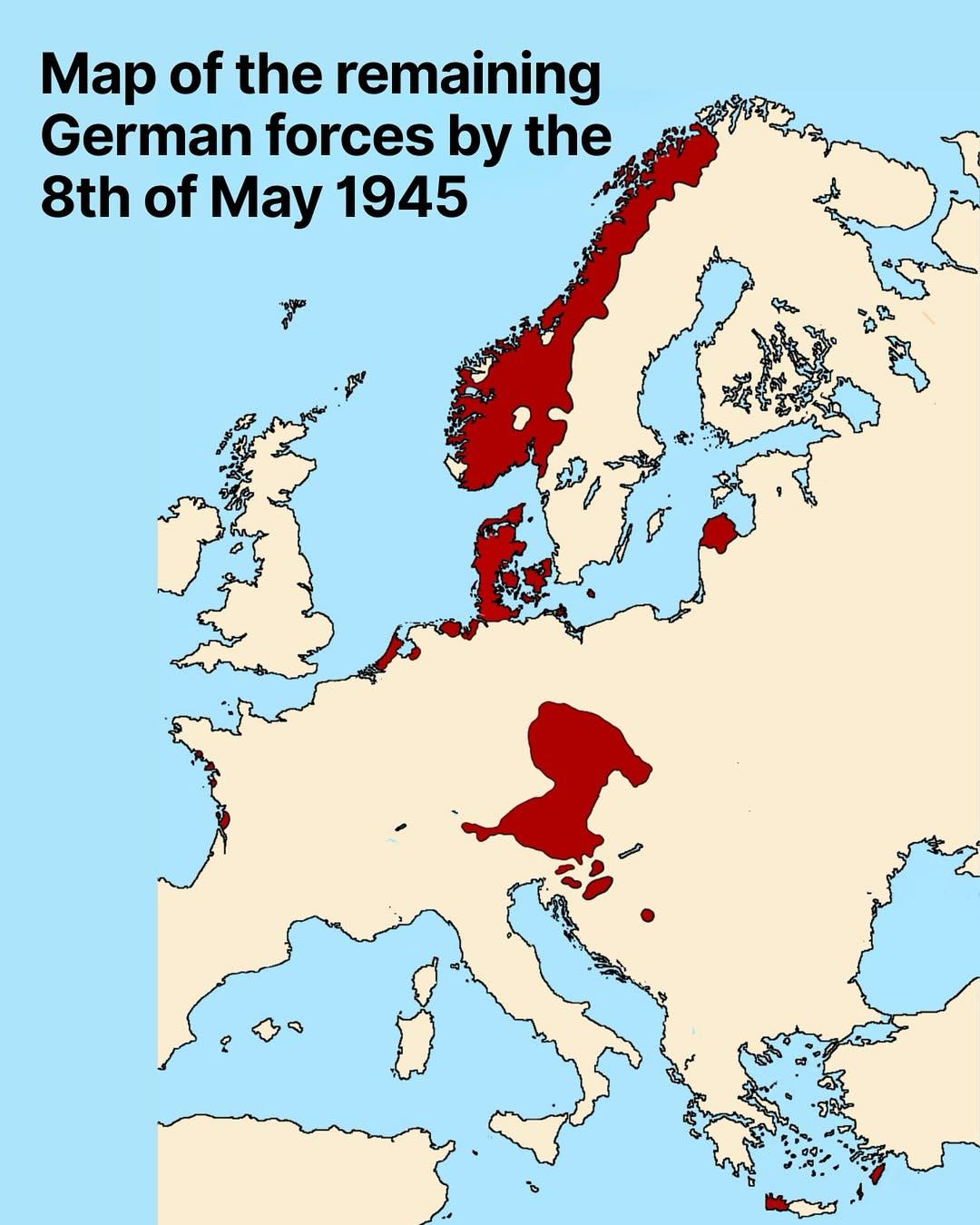
The map titled "Map of Remaining German Forces on May 8, 1945" provides a detailed visualization of the geographic distribution of German military units at the end of World War II in Europe. This pivotal date marks the official surrender of Nazi Germany, culminating the European theatre of the war. The map highlights the locations of remaining German troops, giving us insight into their strategic positions, troop concentrations, and the areas still under their control at this critical moment in history.
Deep Dive into German Military Forces in 1945
In early May 1945, the landscape of Europe was dramatically altered by nearly six years of intense warfare. As the Allied forces advanced from the west and the Soviet Army pushed in from the east, the remaining German forces found themselves in a desperate situation. The German military, once a formidable force, was now a shadow of its former self, with dwindling resources and morale.
Interestingly, by this time, the Wehrmacht was heavily fragmented. The units shown on the map were a mix of regular army troops, Waffen-SS, and Volkssturm, the latter being a national militia comprised of older men and young boys. This reflects not only the desperation in the ranks but also the widespread mobilization of all available manpower in a last-ditch effort to hold territory.
The map indicates that the majority of remaining German forces were concentrated in a few key areas, particularly in the north, near the Baltic Sea, and in southern Germany, around regions such as Bavaria. The concentration of troops in these areas can be attributed to several factors, including geographic advantages, proximity to supply lines, and the desire to defend critical industrial hubs. As of May 8, 1945, the German High Command had largely lost the ability to maneuver effectively, leading to static frontlines and defensive preparations.
The statistics paint a stark picture: by this point, the German army had suffered catastrophic losses. Estimates suggest that around 2.5 million German soldiers were captured by the Allies, and many more had either deserted or been killed in action. The remnants of the German military were not just limited in strength but also plagued by issues such as inadequate supplies, a lack of coordination among units, and the overwhelming numerical superiority of the Allied forces.
Regional Analysis
Examining the map closely, we can see distinct regional patterns in the deployment of remaining German forces. For instance, in northern Germany, particularly around the cities of Hamburg and Bremen, there was a significant concentration of troops. This area was critical as it provided access to the North Sea and was vital for any last-minute resupply efforts. However, as Allied forces moved in, these positions became increasingly untenable.
Conversely, in southern Germany, particularly around Munich and Stuttgart, the German forces were attempting to regroup and establish a defensive line. The mountainous terrain offered some strategic advantages, but it was increasingly clear that this was a futile effort against the encroaching Allied armies. The map vividly illustrates how, by May 8, 1945, the German military was effectively cornered, with limited options left for a successful defense.
The eastern front, depicted in the map, shows the sheer scale of the Soviet offensive, which had encircled Berlin. The rapid advance of Soviet troops meant that remaining German forces had little ability to retreat or regroup. This area was marked by chaos as soldiers faced the formidable Red Army, which was intent on capturing the German capital.
Significance and Impact
Understanding the distribution of remaining German forces on May 8, 1945, is crucial for comprehending not just the military strategies of World War II but also the subsequent political landscape of post-war Europe. The map serves as a snapshot of a nation in collapse, where the remnants of a once-powerful military were unable to sustain control over territory and population.
The surrender of German forces on this date led to the division of Germany and the eventual onset of the Cold War, which would shape global politics for decades. Additionally, the implications of this surrender were felt deeply in the countries that suffered under Nazi occupation, as they began to navigate the challenging transition from war to peace.
Interestingly, the lessons from this map remain relevant today. The geographical and strategic considerations illustrated are not unique to World War II; they resonate in modern military strategy and geopolitical discussions. As nations continue to evolve in the face of conflict, understanding the historical context of troop deployment and military logistics becomes essential in anticipating future developments.
In conclusion, this map not only highlights the immediate military situation at the end of World War II but also serves as a poignant reminder of the broader historical events that shaped the 20th century and continue to influence our world today.
Visualization Details
- Published
- October 4, 2025
- Views
- 48
Comments
Loading comments...