geographic distribution Maps
9 geographic visualizations tagged with "geographic distribution"
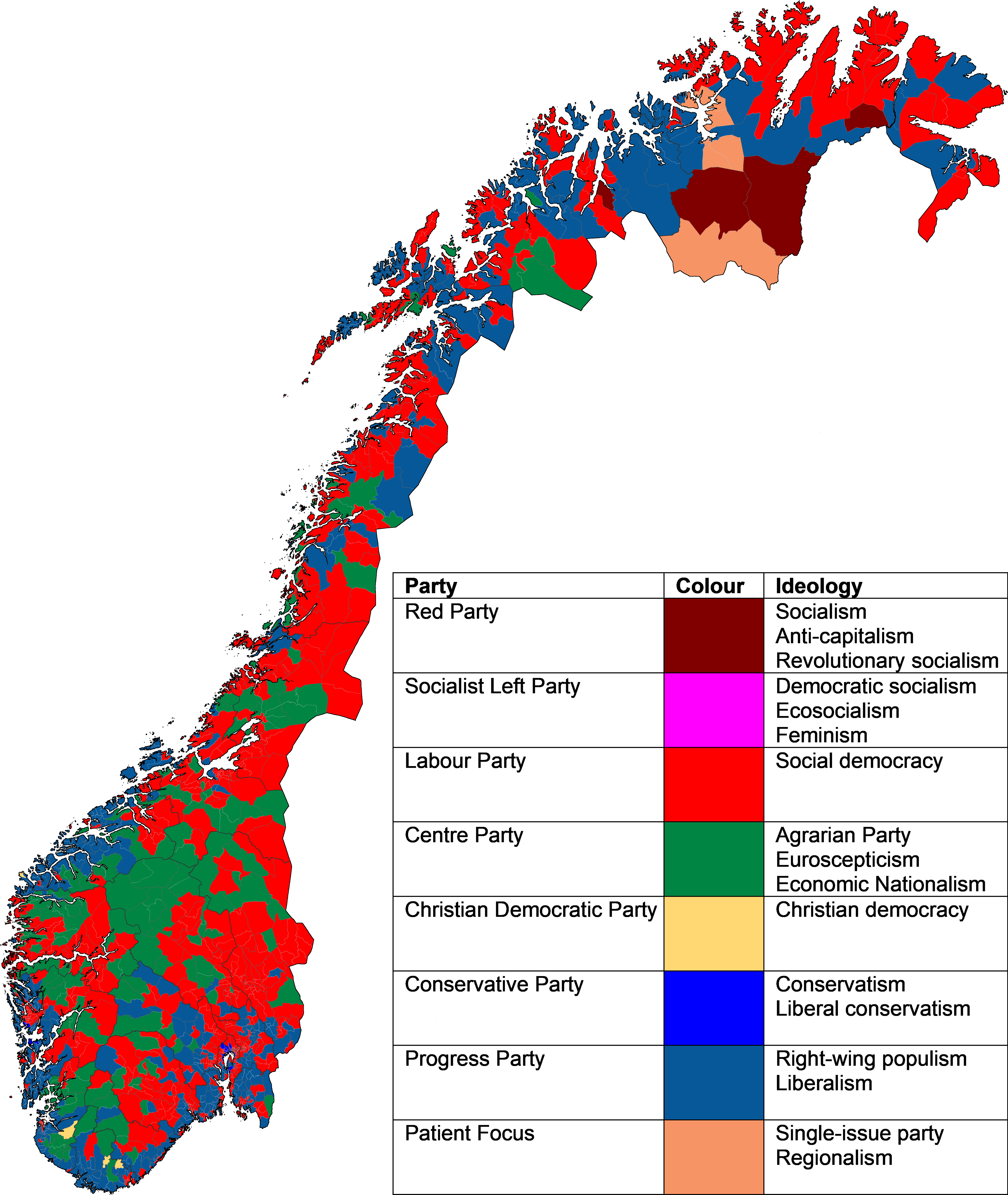
Largest Political Party by Constituency Map Norway 2025
The "Largest Political Party in Each Constituency in the 2025 Norwegian Parliamentary Election" map visually represents ...
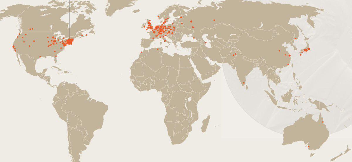
Map of Birthplaces of Nobel Physics Winners
The field of physics has evolved dramatically over the decades, and so have the backgrounds of its winners. Initially, m...
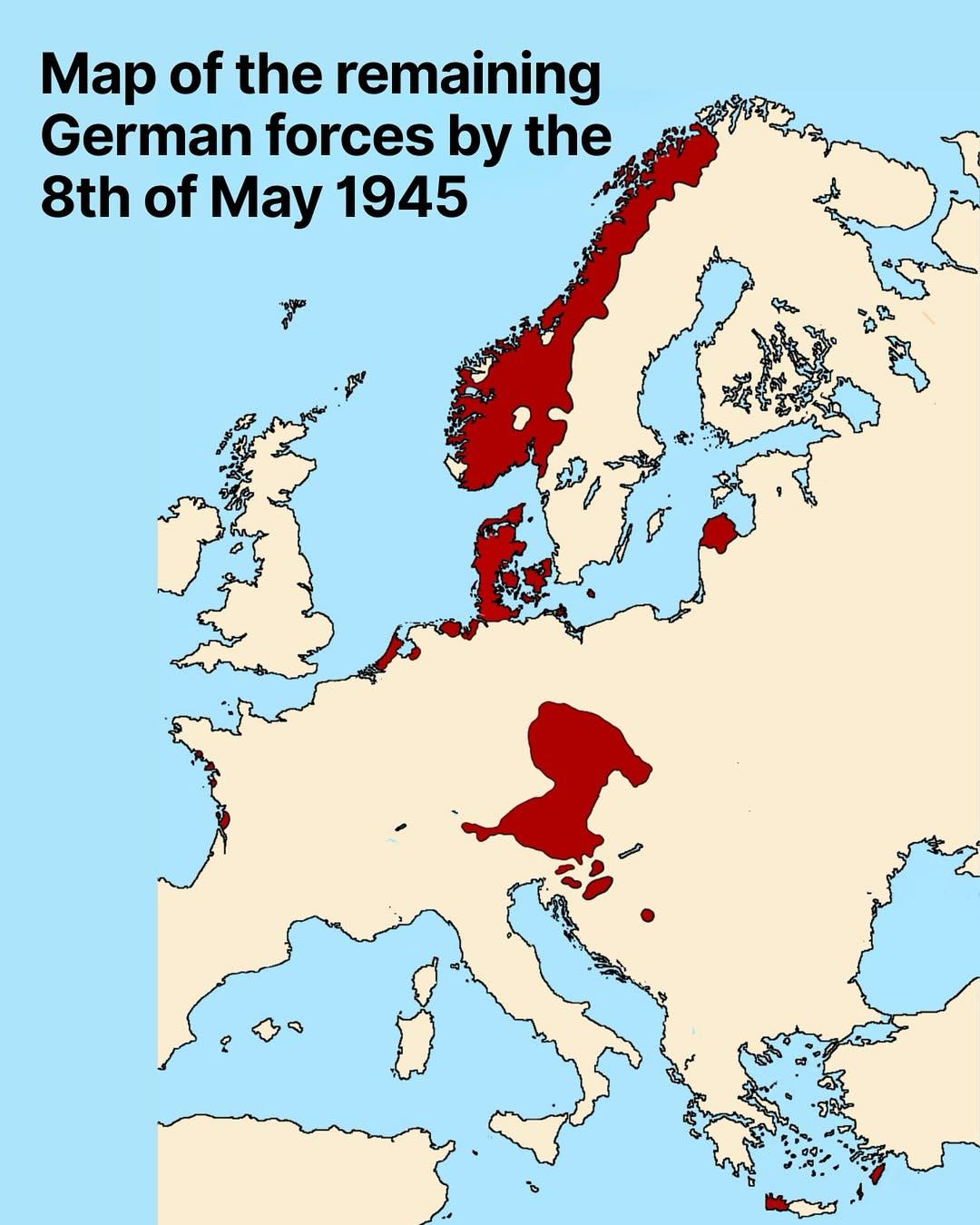
Map of Remaining German Forces on May 8, 1945
The map titled "Map of Remaining German Forces on May 8, 1945" provides a detailed visualization of the geographic distr...
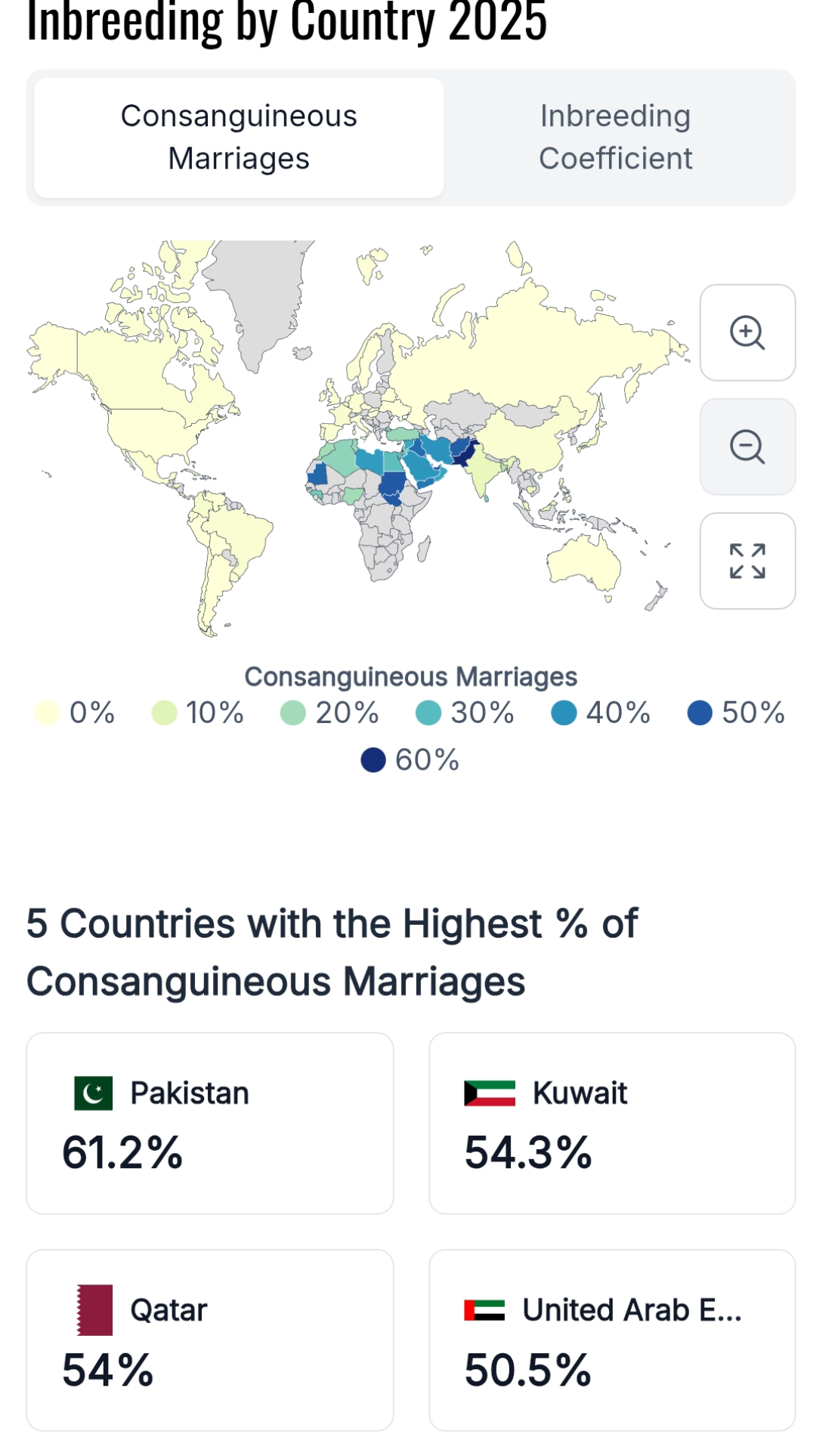
Consanguinity Rates by Country Map
This map presents an estimated percentage of children globally who are born to consanguineous parents, defined as parent...
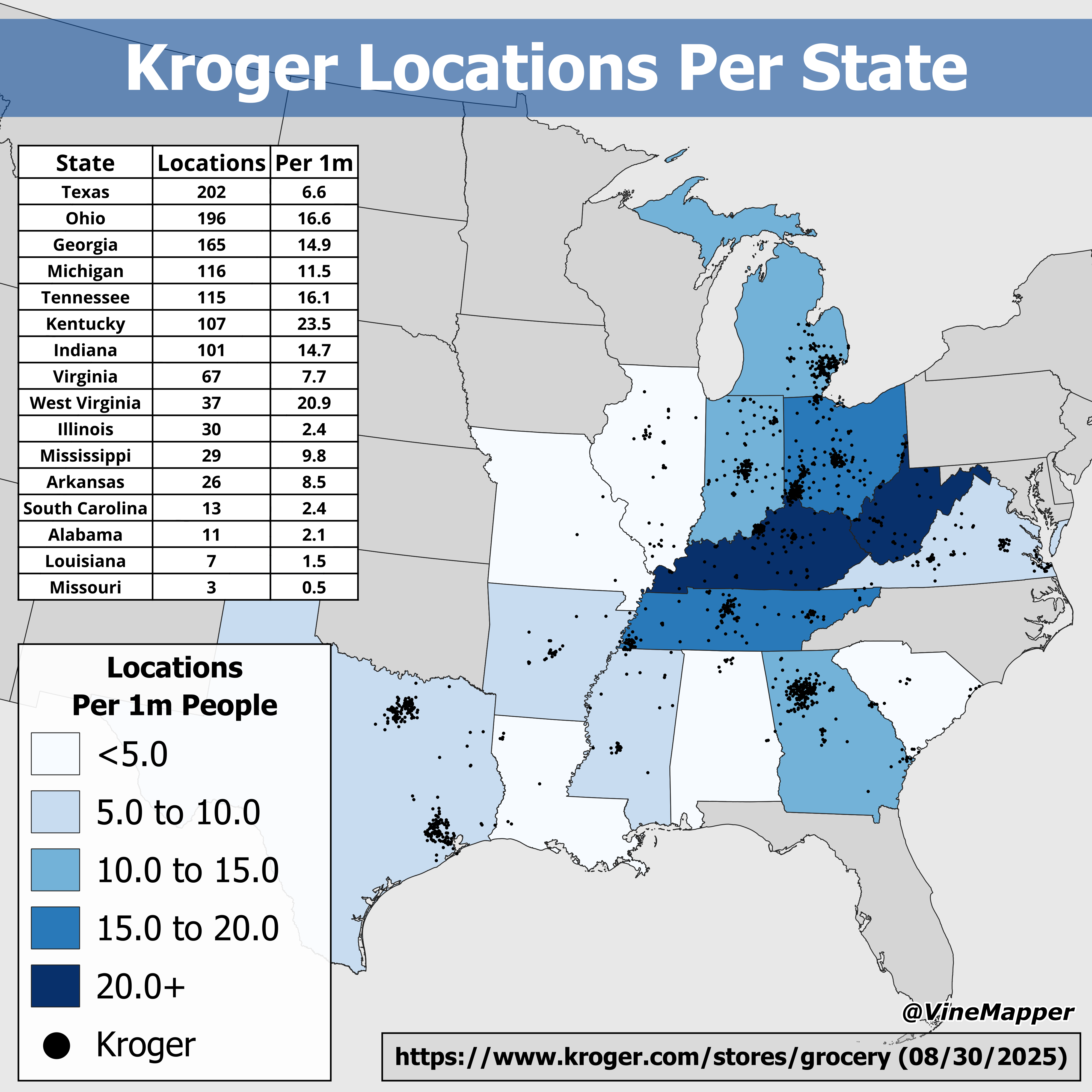
Kroger Locations Per State Map
The "Kroger Locations Per State Map" provides a comprehensive visual representation of where Kroger grocery stores are s...
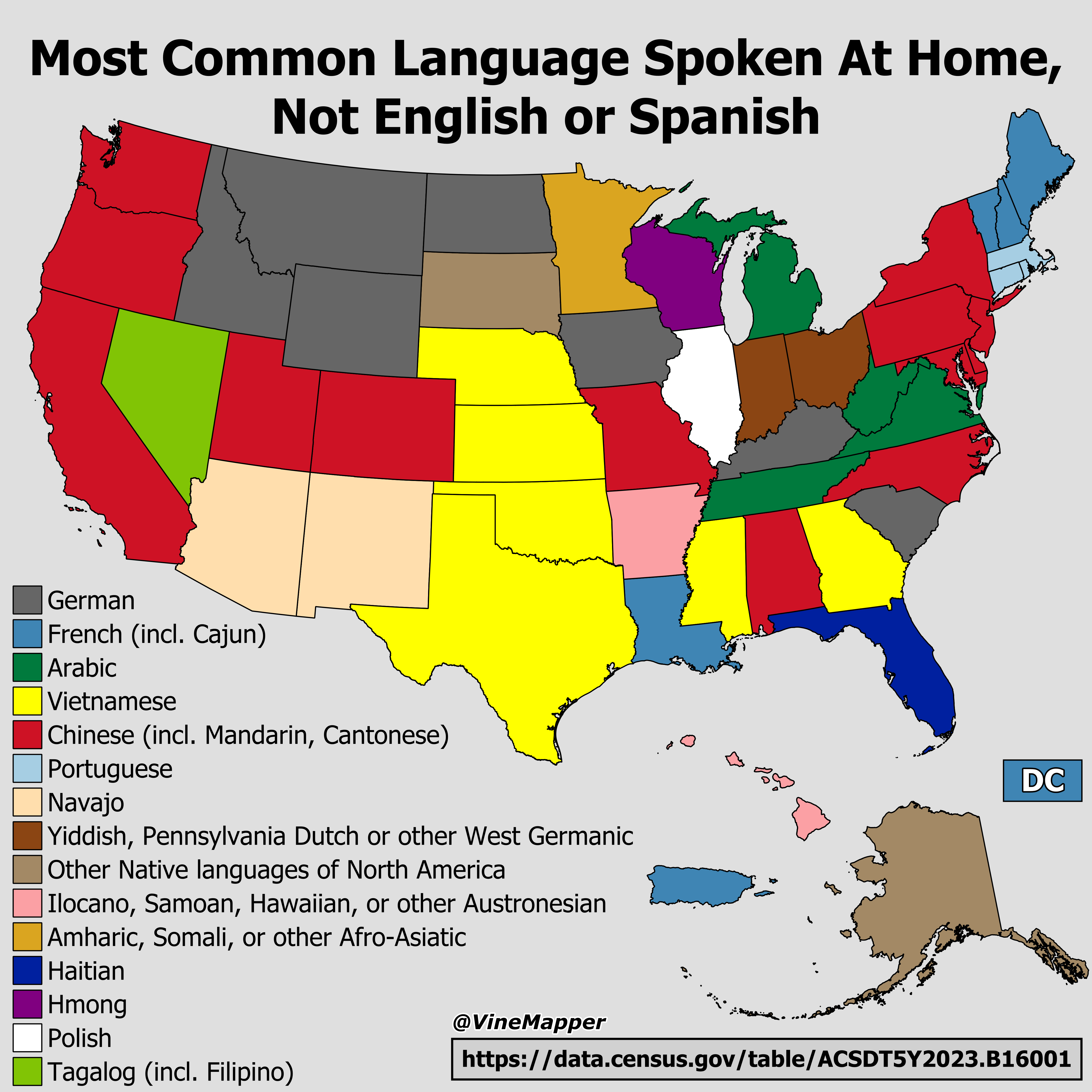
Most Common Language Spoken at Home Map
This map illustrates the most common languages spoken at home in various regions across the United States, excluding Eng...
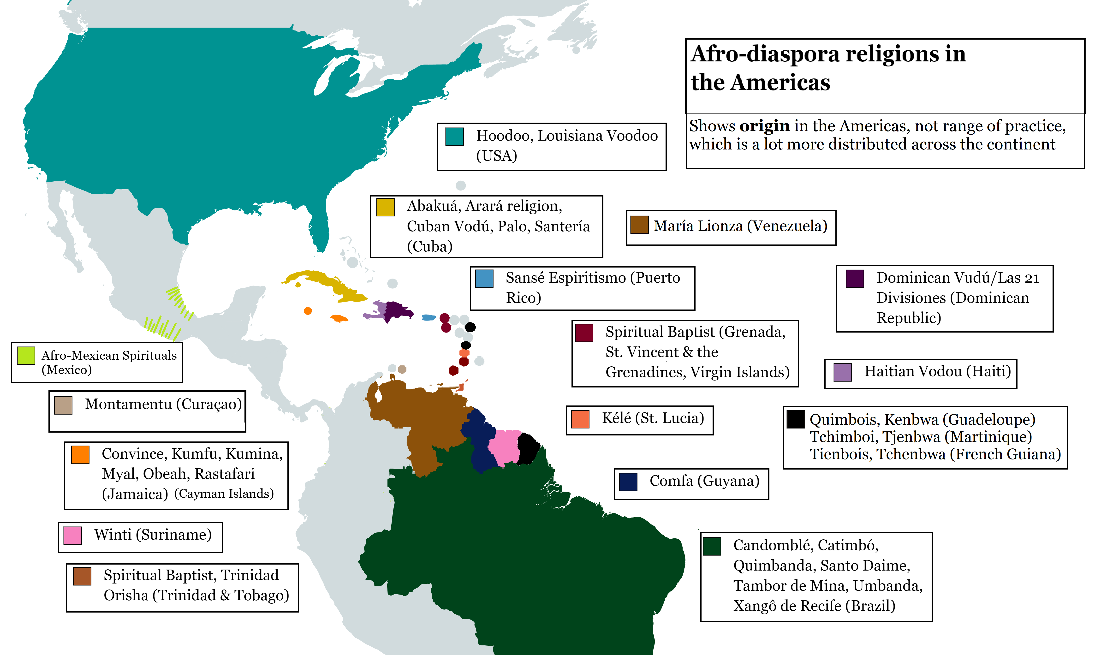
African Diaspora Religions in the Americas Map
This map displays the distribution of African diaspora religions across various countries in the Americas. The visualiza...
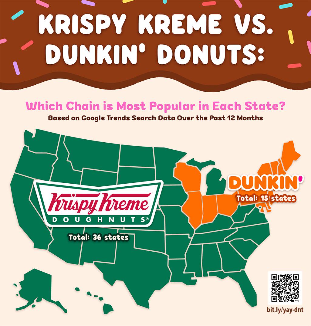
Krispy Kreme vs Dunkin' Donuts Store Location Map
The "Krispy Kreme vs Dunkin' Donuts Store Location Map" provides a visual representation of the geographical distributio...
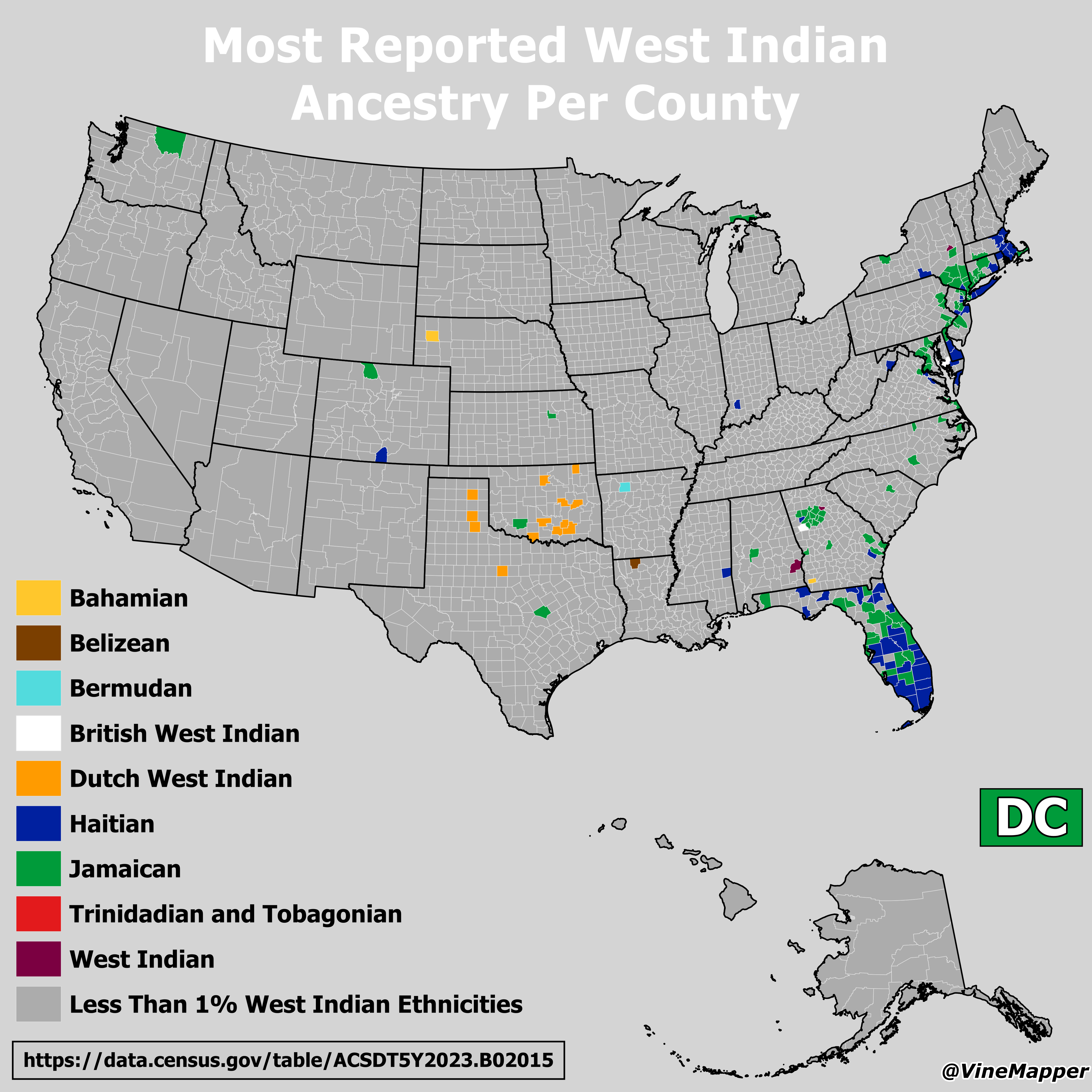
West Indian Ancestry Reported by County Map
This map illustrates the distribution of reported West Indian ancestry across various counties in the United States. It ...