water management Maps
10 geographic visualizations tagged with "water management"
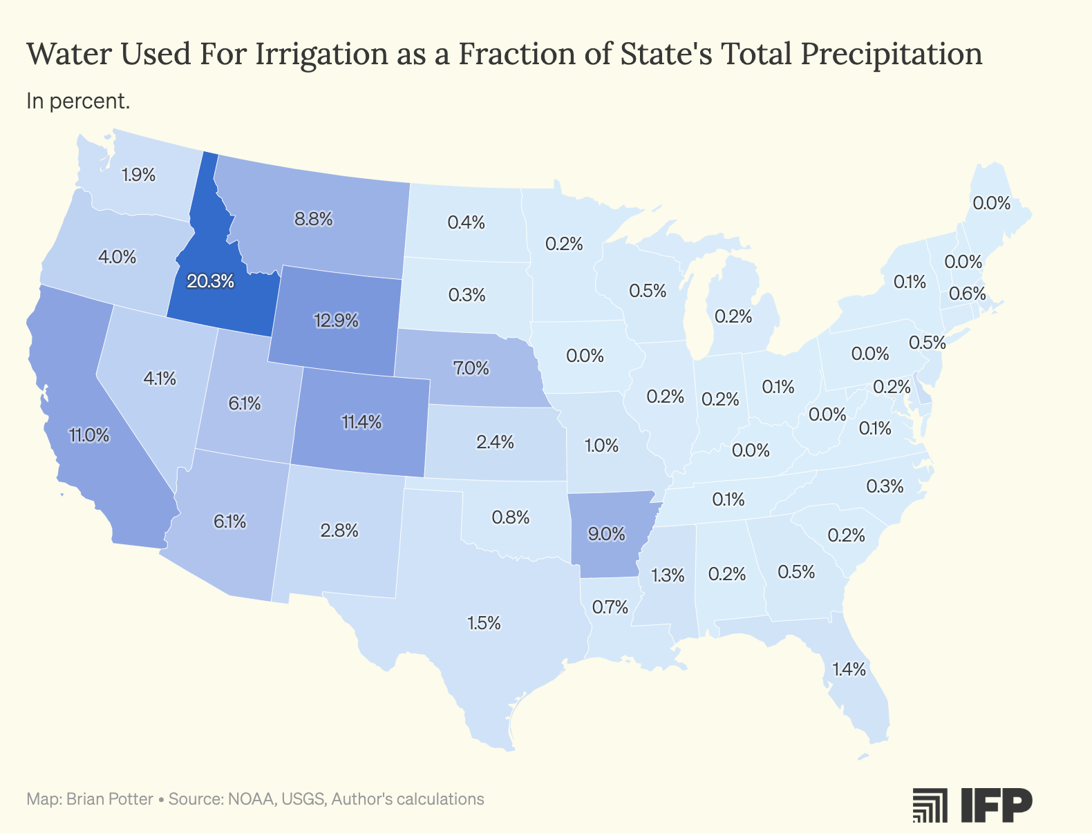
Water Used for Crop Irrigation Map by US States
The map titled "Water Used for Crop Irrigation as a Percentage of US States' Total Precipitation" provides a compelling ...
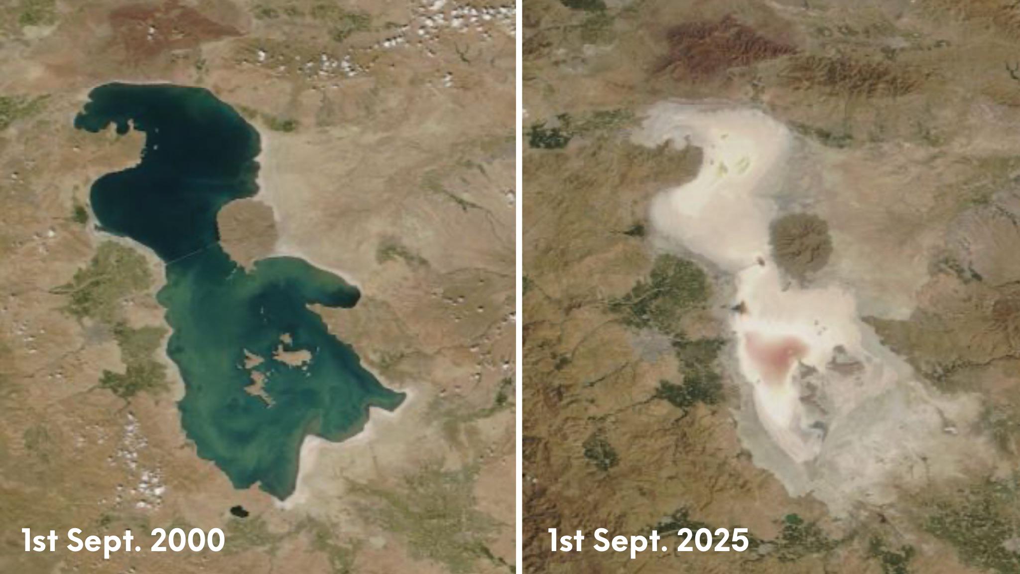
Lake Urmia Iran Map
This map highlights the geographical features and historical significance of Lake Urmia, located in northwestern Iran. O...
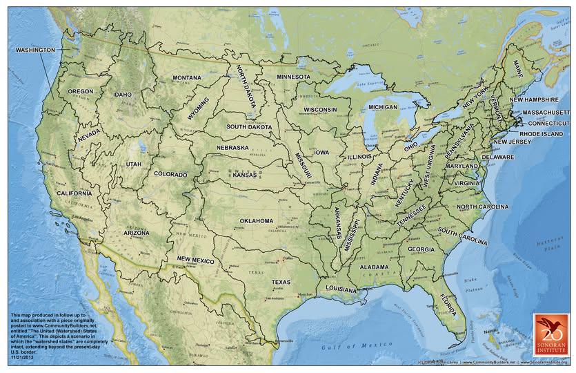
Watershed Boundaries Map Proposal for the U.S.
Understanding the significance of watersheds begins with recognizing their hydrological cycle. When it rains, water does...
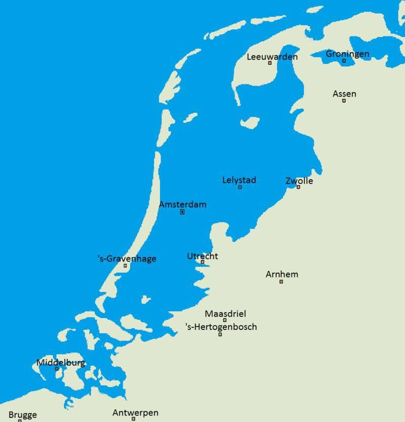
Netherlands Natural Landscape Map Without Dikes
This map vividly illustrates what the Netherlands might look like if dikes and other flood prevention measures had never...
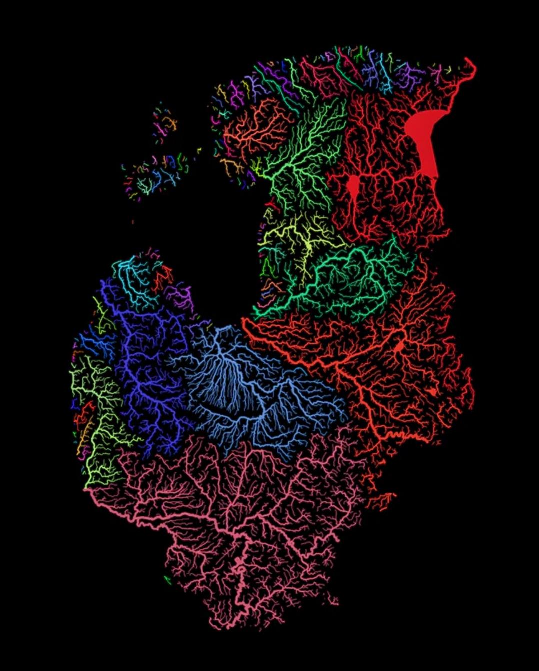
Rivers of the Baltic Nations Map
This map highlights the intricate network of rivers that flow through the Baltic nations of Estonia, Latvia, and Lithuan...
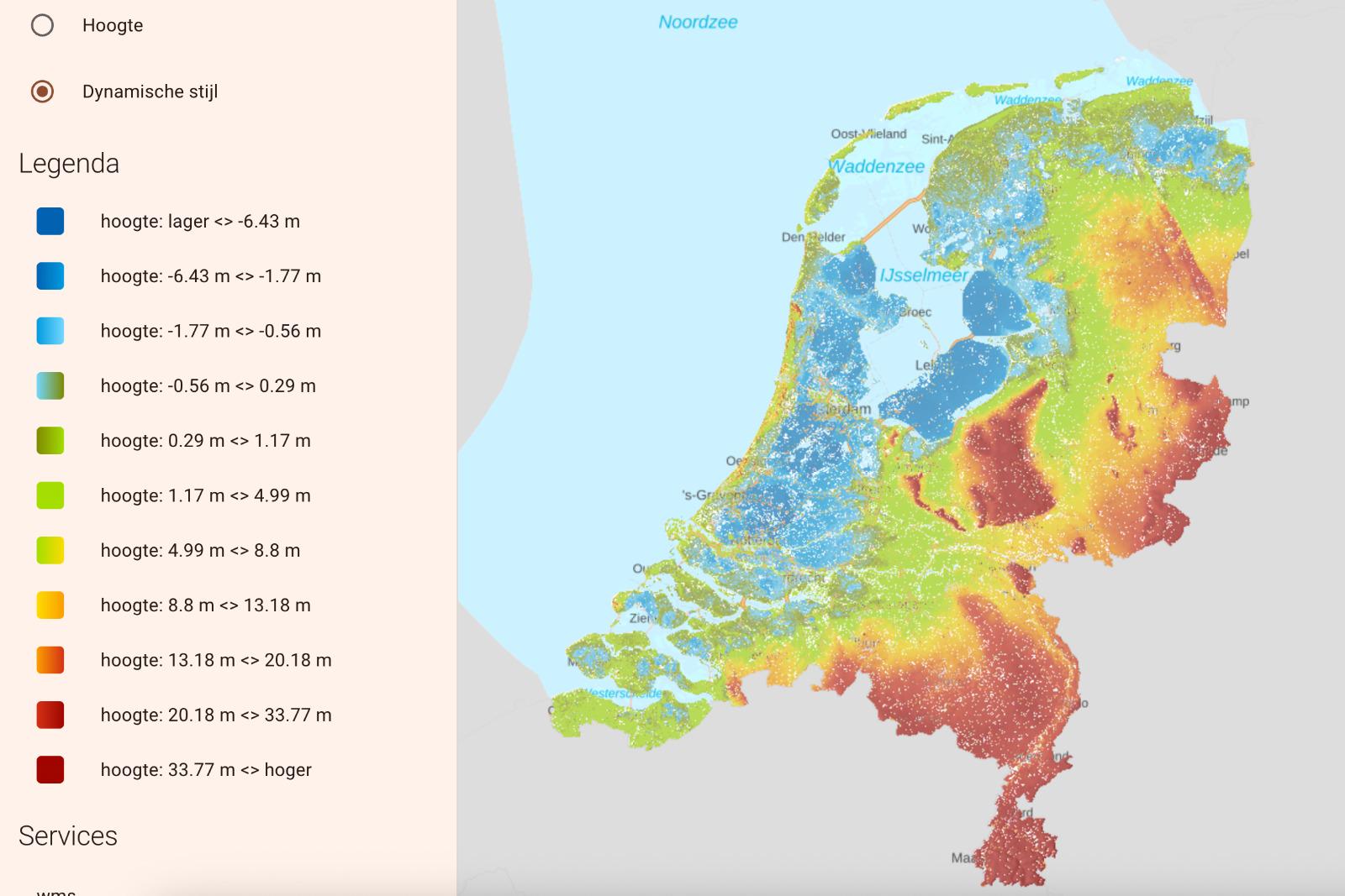
Flooded Netherlands Map without Dikes
This visualization presents a hypothetical scenario of the Netherlands without its extensive network of dikes and flood ...
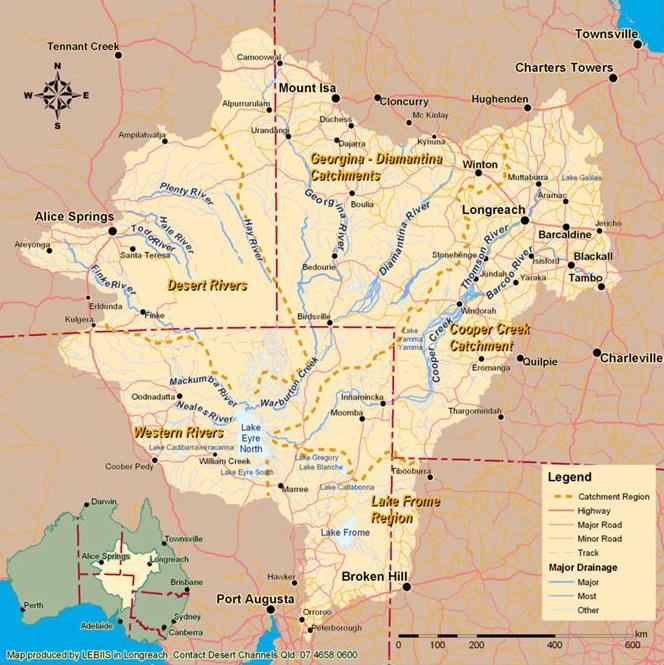
Lake Eyre Basin Map Australia
This visualization focuses on the Lake Eyre Basin, the largest endorheic lake system in Australia. Covering an expansive...
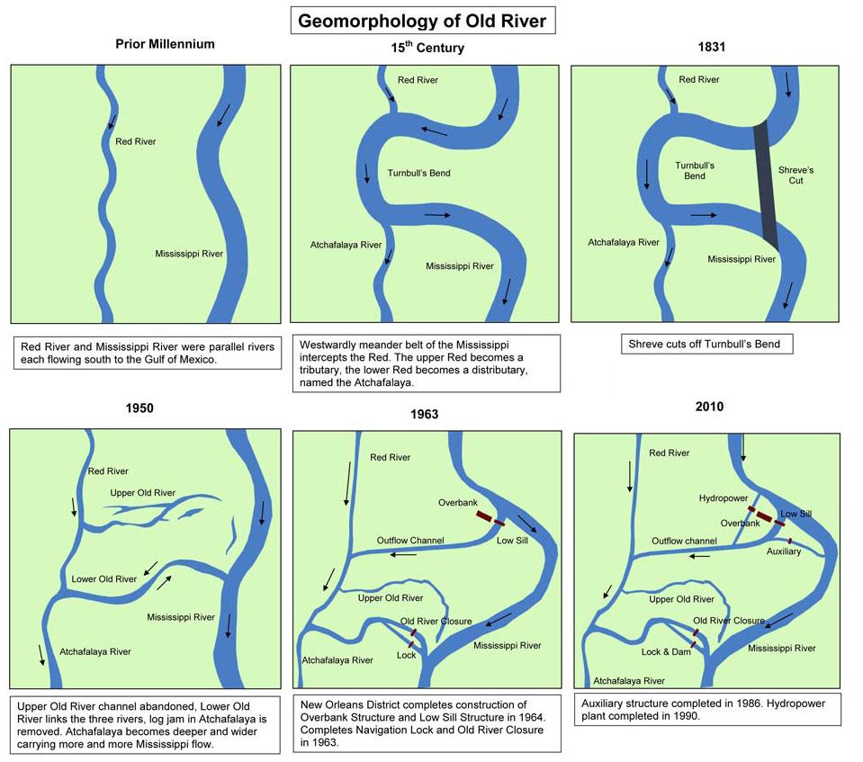
Map of the Old River Control Structure in Louisiana
The map of the Old River Control Structure provides a clear visual representation of a crucial engineering feat located ...
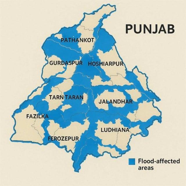
Flood-Affected Areas in Punjab, India Map
Interestingly, Punjab's flat topography contributes to the severity of flooding. Unlike more mountainous regions where w...
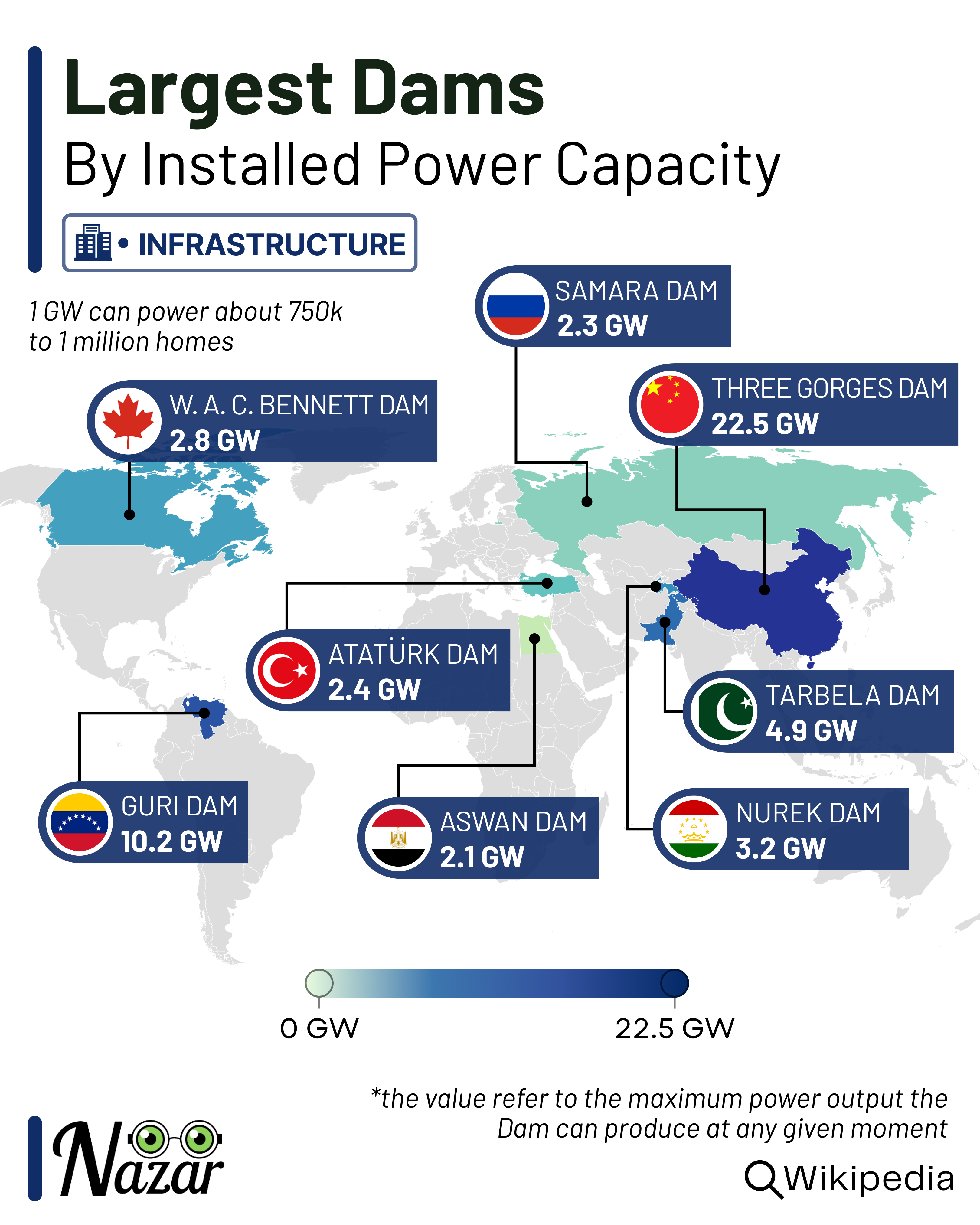
Largest Dams Map
The "Largest Dams Map" provides a comprehensive visualization of the world’s largest dams by height and volume. These mo...