united states Maps
18 geographic visualizations tagged with "united states"
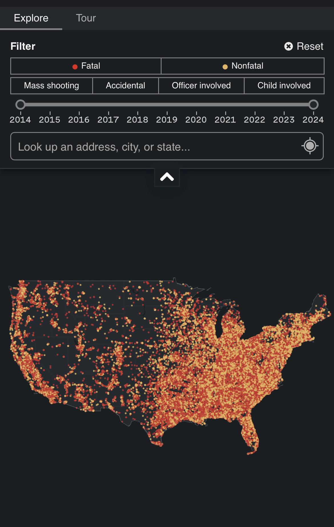
Gun Violence Map of America
The "Interactive Atlas of American Gun Violence" provides a detailed visualization of shootings across the United States...
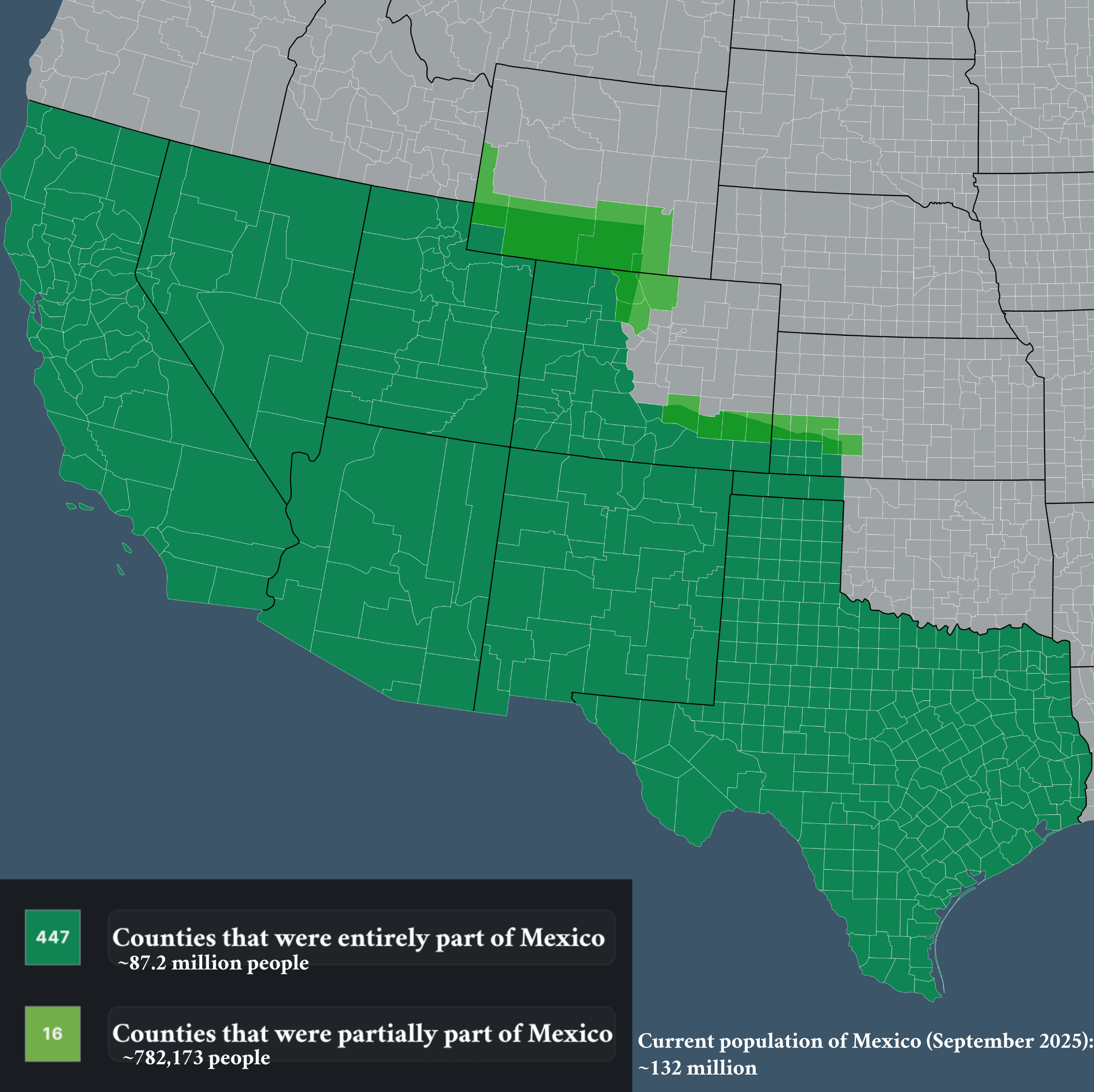
Map of Counties that Used to be Part of Mexico
The visualization titled "Counties that used to be part of Mexico" provides an insightful look into the historical terri...
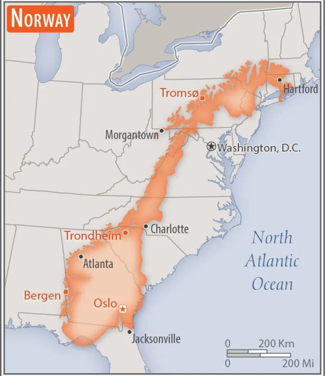
Norway Overlaid on the US Map
This intriguing map overlays the geographical boundaries of Norway onto the continental United States, providing a uniqu...

Mexico Border Election Trends Map 2016-2024
The "Mexico Border Election Trends Map 2016-2024" provides a comprehensive visualization of voting patterns along the U....
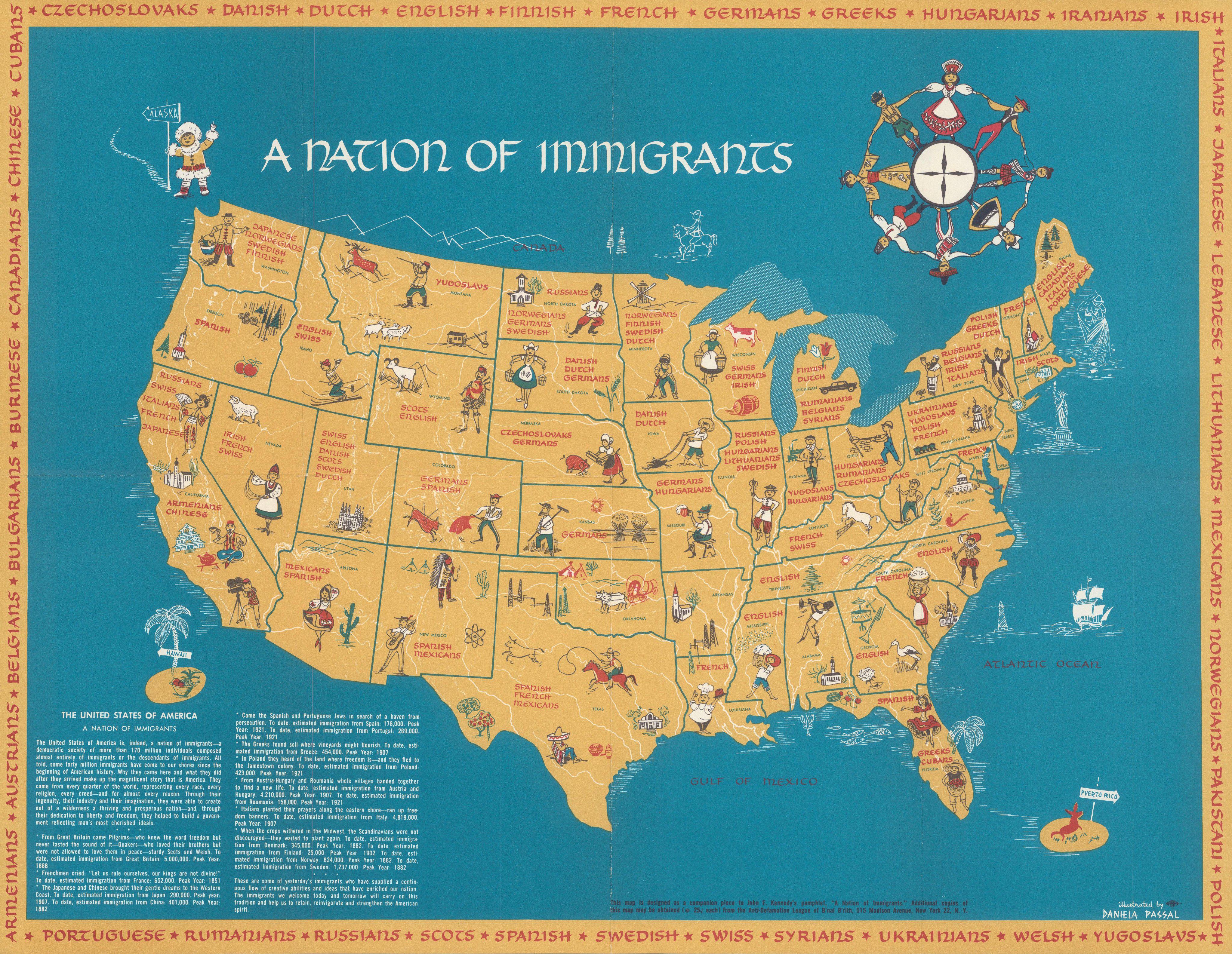
Immigration Patterns Map of the United States
The "A Nation of Immigrants" map by Daniela Pascal is an insightful visualization that illustrates the complex layers of...
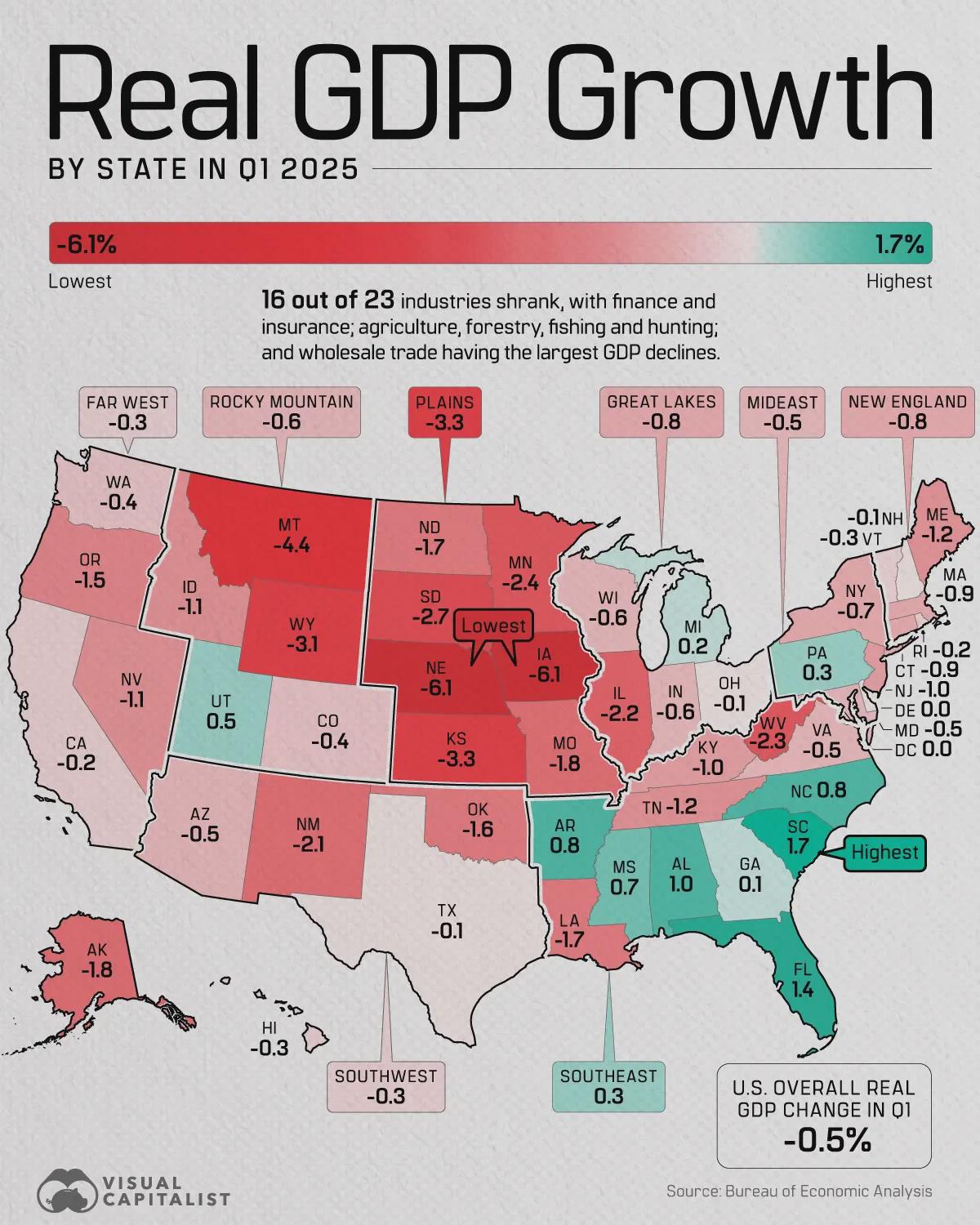
United States Real GDP Growth by State Map
The "United States Real GDP Growth by State in Q1 2025" map visually represents the economic performance of each state i...
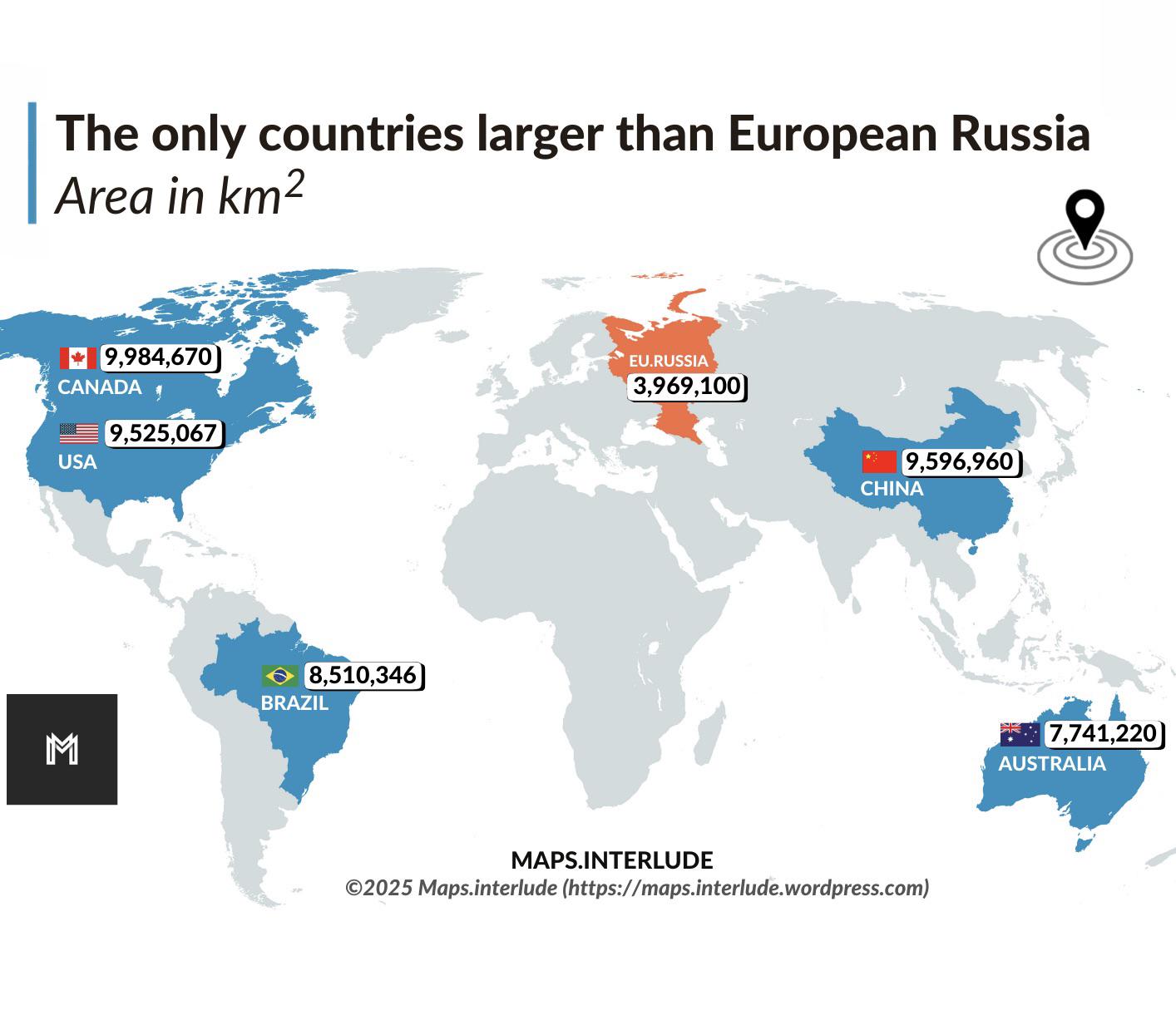
Map of Countries Larger than European Russia
This visualization highlights the countries that surpass European Russia in terms of land area. European Russia, which e...
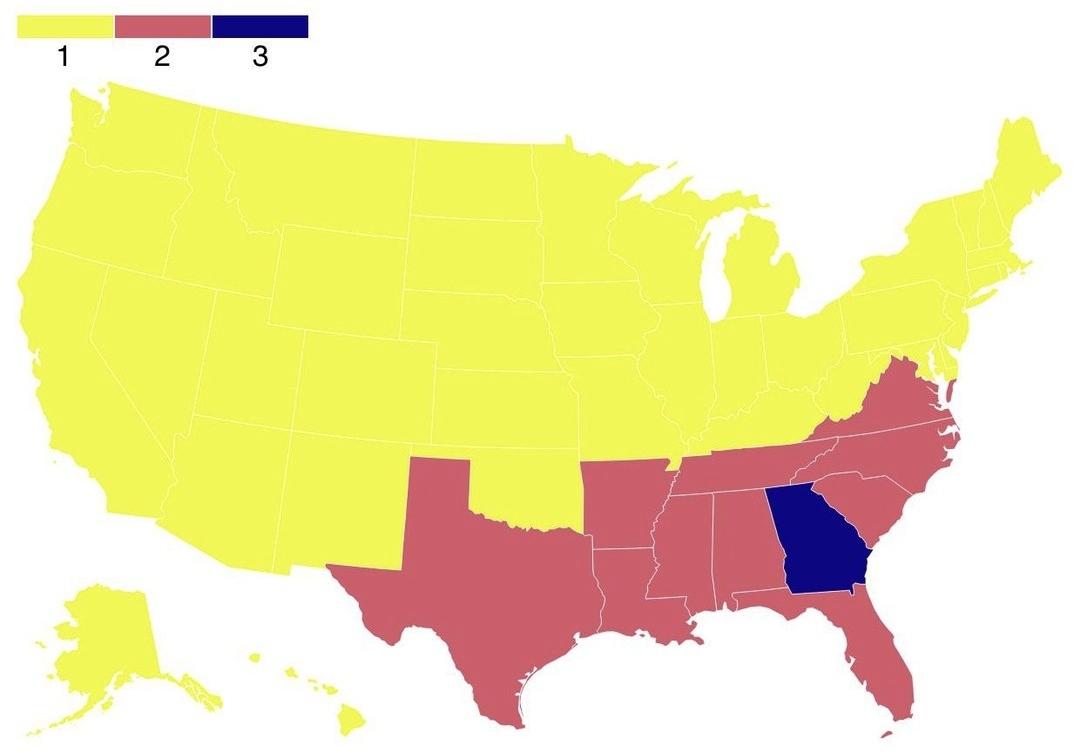
Map of States by Admission into the Union
The map titled "Map of States by Admission into the Union" provides a visual representation of the number of times each ...
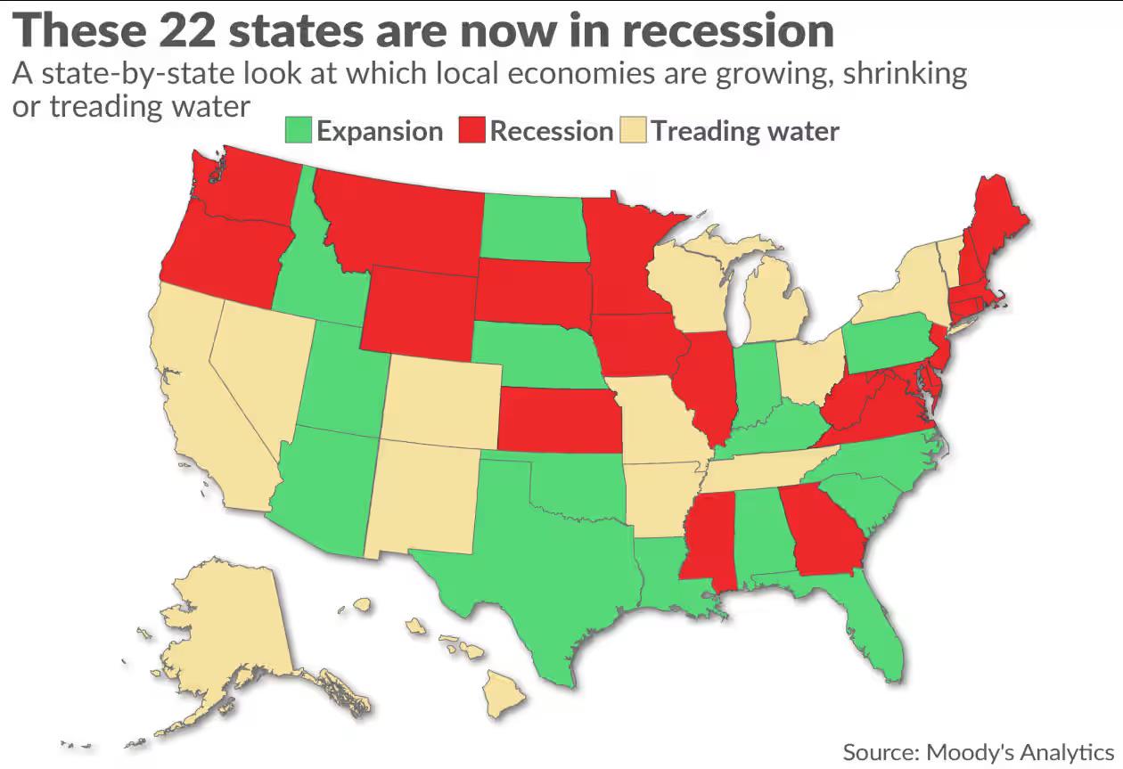
Recession States Map of America as of October 2025
This map provides a visual representation of the American states that are currently experiencing economic recession as o...

Most Common United States Grocery Chain Per State Map
The \...
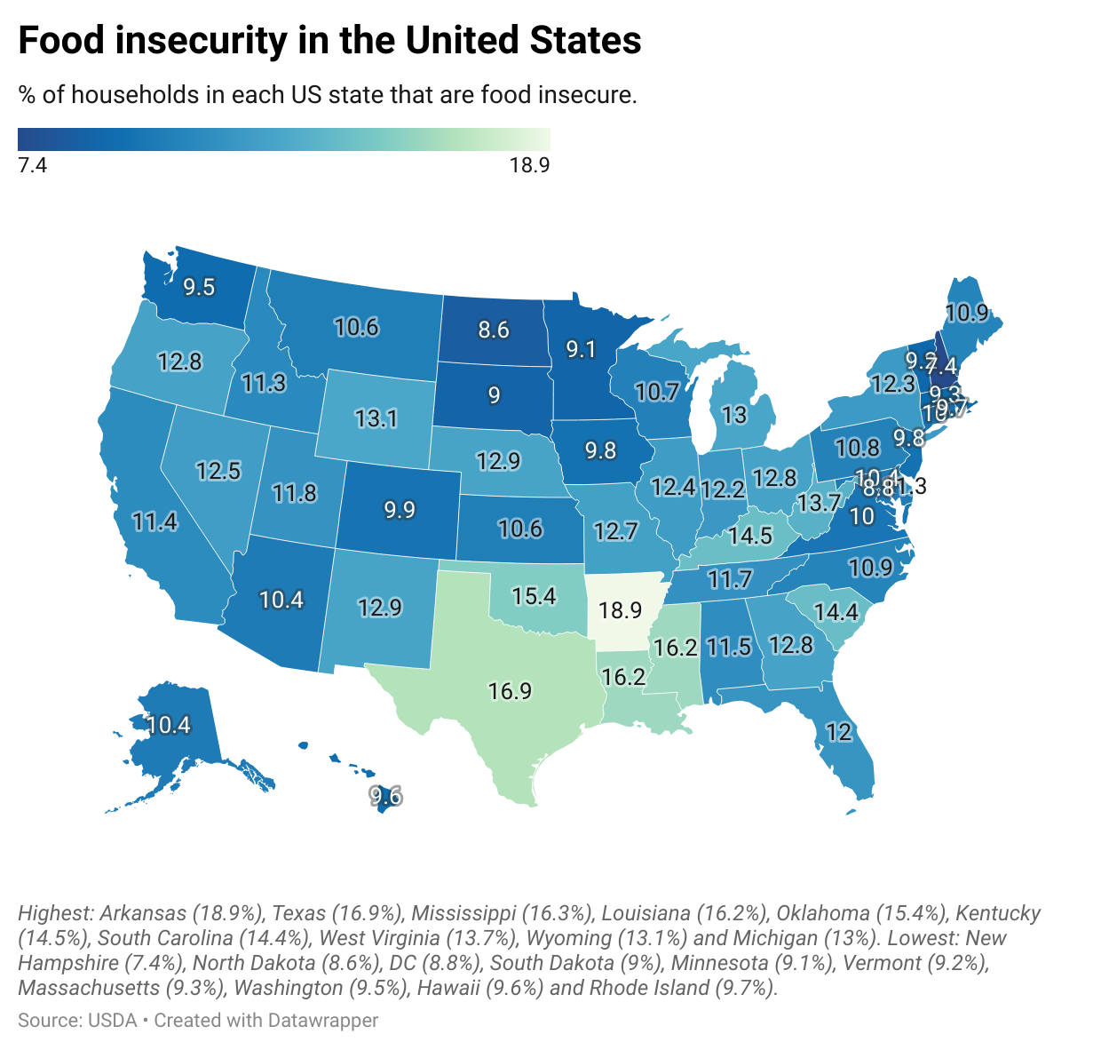
Food Insecurity in the United States Map
The "Food Insecurity in the United States Map" provides an intricate view of the varying levels of food insecurity acros...
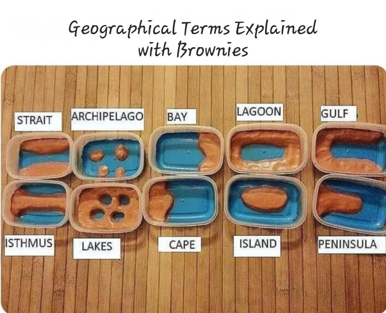
Food Distribution Map of the United States
The "Delicious and Informative!" map provides a comprehensive visualization of food distribution across the United State...
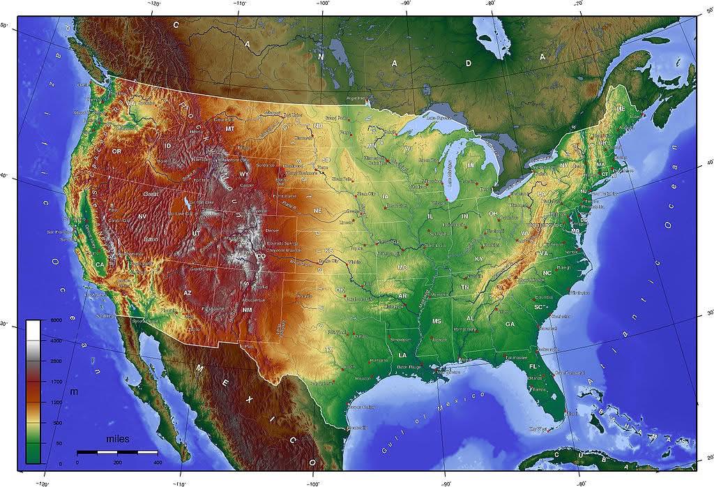
Topographic Map of the US
Transitioning from visualization to the actual topic, let’s delve deeper into the fascinating world of topography and it...
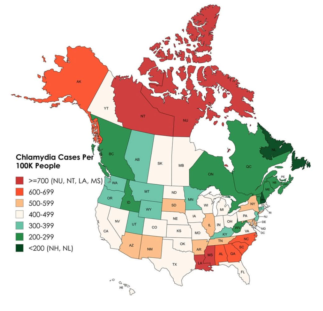
Chlamydia Cases Per 100,000 People Map
This map illustrates the incidence of chlamydia cases per 100,000 people across the United States and Canada, providing ...
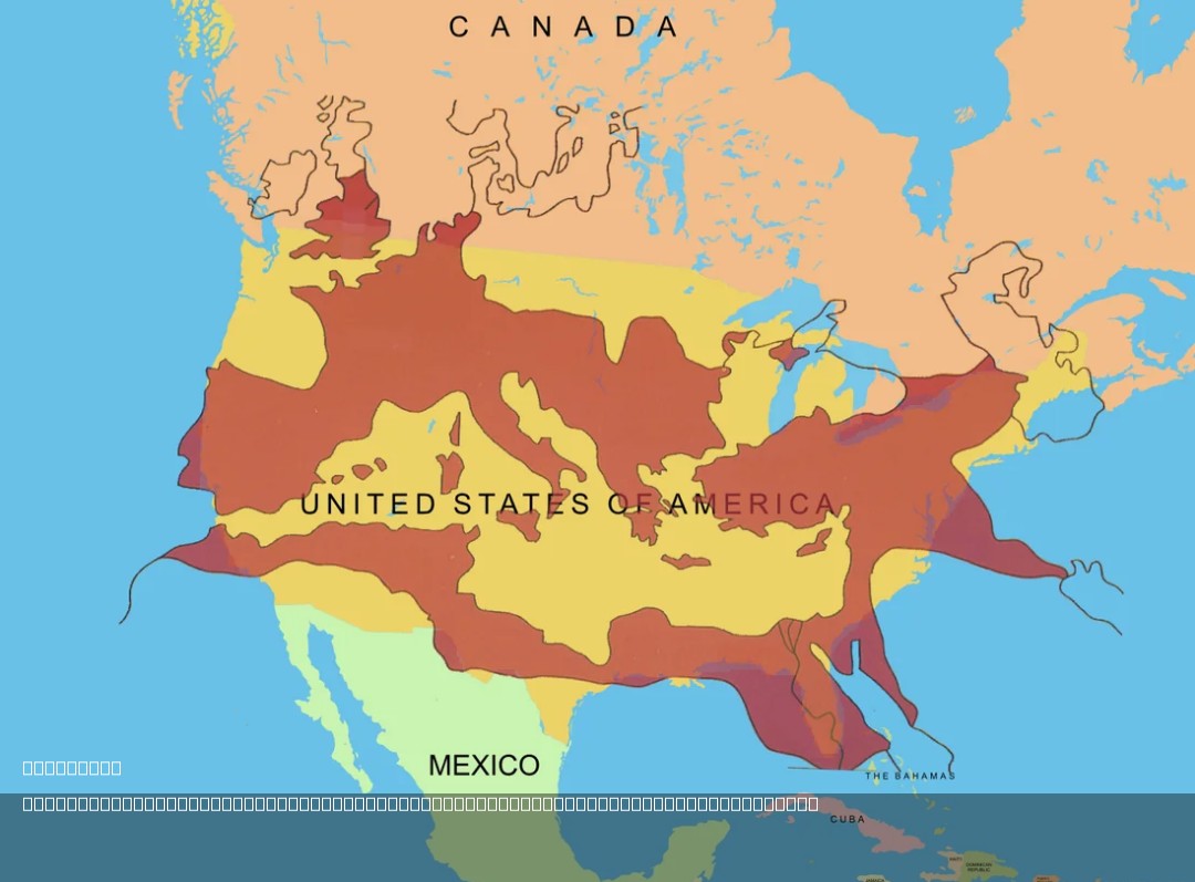
Roman Empire Size Comparison Map with USA
The map titled "The Size of the Roman Empire at Its Height Compared to the United States" visually compares the vast ter...
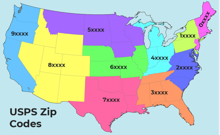
First Digit of ZIP Code Map
The "First Digit of ZIP Code Map" visually represents the first digit of ZIP codes across the United States, revealing r...
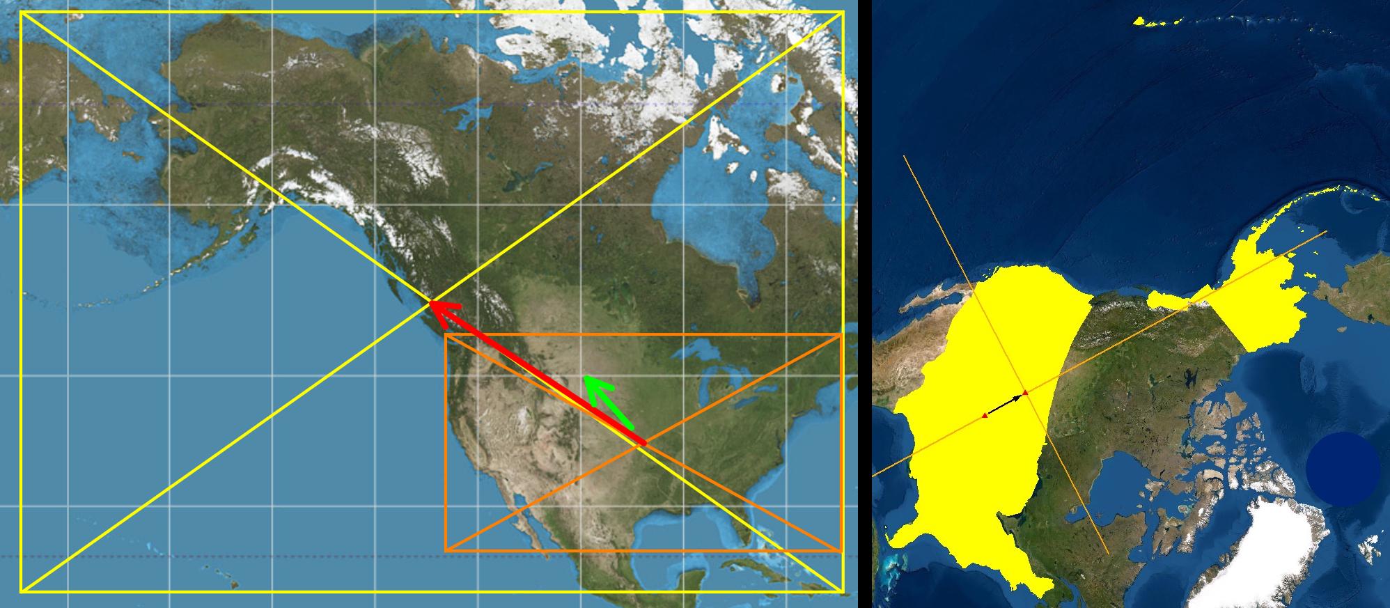
1959 Geographic Center of the United States Map
What’s particularly intriguing about the 1959 shift is how it reflects the broader geopolitical changes occurring within...
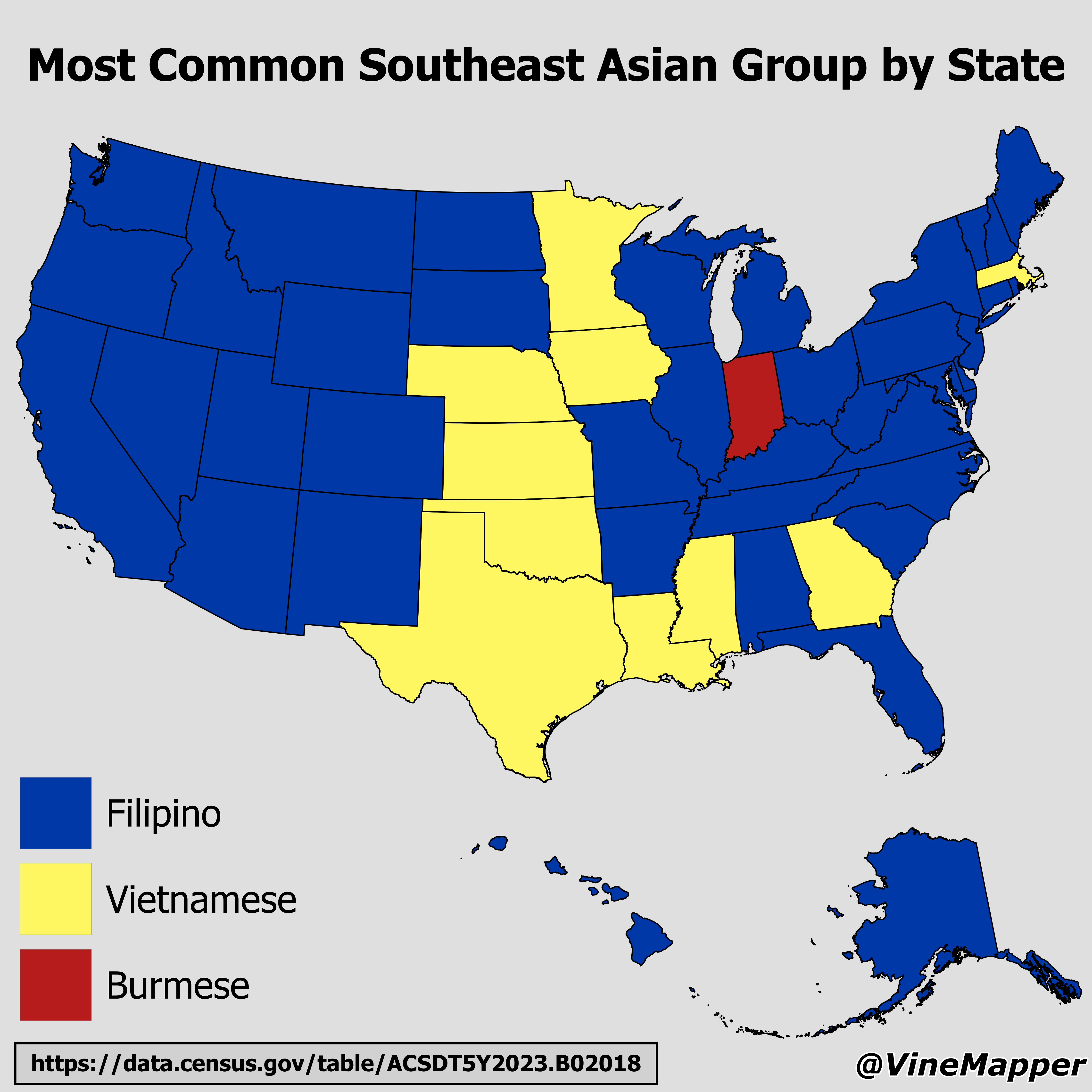
Most Common Southeast Asian Group by State Map
The "Most Common Southeast Asian Group by State" map provides a visual representation of the predominant Southeast Asian...