socioeconomics Maps
15 geographic visualizations tagged with "socioeconomics"
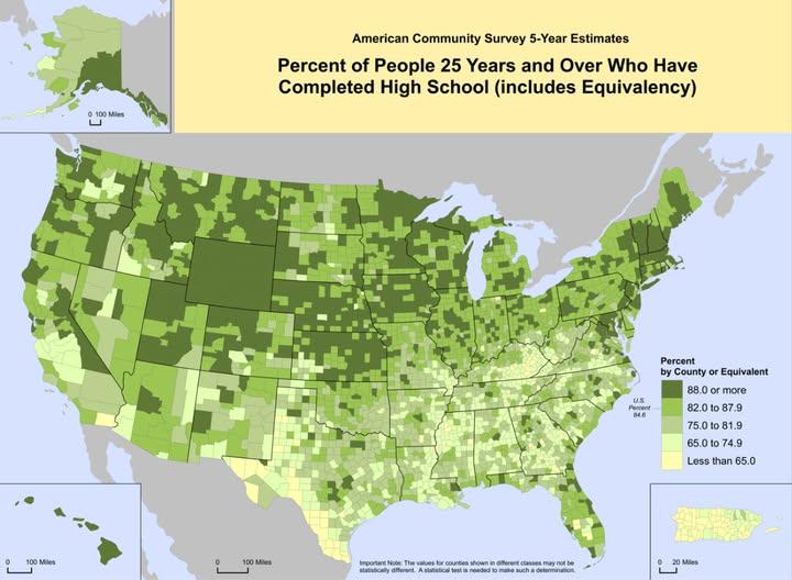
High School Graduation Rates Map of the US
This map visualizes the percentage of individuals over the age of 25 in the United States who have completed high school...
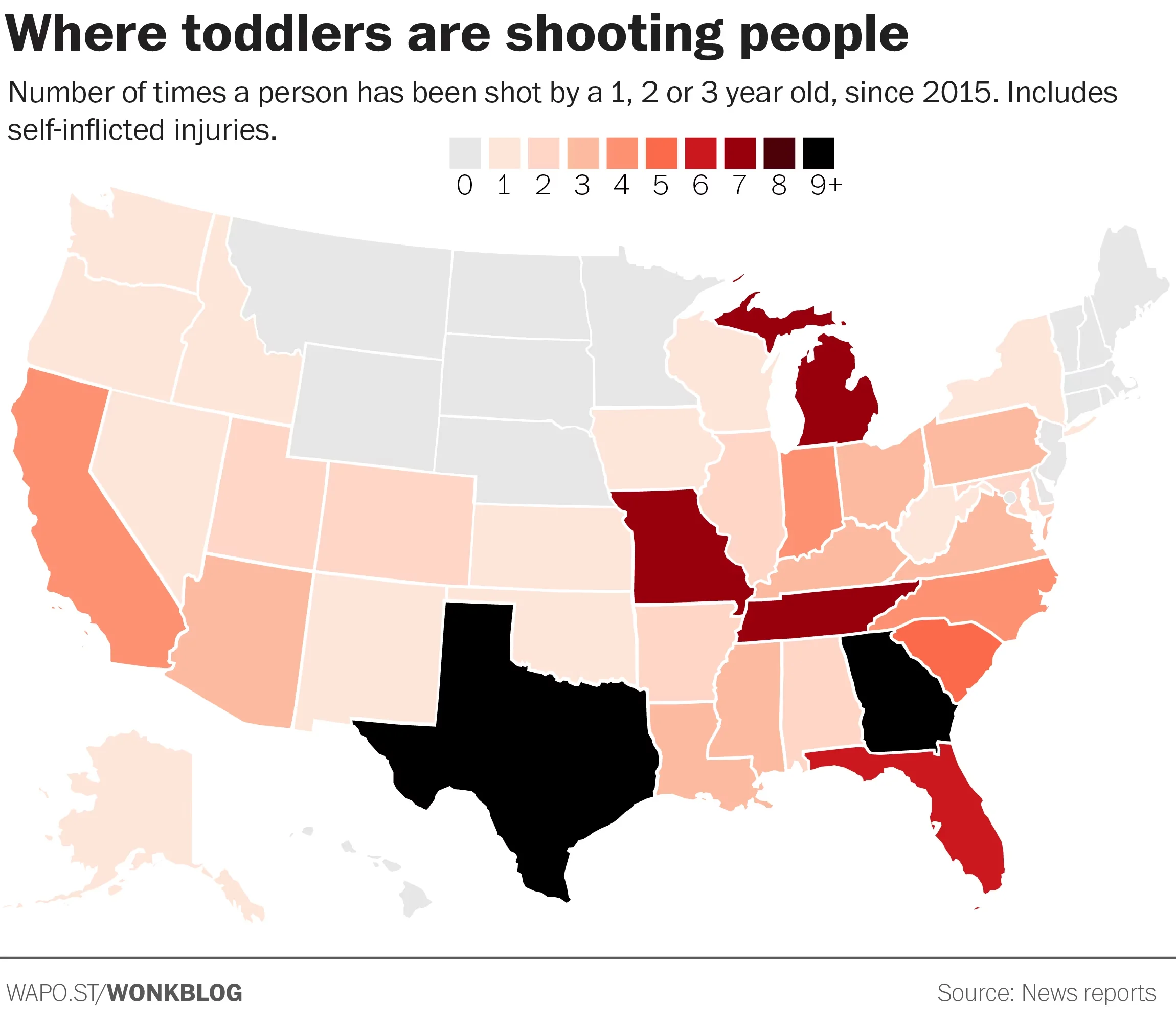
Gun Violence Map of the United States
The \...
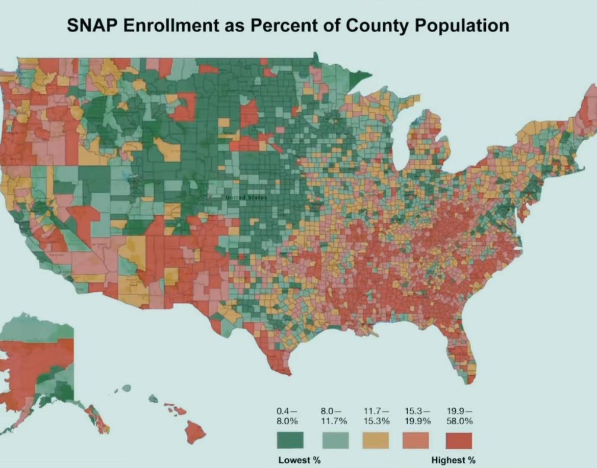
Food Insecurity Map of Red Counties
This map, titled "Awful lot of red counties about to lose their food," visually represents areas in the United States wh...
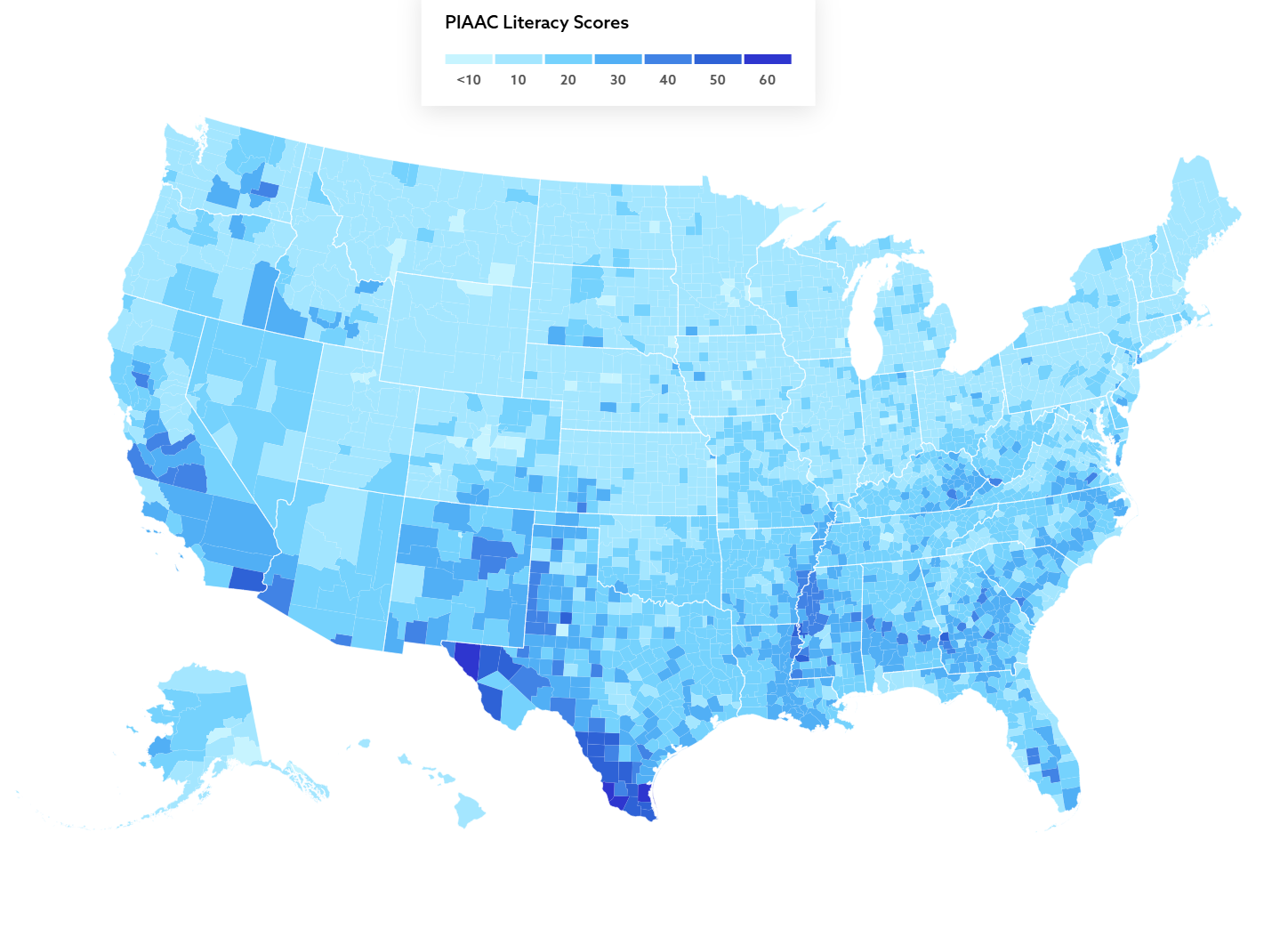
Literacy Skills Map of U.S. Adults
The map titled "Over 36 million adults in the U.S. lack basic literacy skills" provides a visual representation of adult...
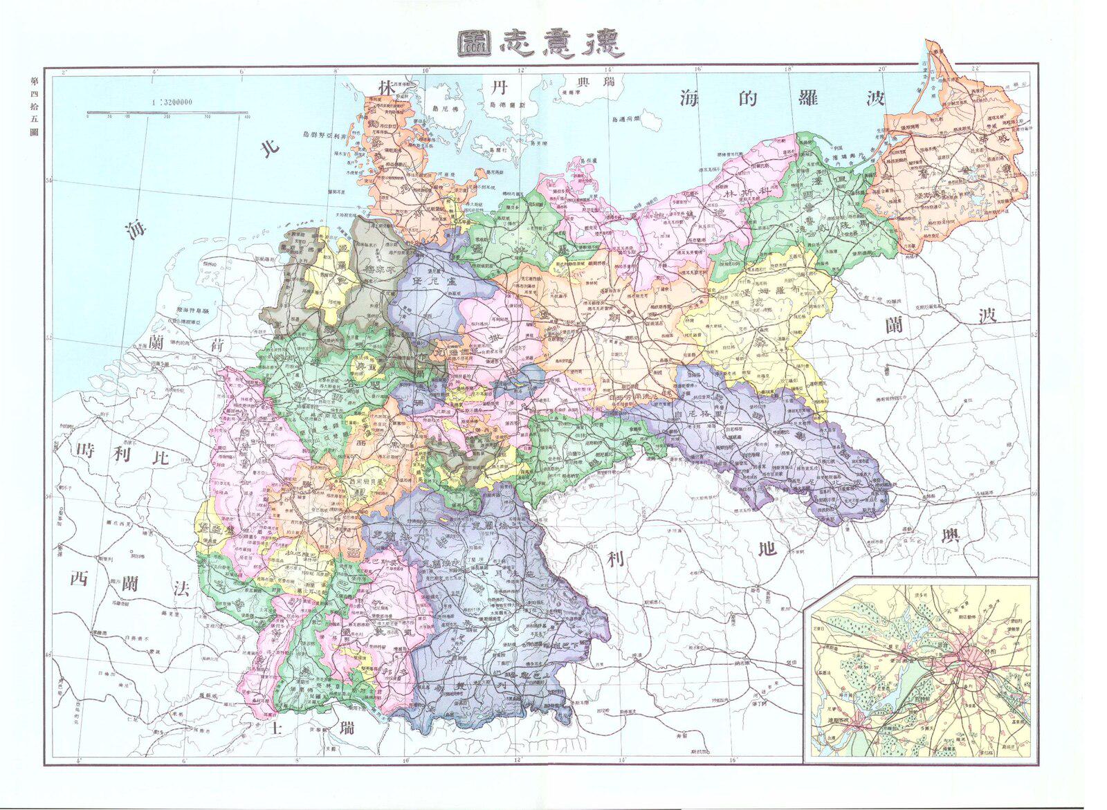
Chinese Map of Germany in 1906
...
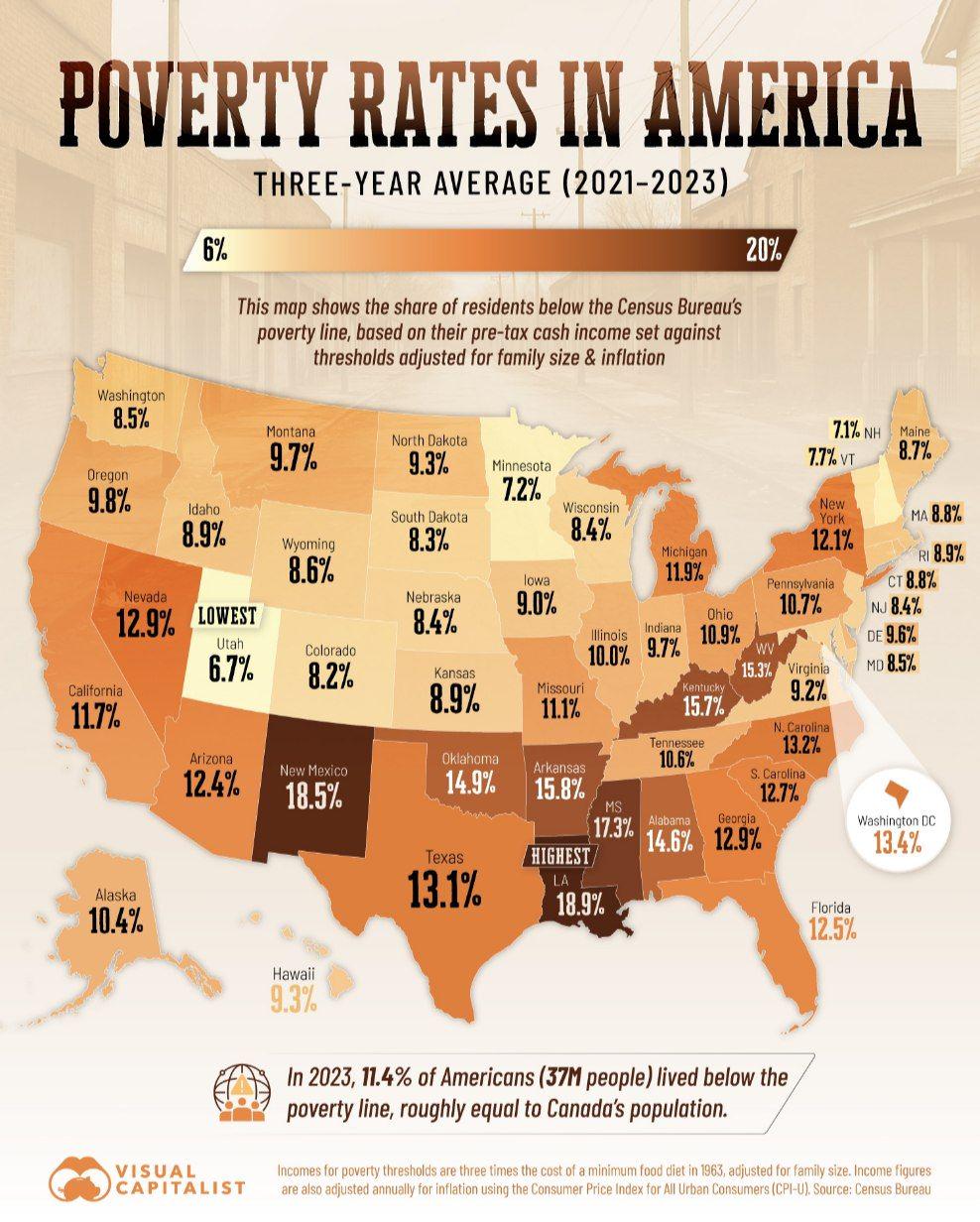
Poverty Rates in US Map
The "Poverty Rates in US Map" presents a visual representation of poverty levels across the United States, highlighting ...
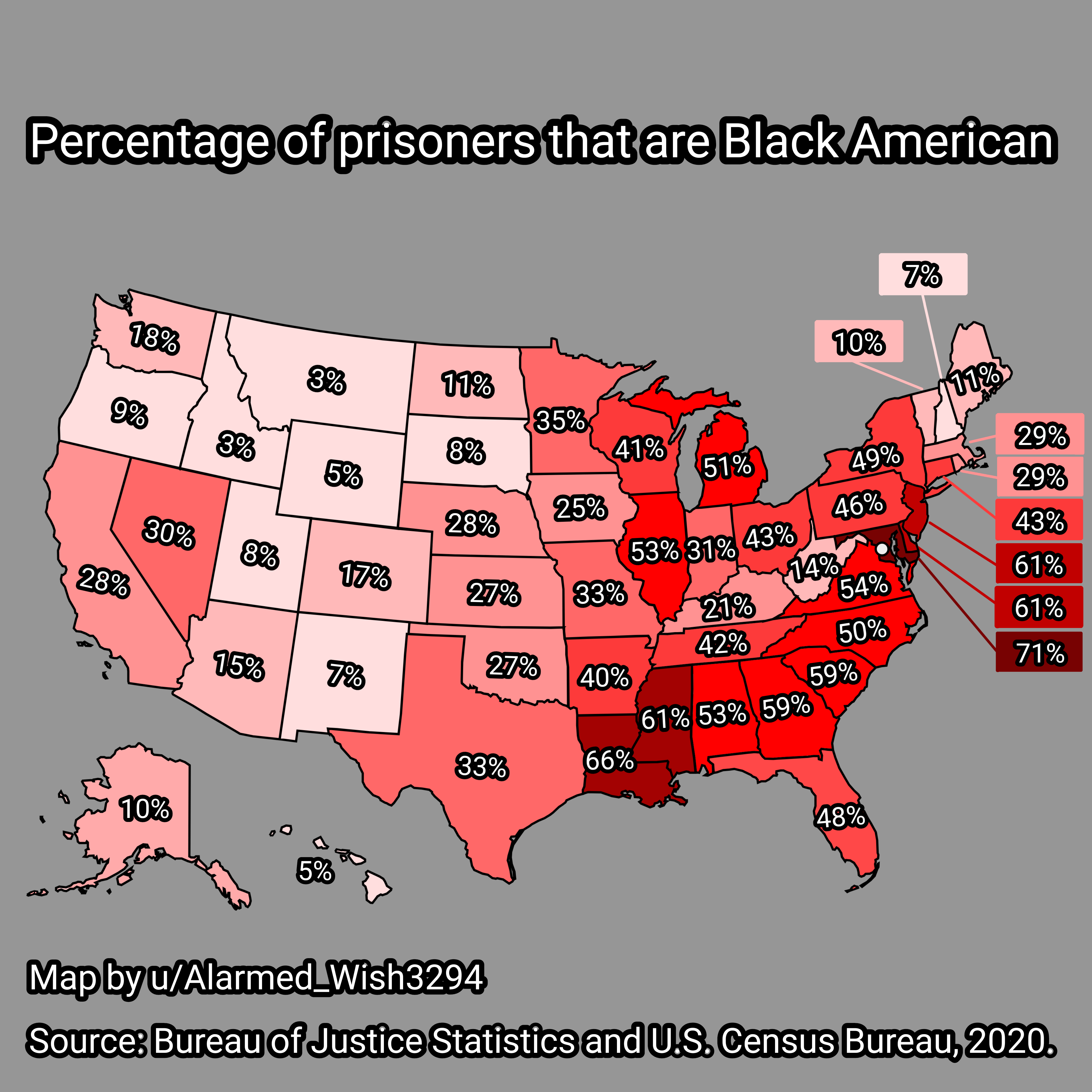
Map of Percentage of Black American Prisoners in USA
The map titled "Percentage of Black American Prisoners in USA" provides a striking visual representation of the racial d...
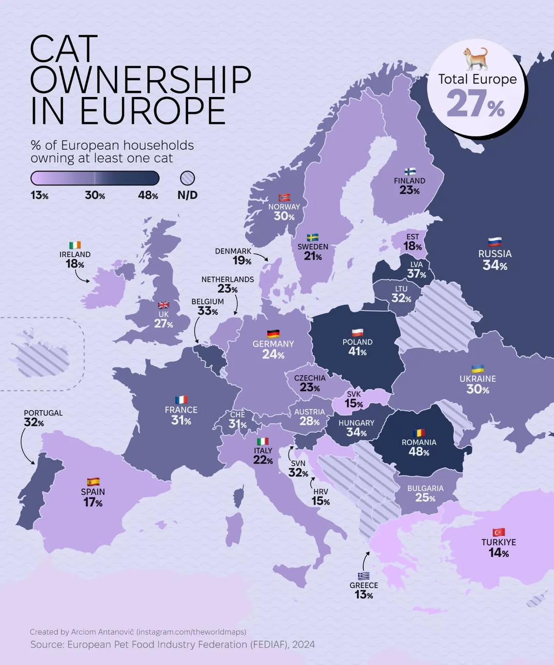
Cat Ownership in Europe Map
The "Cat Ownership in Europe Map" provides a detailed visualization of cat ownership rates across various European count...
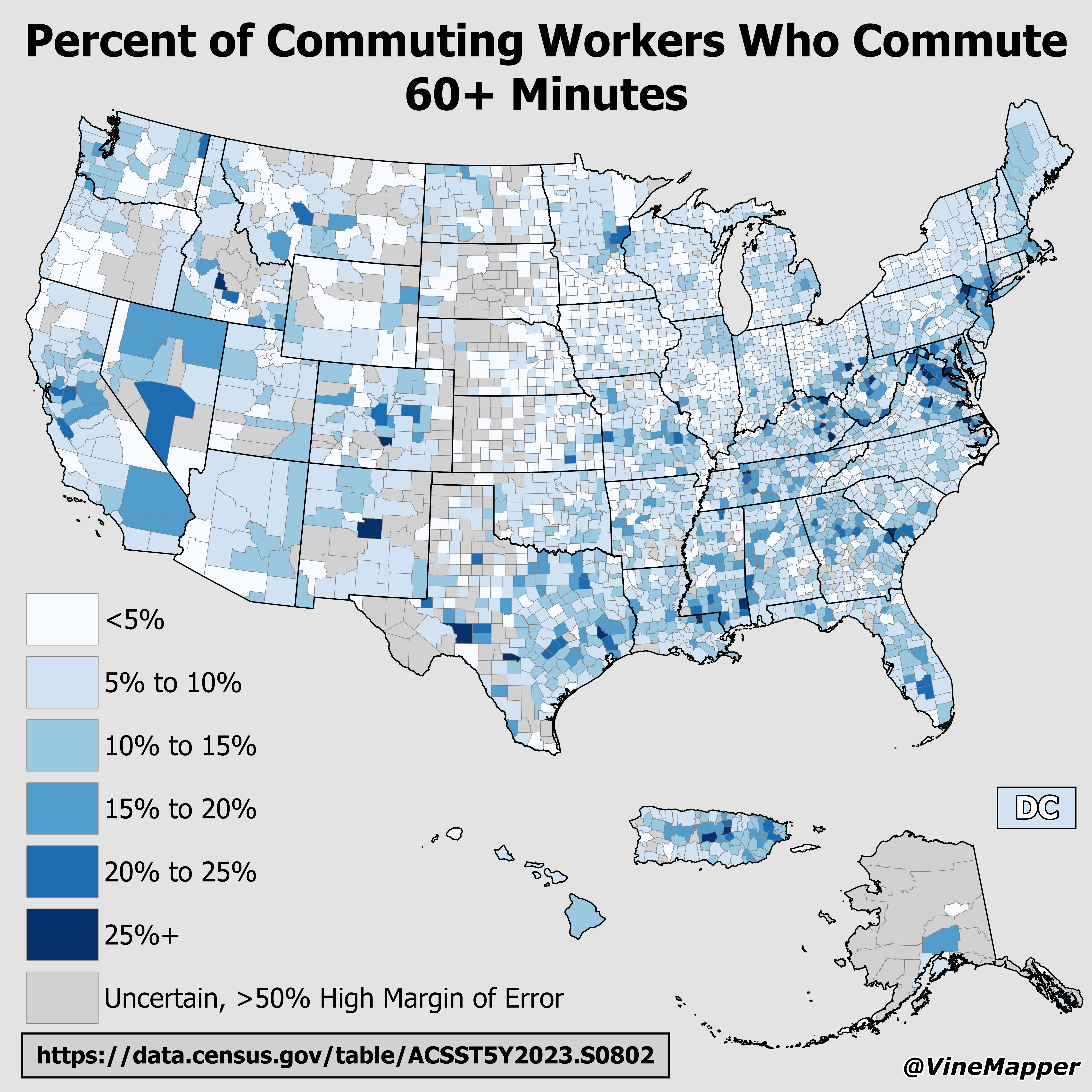
Map of Percent of Commuting Workers Who Commute 60+ Minutes
The visualization titled "Percent of Commuting Workers Who Commute 60+ Minutes" provides a clear illustration of the sta...
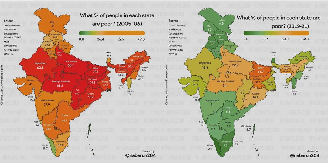
Poverty Change in India Over 15 Years Map
This map visualizes the changes in poverty levels across India over a span of 15 years. It highlights shifts in poverty ...
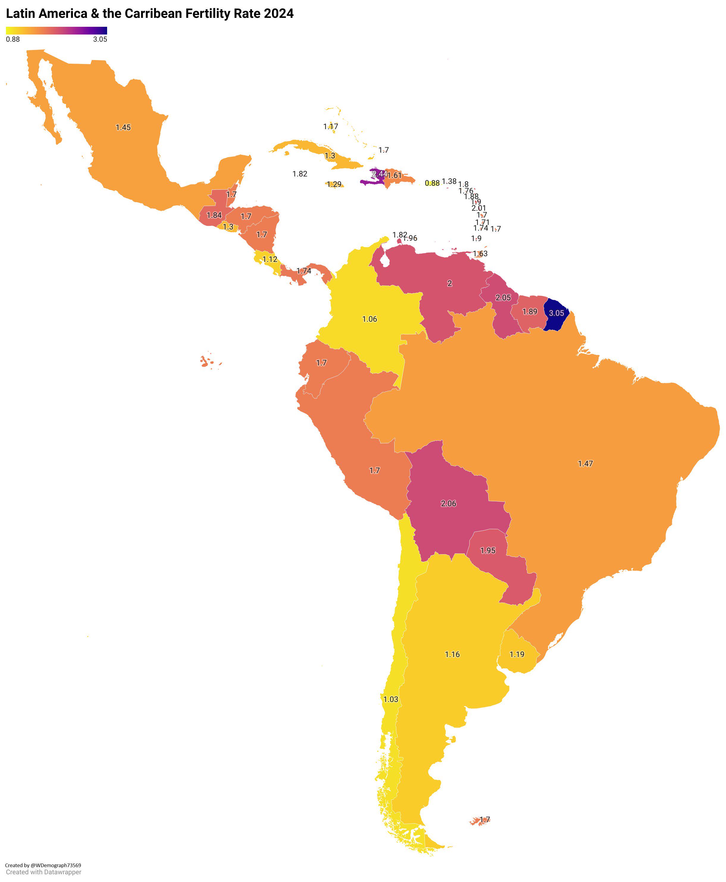
Fertility Rate Map of Latin America & The Caribbean 2024
The "Fertility Rate Map of Latin America & The Caribbean 2024" provides a clear visualization of the current fertility r...
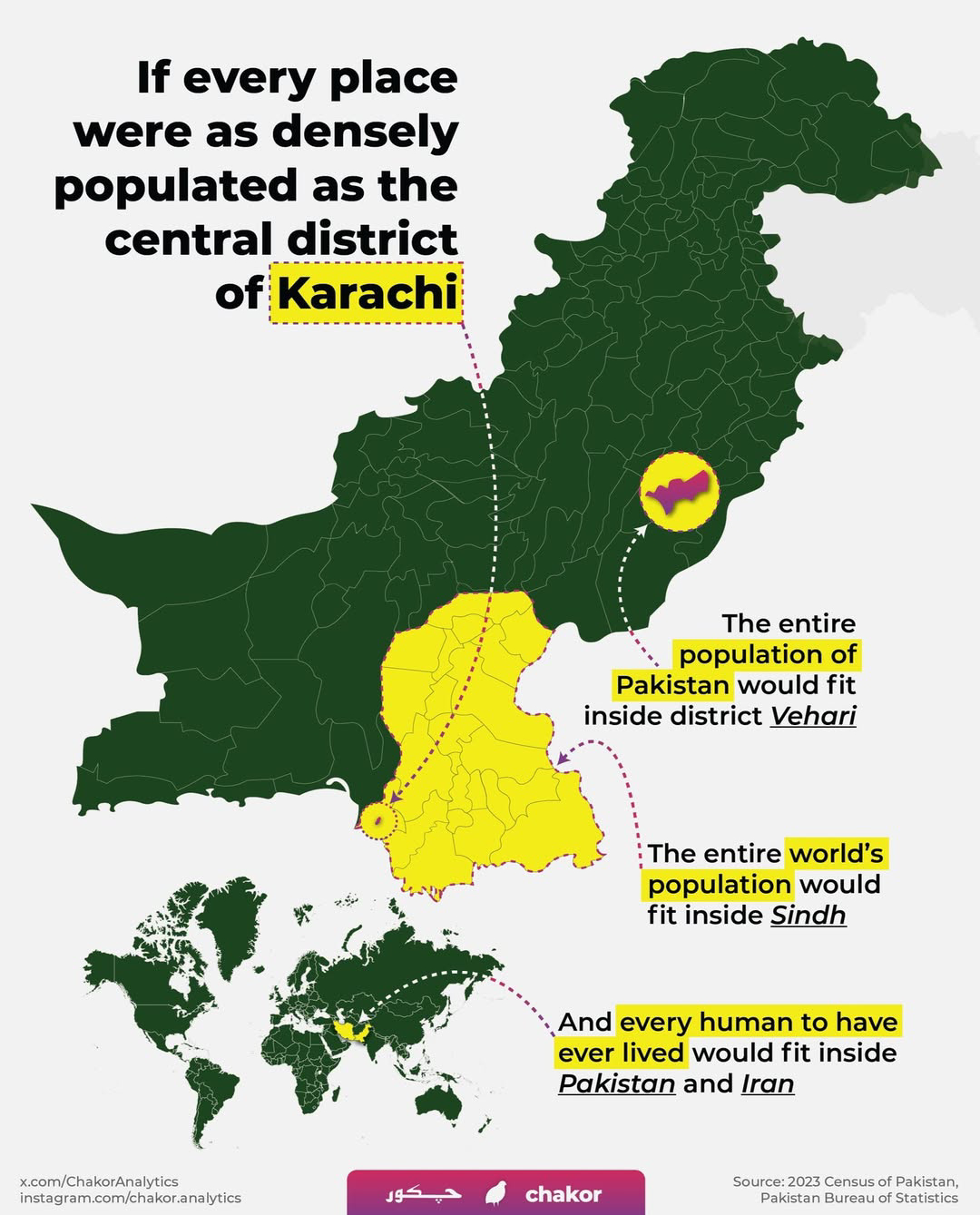
Karachi Population Density Map
Interestingly, the population density can vary dramatically within the city. For instance, areas like Saddar and Gulshan...
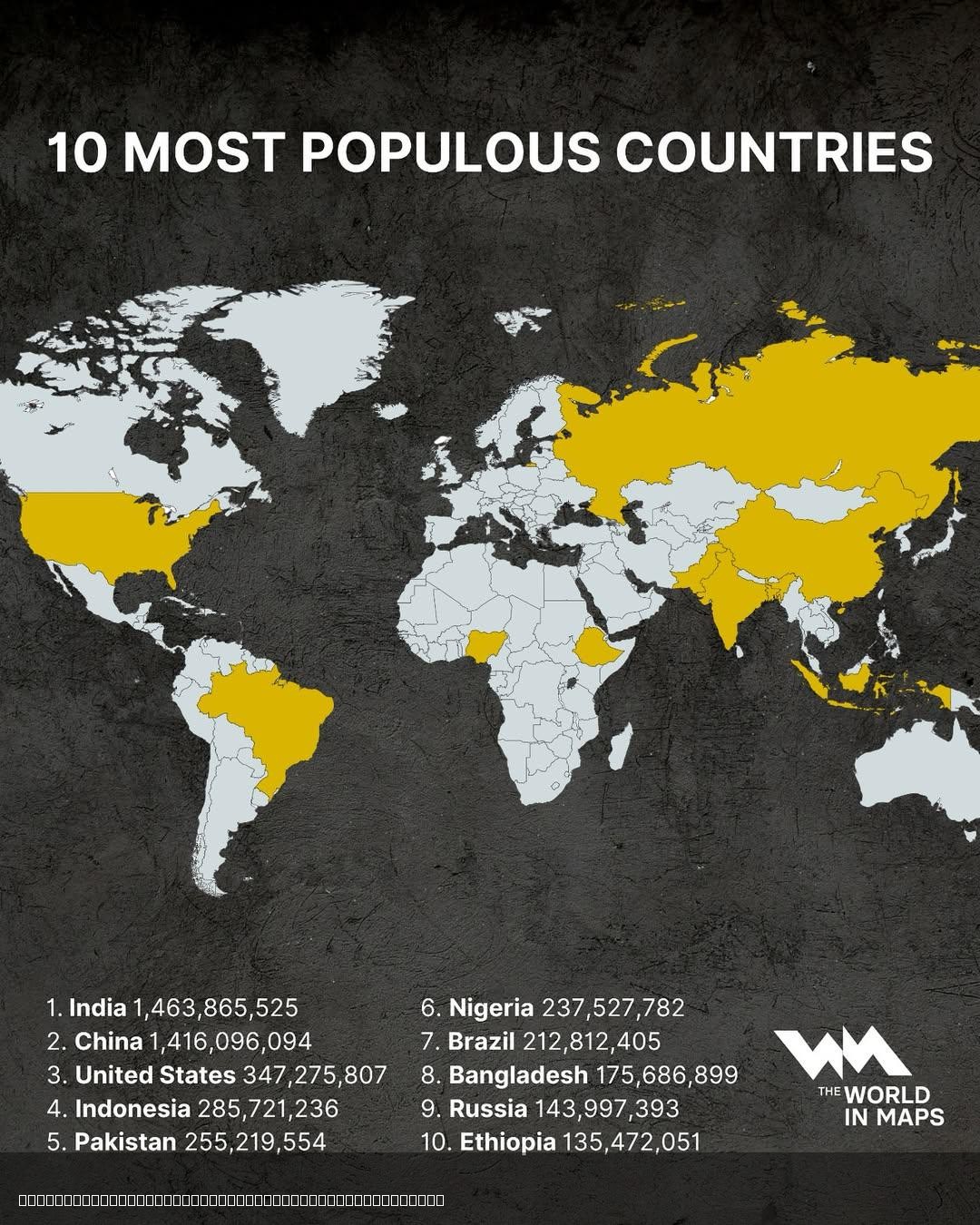
10 Most Populous Countries in the World Map
The "10 Most Populous Countries in the World Map" provides a clear visualization of the countries with the highest popul...
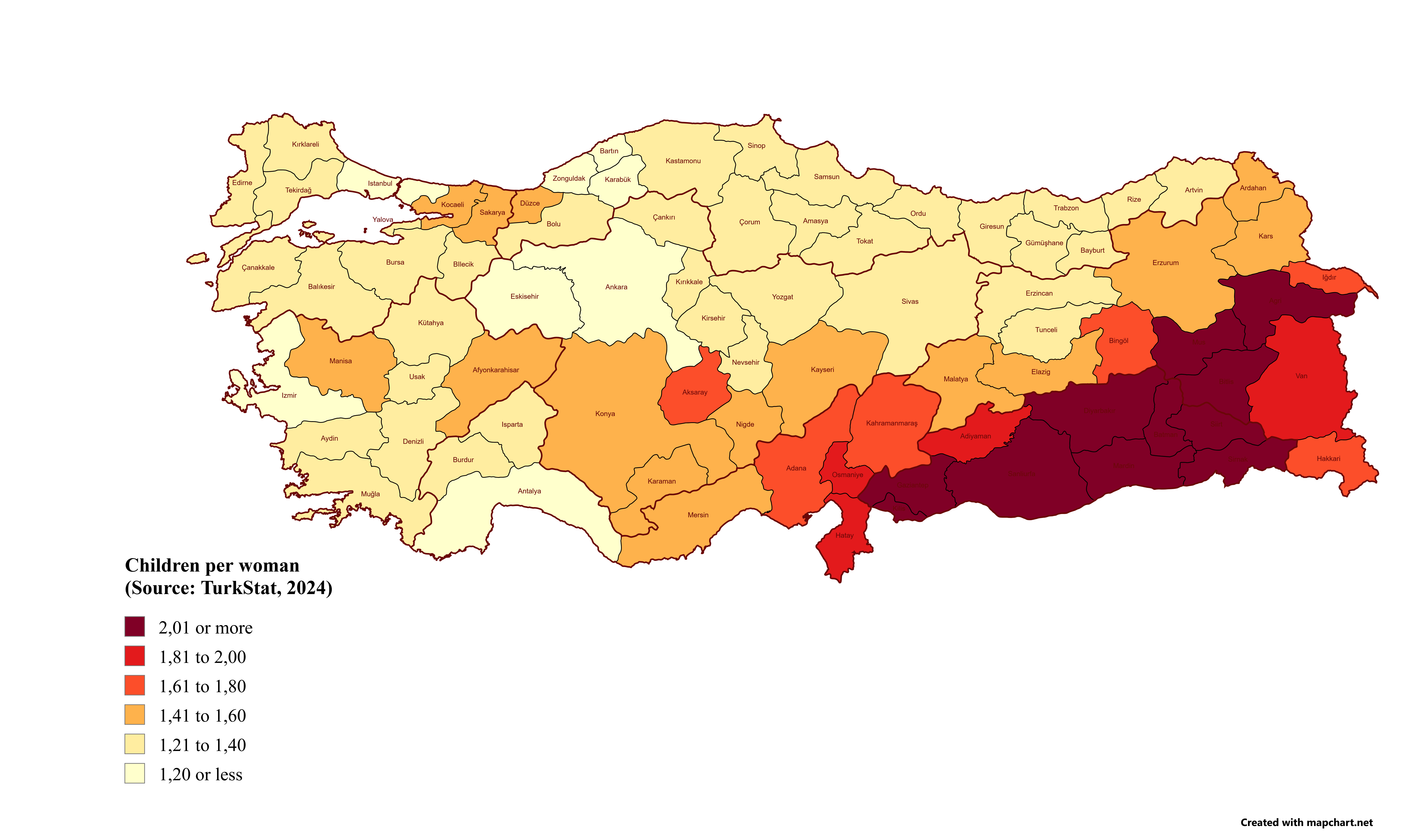
Children per Woman in Turkey by Province Map
The "Children per Woman in Turkey by Province Map" provides a visual representation of fertility rates across Turkey's p...
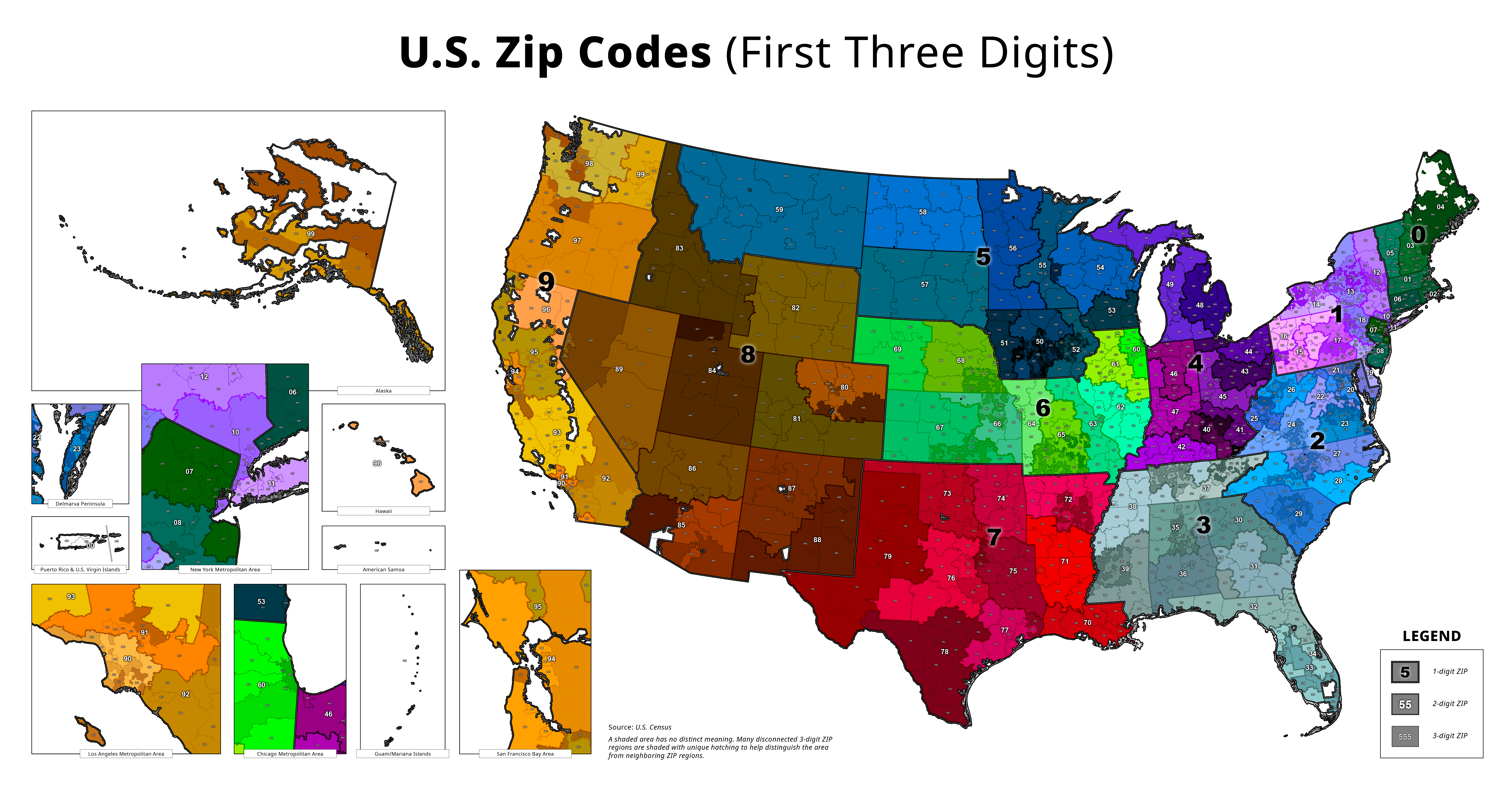
Map of America's Zip Codes
The "Map of America's Zip Codes" provides a comprehensive visualization of the postal code system across the United Stat...