poverty Maps
21 geographic visualizations tagged with "poverty"
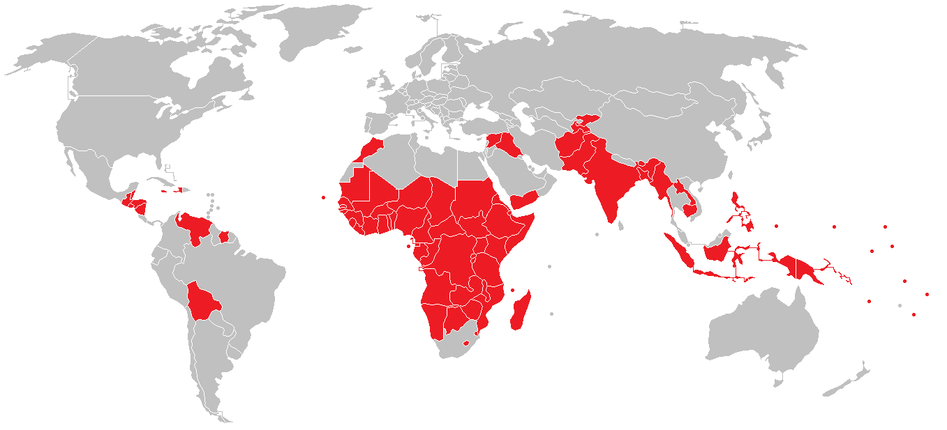
Countries with Lower HDI than West Bank Map
The visualization titled "Countries with Lower HDI than the West Bank & Gaza Strip in 2022" highlights a significant asp...
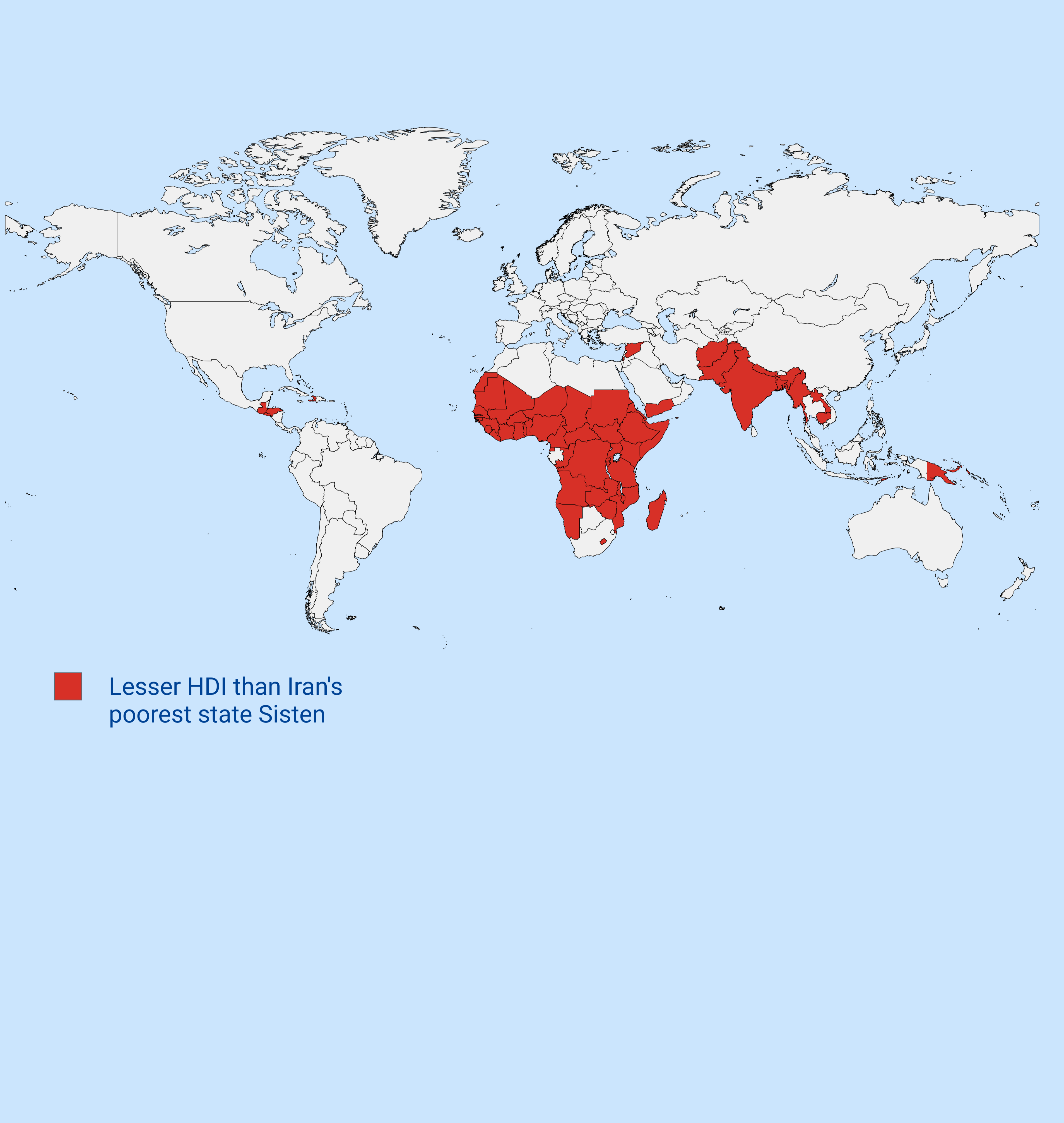
Countries with Lower HDI than Iran's Poorest State Map
The map titled "Countries with Lower HDI than Iran's Poorest State" visually represents nations that exhibit a lower Hum...
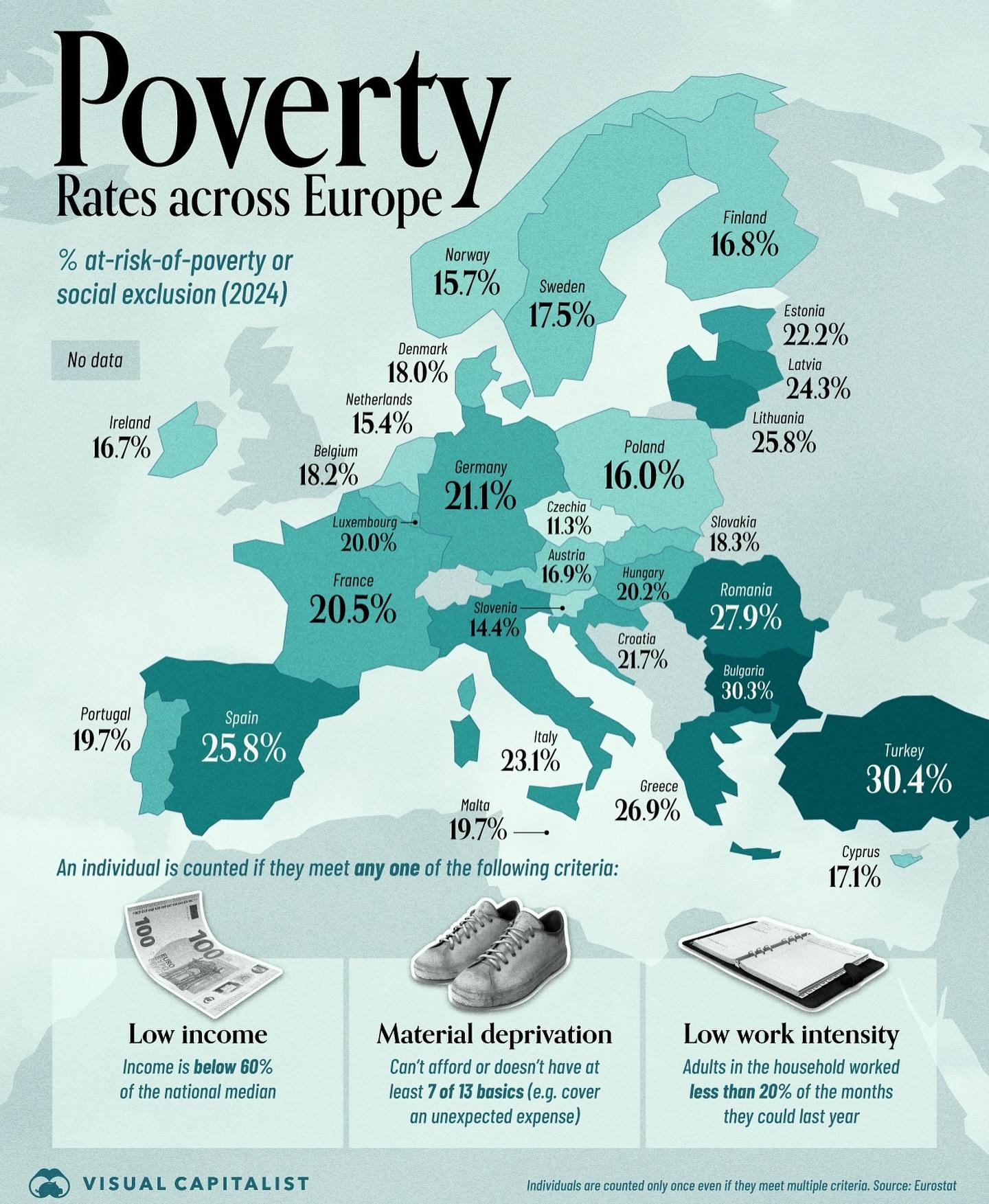
Poverty Across Europe Map
The "Poverty Across Europe Map" provides a detailed visualization of poverty levels across various European countries. I...
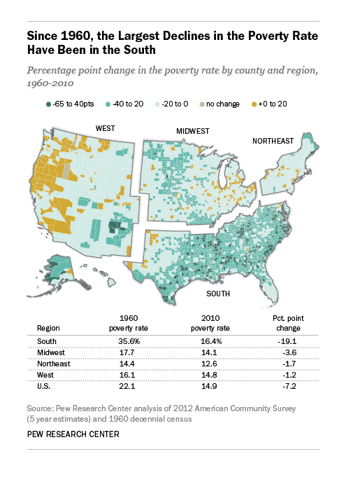
US Poverty Rate Decline Map 1960-2010
The "Decline in the US Poverty Rate 1960-2010" map provides a visual representation of how poverty levels have changed a...
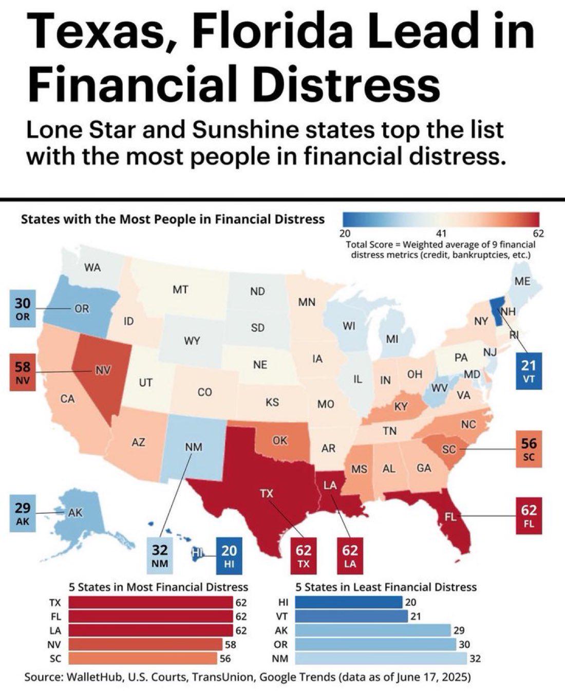
Financial Distress Map of Texas and Florida
The visualization titled "Texas, Florida Lead in Financial Distress" highlights the financial struggles faced by residen...
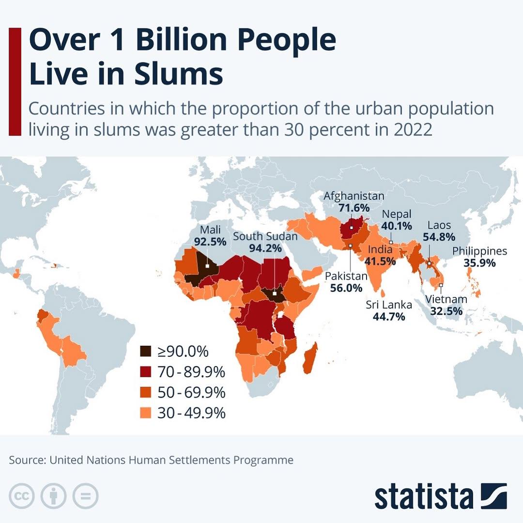
Slum Population Distribution Map
The map titled "Over 1 billion people live in slums" provides a stark visual representation of the global distribution o...
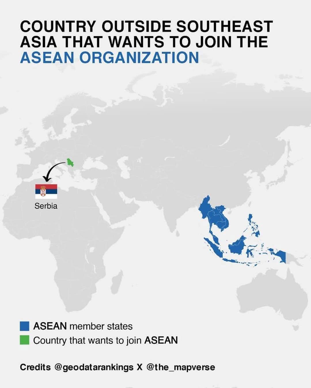
Economic Challenges Map of Serbia
This visualization highlights key economic challenges facing Serbia, illustrating various socio-economic indicators acro...
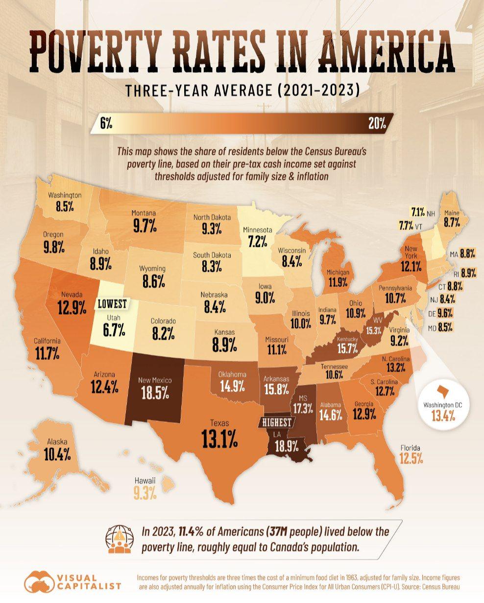
Poverty Rates in US Map
The "Poverty Rates in US Map" presents a visual representation of poverty levels across the United States, highlighting ...
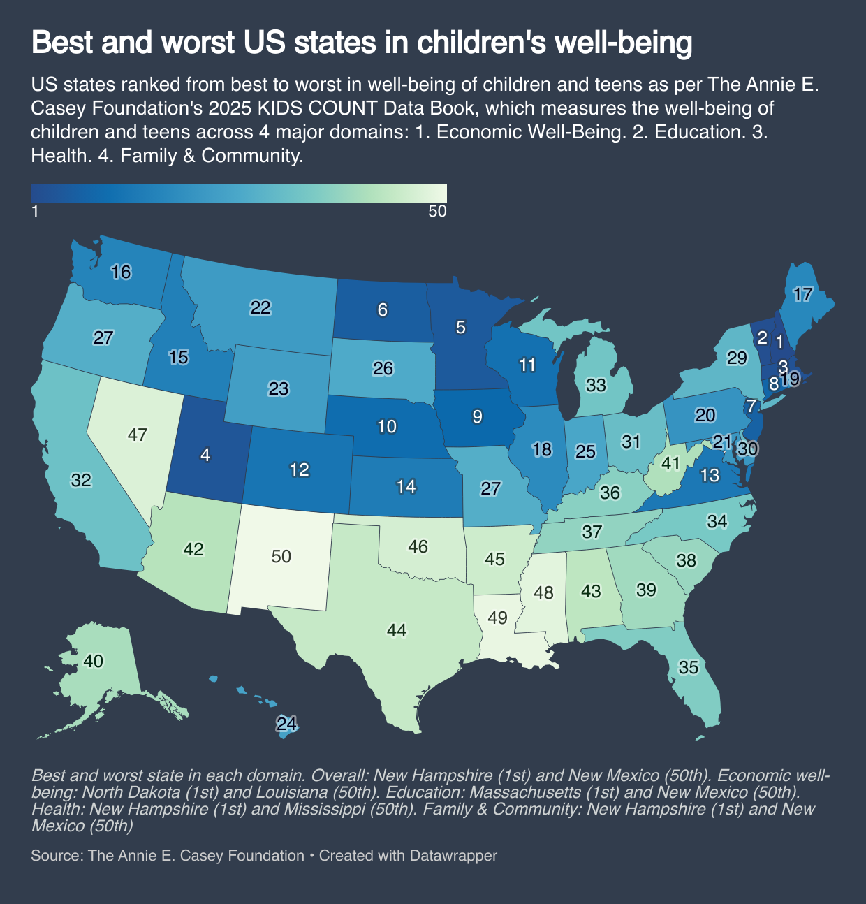
Children's Well-Being by State Map
...
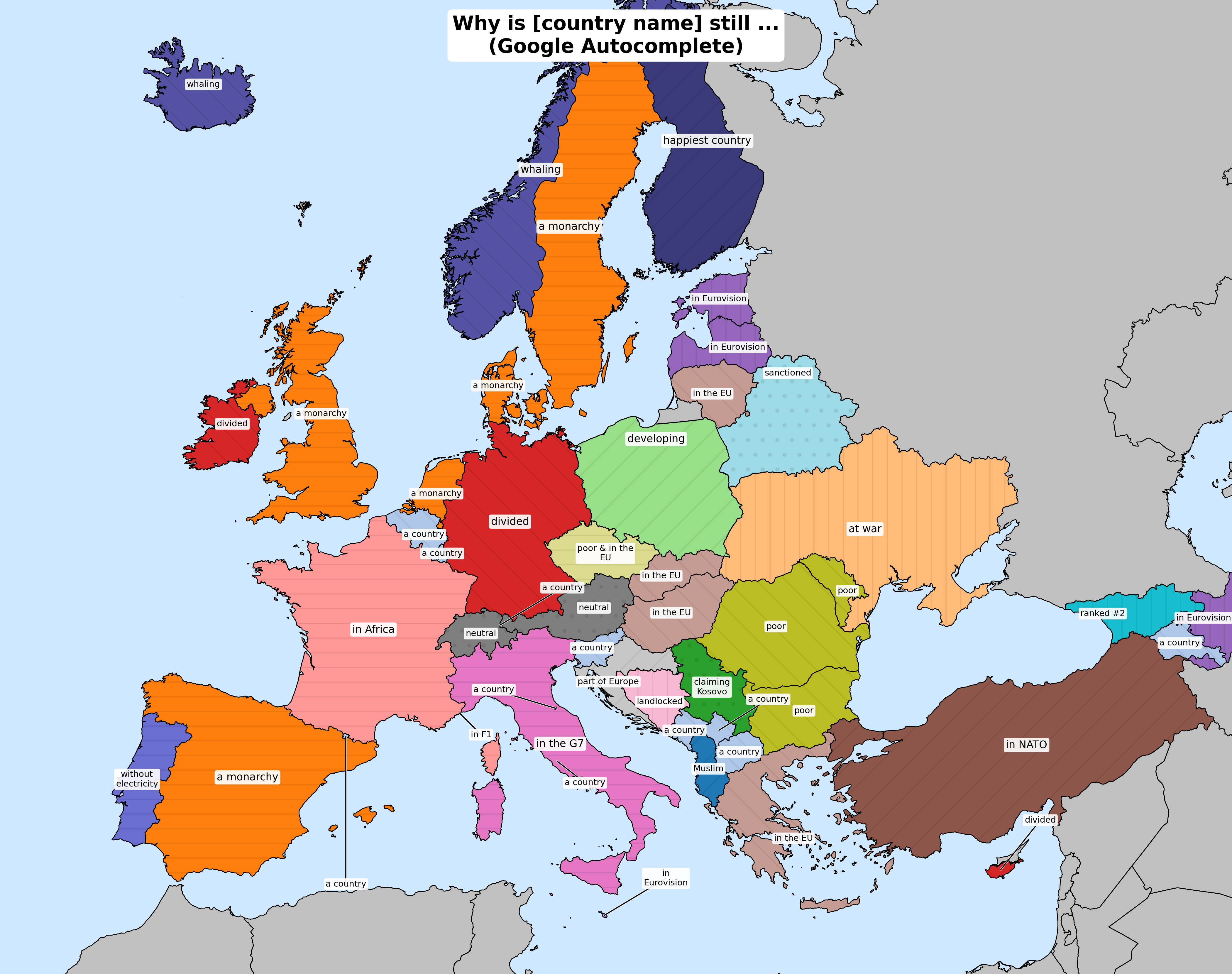
Economic Development Map of Haiti
Interestingly, Haiti ranks among the poorest countries in the Western Hemisphere, with a GDP per capita of around $1,200...
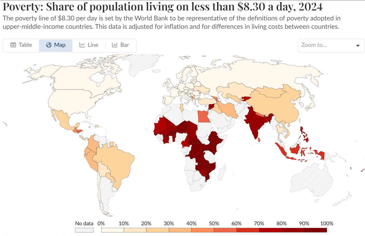
% of People Living Under $8.30 a Day Map
This map provides a visual representation of the percentage of people living on less than $8.30 per day across different...
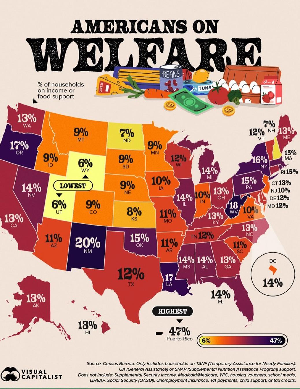
% of Households on Income or Food Support Map
The "% of Households on Income or Food Support" map provides a visual representation of the percentage of households wit...
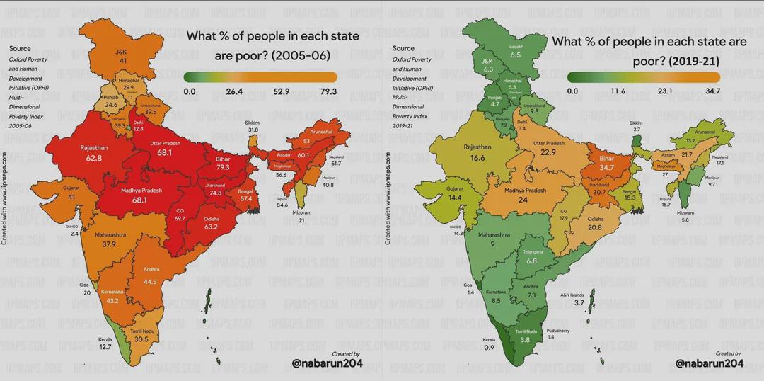
Poverty Change in India Over 15 Years Map
This map visualizes the changes in poverty levels across India over a span of 15 years. It highlights shifts in poverty ...
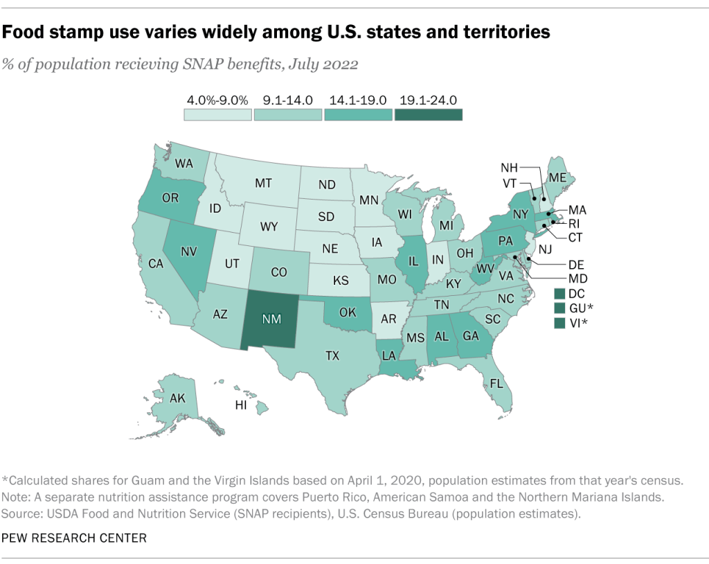
SNAP Dependency by State Map
The "SNAP Dependency by State Map" visually illustrates the percentage of the population in each U.S. state that relies ...
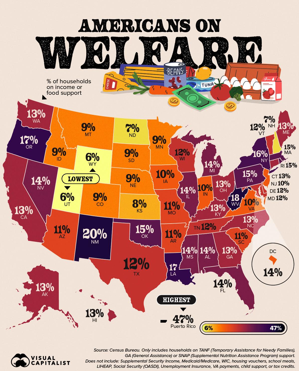
Map of American Households on Income or Food Support
The map titled "Percentage of American Households on Income or Food Support" provides a clear visual representation of t...
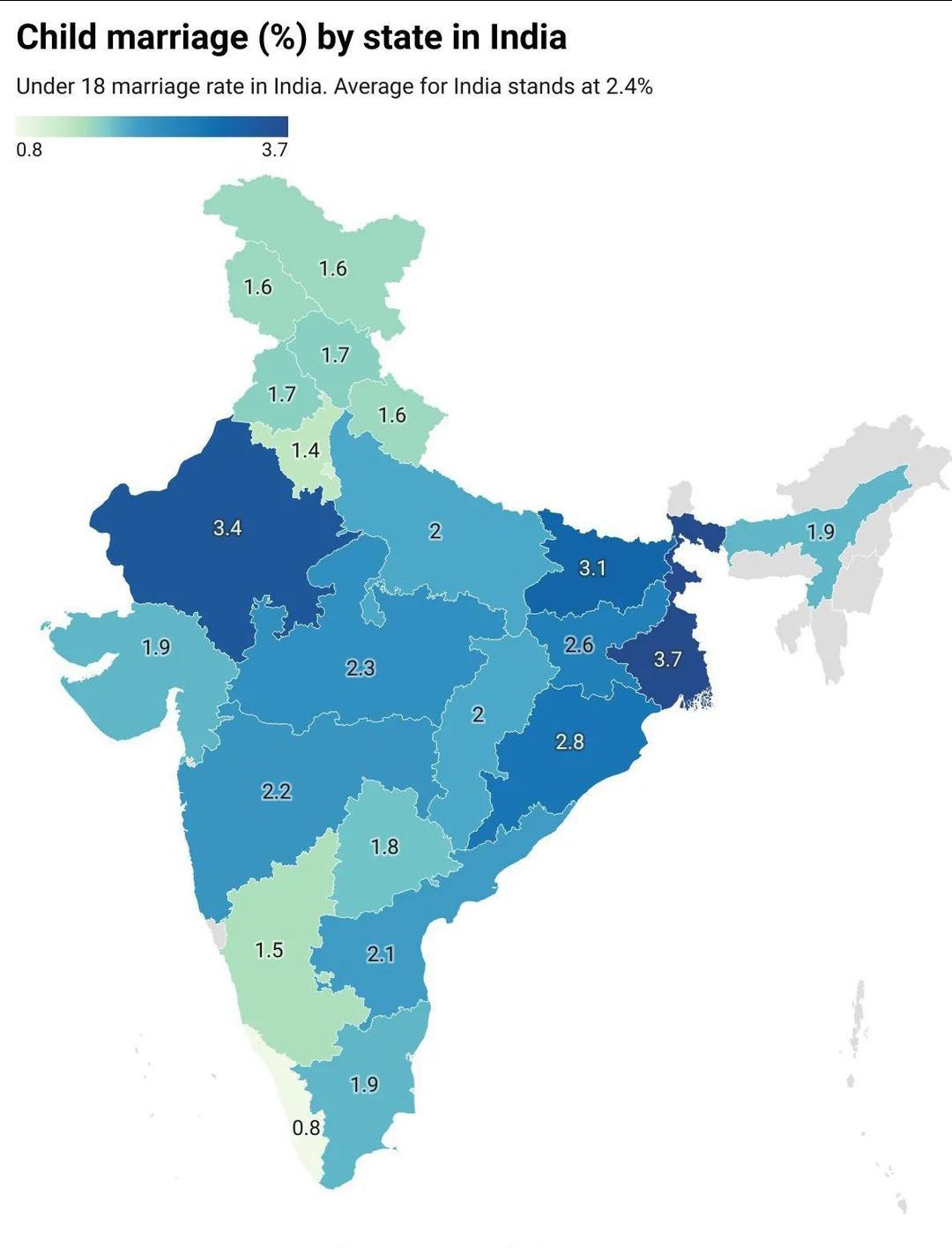
Child Marriage in India Map
...
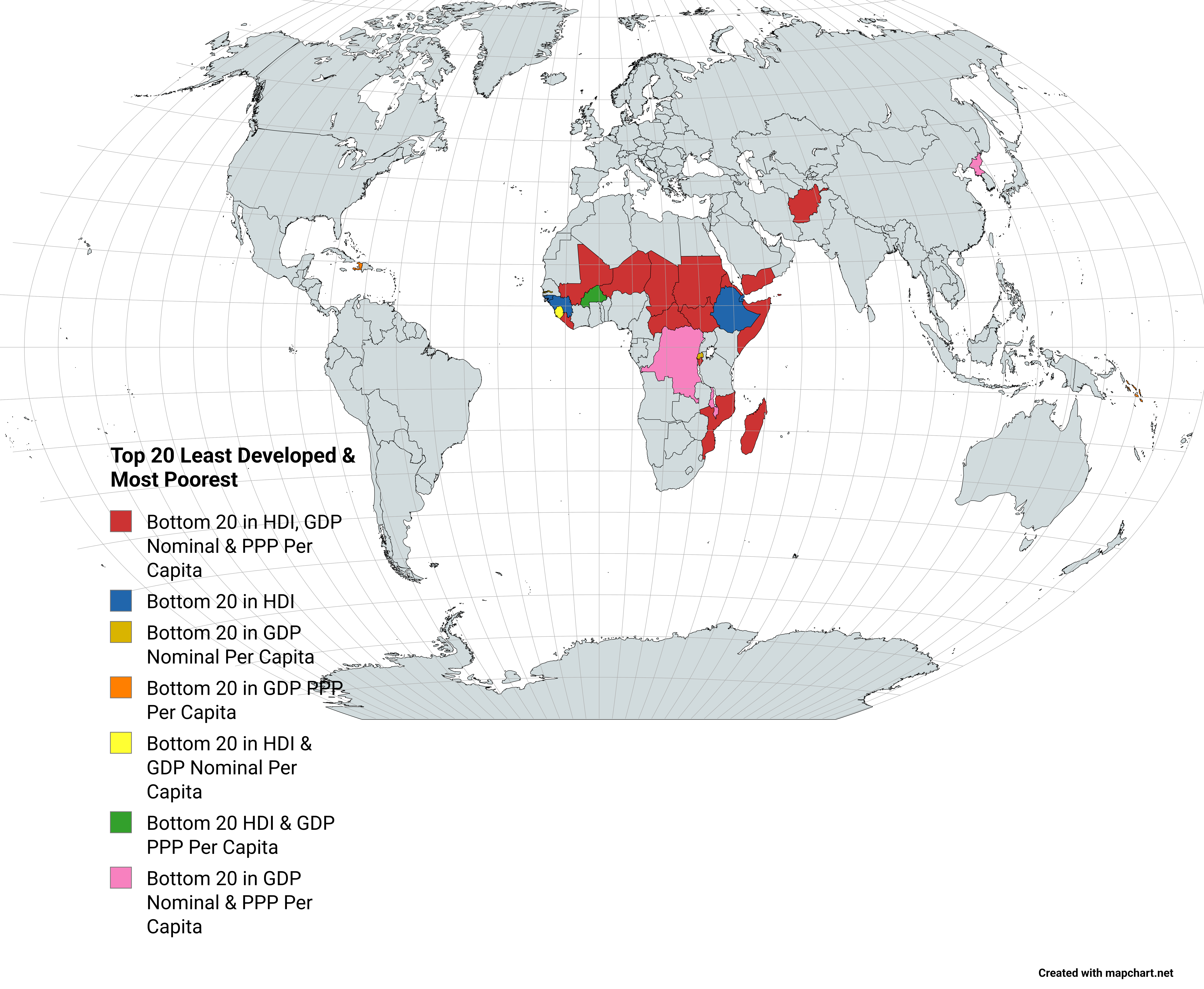
Least Developed and Poorest Countries Map
The "Top 20 Least Developed & Most Poorest Countries" map visually illustrates the economic and social challenges faced ...
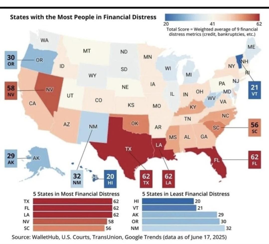
States with Most People in Financial Distress Map
This map illustrates the states with the highest numbers of individuals experiencing financial distress. It highlights t...
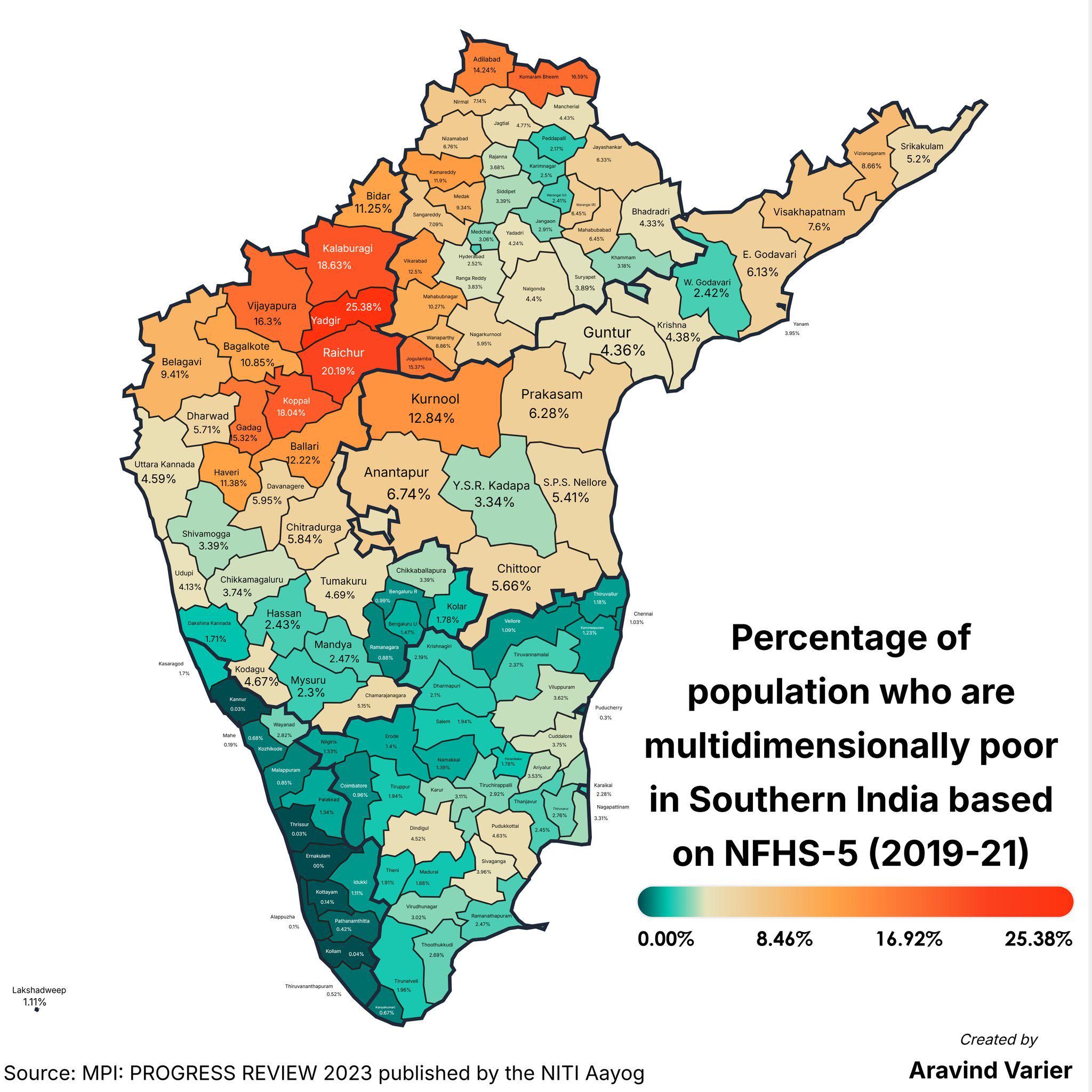
Multidimensional Poverty Percentage Map by District
The "Percentage of People Who Are Multidimensionally Poor (District Wise) Map" provides a detailed breakdown of multidim...
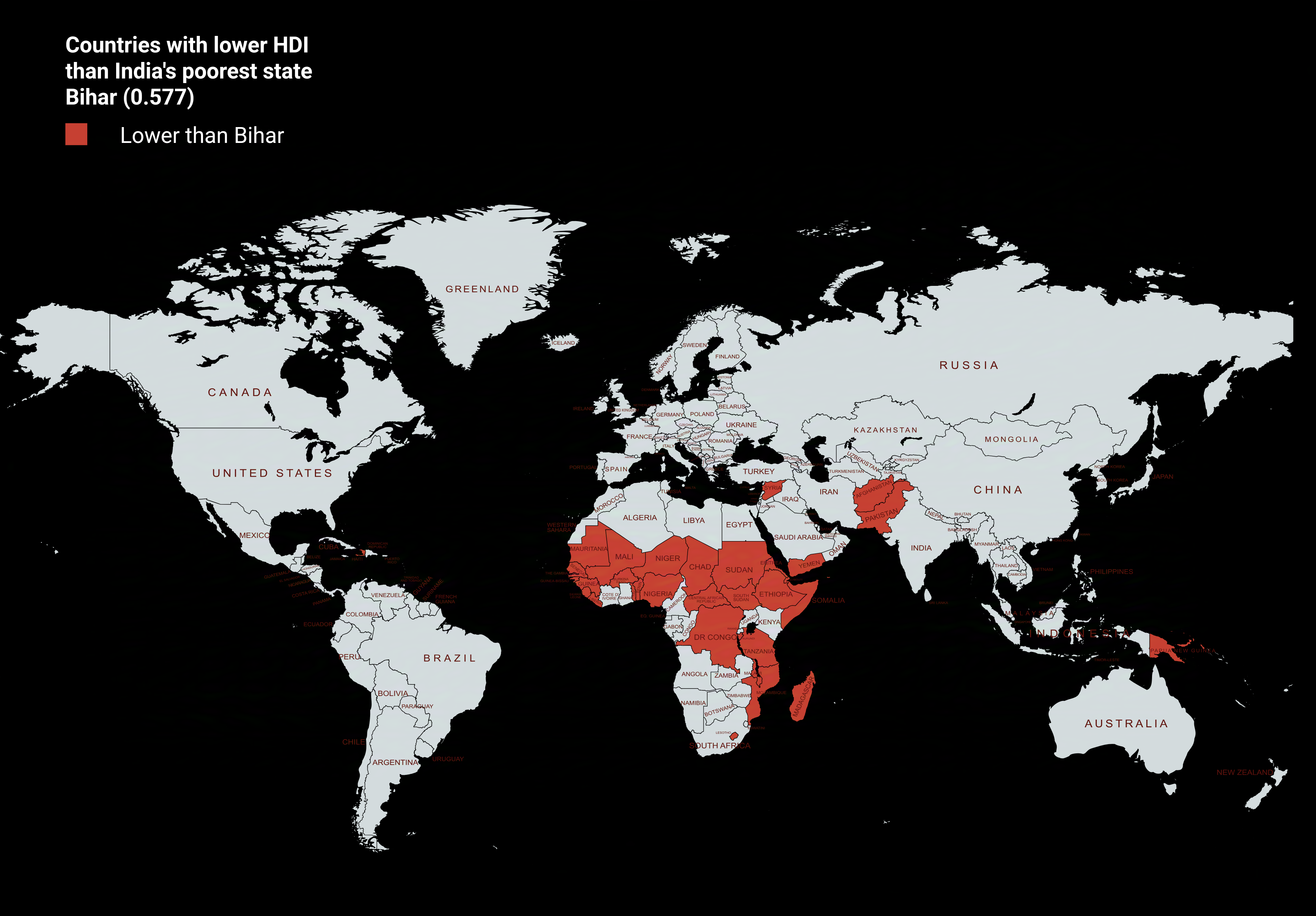
Countries with Lower HDI than Bihar Map
The visualization titled "Countries with Lower HDI than Bihar Map" provides a stark comparison of human development acro...
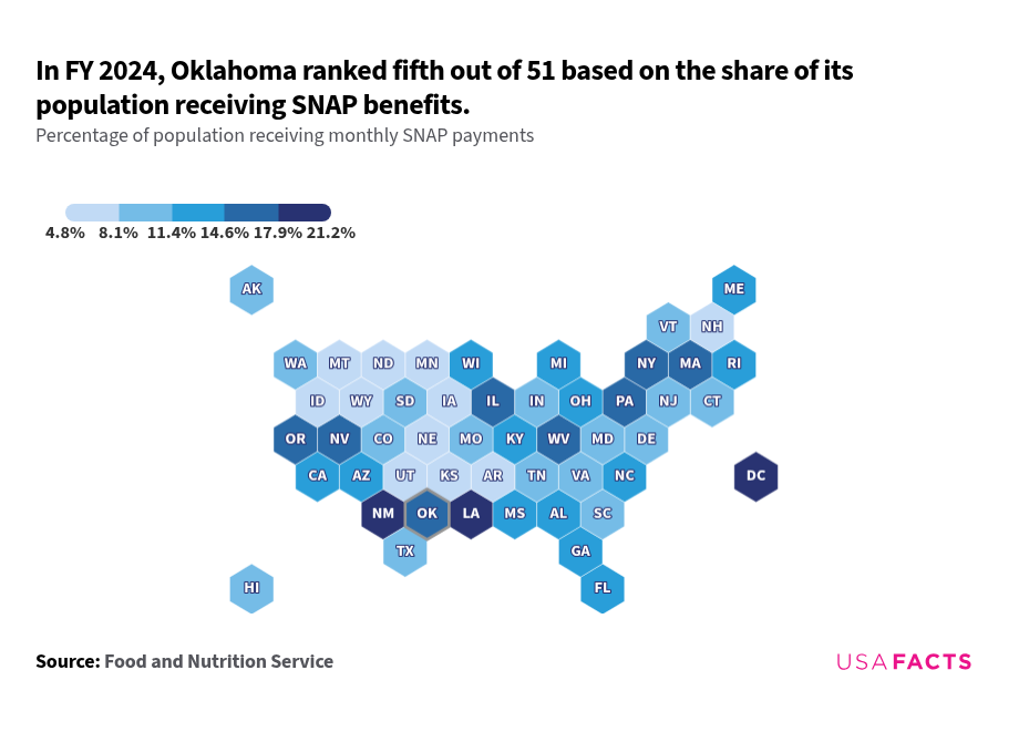
SNAP Benefits Distribution Map in the USA
The SNAP interactive map from USAFacts provides a unique visualization of the distribution of Supplemental Nutrition Ass...