Geographic Visualizations
Explore our curated collection of fascinating geographic visualizations and cartographic analyses. Discover detailed maps, data visualizations, and geographical insights from around the world.
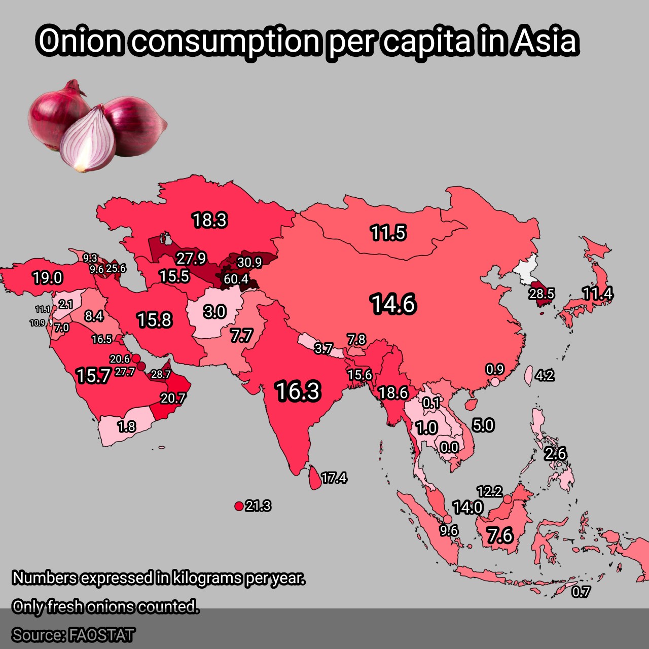
Onion Consumption Per Capita in Asia Map
## What This Map Shows...
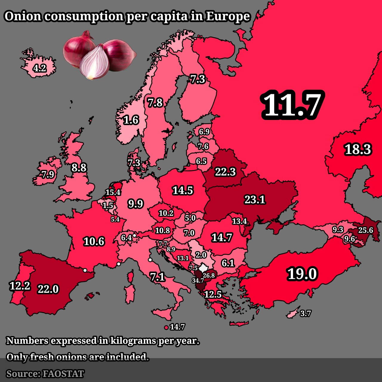
Onion Consumption Per Capita in Europe Map
## What This Map Shows...
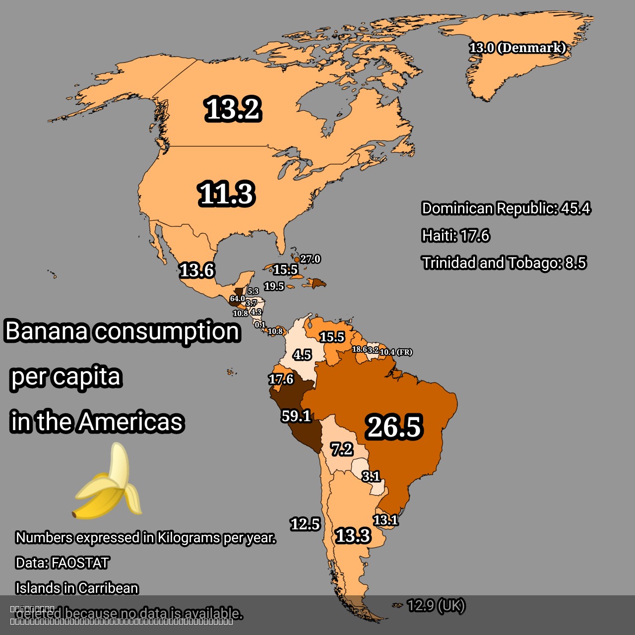
Banana Consumption Per Capita in the Americas Map
## What This Map Shows...
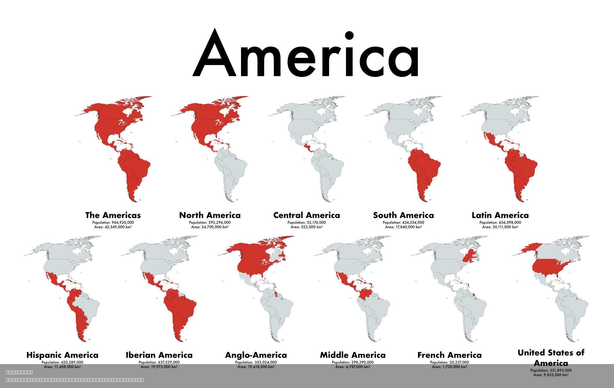
Cultural Diversity Map of the Americas
## What This Map Shows...
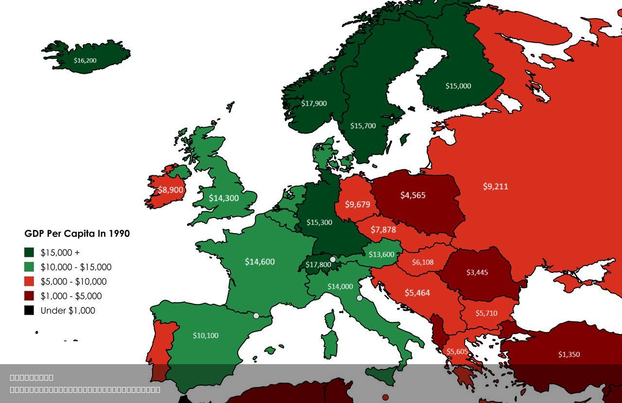
GDP Per Capita by Country Map 1990
## What This Map Shows...
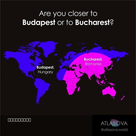
Proximity Map of Budapest and Bucharest
## What This Map Shows\nThis intriguing visualization provides a clear perspective on the geographical proximity of two ...
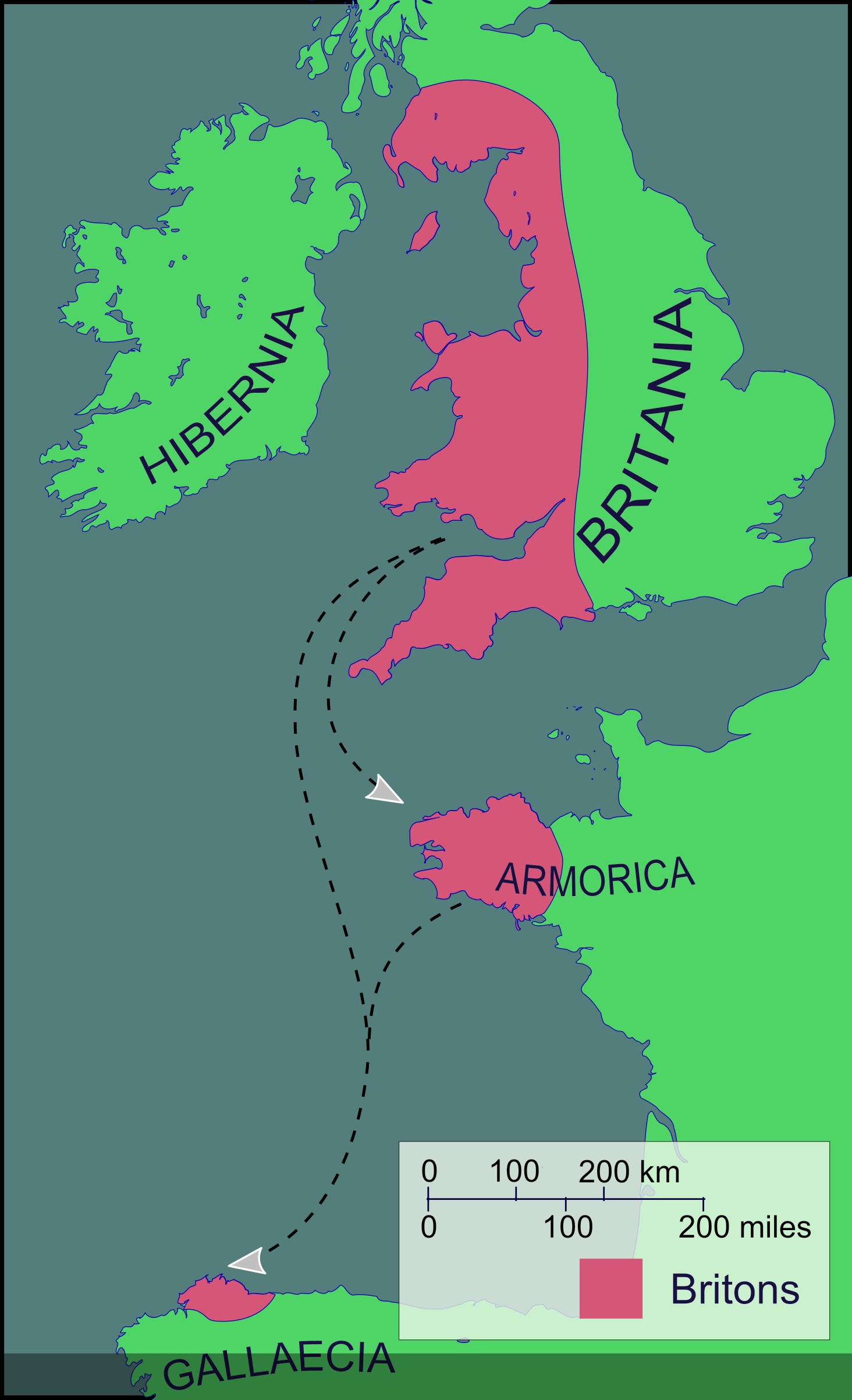
Brittonic-speaking Community Map of the Sixth Century
## What This Map Shows\nThe map titled \...
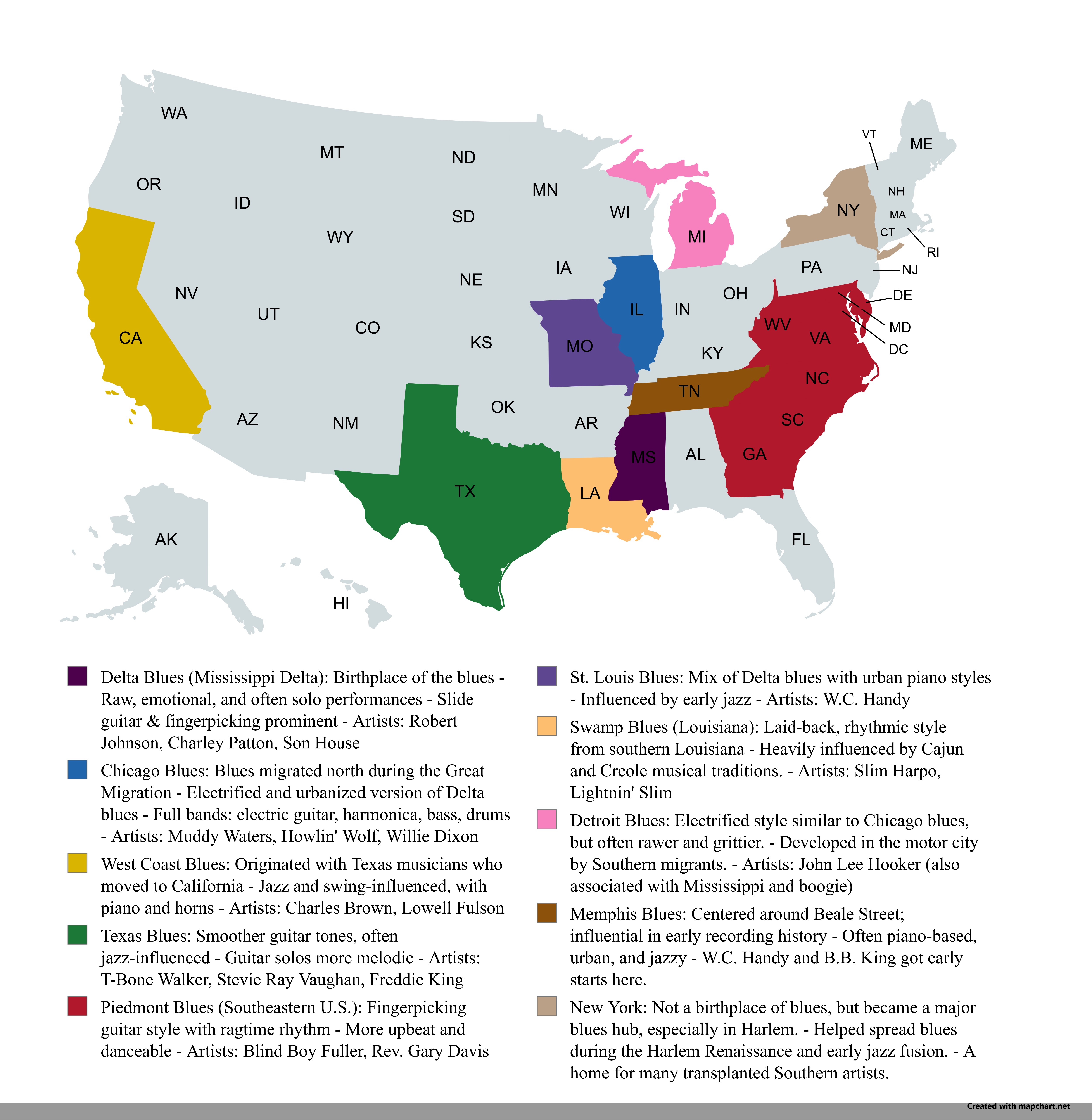
Regional Blues Music Map of the USA
## What This Map Shows...
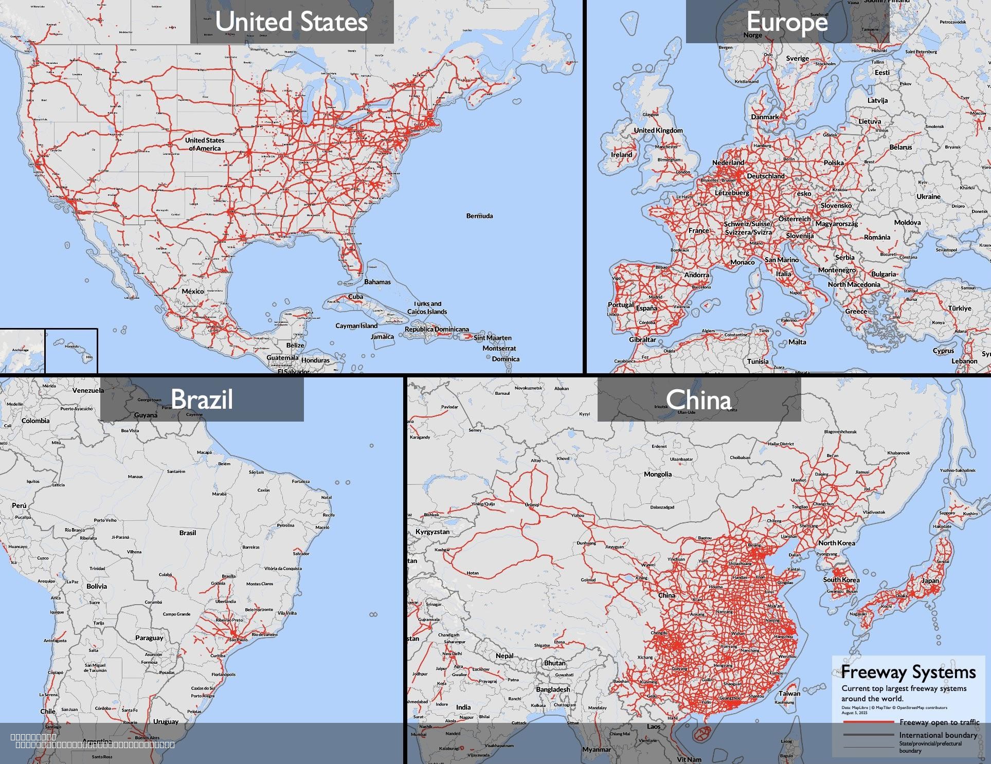
Largest Freeway Systems in 2025 Map
## What This Map Shows...
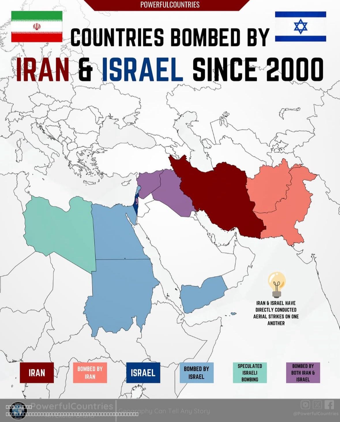
Countries Bombed by Israel and Iran Since 2000 Map
## What This Map Shows...
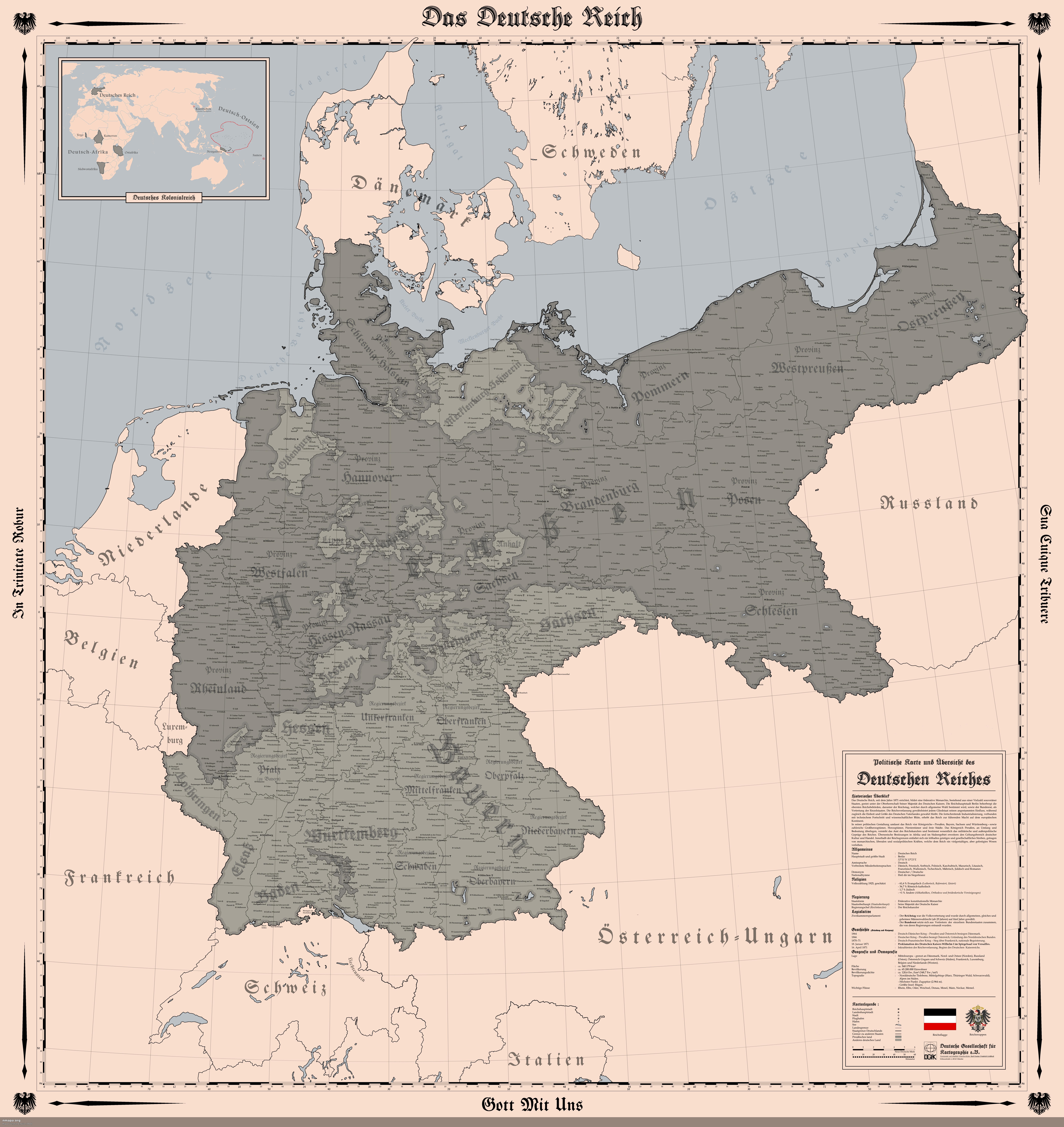
Map of the German Empire in 1914
## What This Map Shows...
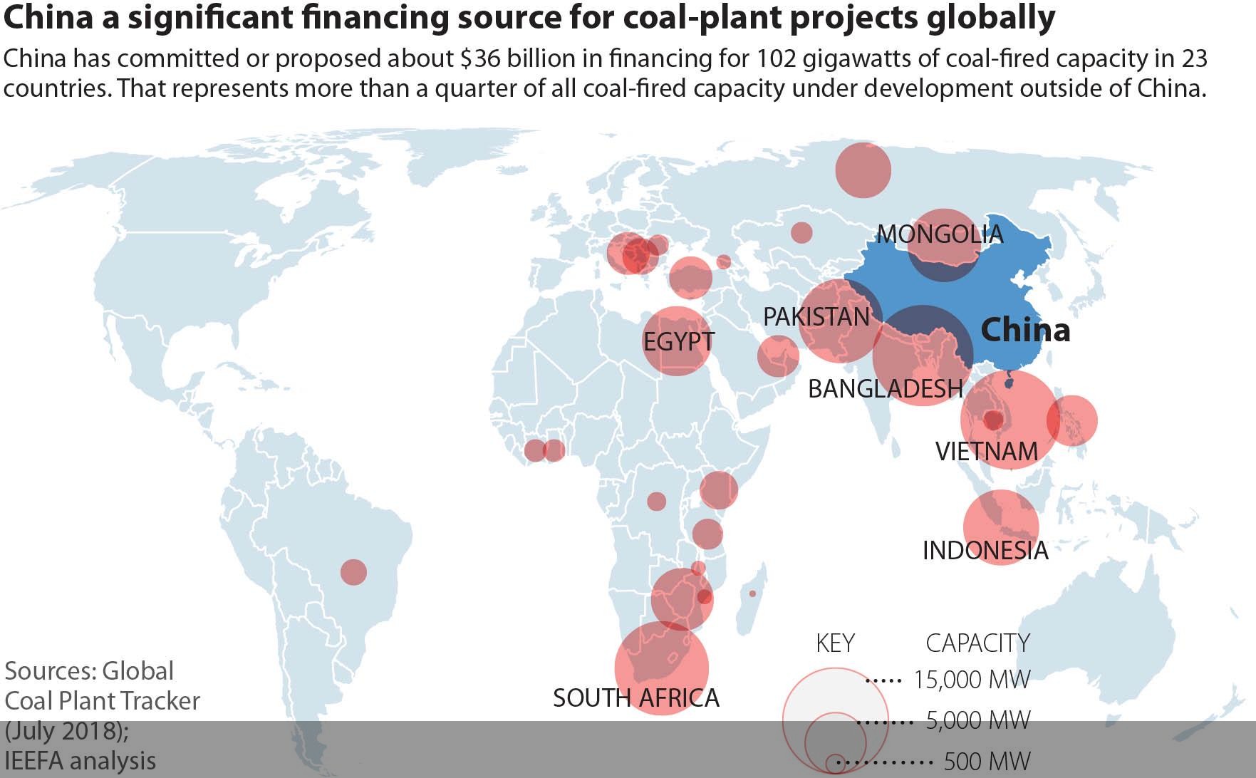
Chinese Funding for Coal Power Plants Outside China Map
## What This Map Shows...
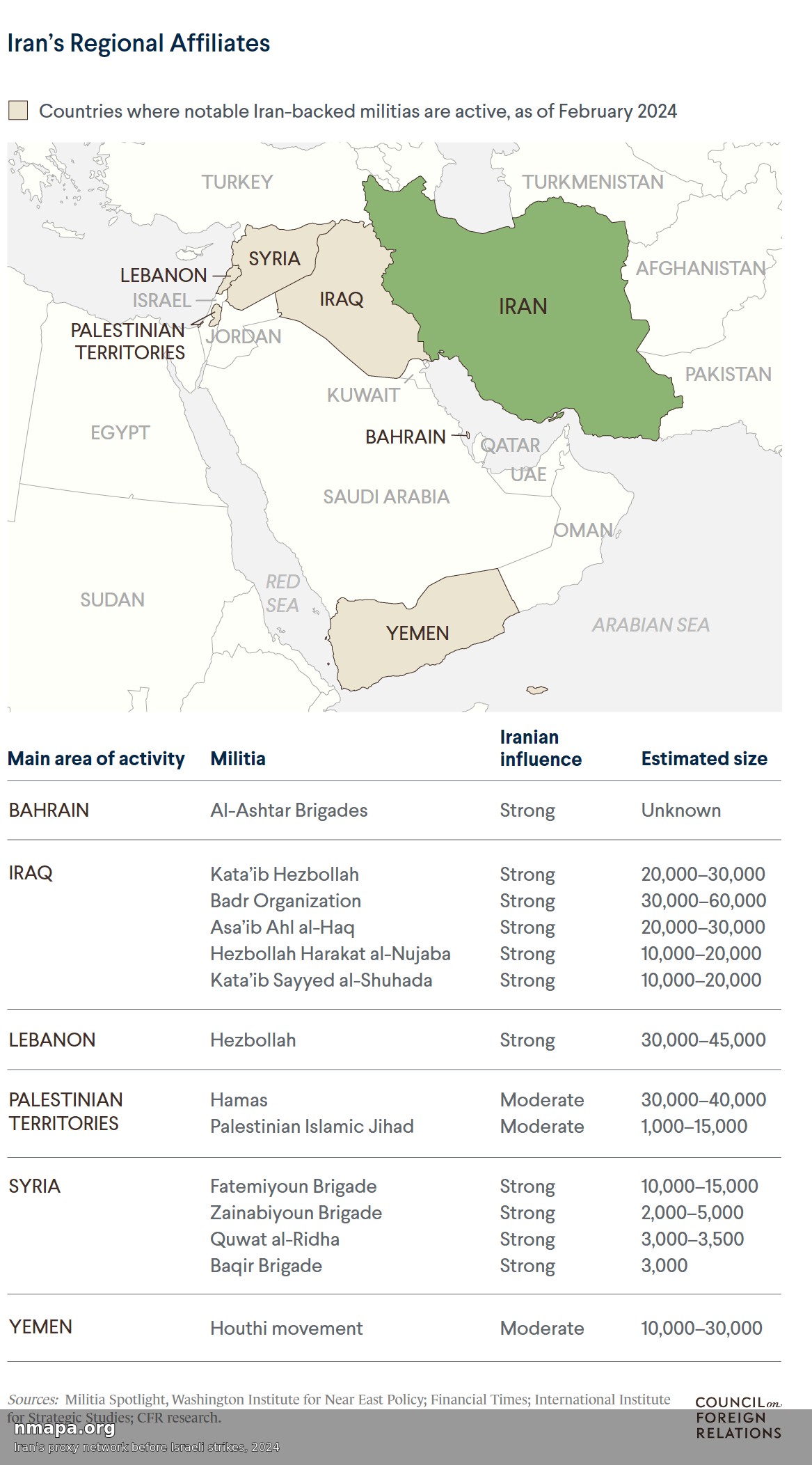
Iran's Proxy Network Map Before Israeli Strikes, 2024
## What This Map Shows...
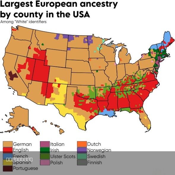
Largest European Ancestry in the US Map
## What This Map Shows...
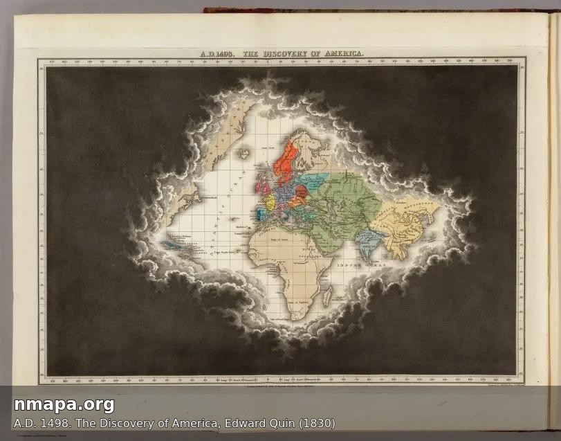
Map of America in A.D. 1498 by Edward Quin
## What This Map Shows...
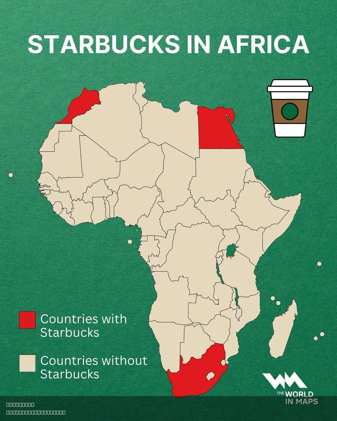
Starbucks Locations in Africa Map
## What This Map Shows\nThis visualization highlights the locations of Starbucks stores across Africa. The map provides ...
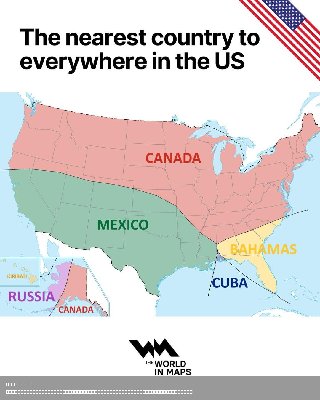
Nearest Foreign Country to Every Point in the United States Map
## What This Map Shows...
