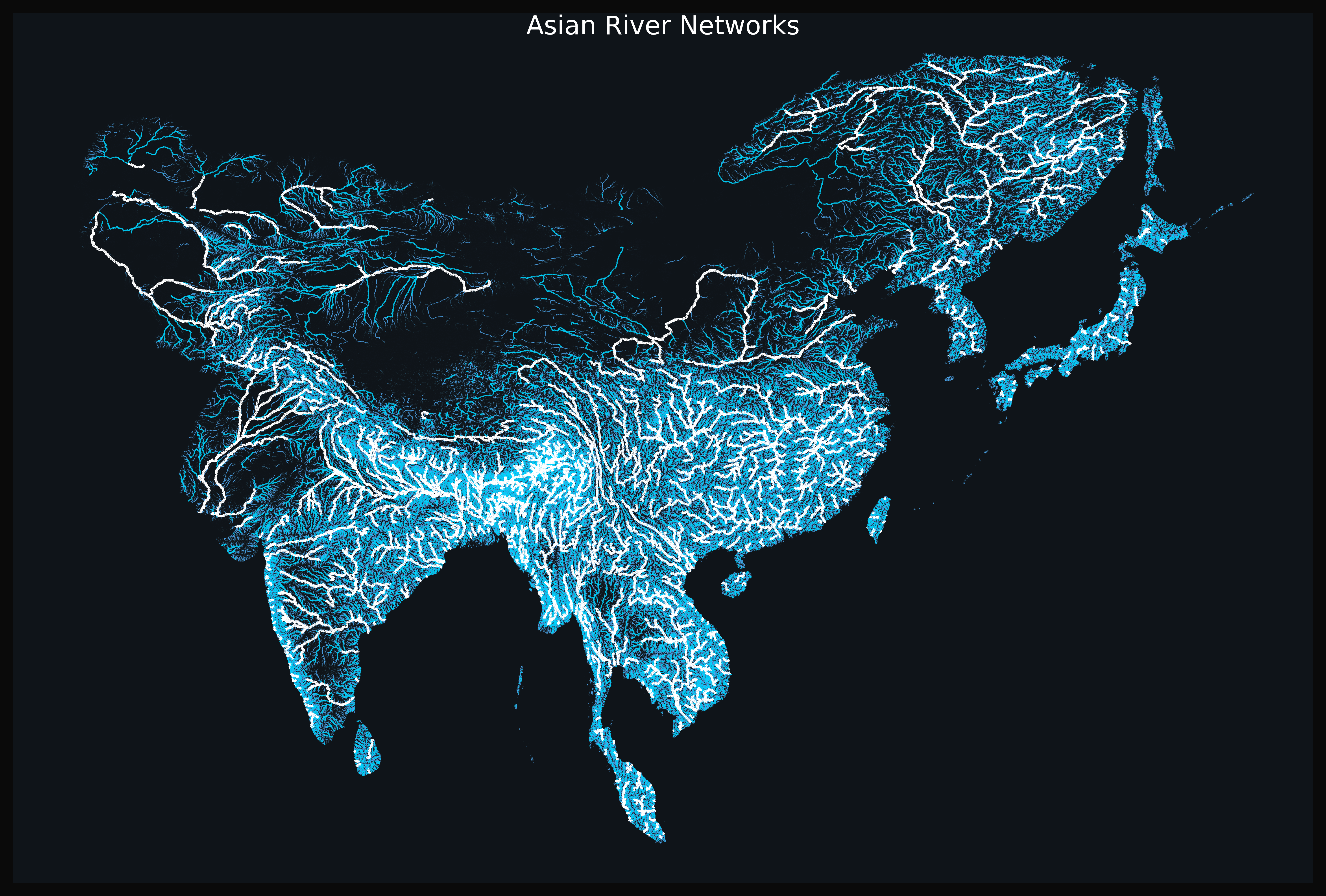
Geographic Visualizations
Explore our curated collection of fascinating geographic visualizations and cartographic analyses. Discover detailed maps, data visualizations, and geographical insights from around the world.
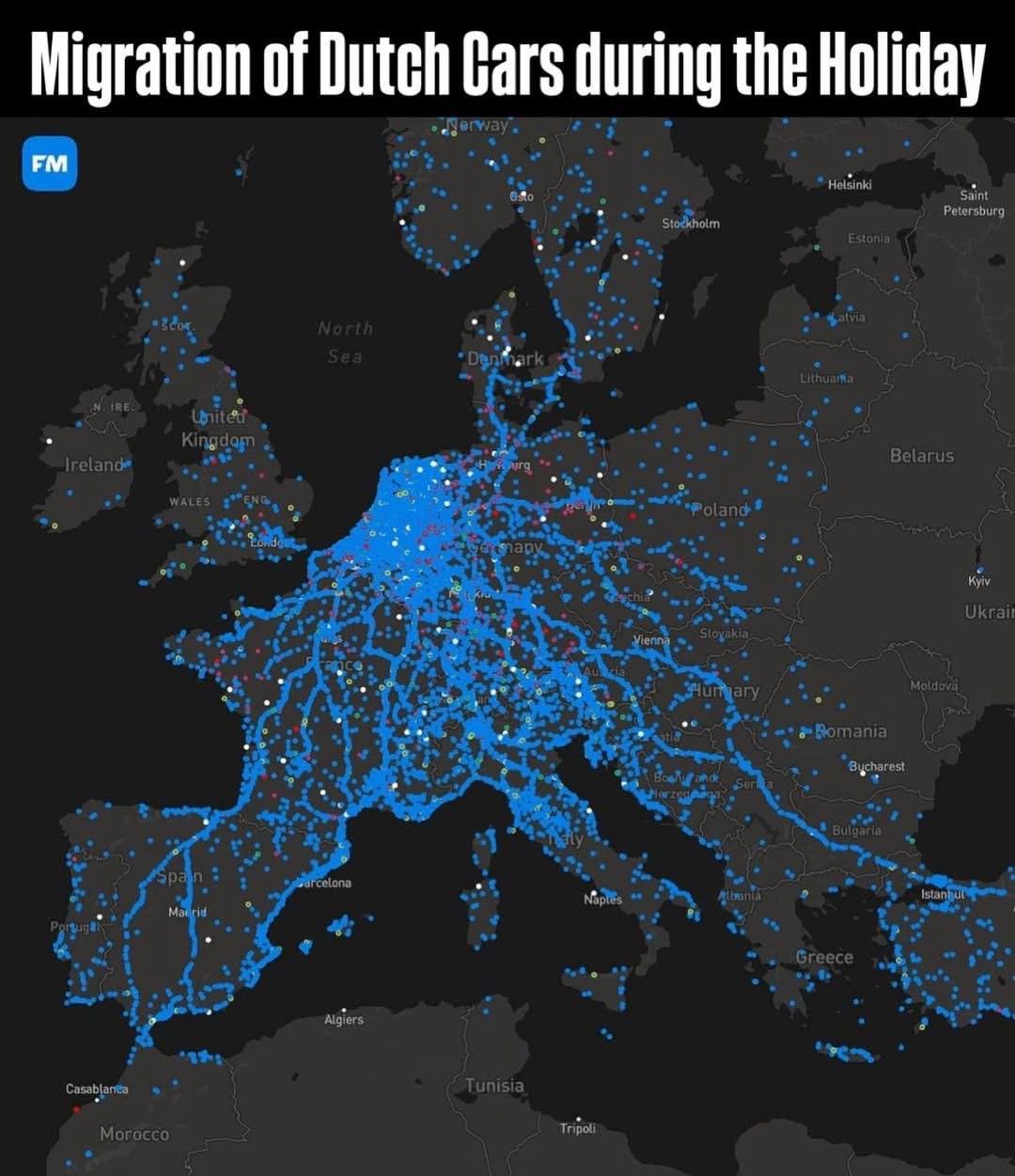
Migration of Dutch Cars During Summer Holiday Map
## What This Map Shows...
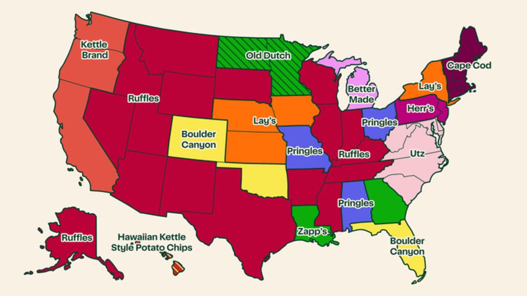
Most Popular Potato Chip Brand by State Map
## What This Map Shows...
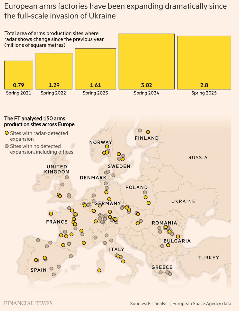
European Arms Factories Expansion Map 2021-2025
## What This Map Shows...
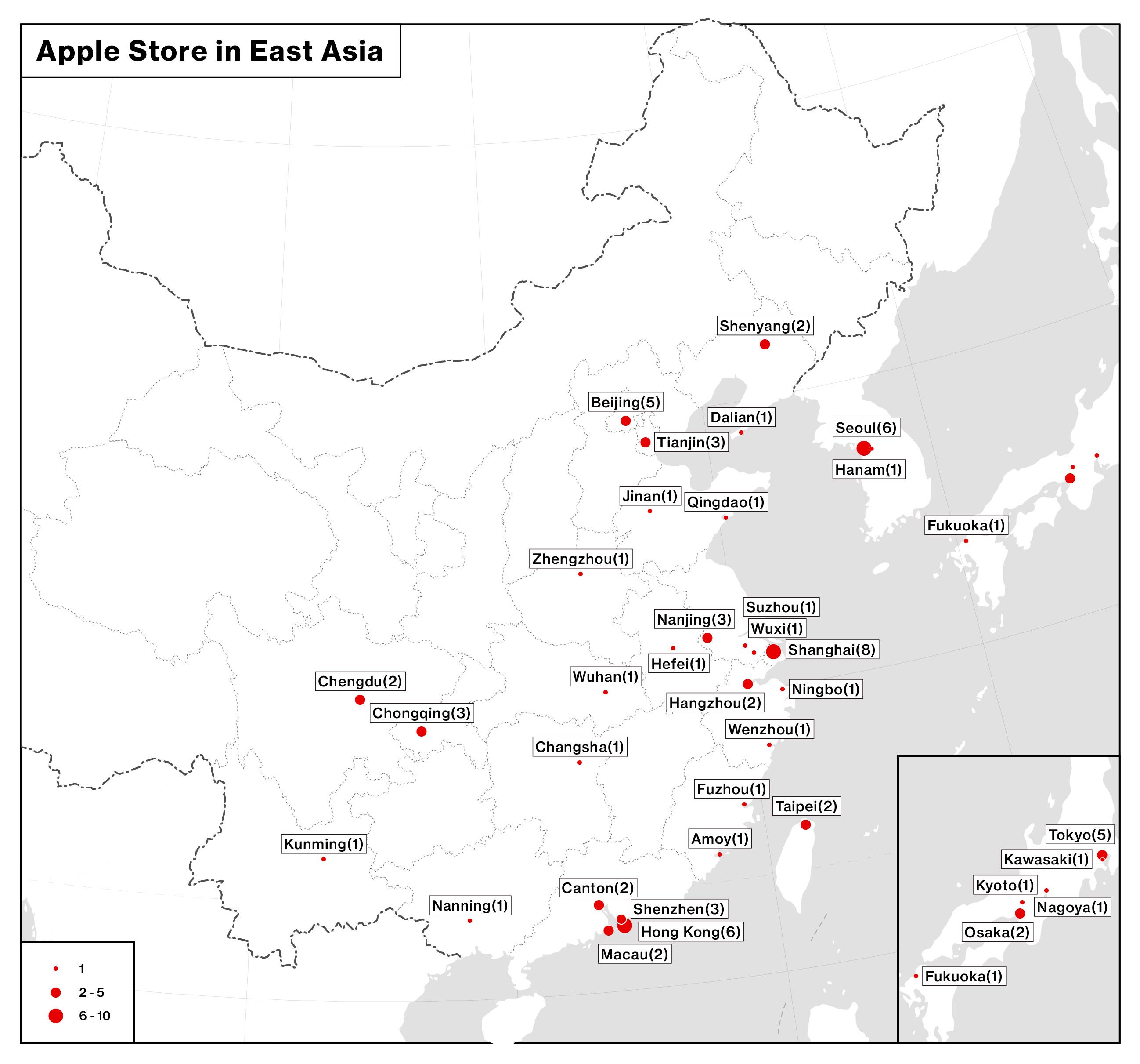
Apple Store Locations in East Asia Map 2025
## What This Map Shows...
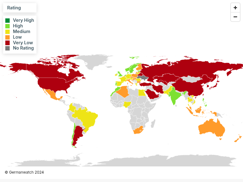
Climate Change Performance Index 2025 Map
## What This Map Shows...
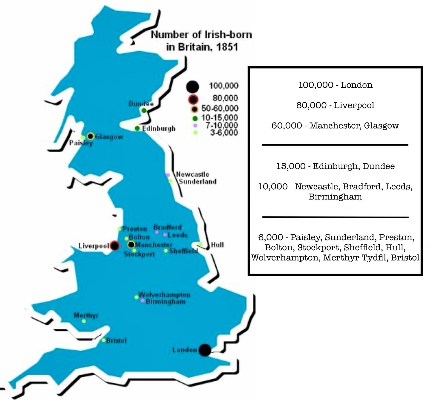
Map of Irish-born Population in Britain in 1851
## What This Map Shows...
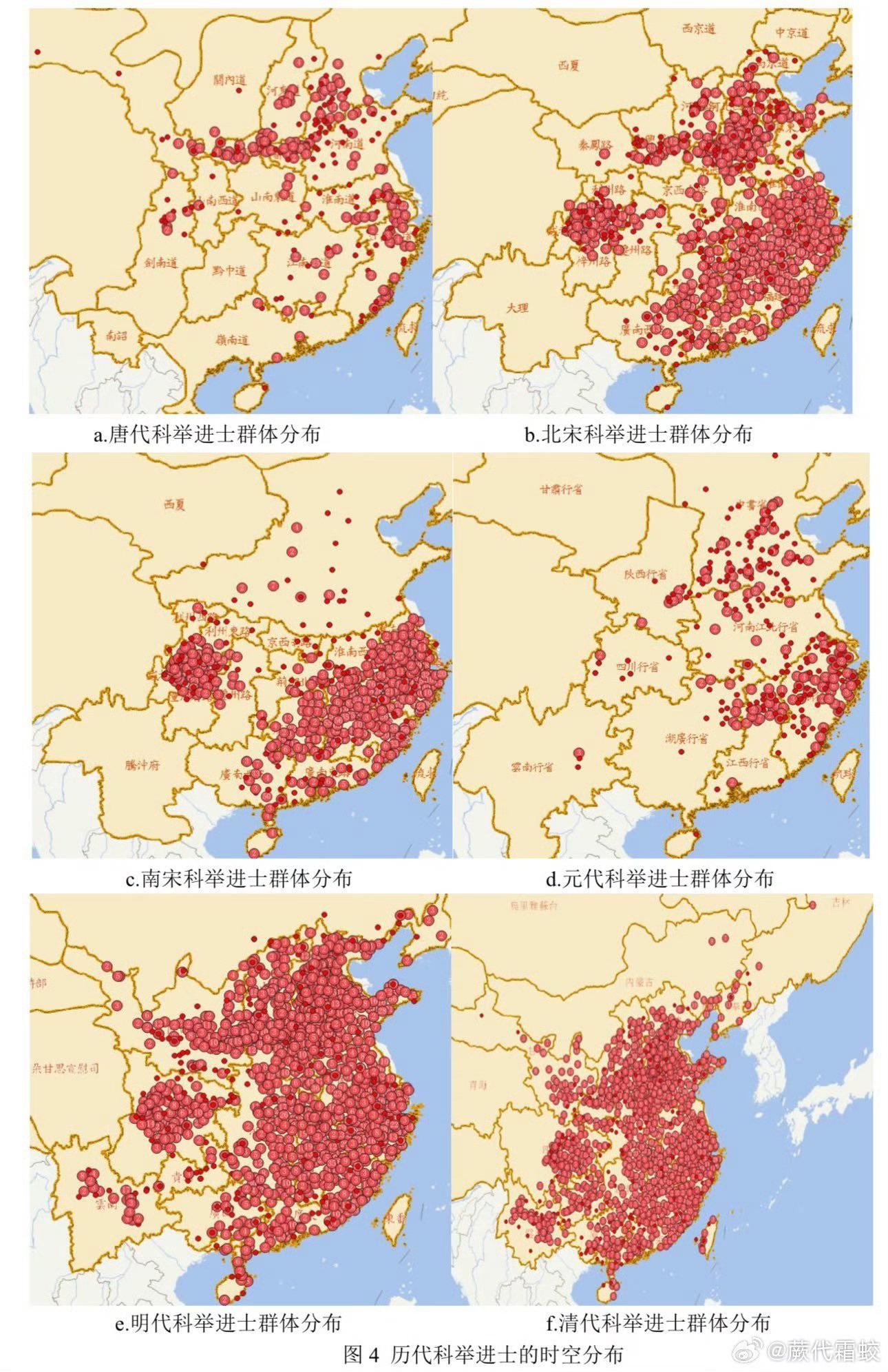
Map of No.1 Scholars in Chinese Civil Exams
## What This Map Shows\nThis map visualizes the geographical origins of the top scholars who achieved the highest rank i...
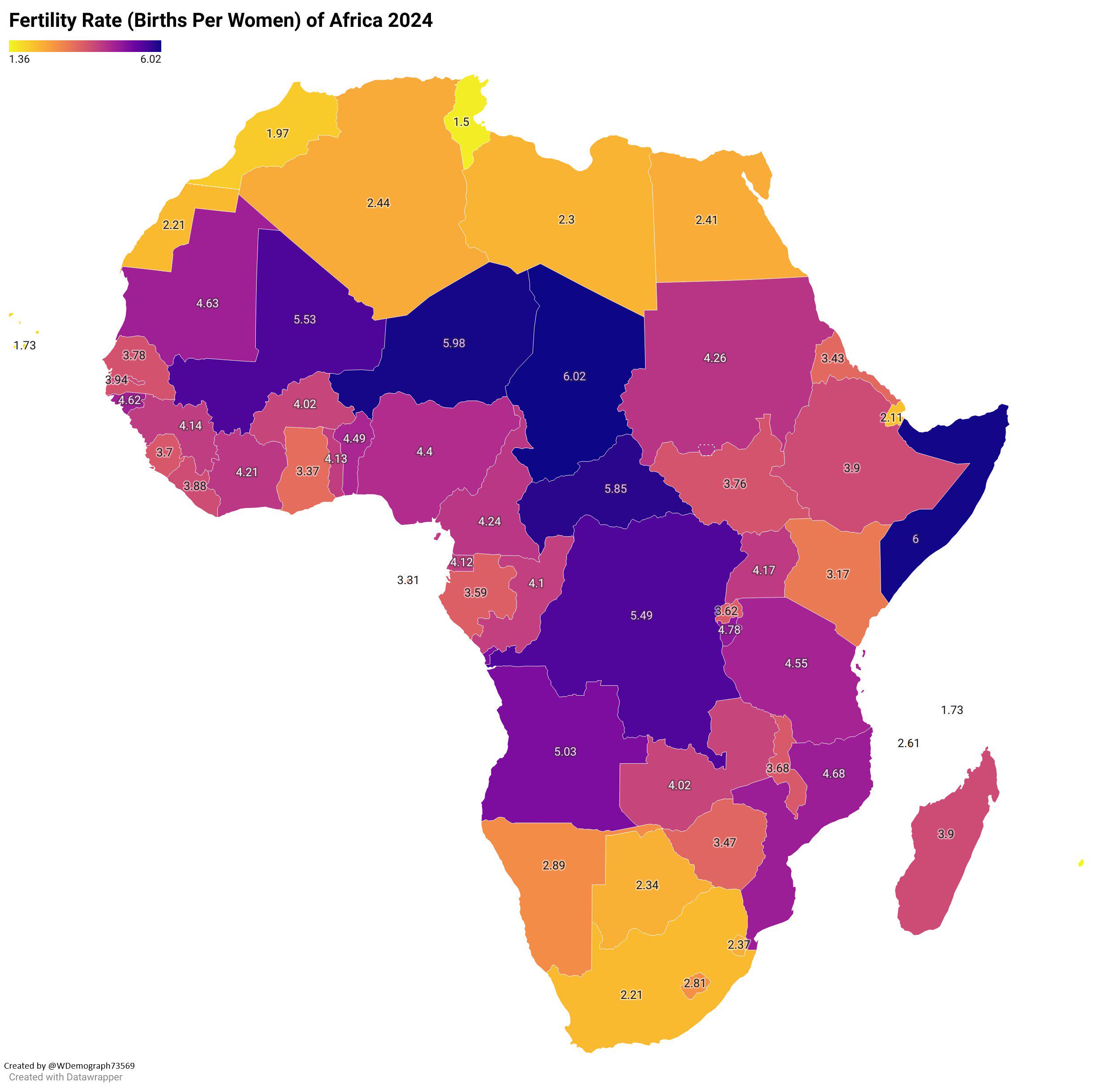
Fertility Rate of Africa 2024 Map
## What This Map Shows...
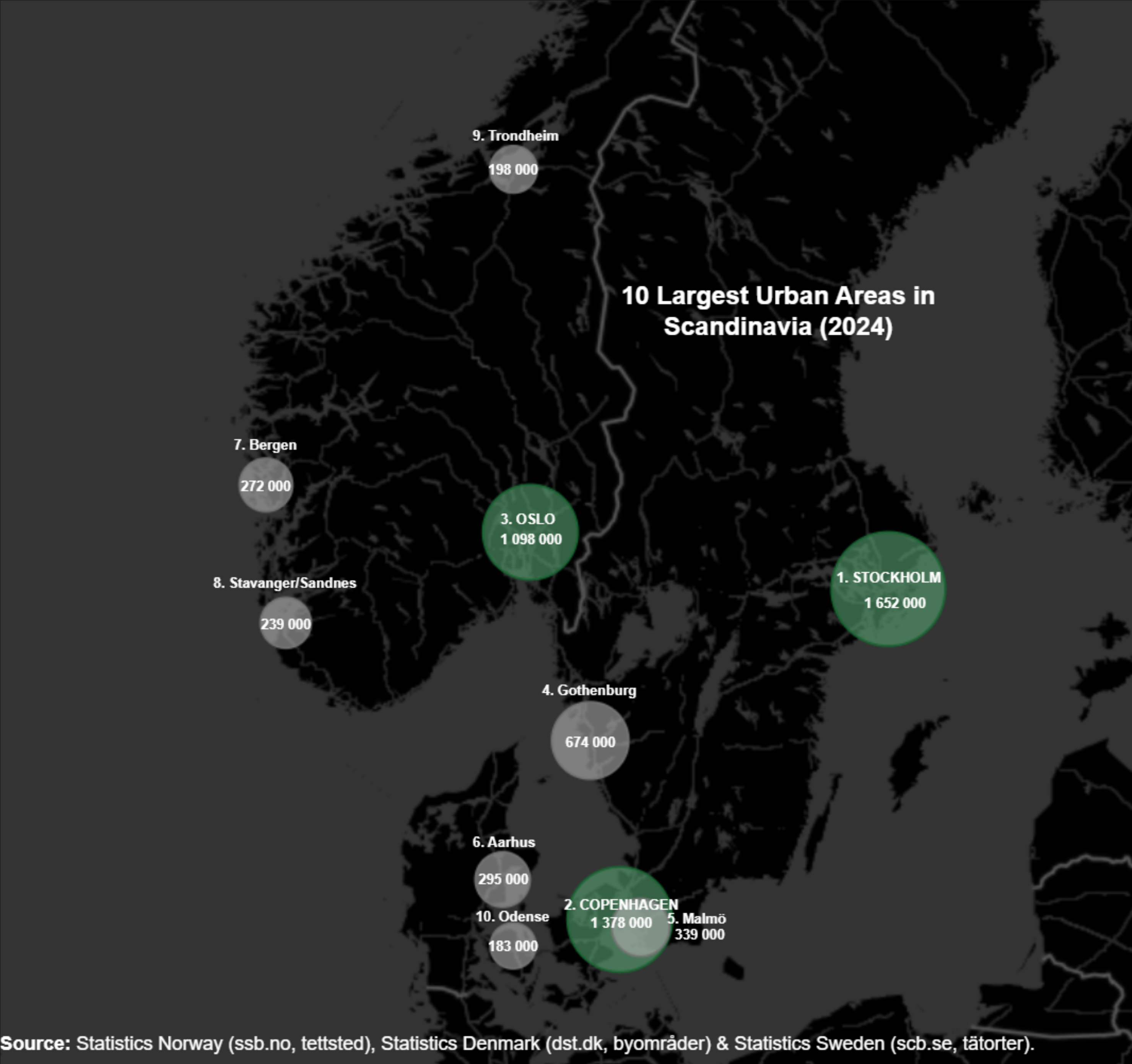
Largest Cities in Scandinavia Map
## What This Map Shows\nThis map visualizes the ten largest cities and urban areas in Scandinavia for the year 2024. It ...
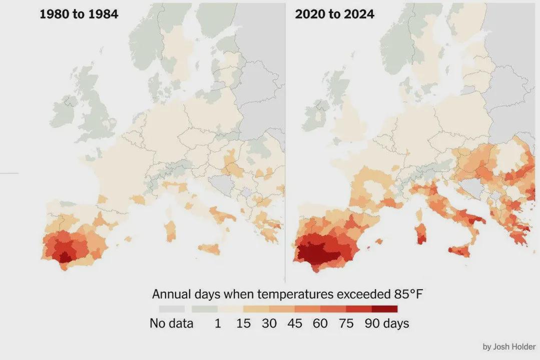
Days Over 30ºC in Europe Map
## What This Map Shows...
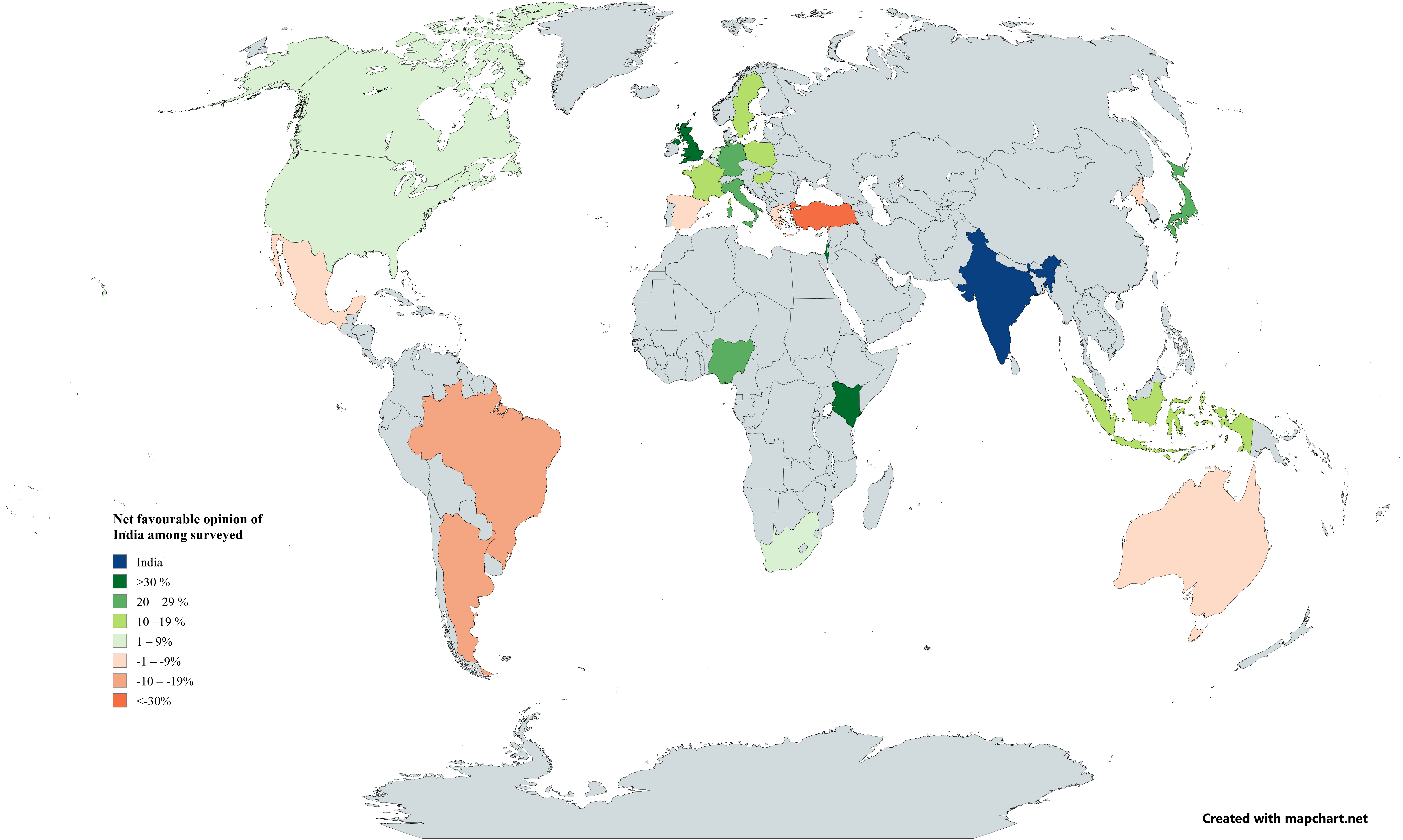
International Opinion of India Map 2025
## What This Map Shows...
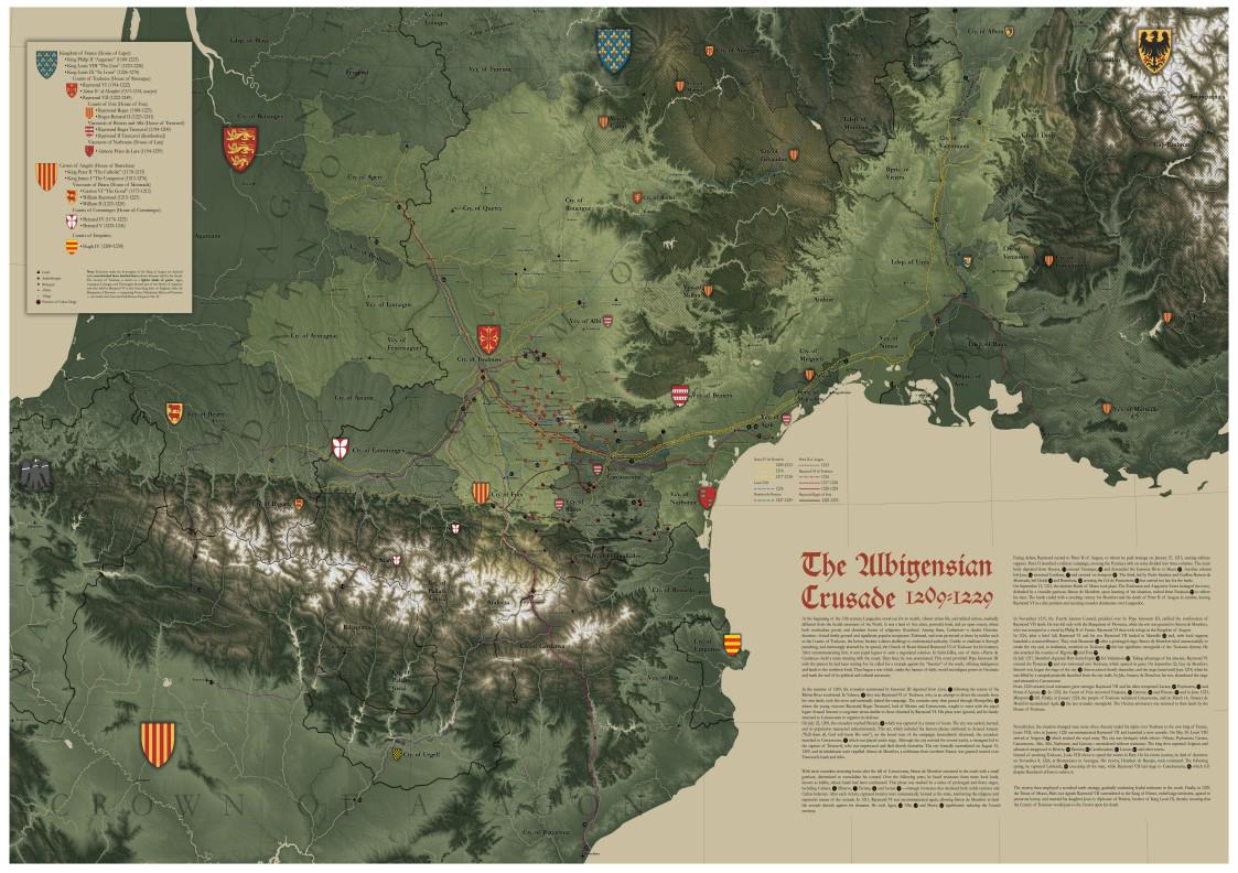
Albigensian Crusade Geography Map
## What This Map Shows...
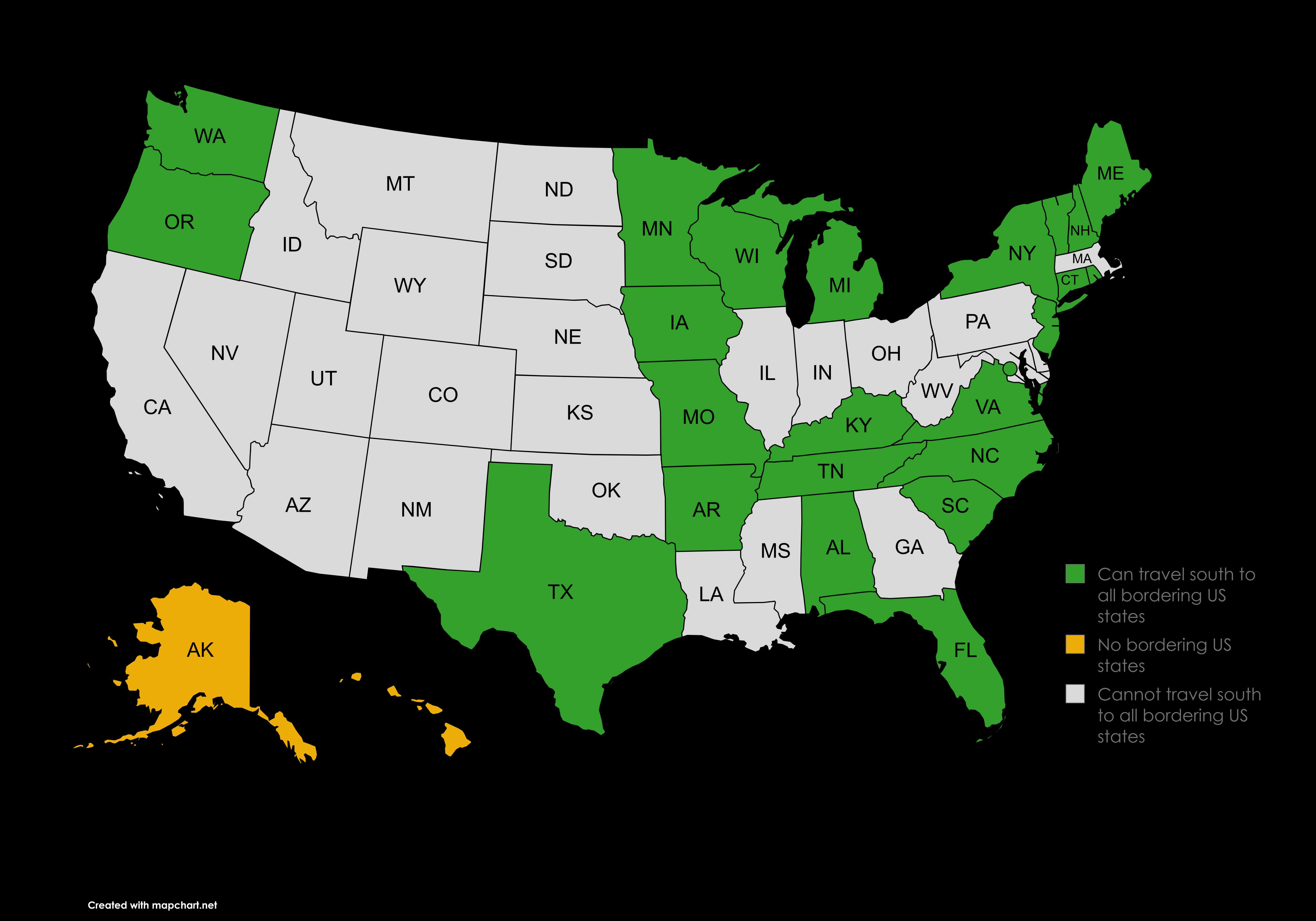
Map of US States Traveling South to Bordering States
## What This Map Shows...
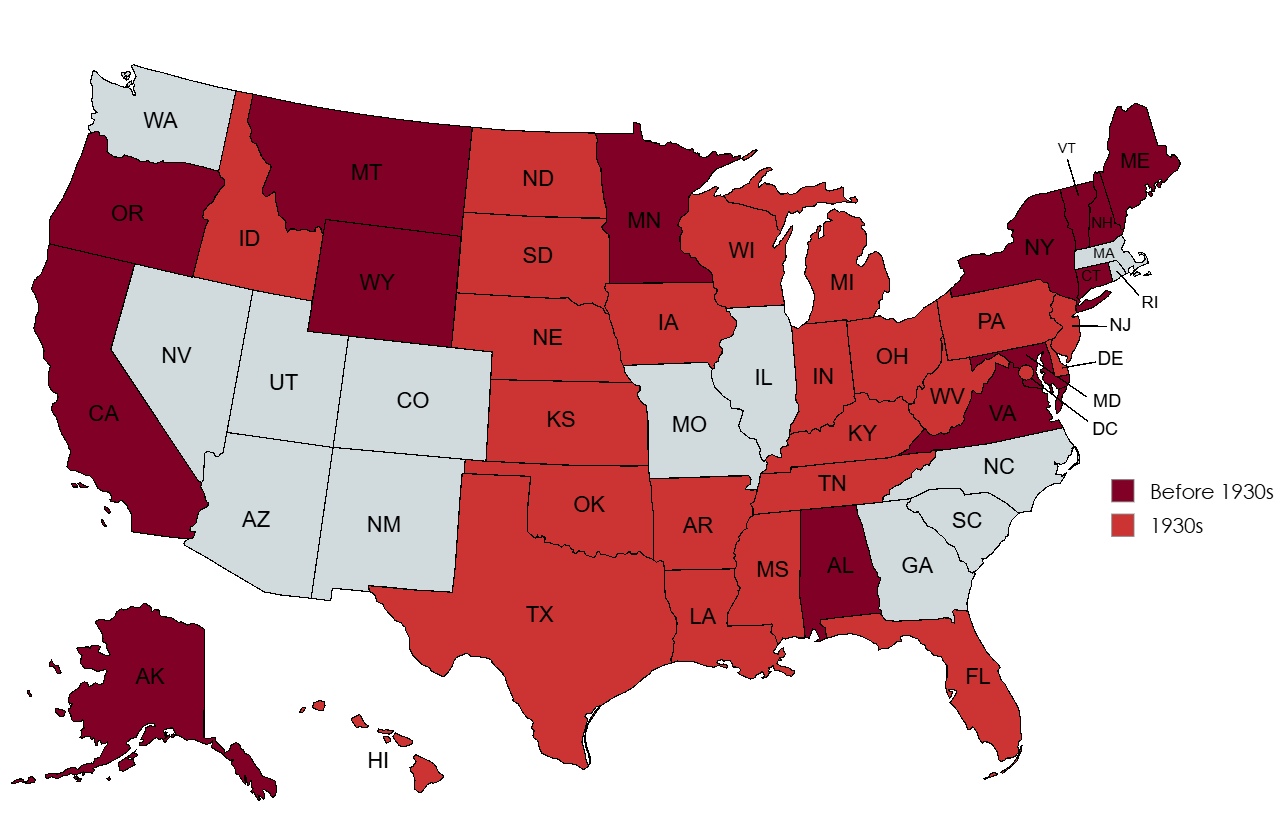
Map of US States with Record High Temperatures Before 1930s
## What This Map Shows...
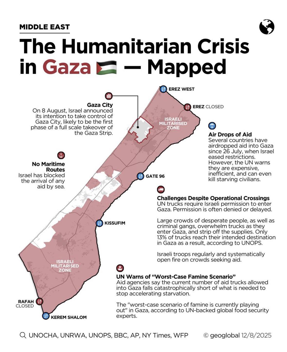
Current Situation in Gaza Map
## What This Map Shows...
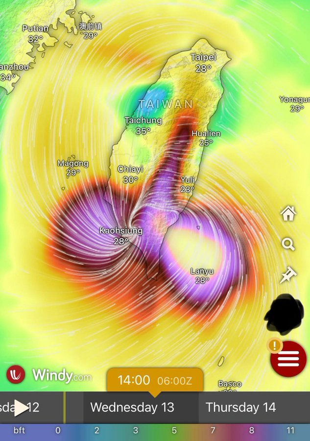
Typhoon Podul Atmospheric Map Over Taiwan and South China
## What This Map Shows\nThe atmospheric map of Typhoon Podul currently crossing over Taiwan and South China provides a v...
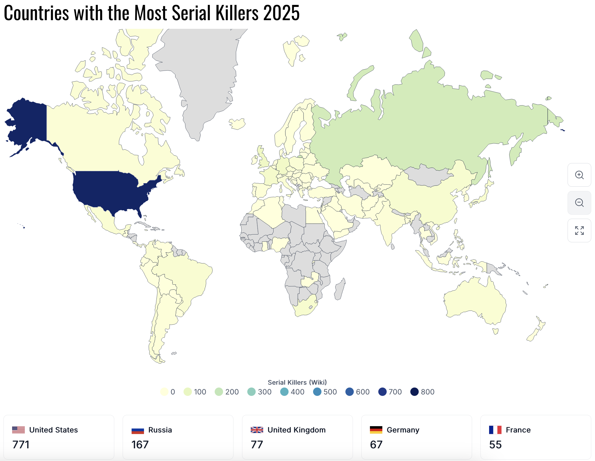
Countries with the Most Serial Killers Map
## What This Map Shows...
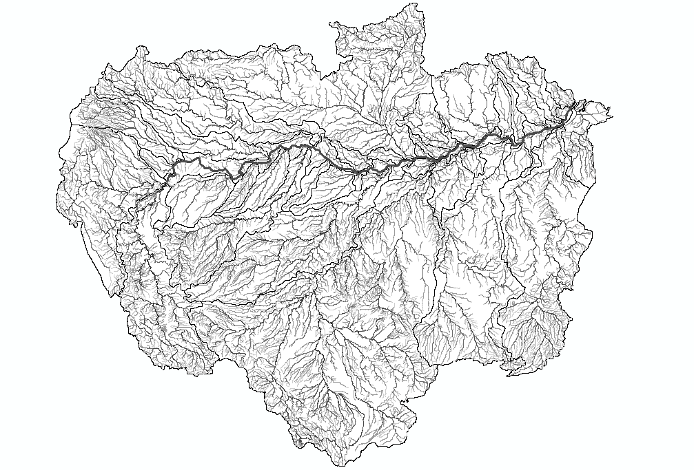
Amazon Basin River Network Map
## What This Map Shows...
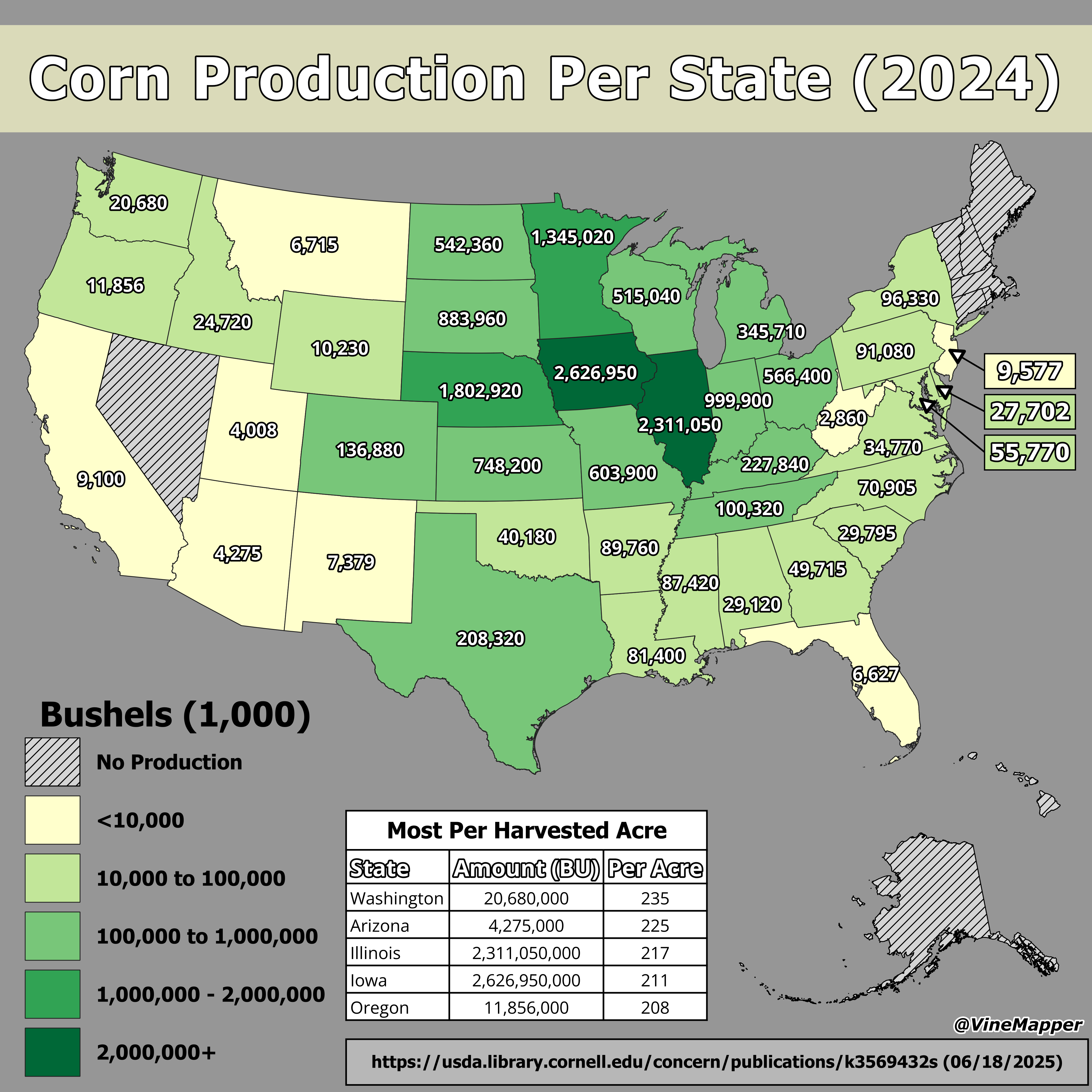
Corn Production Per State Map
## What This Map Shows...
