Geographic Visualizations
Explore our curated collection of fascinating geographic visualizations and cartographic analyses. Discover detailed maps, data visualizations, and geographical insights from around the world.
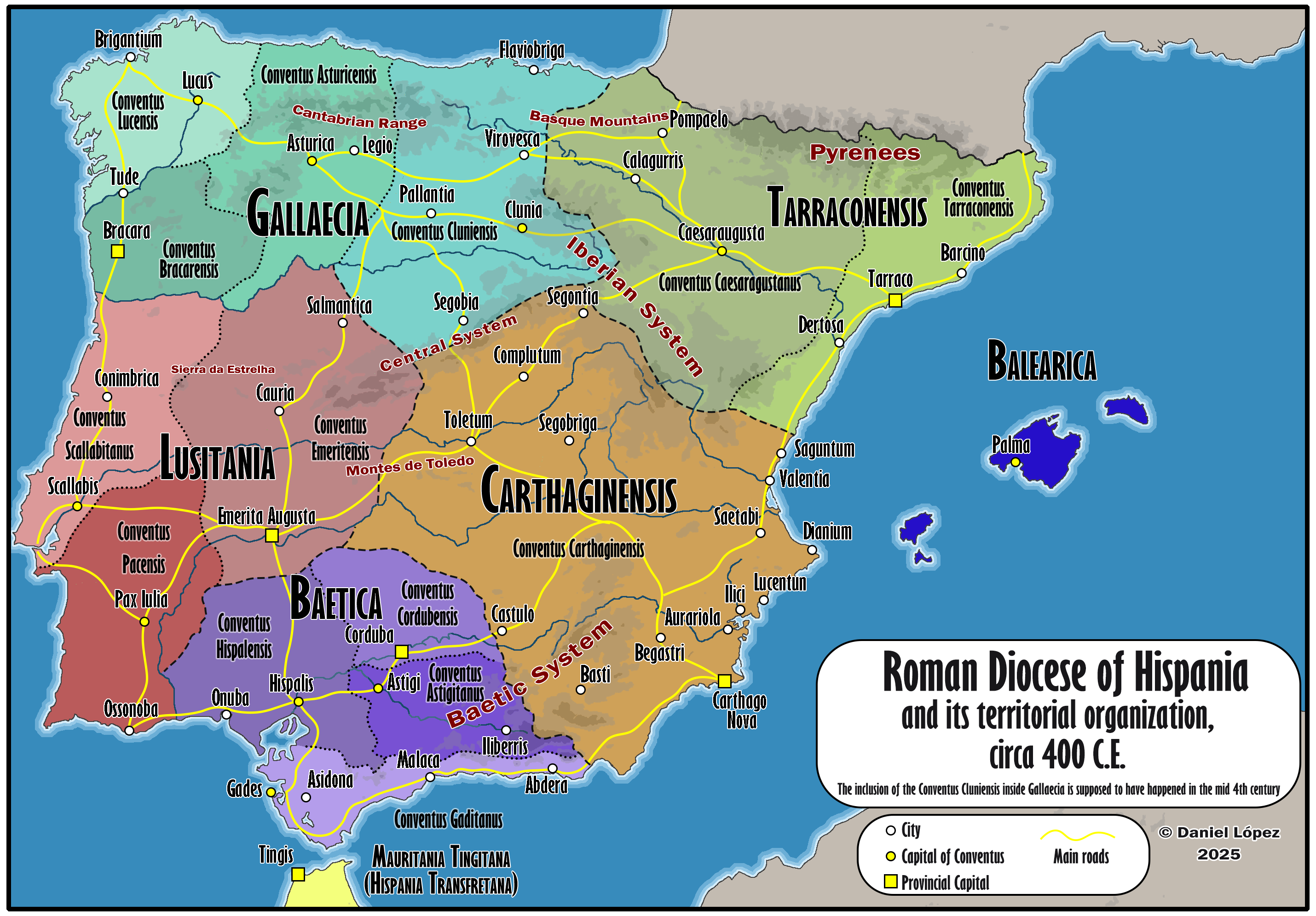
Map of Roman Hispania Circa 400
## What This Map Shows...
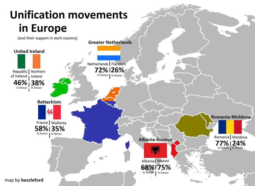
European Unification Movements Map
## What This Map Shows...
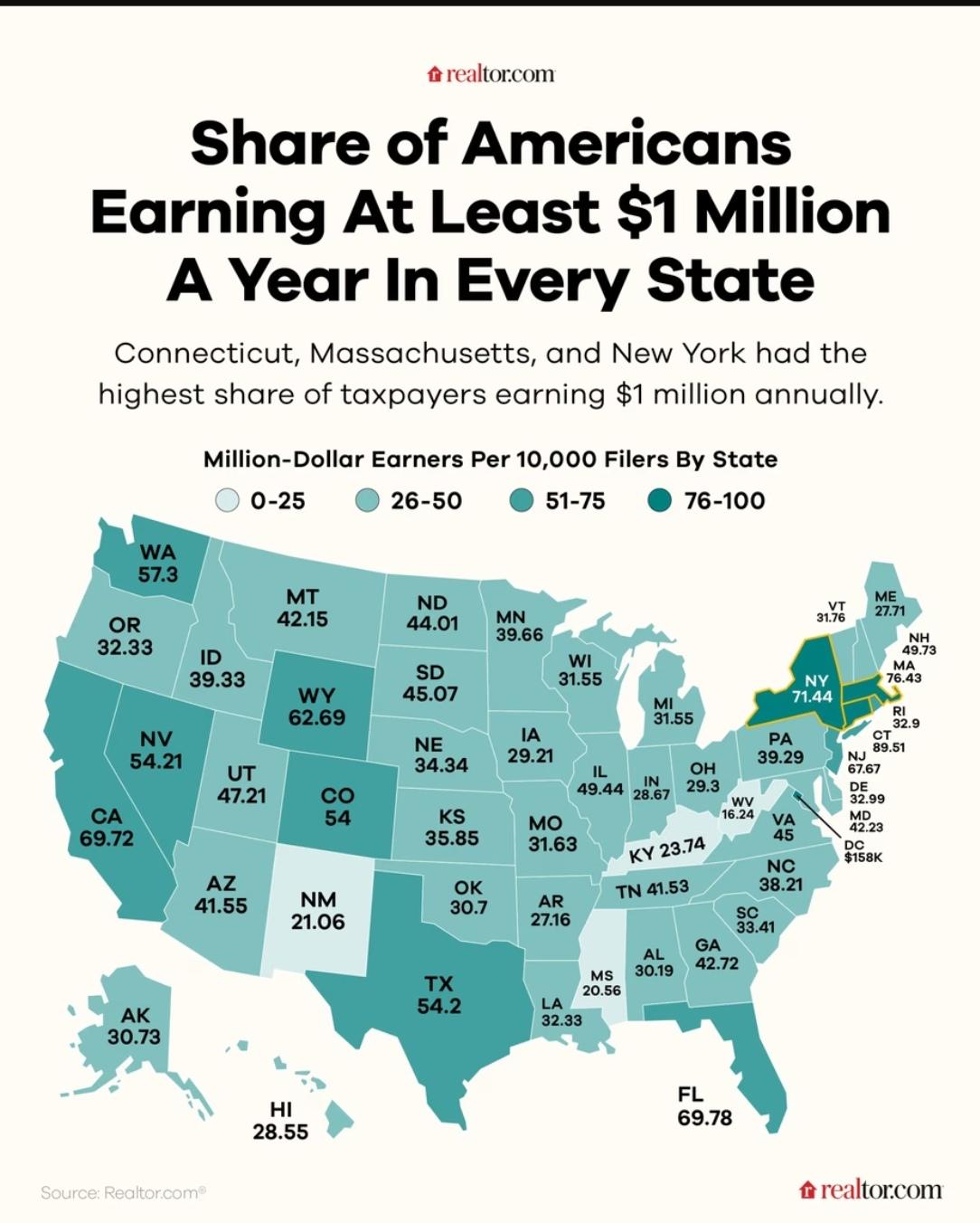
Map of Highest Earners in America
## What This Map Shows...
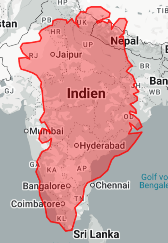
Greenland Overlay Map of India and Nepal
## What This Map Shows...
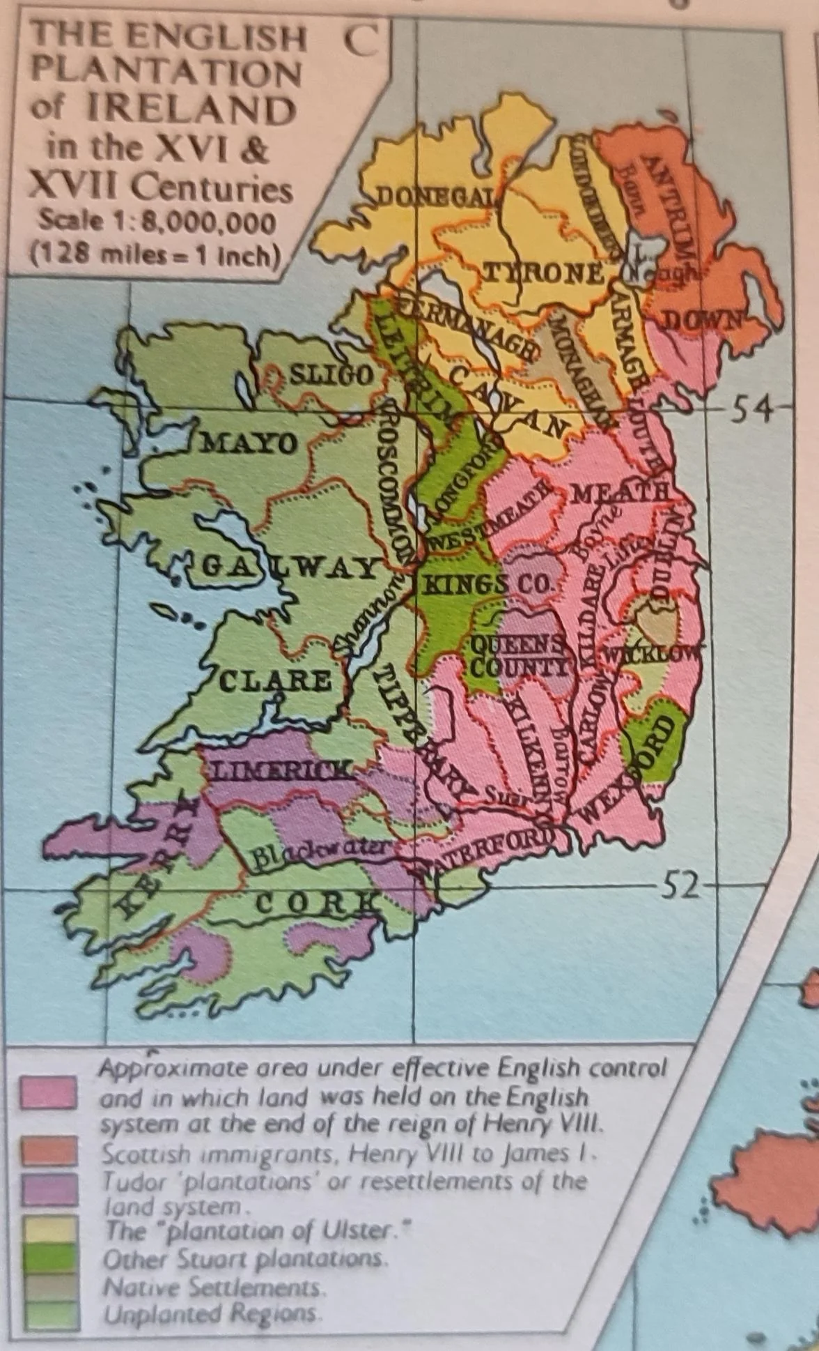
Map of English Plantations in Ireland 16th 17th Century
## What This Map Shows...
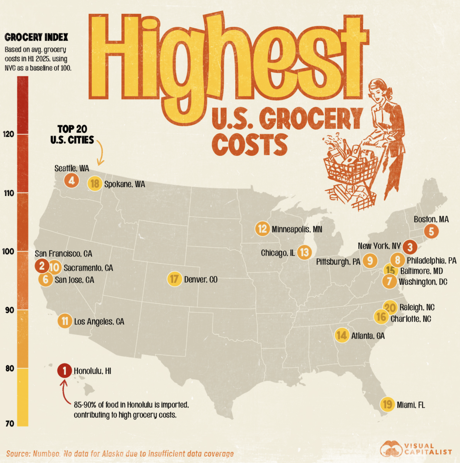
Grocery Cost Map of U.S. Cities
## What This Map Shows...
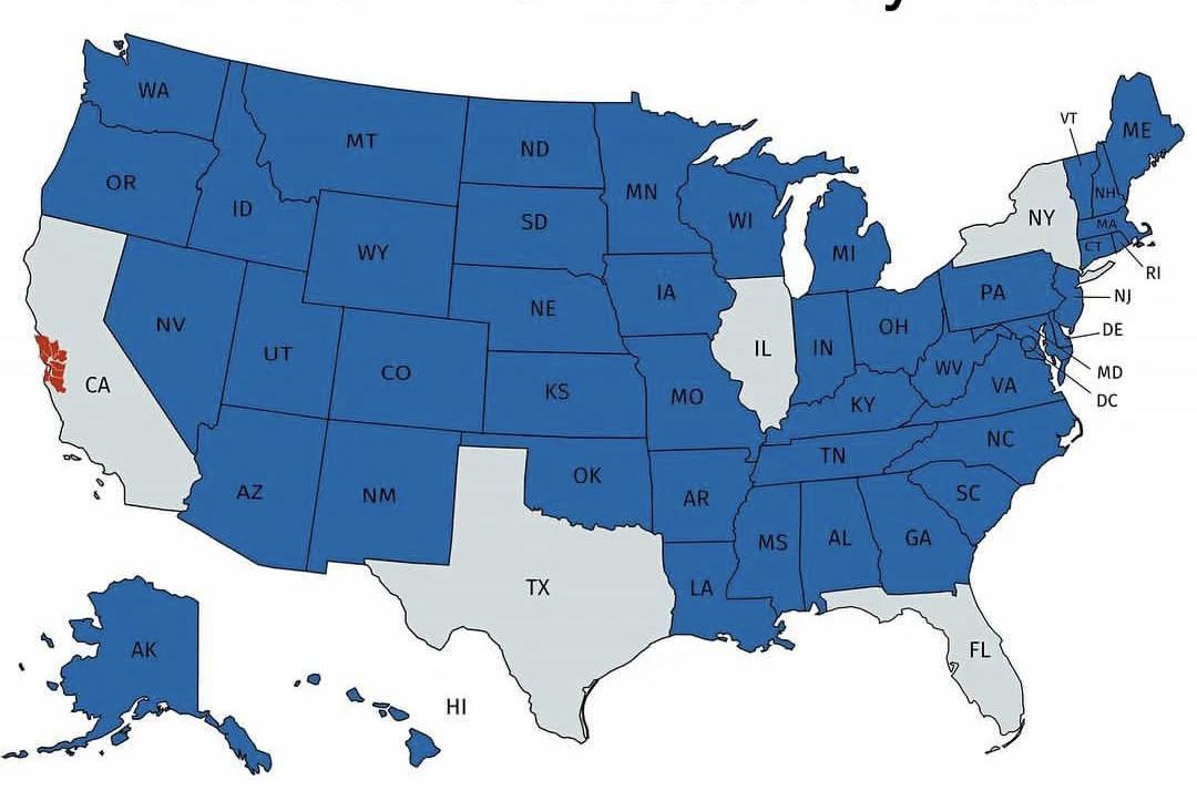
U.S. States with Smaller Economies than San Francisco Bay Area Map
## What This Map Shows...
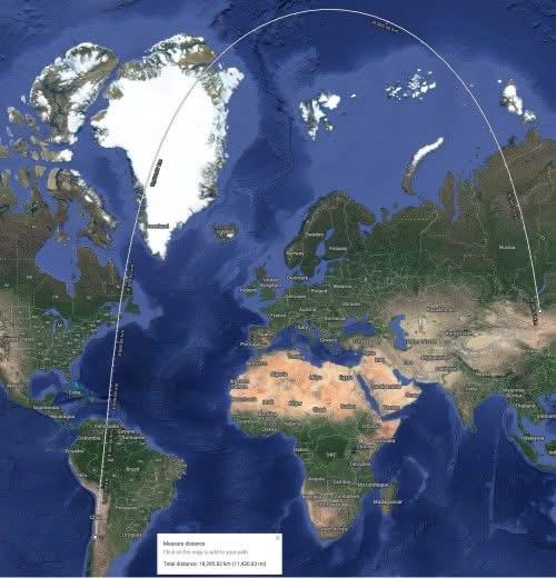
Shortest Route Map from Santiago, Chile to Ulaanbaatar, Mongolia
## What This Map Shows...
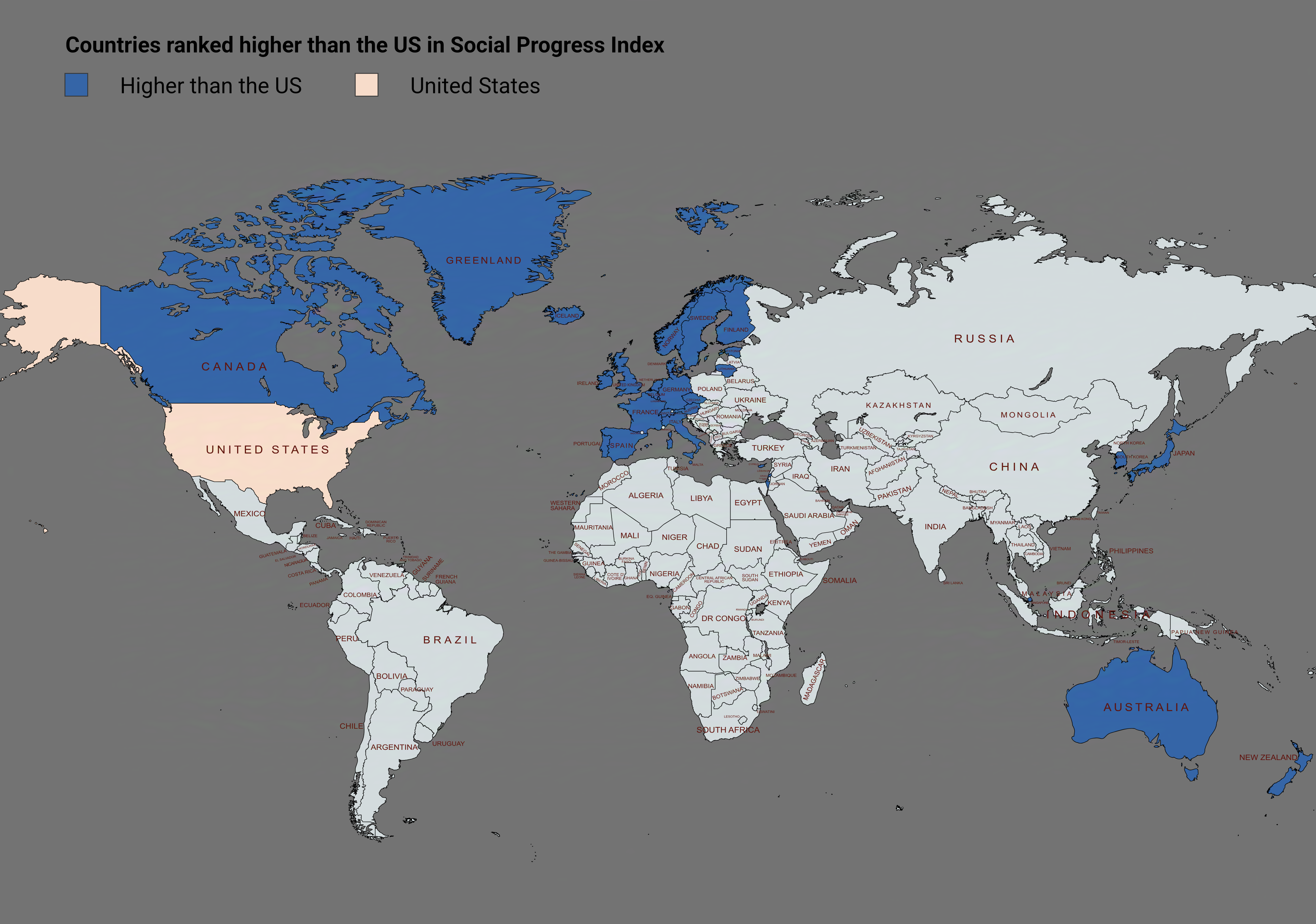
Social Progress Index Rankings Map by Country
## What This Map Shows...
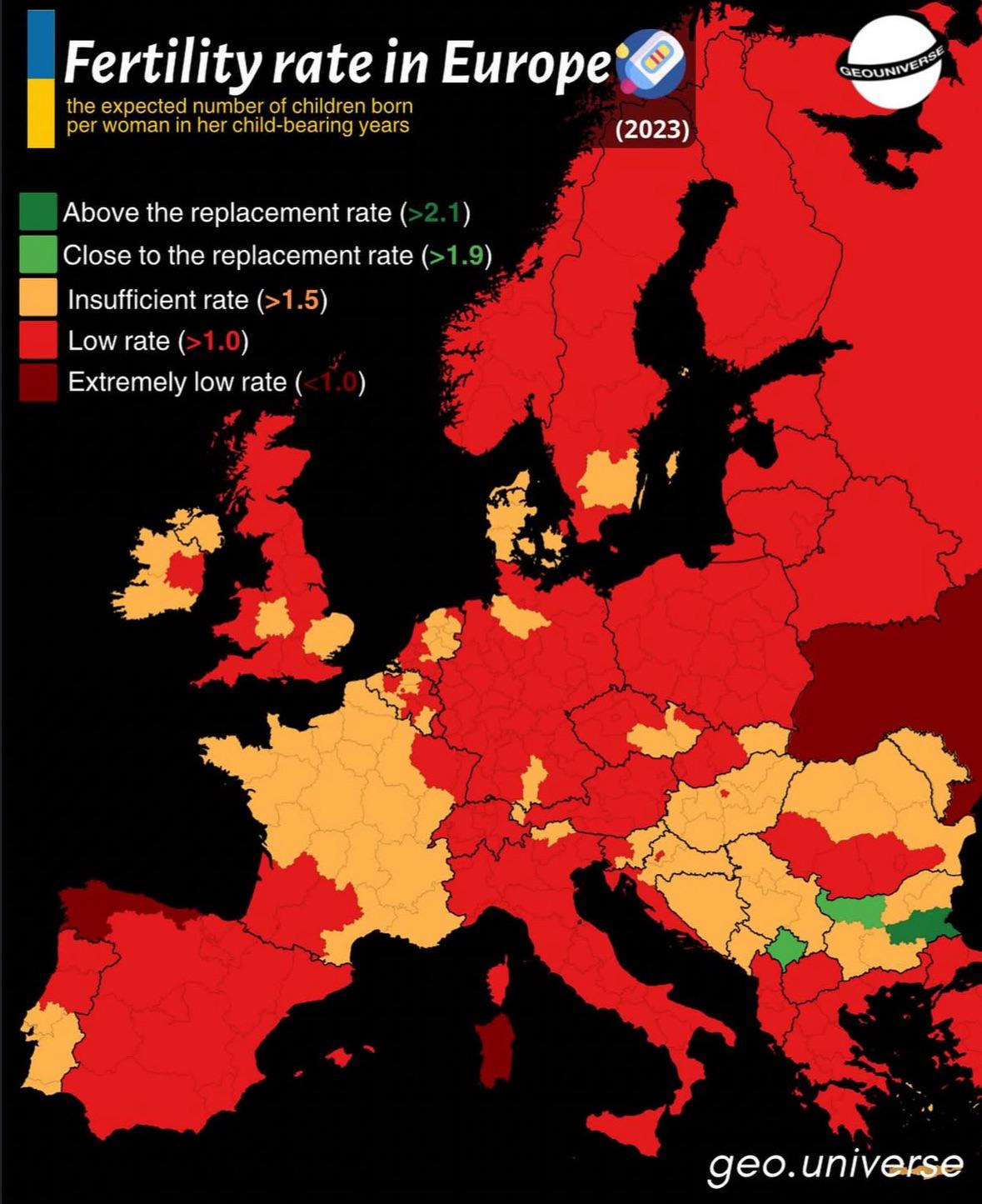
Fertility Rate in Europe Map
## What This Map Shows...
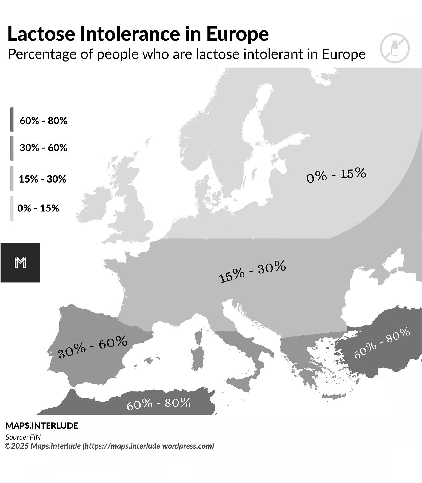
Lactose Intolerance in Europe Map
## What This Map Shows...
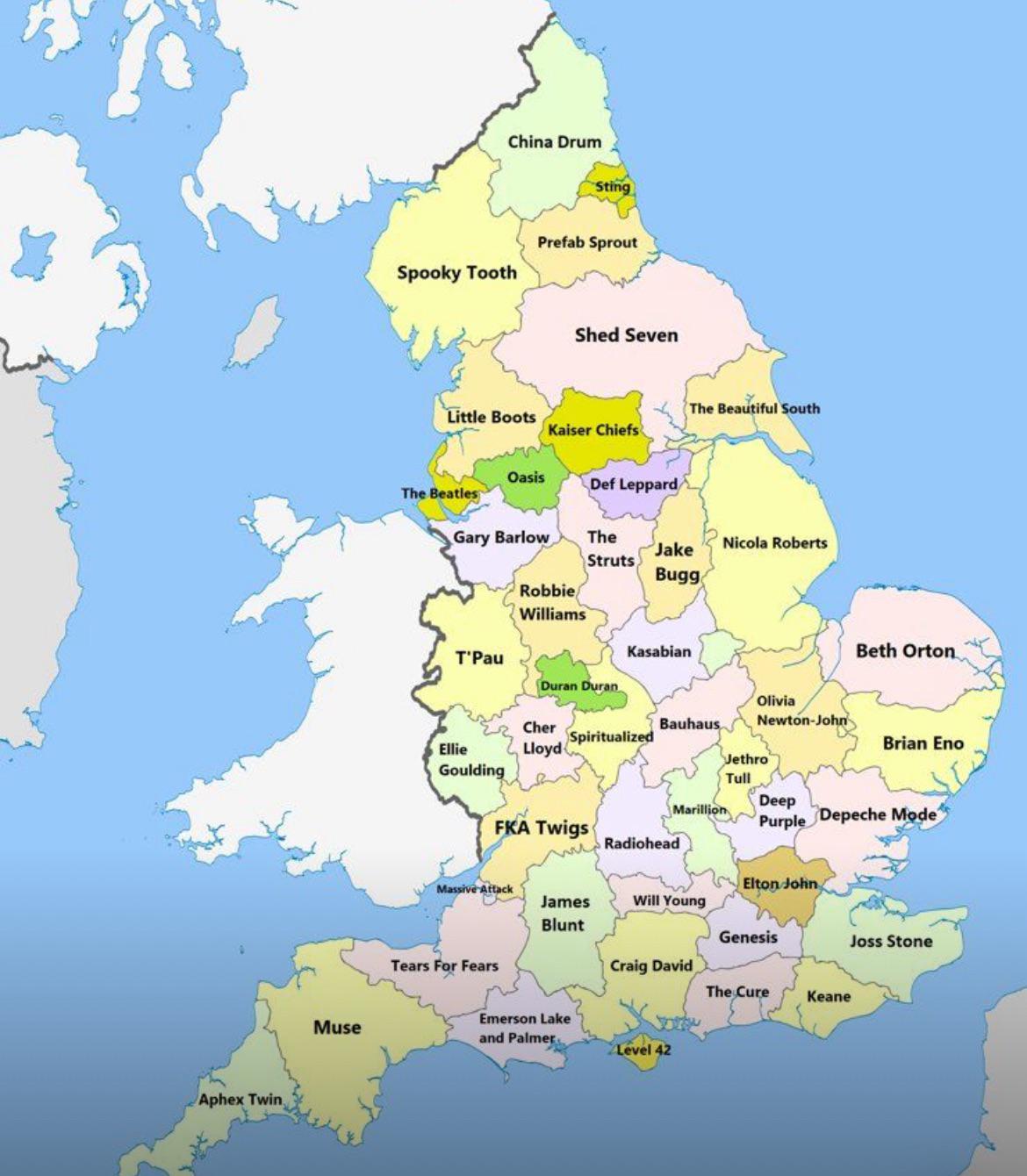
Best Selling Artists by Regions Map
## What This Map Shows...
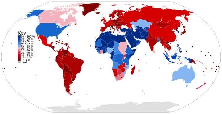
Male Circumcision Rates by Country Map
## What This Map Shows...
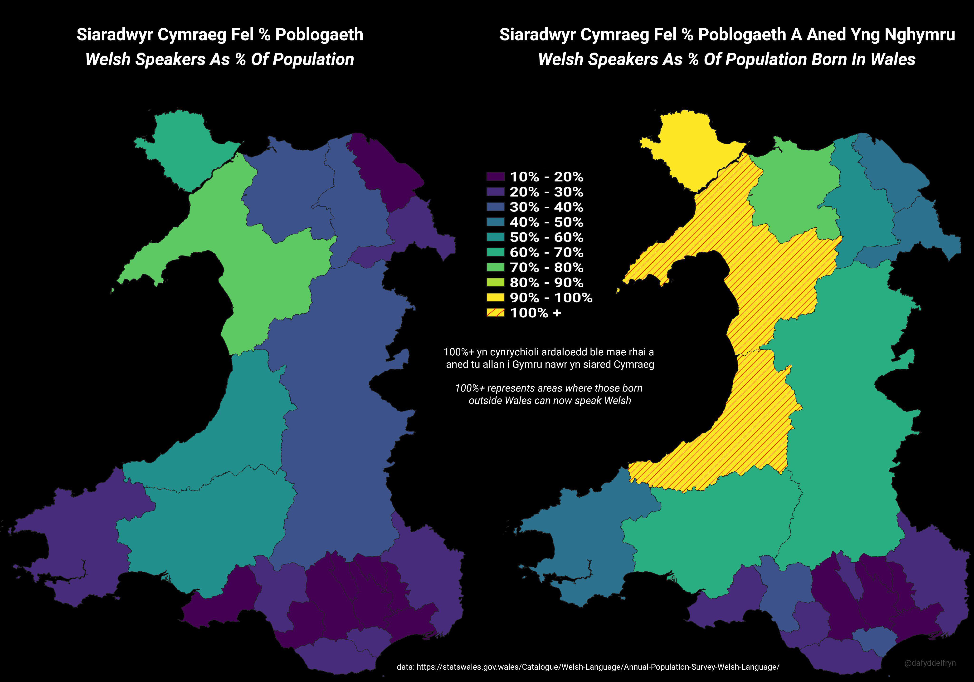
Welsh Speakers as Percentage of Population Map
## What This Map Shows\nThe visualization titled 'Welsh Speakers as % of Population Born in Wales (2021)' presents a com...
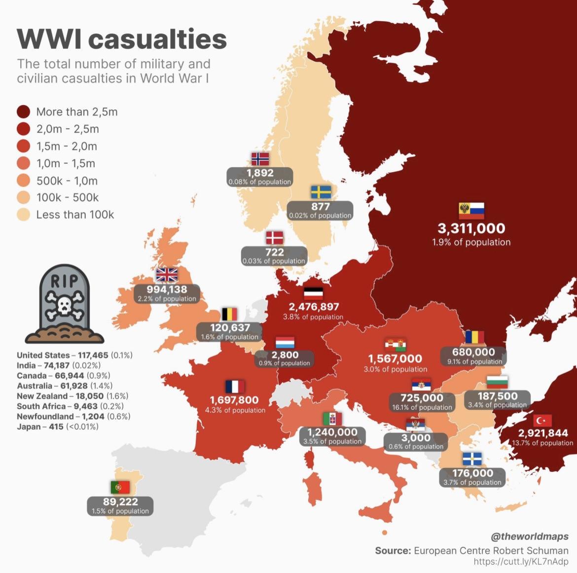
Map of Countries that Lost the Most People in WW1
## What This Map Shows...
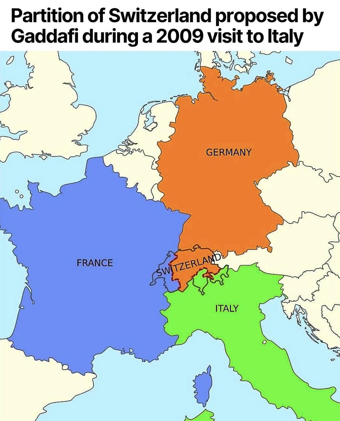
Map of Gaddafi's Proposed Partition of Switzerland
## What This Map Shows...
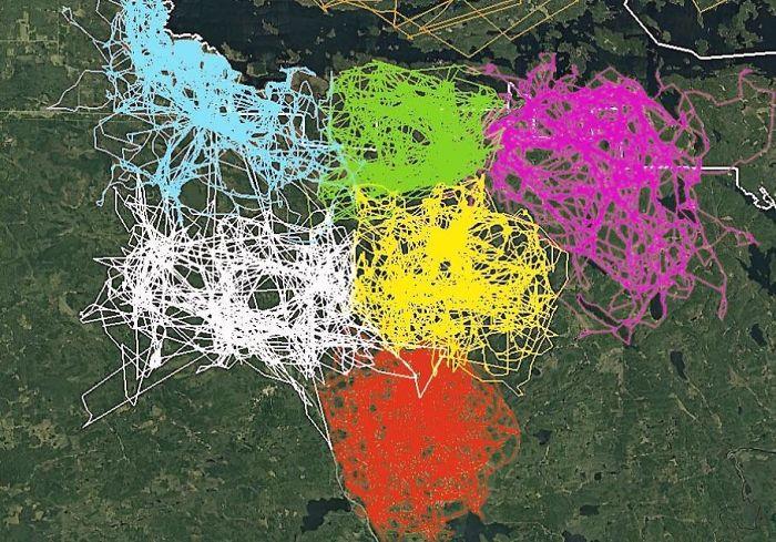
GPS Tracking Map of Wolves in Voyageurs National Park
## What This Map Shows...
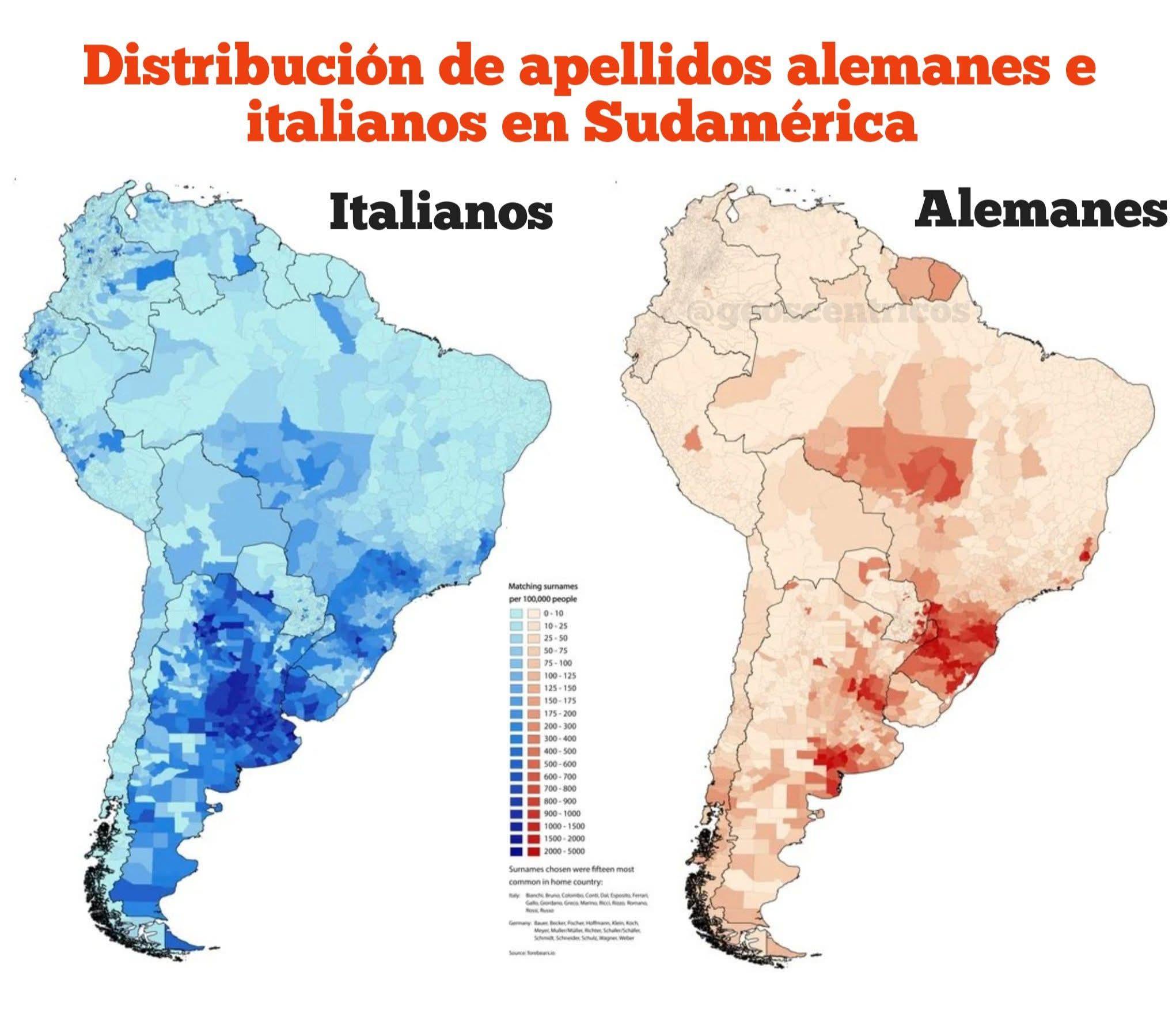
Map of German and Italian Surname Distribution in South America
## What This Map Shows...
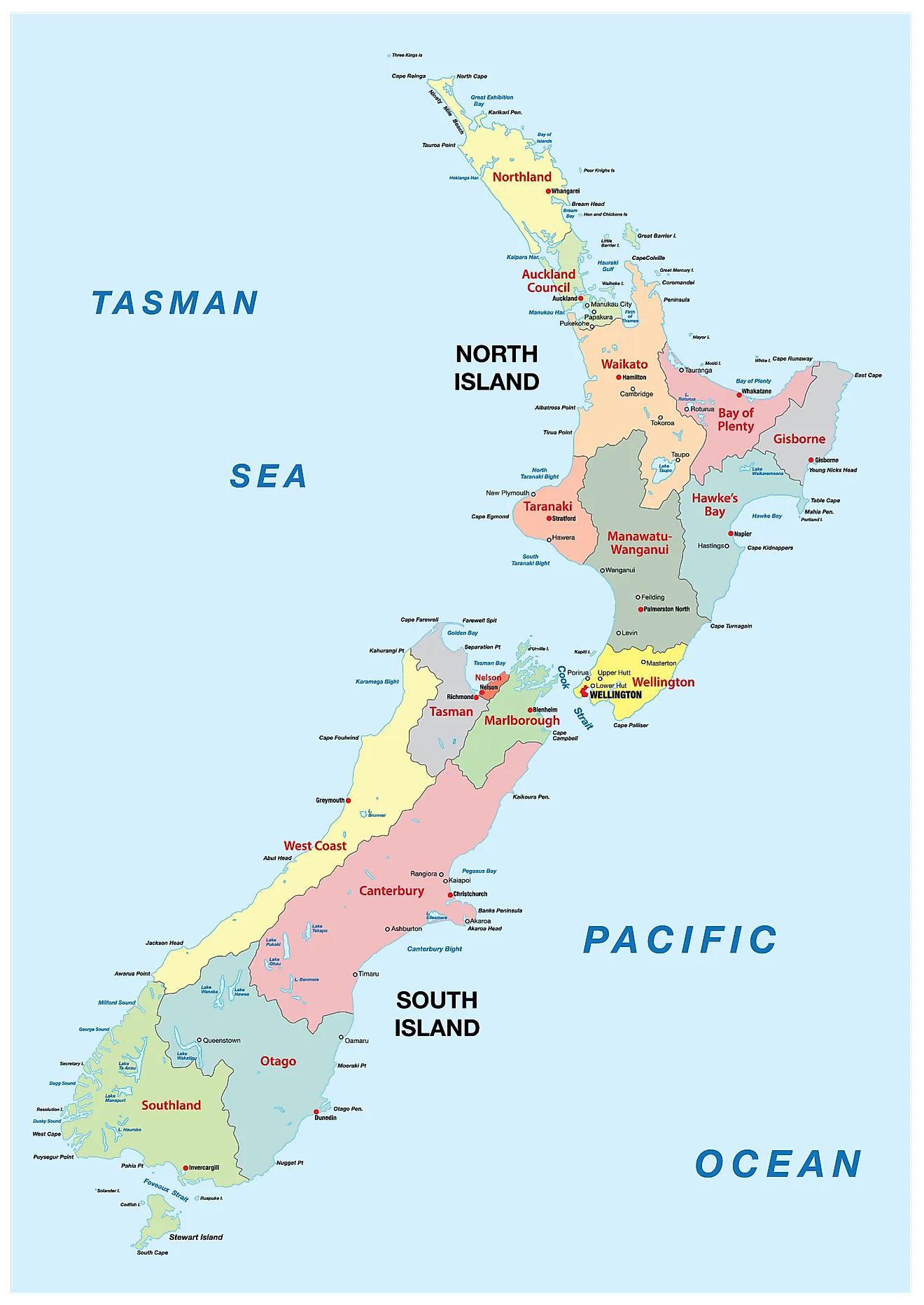
New Zealand Appreciation Map
## What This Map Shows...
