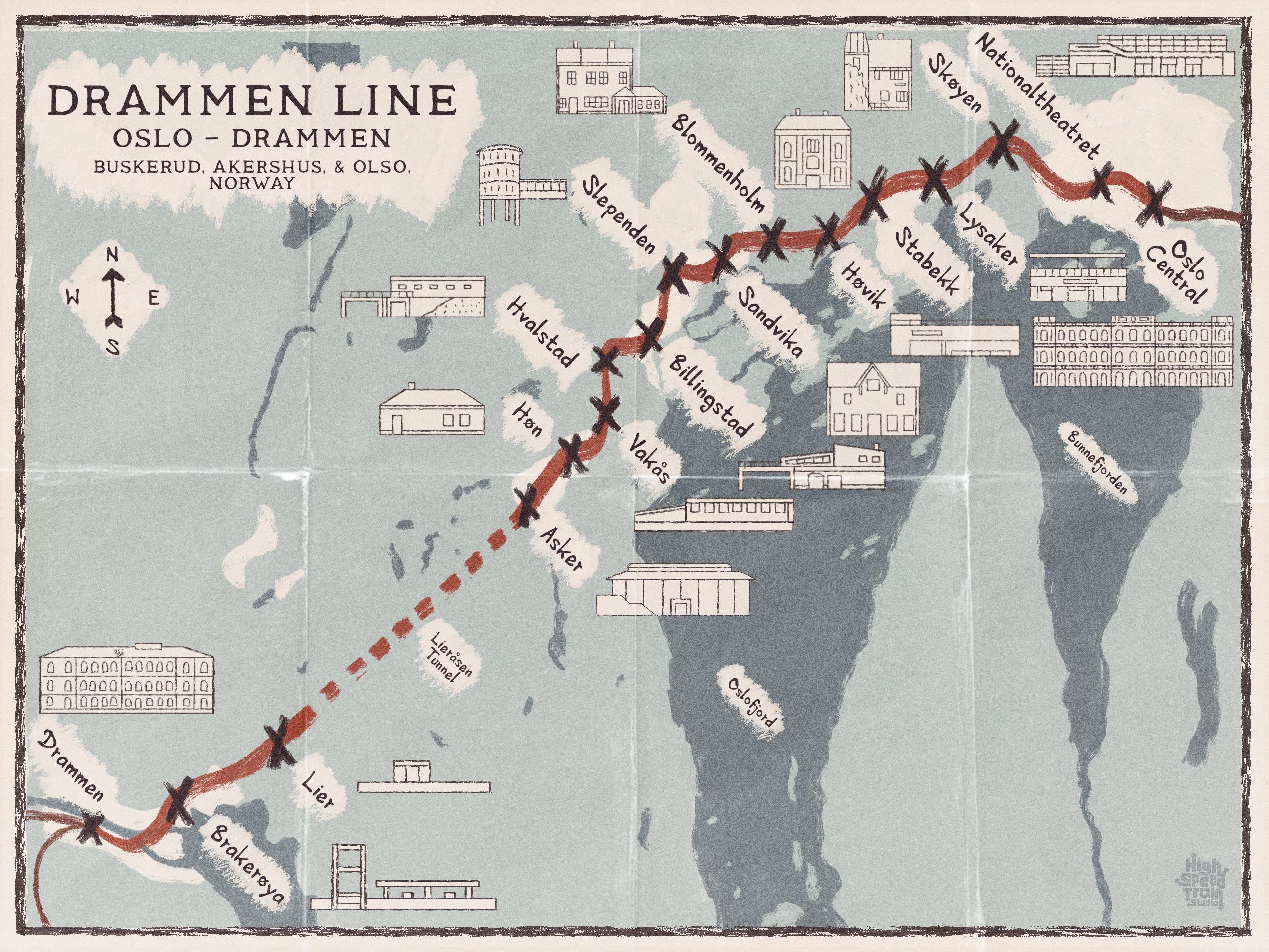
Geographic Visualizations
Explore our curated collection of fascinating geographic visualizations and cartographic analyses. Discover detailed maps, data visualizations, and geographical insights from around the world.
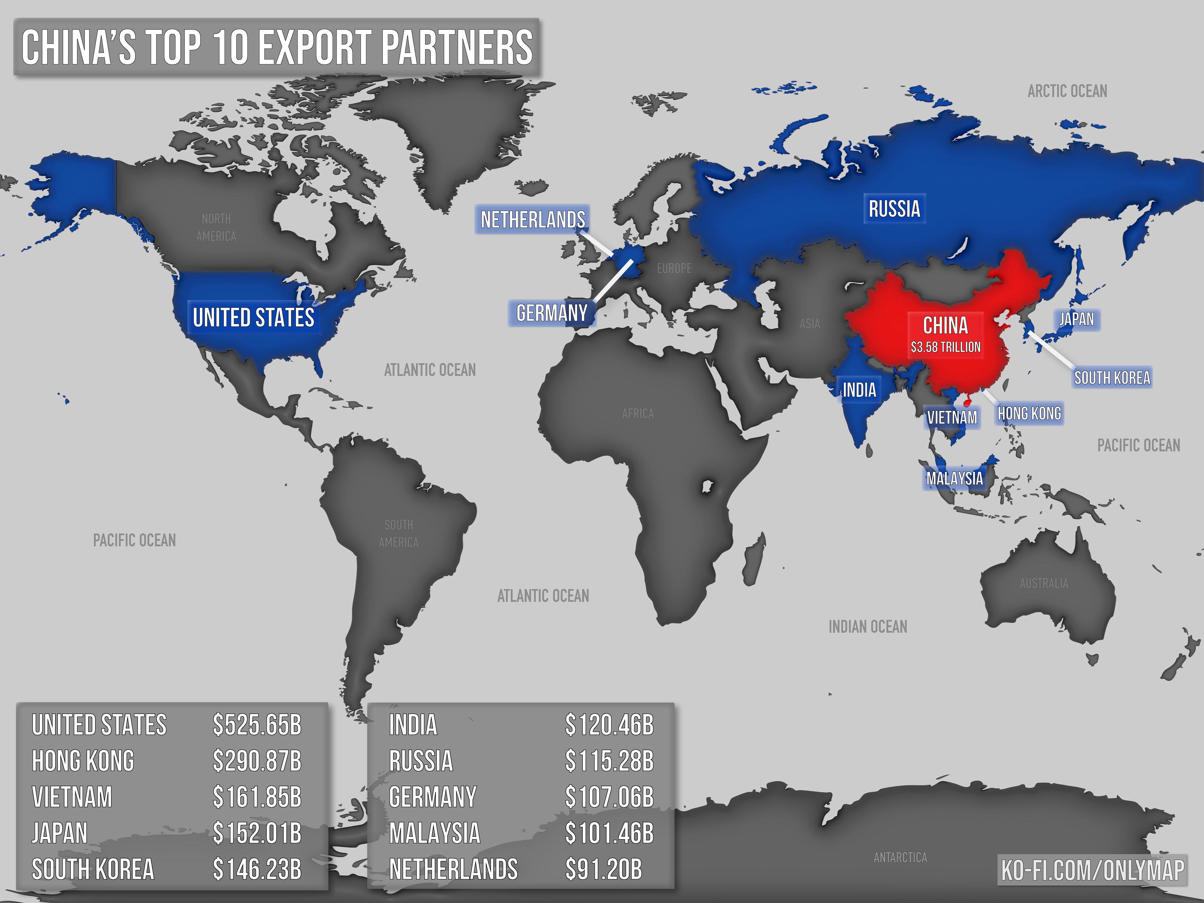
China's Top Export Partners Map
## What This Map Shows...
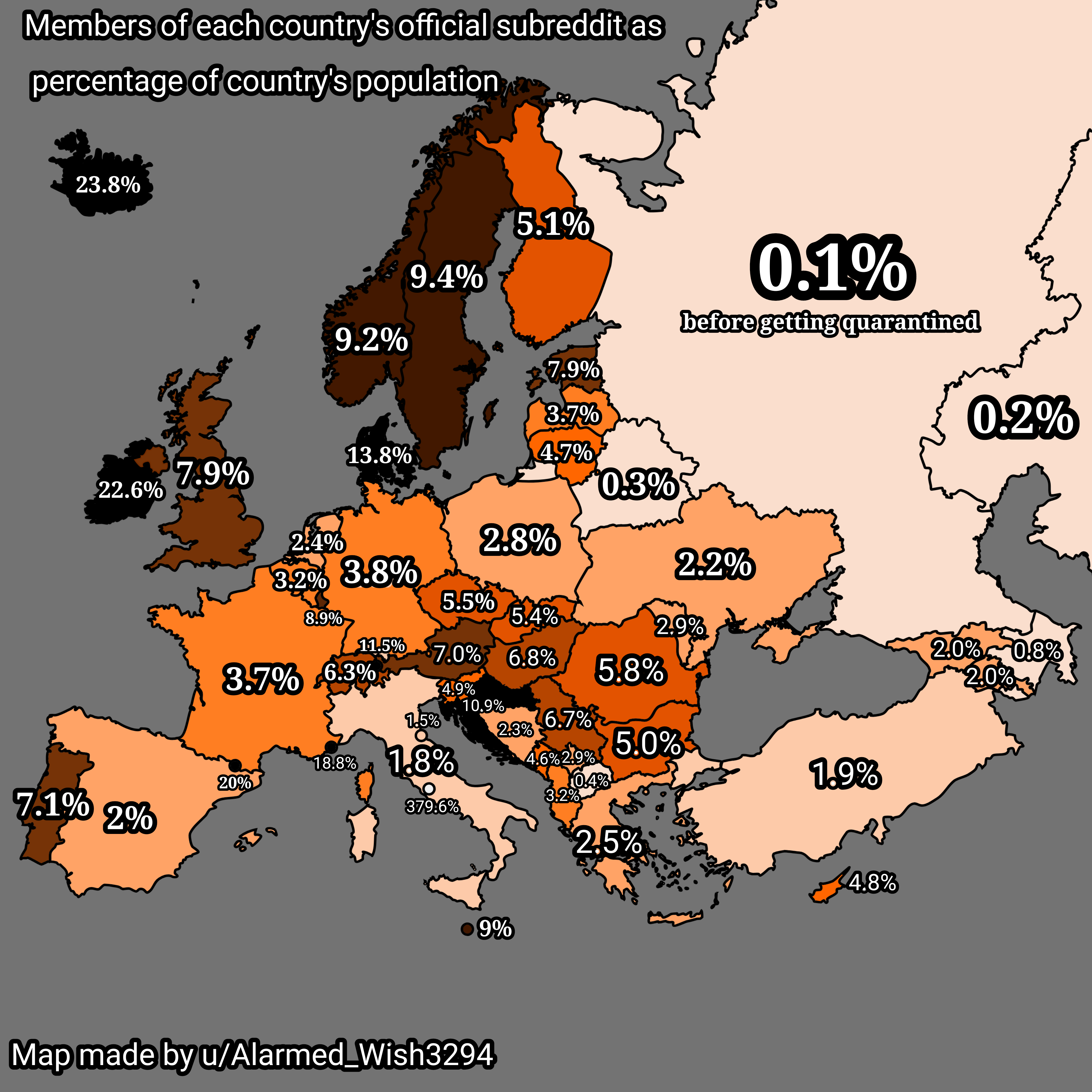
Subreddit Membership by Country Population Map
## What This Map Shows...
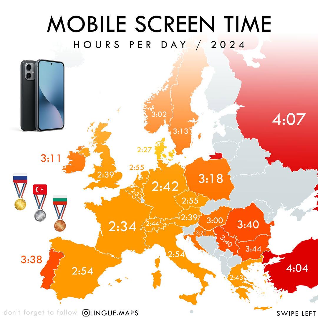
Mobile Screen Time in Hours per Day Map
## What This Map Shows...
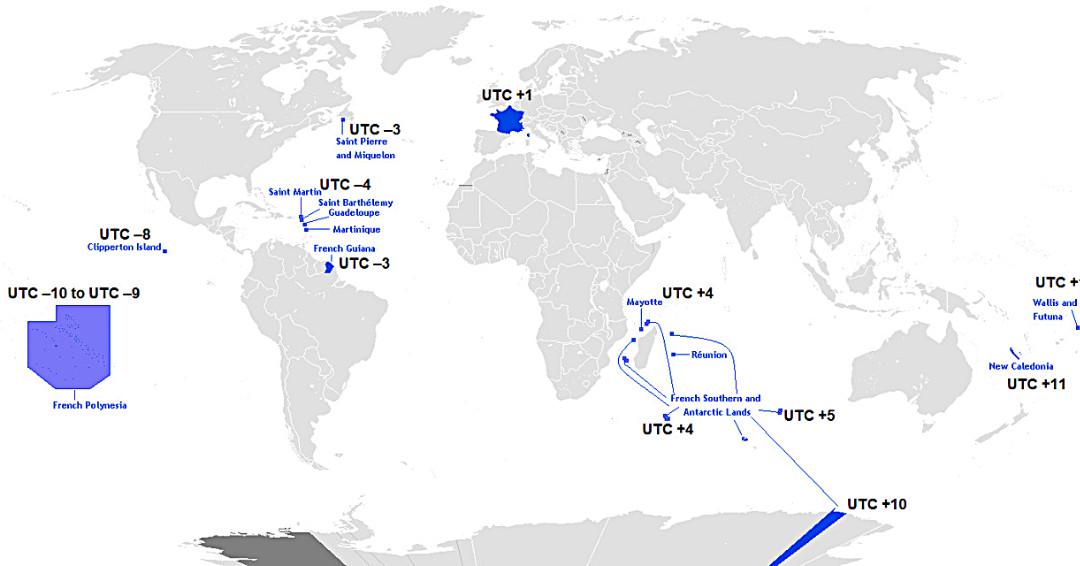
Map of France’s Twelve Time Zones
## What This Map Shows...
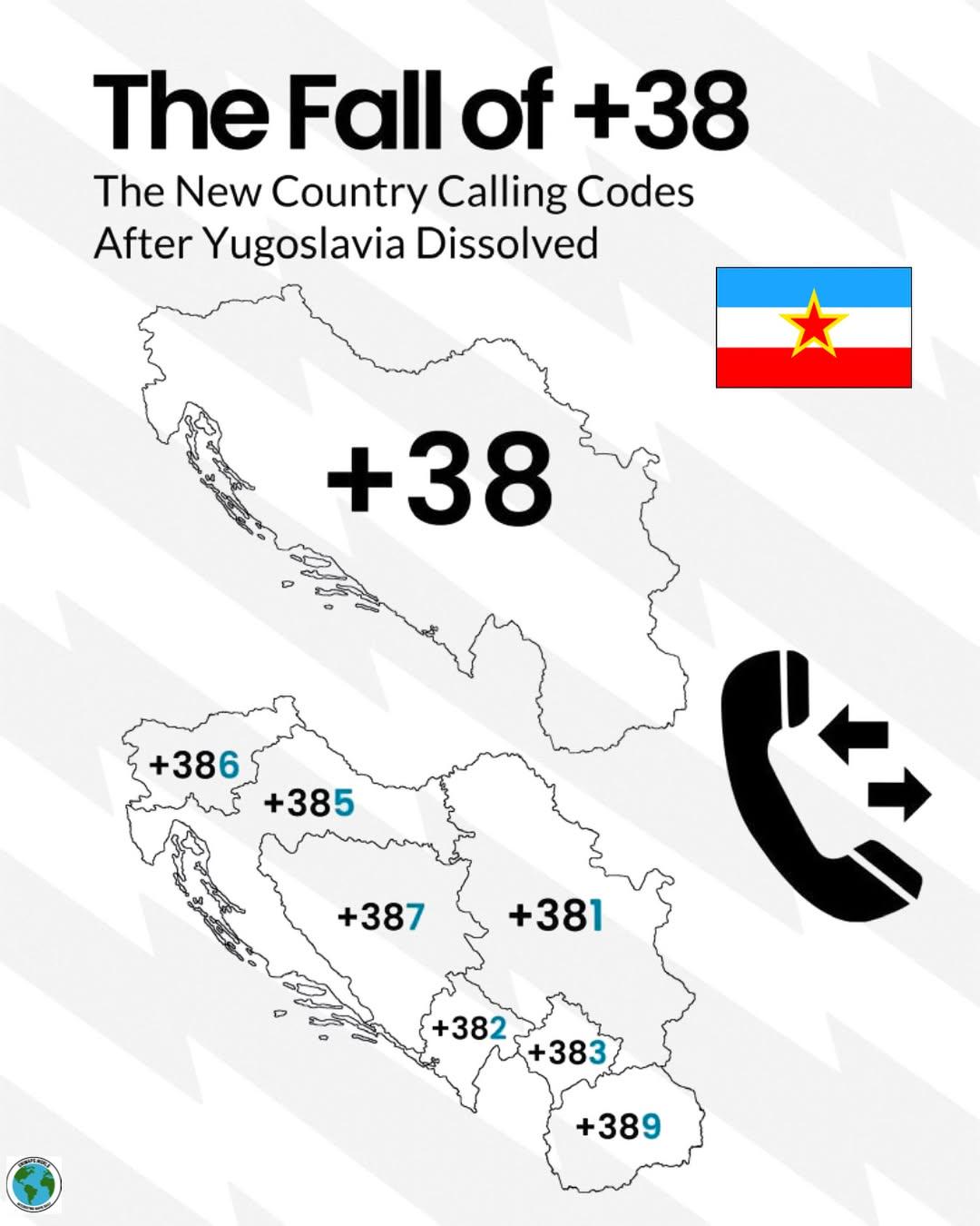
Decline of +38 Calling Code Map
## What This Map Shows...
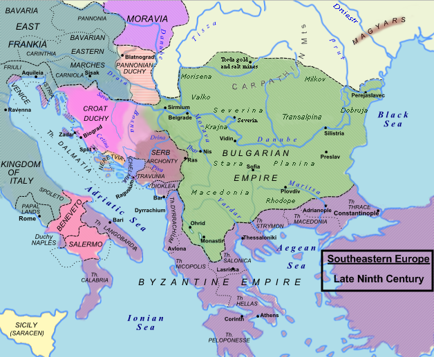
Political Map of Southeastern Europe in the Late 9th Century
## What This Map Shows...
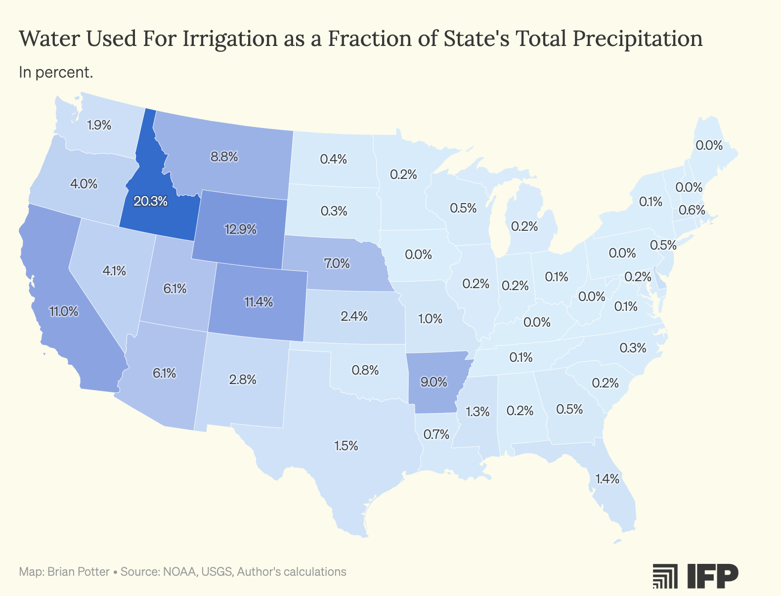
Water Used for Crop Irrigation Map by US States
## What This Map Shows...
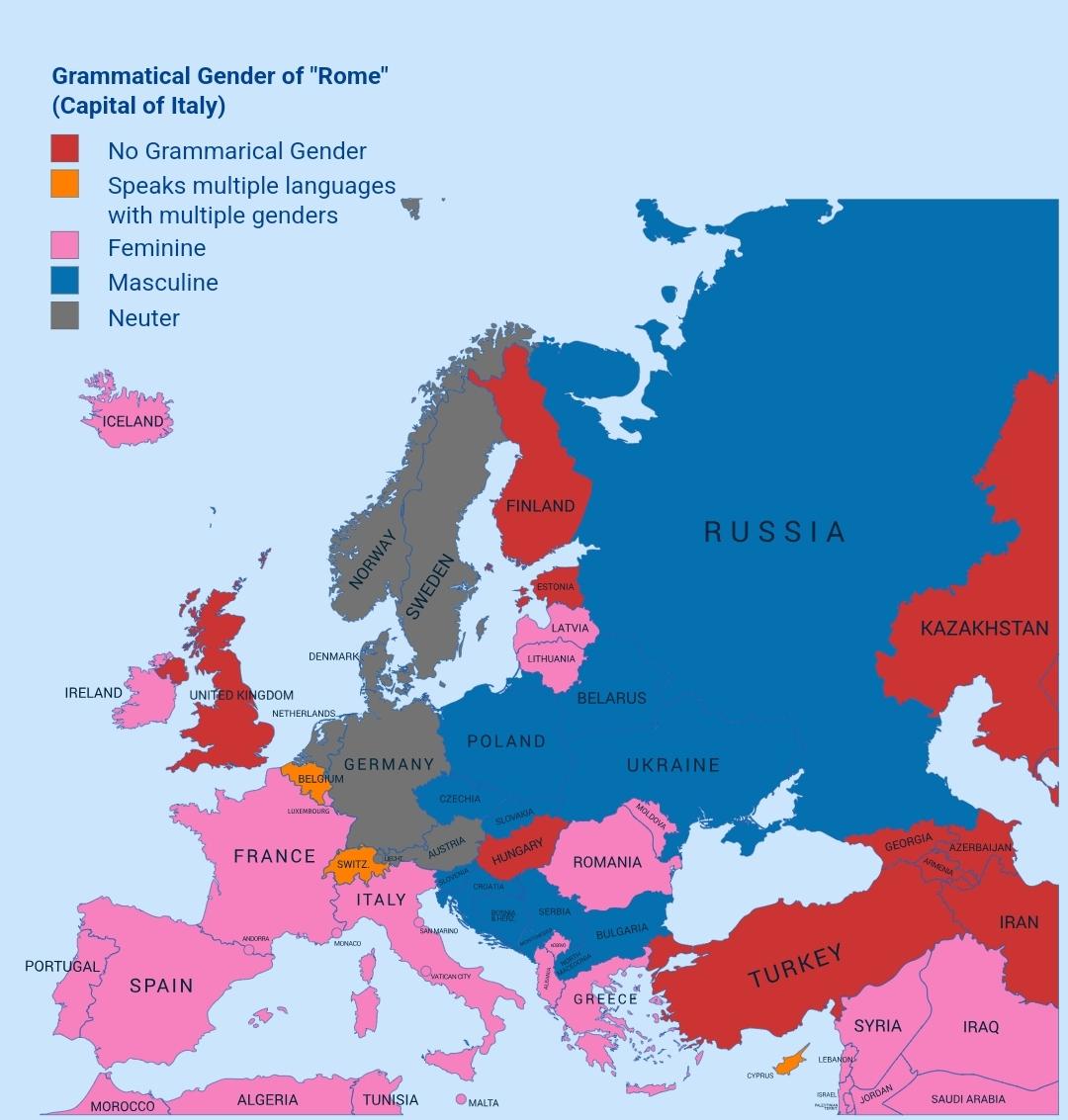
Gender Distribution Map of Rome
## What This Map Shows...
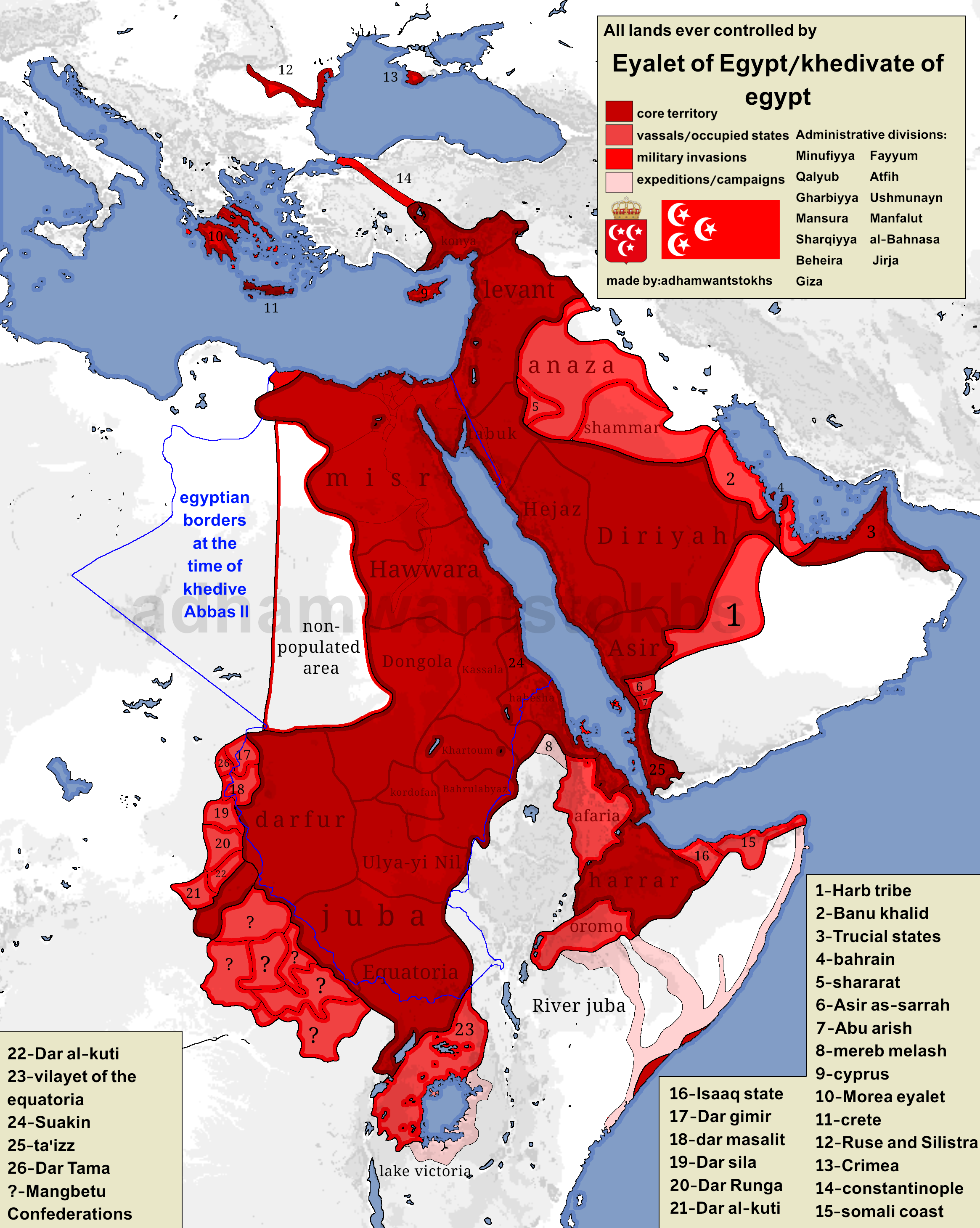
Map of Territories Ruled by Eyalet of Egypt
## What This Map Shows\nThis map illustrates the expansive territories once ruled by the Eyalet of Egypt and the later K...
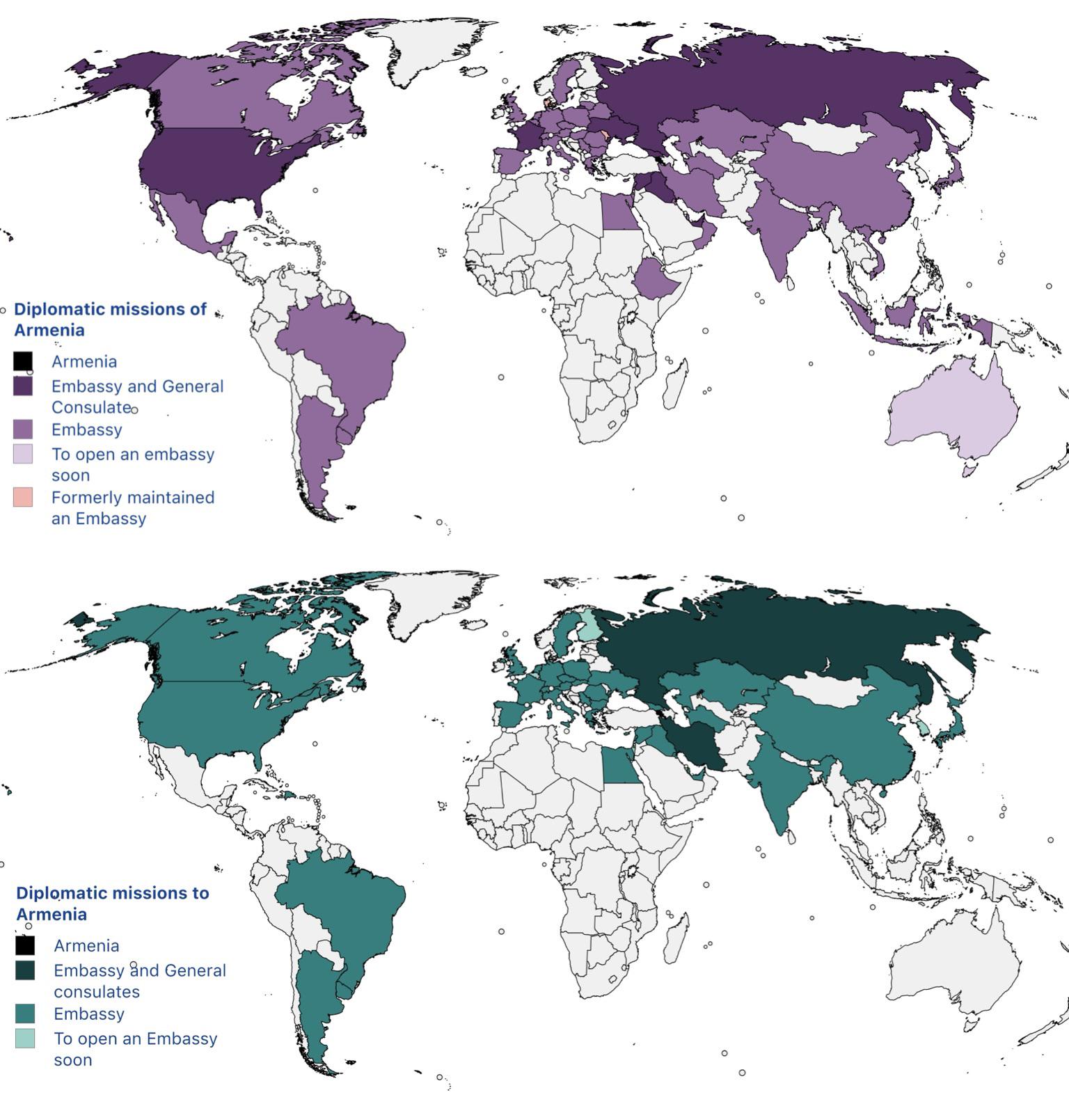
Diplomatic Missions of Armenia Map
## What This Map Shows...
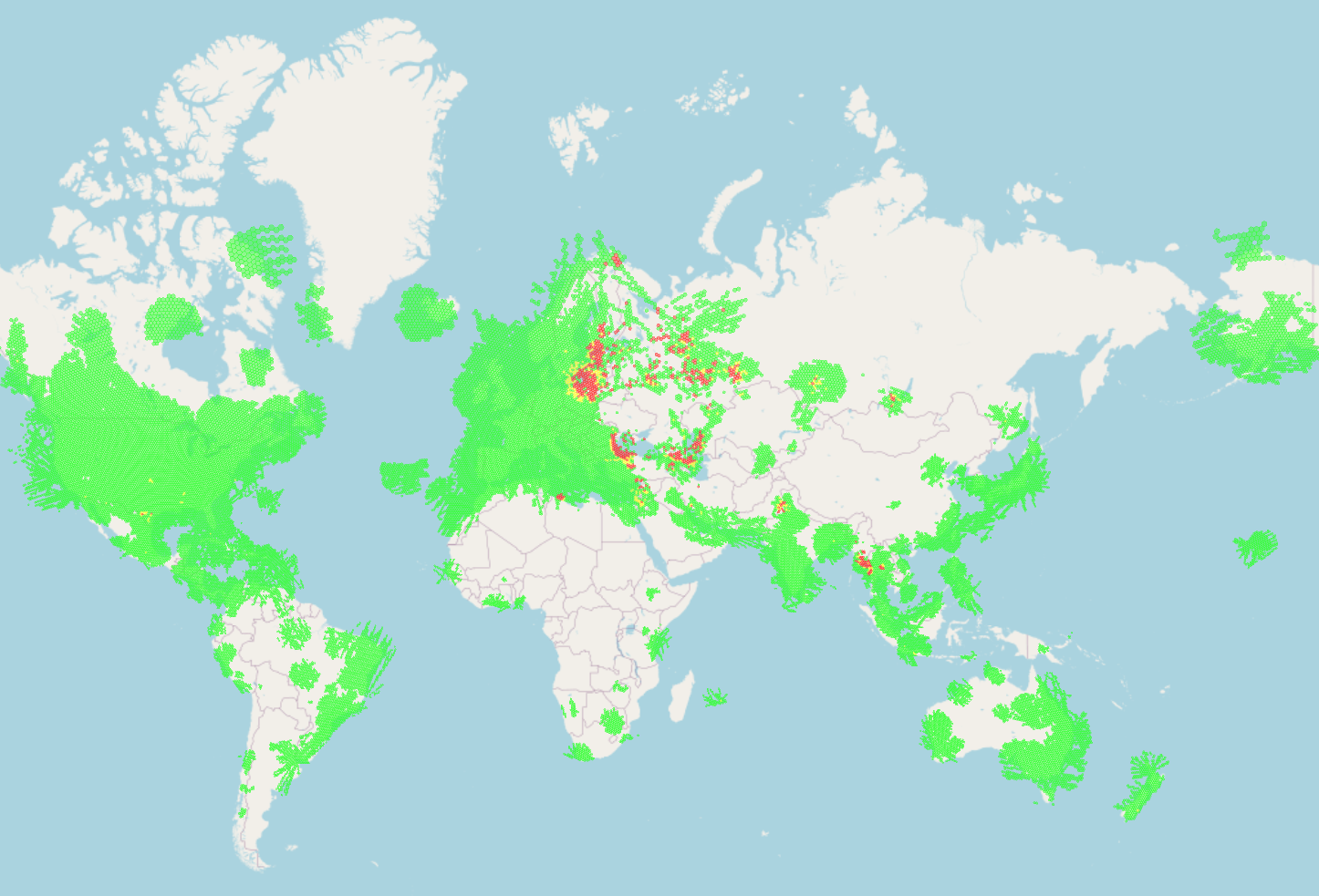
GPS Signal Jamming Map and Global Conflicts
## What This Map Shows\nThe map titled \...
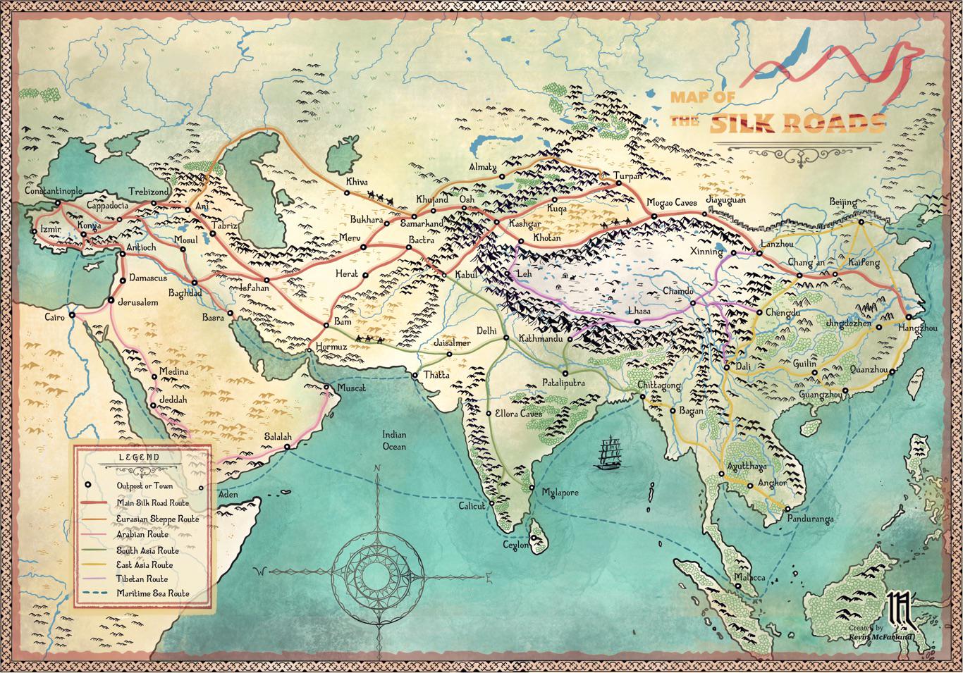
Silk Roads Trade Routes Map
## What This Map Shows\nThis hand-drawn map titled \...
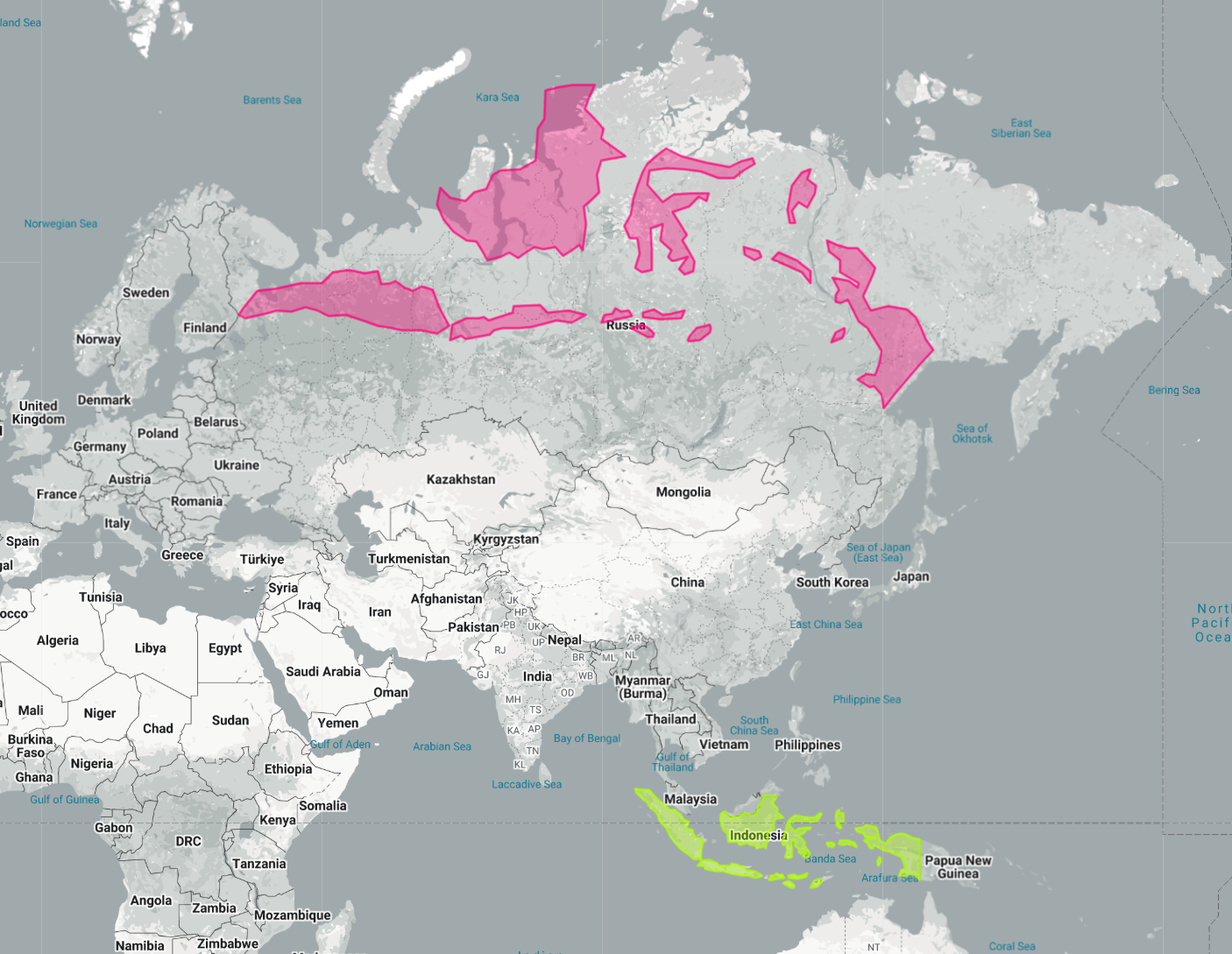
Indonesia Laid Out Over Russia Map
## What This Map Shows...
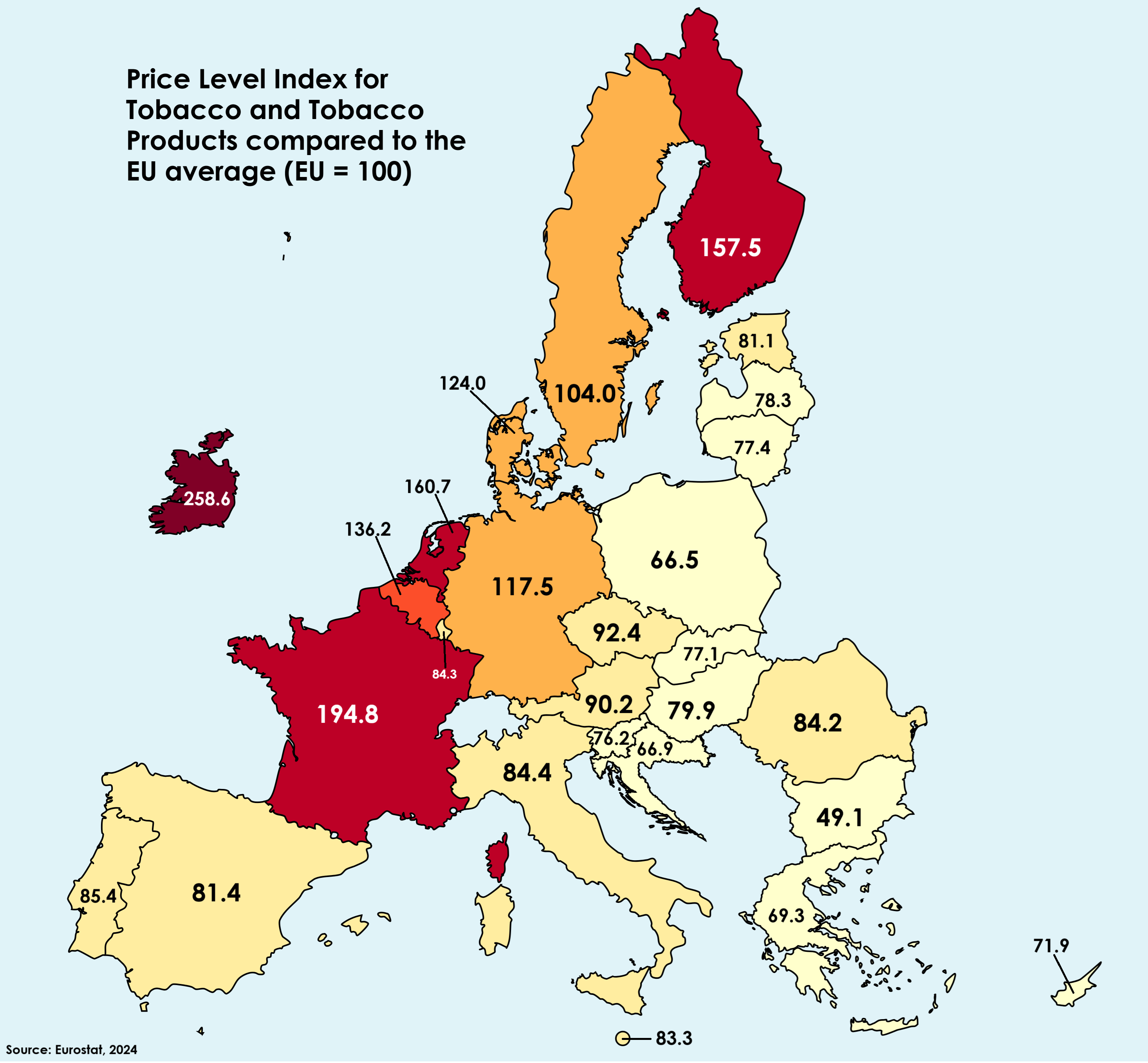
Tobacco Prices in EU Compared to Average Map
## What This Map Shows...
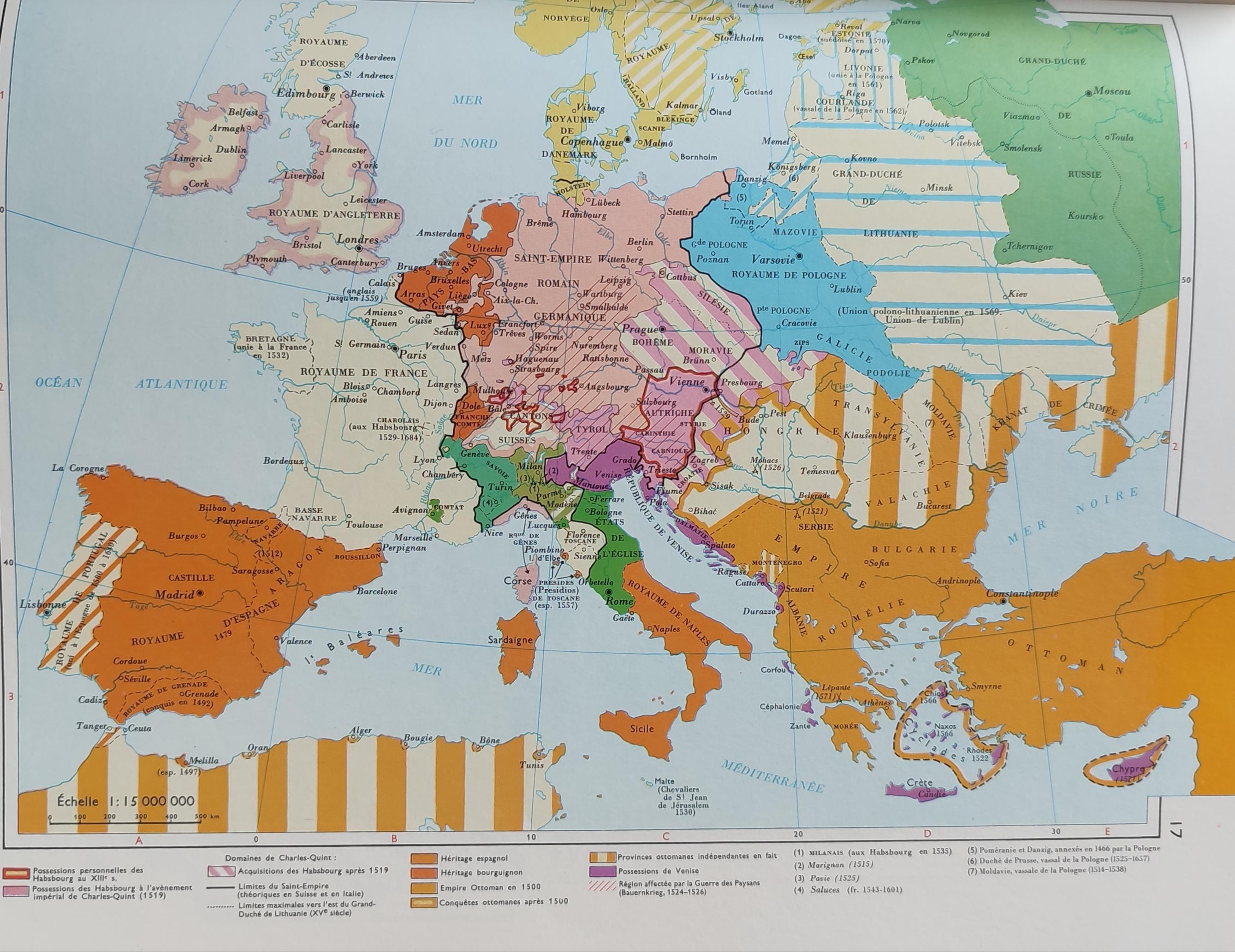
Simplified Map of Europe in the 16th Century
## What This Map Shows...
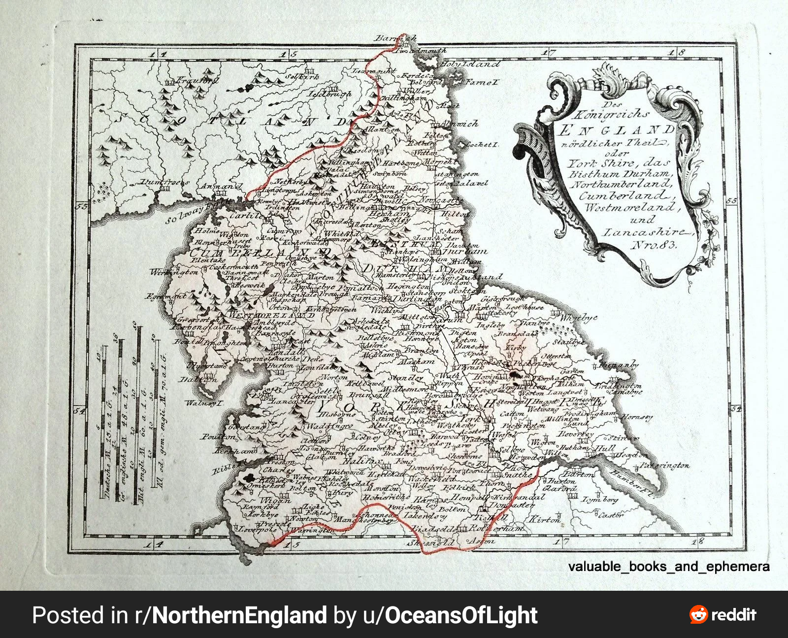
1789 Map of Northern England Map
## What This Map Shows...
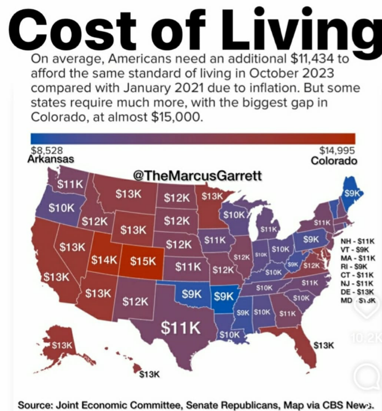
Cost of Living Increase by State Map
## What This Map Shows...
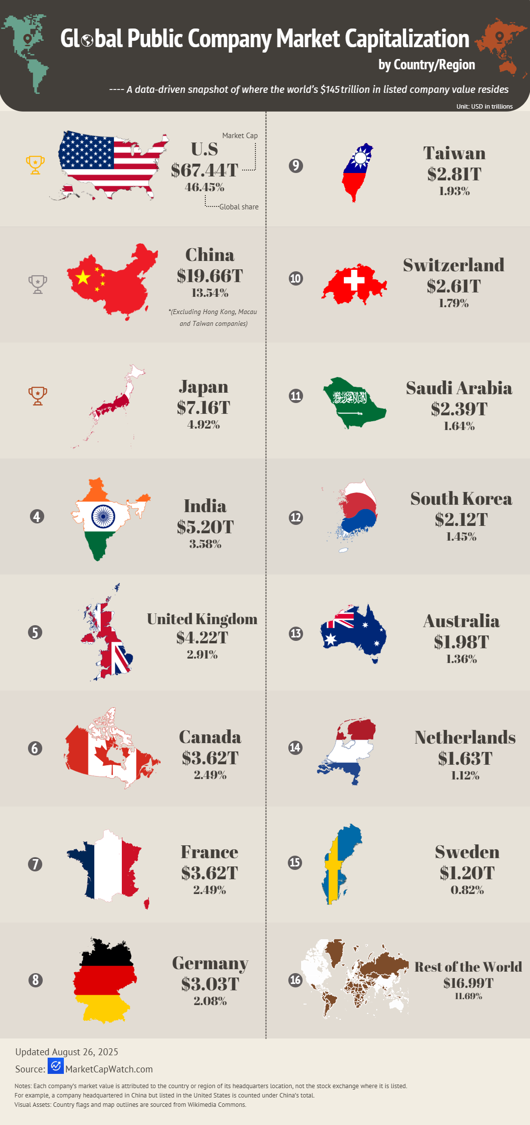
Global Public Company Market Capitalization by Country Map
## What This Map Shows...
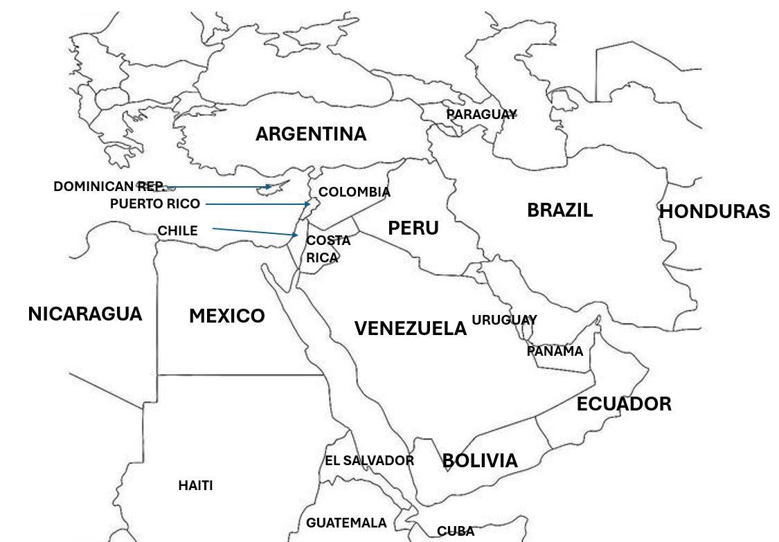
Cultural Perceptions Map of the Middle East
## What This Map Shows...
