Geographic Visualizations
Explore our curated collection of fascinating geographic visualizations and cartographic analyses. Discover detailed maps, data visualizations, and geographical insights from around the world.
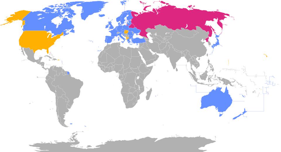
Troop Deployment Map for Ukraine Conflict
## What This Map Shows...
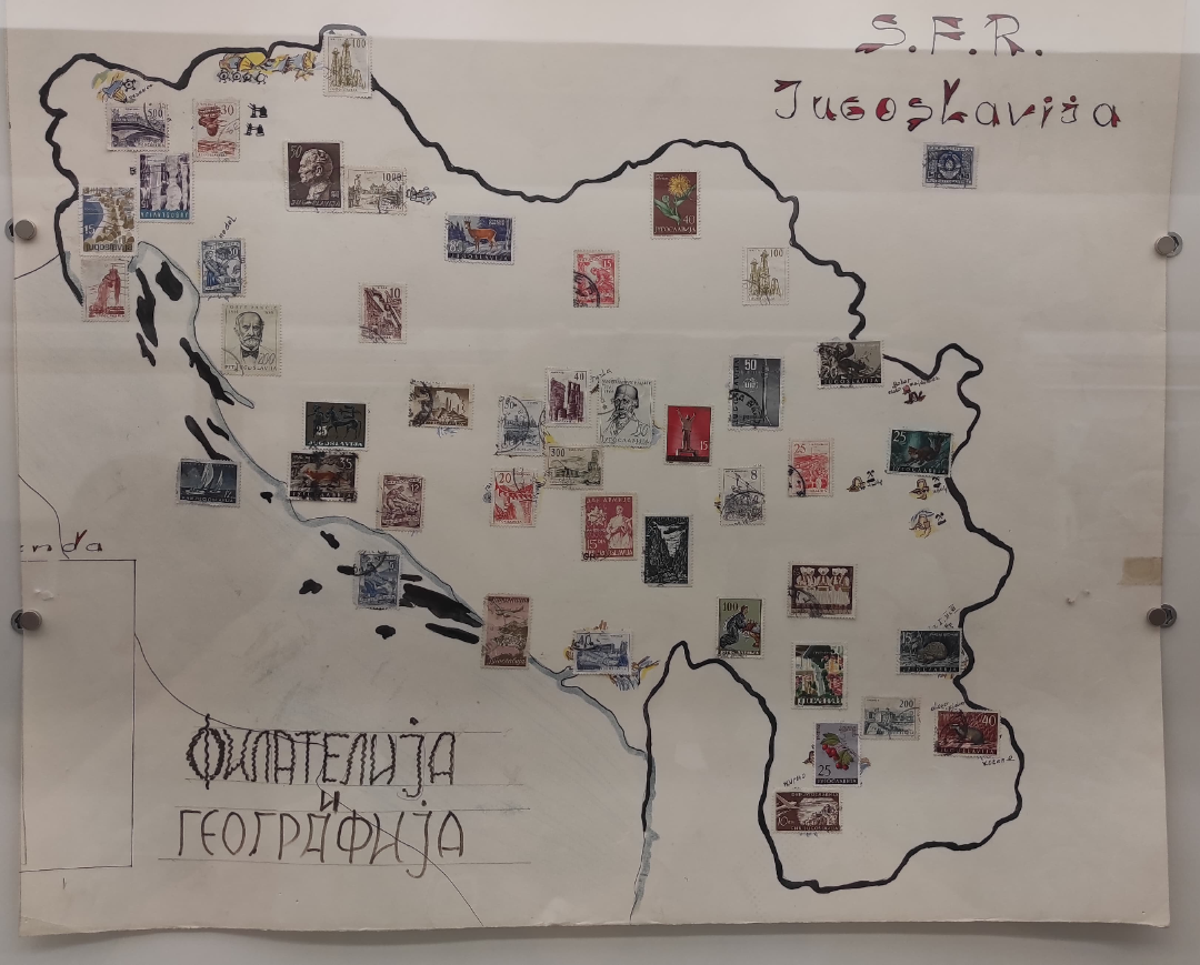
Map of Yugoslavia with Regional Stamps
## What This Map Shows...
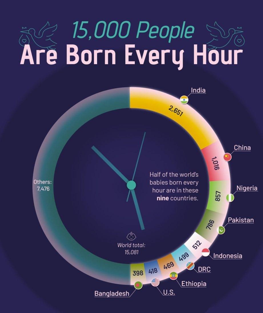
Map of Global Birth Rates by Country
## What This Map Shows...
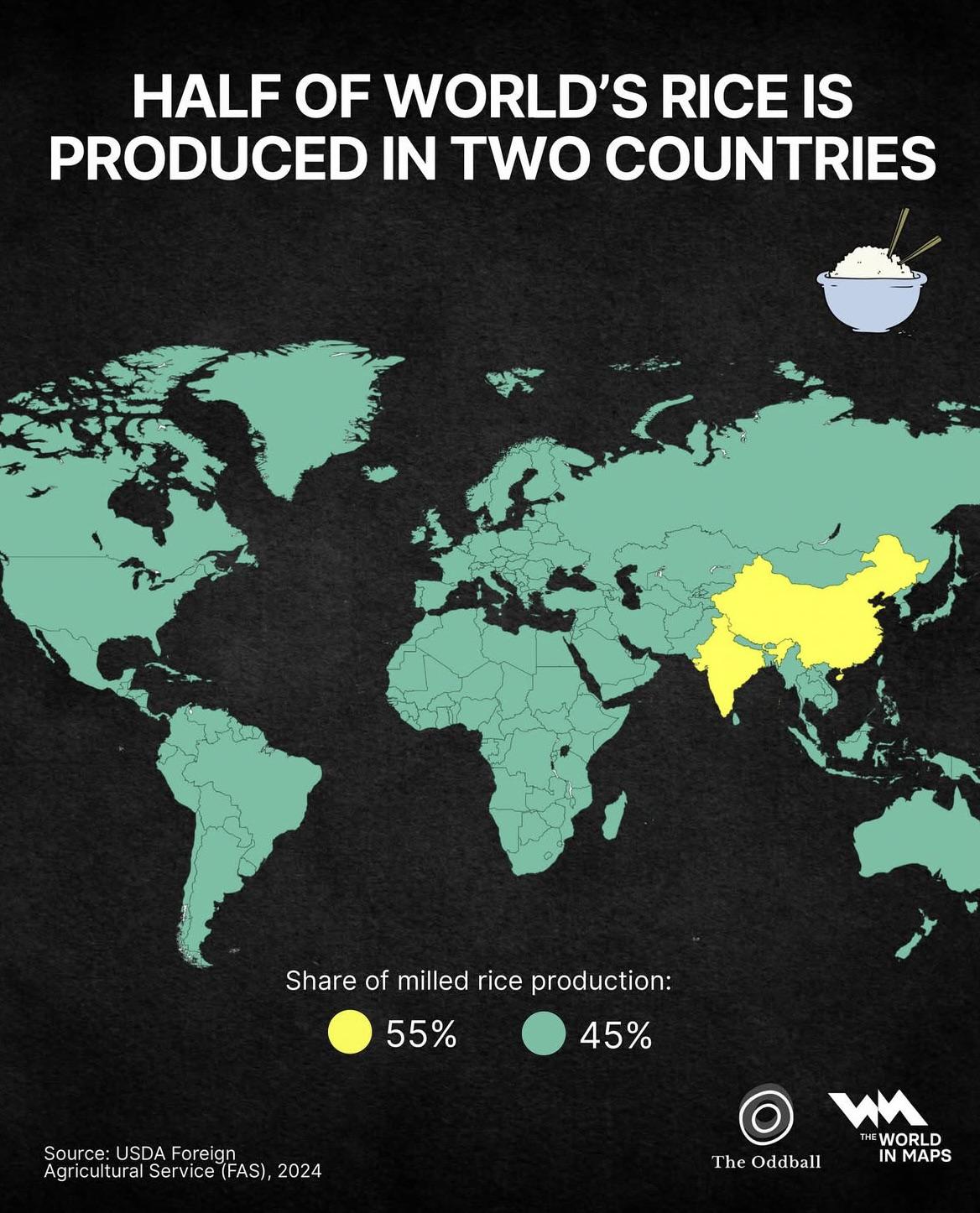
Rice Production Map by Country
## What This Map Shows...
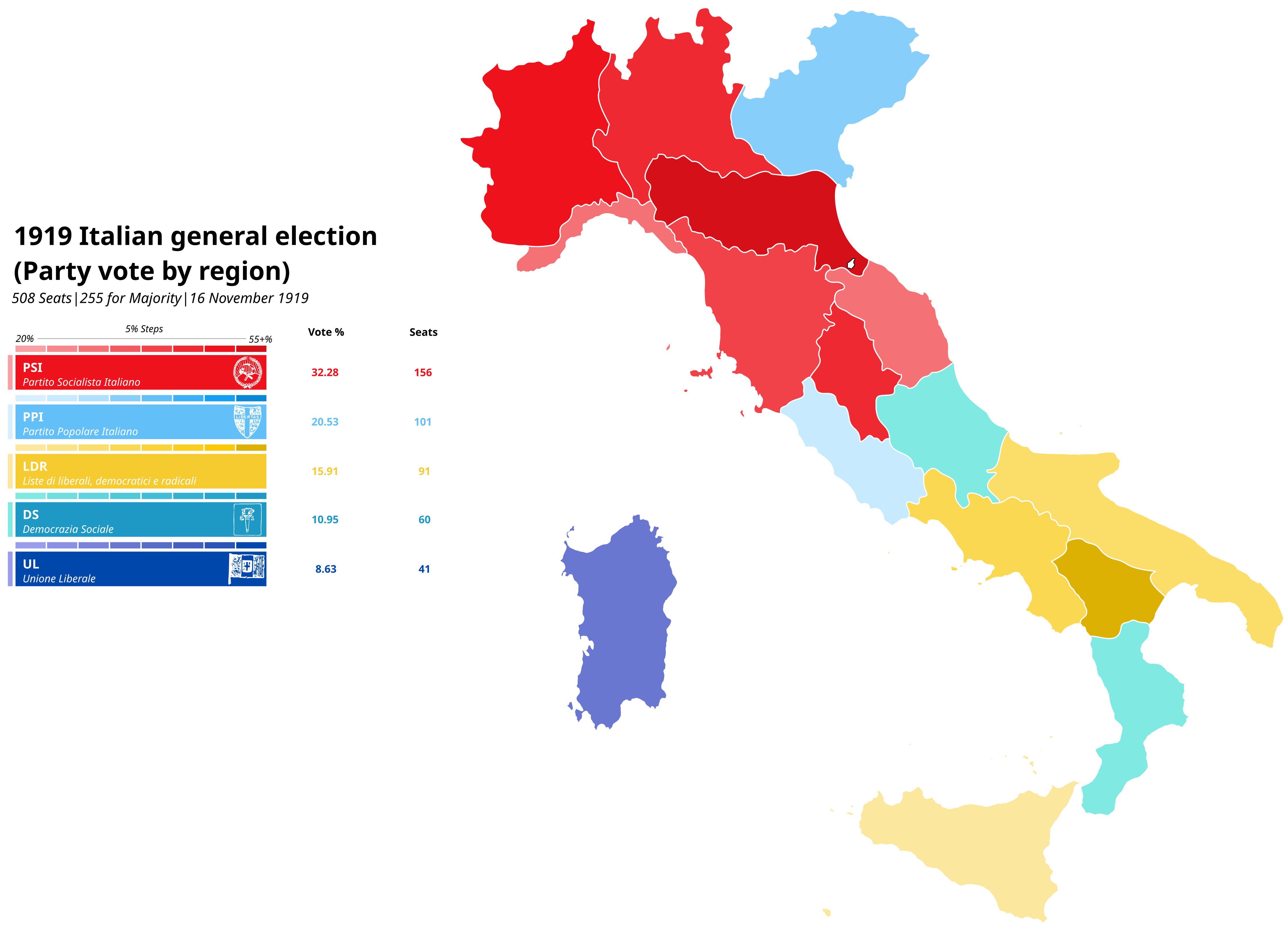
Map of the 1919 Italian General Election by Region
## What This Map Shows...
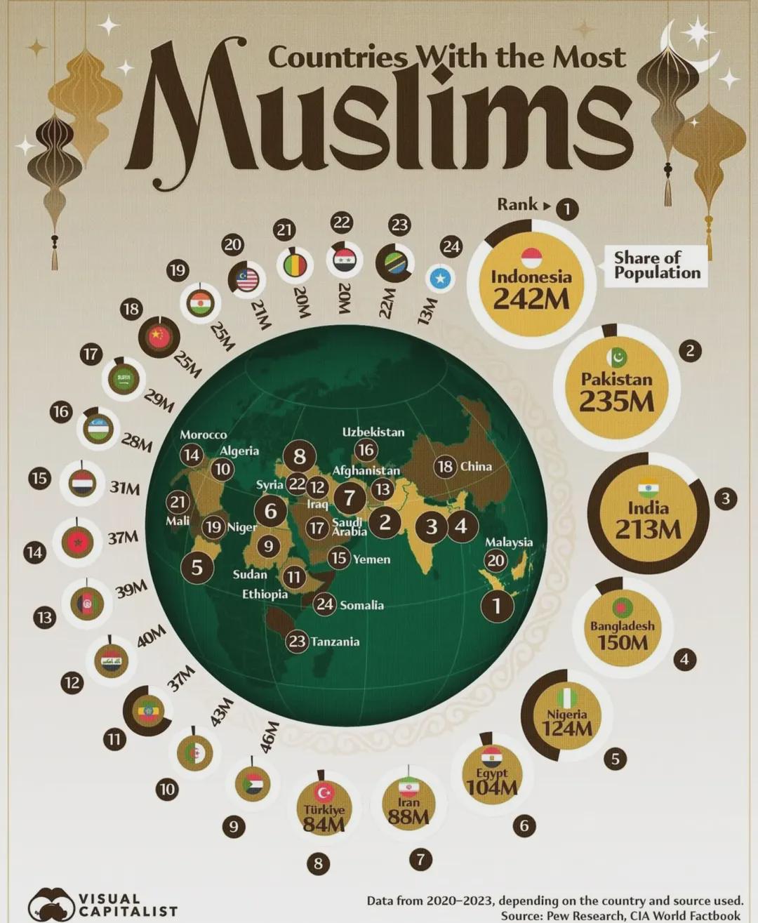
Countries With The Most Muslims Map
## What This Map Shows...
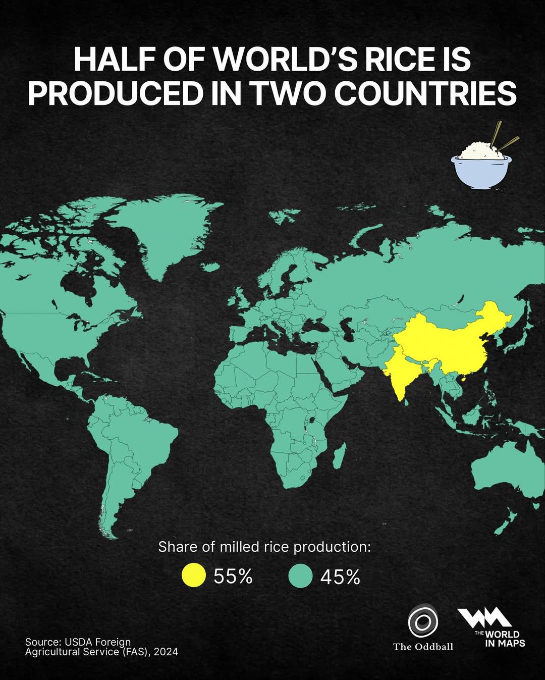
Rice Production Map of the World
## What This Map Shows...
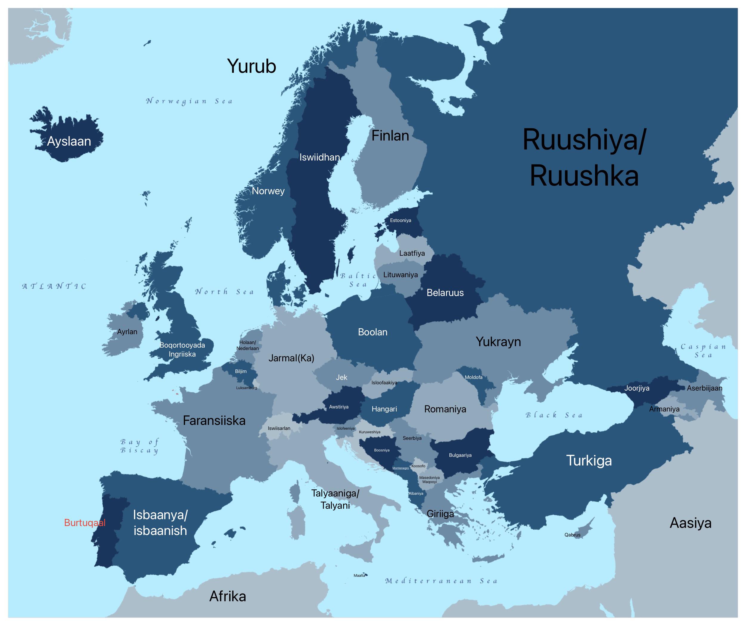
European Countries in AfSomali Map
## What This Map Shows...
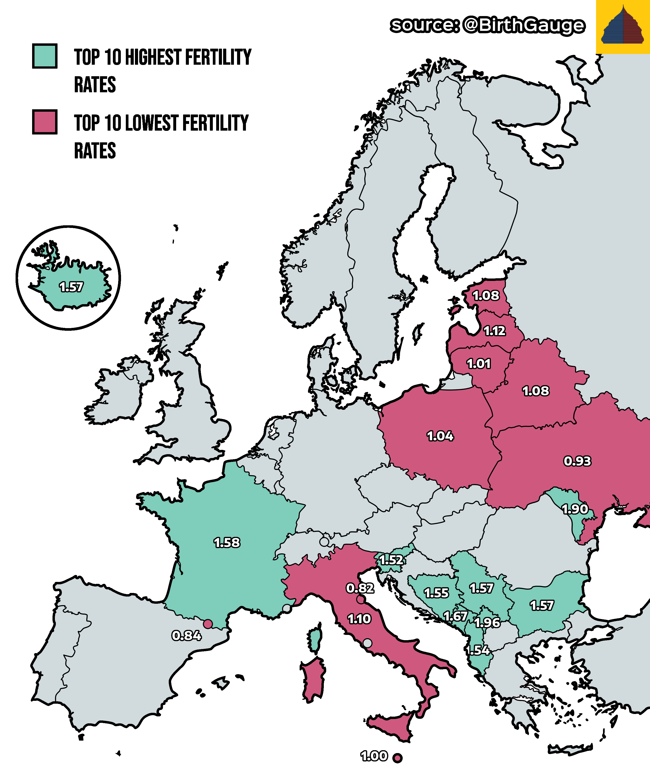
Europe’s Highest and Lowest Fertility Rates Map
## What This Map Shows...
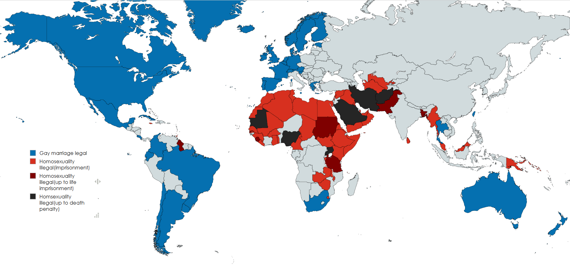
Map of Countries Legalizing Gay Marriage vs. Criminalizing Homosexuality
## What This Map Shows...
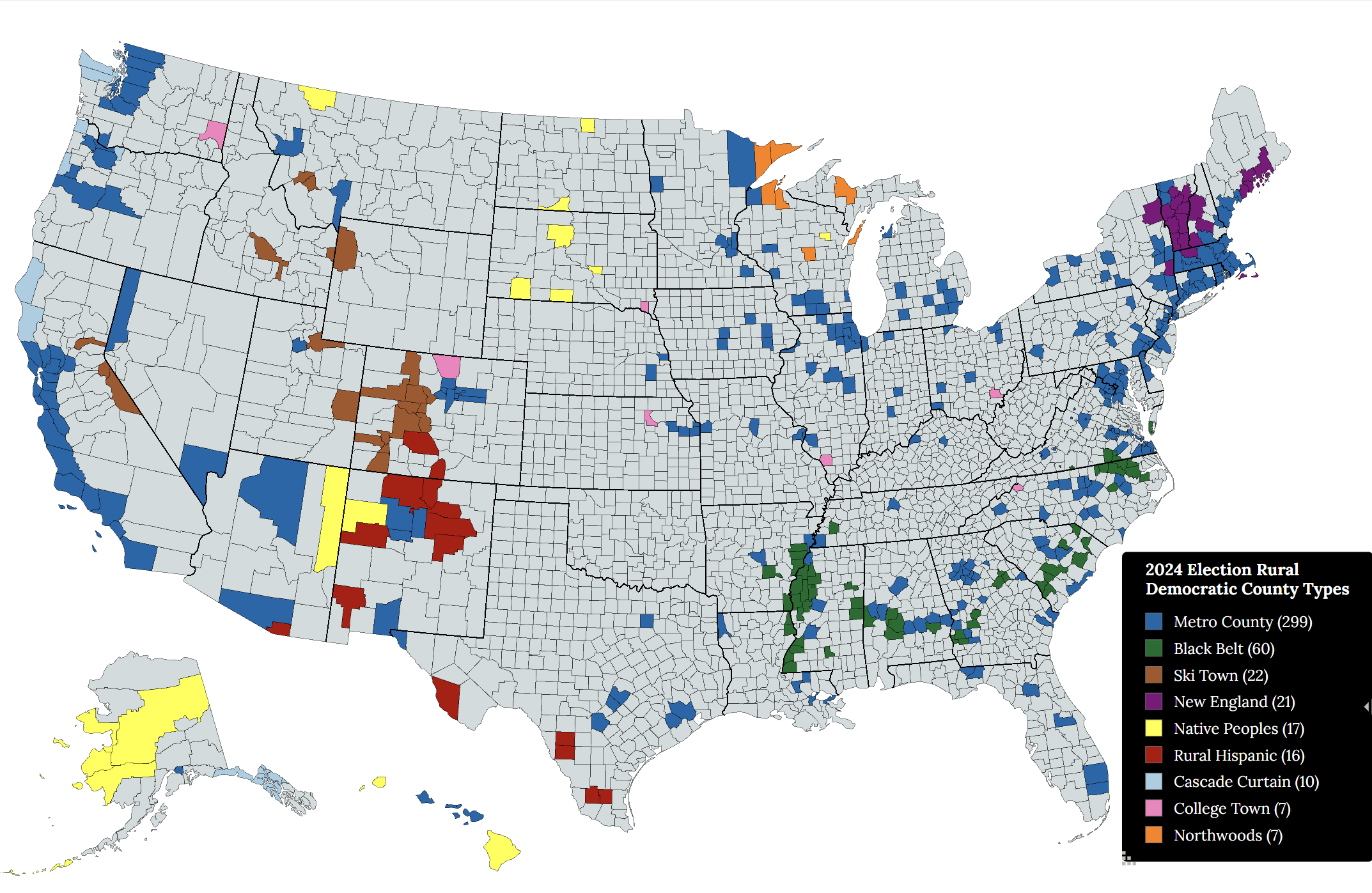
Rural Democratic Voting County Types Map
## What This Map Shows...
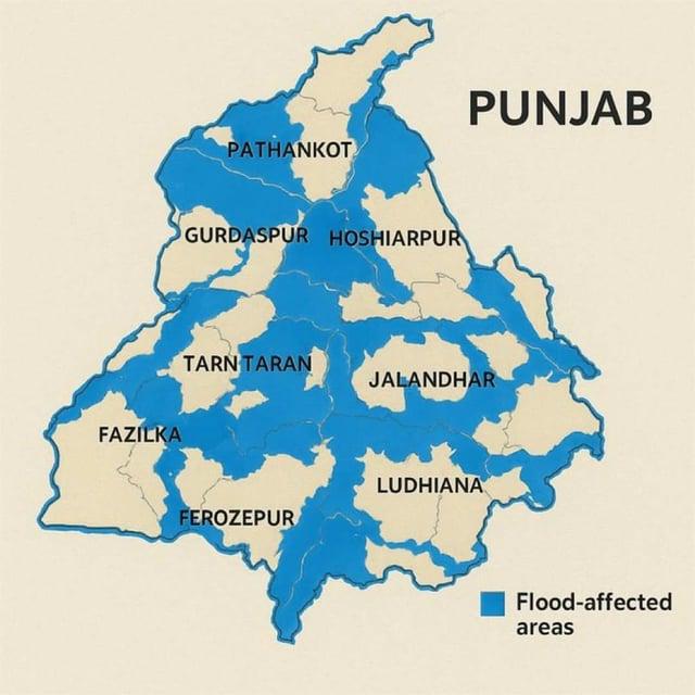
Flood-Affected Areas in Punjab, India Map
## What This Map Shows\nThe map titled 'Flood-Affected Areas in Punjab, India' provides a visual representation of the r...
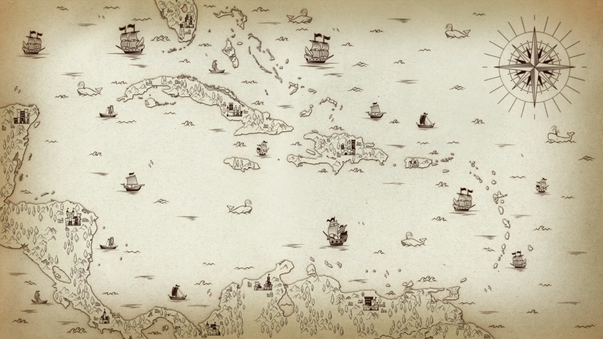
Map from Spongebob Episode Dopey Dick
## What This Map Shows...
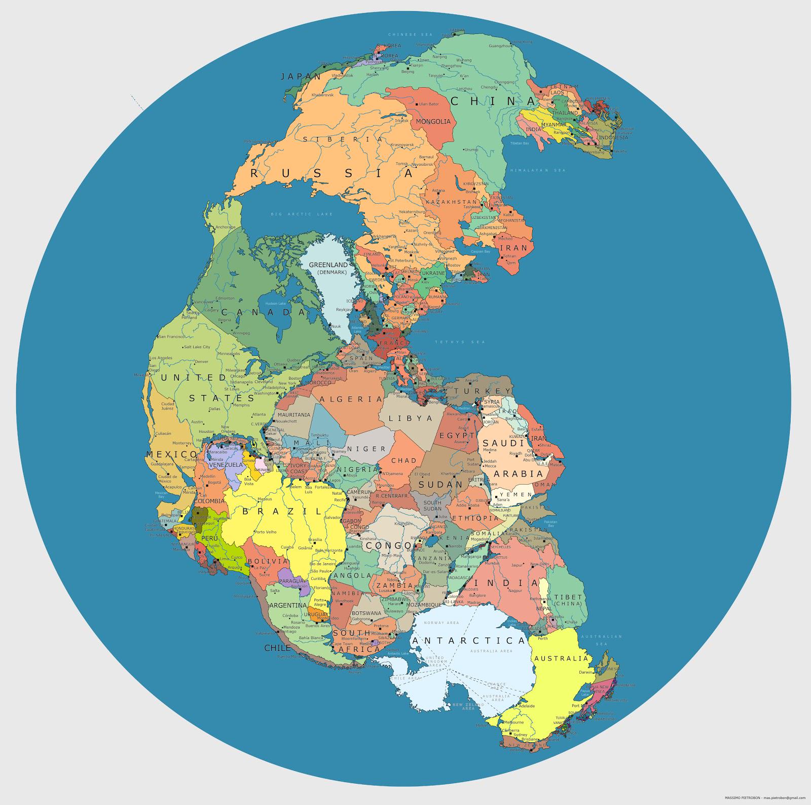
Modern Day Pangea Map with Current Borders
## What This Map Shows...
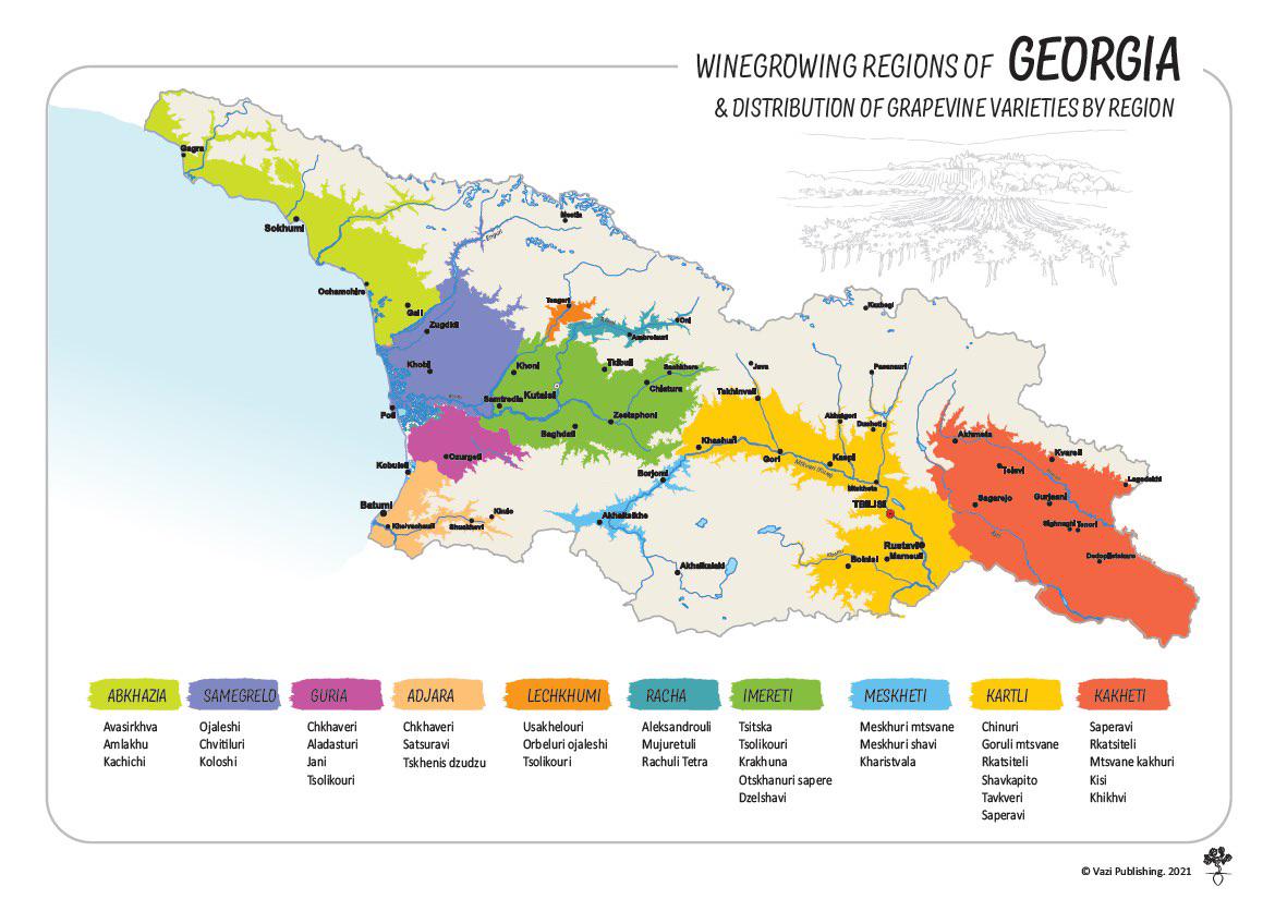
Winegrowing Regions of Georgia Map
## What This Map Shows...
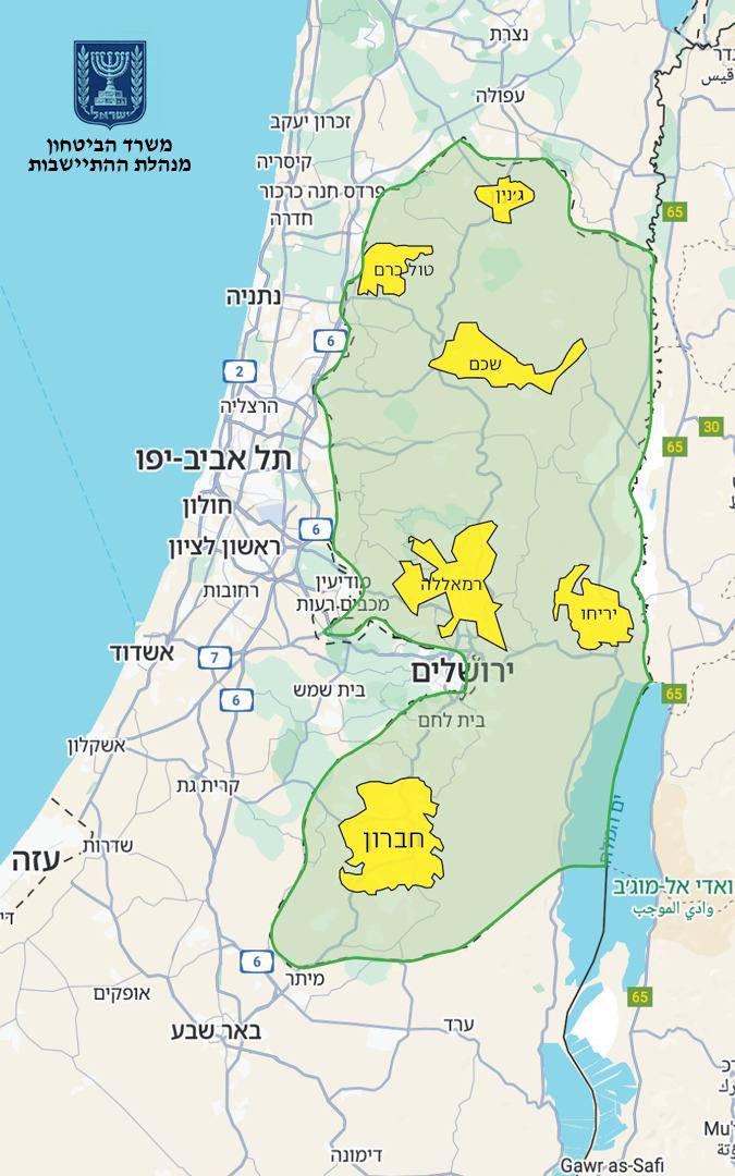
Israel Annexation Map of 82% West Bank
## What This Map Shows...
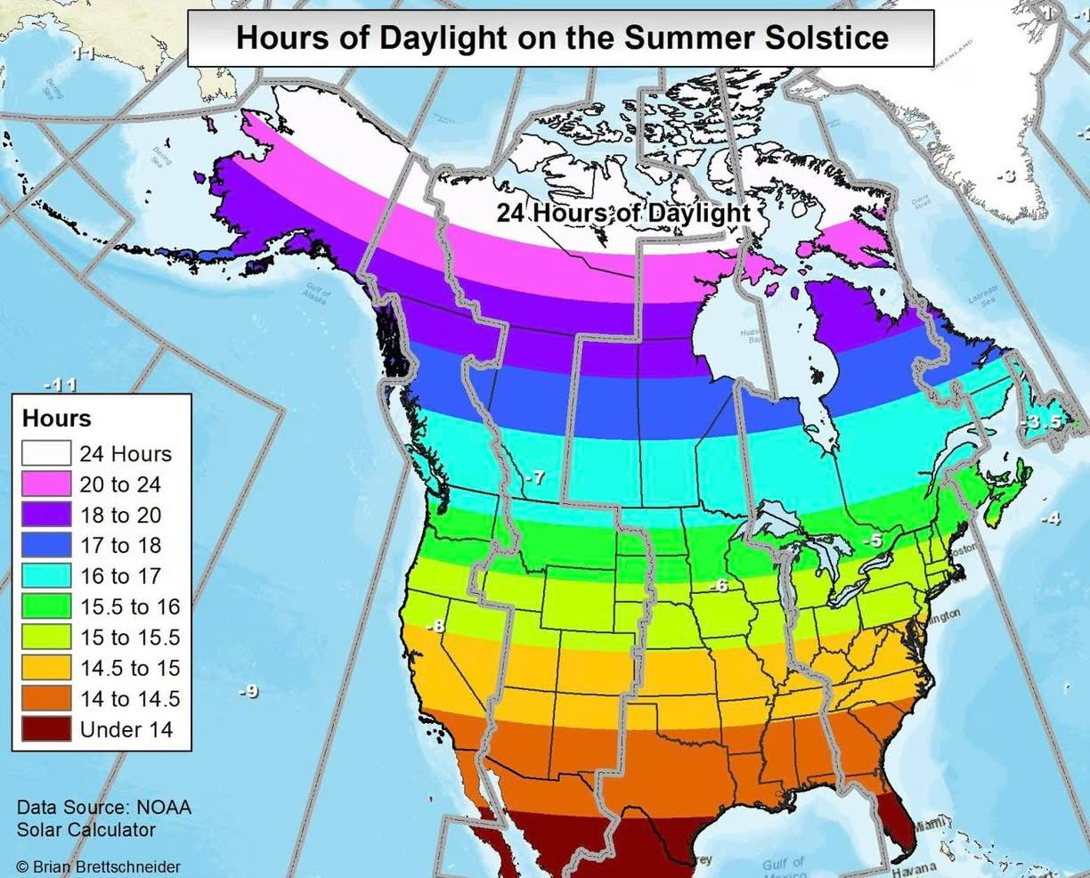
Hours of Daylight on the Summer Solstice Map
## What This Map Shows...
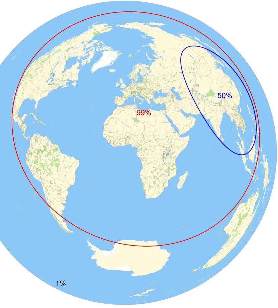
Population Distribution and Area Map
## What This Map Shows...
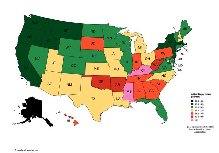
Map of Estimated Daily Sugar Intake By U.S. State
## What This Map Shows...
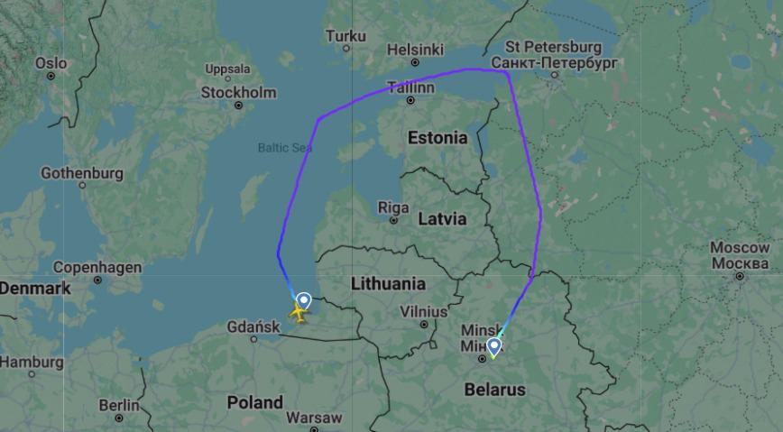
Flight Route Map Between Kaliningrad and Minsk Airports
## What This Map Shows...