urban geography Maps
14 geographic visualizations tagged with "urban geography"
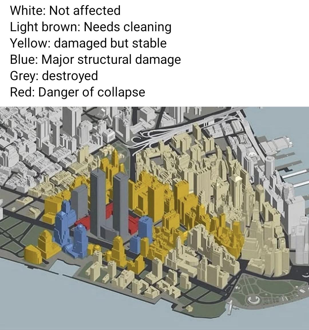
September 11 2001 Damage Map
The "September 11 2001 Damage Map" visually represents the extensive destruction that occurred during the terrorist atta...
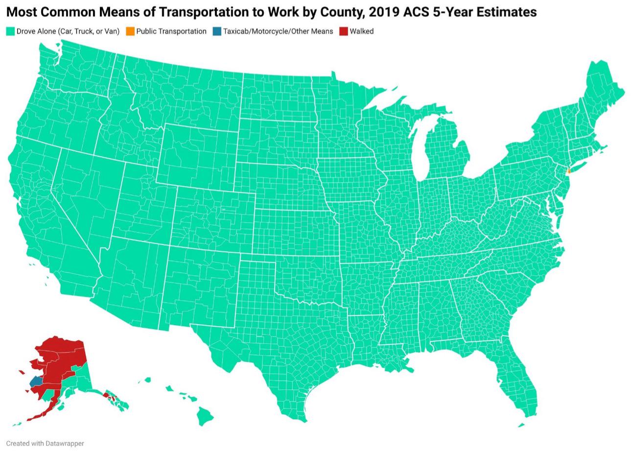
How Americans Get to Work Map
This map provides a visual representation of the various modes of transportation that Americans utilize to commute to wo...
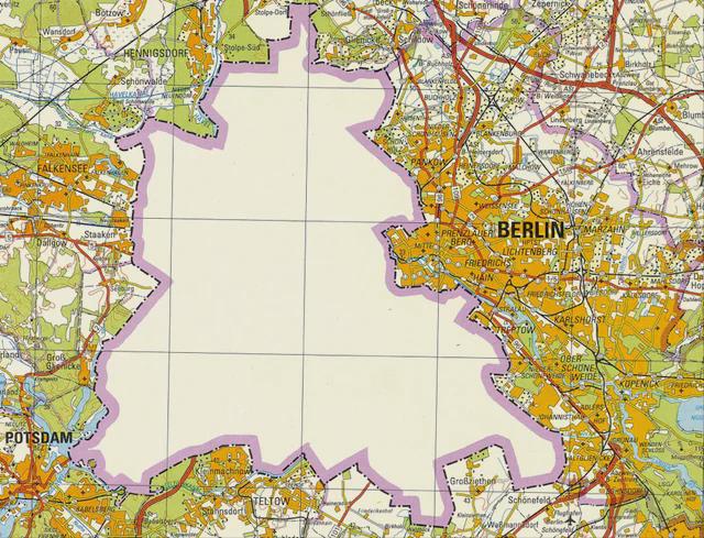
East German Map of West Berlin in 1988
One of the remarkable aspects of West Berlin was its demographic composition. In the late 1980s, the population of West ...
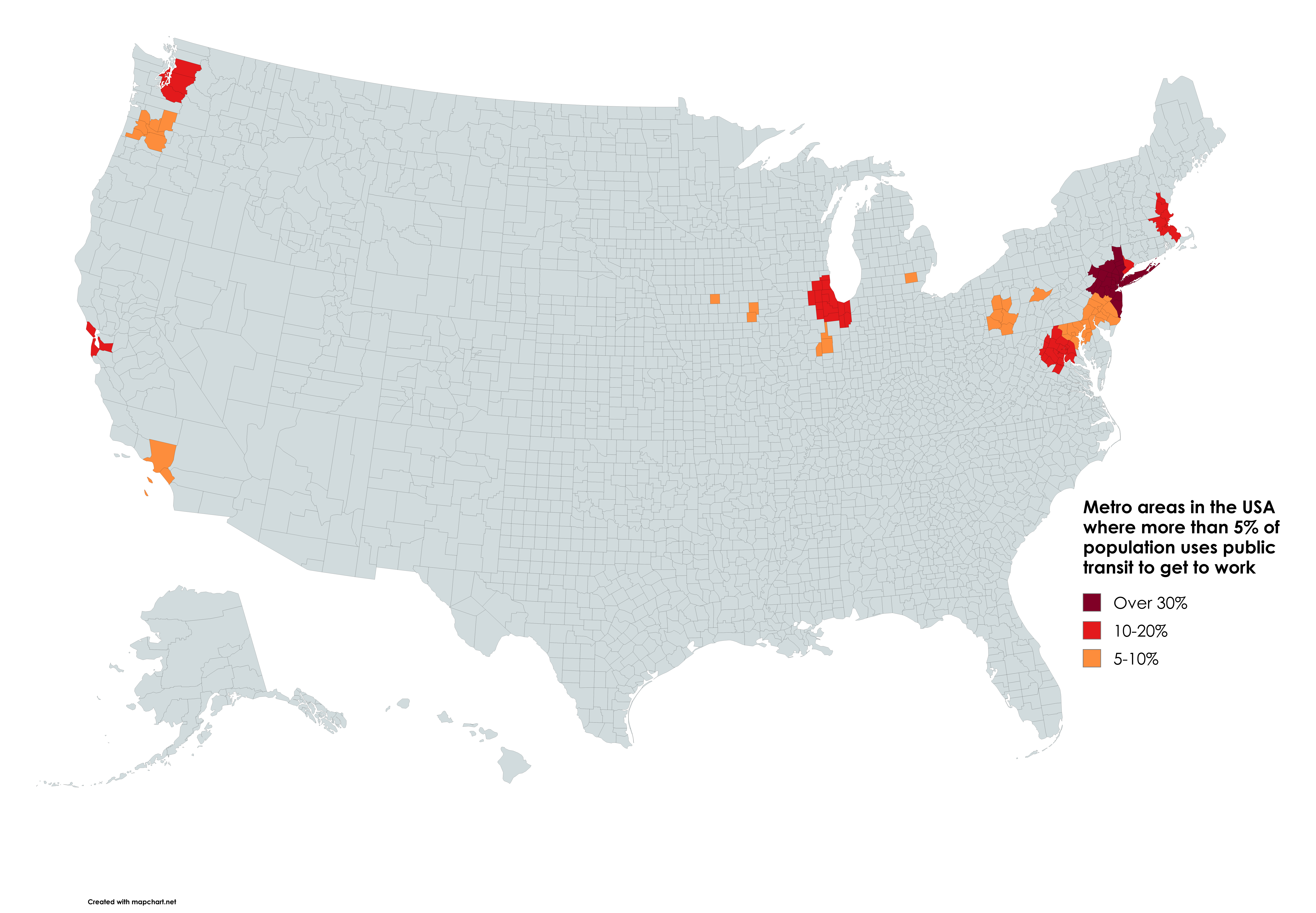
Public Transit Usage by Metro Area Map
According to the latest data from the U.S. Census Bureau, cities like New York, San Francisco, and Washington D.C. showc...
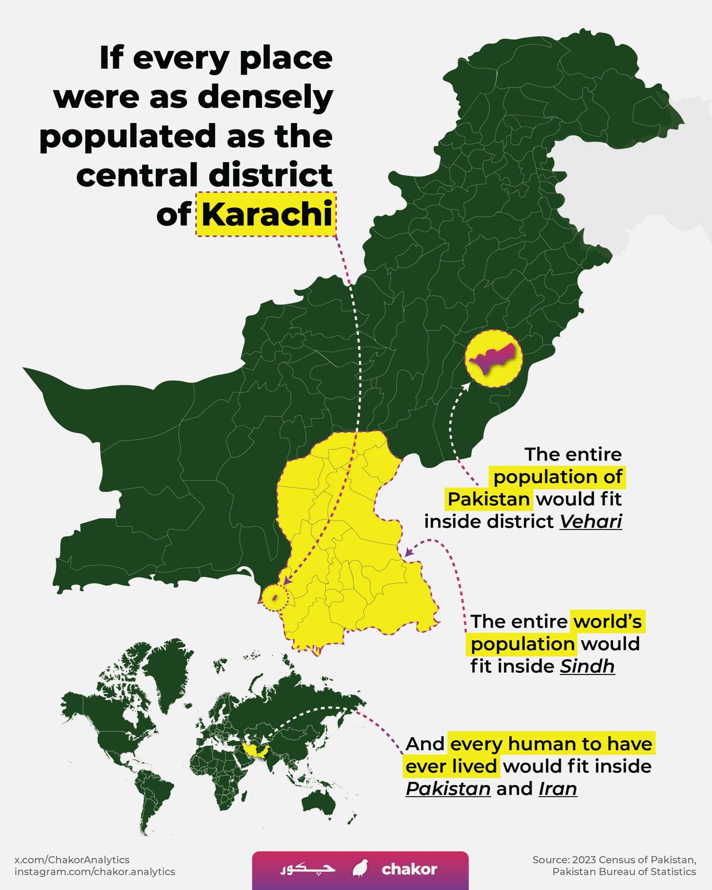
Population Density Map of Central District Karachi
The "Population Density Map of Central District Karachi" offers a detailed visual representation of the distribution of ...
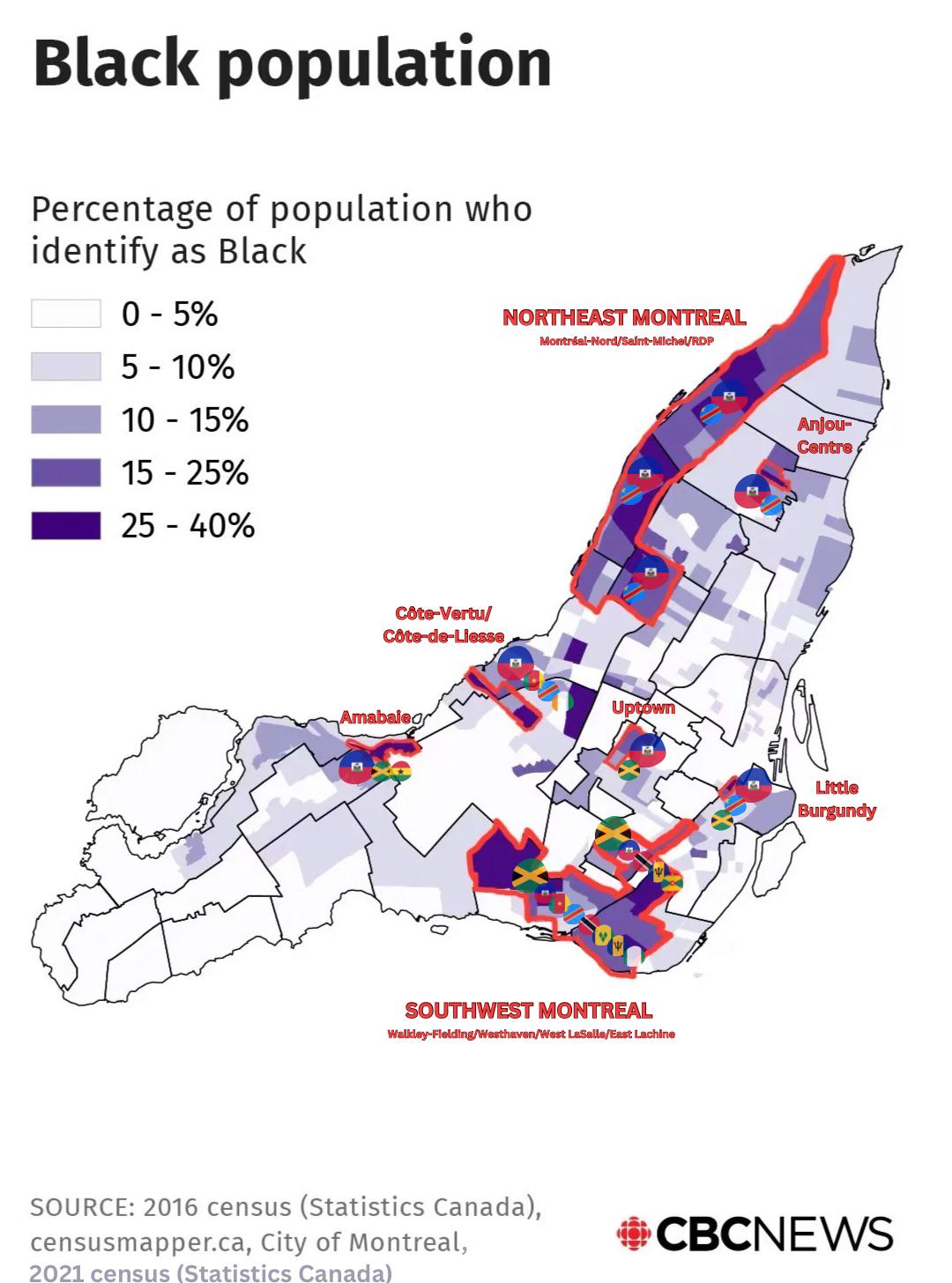
Montreal's Black Population Diversity Map
This map illustrates the diversity and distribution of Montreal's Black population, shedding light on how various commun...
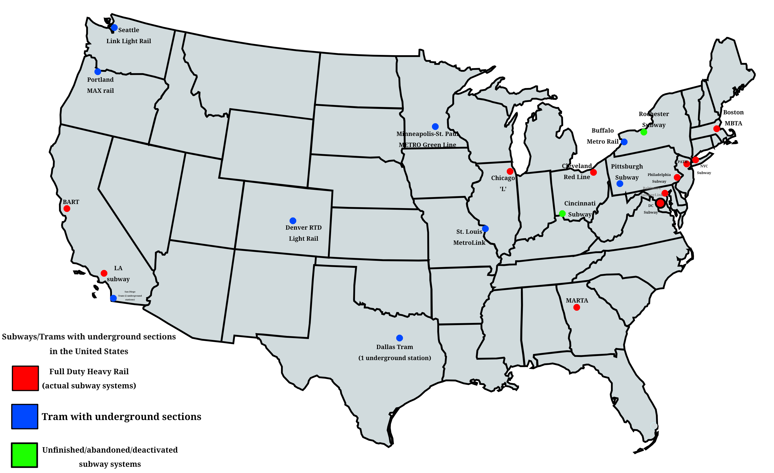
Subway and Tram Systems with Underground Sections Map
This comprehensive map provides a detailed overview of all subway and tram systems across the United States that feature...
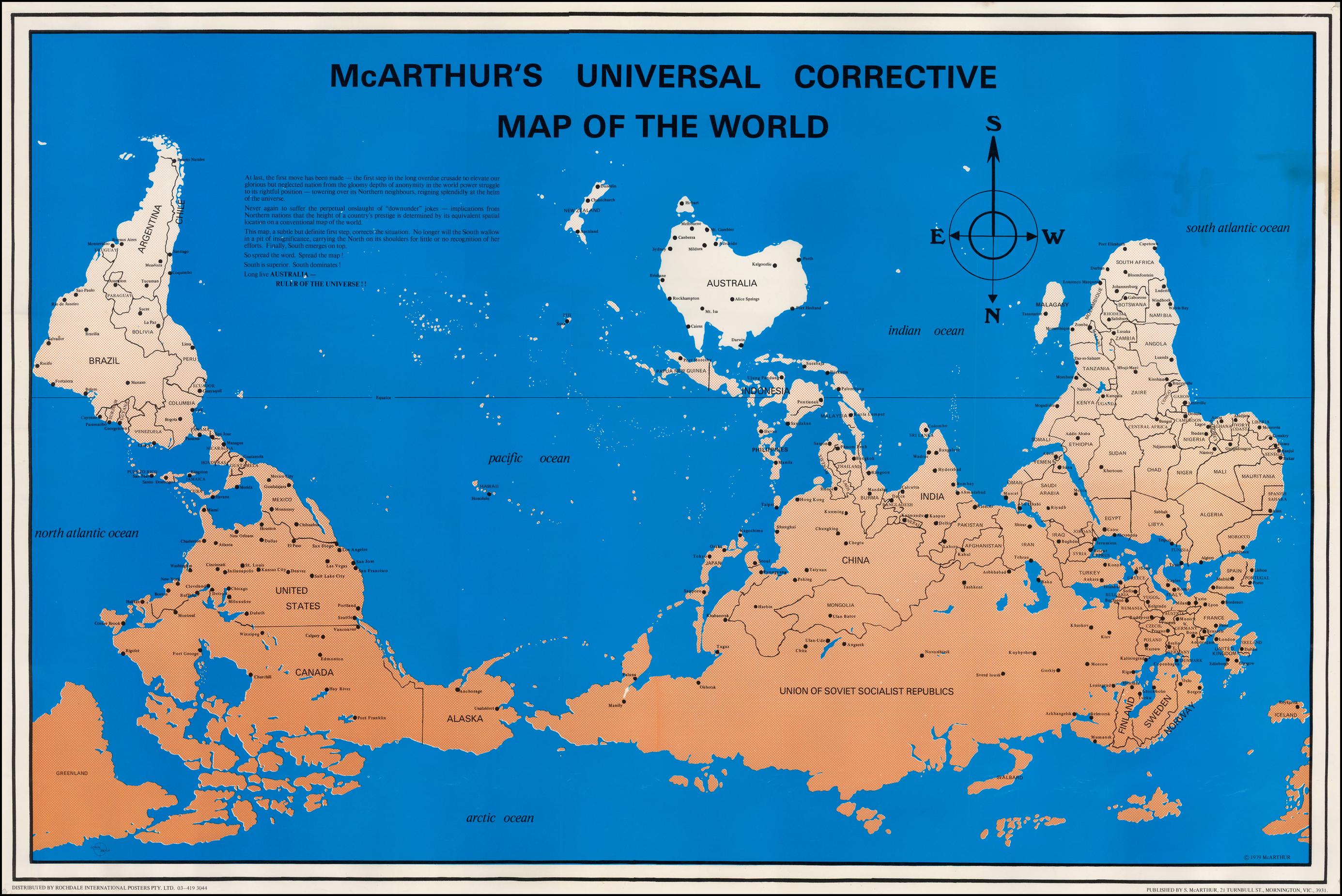
Modern Corrective Upside Down Map
The modern corrective upside down map is a unique visualization that turns the traditional map orientation on its head, ...
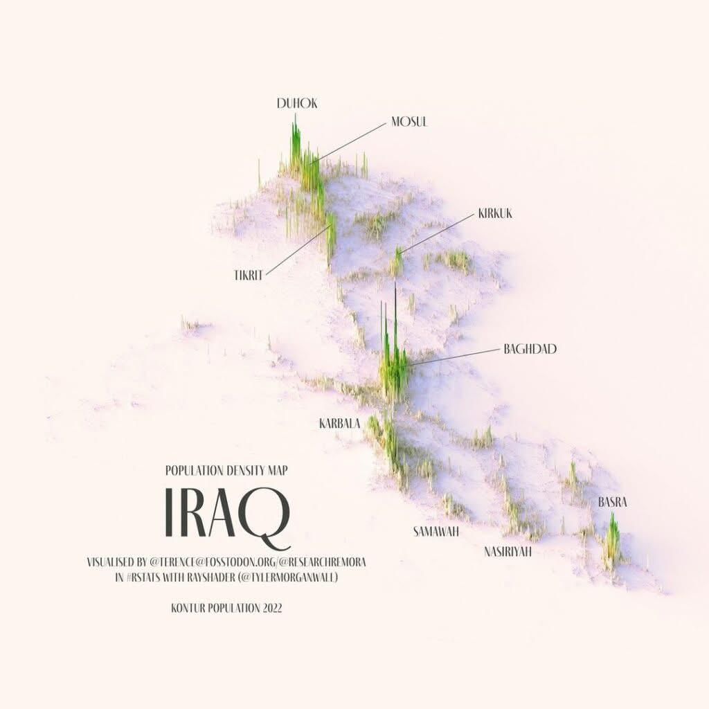
Relief Population Density Map of Iraq
Baghdad, with a population of approximately 8 million, is not just the capital but also the largest city in the country,...
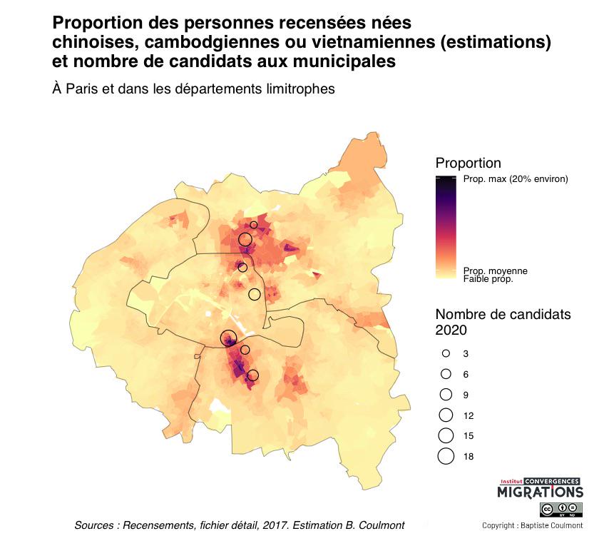
Map of Chinese, Vietnamese, and Cambodian Birthplaces in Paris
This map illustrates the percentage of people born in China, Vietnam, or Cambodia across Paris and its surrounding subur...
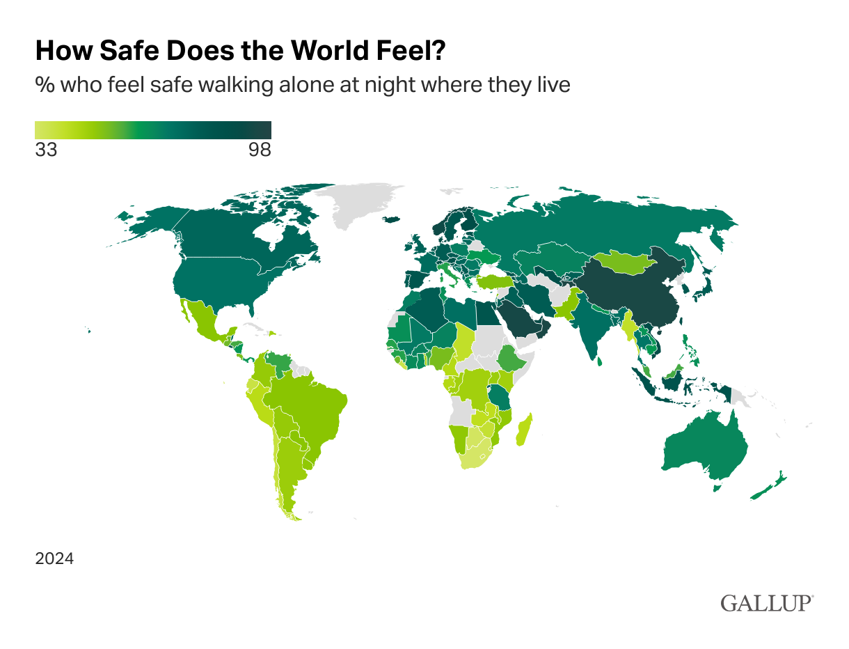
Safety Perception Map Walking at Night
The map titled "Do You Feel Safe Walking at Night?" presents a visual representation of residents' perceptions of safety...
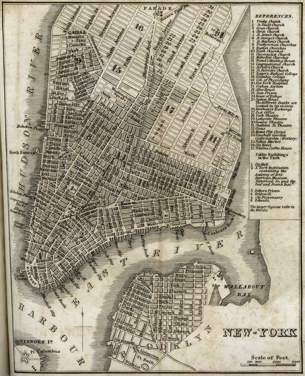
Map of New York City in 1842
The "New-York" map from 1842 by H.S. Tanner provides a detailed depiction of New York City during a transformative perio...
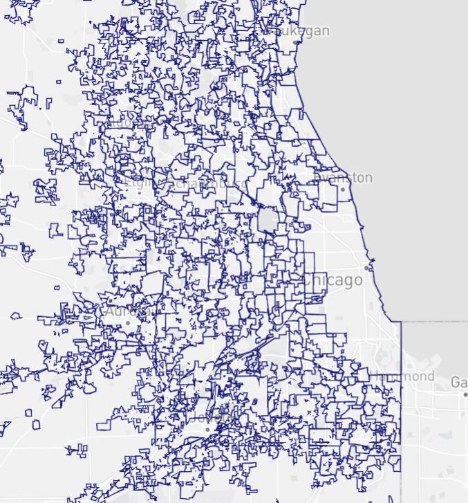
Chicago Metro City Boundaries Map
The "Chicago Metro City Boundaries Map" provides a striking visual representation of the various city boundaries within ...
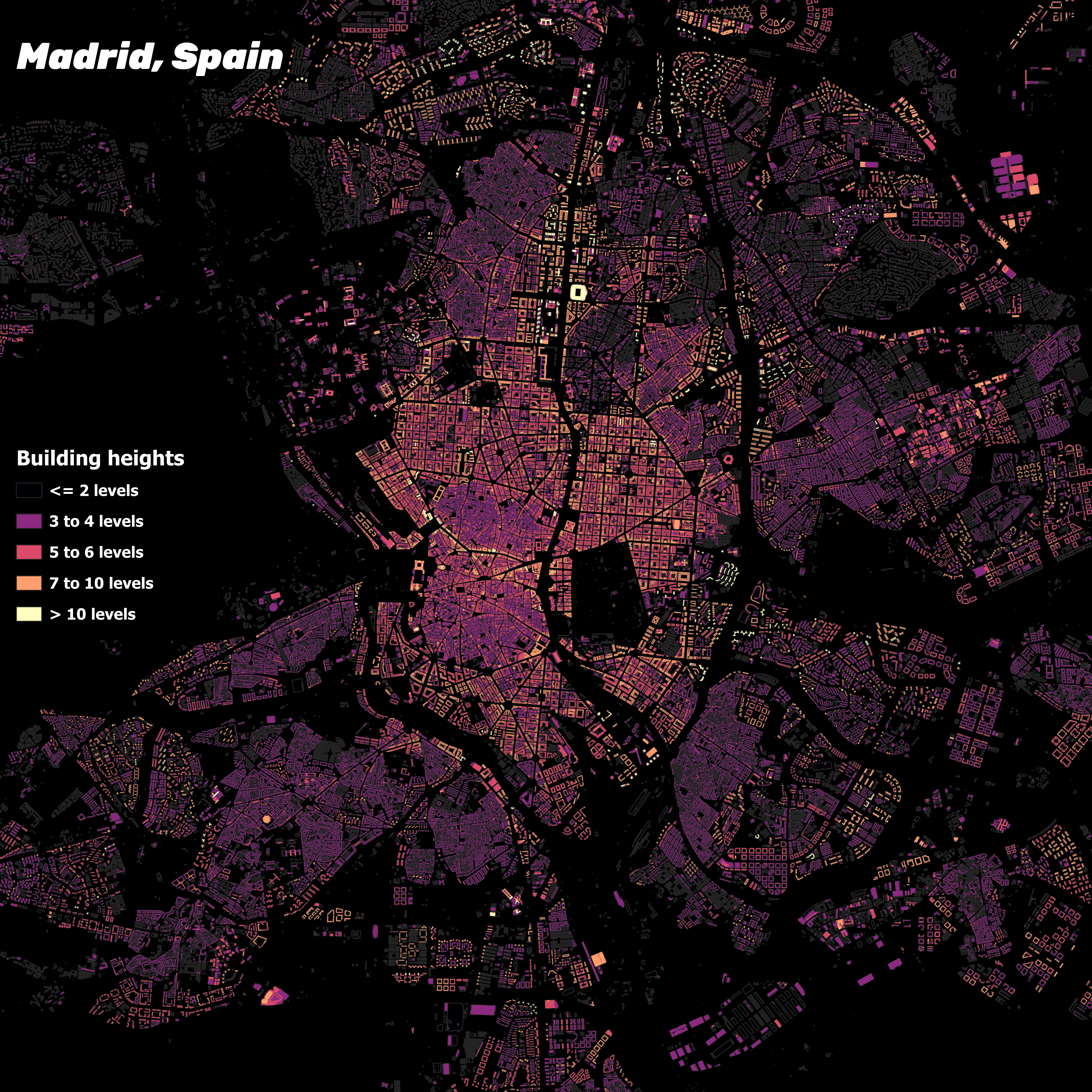
Building Heights in Madrid, Spain Map
The "Building Heights in Madrid, Spain Map" provides a comprehensive overview of the vertical landscape of Madrid, showc...