south america Maps
21 geographic visualizations tagged with "south america"
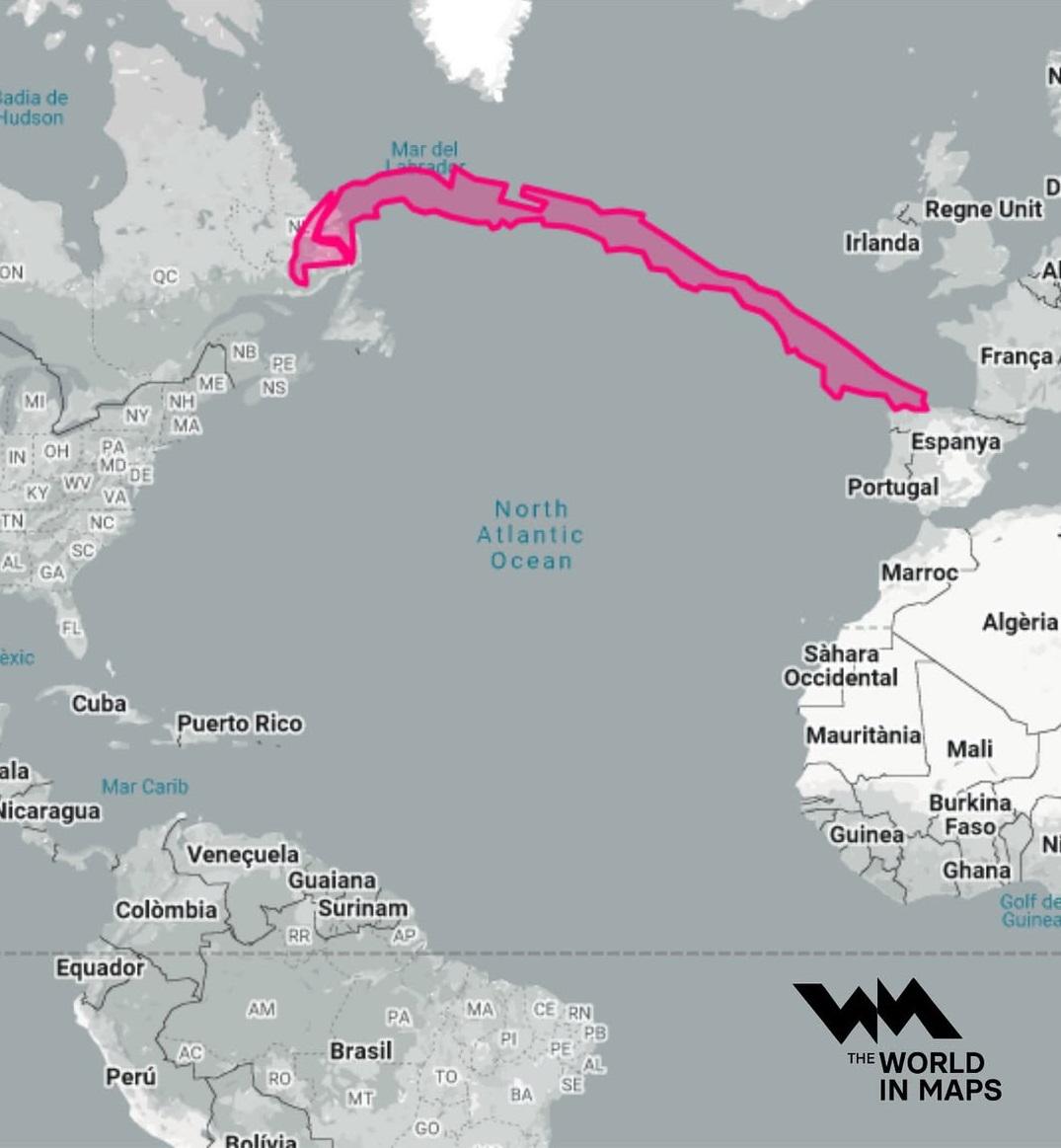
Geographical Length of Chile Map
The northern region of Chile is known for the Atacama Desert, one of the driest places on Earth, where annual rainfall i...
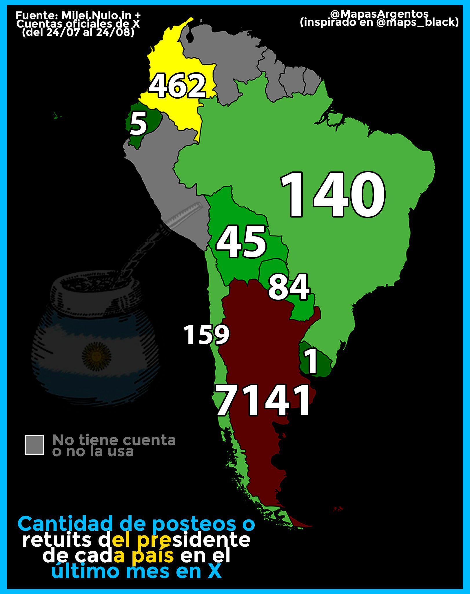
Map of Tweets and Retweets by South American Presidents
The visualization titled "Amount of tweets and retweets last month by the President of each South American country" prov...
Great Wall of South America Map
The "Great Wall of South America" map visualizes a unique geographical phenomenon, showcasing the extensive network of n...
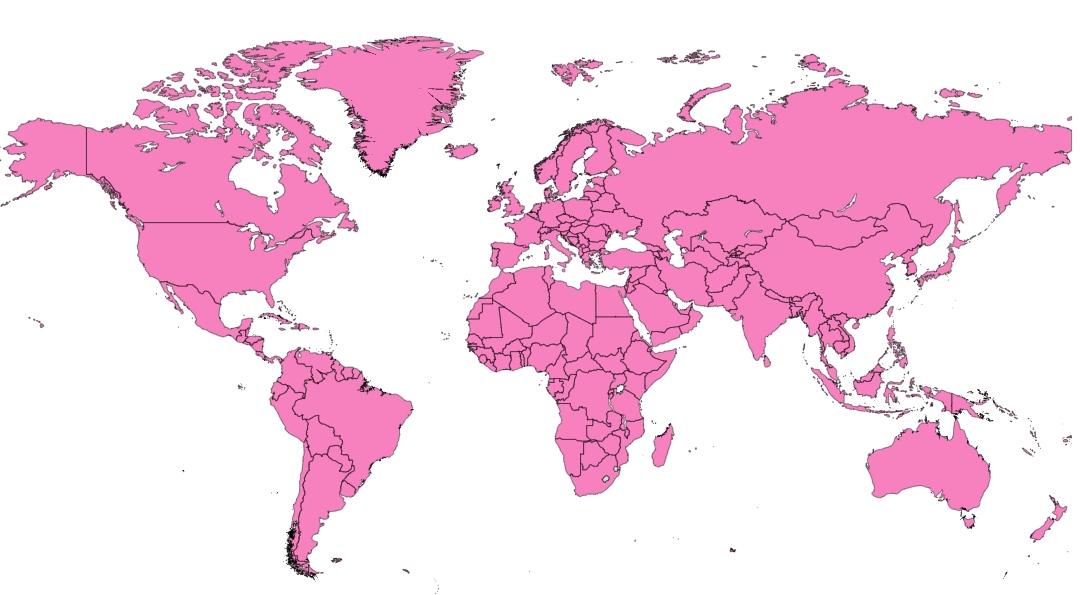
GDP Per Capita Comparison Map: Countries Below Monaco
The map titled "Countries Having Lower GDP Per Capita than Monaco" offers an illuminating view of the global economic la...
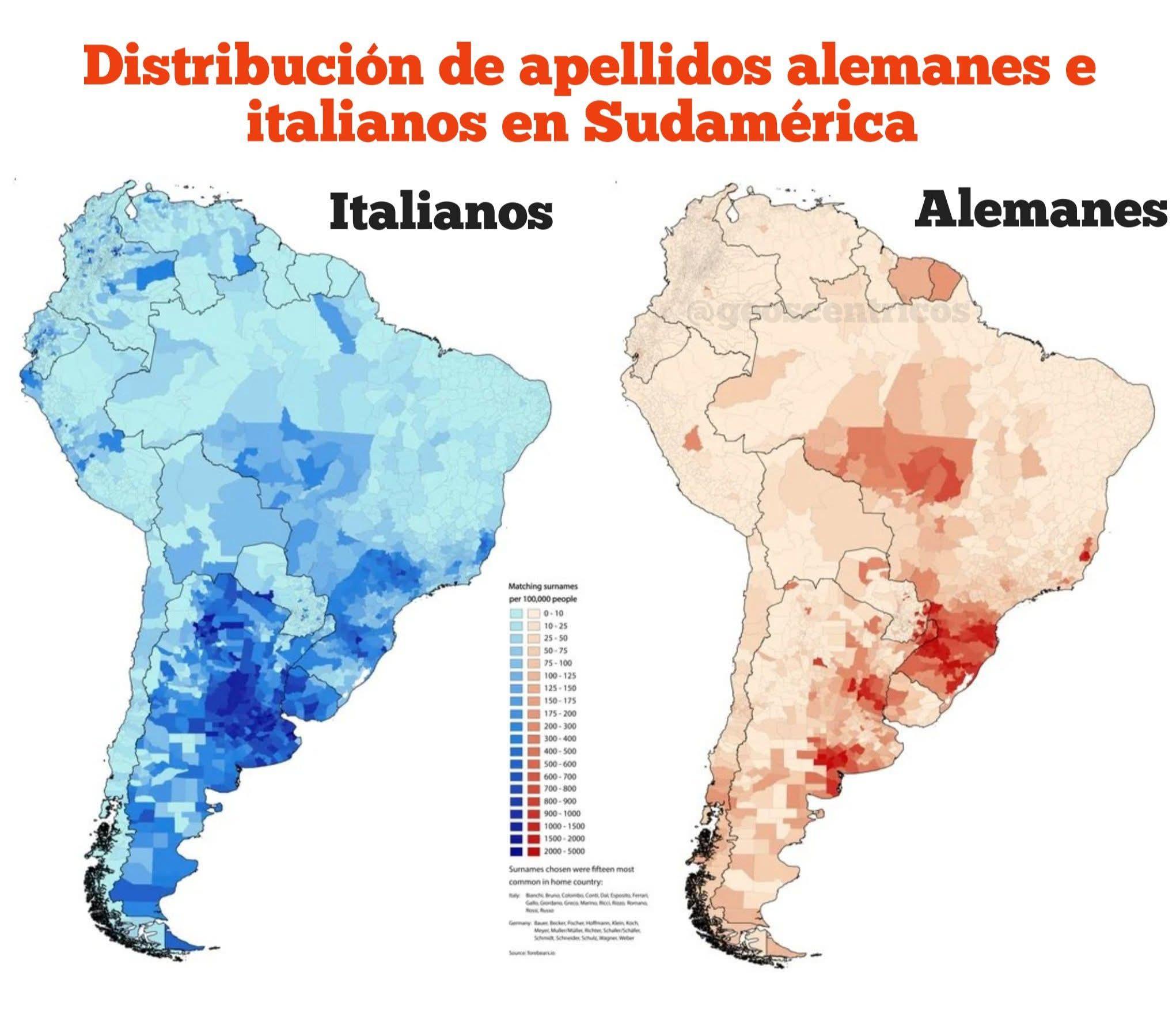
Map of German and Italian Surname Distribution in South America
This map provides a visual representation of the distribution of German and Italian surnames across South America, parti...
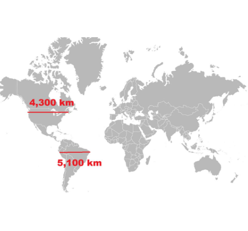
Length of North vs South America Map
The visualization titled "Length of North vs South America" presents a comparative analysis of the geographical extents ...
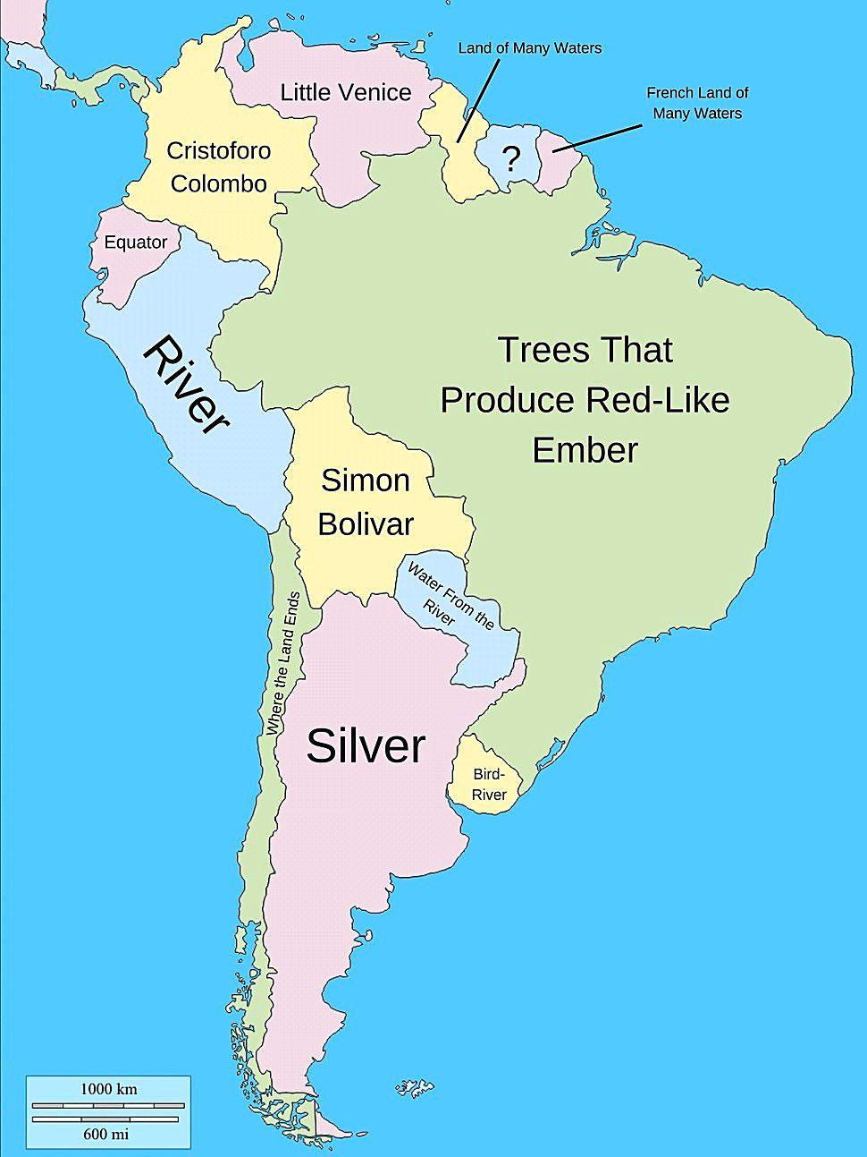
Literal Meanings of South American Country Names Map
This map provides an intriguing look into the literal meanings of South American country names, revealing a tapestry of ...
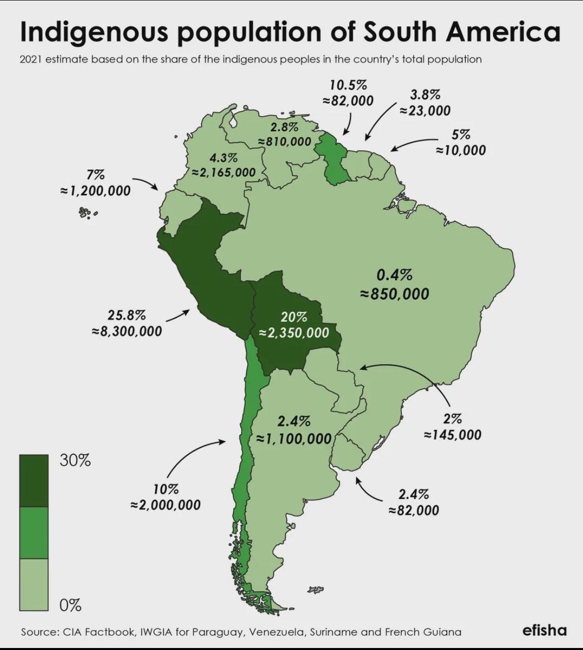
Indigenous Population of South America Map
In countries like Peru and Bolivia, Indigenous populations represent a significant part of the national identity. For in...
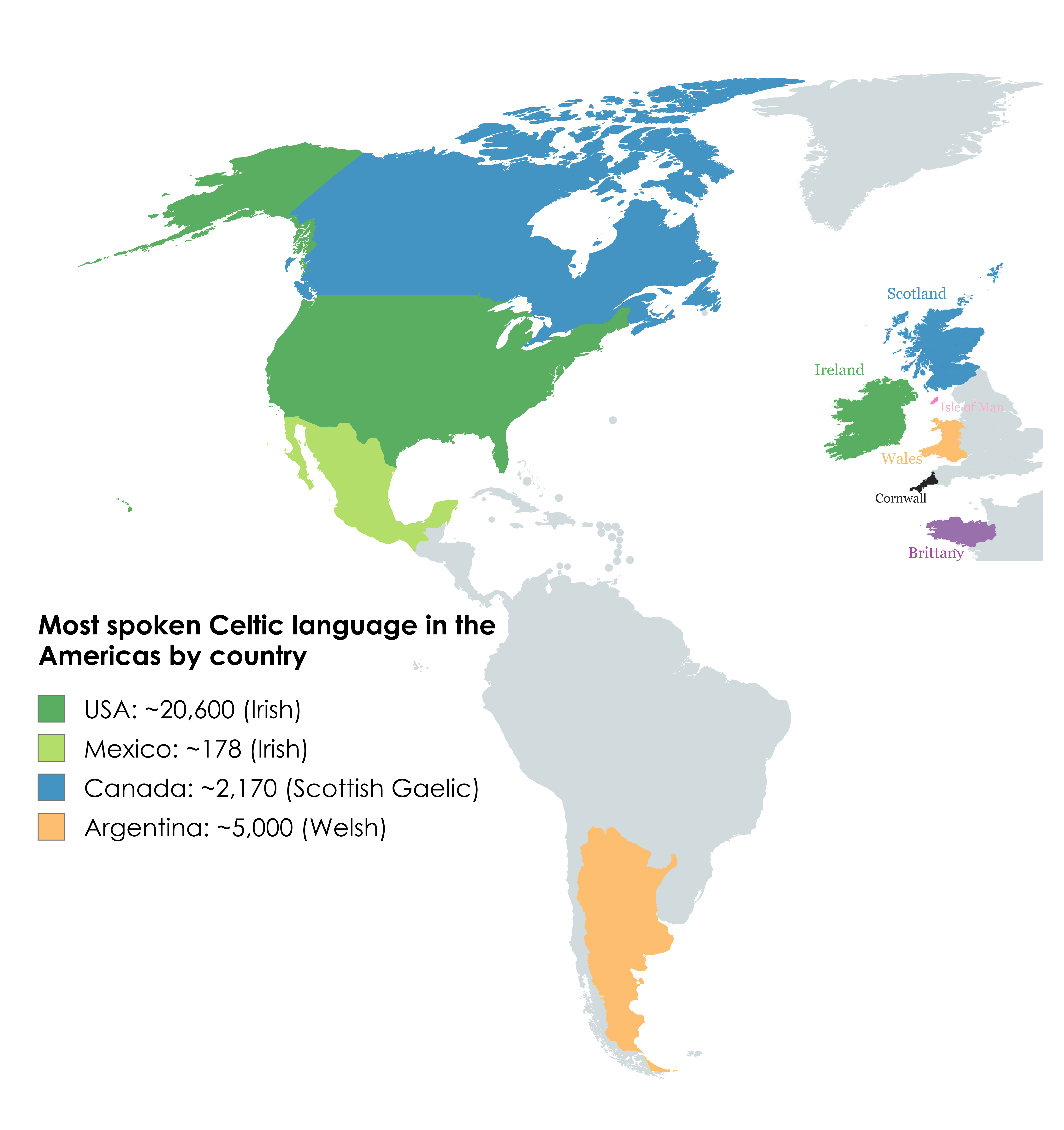
Most Spoken Celtic Language in the Americas Map
The "Most Spoken Celtic Language in the Americas Map" provides a visual representation of the distribution and prevalenc...
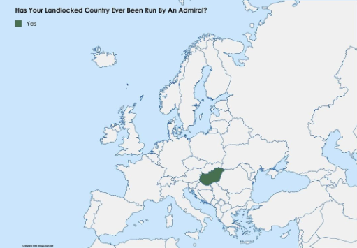
Map of Landlocked Countries Led by Admirals
This map visualizes an intriguing political intersection: the landlocked nations that have been led by admirals. While i...
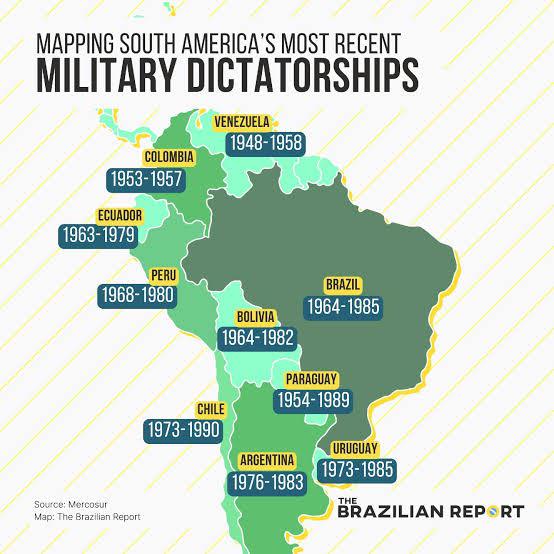
South America Military Dictatorships Map
The "South America Military Dictatorships Map" provides a stark visual representation of the political turmoil that grip...
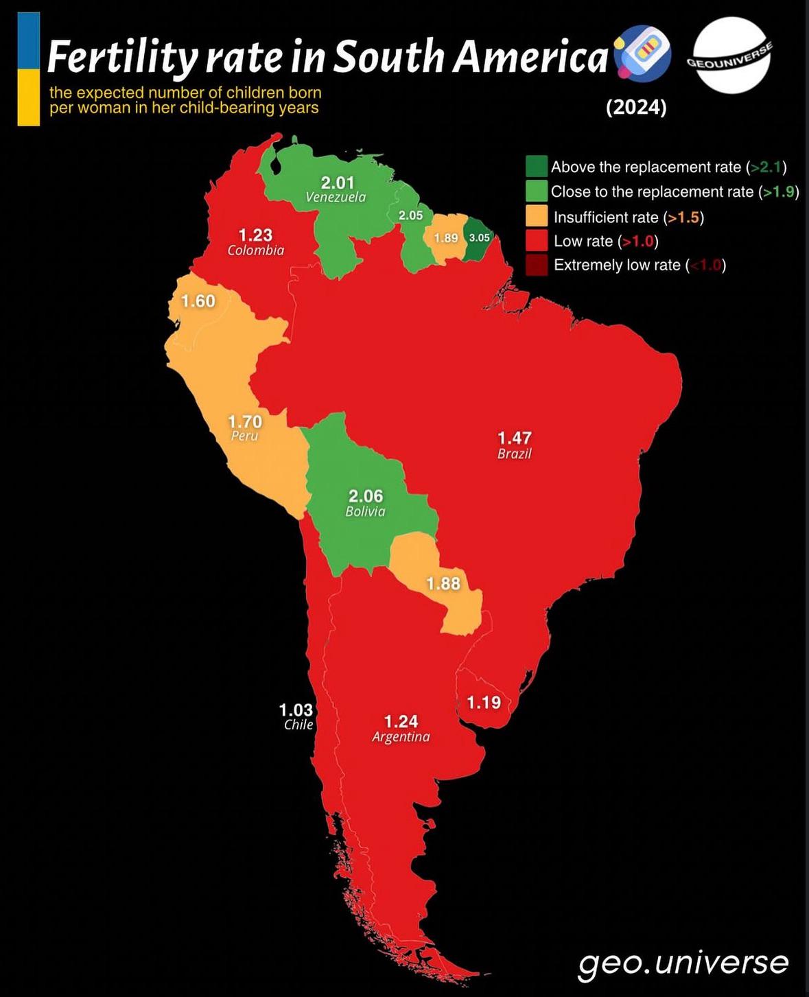
Fertility Rate Map of South America
The "Fertility Rate Map of South America" provides a visual representation of the birth rates across different countries...
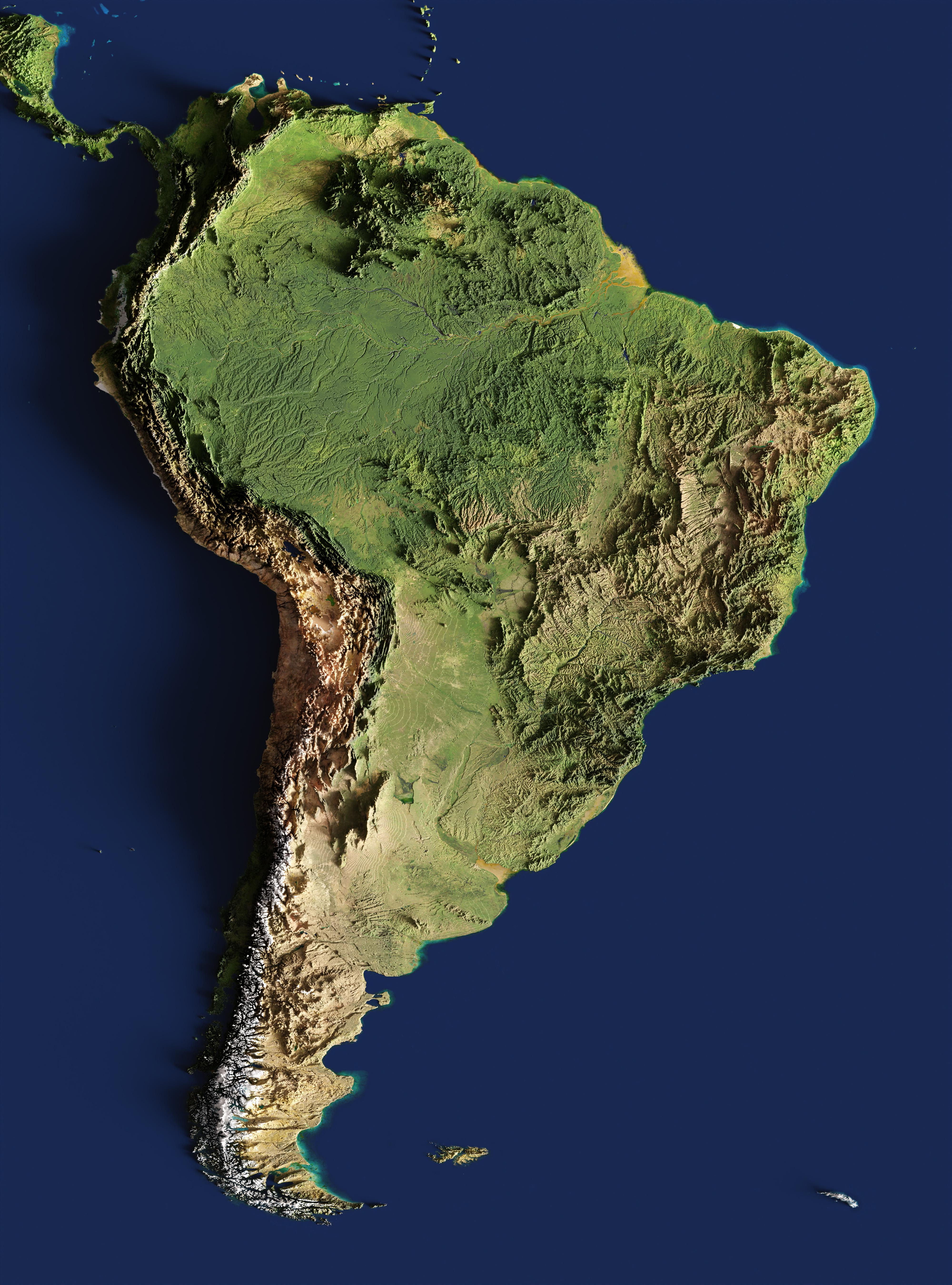
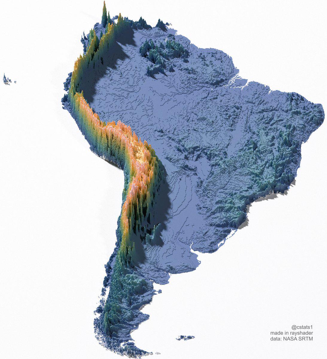
3-D Relief Map of South America
The 3-D relief map of South America provides a striking visual representation of the continent’s topography. This three-...
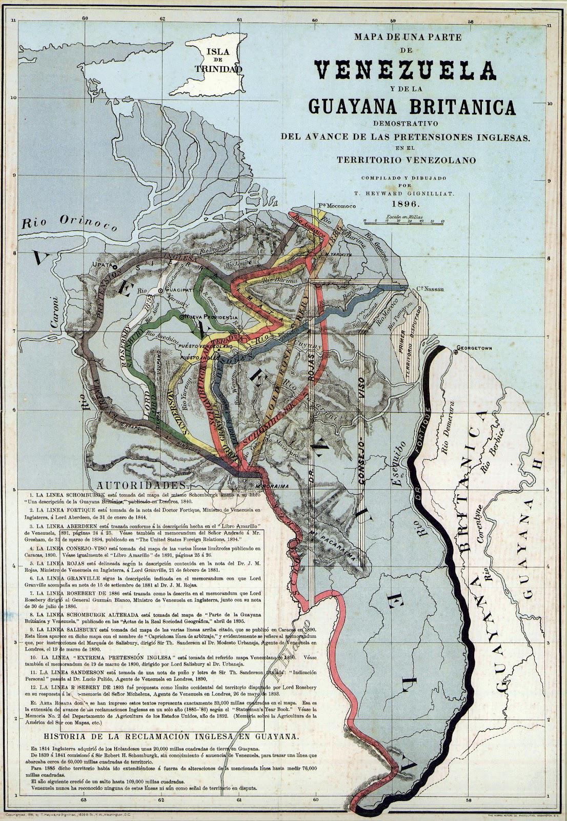
Proposed Boundaries for Guyana Map
The "Proposed Boundaries for Guyana Map" visualizes the various territorial claims and proposed administrative borders w...
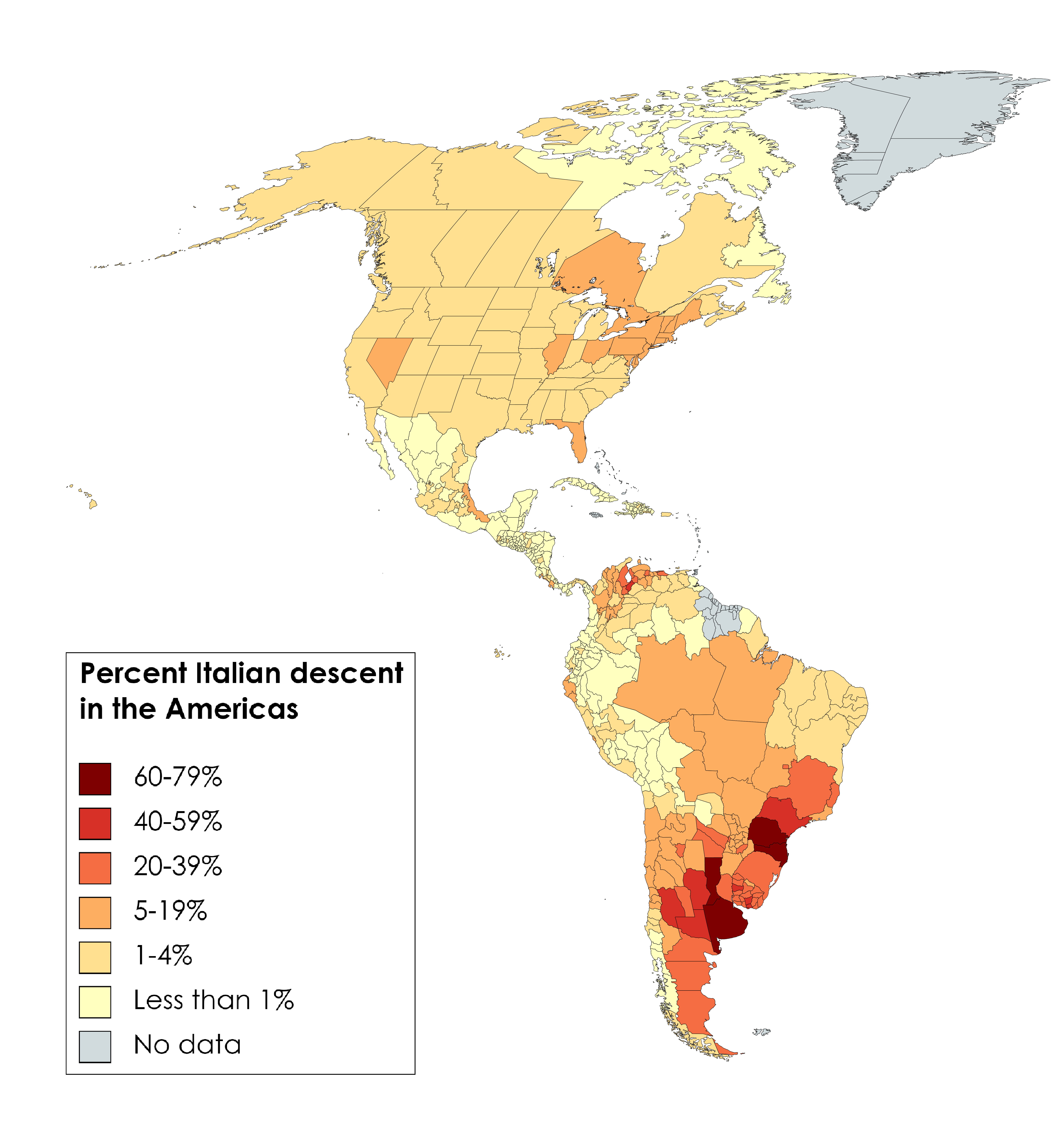
Percent Italian Descent in the Americas Map
The "Percent Italian Descent in the Americas Map" provides a fascinating look at the distribution of people of Italian a...
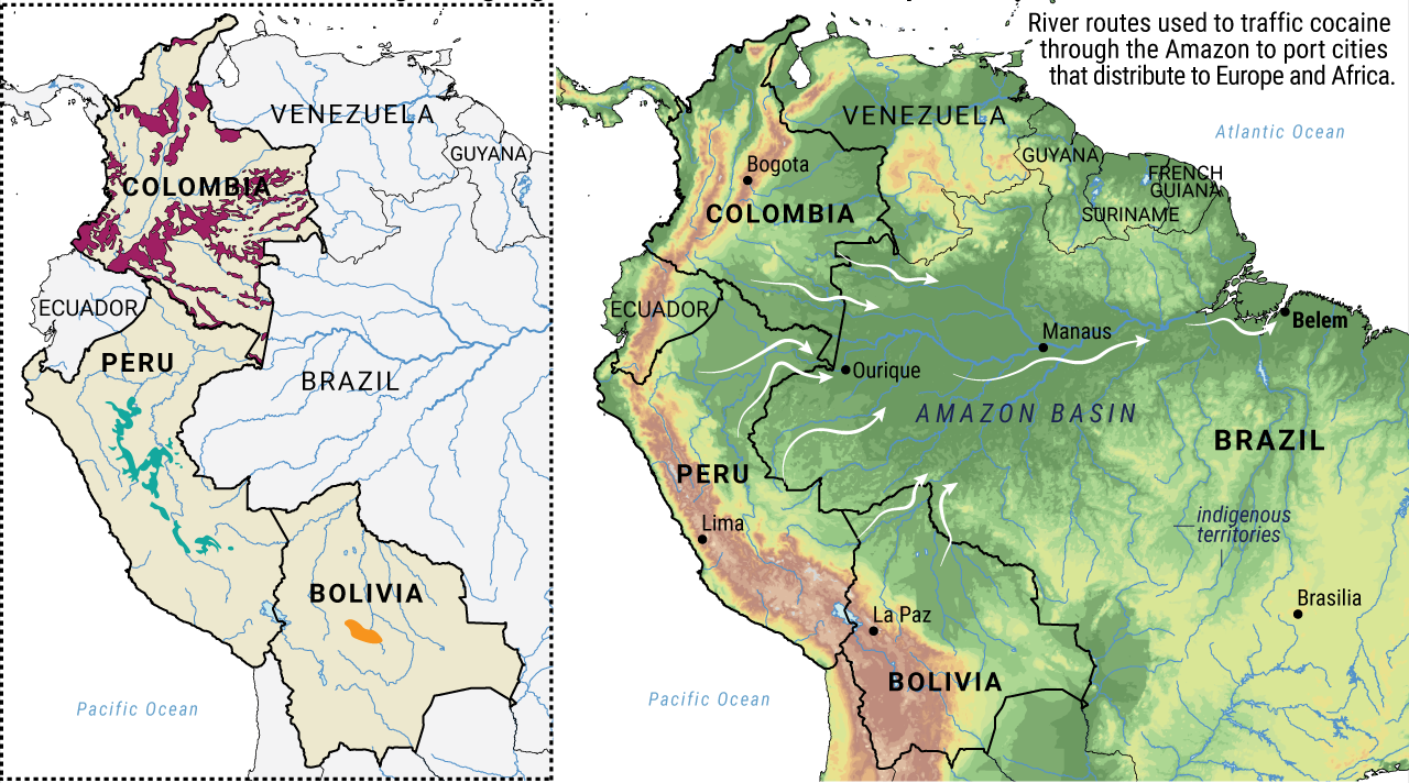
Coca-Growing Regions and River Routes Map
The visualization titled "Known South American coca-growing regions and the river routes they transport on" provides a d...
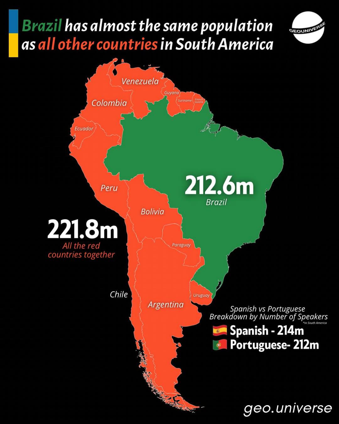
Population Comparison Map of Brazil and South America
Interestingly, Brazil's vast population is not evenly distributed. The Southeast region, which includes major urban cent...
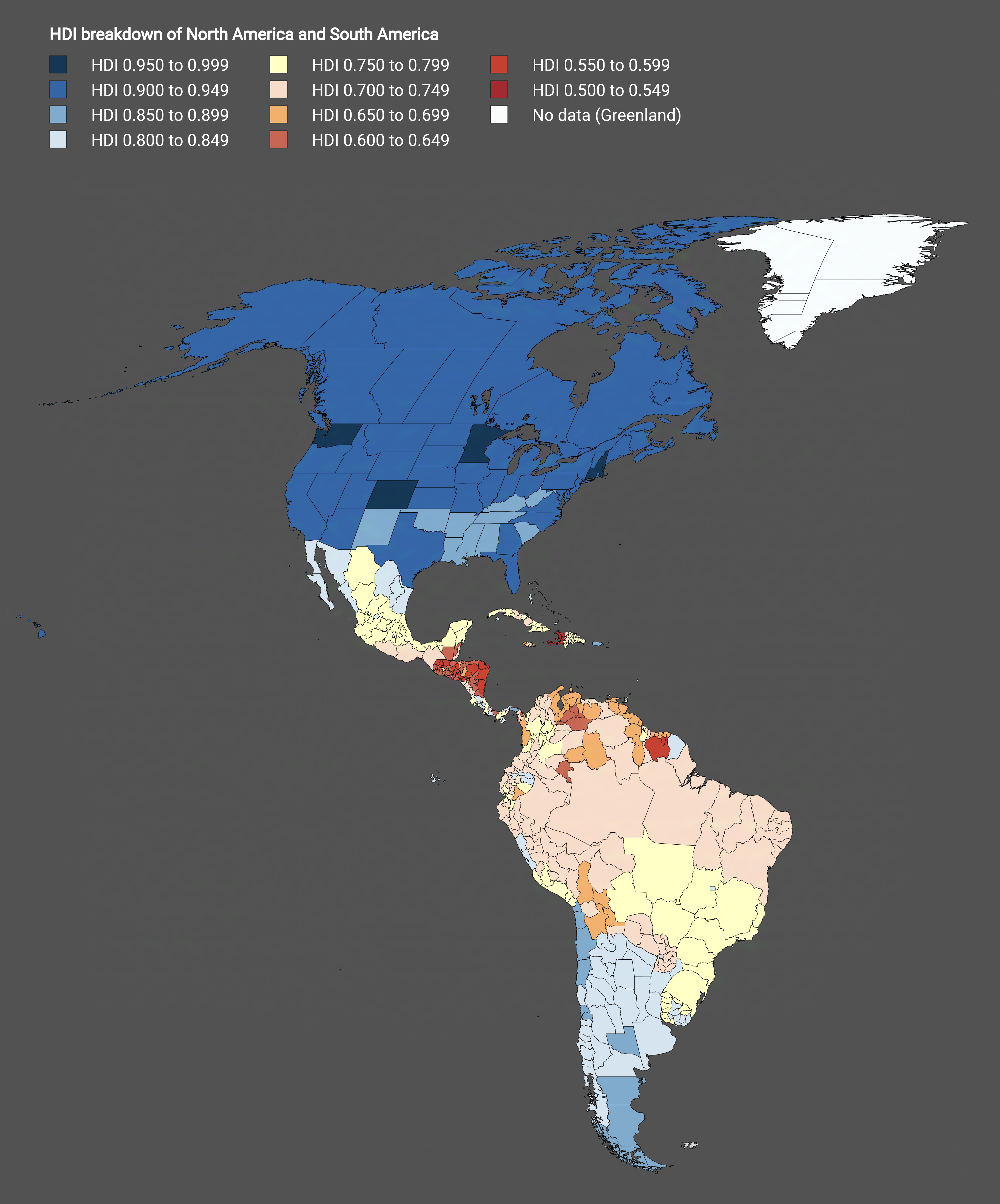
HDI Subdivisions Map of North America and South America
The visualization titled "Subdivisions of North America and South America by HDI" provides a detailed breakdown of Human...
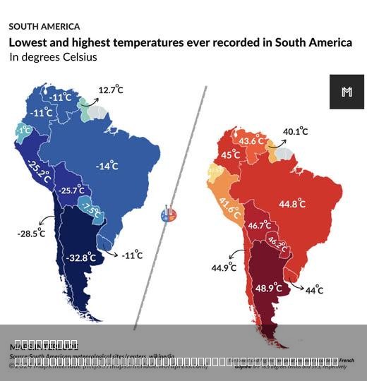
Highest & Lowest Temperatures Ever Recorded in South America Map
The visualization titled "Highest & Lowest Temperatures Ever Recorded in South America" showcases the extreme temperatur...
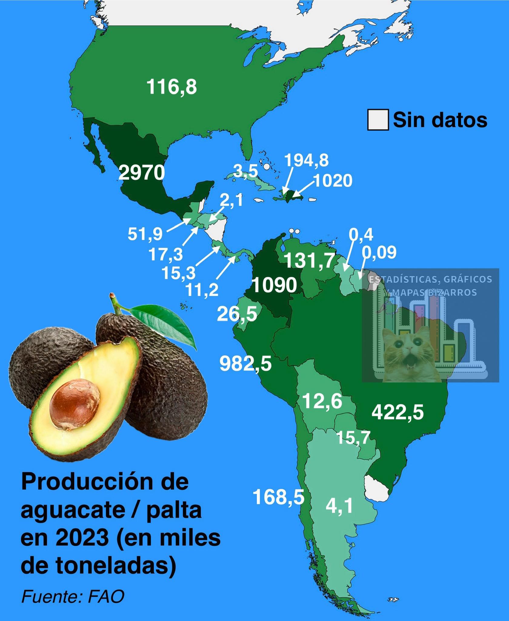
Avocado Production in the Americas Map
The \...
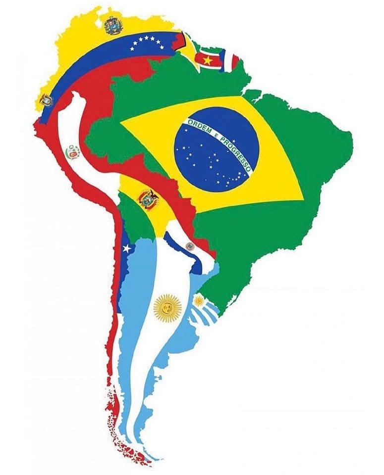
Map of South America with Flags
The 'Map of South America with Flags' is a vibrant visual representation that showcases the flags of each South American...