colonial history Maps
17 geographic visualizations tagged with "colonial history"
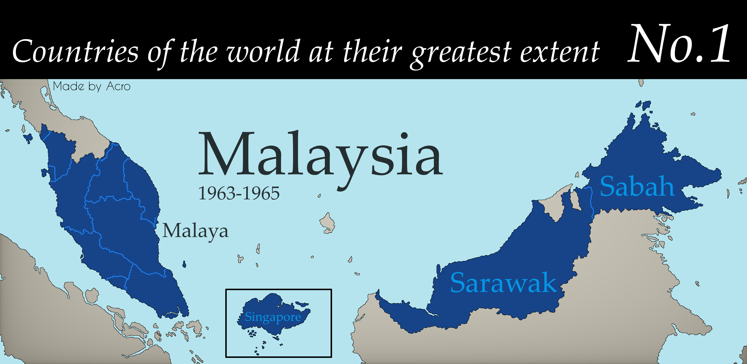
Countries at Their Greatest Extent Map
The "Countries at Their Greatest Extent" map presents a fascinating visualization of the maximum territorial reach of va...
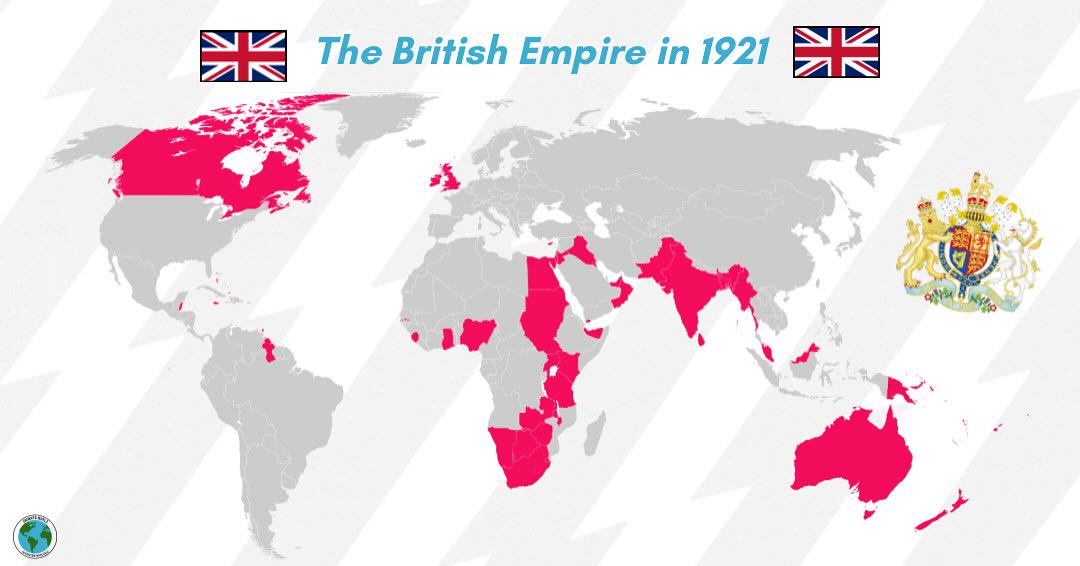
British Empire Map of 1921
The map titled "The British Empire in 1921" provides a comprehensive visual representation of the vast territories contr...
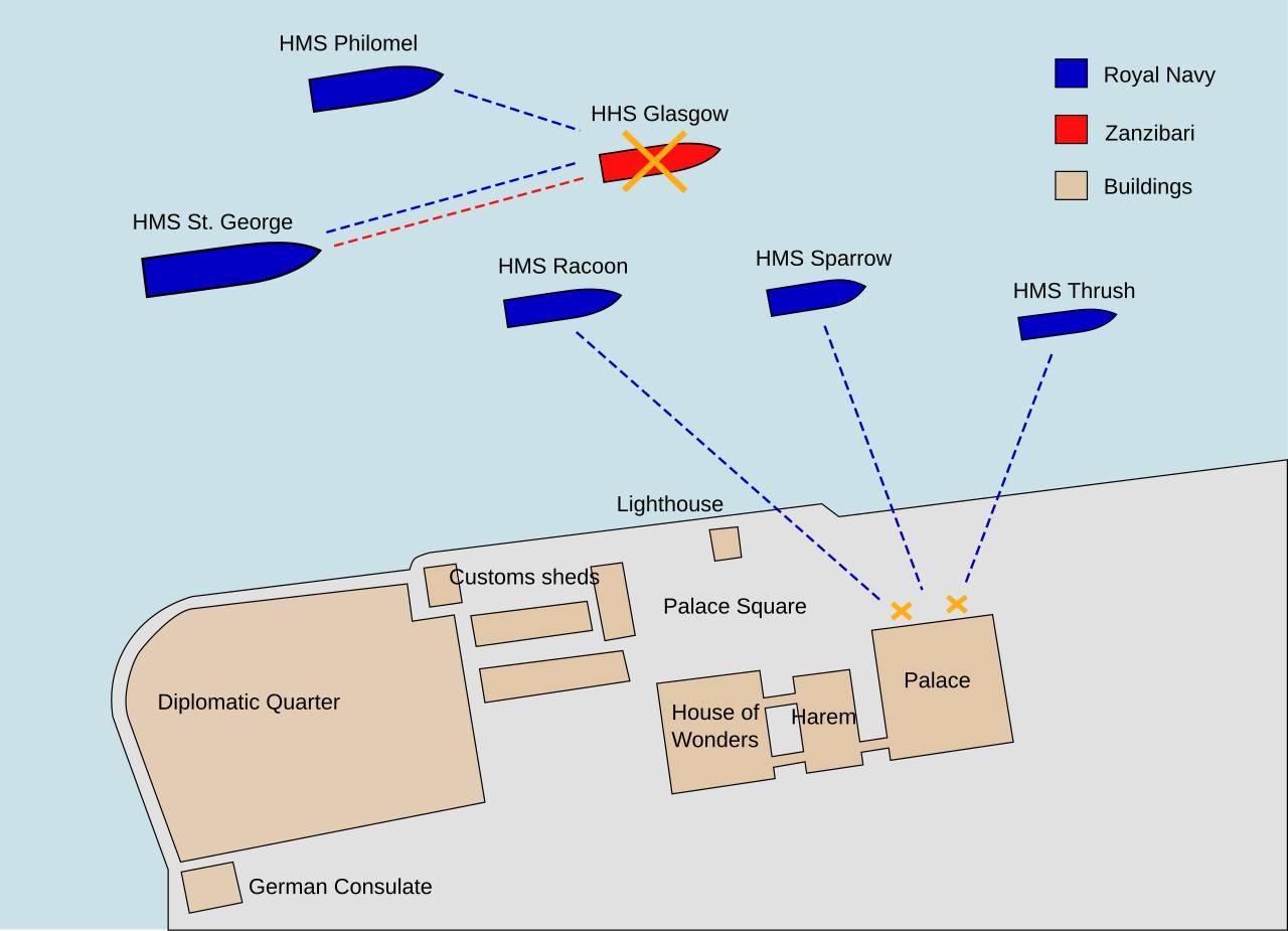
Map of the Anglo-Zanzibar War
This map provides a detailed overview of the Anglo-Zanzibar War, which is famously known as the shortest war in history,...
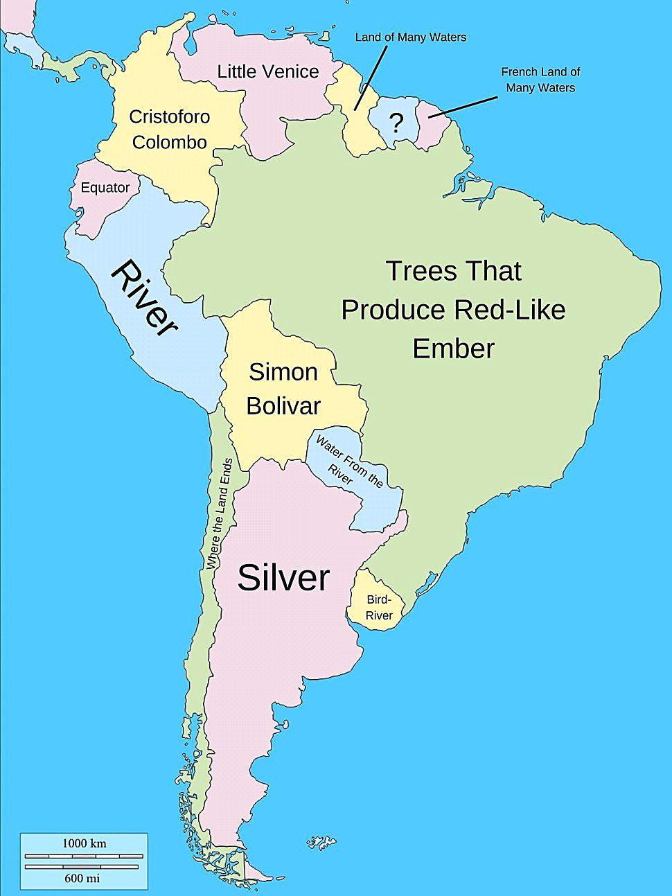
Literal Meanings of South American Country Names Map
This map provides an intriguing look into the literal meanings of South American country names, revealing a tapestry of ...
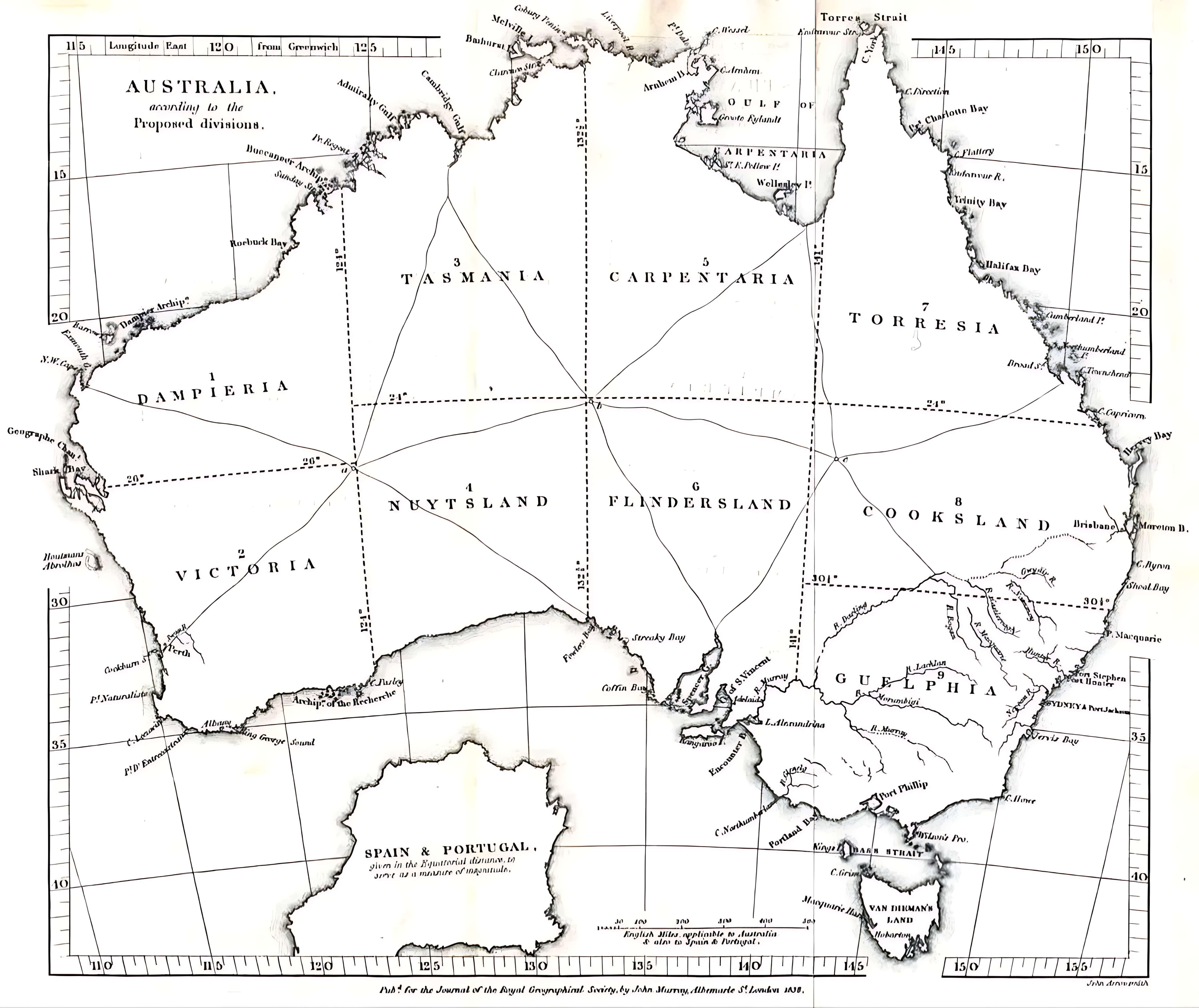
1838 Australia Division Plan Map Analysis
This map visualizes the proposed division of Australia as suggested in 1838, illustrating a radical restructuring of sta...
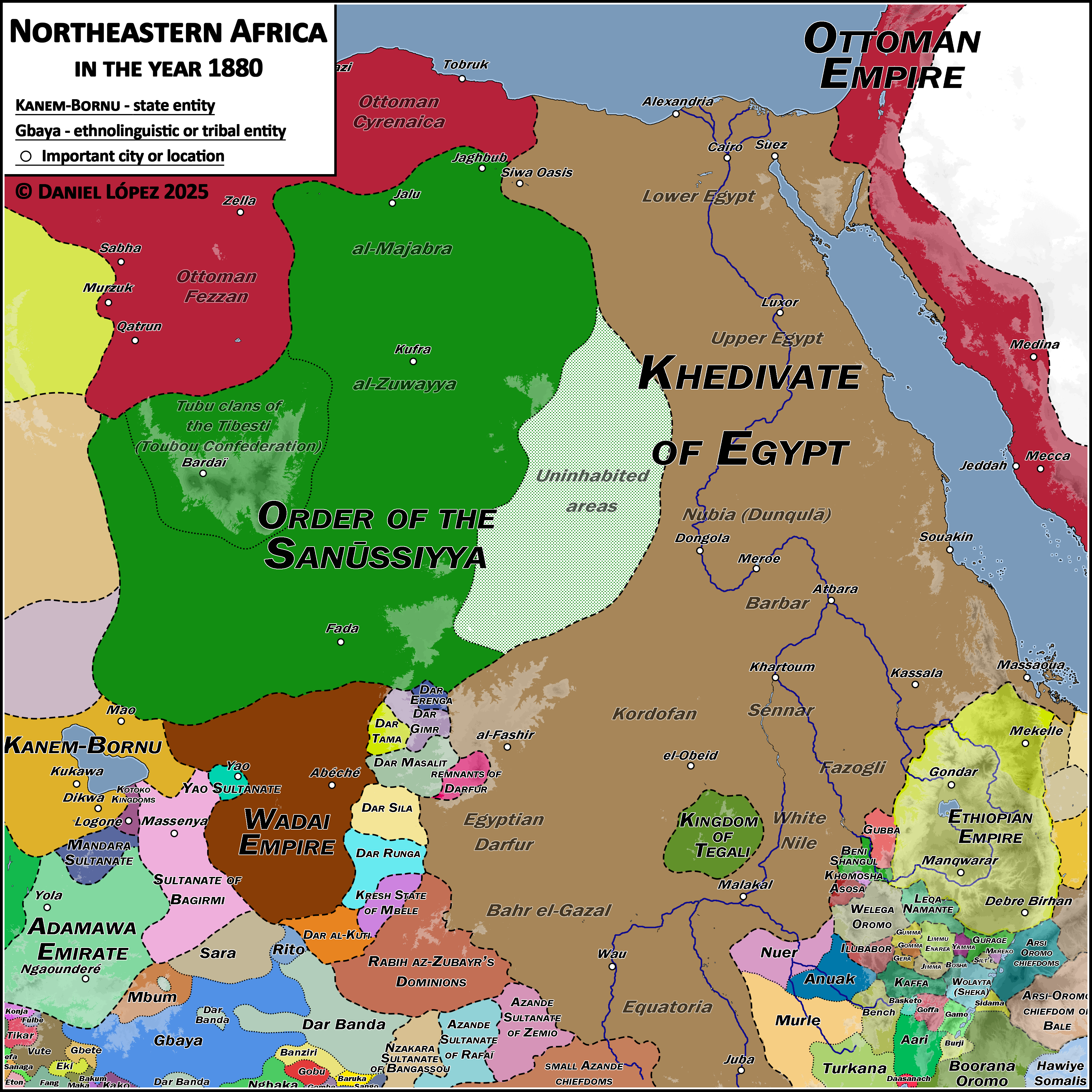
Political Map of Northeast Africa 1880
...
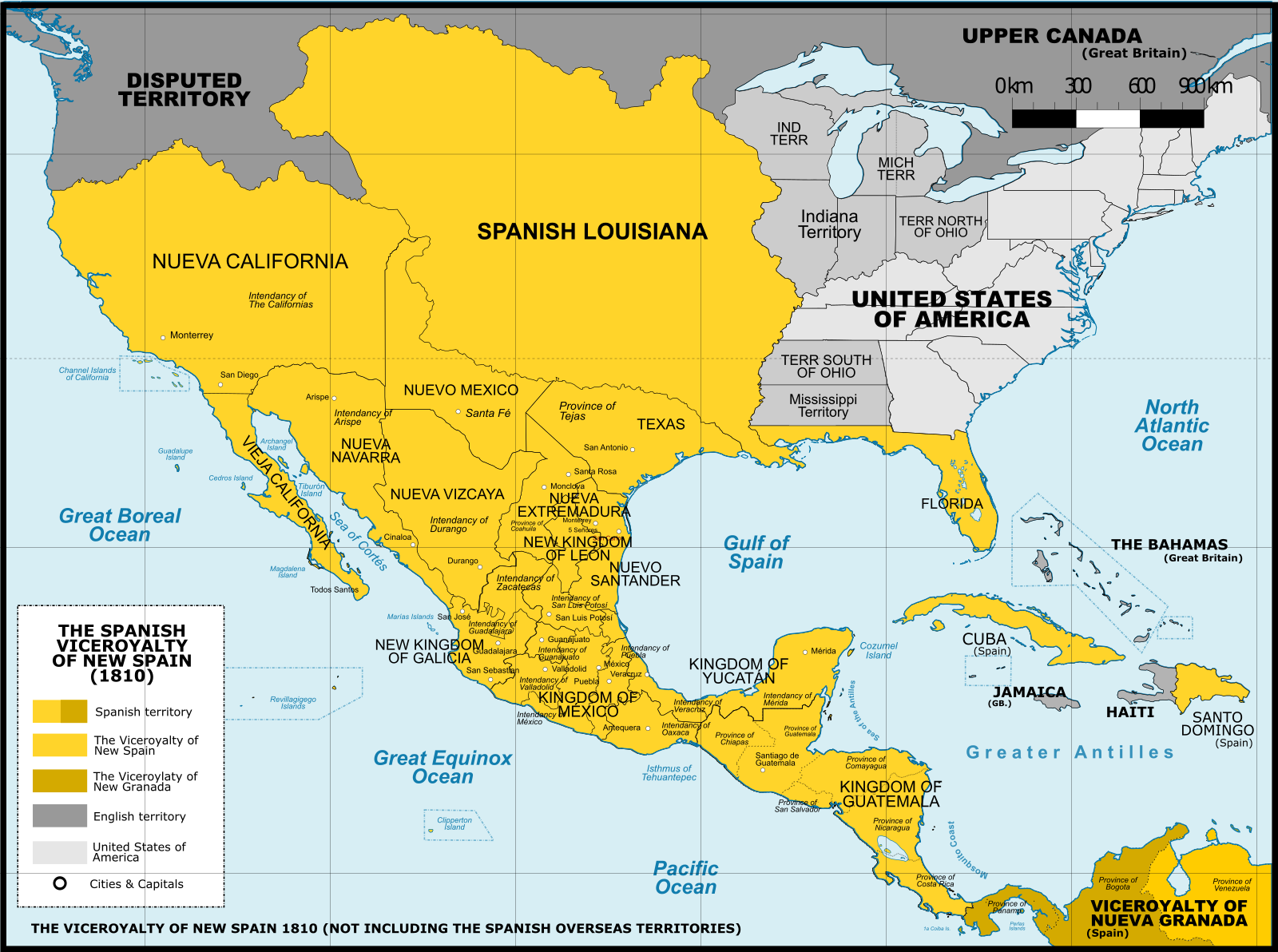
Maximum Territorial Extent of New Spain Map
The map titled "Maximum Territorial Extent of New Spain" vividly illustrates the vast geographical boundaries that defin...
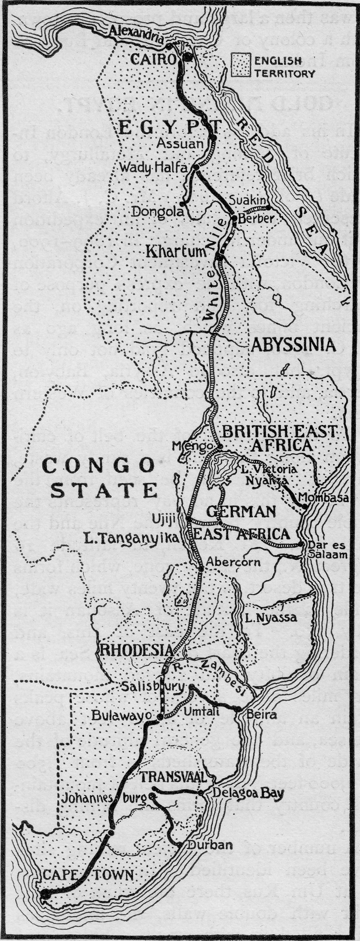
East Africa 1902 Map and Historical Context
The map titled "East Africa, 1902" provides a historical snapshot of the region during a pivotal time in its colonial hi...
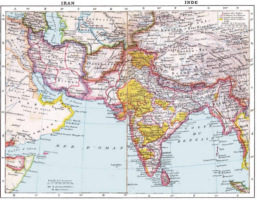
1907 French Colonial Map of South Asia
The 1907 French map of South Asia offers a detailed representation of the region during a pivotal time in its history. T...
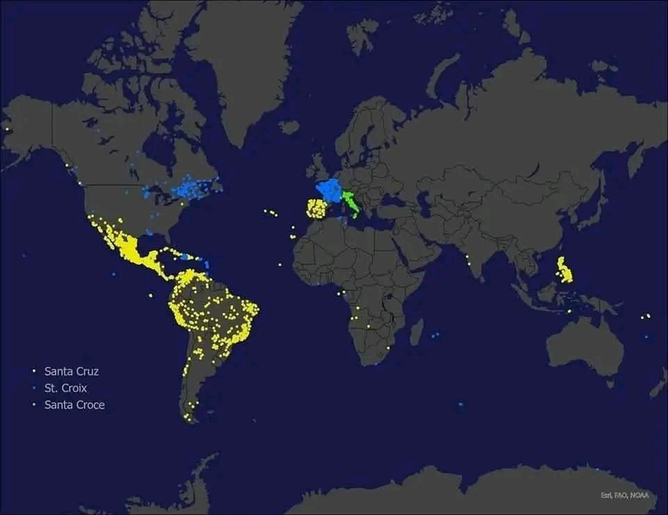
Santa Cruz Locations Map Across the Globe
The map titled "Places named Santa Cruz... move over Springfield!!" presents a fascinating visualization of the numerous...
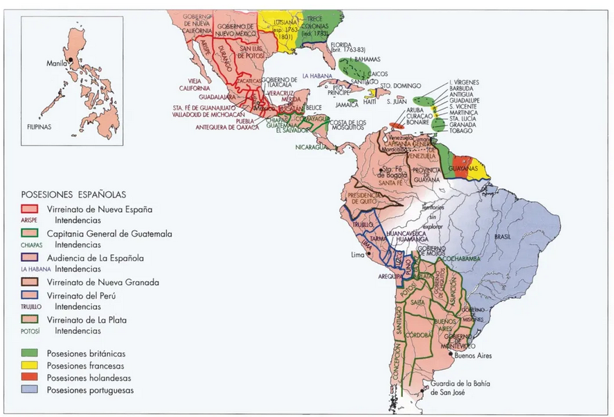
Spanish Colonies in the Americas Map
This map provides a detailed visualization of the Spanish colonies in the Americas during the 18th century, illustrating...
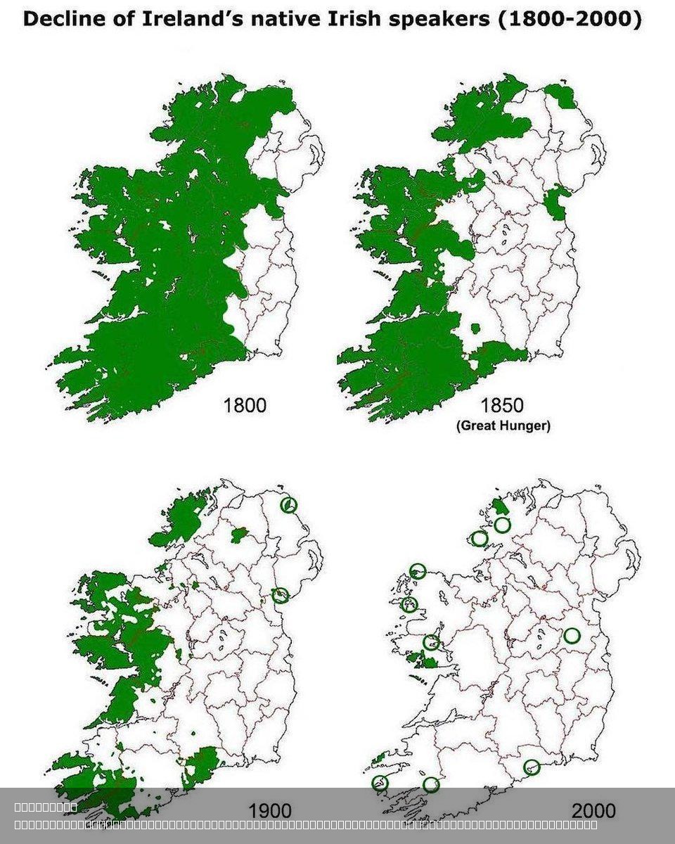
Decline of Native Irish Speakers Map
Interestingly, the British authorities implemented policies explicitly aimed at discouraging the use of the Irish langua...
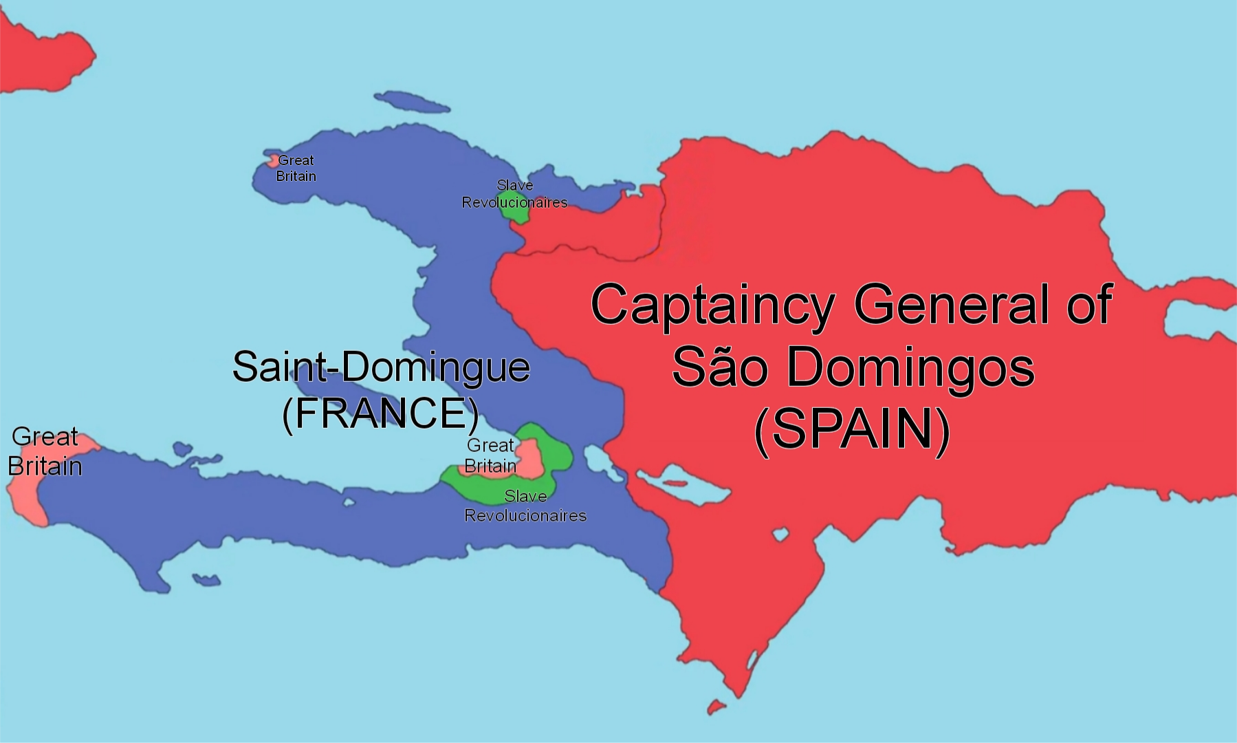
Hispaniola Islands in 1794 Map
The map titled "Hispaniola Islands in 1794" provides a fascinating snapshot of the Caribbean island of Hispaniola during...
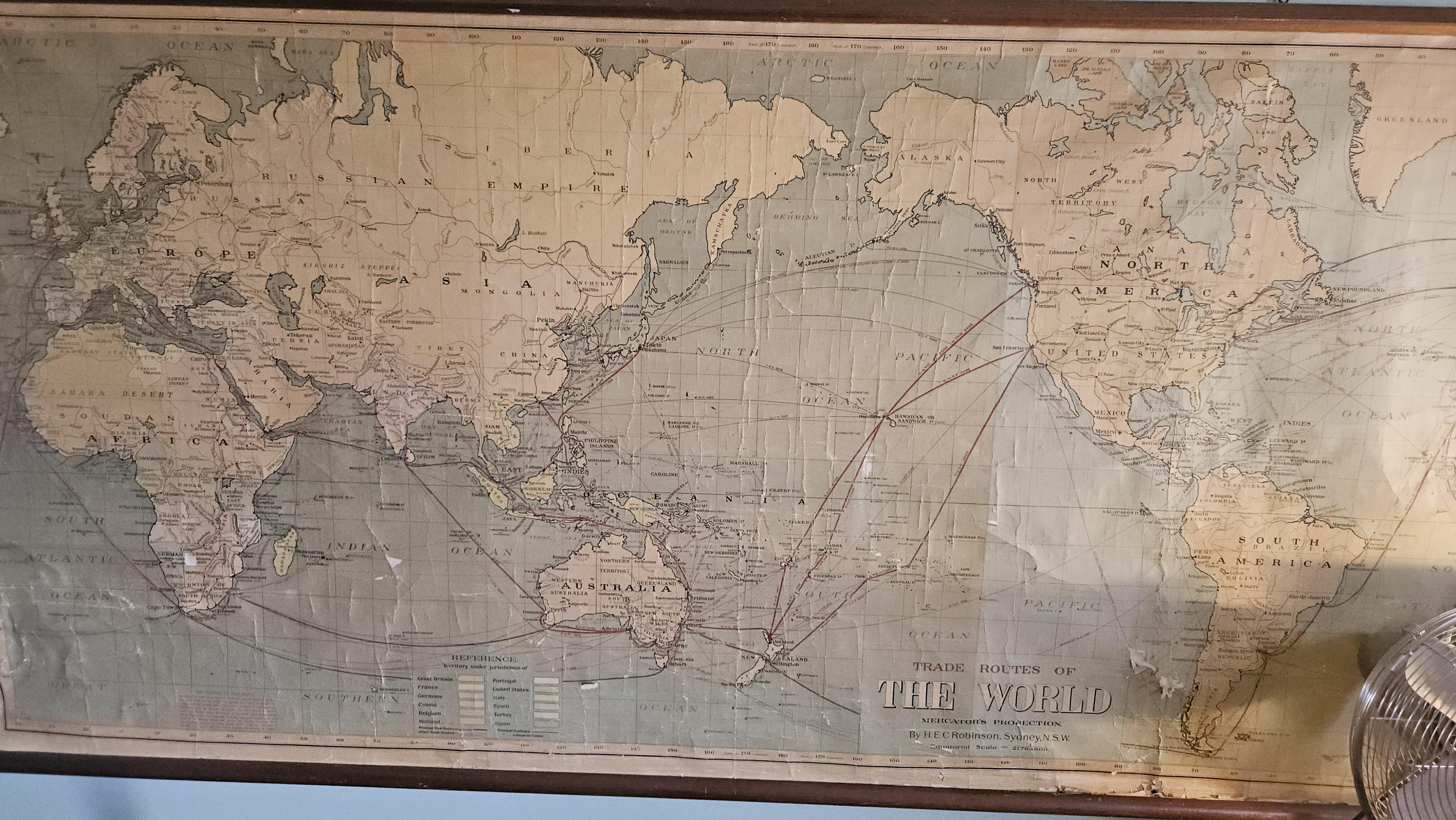
Historical Map of Southeast Asia
This historical map, featuring the terms "Siam," "Burma," "Russian Empire," and "Holland," provides a glimpse into the g...
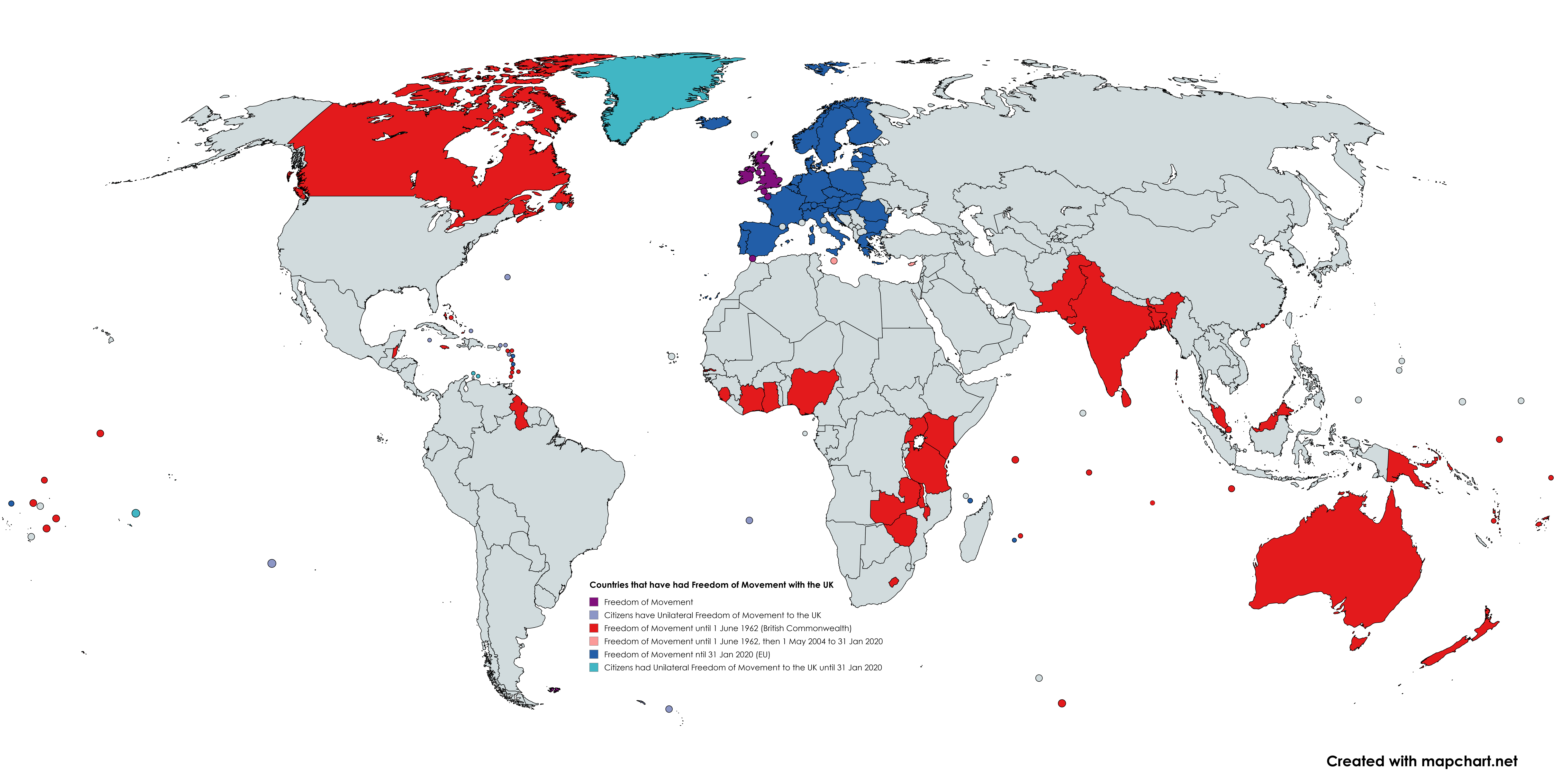
UK Historical Freedom of Movement Regimes Map
This map illustrates the historical regimes of freedom of movement between the UK and various nations, specifically high...
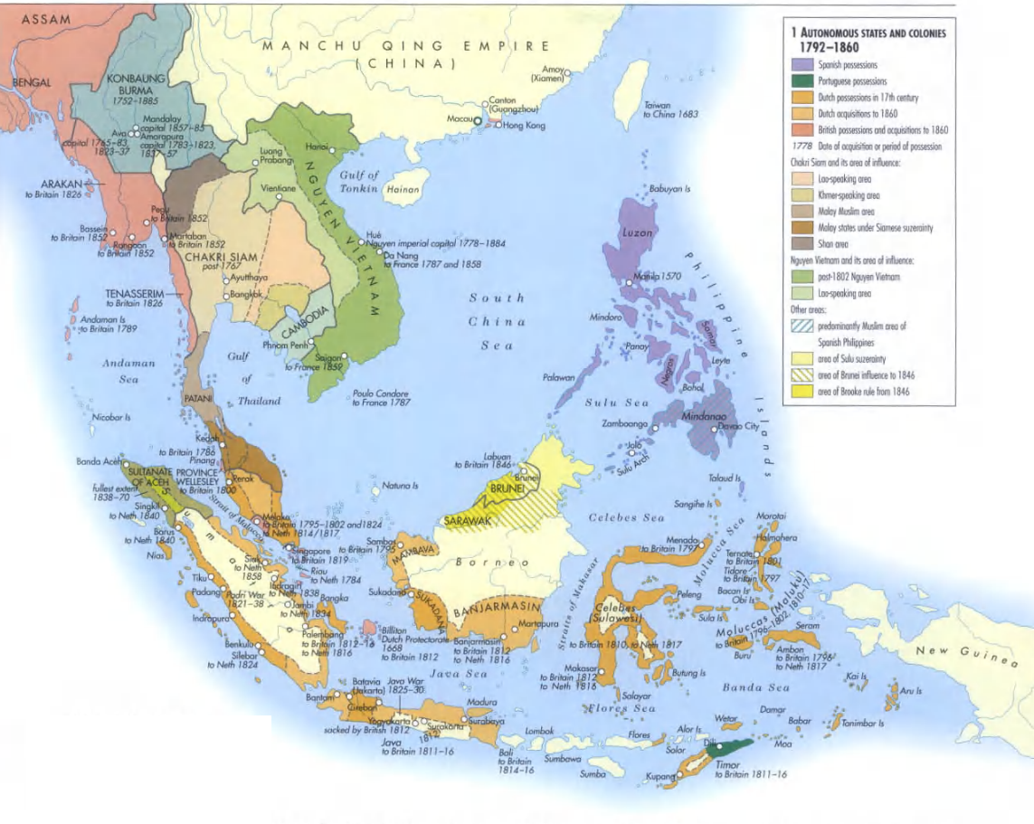
Southeast Asia Historical Map 1792-1860
The "Southeast Asia 1792-1860" map offers an intriguing glimpse into a region that has undergone significant transformat...
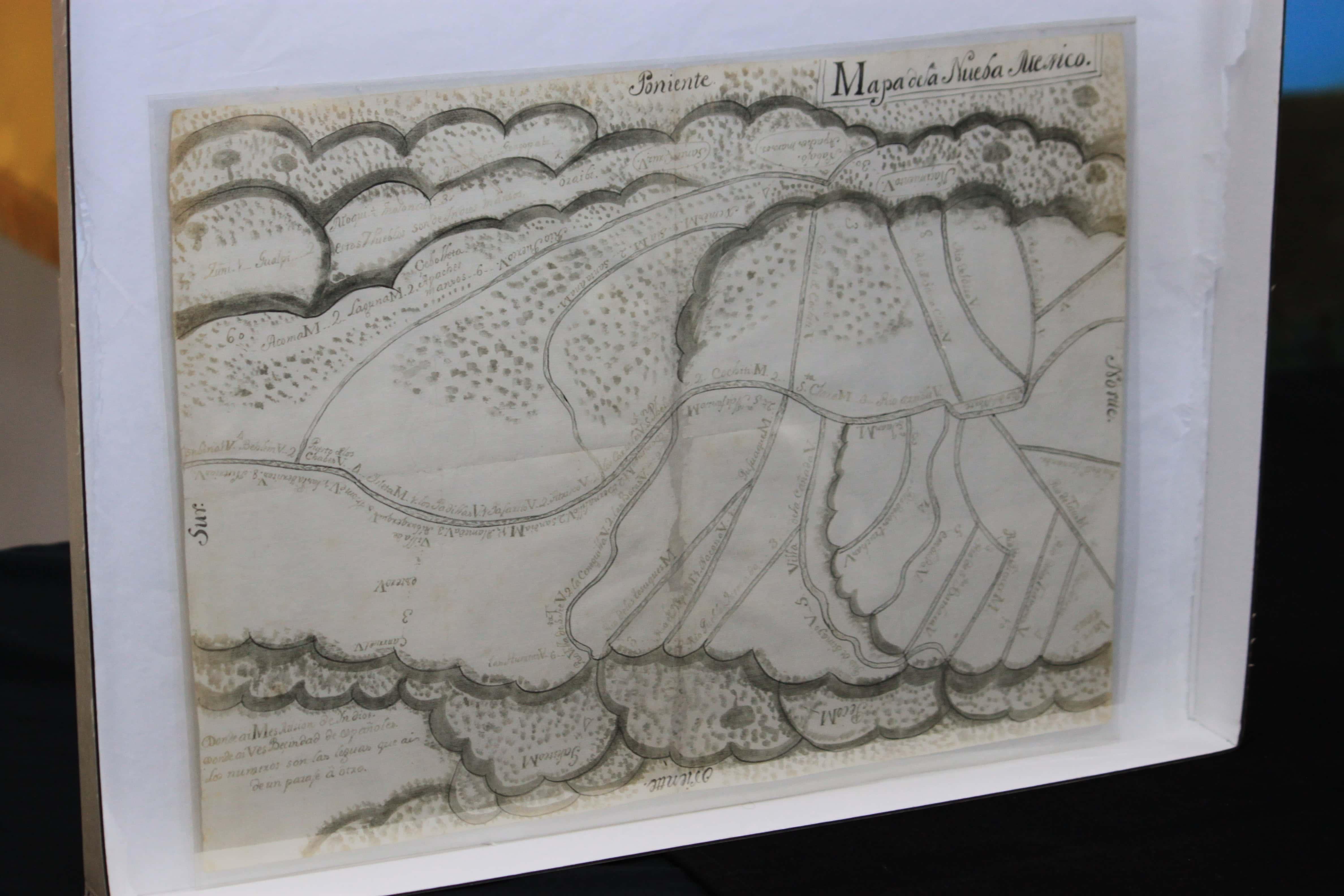
Historical Map of Colonial Mexico
Interestingly, the region's rivers, such as the Rio Grande and Rio Lerma, played vital roles in shaping settlements and ...