Countries at Their Greatest Extent Map

Alex Cartwright
Senior Cartographer & GIS Specialist
Alex Cartwright is a renowned cartographer and geographic information systems specialist with over 15 years of experience in spatial analysis and data...
Geographic Analysis
What This Map Shows
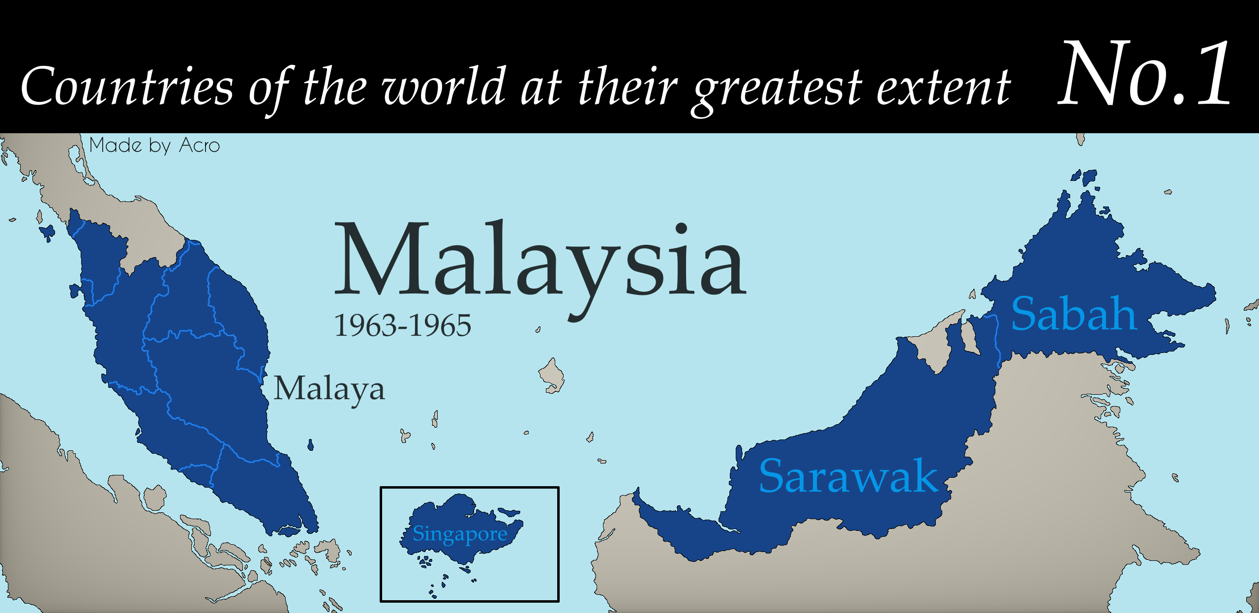
The "Countries at Their Greatest Extent" map presents a fascinating visualization of the maximum territorial reach of various nations at a scale of 1:195. This map showcases countries in their largest historical contexts, allowing viewers to comprehend not just the current borders but also the expansive territories that once belonged to these nations. This visualization serves as a vivid reminder of the dynamic nature of borders throughout history.
Deep Dive into Territorial Changes
Understanding the historical context of territorial changes is crucial for grasping the complexities of modern geopolitics. Countries have often shifted in size due to wars, treaties, colonization, and other historical events. For instance, the Roman Empire at its height in 117 AD covered vast regions of Europe, North Africa, and parts of the Middle East, illustrating the power dynamics of the time. Similarly, the Mongol Empire, which existed in the 13th century, holds the record for the largest contiguous empire in history, spreading from Eastern Europe to Asia.
Interestingly, the notion of territorial extent isn't just a matter of pride or history; it also reflects economic, cultural, and social changes over time. For example, when we consider the greatest extent of the British Empire, we remember not only the vast lands it encompassed but also the cultural influences it exerted around the globe. The empire's expansion facilitated the spread of the English language, legal systems, and even sports like cricket.
In contrast, countries like Russia have evolved through various territorial adjustments. The Russian Empire, at its greatest extent in the 19th century, stretched from Eastern Europe across Asia, showcasing the vastness of its landmass and diversity of cultures. However, the dissolution of the Soviet Union in 1991 led to significant territorial reductions for Russia, creating independent nations from the former Soviet republics.
As we analyze these historical contexts, we must also consider the impact of colonialism. The scramble for Africa in the late 19th century led to arbitrary borders that did not reflect the continent's ethnic and cultural realities. This has left a legacy of conflict and division that is still seen in various regions today. The current geopolitical landscape is a testament to these historical shifts, and understanding them is vital for appreciating today’s international relations.
Regional Analysis
When we delve into different regions highlighted in the map, intriguing comparisons emerge. For instance, in Europe, the Austro-Hungarian Empire once spanned a large part of Central and Eastern Europe. Today, the successor states like Austria, Hungary, and the Czech Republic reflect the fragmented history of empires and national identities. Similarly, the Ottoman Empire’s vast territories in Southeast Europe, Western Asia, and North Africa have split into multiple nations, each with distinct cultural identities.
In Asia, the territorial changes of China, especially during the Qing Dynasty, offer another perspective. At its zenith, China controlled territories that included Mongolia and parts of Tibet and Xinjiang. Nowadays, the political and ethnic complexities within these regions continue to provoke significant discussion and tension. On the other hand, India's territorial changes post-colonization and partition in 1947 illustrate the impact of historical events on national borders and demographics, with Pakistan and Bangladesh emerging from the former British India.
In the Americas, the historical territorial extent of Spain and Portugal during the Age of Exploration has shaped modern-day countries like Mexico, Brazil, and Argentina. The legacy of colonization is apparent in the languages spoken and the cultural practices observed across these nations. However, the territorial disputes between nations, such as those seen in the Falkland Islands, remind us that historical claims can still spur contemporary conflicts.
Significance and Impact
Understanding countries at their greatest extent is not merely an academic exercise; it has profound implications for contemporary geopolitical issues. The legacy of territorial expansion, colonization, and the ensuing conflicts shapes national identities and international relations today. For instance, the remnants of colonial borders in Africa contribute to ongoing ethnic tensions and conflicts, highlighting how historical decisions continue to affect millions.
Moreover, as nations navigate globalization, territorial disputes remain a significant aspect of international diplomacy. The South China Sea, with its complex claims from multiple countries, illustrates how historical territorial claims can lead to modern-day confrontations. Ever wondered why these disputes often escalate? It’s partly due to the resources involved and national pride tied to historical claims.
As we look to the future, understanding these historical territorial extents may help us address current global challenges. It offers insights into why nations behave as they do and may provide pathways towards conflict resolution and cooperation. The patterns of the past can inform our approaches to building a more peaceful international community.
In conclusion, the "Countries at Their Greatest Extent" map serves as a powerful reminder of the fluid nature of borders and the historical narratives that shape our world today. By exploring the territorial changes of nations, we gain valuable insights into the complexities of national identity, culture, and international relations.
Visualization Details
- Published
- September 21, 2025
- Views
- 40
Comments
Loading comments...