Geographic Visualizations
Explore our curated collection of fascinating geographic visualizations and cartographic analyses. Discover detailed maps, data visualizations, and geographical insights from around the world.
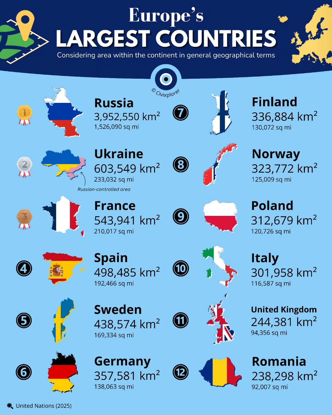
Largest Countries in Europe by Land Area Map
## What This Map Shows...
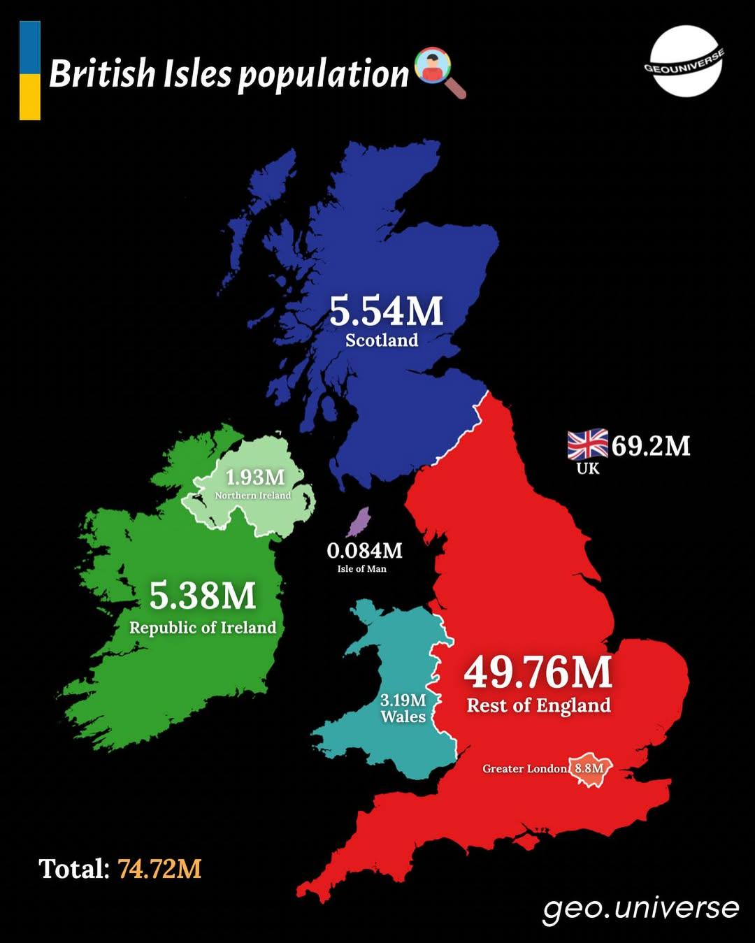
Population Distribution Map of the British Isles
## What This Map Shows...
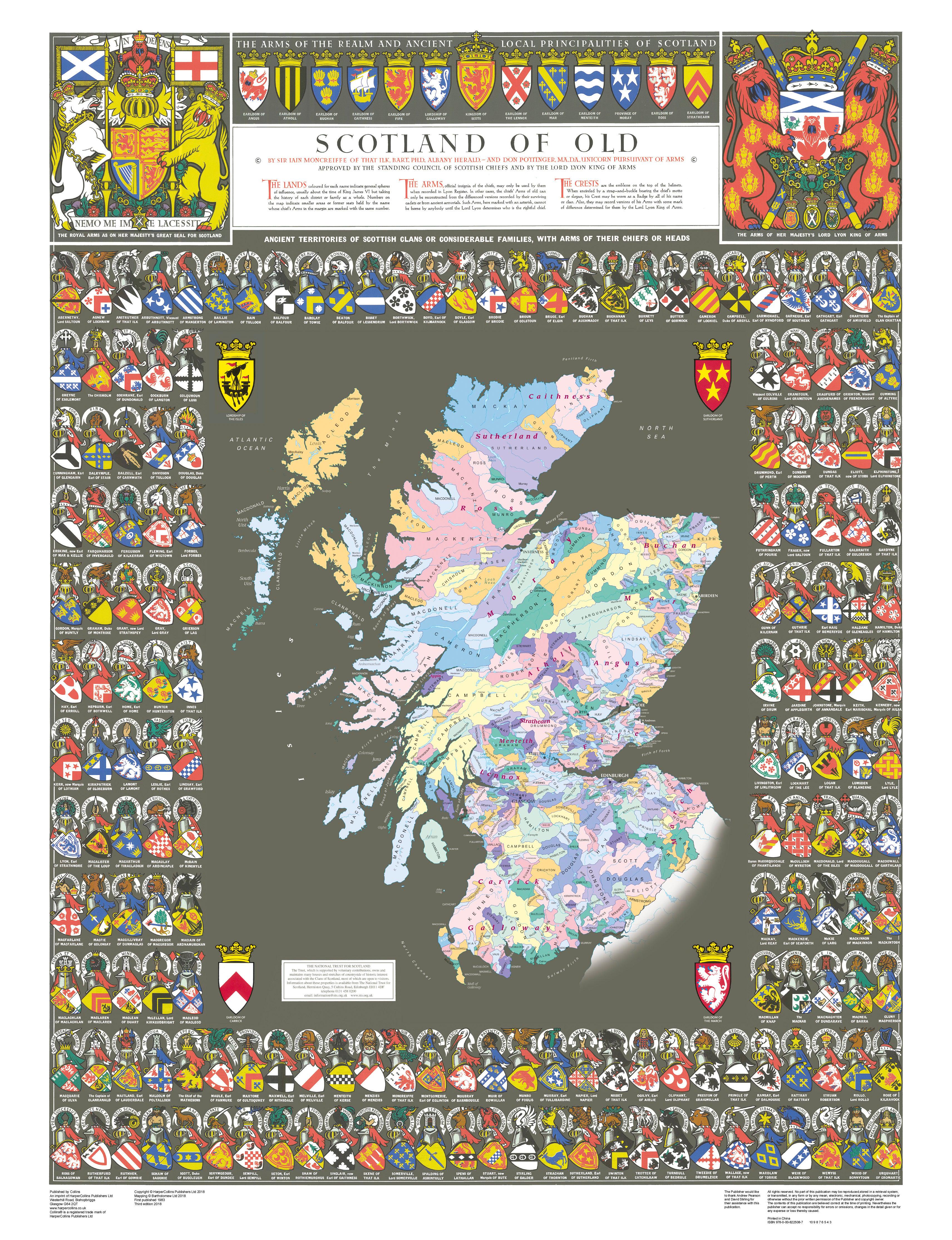
Historical Clan Map of Medieval Scotland
## What This Map Shows...
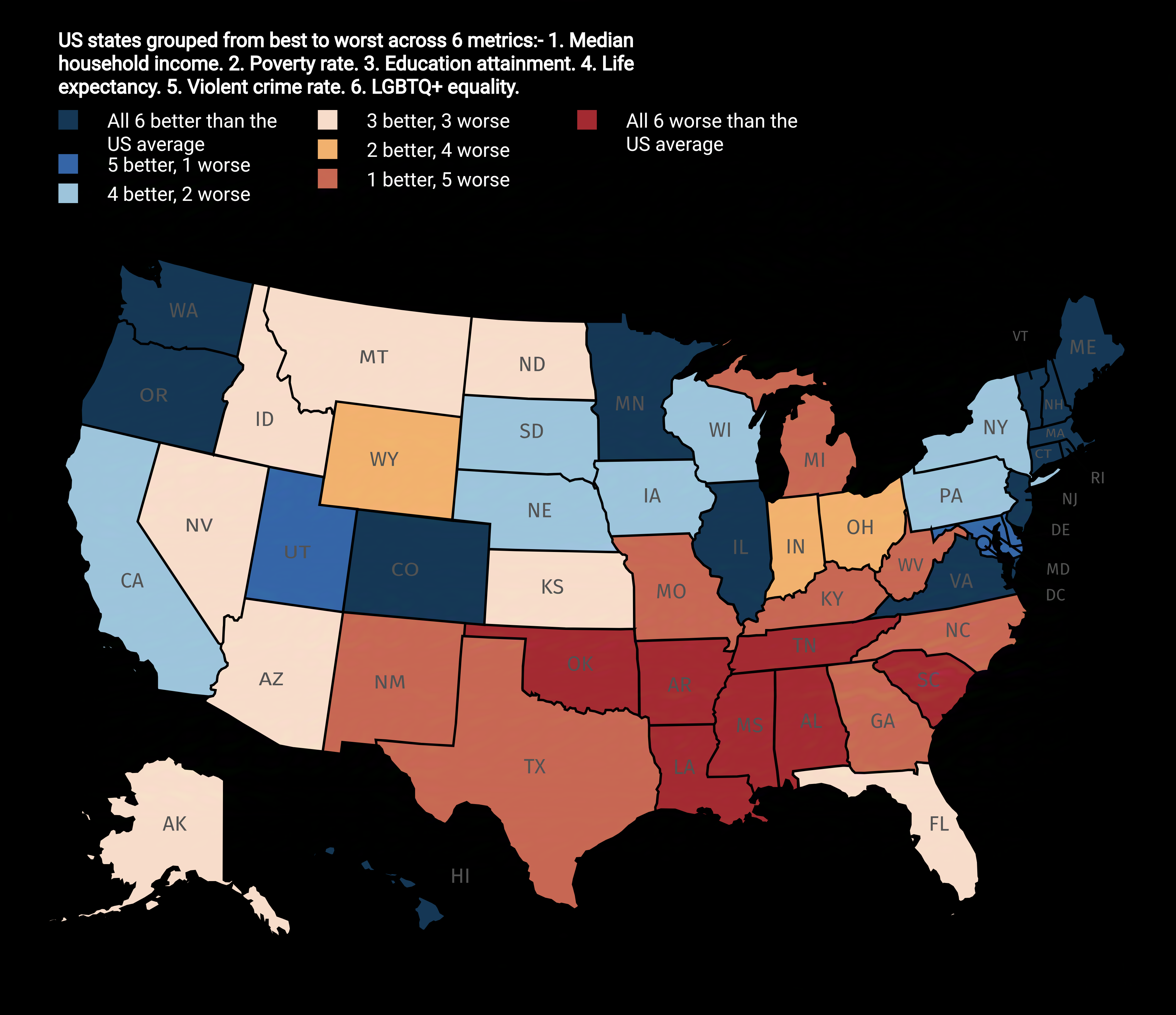
US States Ranked from Best to Worst Map
## What This Map Shows...
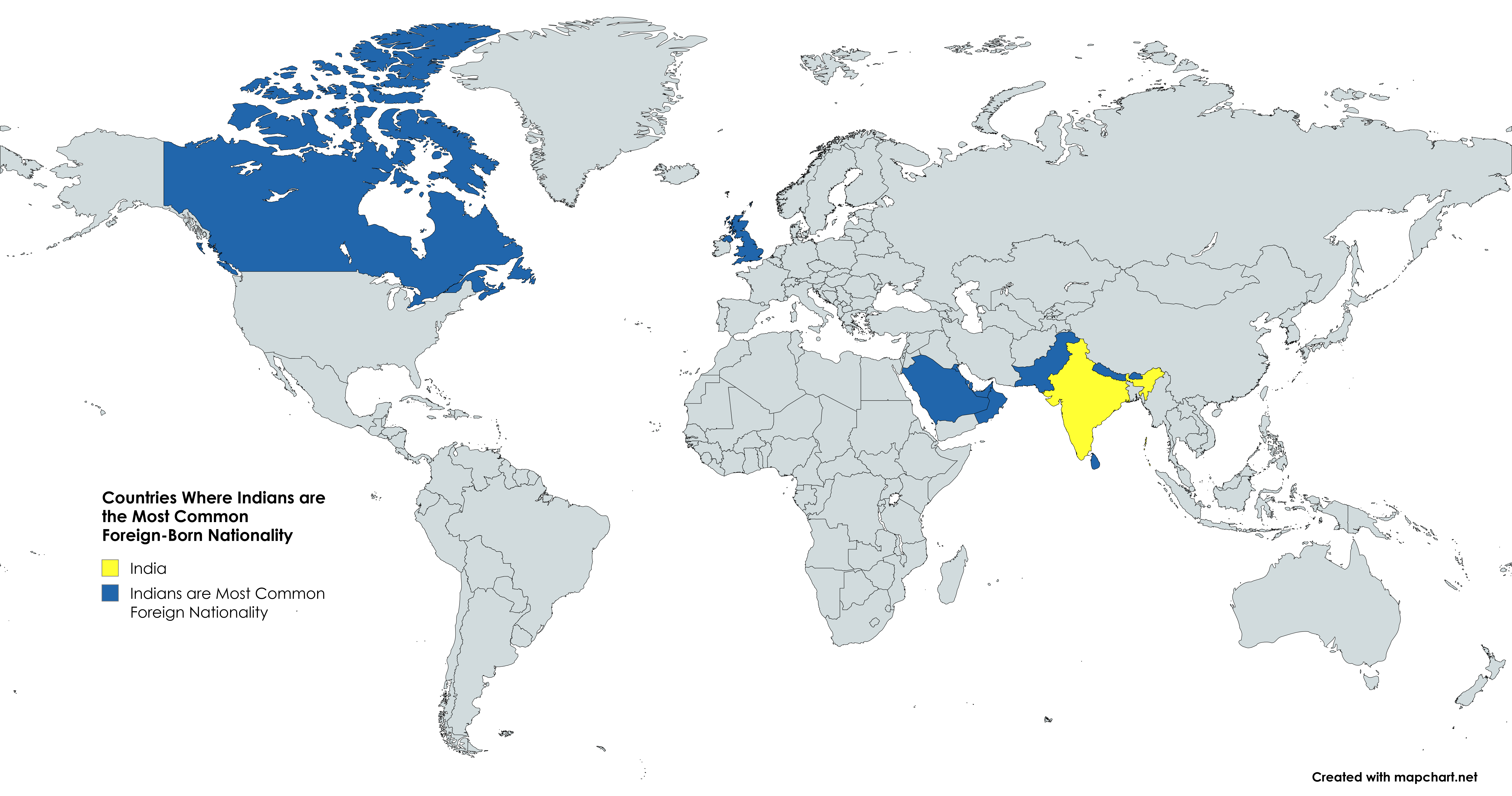
Countries Map Where Indians are the Most Common Foreign-Born Nationality
## What This Map Shows...
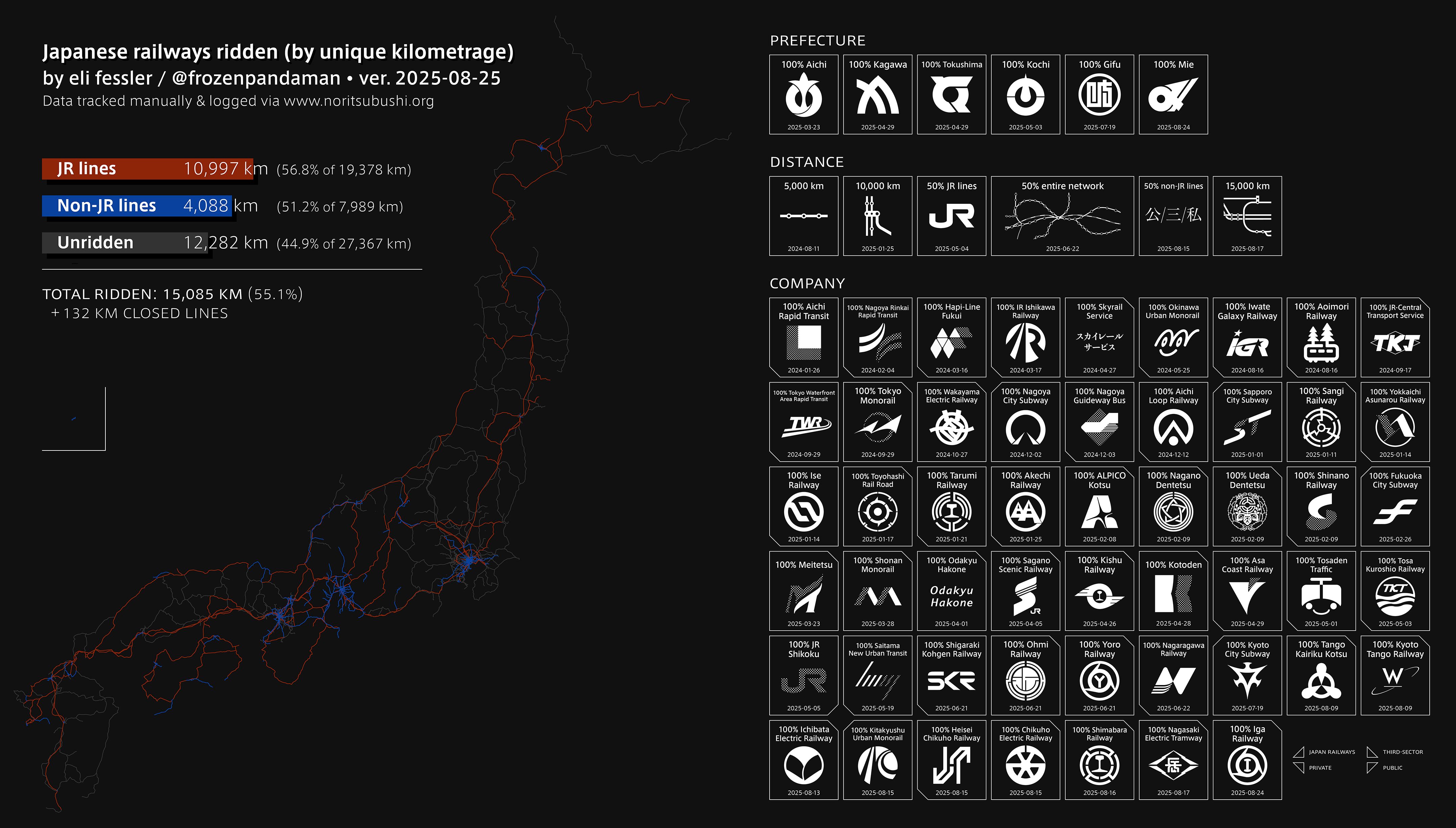
Railway Network Map of Japan
## What This Map Shows...
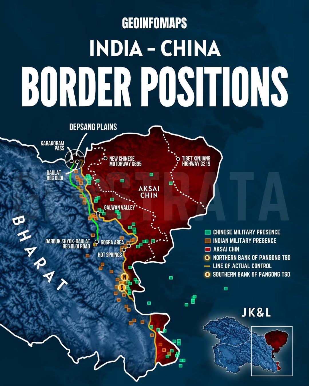
India-China Border Positions Map
## What This Map Shows...
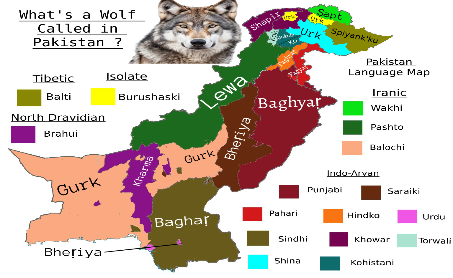
Wolf Species Names Map in Pakistan
## What This Map Shows\nThis map provides an intriguing look at how wolves are referred to in various regions of Pakista...
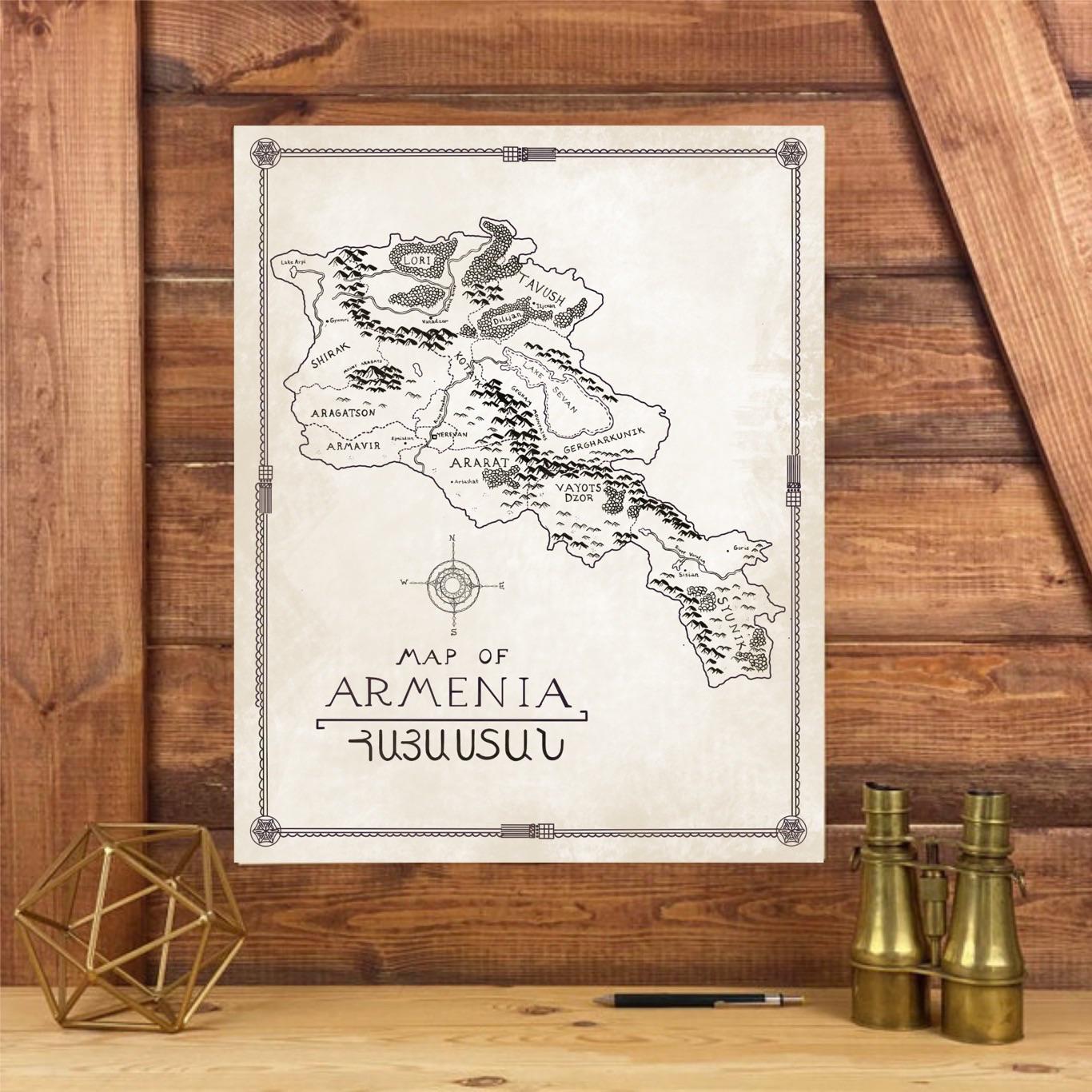
Hand-Drawn Map of Armenia in Tolkien Style
## What This Map Shows...
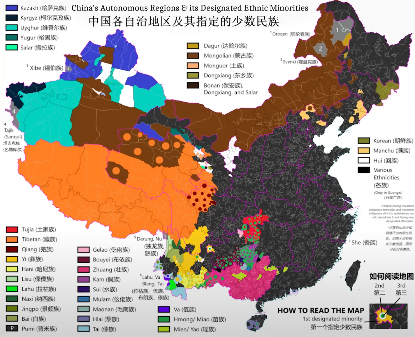
China's Autonomous Regions and Ethnic Minorities Map
## What This Map Shows\nThis map highlights China’s autonomous regions and the designated ethnic minorities residing wit...
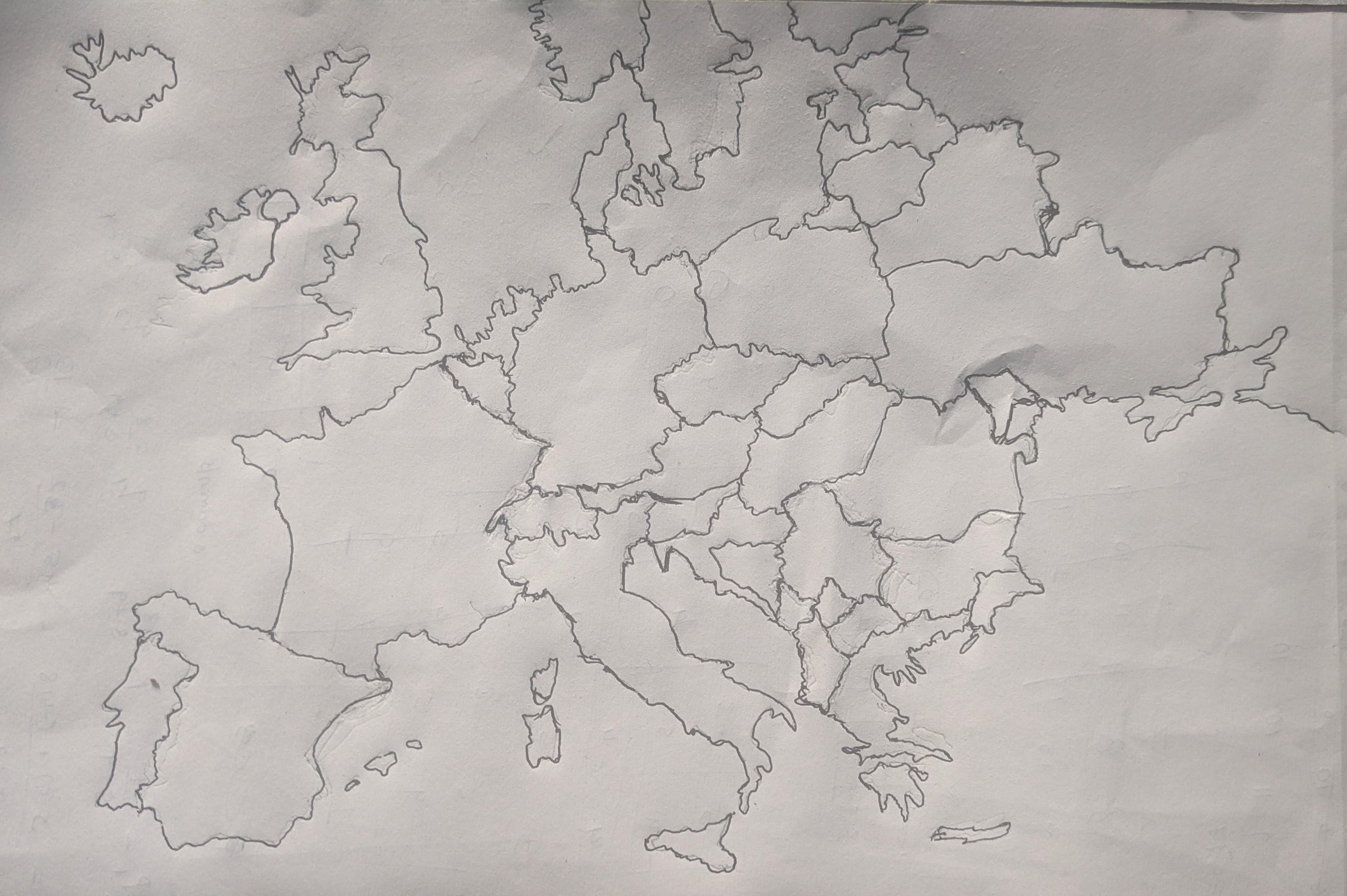
Hand Drawn Map of Europe Overview
## What This Map Shows\nThis hand-drawn map of Europe displays a unique and personal representation of the continent, hi...
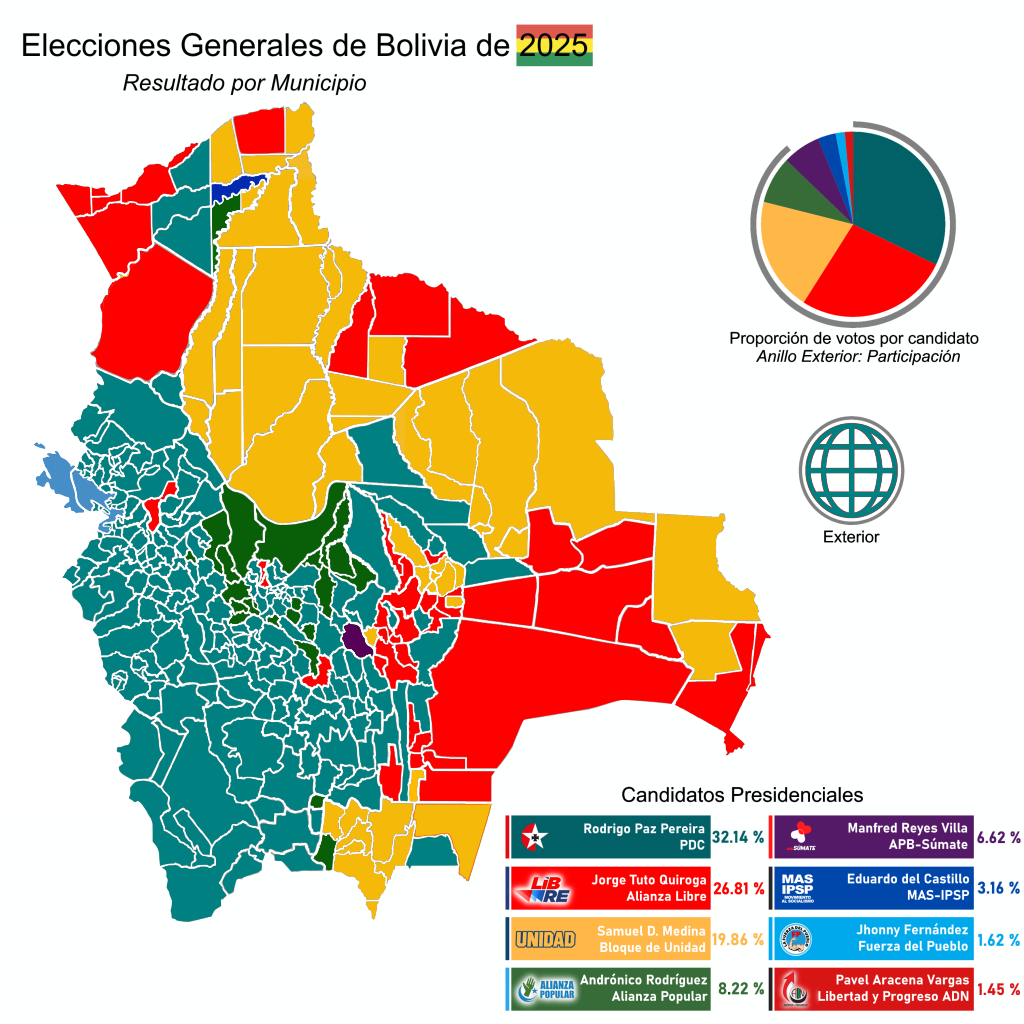
2025 Bolivian General Election Results by Municipality Map
## What This Map Shows...
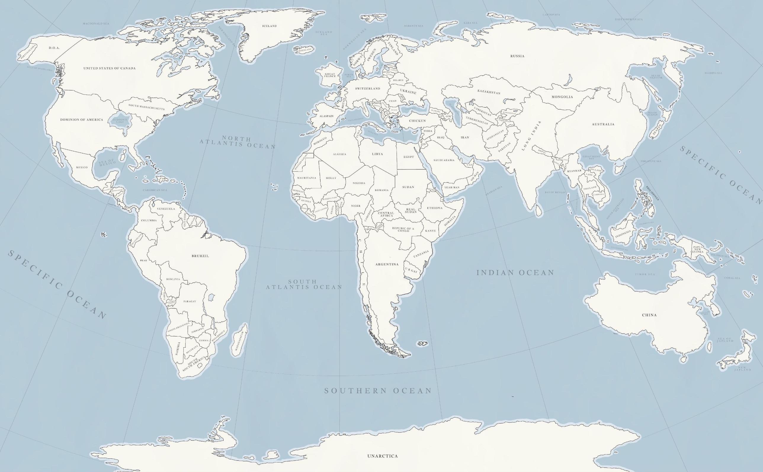
Cursed Places Around the World Map
## What This Map Shows...
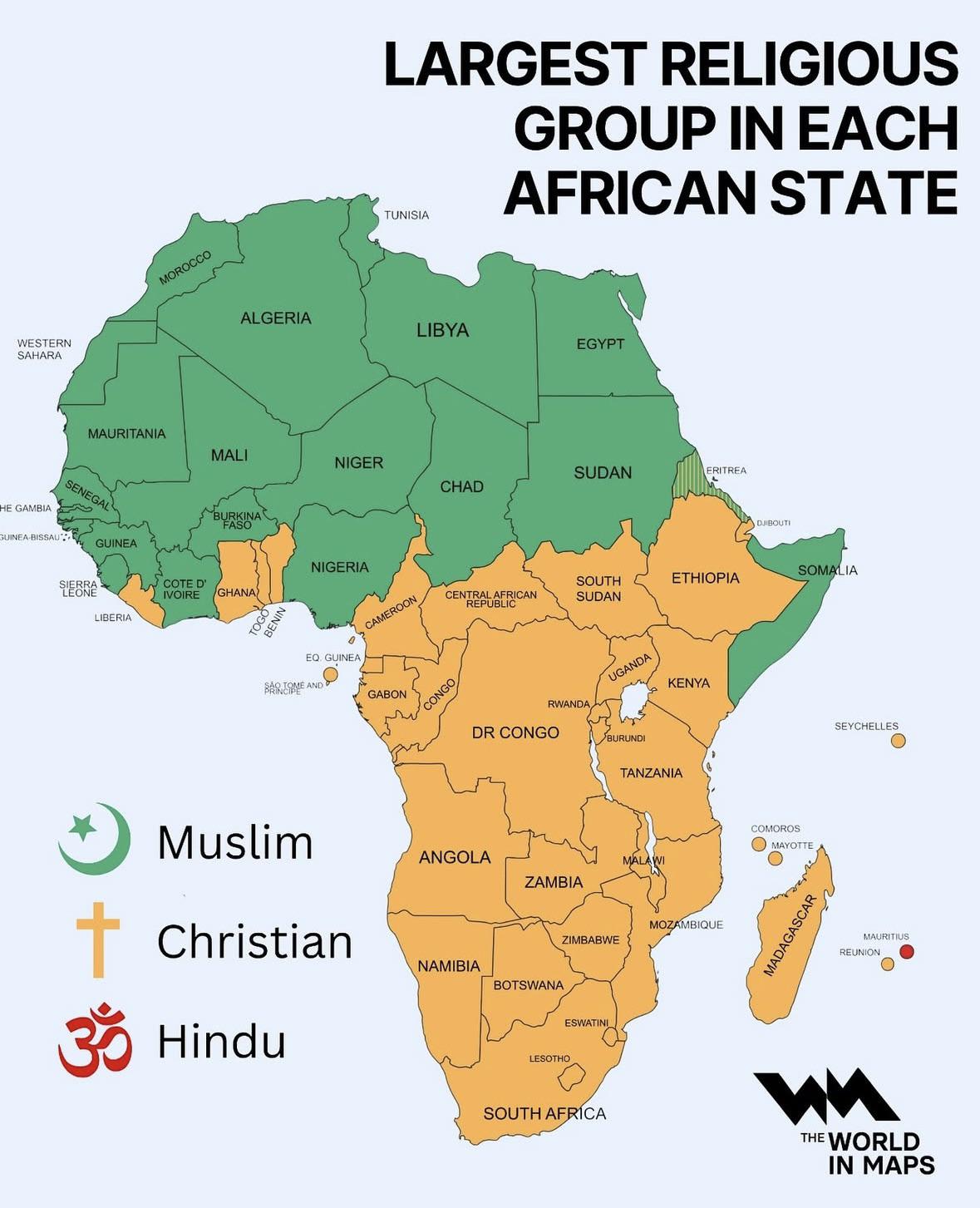
Map of Largest Religious Group in Each African State
## What This Map Shows...
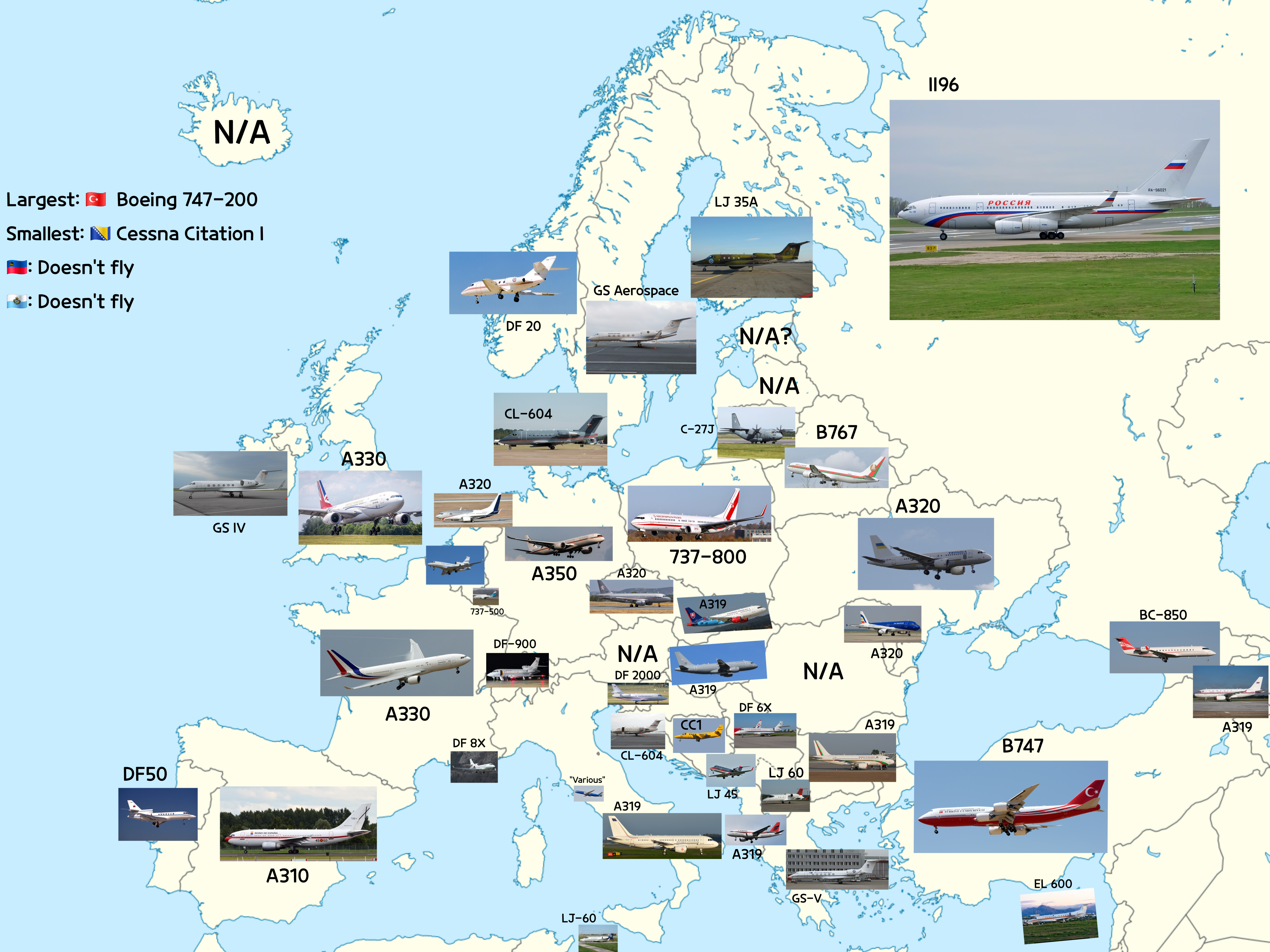
Map of Aircraft Types Heads of State Fly in Europe
## What This Map Shows...
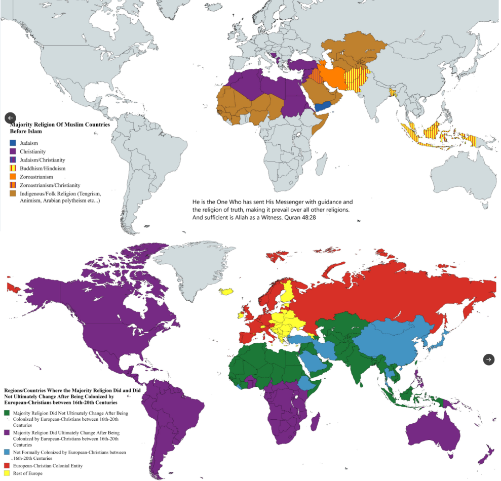
Religion Change Map Due to Islamic and Christian Imperialism
## What This Map Shows\nThis map visually represents the shifts in religious adherence across various regions of the wor...
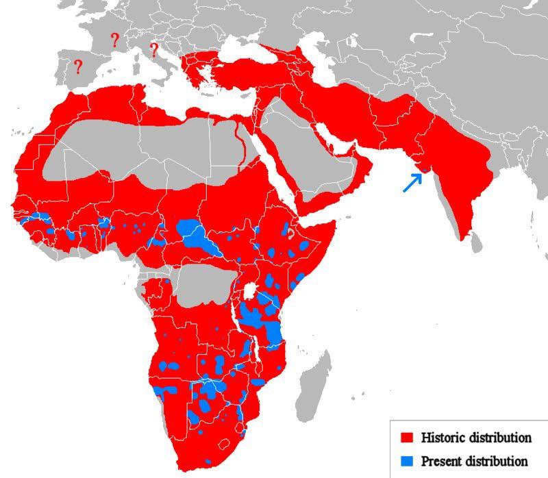
Historic vs Present Distribution of Lions Map
## What This Map Shows...
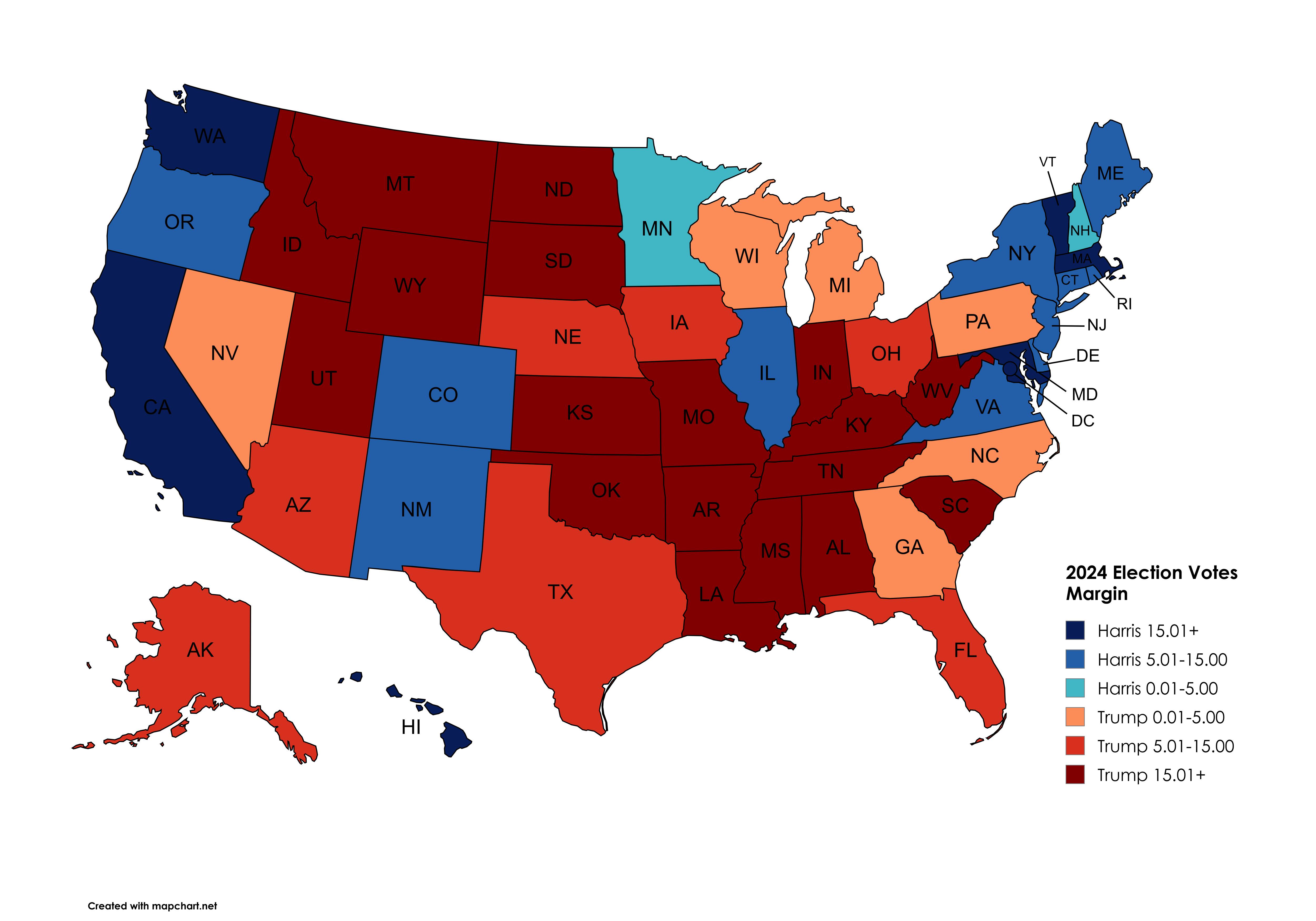
2024 Presidential Election States Margin of Votes Map
## What This Map Shows...
