Geographic Visualizations
Explore our curated collection of fascinating geographic visualizations and cartographic analyses. Discover detailed maps, data visualizations, and geographical insights from around the world.
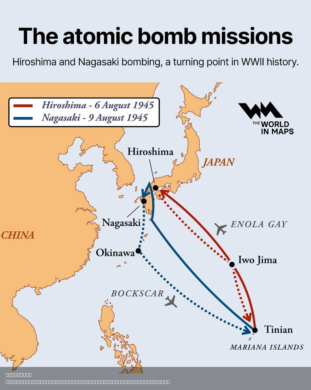
Atomic Bomb Missions Map of Hiroshima and Nagasaki
## What This Map Shows...
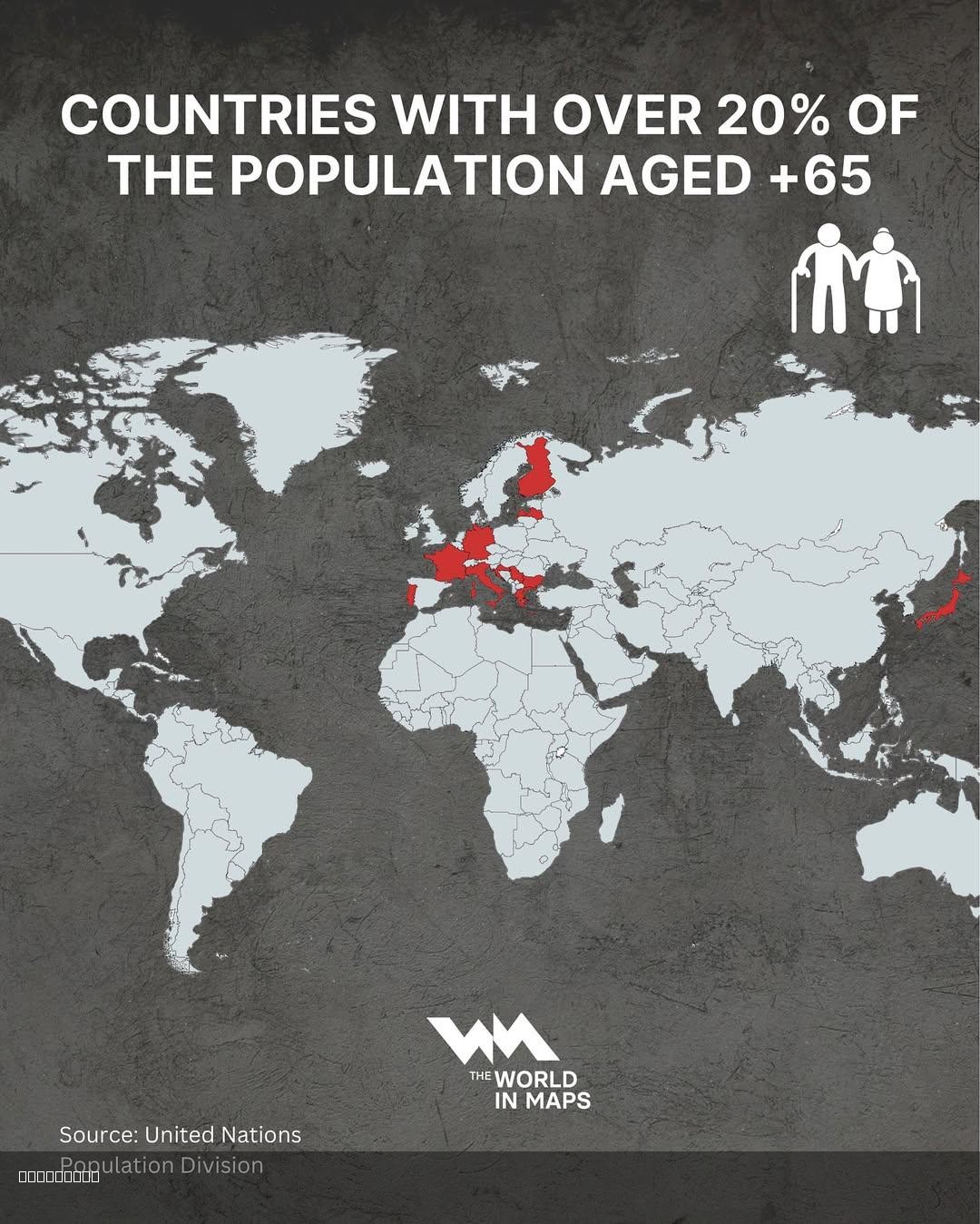
Countries with Over 20% Population Aged 65+ Map
## What This Map Shows...
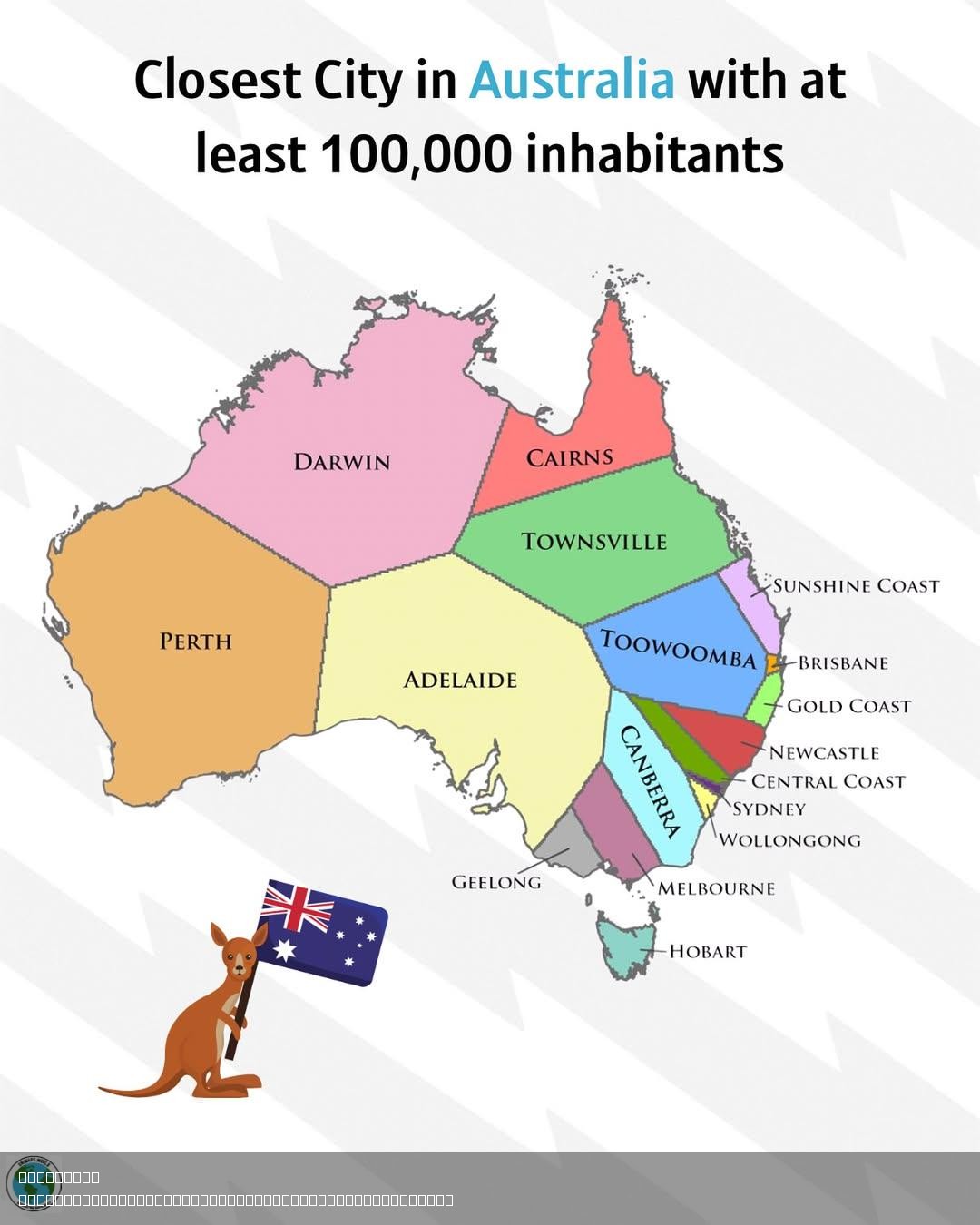
Closest Australian City with 100,000 Inhabitants Map
## What This Map Shows...
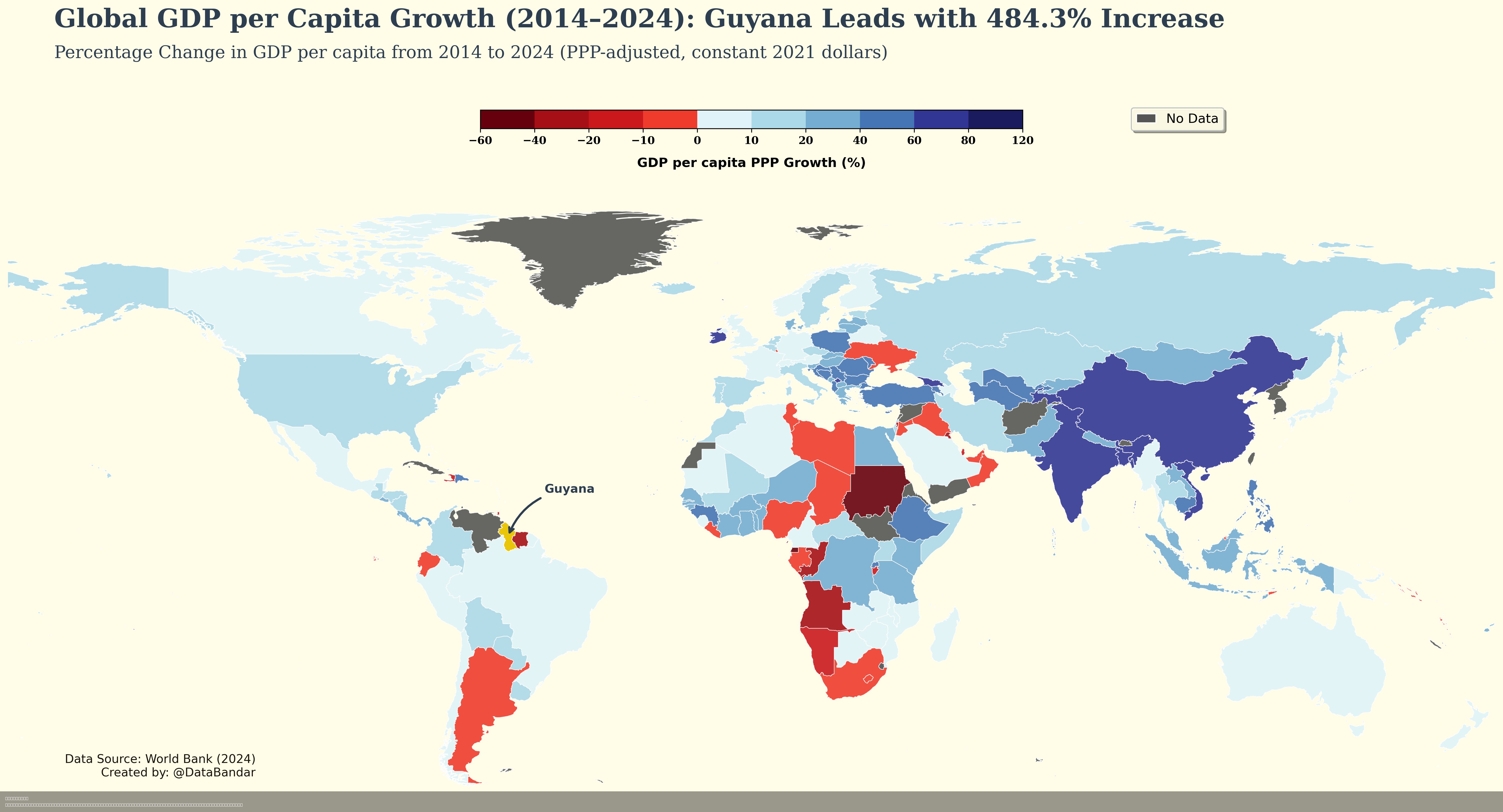
GDP Per Capita Growth Map of Guyana
## What This Map Shows...
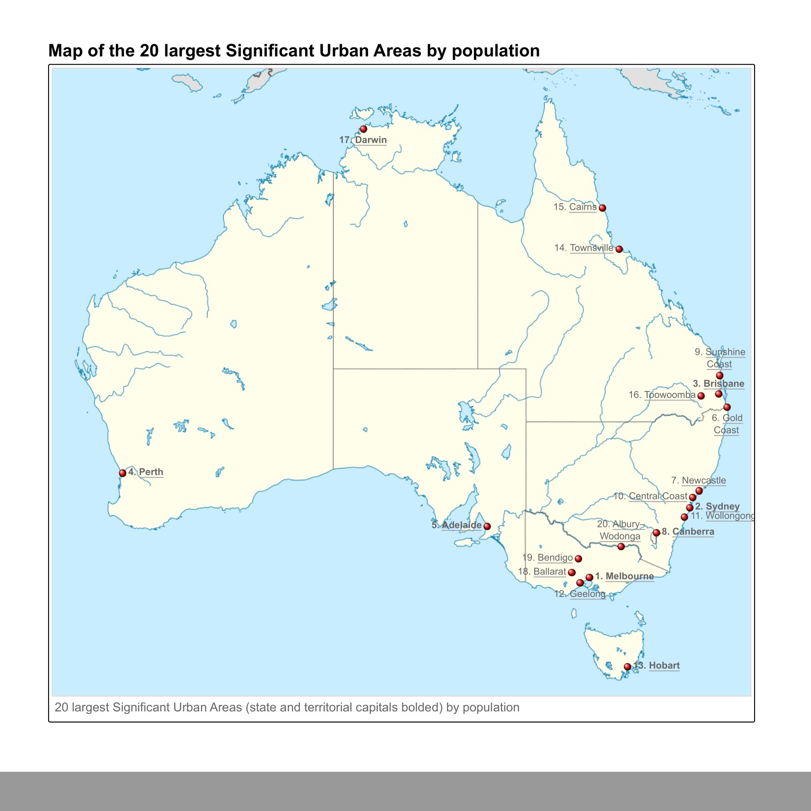
Twenty Largest Urban Areas in Australia Map
## What This Map Shows...
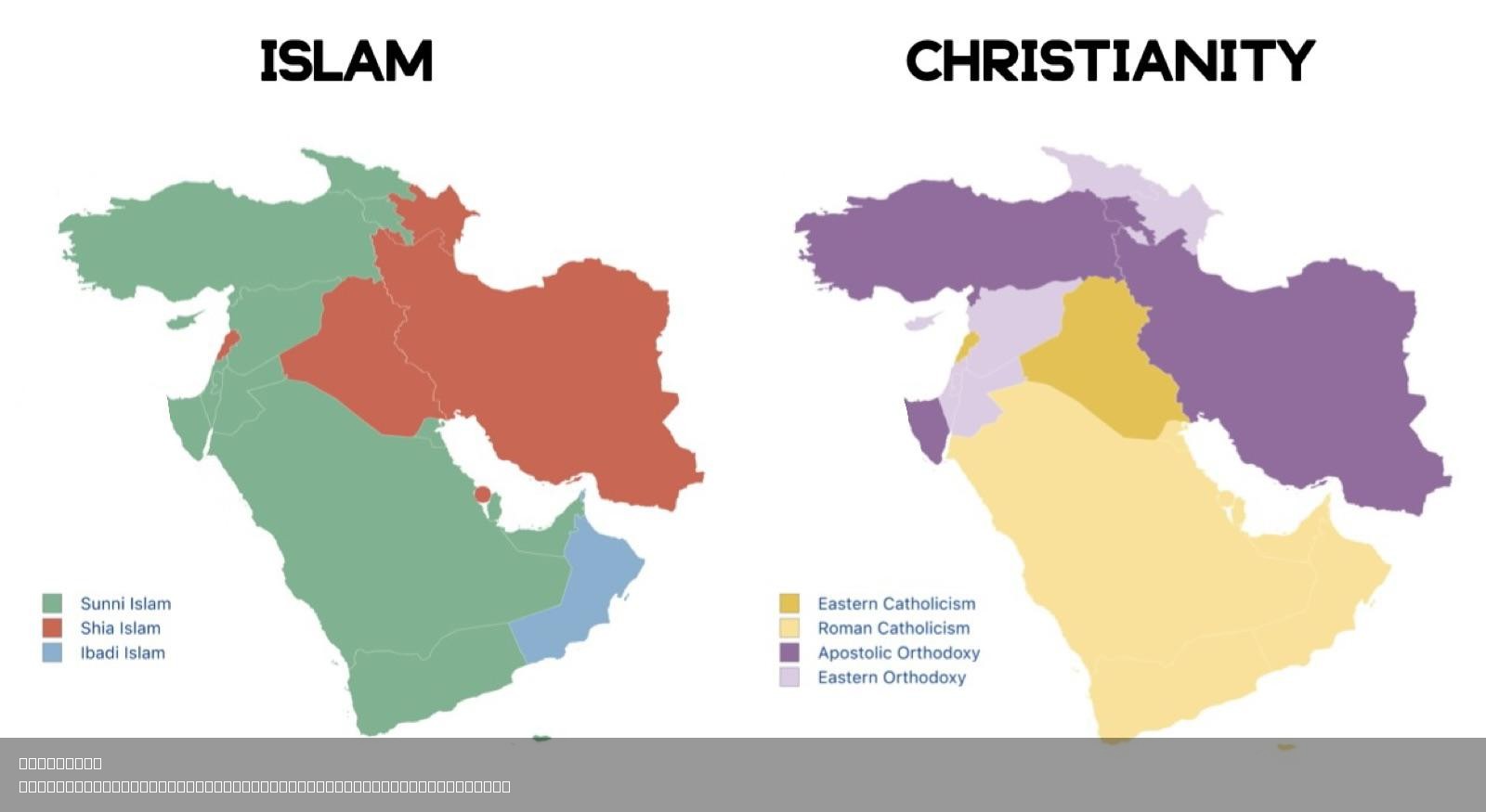
Largest Sect of Islam and Christianity in West Asia Map
## What This Map Shows...
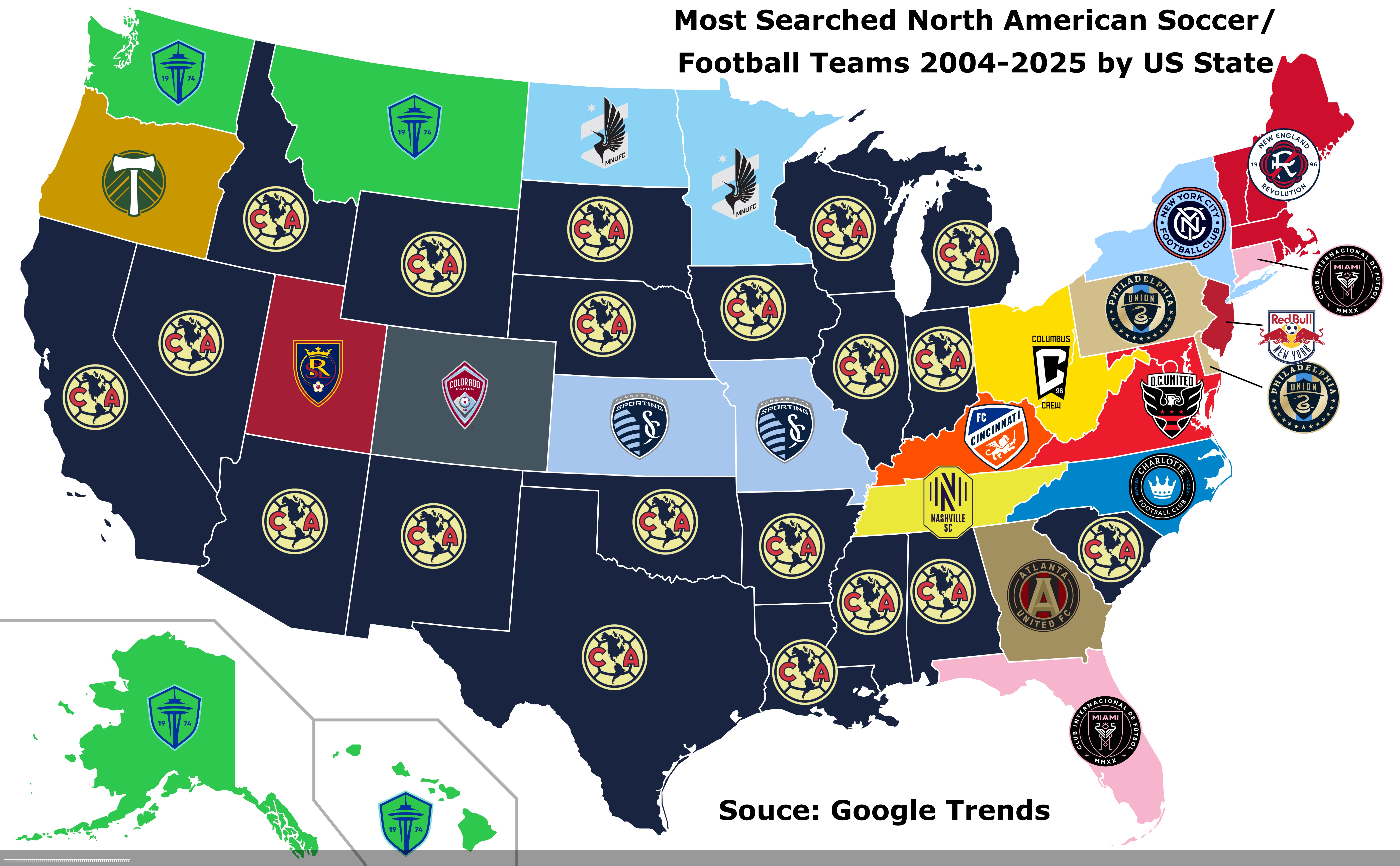
Most Searched North American Soccer Teams Map
## What This Map Shows...
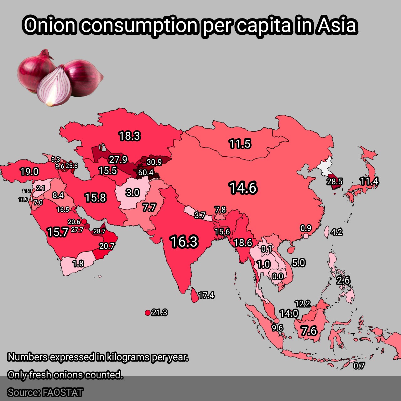
Onion Consumption Per Capita in Asia Map
## What This Map Shows...
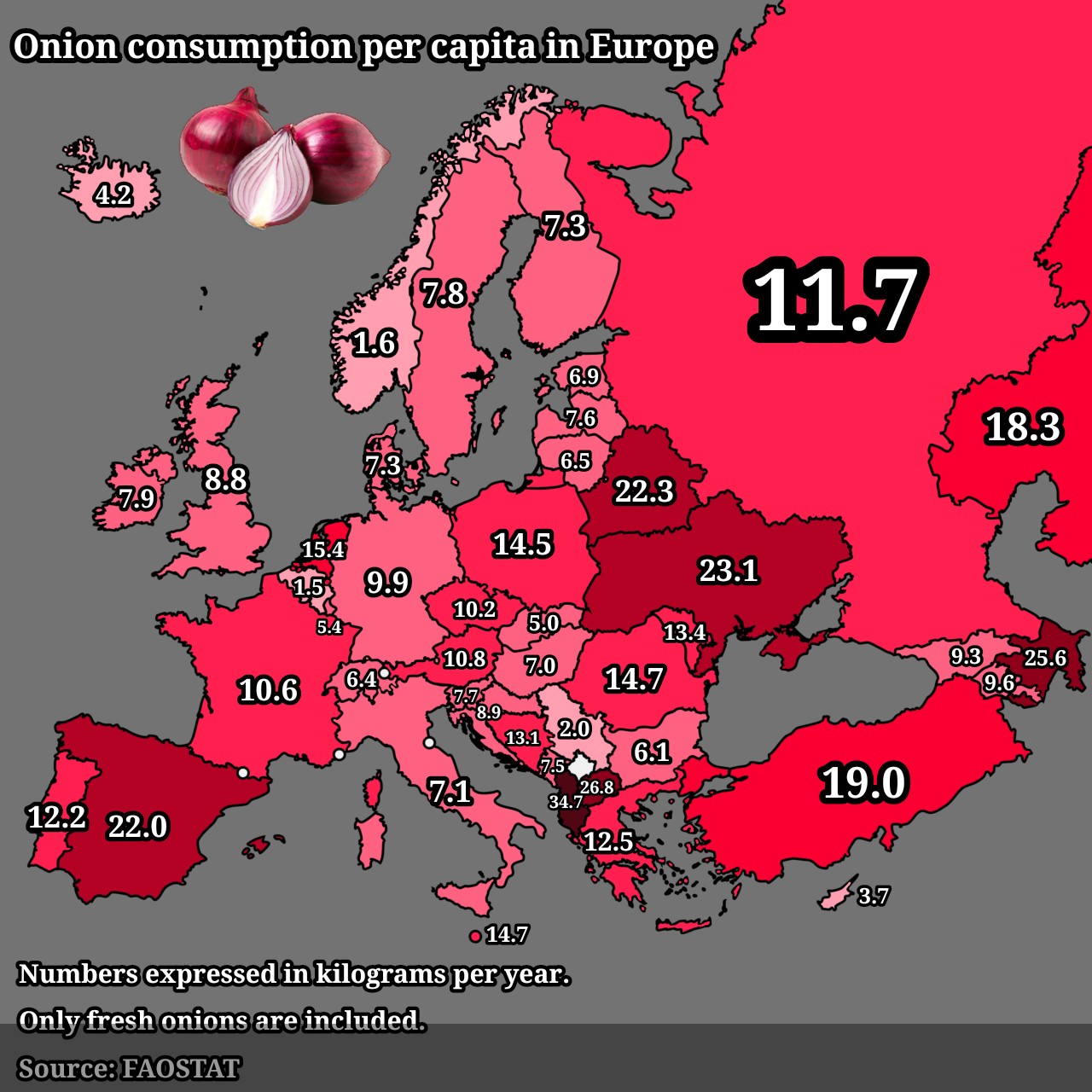
Onion Consumption Per Capita in Europe Map
## What This Map Shows...
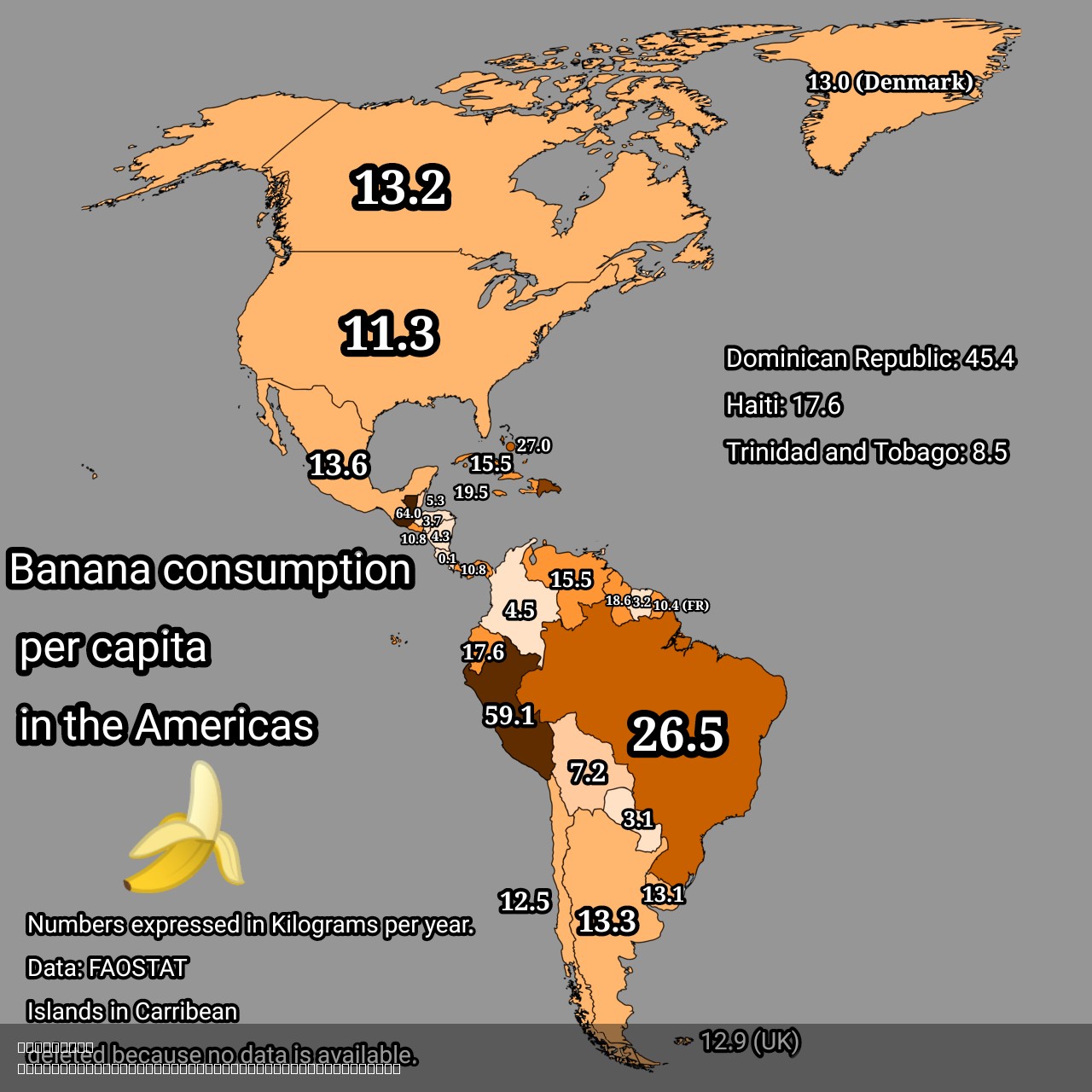
Banana Consumption Per Capita in the Americas Map
## What This Map Shows...
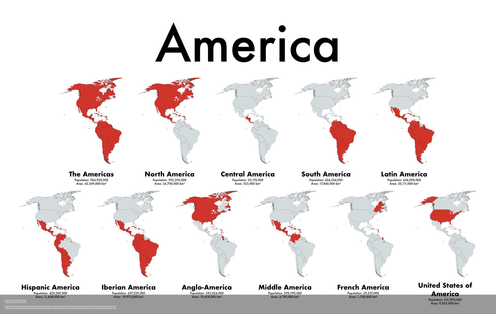
Cultural Diversity Map of the Americas
## What This Map Shows...
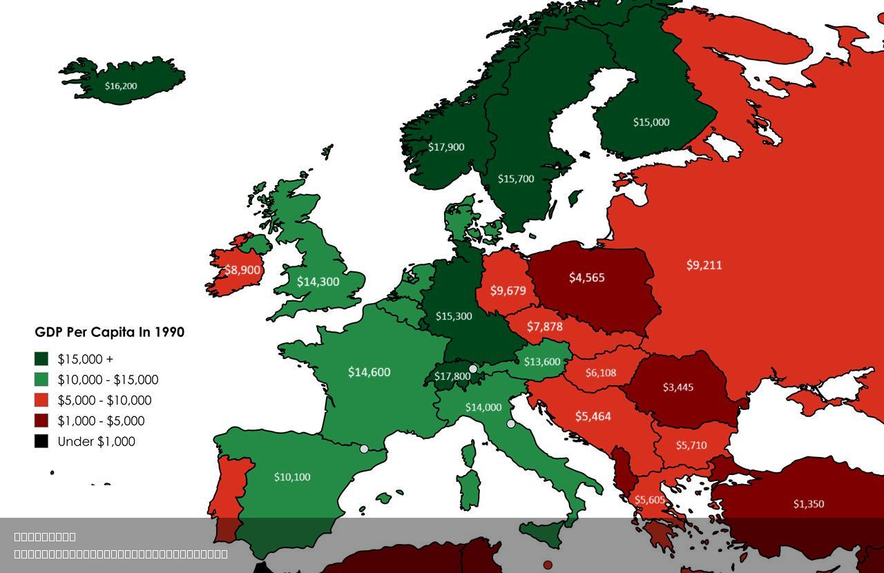
GDP Per Capita by Country Map 1990
## What This Map Shows...
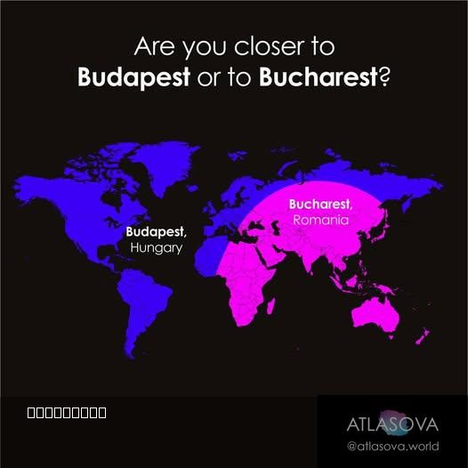
Proximity Map of Budapest and Bucharest
## What This Map Shows\nThis intriguing visualization provides a clear perspective on the geographical proximity of two ...
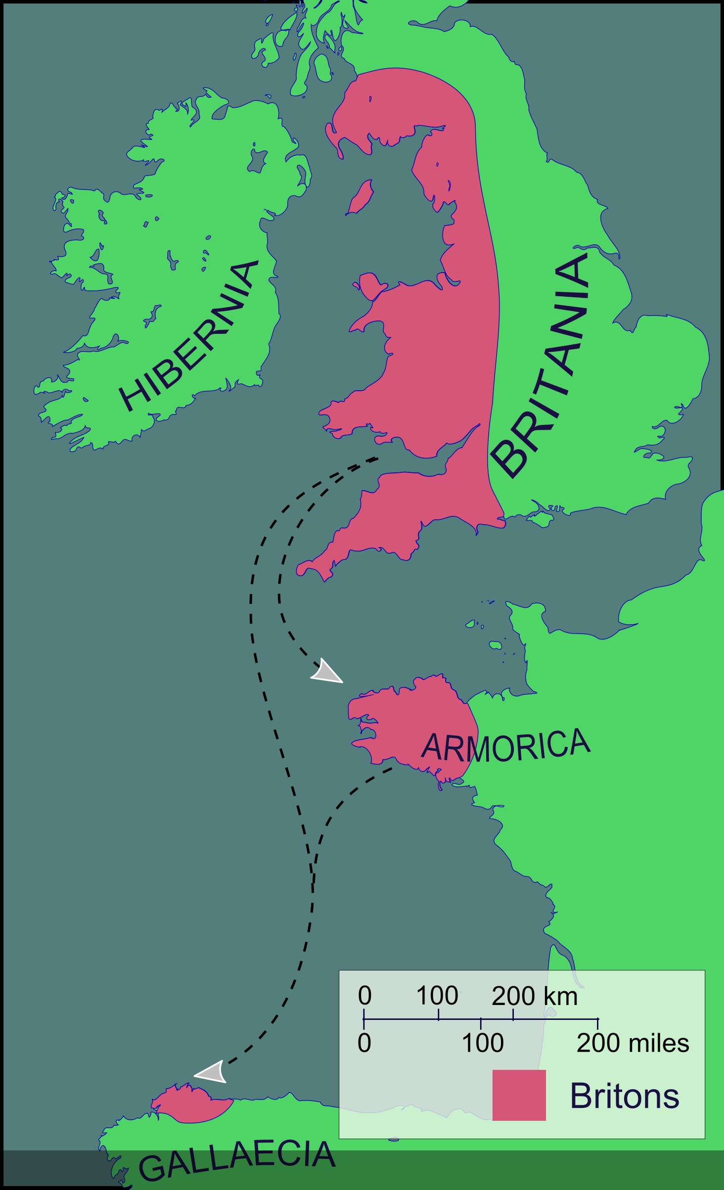
Brittonic-speaking Community Map of the Sixth Century
## What This Map Shows\nThe map titled \...
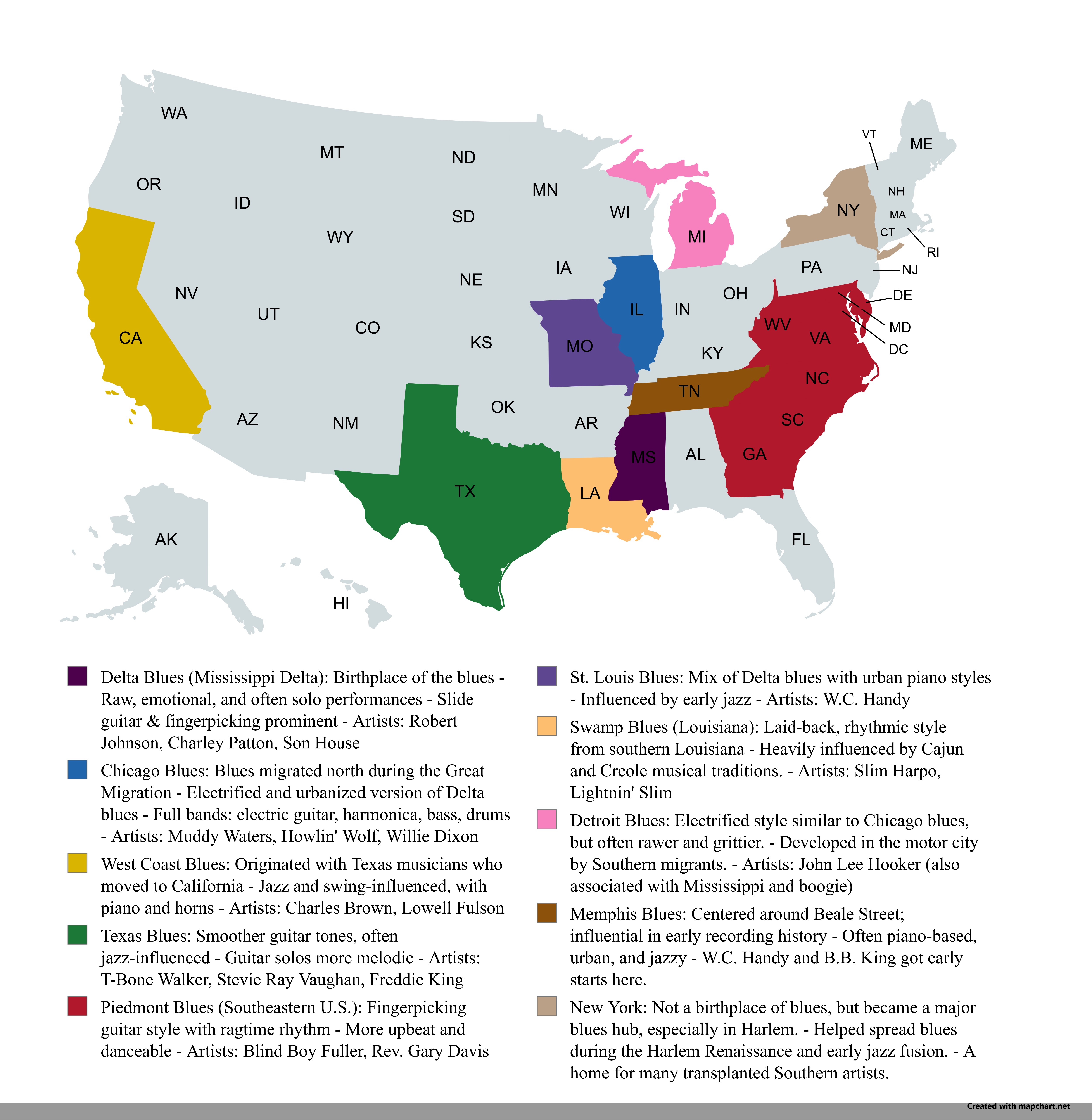
Regional Blues Music Map of the USA
## What This Map Shows...
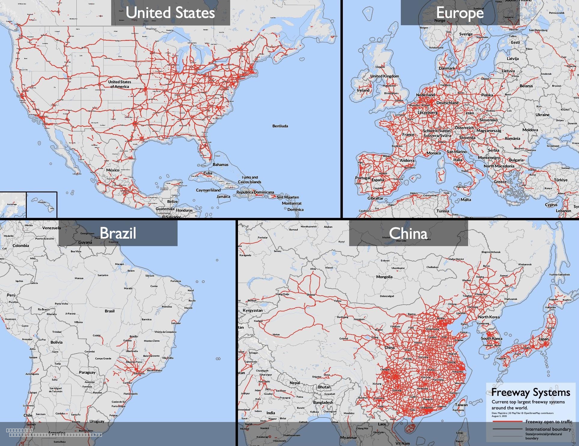
Largest Freeway Systems in 2025 Map
## What This Map Shows...
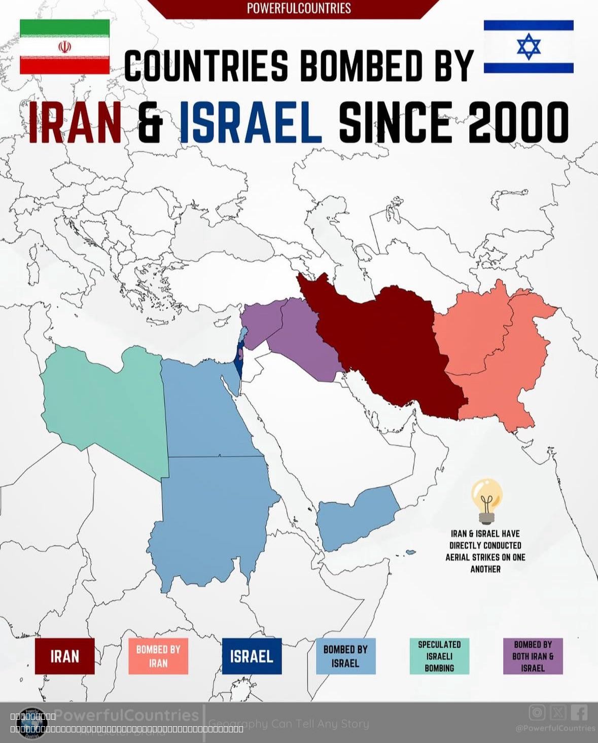
Countries Bombed by Israel and Iran Since 2000 Map
## What This Map Shows...
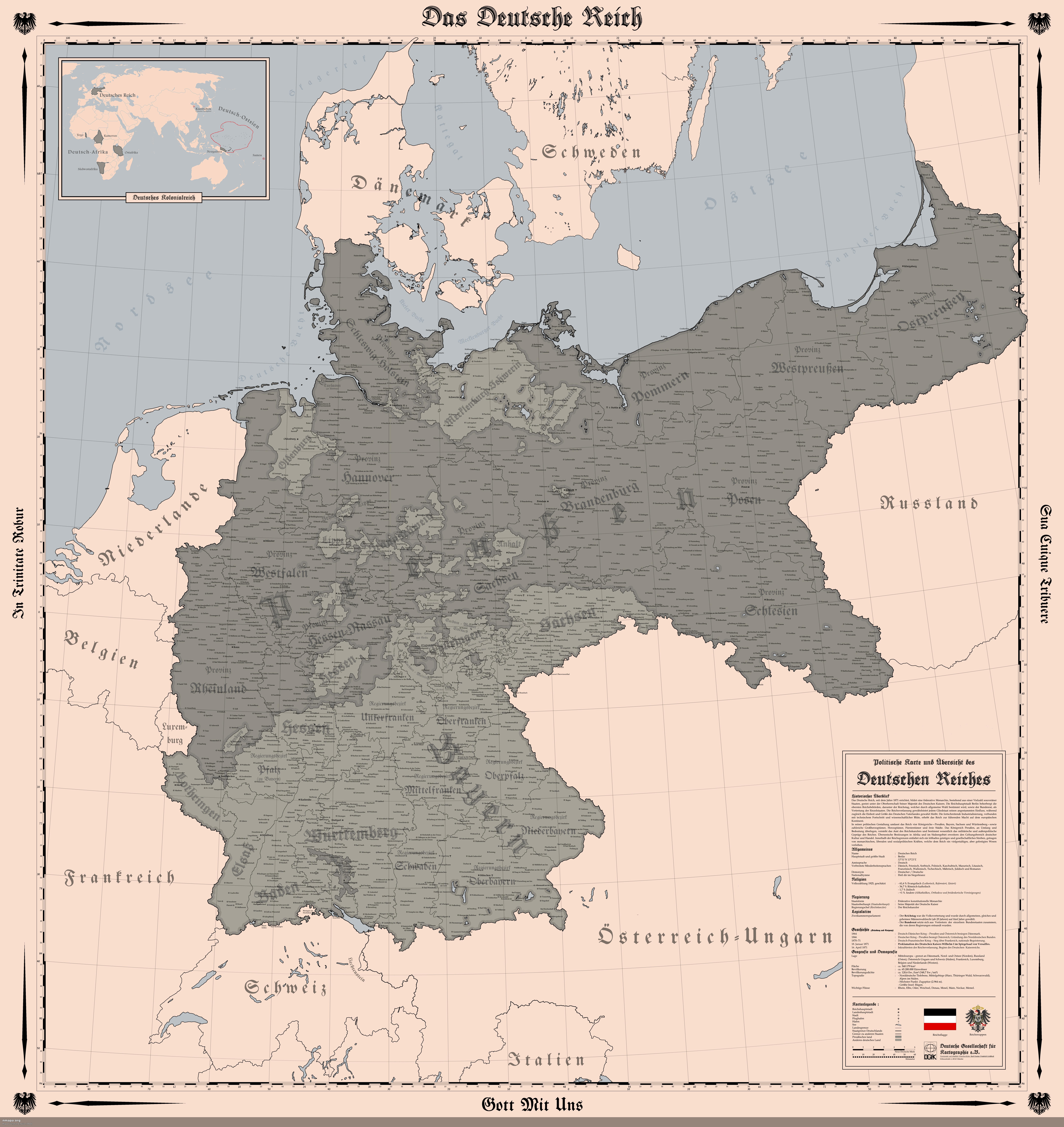
Map of the German Empire in 1914
## What This Map Shows...
