Netherlands Provinces and Capitals Map

Marcus Rodriguez
Historical Geography Expert
Marcus Rodriguez specializes in historical cartography and geographic data analysis. With a background in both history and geography, he brings unique...
Geographic Analysis
What This Map Shows
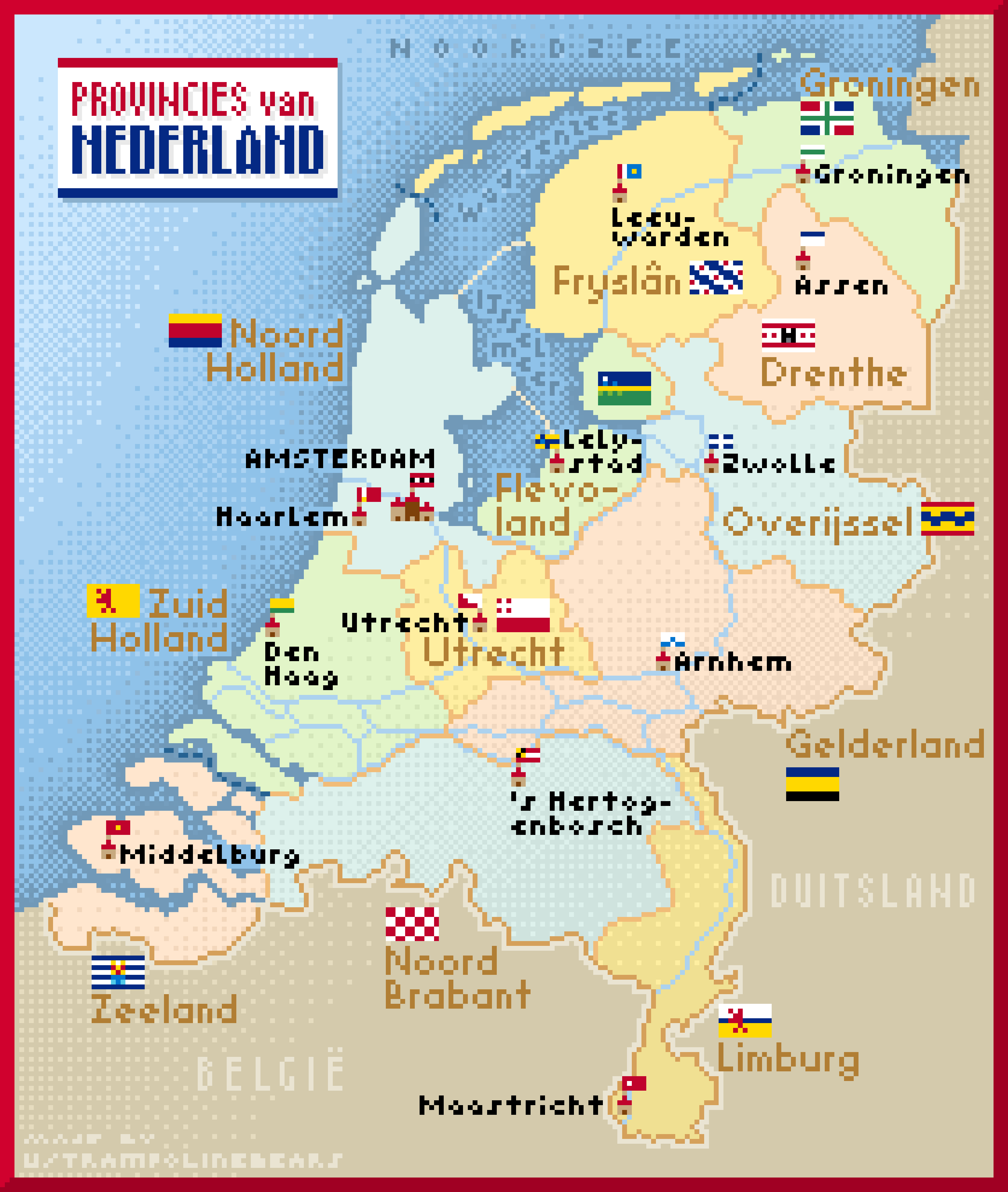
This pixel art map of the Netherlands beautifully illustrates the country's provinces, complete with their capitals and distinctive province flags, alongside tiny representations of the capital city flags. Each province is given a vibrant color, emphasizing the rich diversity and unique identity of each region. The visual appeal of pixel art adds a playful touch, making it an engaging way to understand the geographical and political landscape of the Netherlands.
However, this map is more than just a colorful representation; it serves as a gateway to understanding the cultural, historical, and geographical significance of each province. The Netherlands, known for its rich heritage, waterways, and innovative land reclamation techniques, has a lot to offer in terms of geographical diversity and provincial identity.
Deep Dive into Provinces of the Netherlands
The Netherlands is divided into twelve provinces, each with its own unique characteristics and history. These provinces are: 1. **Drenthe** 2. **Flevoland** 3. **Friesland** 4. **Gelderland** 5. **Groningen** 6. **Limburg** 7. **North Brabant** (Noord-Brabant) 8. **North Holland** (Noord-Holland) 9. **Overijssel** 10. **South Holland** (Zuid-Holland) 11. **Utrecht** 12. **Zeeland**
Each of these provinces has its own capital city, which serves as a political and cultural hub. For instance, Amsterdam, the capital of North Holland, is not only the largest city in the country but also a center of art, history, and commerce. On the other hand, the capital of Friesland, Leeuwarden, is known for its rich history and was even designated the European Capital of Culture in 2018.
Interestingly, the geographical distribution of these provinces reveals a fascinating interplay between urbanization and rural areas. The western provinces like South Holland and North Holland are densely populated and industrialized, while provinces like Drenthe and Zeeland are more rural, showcasing the Netherlands' agricultural traditions and natural landscapes.
According to recent statistics, the population density in South Holland is among the highest in the country, with urban centers such as Rotterdam and The Hague driving this trend. In contrast, provinces like Groningen have lower population densities, which can impact local economies and infrastructure development.
Regional Analysis
Let’s break down the provinces by their unique characteristics: - **North Holland**: This province is home to Amsterdam and boasts a mix of urban and coastal landscapes. The vibrant city life contrasts with the serene beauty of the North Sea beaches. - **South Holland**: Known for its bustling cities like Rotterdam and The Hague, South Holland is a hub of commerce and governance. It has the largest port in Europe, making it a critical economic center. - **Utrecht**: Often considered the cultural heart of the Netherlands, Utrecht has a rich history and is famed for its medieval old town and canals. - **Friesland**: This province is renowned for its unique language and culture, distinct from the rest of the Netherlands. It’s also known for its beautiful lakes and outdoor activities. - **Zeeland**: Famous for its coastal landscapes and dikes, Zeeland is a testament to the Netherlands' battle against the sea. Its economy thrives on tourism and agriculture.
The variations among these provinces are not only geographical but also cultural. For example, Friesland's strong cultural identity, including its own language, contrasts sharply with the cosmopolitan nature of North Holland.
Significance and Impact
Understanding the provinces of the Netherlands through this map is essential for grasping the country's socio-economic dynamics. Each province contributes uniquely to the national identity, economy, and cultural tapestry of the Netherlands. Moreover, as the country faces challenges such as climate change and urbanization, the role of each province becomes increasingly significant.
For instance, provinces like Zeeland are on the frontline of climate change impacts, dealing with rising sea levels and the need for innovative water management solutions. Meanwhile, urban provinces like South Holland are grappling with issues related to overpopulation and sustainability.
As we look to the future, the balance between preserving the rich cultural heritage of each province and addressing contemporary challenges will be crucial. The map not only serves as a visual guide but also as a reminder of the complexities that define the Netherlands today. Ever wondered how these provinces will adapt to the changing landscape of Europe? The interplay of culture, economy, and environment will undoubtedly shape their paths ahead.
Visualization Details
- Published
- September 8, 2025
- Views
- 94
Comments
Loading comments...