provinces Maps
5 geographic visualizations tagged with "provinces"
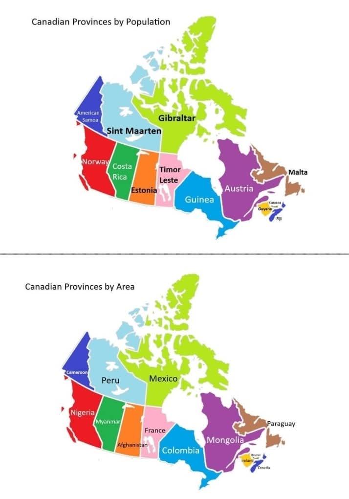
Canadian Provinces and Territories Size and Population Map
This map presents a fascinating comparison between the provinces and territories of Canada and various countries that sh...
👁 60📅 9/20/2025
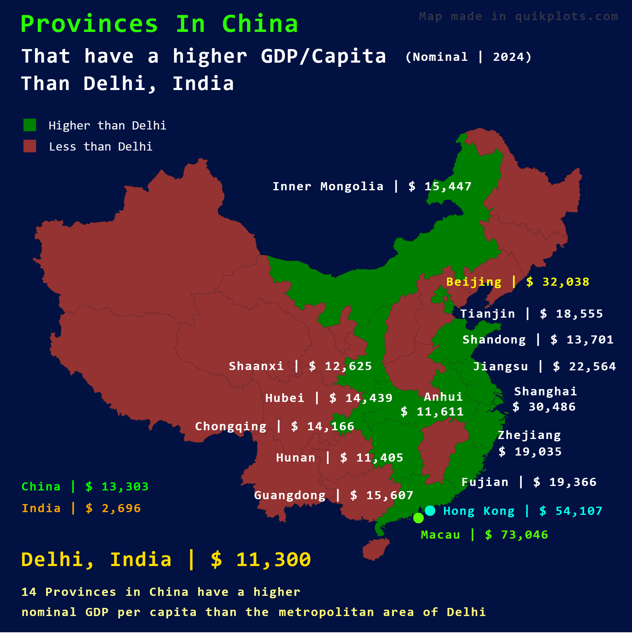
Map of Chinese Provinces with Higher GDP Per Capita than Delhi
This map illustrates which provinces in China have a higher nominal GDP per capita compared to Delhi, India. By placing ...
👁 34📅 9/28/2025
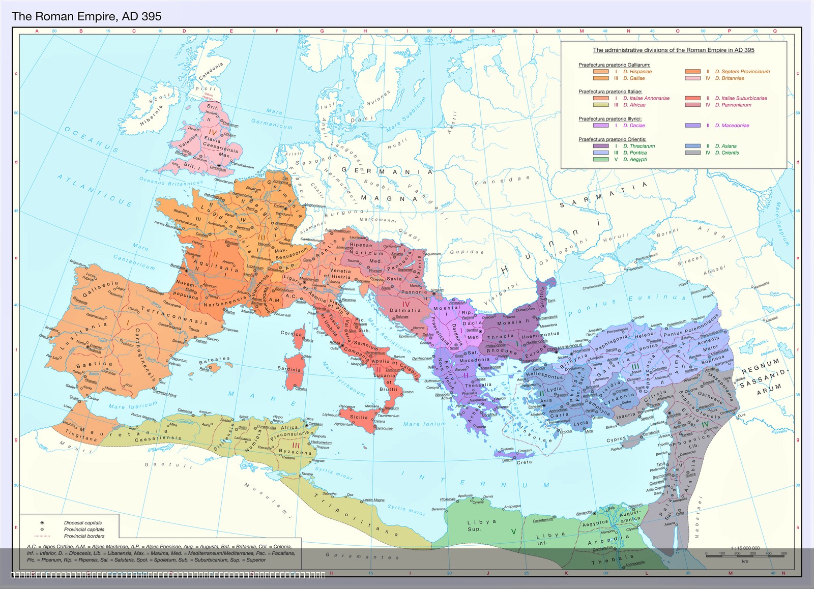
Territorial Organization of the Late Roman Empire Map
The map titled "The Territorial Organization of the Late Roman Empire (395 AD)" provides a detailed visualization of the...
👁 128📅 8/7/2025
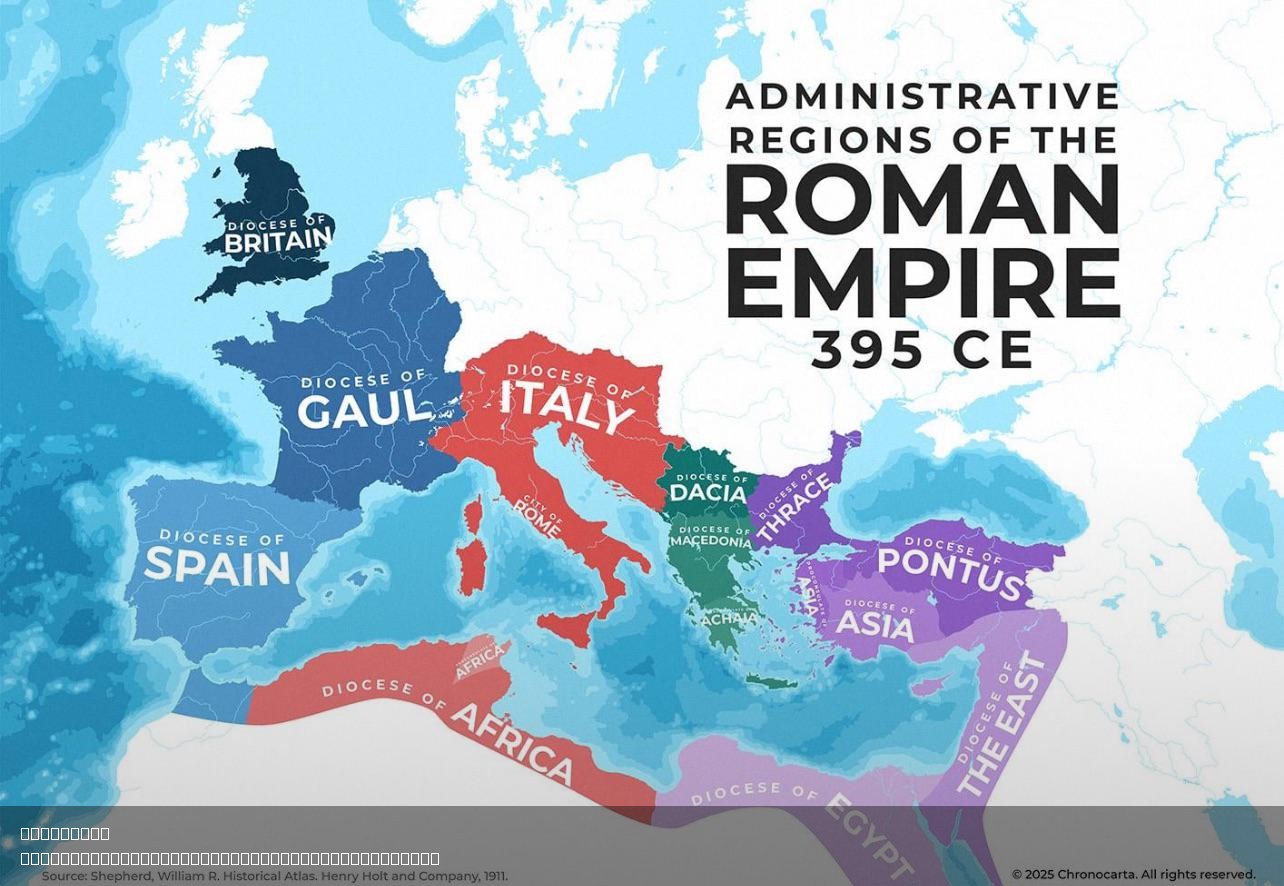
Administrative Regions of the Roman Empire Map
The "Administrative Regions of the Roman Empire Map" provides a detailed representation of the vast territories governed...
👁 110📅 8/7/2025
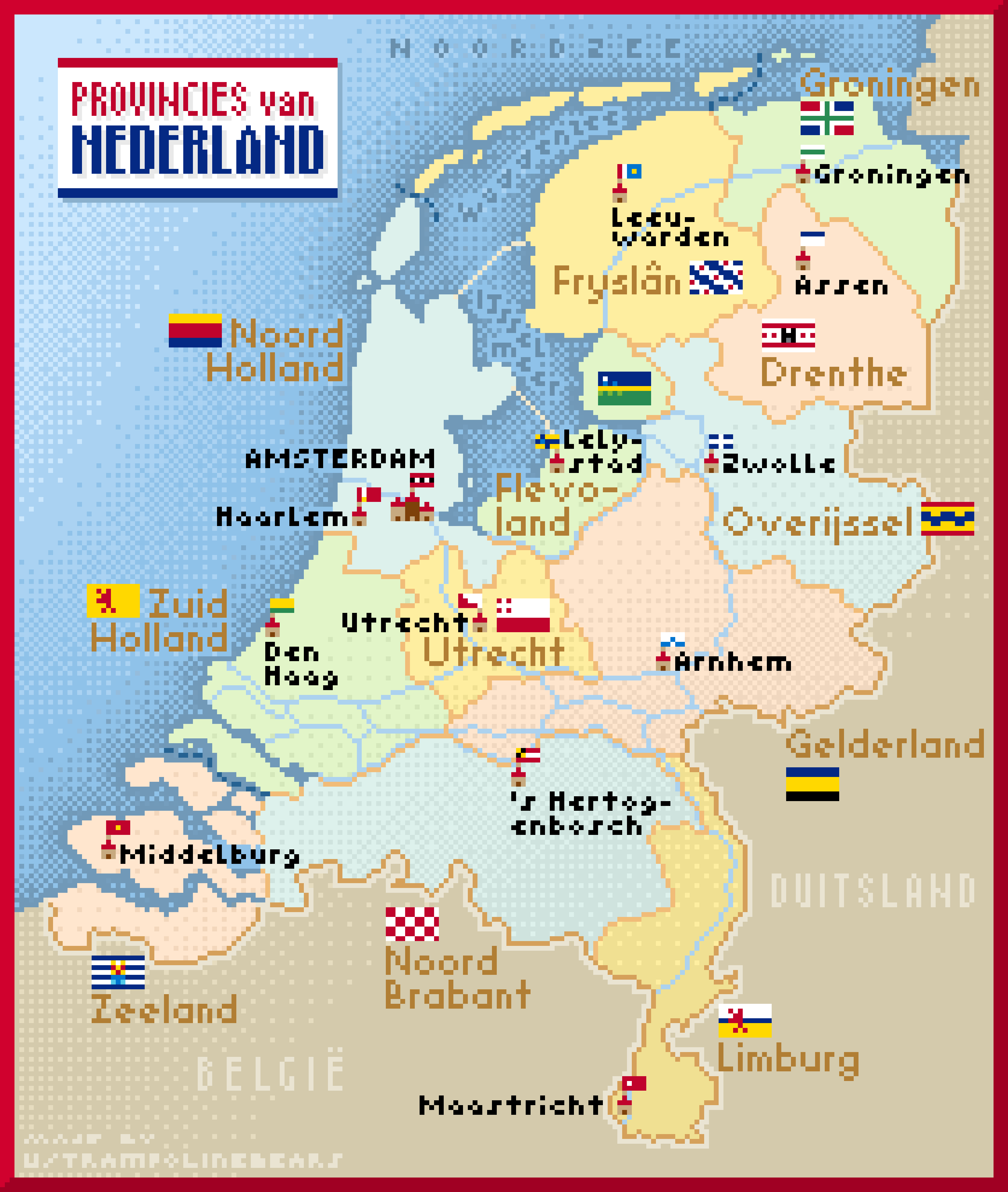
Netherlands Provinces and Capitals Map
This pixel art map of the Netherlands beautifully illustrates the country's provinces, complete with their capitals and ...
👁 66📅 9/8/2025