netherlands Maps
7 geographic visualizations tagged with "netherlands"
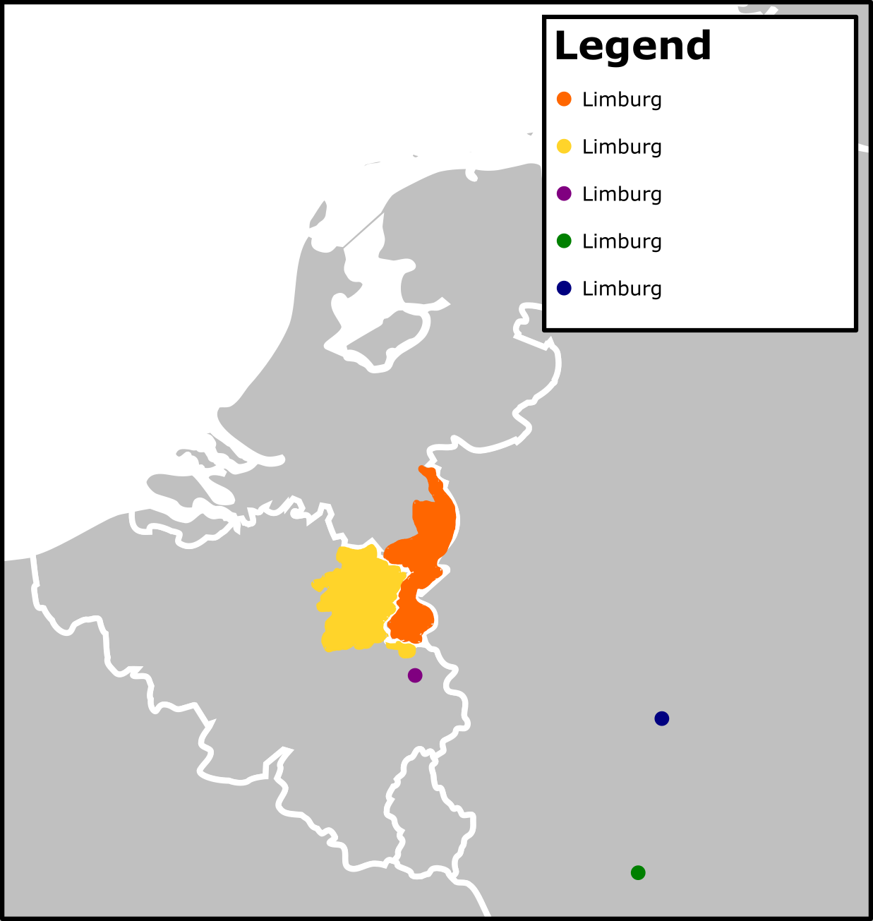
Limburg Population Density Map
This map presents the population density of Limburg, a province in the Netherlands. Through a visual representation of t...
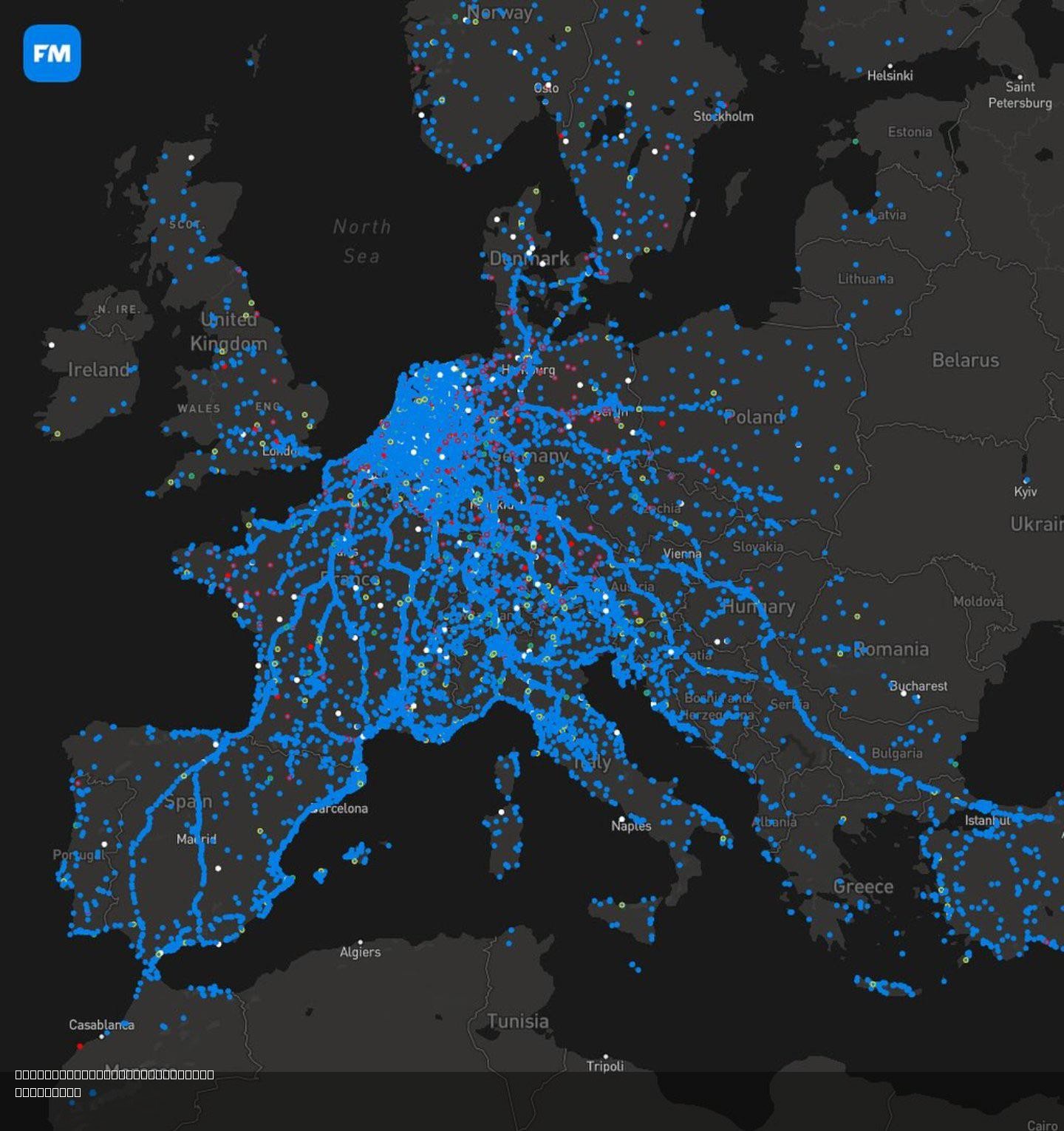
Migration Map of the Dutch for Autumn Season
The "Migration Map of the Dutch for Autumn Season" illustrates the seasonal movement patterns of the Dutch population du...
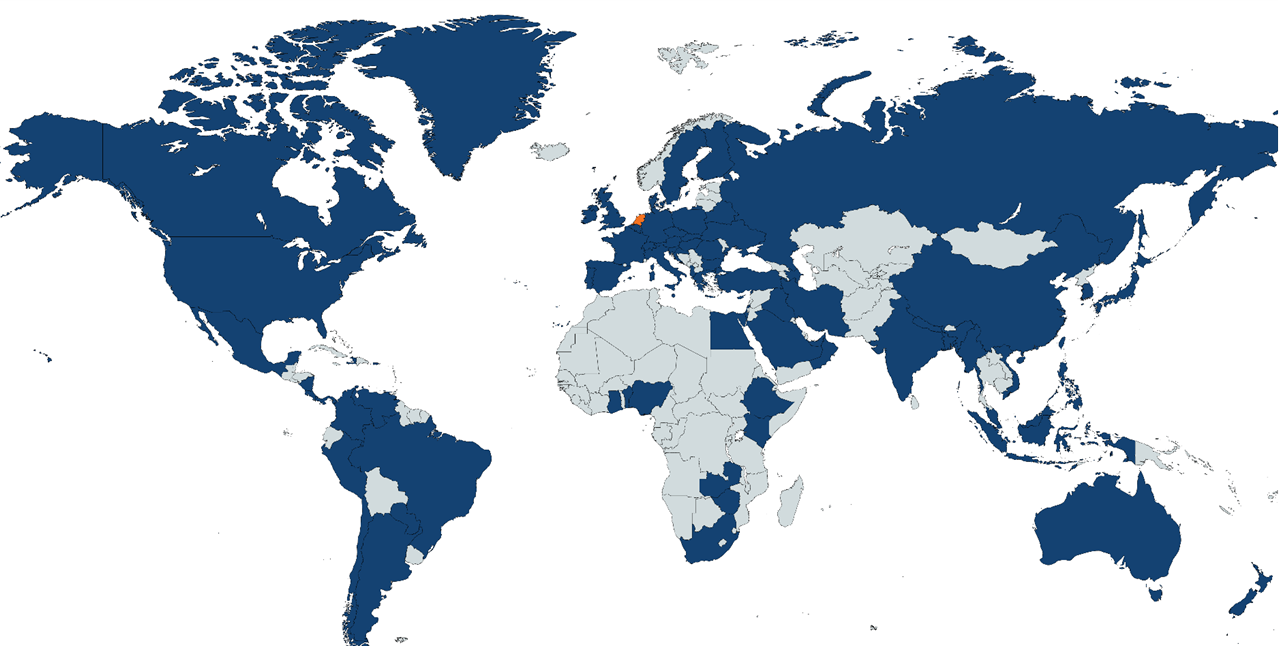
Map of Countries Receiving Diplomas from Netherlands Agency
This visualization highlights all the countries to which diplomas have been sent by a government agency in the Netherlan...
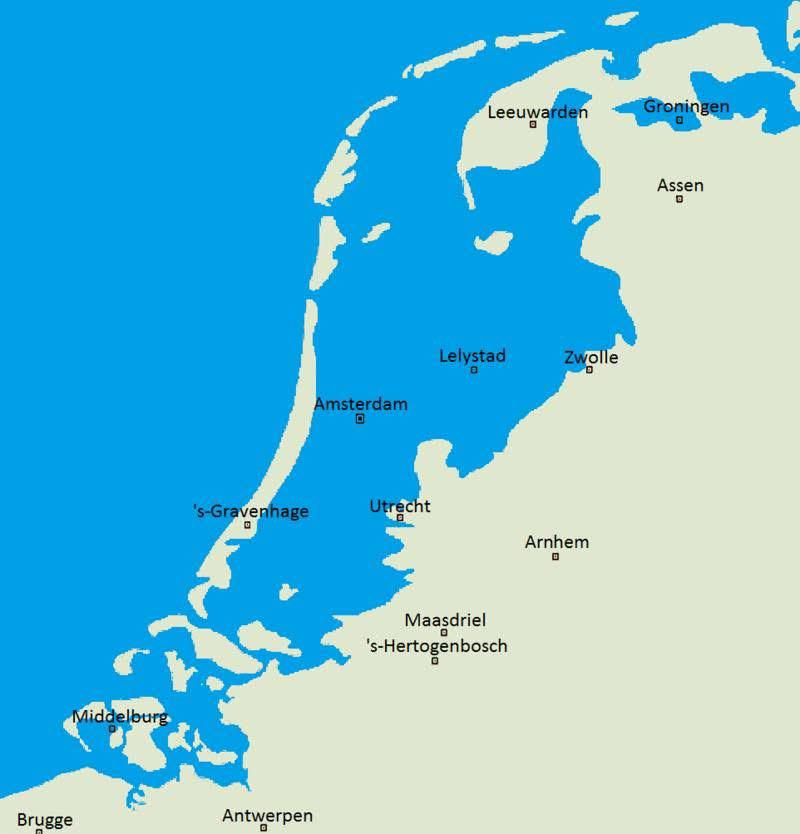
Netherlands Natural Landscape Map Without Dikes
This map vividly illustrates what the Netherlands might look like if dikes and other flood prevention measures had never...
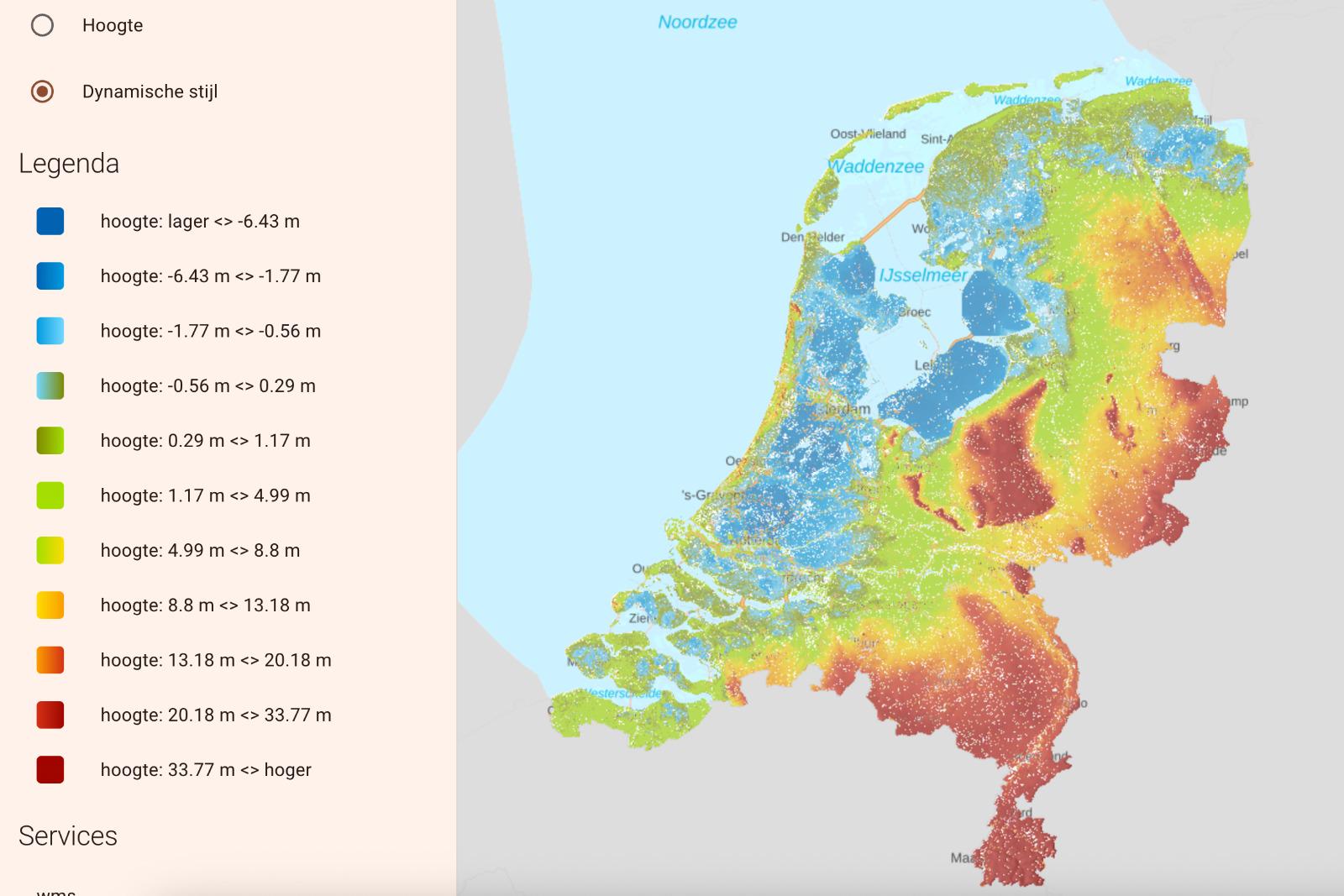
Flooded Netherlands Map without Dikes
This visualization presents a hypothetical scenario of the Netherlands without its extensive network of dikes and flood ...
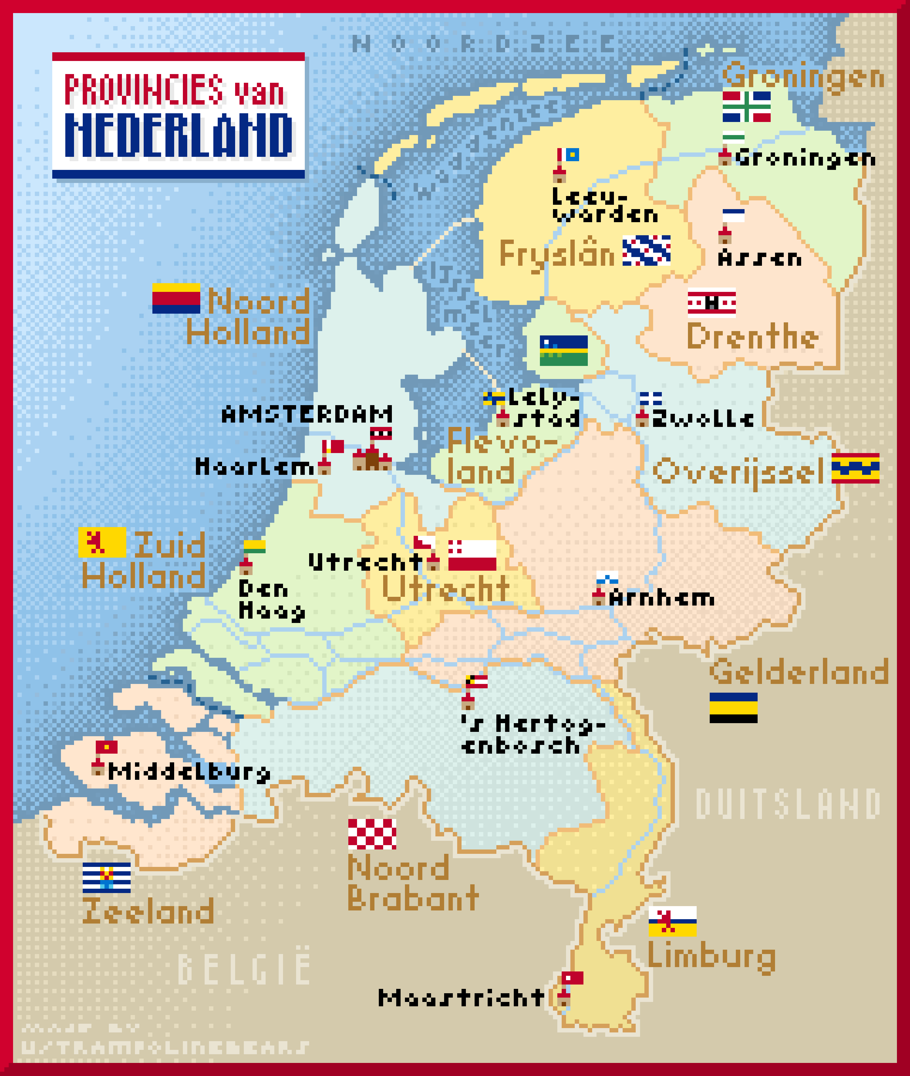
Netherlands Provinces and Capitals Map
This pixel art map of the Netherlands beautifully illustrates the country's provinces, complete with their capitals and ...
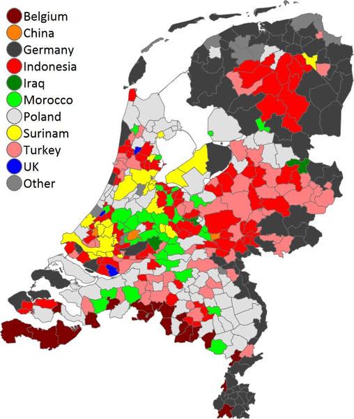
Most Common Foreign Country of Birth in the Netherlands Map
This map visualizes the most common foreign country of birth for residents in municipalities across the Netherlands. It ...