territorial boundaries Maps
5 geographic visualizations tagged with "territorial boundaries"
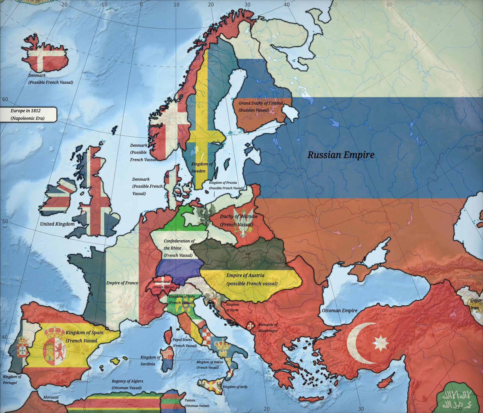
Political Map of Europe in 1812
The map titled "Europe in 1812" provides a detailed political landscape of Europe during a pivotal moment in history. It...
👁 134📅 9/9/2025
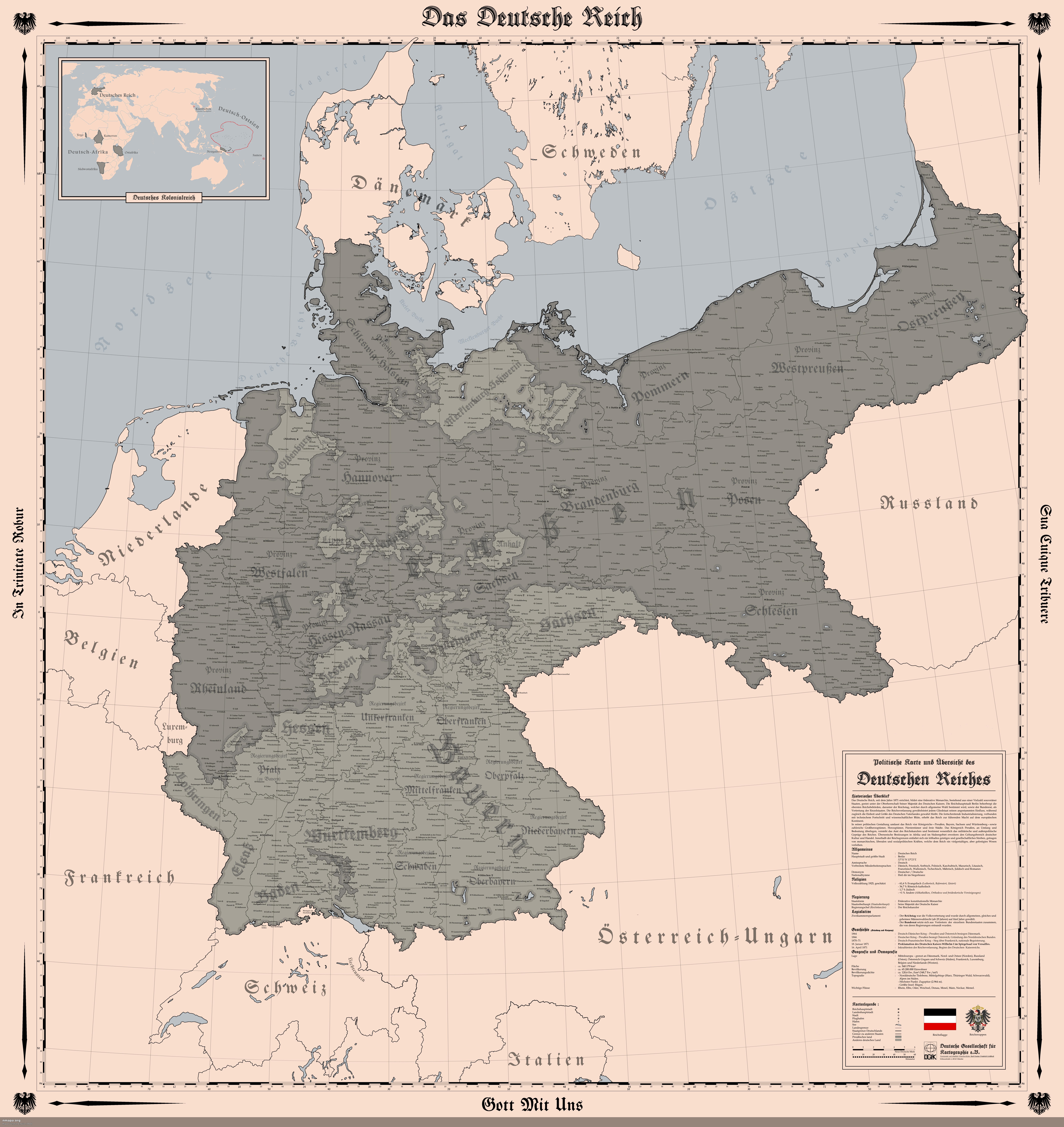
Map of the German Empire in 1914
The "Map of the German Empire (1914)" provides a detailed representation of the territorial boundaries, cities, and infr...
👁 164📅 8/5/2025
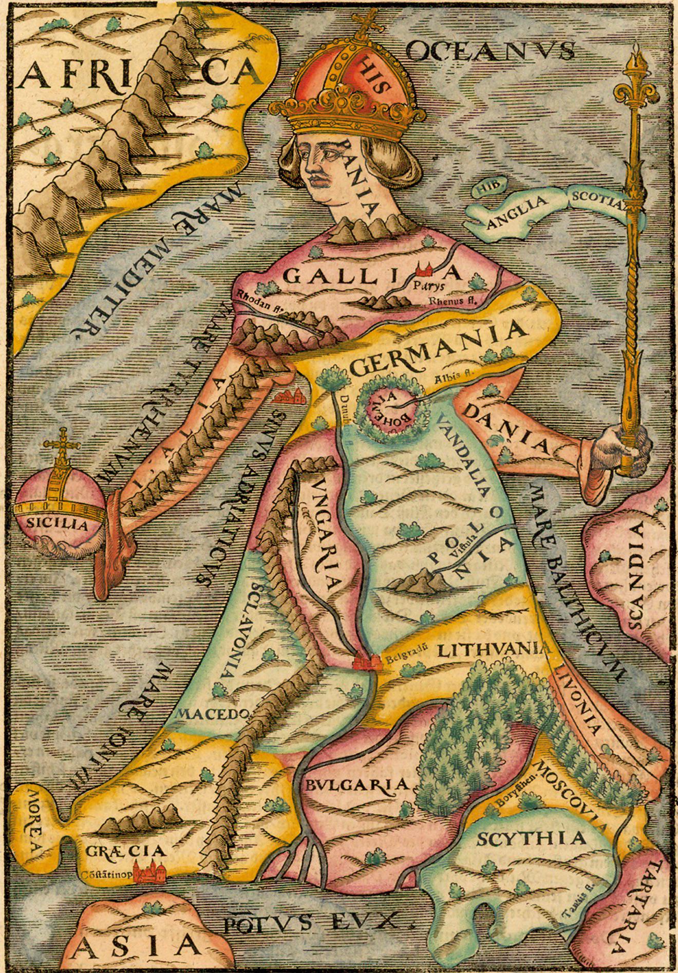
Geopolitical Map of Europe 1588
The "Europa Regina" map from the 1588 edition of Cosmographia presents a unique depiction of Europe during a transformat...
👁 6📅 10/30/2025
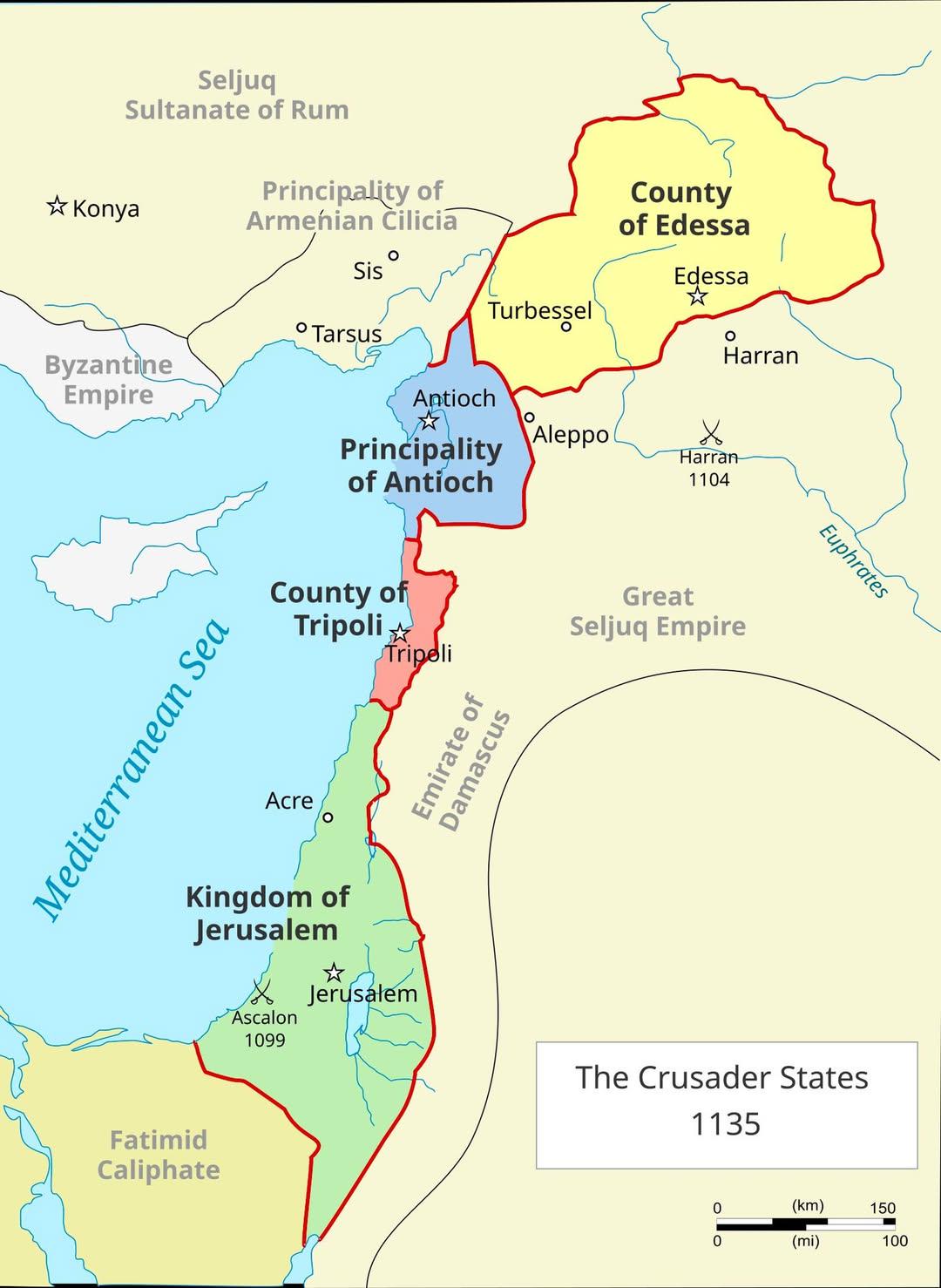
Crusader States in 1135 Map
The visualization titled "The Crusader States in 1135 Map" displays the territorial boundaries of the Crusader states es...
👁 8📅 10/26/2025
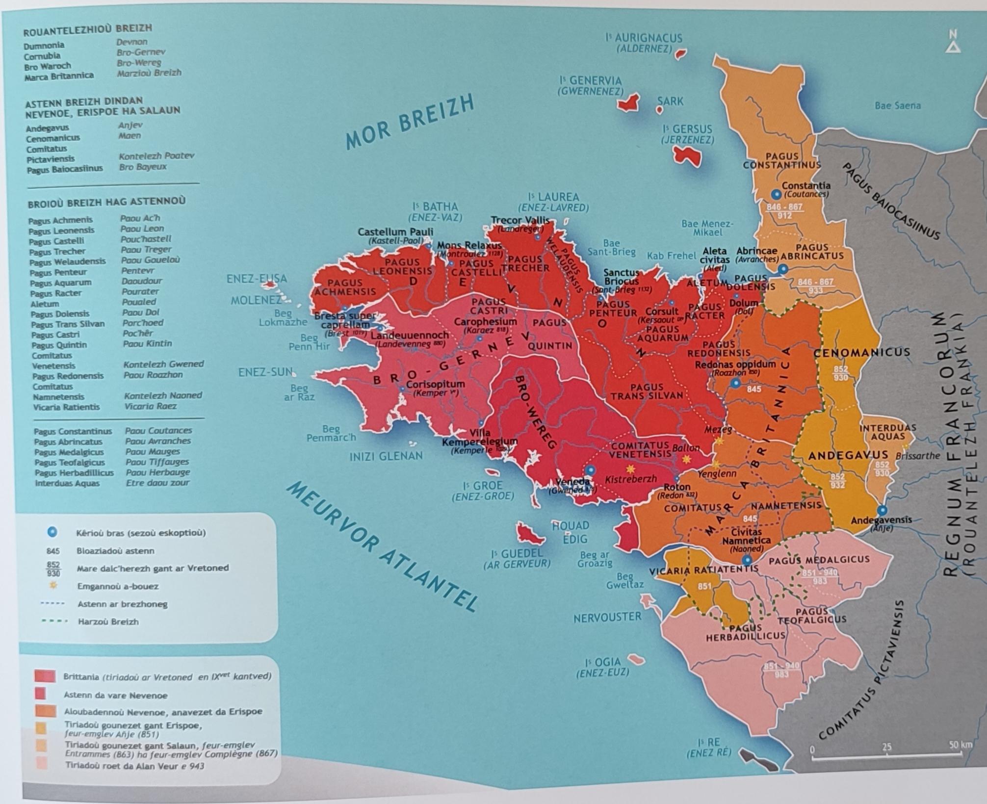
Territorial Extent Map of the Kingdom of Brittany (9th-10th Century AD)
The map titled "Territorial Extent of the Kingdom of Brittany (9th-10th Century AD)" provides a detailed portrayal of th...
👁 50📅 10/1/2025