rural development Maps
6 geographic visualizations tagged with "rural development"

Iceland Population Distribution Map
This map illustrates a striking aspect of Iceland's population distribution: the red area represents only 1% of the coun...
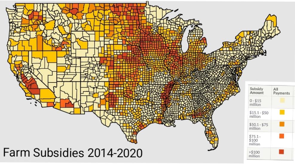
US Farm Subsidies by County Map
The "US Farm Subsidies by County Map" provides a visual representation of how federal farm subsidies are distributed acr...
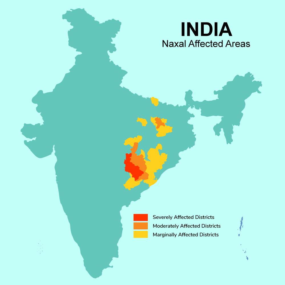
Maoist Insurgency Affected Areas Map in India
The map titled 'Maoist Insurgency Affected Areas in India' provides a stark visual representation of the districts most ...
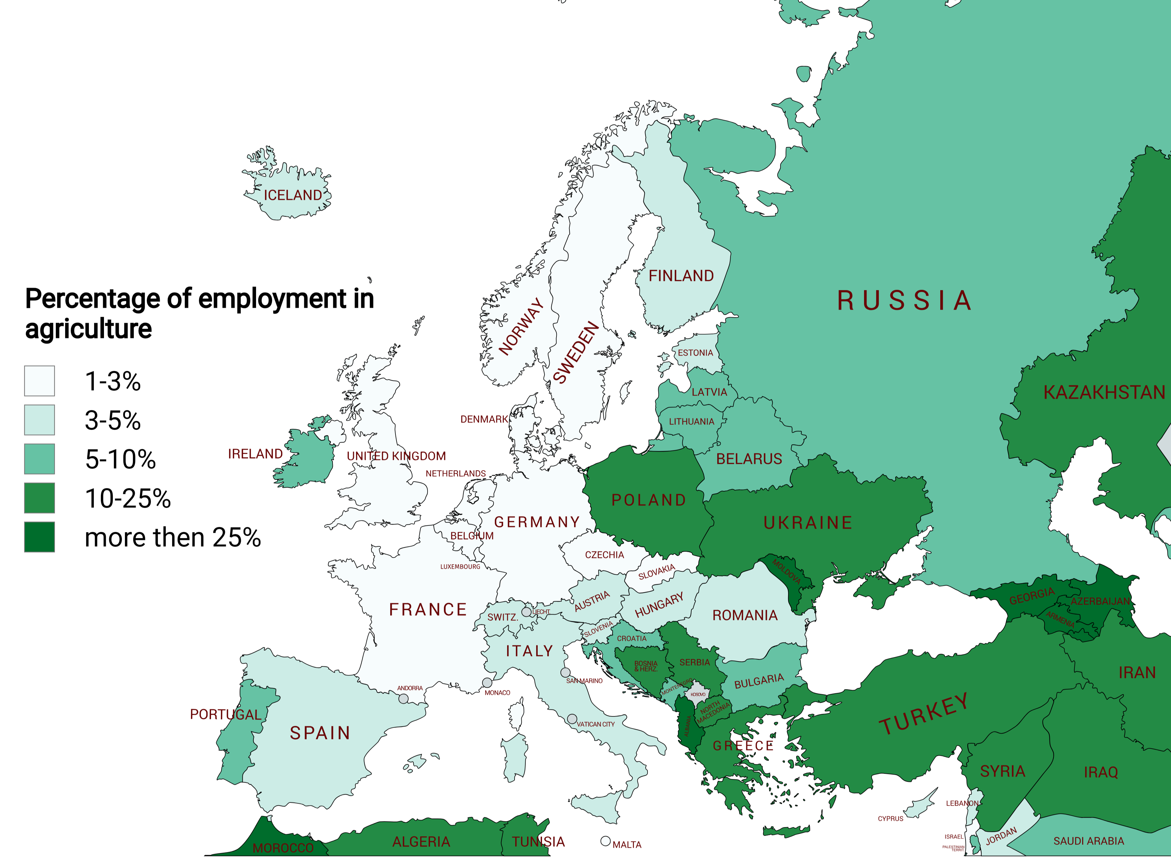
Agricultural Employment Percentage Map of Europe
The "Agricultural Employment Percentage Map of Europe" provides a clear visual representation of the proportion of total...
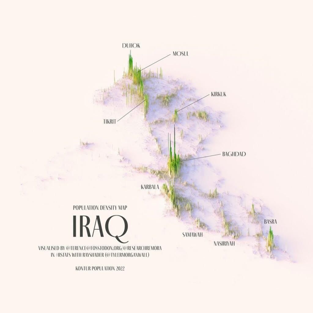
Relief Population Density Map of Iraq
Baghdad, with a population of approximately 8 million, is not just the capital but also the largest city in the country,...
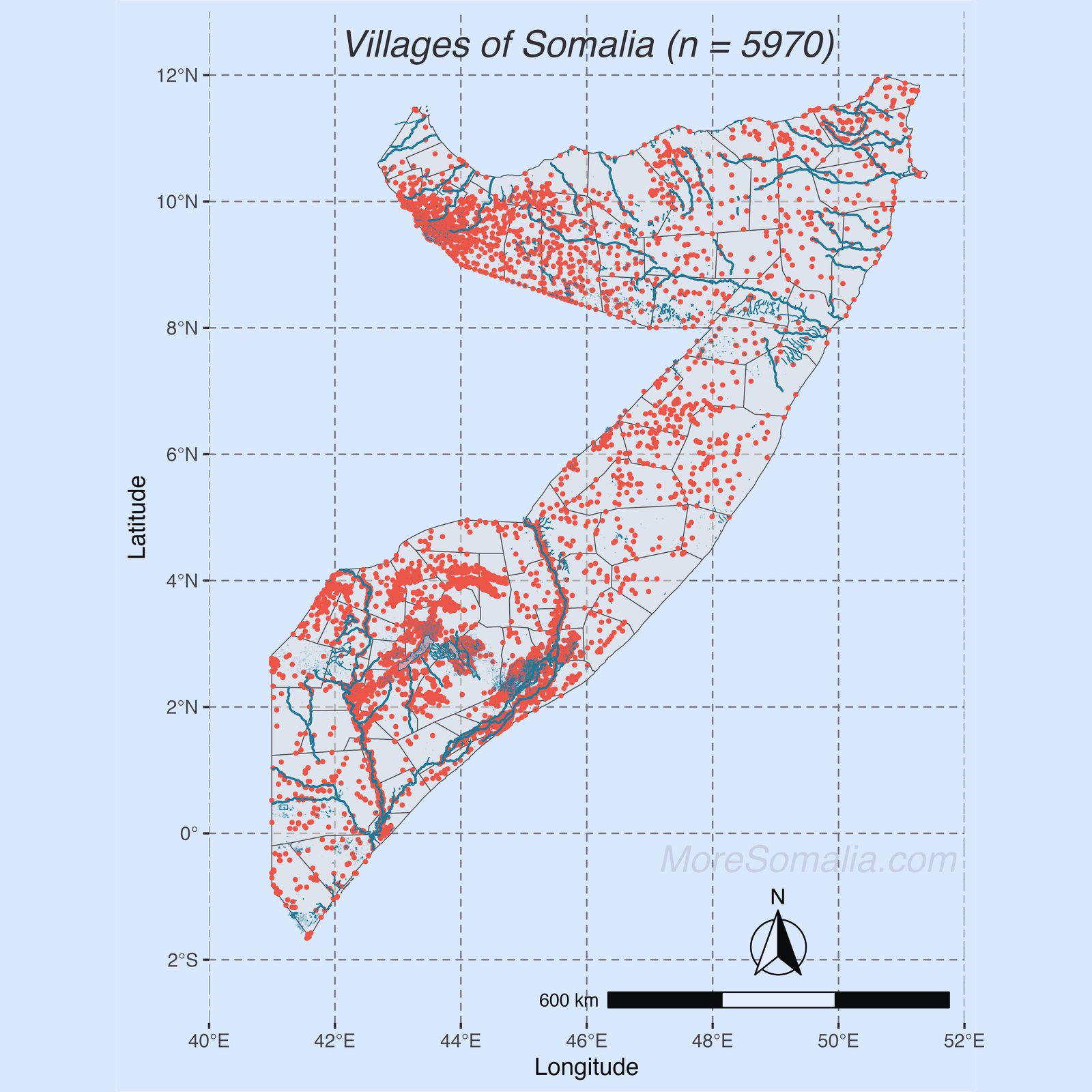
Map of Villages in Somalia
The map titled "Villages of Somalia" provides a comprehensive overview of the various villages scattered throughout this...