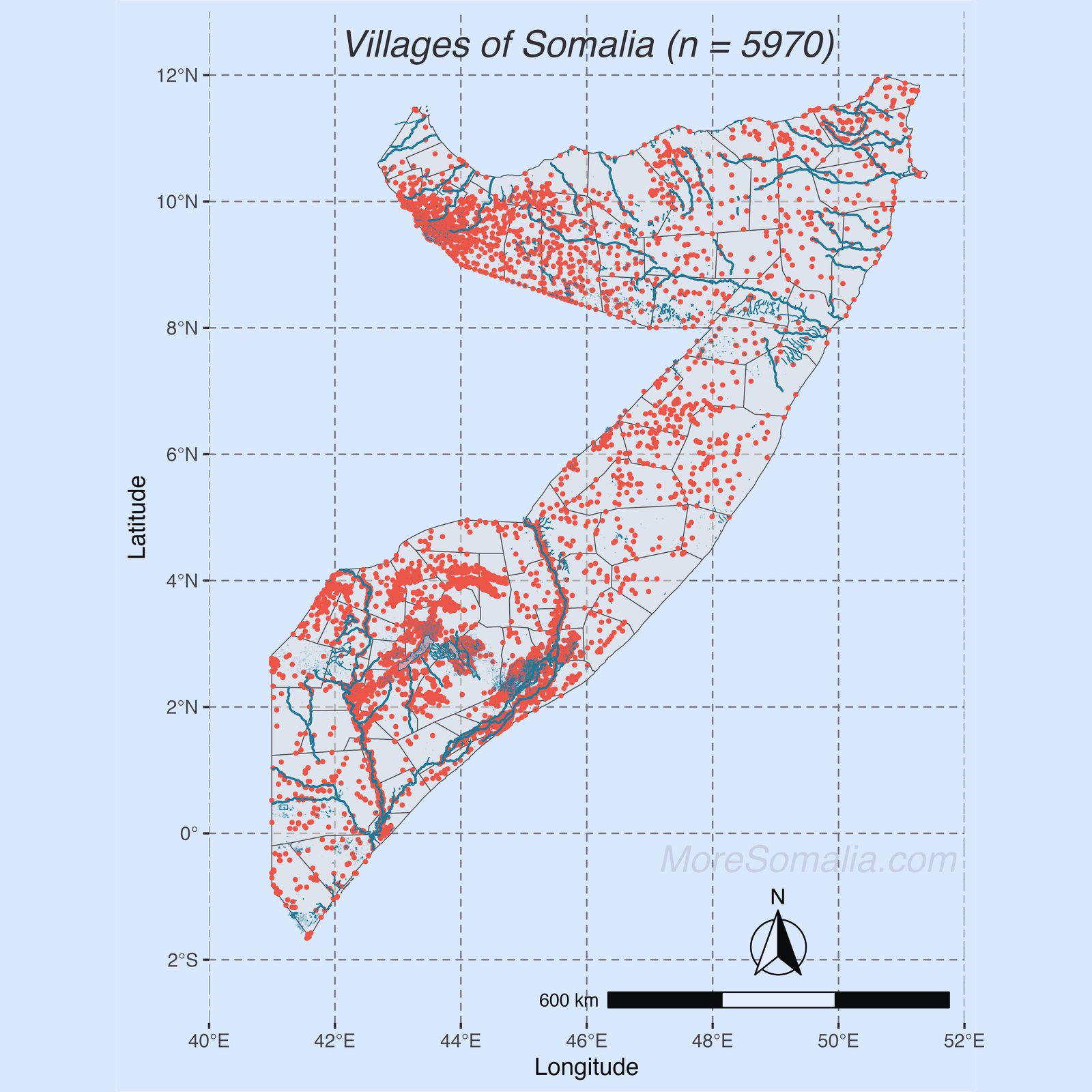
Map of Villages in Somalia

David Chen
Data Visualization Specialist
David Chen is an expert in transforming complex geographic datasets into compelling visual narratives. He combines his background in computer science ...
Geographic Analysis
What This Map Shows
The map titled "Villages of Somalia" provides a comprehensive overview of the various villages scattered throughout this East African nation. This visualization represents not only geographical locations but also serves as a gateway to understanding the cultural landscape, demographic distribution, and socio-economic factors that characterize village life in Somalia. With thousands of villages dotting the landscape, this map is an essential tool for anyone looking to grasp the spatial distribution of communities within this complex country.
Deep Dive into Villages in Somalia
Somalia is known for its rich tapestry of cultures, languages, and traditions, largely shaped by its many villages. These villages are the heart of Somali life, serving as hubs of social interaction, economic activity, and cultural preservation. Interestingly, Somalia has over 4,000 villages, ranging from small settlements with only a few hundred inhabitants to larger villages that may house several thousand people. The majority of these villages are located in the southern regions, particularly in the fertile areas along the Jubba and Shabelle rivers, where agriculture thrives.
One of the key aspects of Somali villages is their reliance on traditional pastoralist and agricultural practices. Villages often consist of clan-based systems, where families live and work together, sharing resources and responsibilities. Have you noticed that in many cases, villages are strategically located near water sources? This is crucial, especially in a country where drought is a recurring challenge. The proximity to rivers or seasonal water sources not only supports farming but also provides drinking water for both people and livestock.
Additionally, Somalia's villages are often characterized by unique architectural styles, influenced by the local environment and available materials. Traditional Somali houses, known as "aqal," are typically made from mud, thatch, and wood, reflecting the nomadic lifestyle and the need for mobile, adaptable homes. However, urbanization is gradually changing this landscape, with many villagers migrating to larger towns in search of better opportunities, transforming the socio-economic dynamics of the region.
Regional Analysis
When examining the map of villages in Somalia, we can identify distinct regional characteristics. In the northern regions, such as Somaliland and Puntland, villages are often more established and may have access to better infrastructure and services compared to the southern regions, which have been more affected by conflict and instability. For instance, villages in Somaliland, like Hargeisa, have seen significant development, with improved access to education and healthcare.
Conversely, southern Somalia, especially areas like Jubaland and Southwest State, presents a different picture. Here, many villages are still grappling with the aftereffects of prolonged conflict, leading to a lack of stability and basic services. Despite this, the resilience of village communities is remarkable. Many have organized themselves to rebuild and maintain essential services, such as education and healthcare, through community-led initiatives.
What’s fascinating is that the demographic composition of villages can vary significantly across regions. For example, villages in the north may have a higher concentration of ethnic Somali clans, while those in the south might be more diverse due to historical migrations and inter-clan interactions. This diversity contributes to a rich cultural landscape, with each village preserving its unique traditions, dialects, and customs.
Significance and Impact
Understanding the distribution of villages in Somalia is crucial for several reasons. Firstly, it provides insight into the socio-economic structures of the country, highlighting areas of both development and need. Policymakers and humanitarian organizations can use this information to target interventions more effectively, ensuring that resources are allocated to those communities that need them most.
Furthermore, as Somalia continues to navigate its path towards stability and recovery, the role of villages will be pivotal. They serve as the backbone of Somali society, fostering community resilience and cultural identity. Current trends indicate a growing interest in sustainable development initiatives that aim to empower rural communities, enhance agricultural productivity, and promote environmental conservation. The future projections suggest that with adequate support, these villages could emerge as key players in national development, driving economic growth and social cohesion.
In conclusion, the map of villages in Somalia is not just a geographical representation; it is a reflection of the enduring spirit of Somali communities. It illustrates how geography intertwines with culture, economy, and resilience, offering valuable lessons on the importance of local knowledge and community-driven development in shaping a nation's future.
Visualization Details
- Published
- September 8, 2025
- Views
- 84
Comments
Loading comments...