precipitation Maps
5 geographic visualizations tagged with "precipitation"
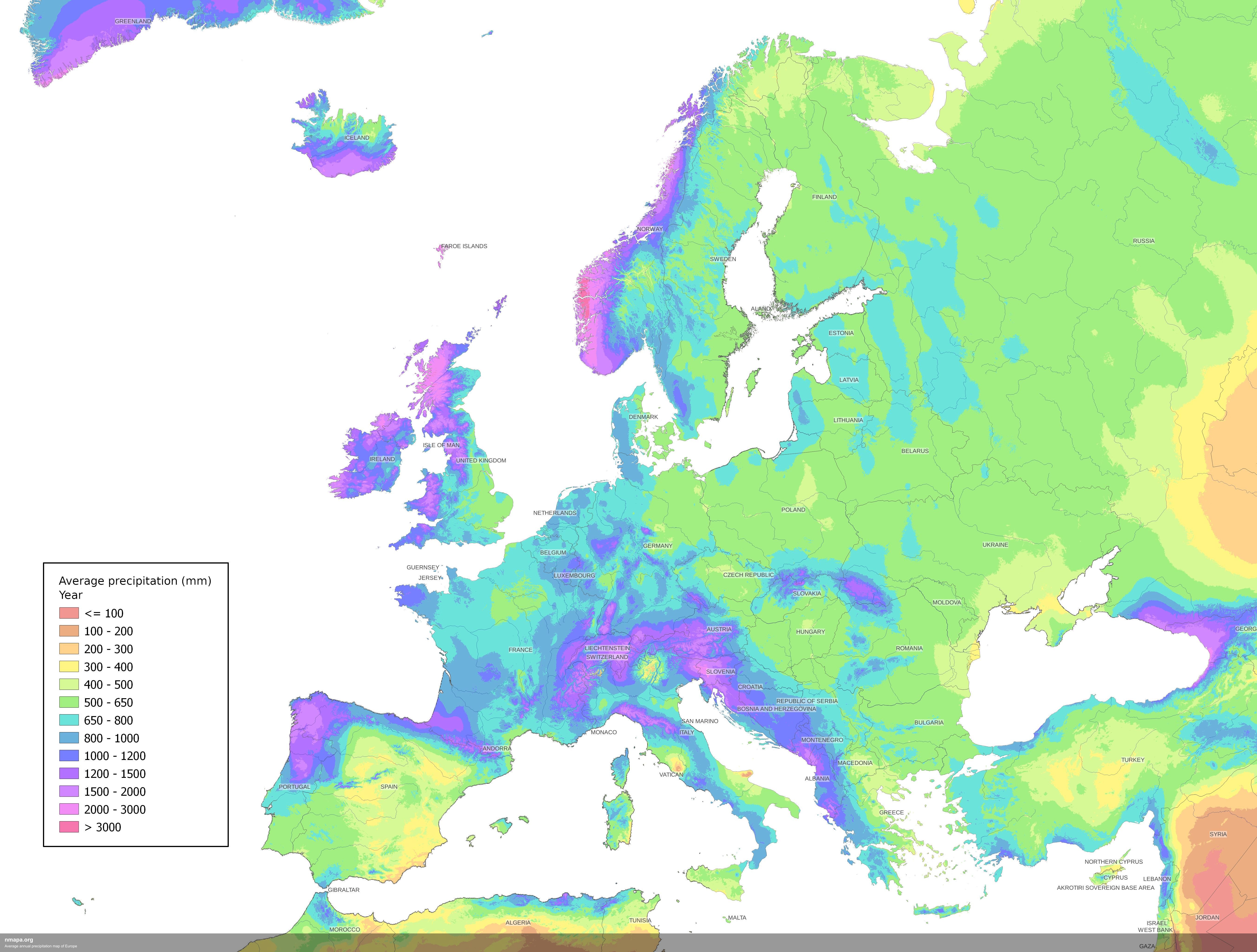
Average Annual Precipitation Map of Europe
The Average Annual Precipitation Map of Europe offers a detailed visualization of rainfall patterns across the continent...
👁 172📅 8/2/2025
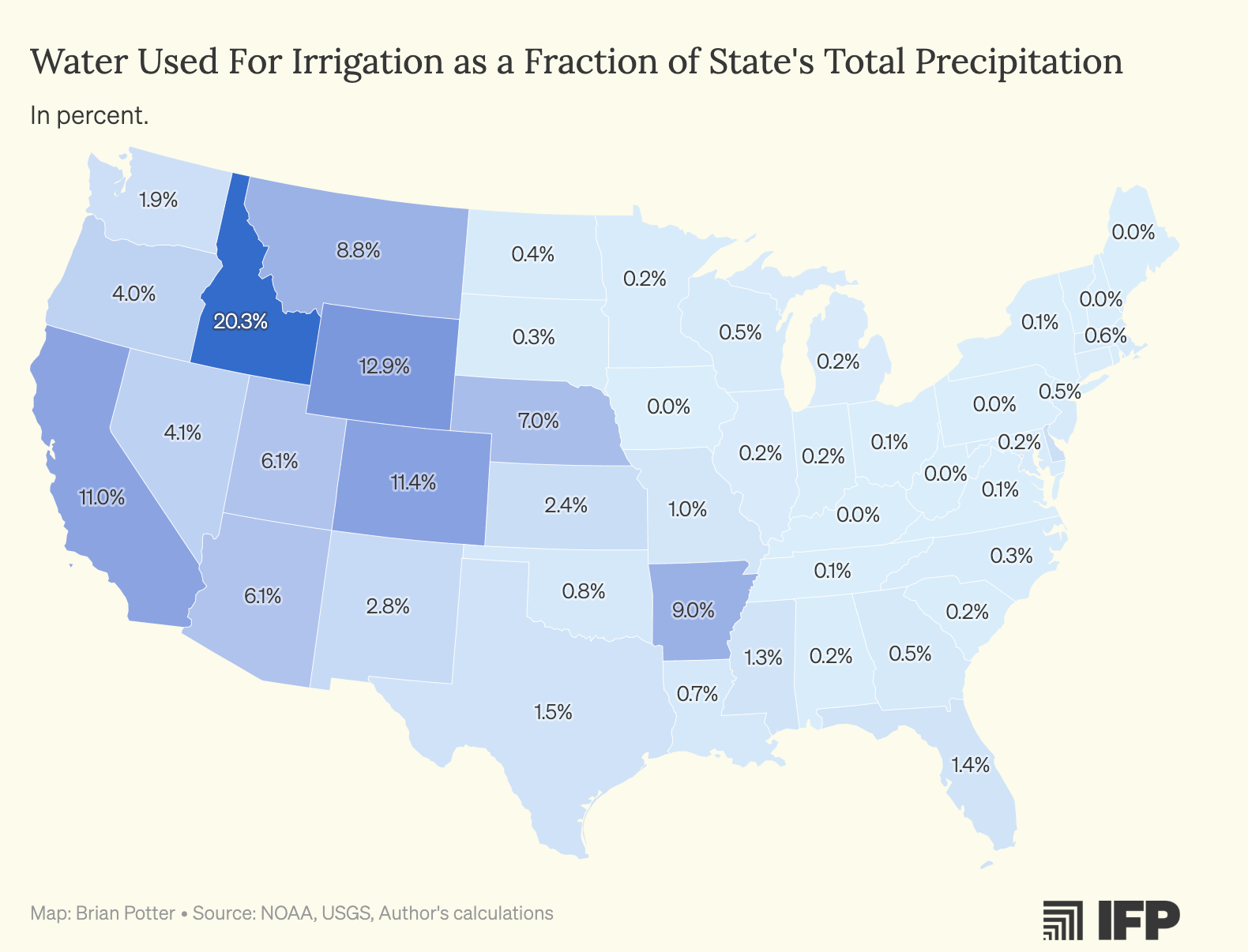
Water Used for Crop Irrigation Map by US States
The map titled "Water Used for Crop Irrigation as a Percentage of US States' Total Precipitation" provides a compelling ...
👁 68📅 8/27/2025
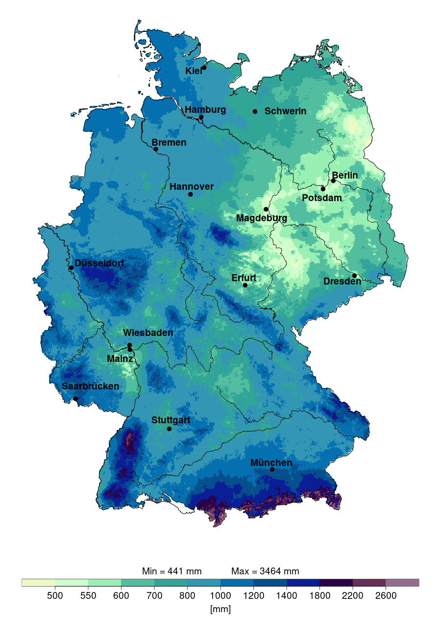
Annual Precipitation Map of Germany 2024
The "Annual Precipitation in Germany in 2024" map provides a detailed visualization of the expected rainfall distributio...
👁 56📅 9/10/2025
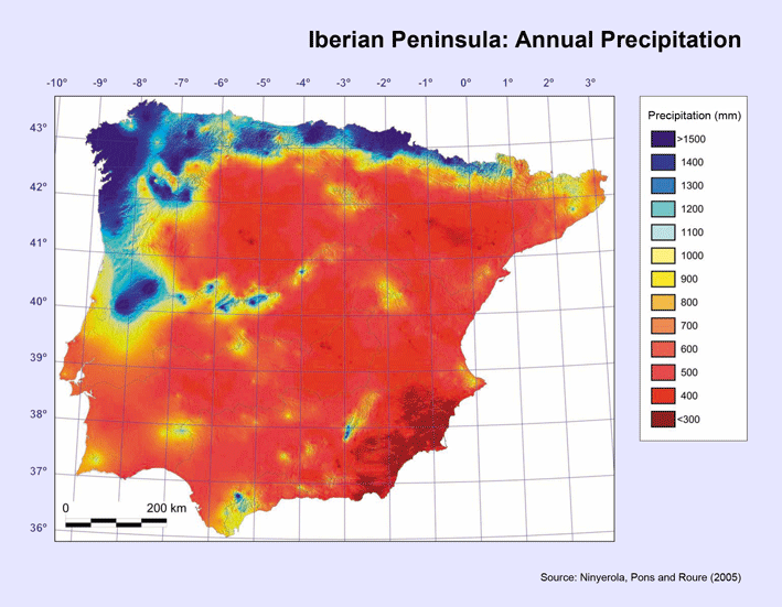
Rainfall Distribution Map of Spain
The visualization titled "The rain in Spain falls mainly on the...mountainous north coast" provides a detailed look at t...
👁 80📅 8/22/2025
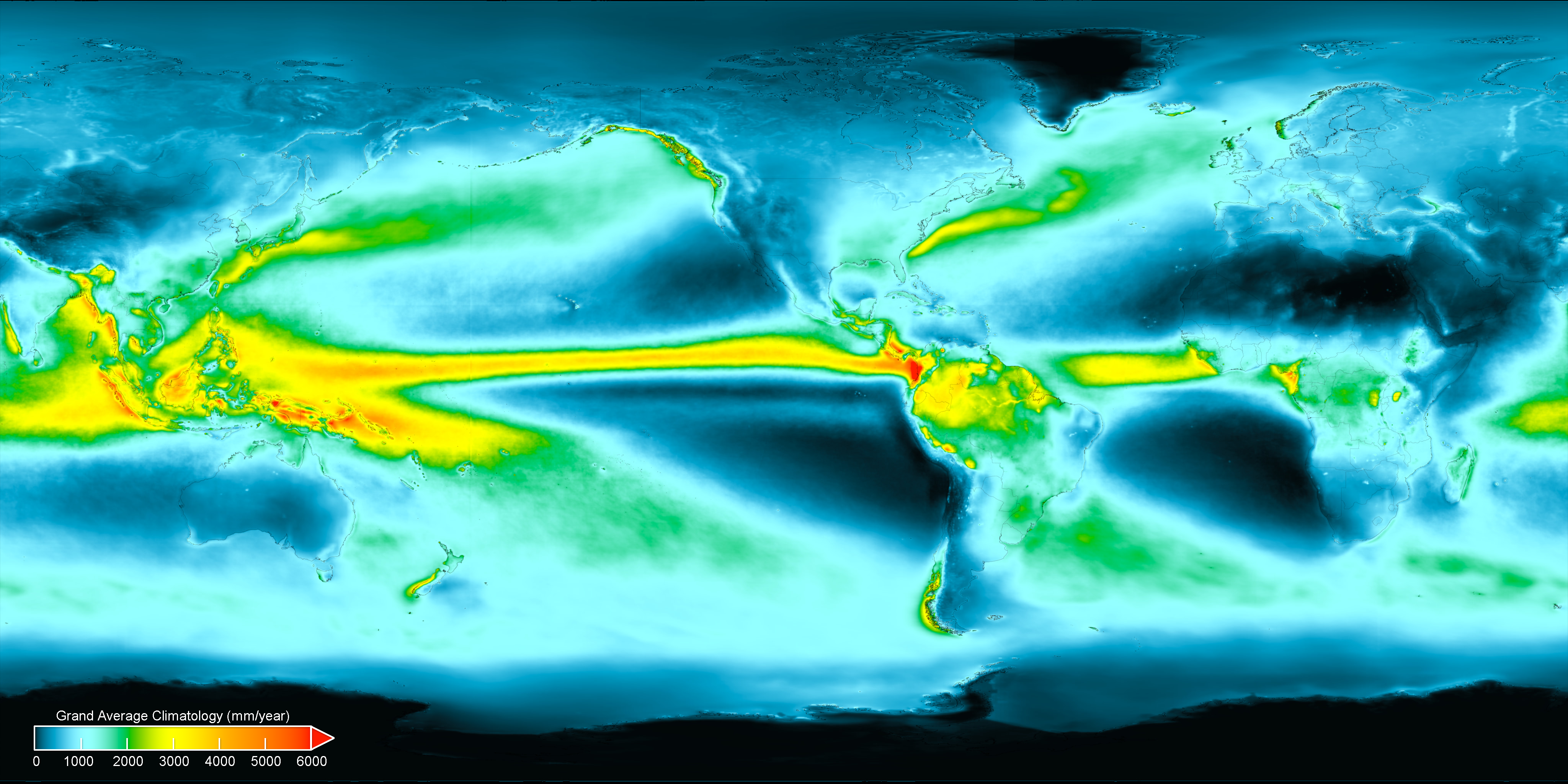
Average Annual Precipitation World Map
Interestingly, precipitation can be categorized into two main types: rain and snow. In warmer climates, rain is the prim...
👁 58📅 9/5/2025