poland Maps
25 geographic visualizations tagged with "poland"
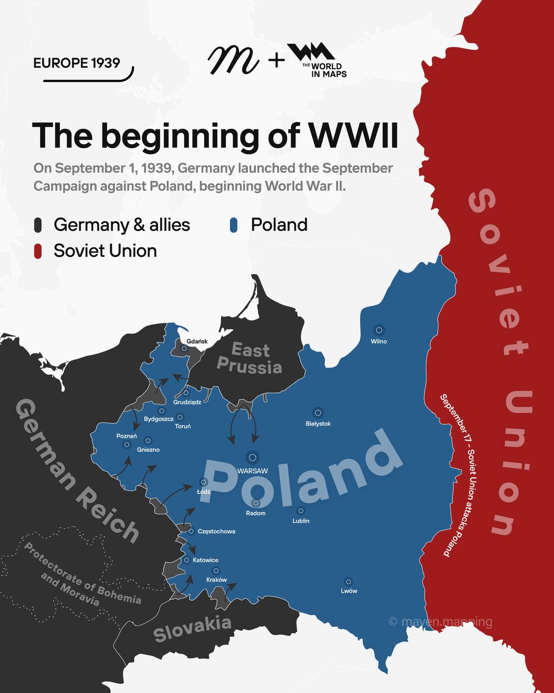
Map of Germany's September Campaign Against Poland
The map titled "On September 1, 1939, Germany launched the September campaign against Poland, beginning WW2" provides a ...
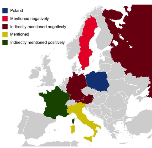
Countries Mentioned in the Polish National Anthem Map
The map titled "All The Countries Mentioned In The Polish National Anthem" provides a unique geographical insight into t...
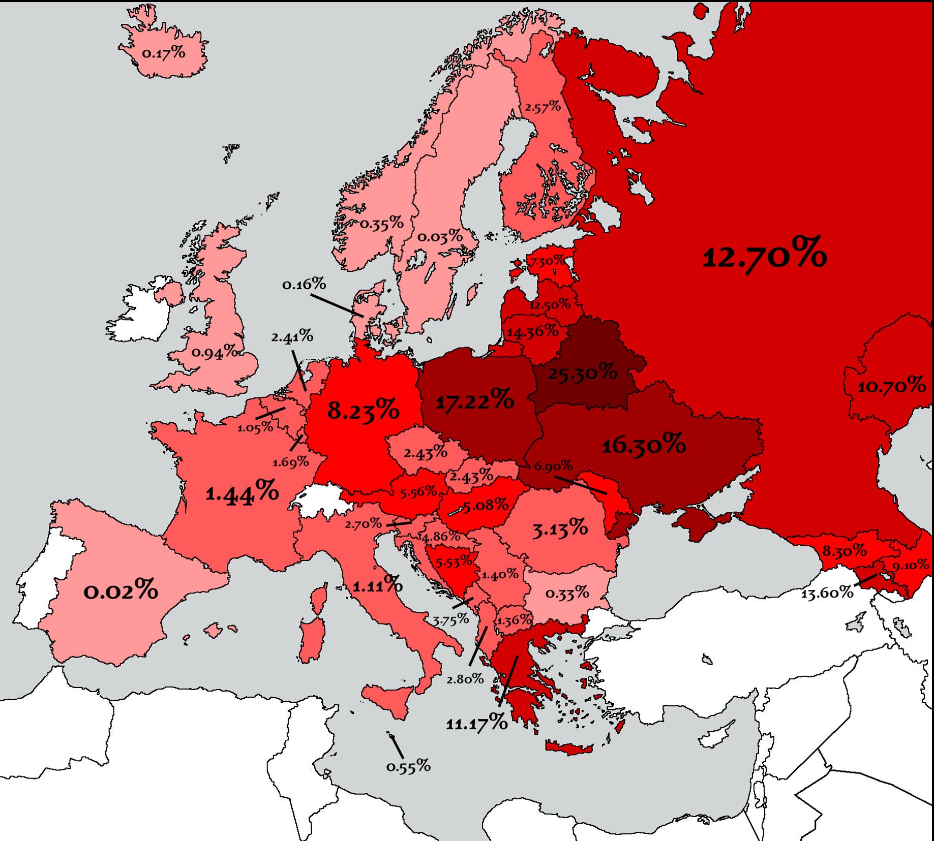
Countries That Lost the Most People in WW2 Map
The map titled "Countries That Lost the Most People in WW2" provides a stark visual representation of the human cost of ...
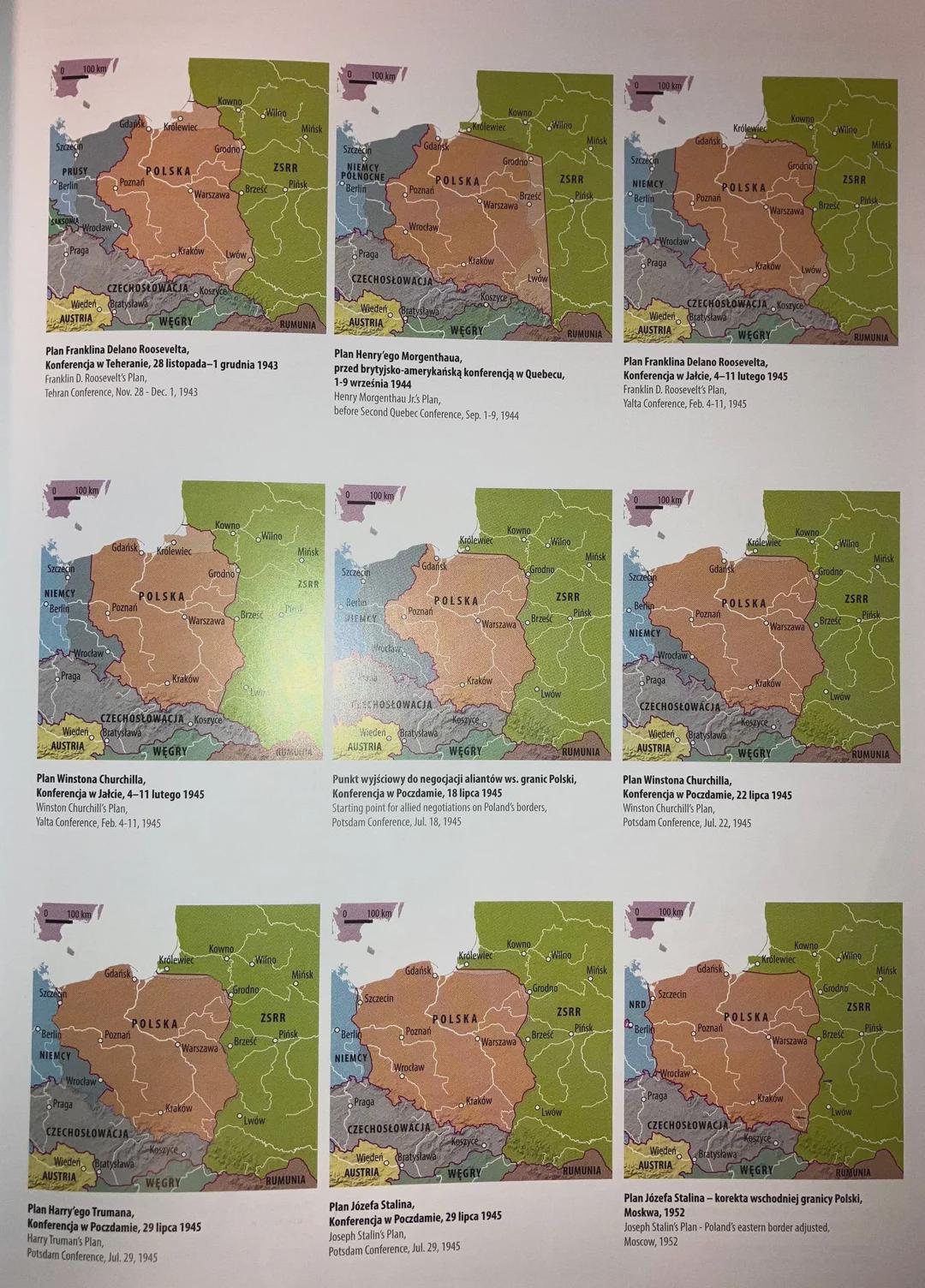
Post-War Border Proposals Map of Poland and Germany
...
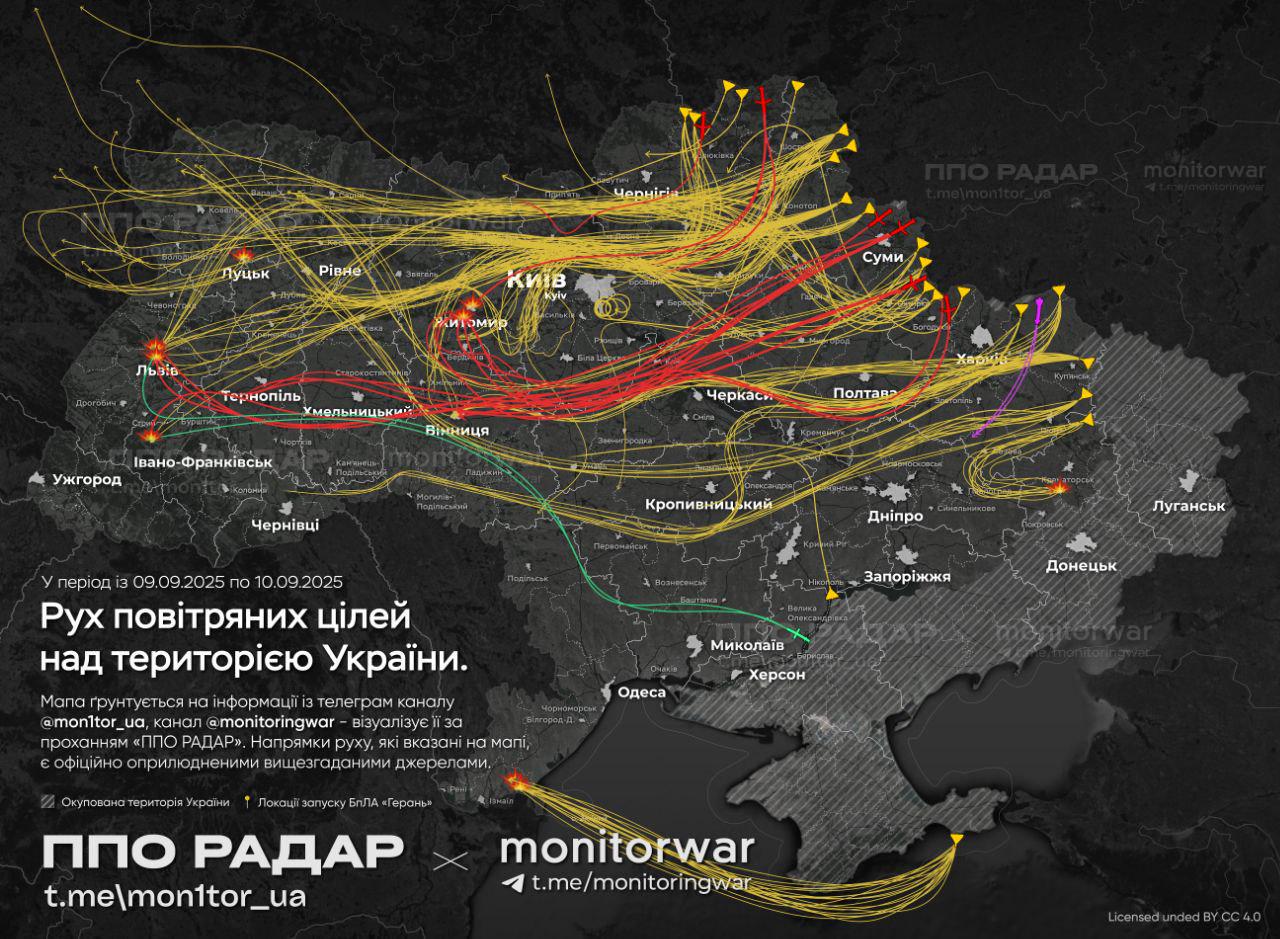
Map of Russian Drone Attacks on Poland
The map in question provides a crucial visualization of the locations and frequency of Russian drone attacks on Polish t...
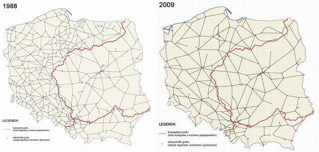
Downgrade of Polish Railway System Map
The "Downgrade of Polish Railway System Map" provides a stark visual representation of the decline in railway infrastruc...
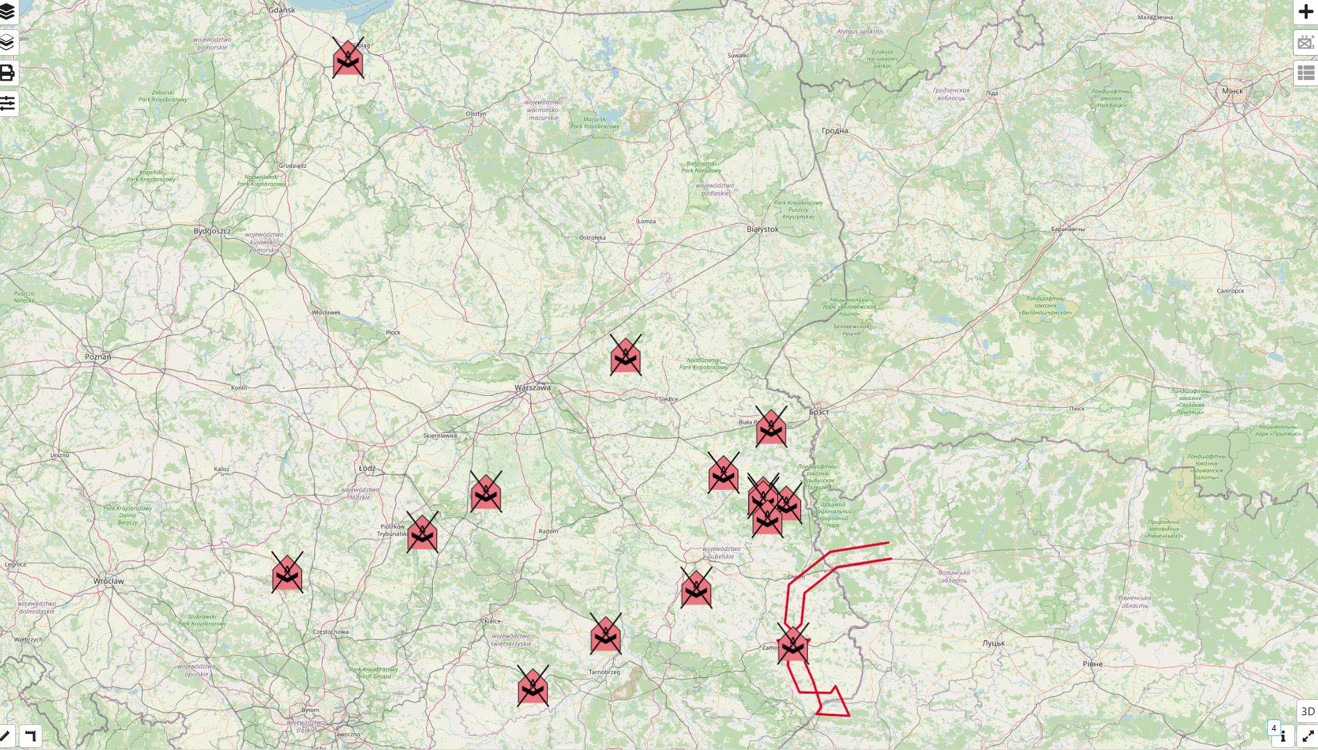
Map of Locations Where Poland Shot Down Russian Drones
This map provides a detailed visualization of the locations in Poland where Russian drones were shot down. Specifically,...
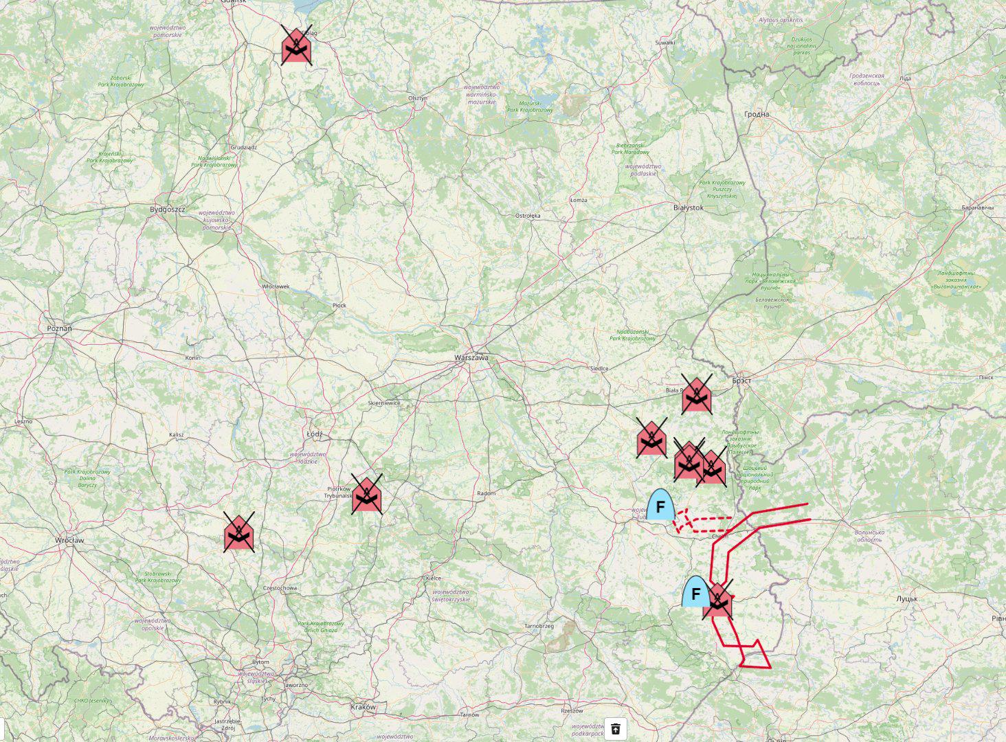
Map of Places Where Poland Shot Down Russian Drones
The map titled "Map of all places where Poland shot down Russian drones" provides a visual representation of the specifi...
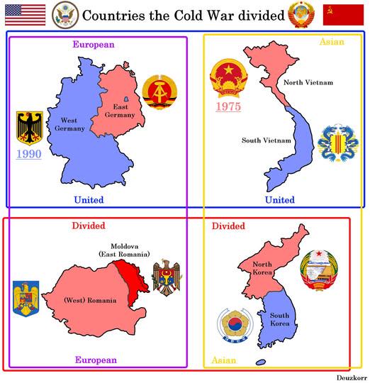
Map of Countries Divided by WW2 and Cold War
This map visually represents the geopolitical divisions of four countries—Germany, Korea, Vietnam, and Poland—resulting ...
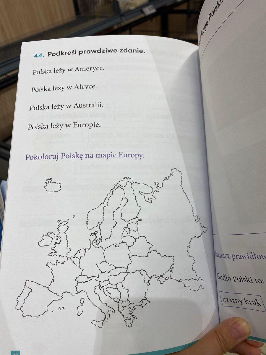
Polish Exercise Book for Primary School Map
The "Polish Exercise Book for Primary School" map is a fascinating representation of educational resources, specifically...
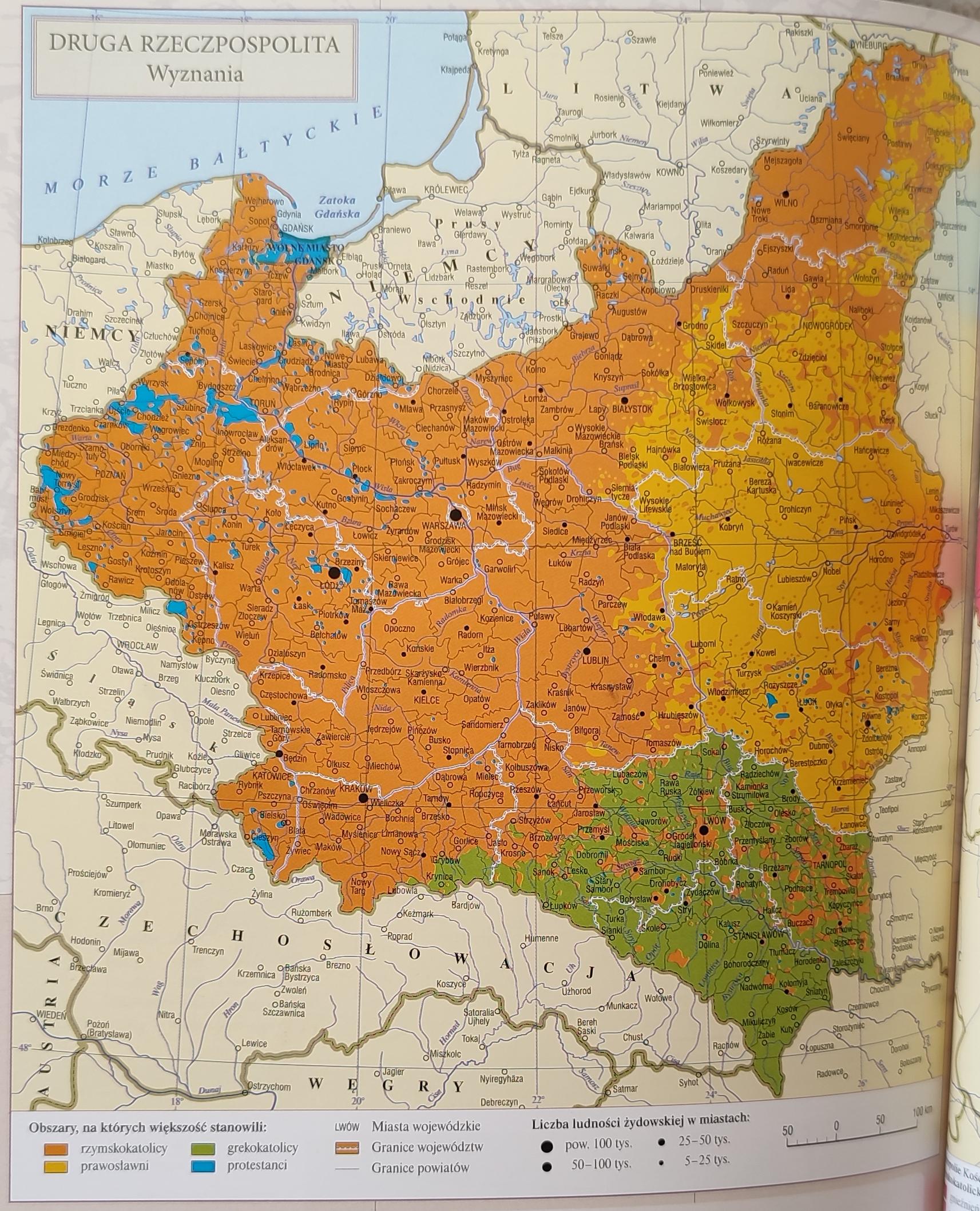
Religions in the Second Polish Republic Map
The "Religions in the Second Polish Republic Map" provides a vivid representation of the diverse religious landscape of ...
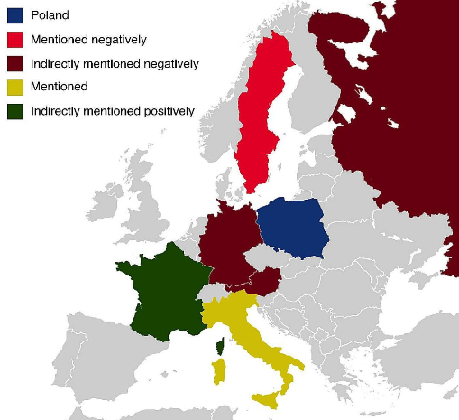
Countries Featured in Poland's Anthem Map
...
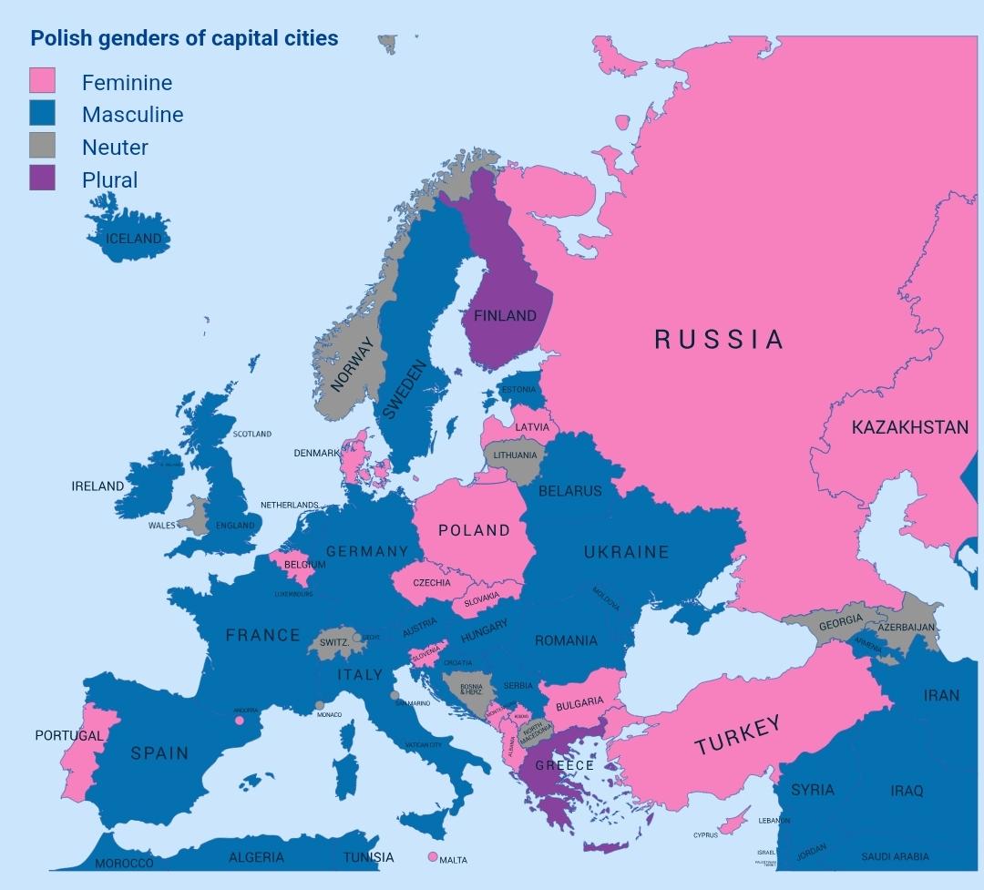
Genders of Capital Cities in Poland Map
The "Genders of Capital Cities in Poland Map" provides a unique perspective on the linguistic aspect of Polish capital c...
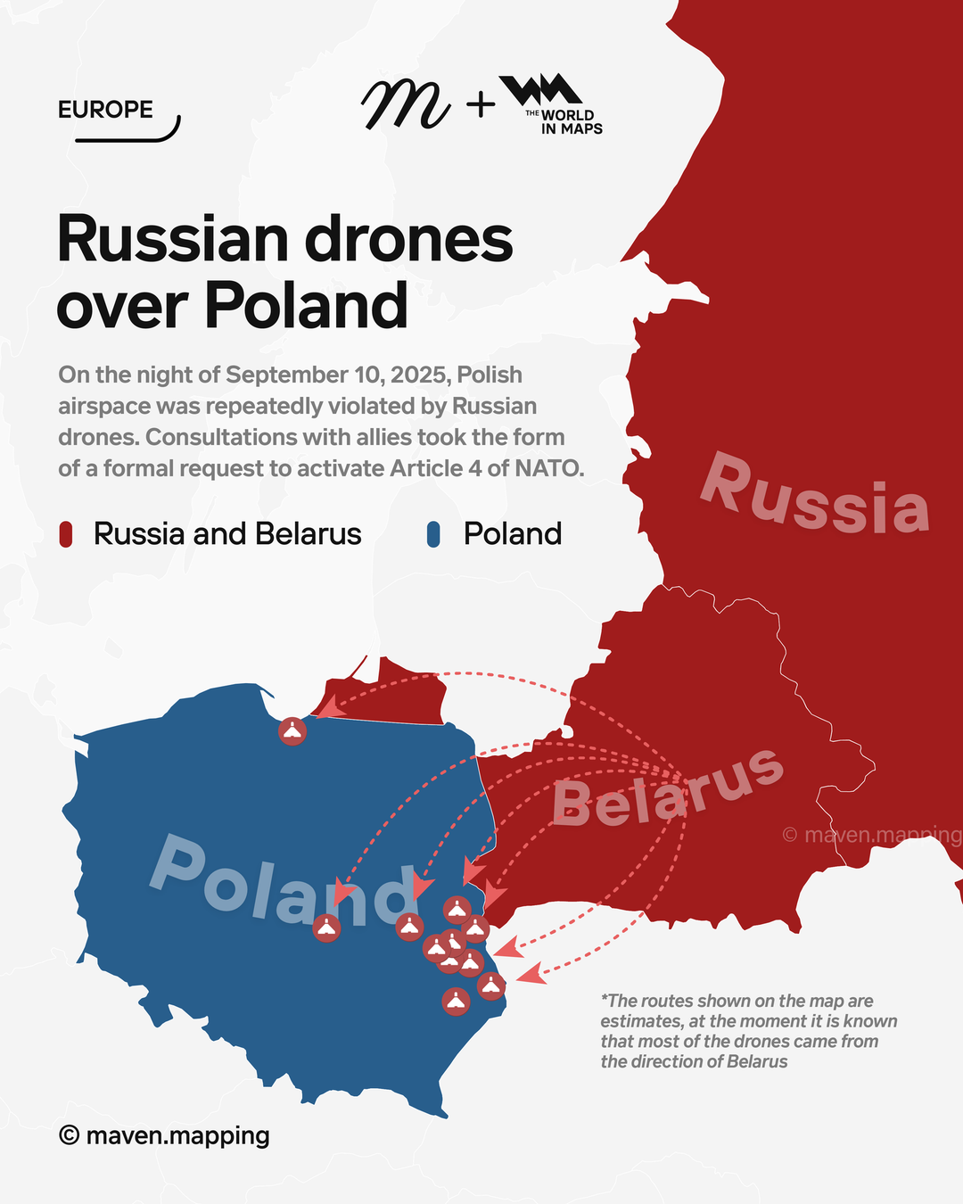
Map of Russian Drones Over Poland September 2025
The visualization titled "Russian Drones Over Poland (September 10, 2025)" presents a detailed overview of drone activit...
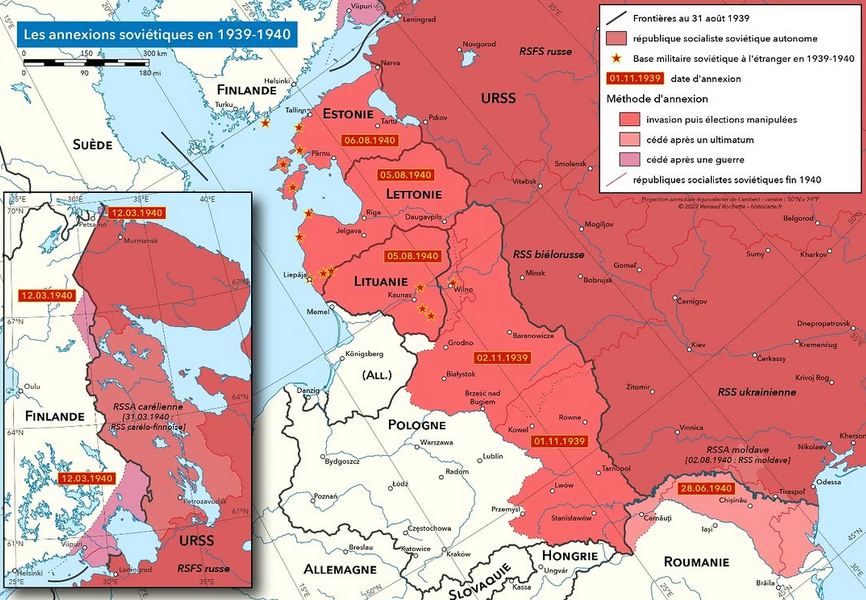
Soviet Annexations in 1939-1940 Map
One of the most significant events was the invasion of Poland in September 1939. The Soviet forces entered from the east...
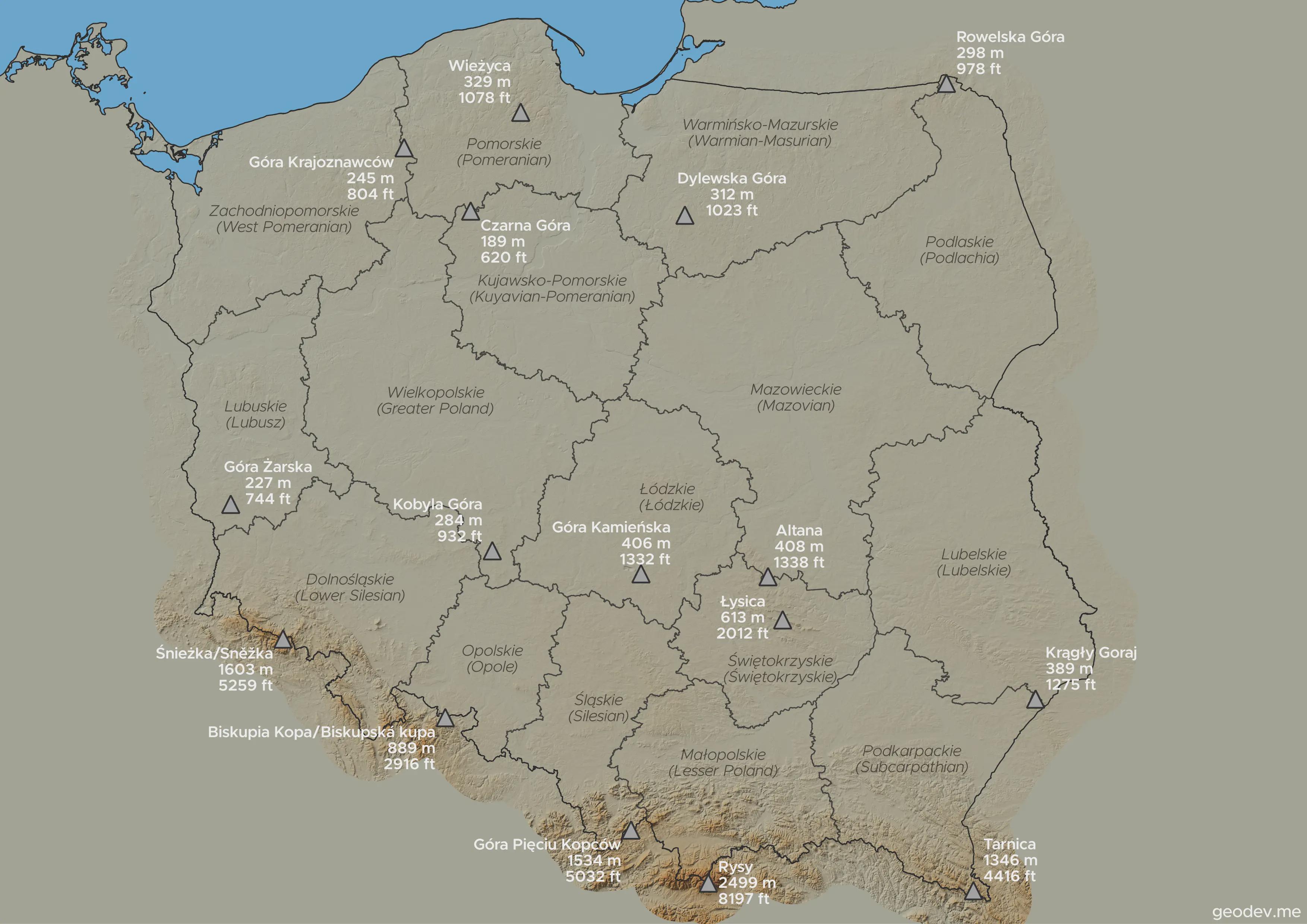
Highest Points in Each Voivodeship Map
This visualization highlights the highest points in every voivodeship in Poland, showcasing the diverse topography acros...
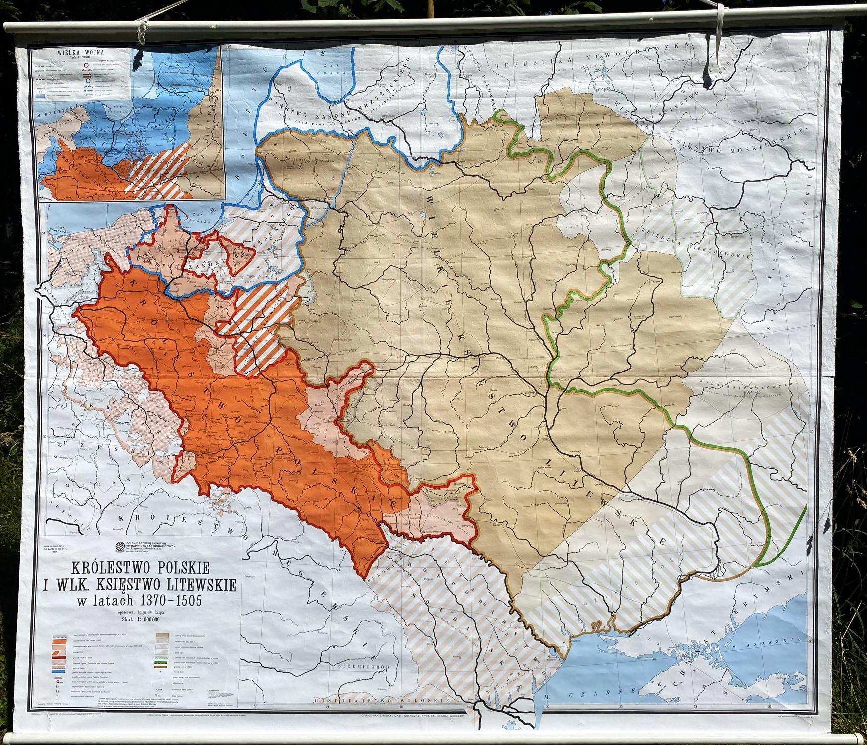
Poland and Lithuania Historical Map 1370-1505
This vintage school map illustrates the territorial expanse of Poland and Lithuania during the years 1370 to 1505, a tim...
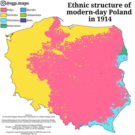
Ethnic Groups Map of Poland in 1914
This map titled "Ethnic Poles, Germans & Other Groups Living Within The Borders Of Modern Poland In 1914" provides a str...
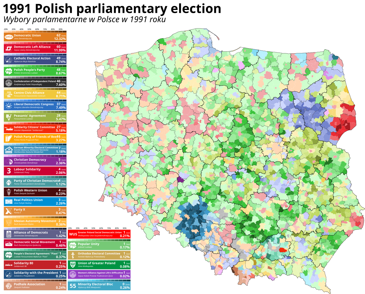
1991 Polish Parliamentary Election Map
This map visualizes the results of the 1991 Polish parliamentary election, marking a pivotal moment in Poland's history ...
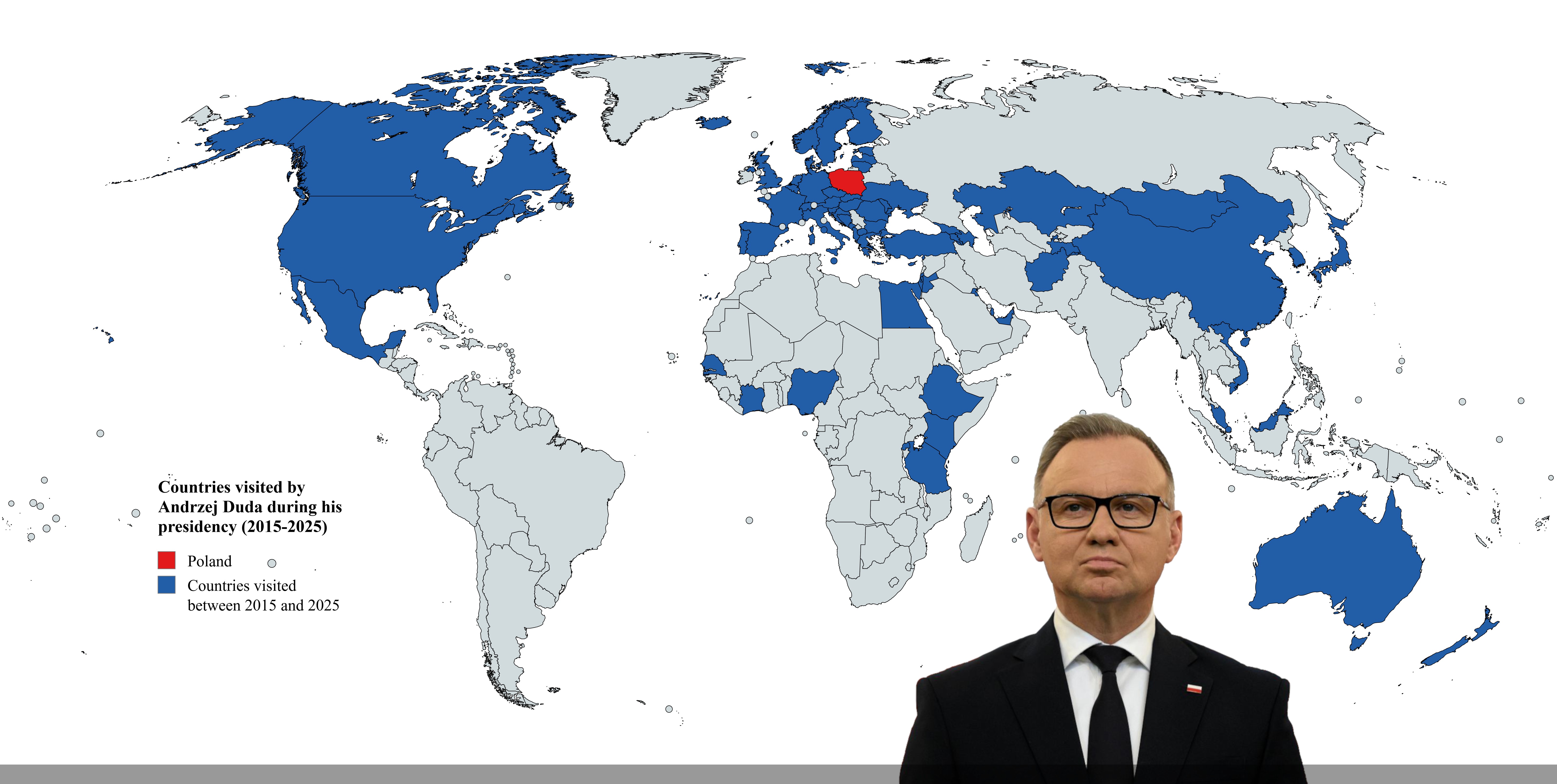
Countries Visited by Poland's President Duda Map
This map illustrates the countries visited by Andrzej Duda, the President of Poland, during his presidency from 2015 to ...
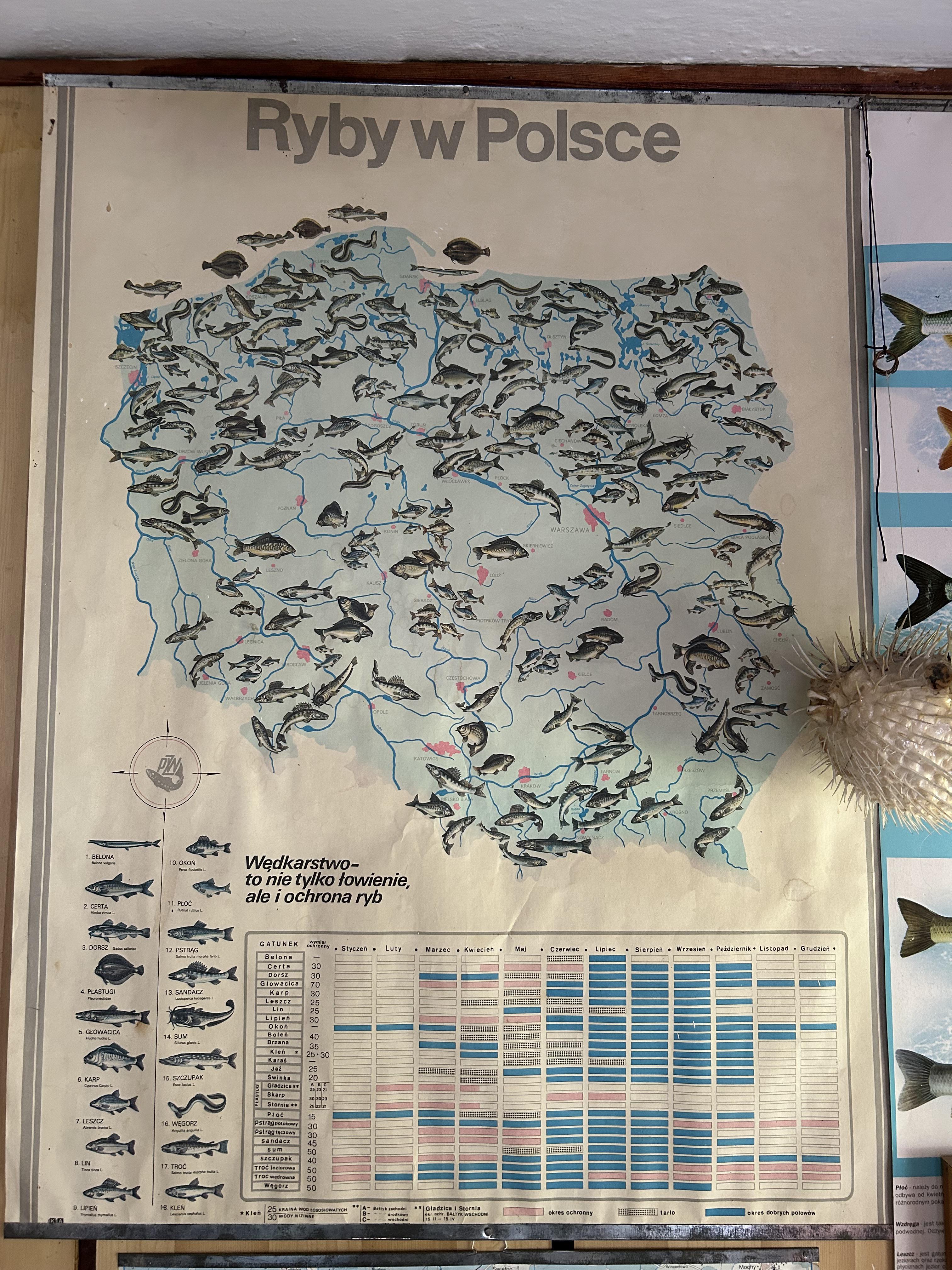
Freshwater Fish Distribution Map of Poland
The "Freshwater Fish Distribution Map of Poland" provides a detailed visualization of the various species of freshwater ...
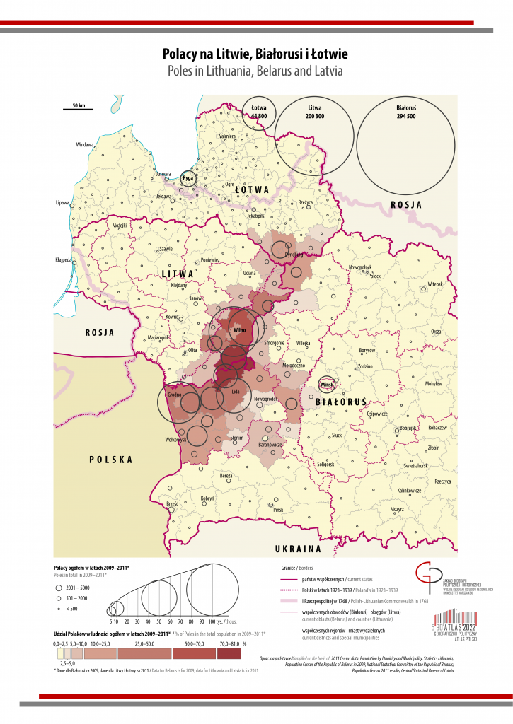
Map of Polish Population in Lithuania, Belarus, and Latvia
The map titled 'Polish Population in Lithuania, Belarus, and Latvia' provides a visual representation of the distributio...
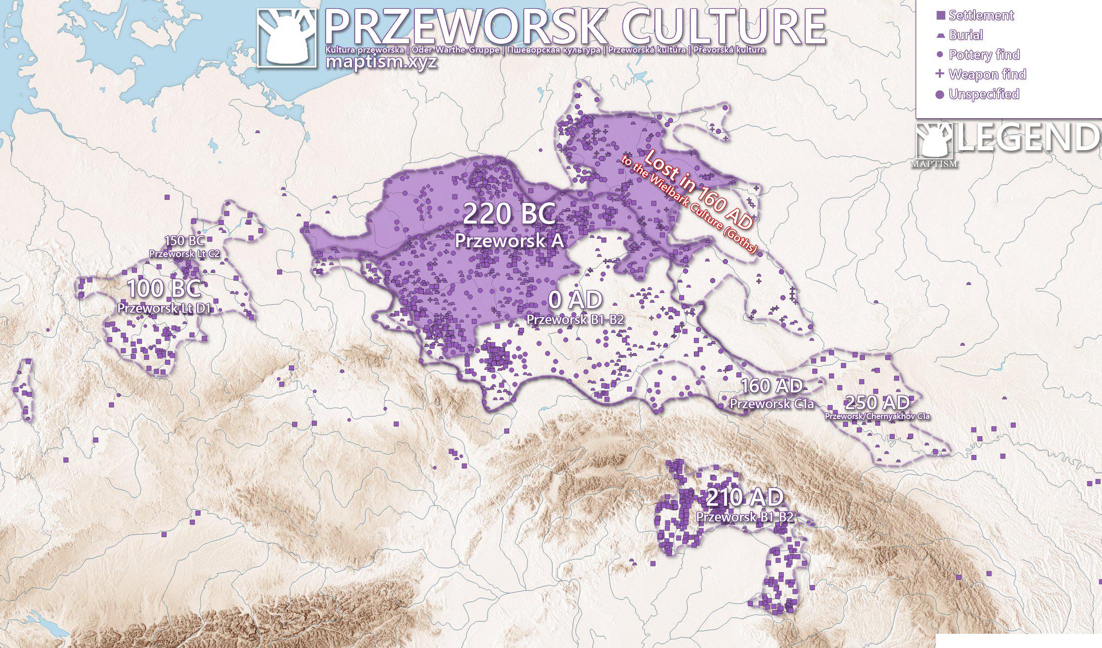
Przeworsk Culture Map of Poland
The Przeworsk Culture Map of Poland provides a visual representation of the archaeological sites and settlements associa...
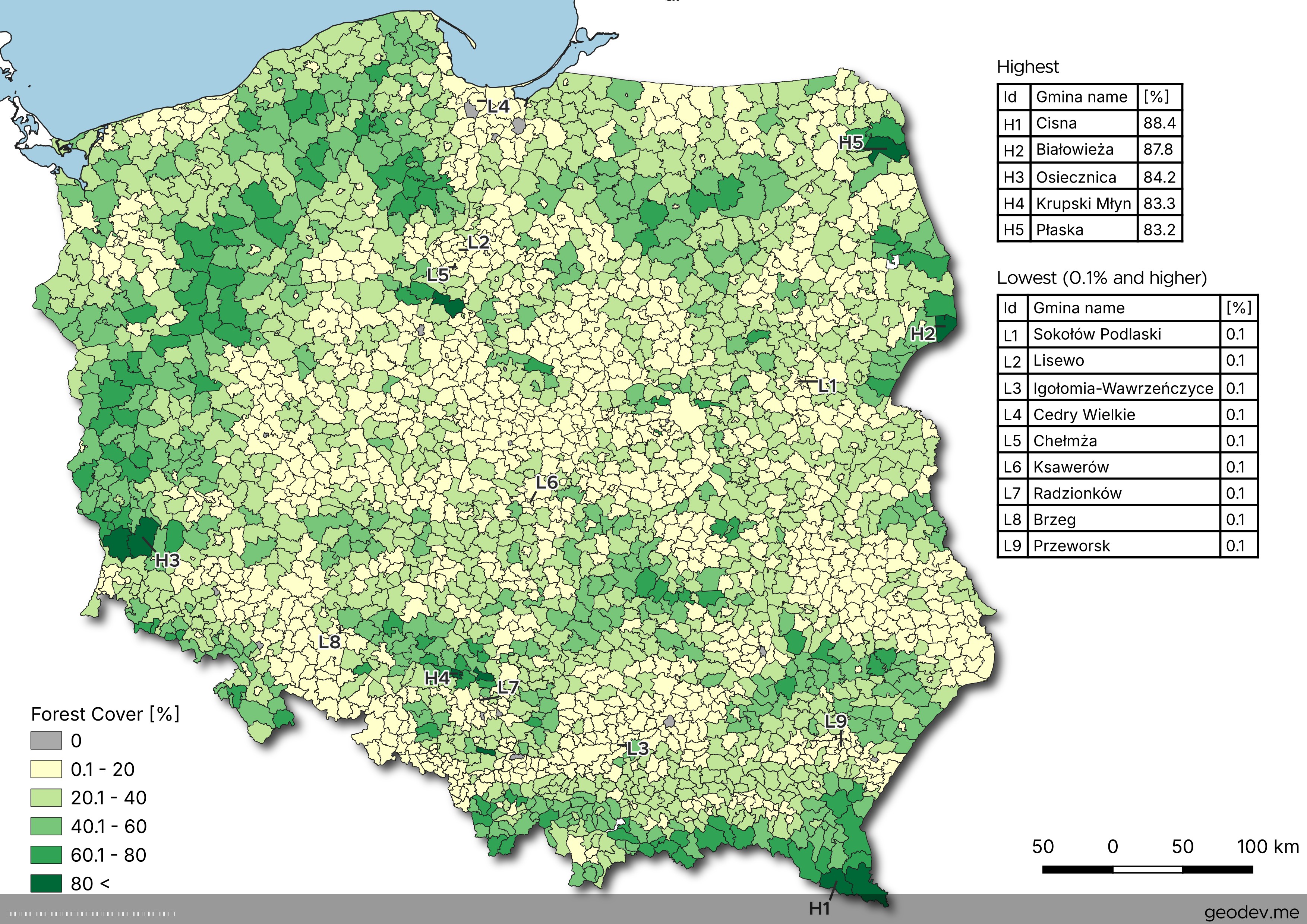
Forest Cover by Municipality Map of Poland
The map titled "Forest Cover by Municipality Map of Poland" presents a detailed visualization of forest coverage across ...
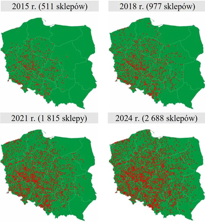
Dino Markets Expansion in Poland Map
The "Dino Markets Expansion in Poland (2015-2024) Map" provides a visual representation of the growth of Dino, a promine...