italy Maps
22 geographic visualizations tagged with "italy"
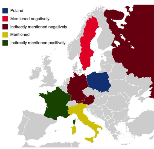
Countries Mentioned in the Polish National Anthem Map
The map titled "All The Countries Mentioned In The Polish National Anthem" provides a unique geographical insight into t...
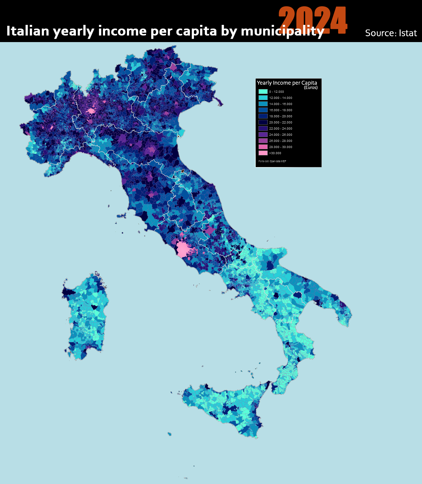
Italian Yearly Income Per Capita by Municipality Map
The "Italian Yearly Income per Capita by Municipality 2024" map provides an insightful look into the economic landscape ...
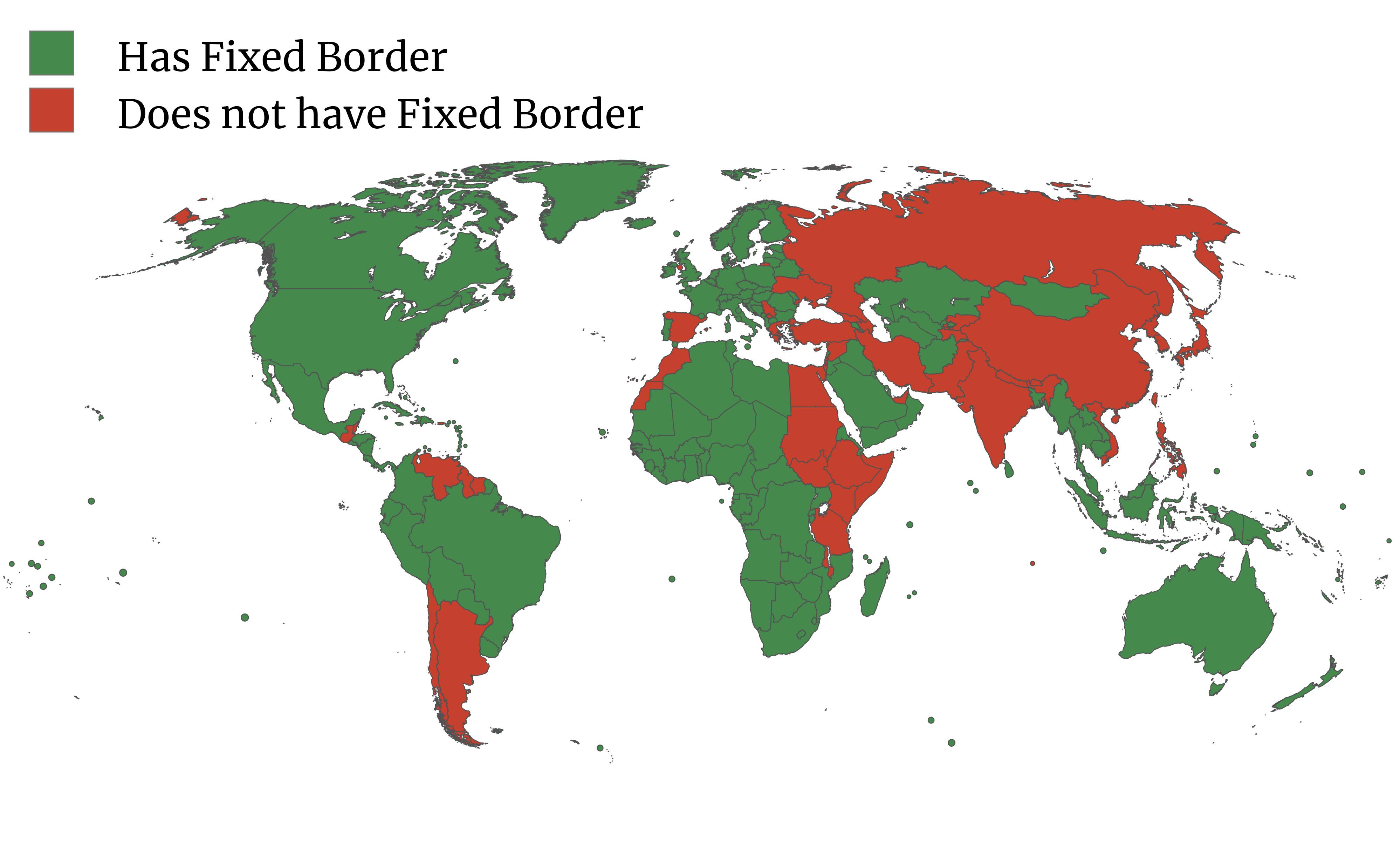
Google Maps Fixed Borders by Country Map
The map titled "Does Google Maps consider your country to have a fixed border?" highlights an interesting aspect of inte...
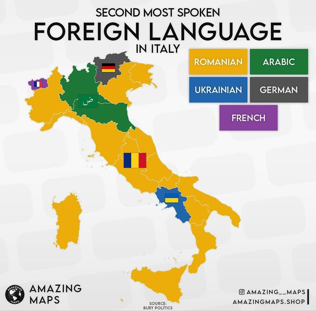
Second Most Spoken Language in Italian Regions Map
The map titled "Second Most Spoken Language in Italian Regions" provides a fascinating look into the linguistic diversit...
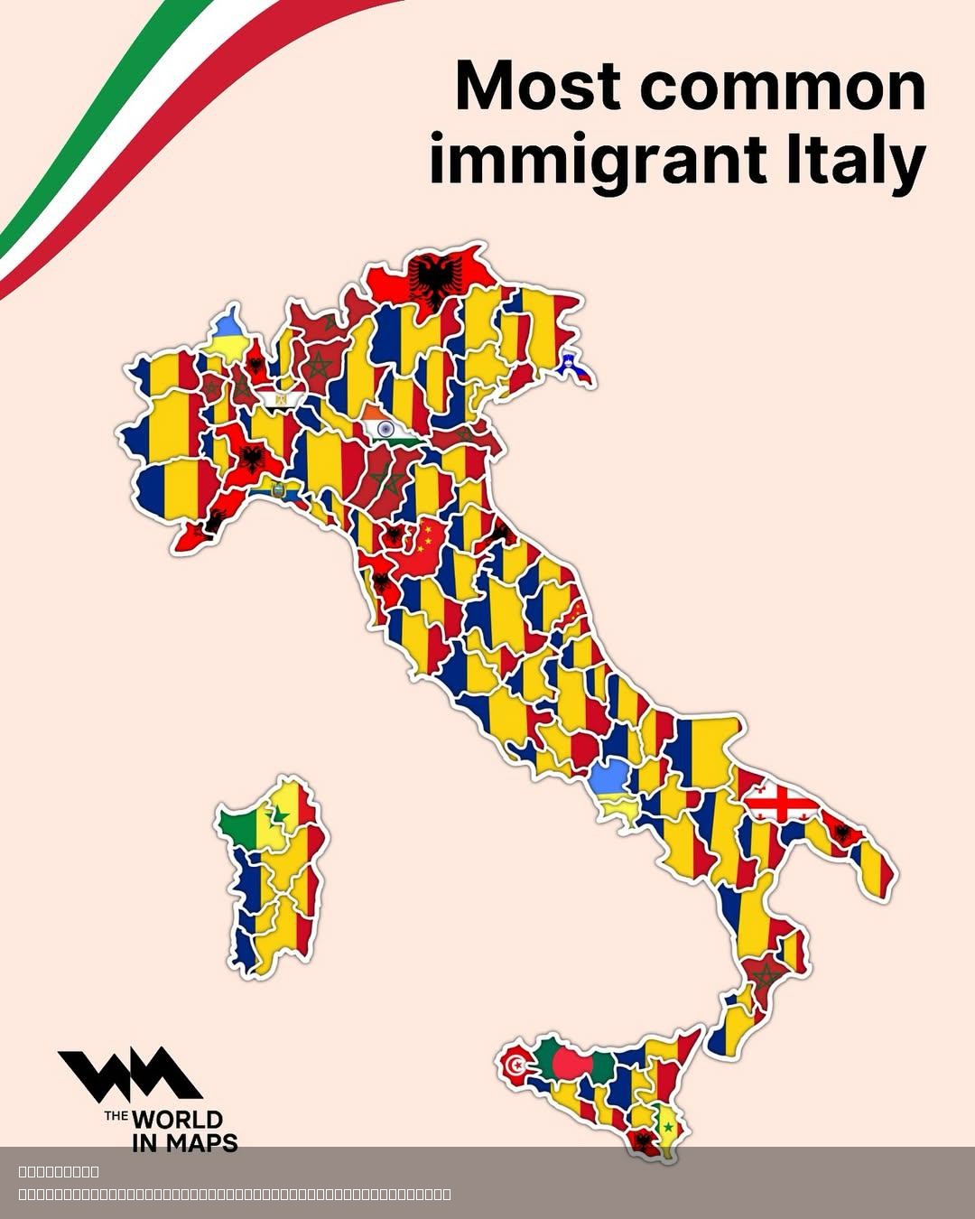
Italy's Most Common Immigrant Groups by Province Map
The map titled "Italy's Most Common Immigrant Groups by Province" provides a detailed visualization of the diverse tapes...
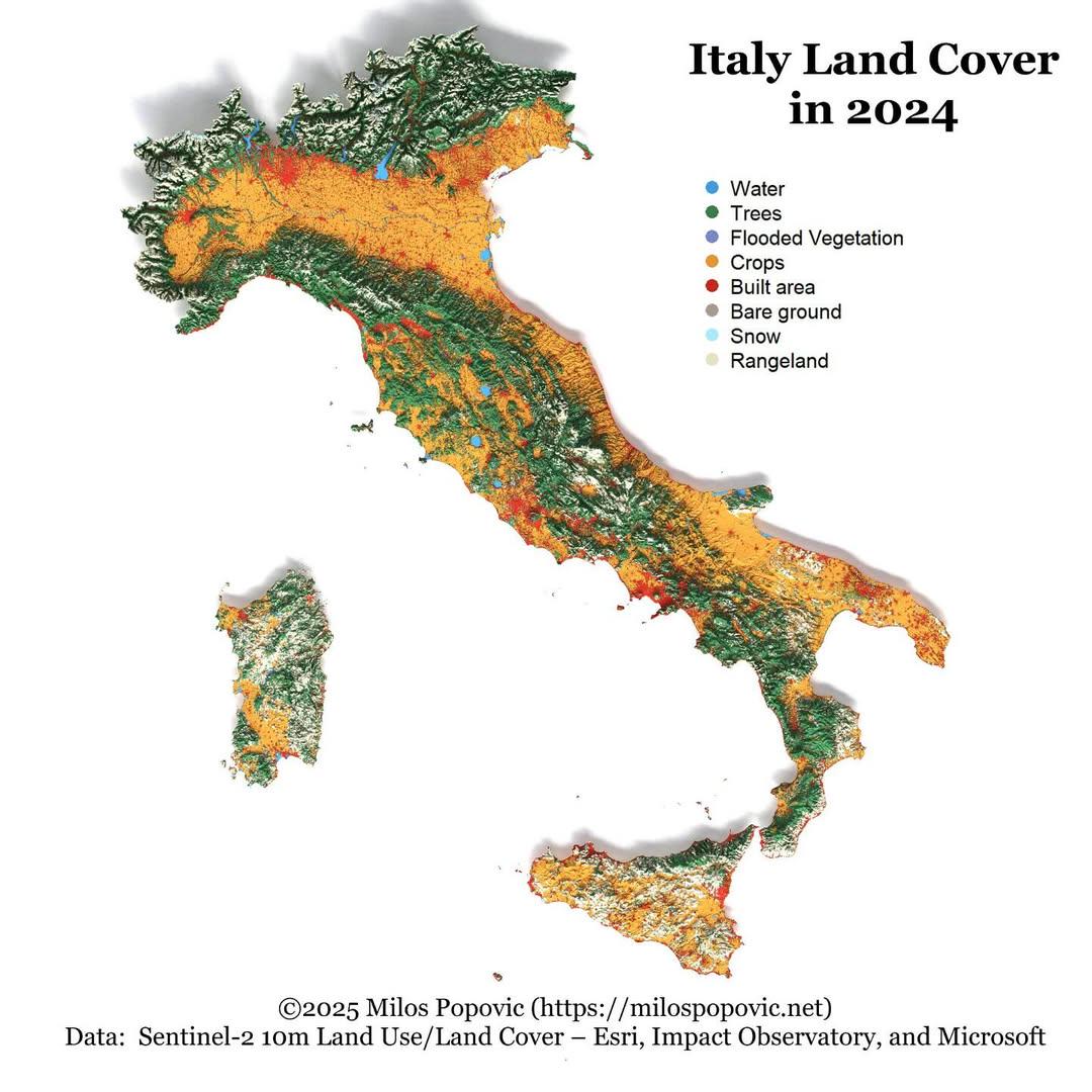
Italy Land Cover Map 2024
The "Italy Land Cover Map 2024" provides a comprehensive visualization of the various land cover types across Italy, ill...
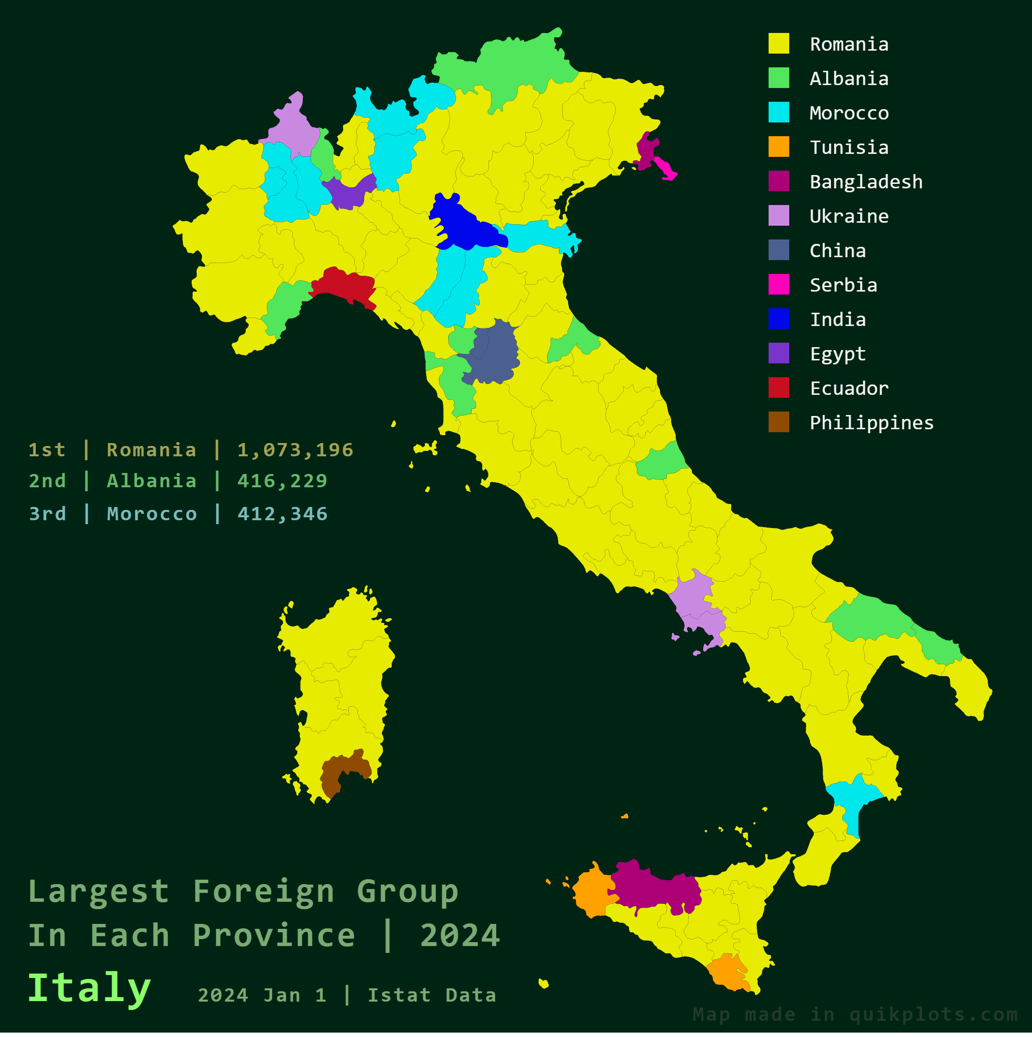
Largest Foreign Groups in Italy Map
The \...
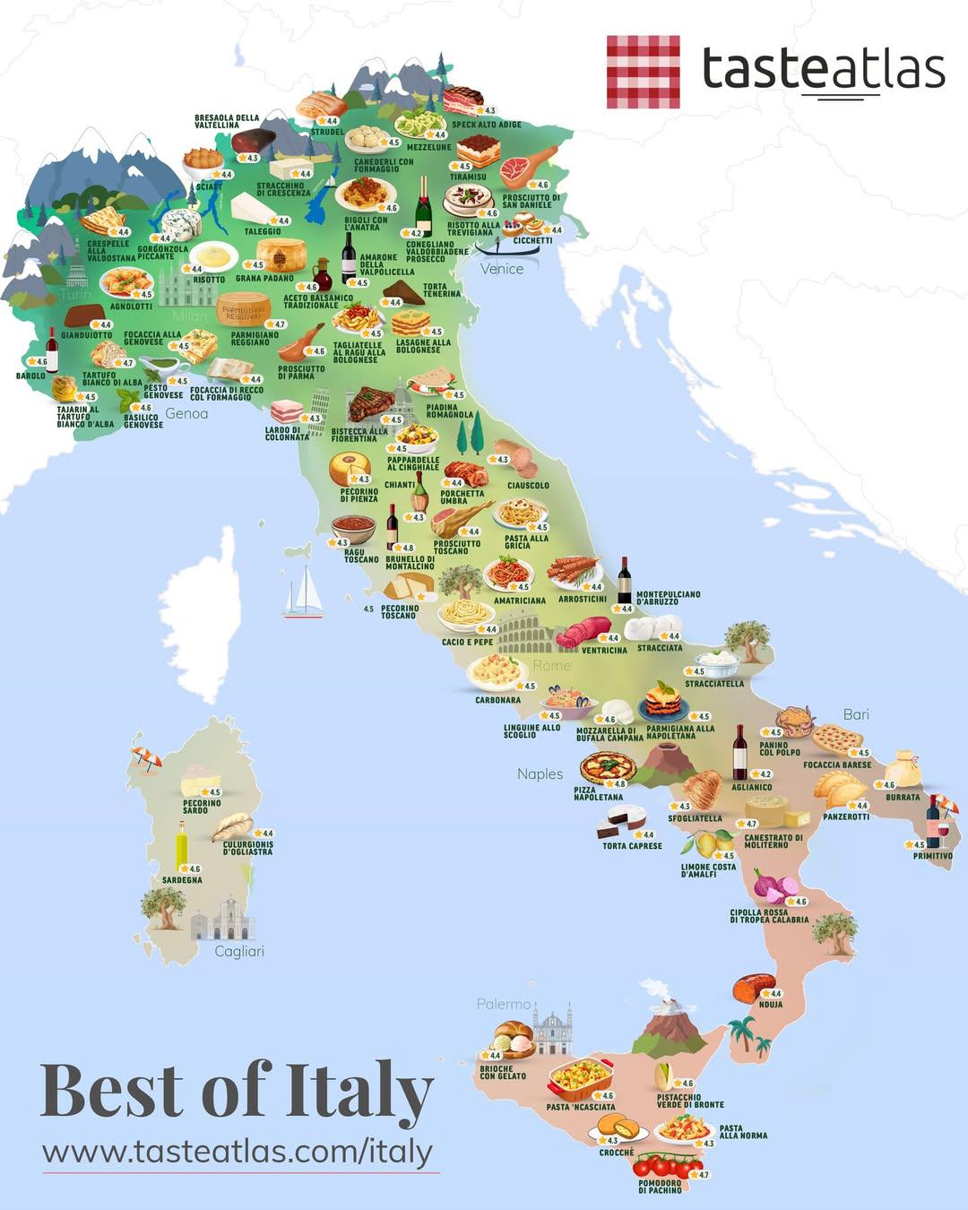
Italian Foods Map by Region
This map provides a visual representation of some of the best Italian foods, categorized by regions across Italy. It ser...
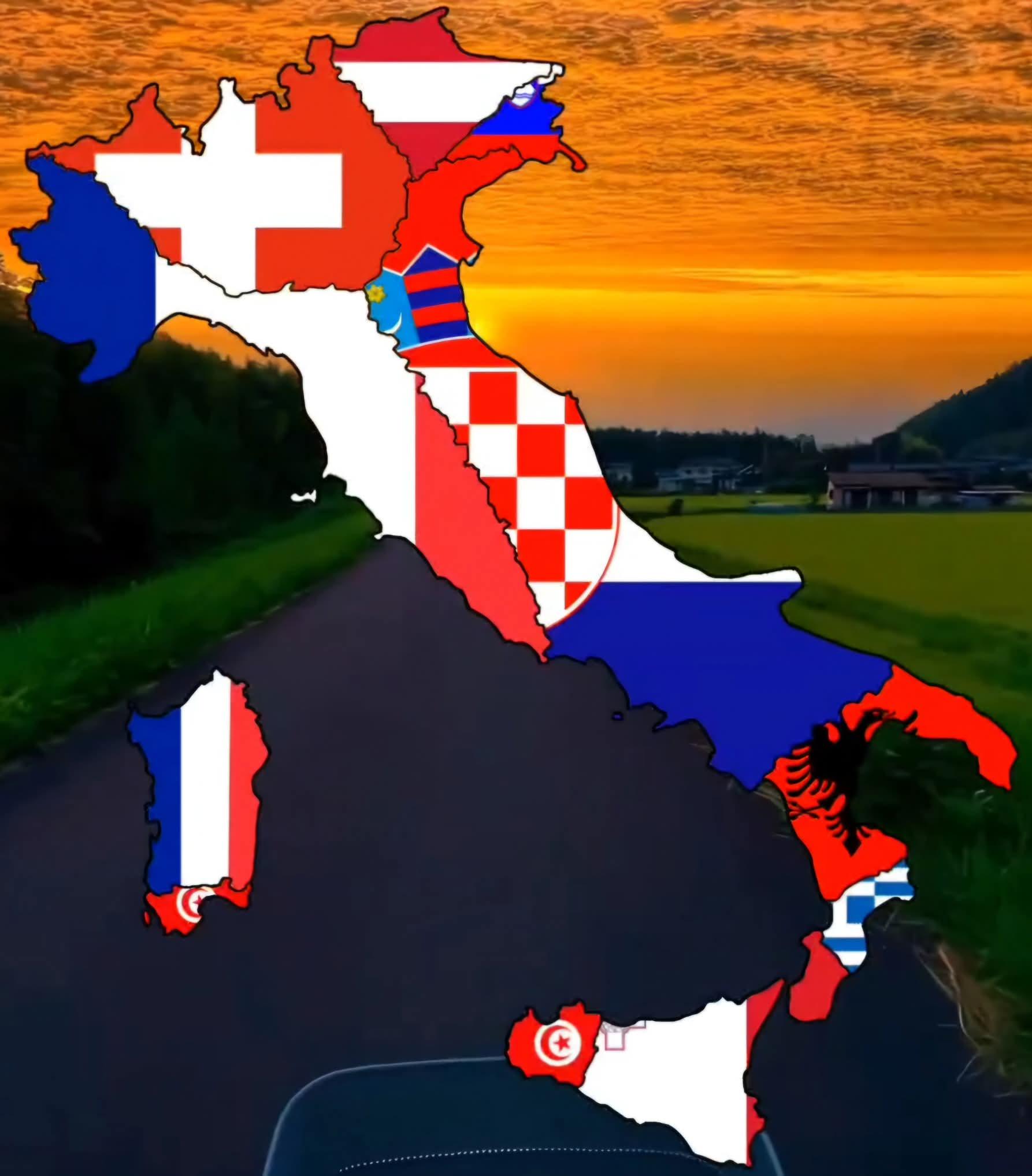
Closest Foreign Country to Italy Map
This map illustrates the closest foreign countries to Italy, highlighting the geographical proximity of its neighboring ...
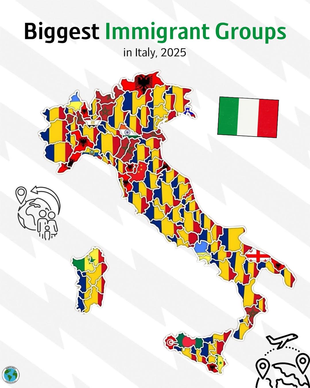
Biggest Immigrant Groups in Italy Map
The \...
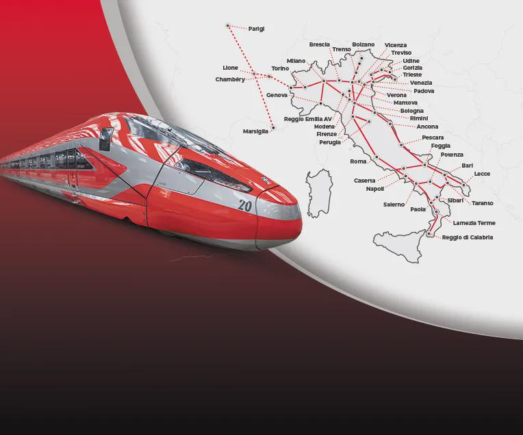
Frecciarossa High Speed Train Routes Map
The "Routes of the Frecciarossa High-Speed Trains in Italy and France" map provides a detailed visualization of the exte...
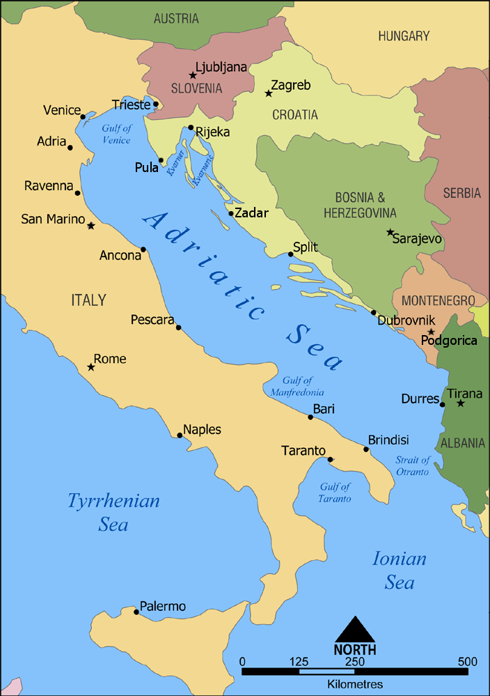
Geographic Orientation Map of Croatia and Bosnia
The visualization titled 'Croatia is more North, West and South than Bosnia & Herzegovina, whilst Italy is more North, W...
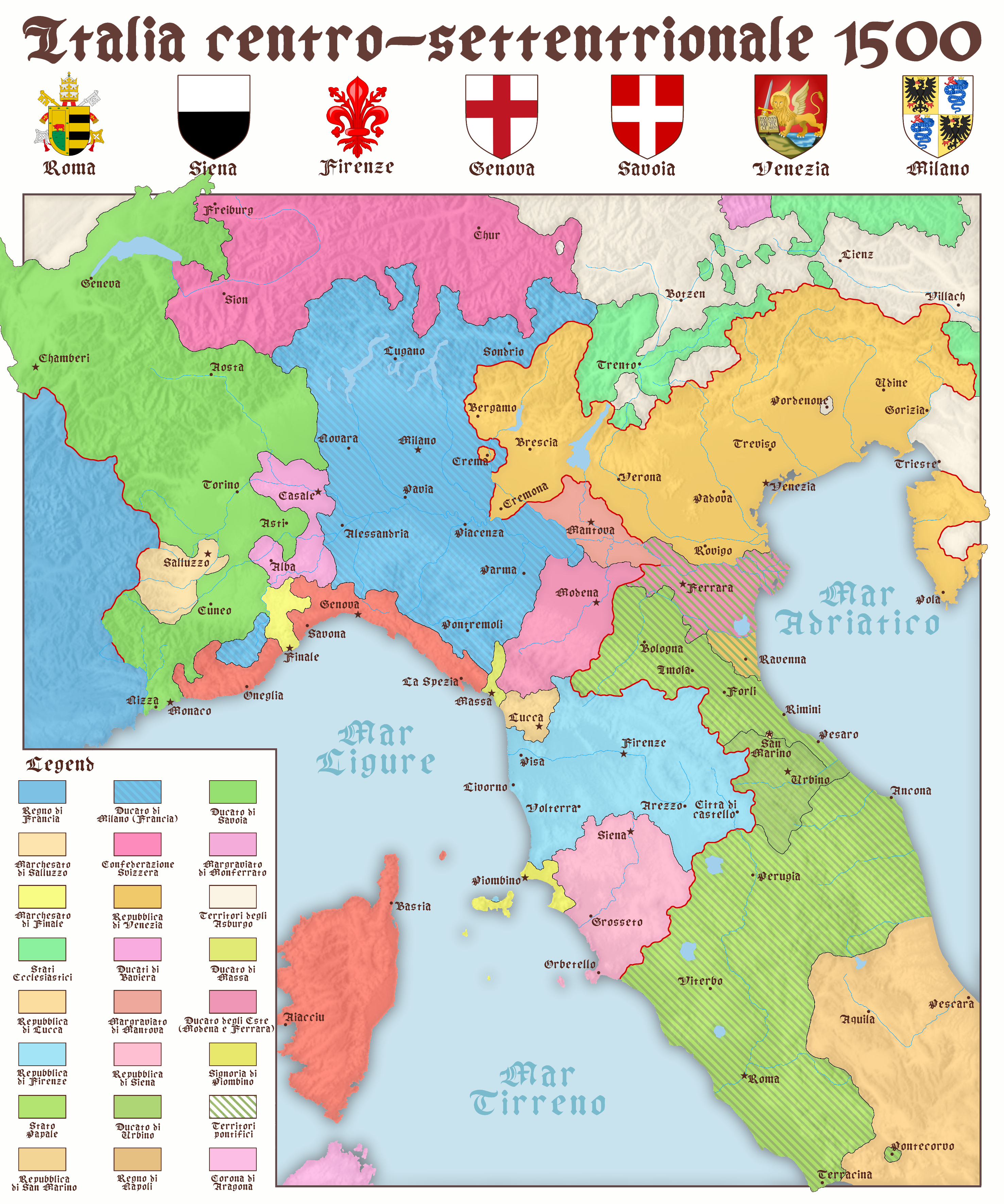
Map of North and Central Italy in 1500
The map titled "North and Center Italy in 1500" provides a detailed snapshot of the geographical and political landscape...
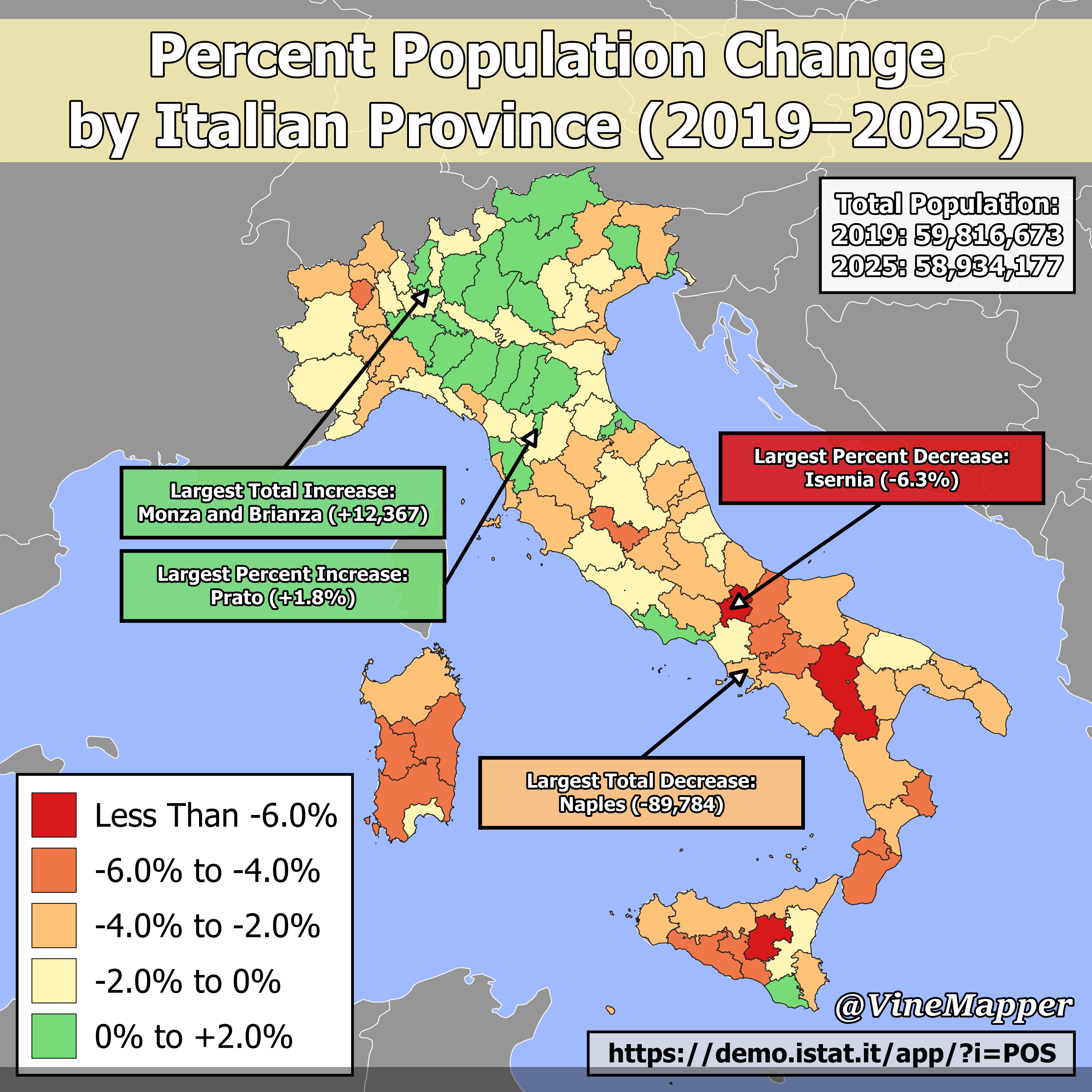
Percent Population Change by Italian Province Map
...
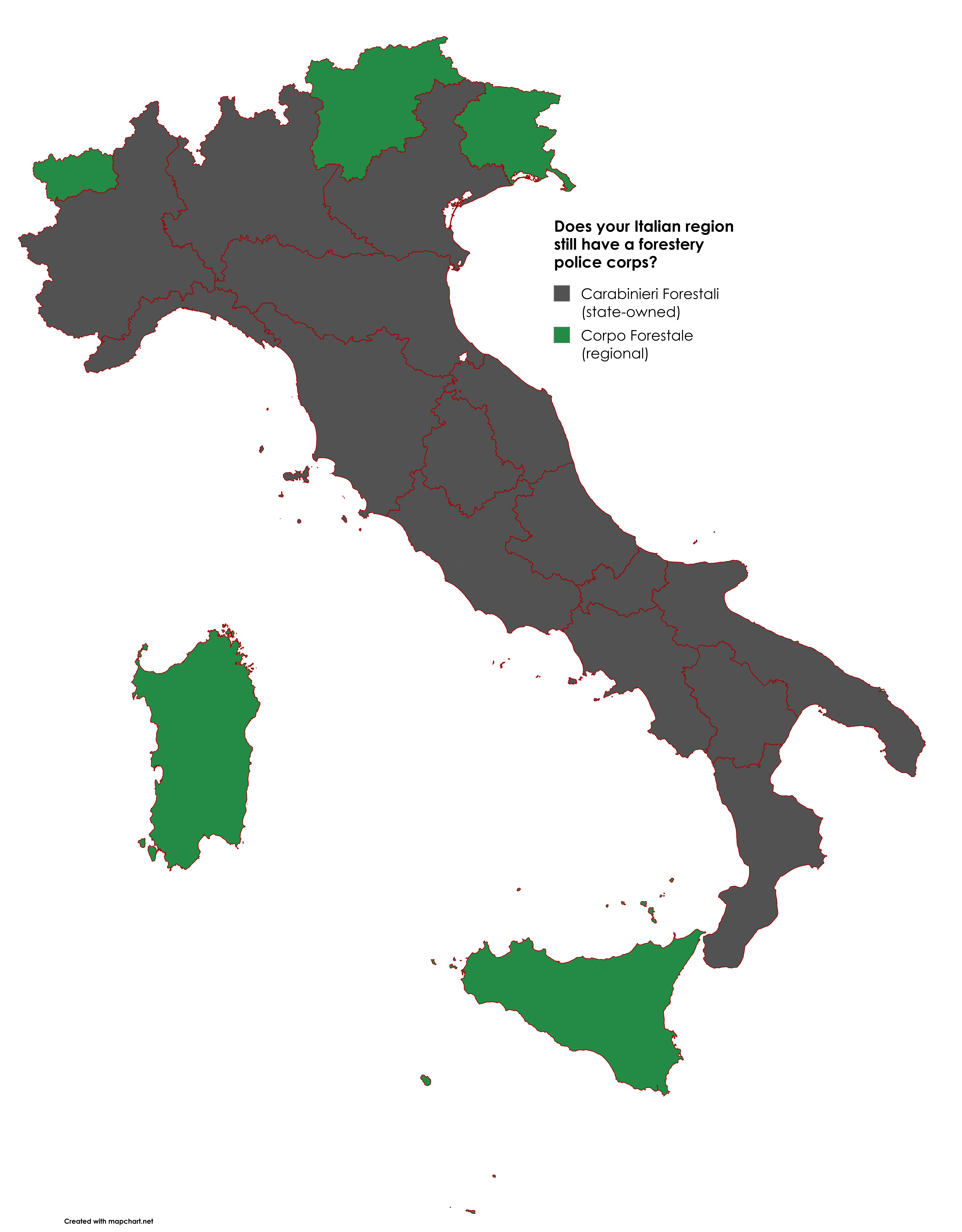
Map of Italy's Forestry Law Enforcement
The map titled "A Map of Italy's Forestry Law Enforcement" provides a comprehensive overview of the various enforcement ...
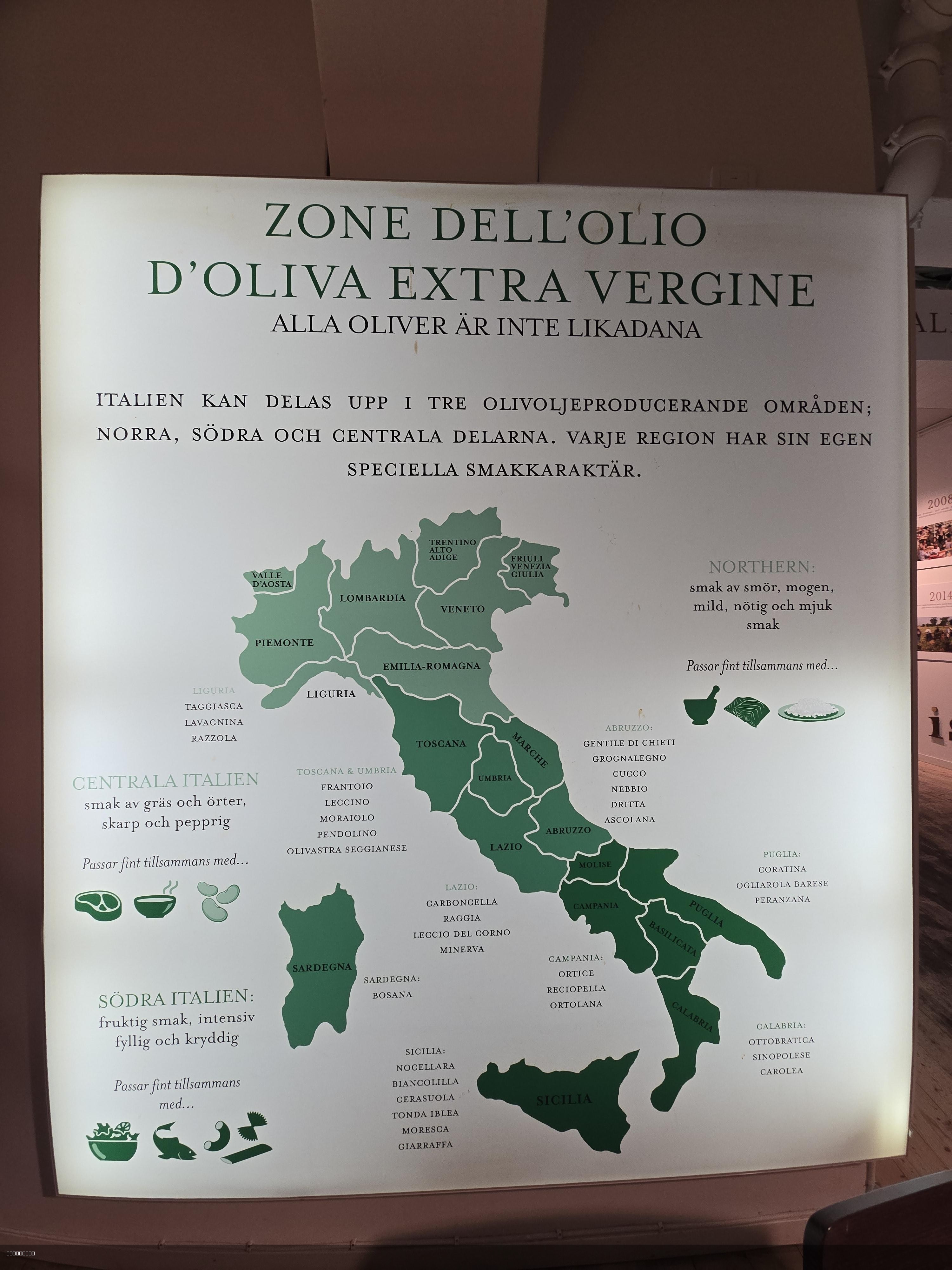
Italy Olive Oil Production Areas Map
This map offers a detailed visualization of Italy's olive oil production areas, showcasing the regions where this belove...

GDP Per Capita by Italian Regions Map
Interestingly, regions like Lombardy, home to Milan, the financial capital of Italy, showcase a robust economy driven by...
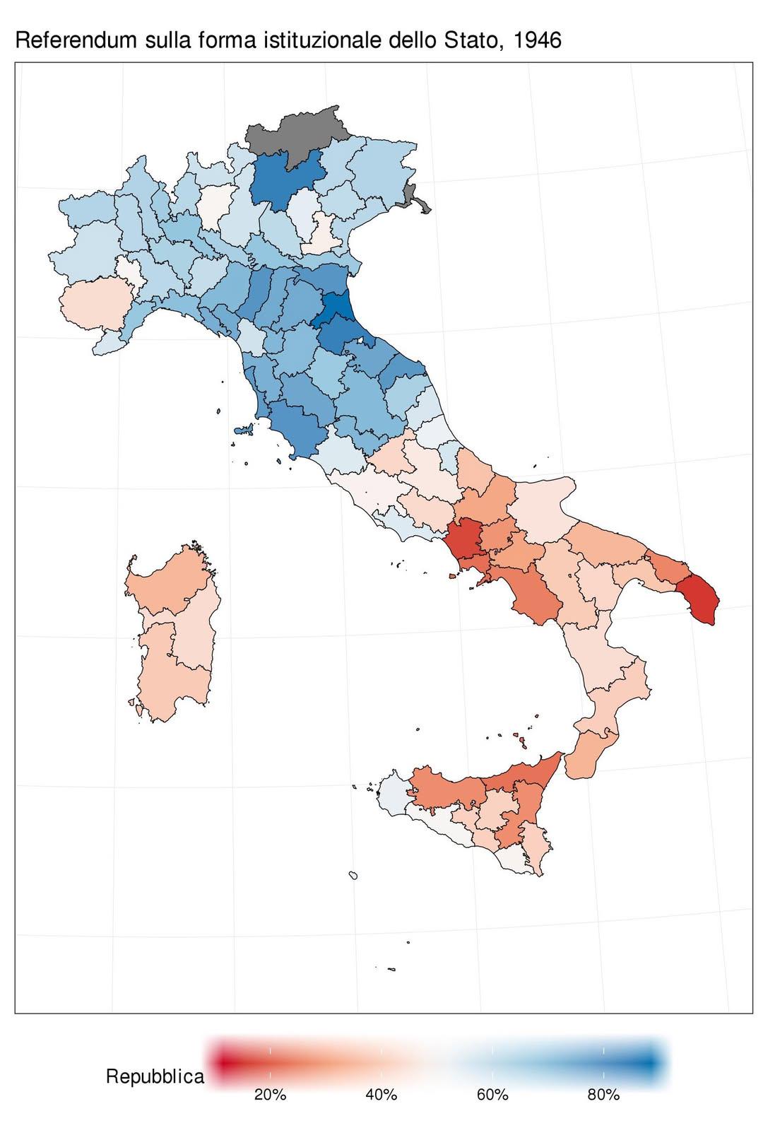
1946 Italian Referendum Voting Results Map
The map titled "How Italians voted in the 1946 referendum: Republic (blue) vs Monarchy (red)" visually represents the re...
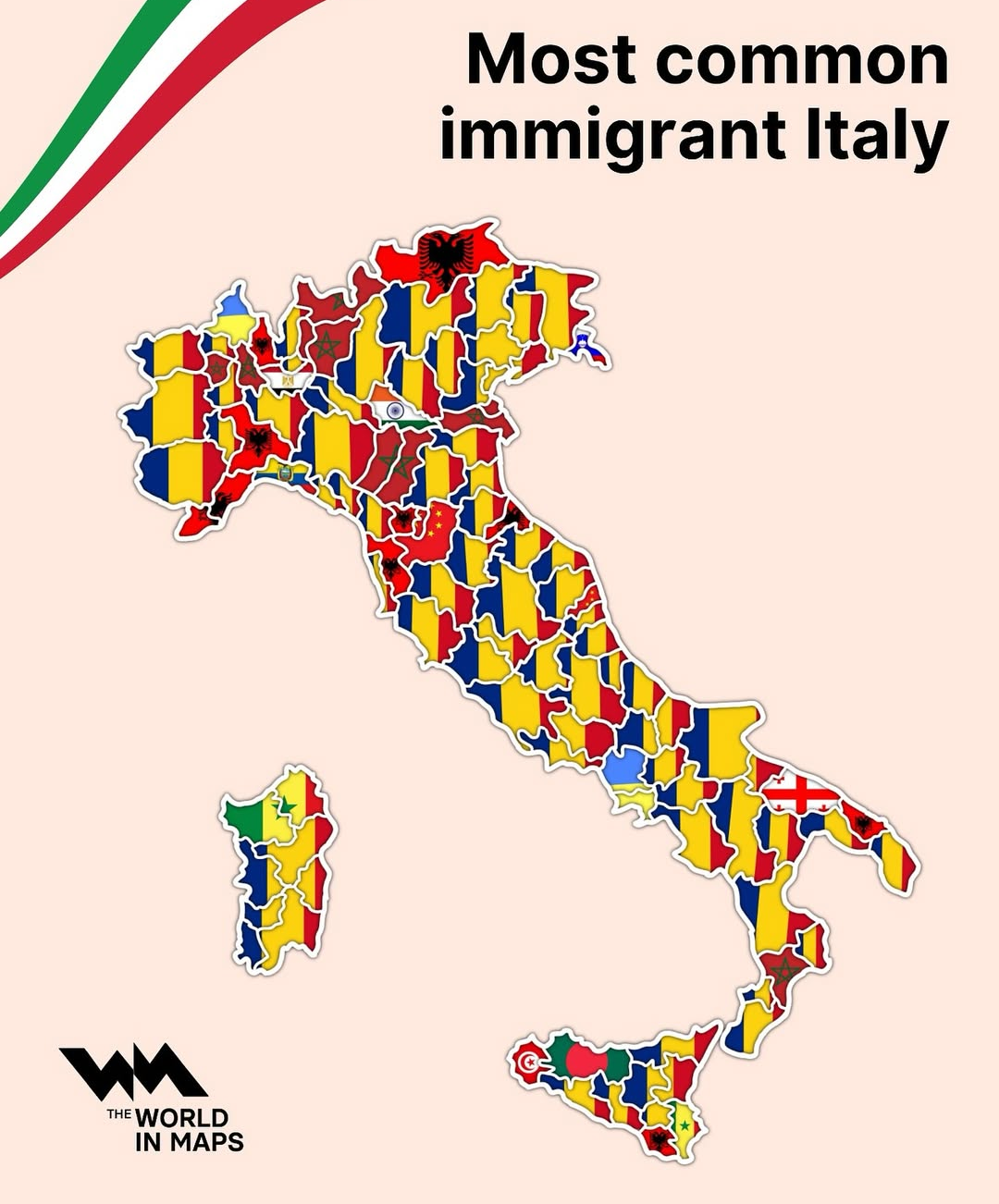
Most Common Immigrant Groups in Italy Map
The "Most Common Immigrant Groups in Italy Map" provides a comprehensive visual representation of the nationalities of i...
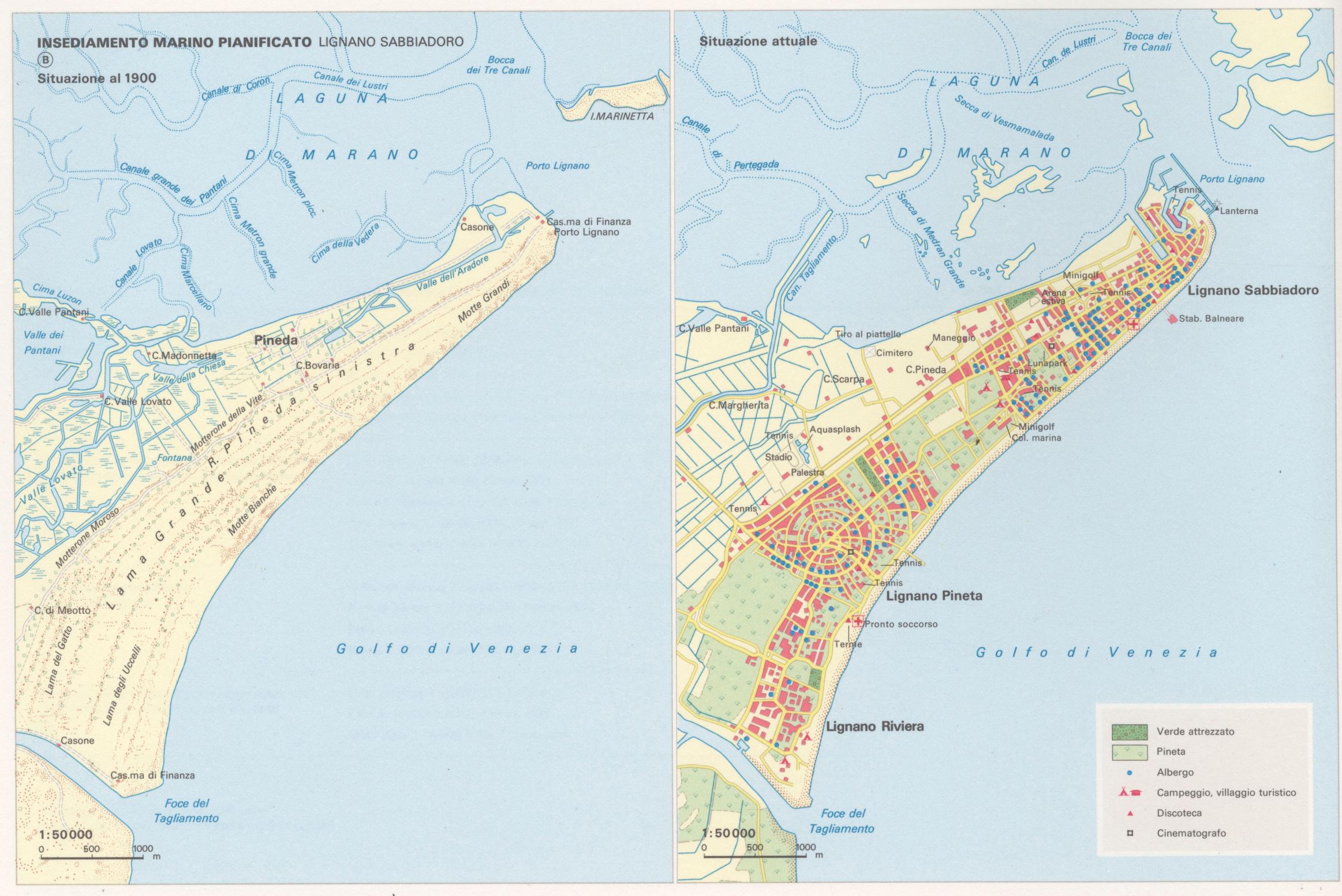
Lignano Sabbiadoro Historical Map 1900 and Today
The map titled "Lignano Sabbiadoro in 1900 and today" presents a striking visual juxtaposition of this popular Italian s...
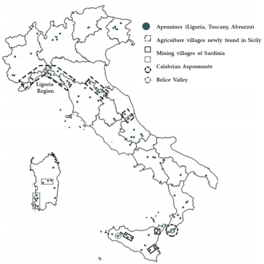
Ghost Towns in Italy Map
The "Ghost Towns in Italy Map" provides a fascinating look at abandoned towns scattered throughout the Italian peninsula...
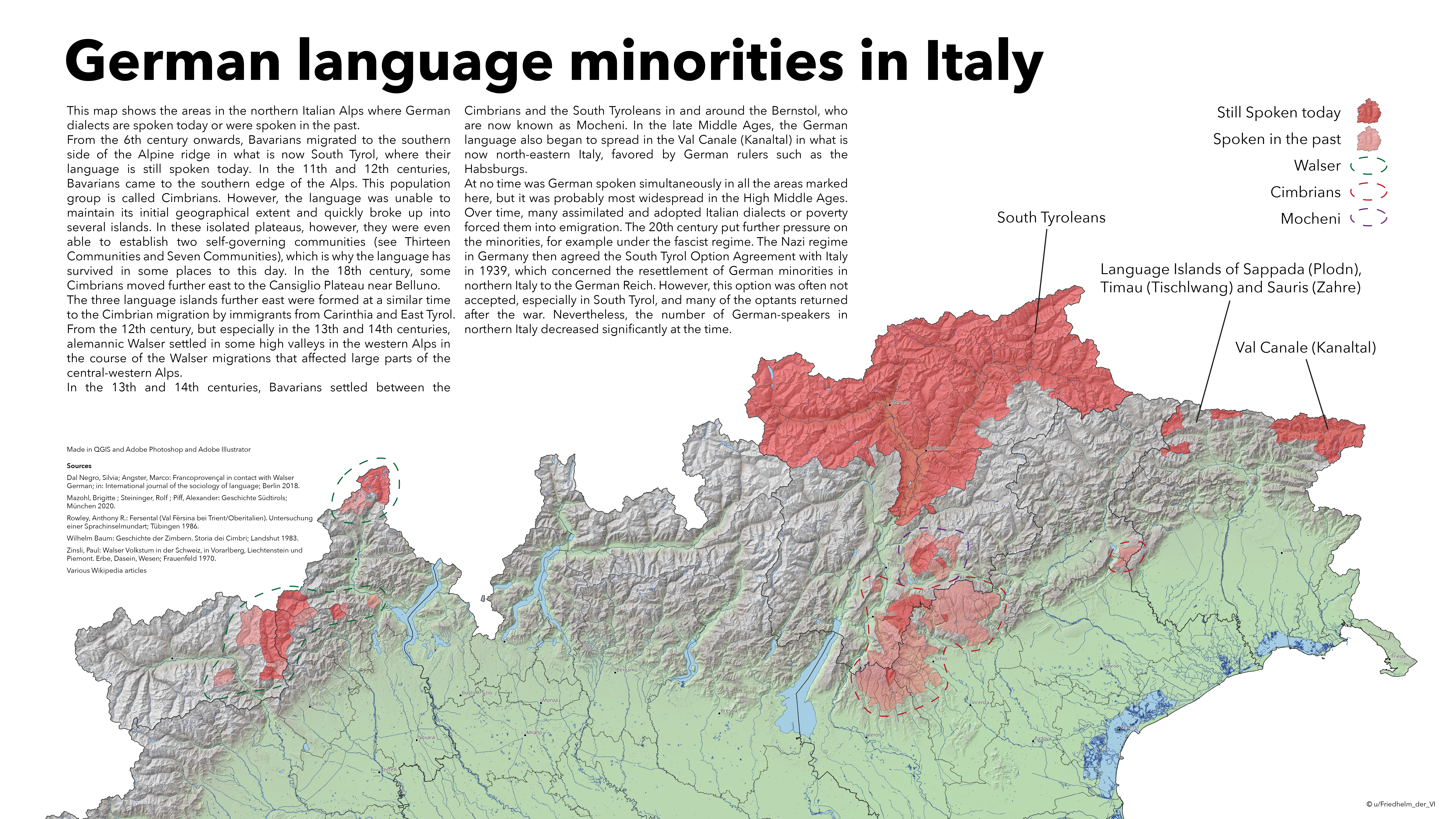
German Language Minorities in Italy Map
This map illustrates the distribution of German language minorities in Italy, focusing primarily on the regions where Ge...